| Previous :: Next Topic |
| Author |
Message |
Eric Gilbertson
Member


Joined: 04 Jul 2018
Posts: 188 | TRs | Pics
Location: Seattle |
Surveys of Windy Peak, Apex Peak, Armstrong Mountain
Oct 14-15, 2023
Summary of Results:
Windy 8335.1 ft +/-0.1 ft
Apex 8302.0 ft +/- 0.1 ft
Armstrong NW 8131.6 ft +/-0.1 ft
Armstrong SE 8123.8 ft +/- 0.5 ft
Link to up-to-date WA Top 100 list google doc: https://docs.google.com/spreadsheets/d/1gYaBTa32bLfXiQFrcpTJ58KjO1HIAEEMBDrttHFxUOg/edit?usp=sharing
45 miles, 10kft gain
There are a handful of peaks in the northeast Pasayten that are edge cases for inclusion in the Washington Top 100 list. These are peaks with a quad-surveyed height within 40ft of the bottom of the list (currently 8326ft). I've found based on past surveys and Lidar data comparison that quad-surveyed heights can be off by up to 40ft in rare instances. I'm working to survey these edge-case peaks to see if they qualify for the list or not. The grand plan for this trip was five peaks, but it got downgraded to three peaks after the weather was a bit worse than expected.
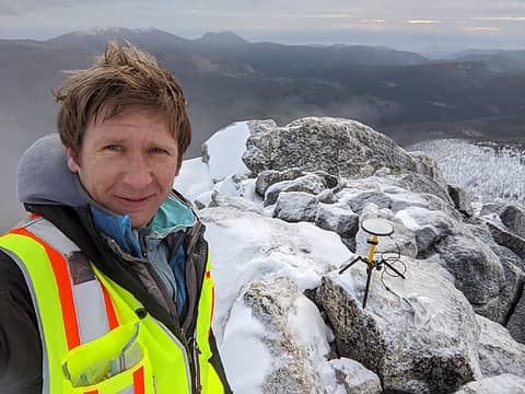 On Windy Peak at sunrise 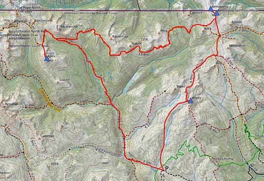 The route 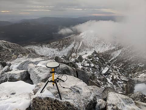 On Windy Peak 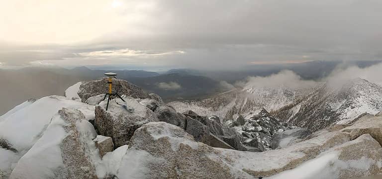 Summit panorama 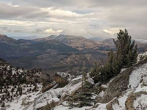 Heading towards Armstrong 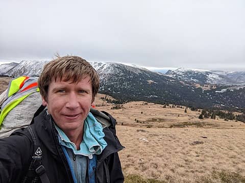 Hiking up Armsrong with Horseshoe Pass in the background 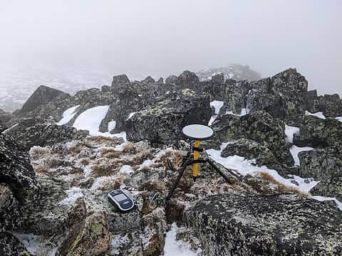 On the Armstrong NW summit 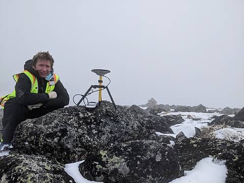 On Armstrong SE summit 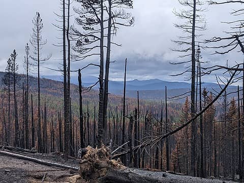 Hiking through the burn zone 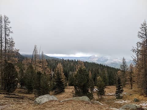 Larches turning brown 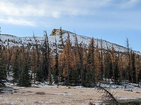 Apex Peak from the pass 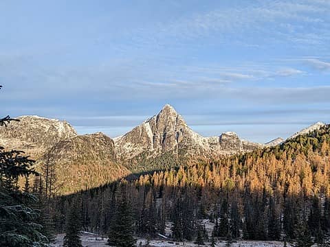 Looking back to Cathedral Peak 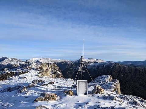 Interesting antenna on the summit. 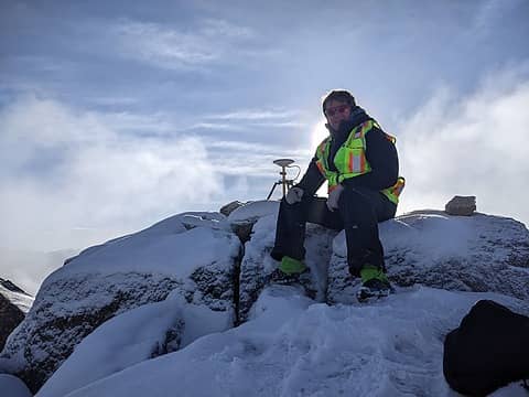 Setup on the summit 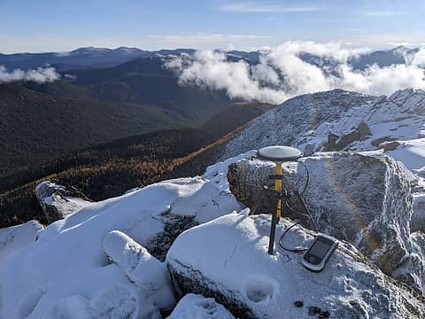 Summit vies to the east 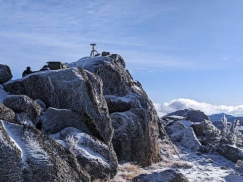 On the summit 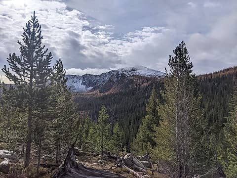 Looking back at Apex 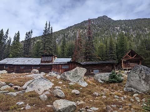 The Tungsten Mine cabin 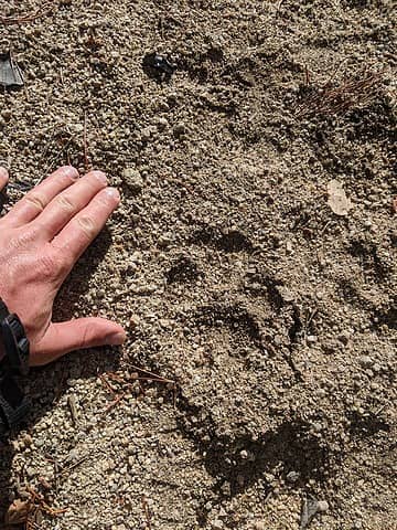 Cat tracks on the trail out
 Gimpilator, Nancyann, LukeHelgeson, Scramblin Rover, jstern, SeanSullivan86, wallorcrawl, RichP, John Mac, yukon222, jaysway, zimmertr, neek, Randito Gimpilator, Nancyann, LukeHelgeson, Scramblin Rover, jstern, SeanSullivan86, wallorcrawl, RichP, John Mac, yukon222, jaysway, zimmertr, neek, Randito
Gimpilator, Nancyann, LukeHelgeson, Scramblin Rover, jstern, SeanSullivan86, wallorcrawl, RichP, John Mac, yukon222, jaysway, zimmertr, neek, Randito |
| Back to top |
  
|
|
jaysway
Member

Joined: 16 Jul 2020
Posts: 349 | TRs | Pics
|
|
jaysway
Member
|
 Wed Oct 18, 2023 10:26 pm |
|
|
I love these surveys, great work!
IanB, Eric Gilbertson
IanB, Eric Gilbertson |
| Back to top |
|
|
RichP
Member

Joined: 13 Jul 2006
Posts: 5635 | TRs | Pics
Location: here |
|
RichP
Member
|
Thu Oct 19, 2023 8:36 am |
|
|
Speaking of mice, I camped at the Cathedral Driveway Trailhead recently for a hike of Windy and that's one of the mousiest places I've ever been. No keeping them out if they want in. Another cool survey, Eric.  He Devil and She Devil must be awfully close if we haven't heard the results yet.
Eric Gilbertson
Eric Gilbertson |
| Back to top |
|
|
Eric Gilbertson
Member
Joined: 04 Jul 2018
Posts: 188 | TRs | Pics
Location: Seattle |
| Quote: | | Speaking of mice, I camped at the Cathedral Driveway Trailhead recently for a hike of Windy and that's one of the mousiest places I've ever been. No keeping them out if they want in. Another cool survey, Eric. up.gif
He Devil and She Devil must be awfully close if we haven't heard the results yet. |
I had the same experience with mice at that trailhead! When I got back to the truck there was mouse poop everywhere. I need to start setting traps again.
I finally made some good progress on processing the He/She Devil results with acceptable errors. I'll try to get the report posted this week. Just triple checking everything now.
RichP  kitya kitya
RichP kitya |
| Back to top |
|
|
IanB
Vegetable Belayer

Joined: 21 Jul 2010
Posts: 1062 | TRs | Pics
Location: gone whuljin' |
|
IanB
Vegetable Belayer
|
Thu Oct 26, 2023 11:14 pm |
|
|
This series of trip reports is one of the coolest things to come along on NWH in a long time!
The physical exertion and challenges weathered in the pursuit of scientific data collection, all with a solid measure of beauty and appreciation of the alpine environment, it's just fantastic. You've found a wonderful way to re-walk mountain routes tread by previous cartographers while adding to the modern body of scientific knowledge. Bravo!
"Forget gaining a little knowledge about a lot and strive to learn a lot about a little." - Harvey Manning
dave allyn, Eric Gilbertson
"Forget gaining a little knowledge about a lot and strive to learn a lot about a little." - Harvey Manning
dave allyn, Eric Gilbertson
|
| Back to top |
|
|
texasbb
Misplaced Texan
Joined: 30 Mar 2009
Posts: 1153 | TRs | Pics
Location: Tri-Cities, WA |
|
texasbb
Misplaced Texan
|
Fri Oct 27, 2023 5:46 am |
|
|
I have to agree with @IanB. Who would've thought posts on surveying would be so interesting.
Eric Gilbertson
Eric Gilbertson |
| Back to top |
|
|
jboealps
Member
Joined: 10 Aug 2006
Posts: 71 | TRs | Pics
Location: Seattle |
|
jboealps
Member
|
Sat Nov 04, 2023 7:25 am |
|
|
Eric
What are your thoughts on the 8264ft high point north of Cathedral Peak
|
| Back to top |
|
|
Eric Gilbertson
Member
Joined: 04 Jul 2018
Posts: 188 | TRs | Pics
Location: Seattle |
| jboealps wrote: | | What are your thoughts on the 8264ft high point north of Cathedral Peak |
That peak is called "The Pope" and is on the Bulgers Top 200/220 list, but not currently on the strict top 200 list because the clean prominence is less than 400ft (it's 390ft according to peakbagger). Clean prominence from the quad is usually an underestimate though, in my experience, so there's a good chance if I measure it with the dGPS it might qualify for top 200 list.
The elevation is directly surveyed on the quad, and I've found those have errors at most about 40ft for the ones I've checked. So it's unlikely it would be in error enough that it's actually a top 100 peak. Current cutoff is 8326ft, so the quad surveyed height would have to be off by 62ft. Not impossible I suppose. I'll add that to the to-do list.
|
| Back to top |
|
|
|
|
You cannot post new topics in this forum
You cannot reply to topics in this forum
You cannot edit your posts in this forum
You cannot delete your posts in this forum
You cannot vote in polls in this forum
|
Disclosure: As an Amazon Associate NWHikers.net earns from qualifying purchases when you use our link(s). |


