| Previous :: Next Topic |
| Author |
Message |
Jeff R
Closet hiker.

Joined: 10 Apr 2005
Posts: 972 | TRs | Pics
Location: Everret |
|
Jeff R
Closet hiker.
|
 Sun May 08, 2005 12:52 pm |
|
|
John, and myself arrived at the barlow pass parking lot at 2:30, we gathered up the gear, and rode our bikes to the Monte Cristo townsite by 3:00. We enjoyed a snack, and the old relics that were scattered around for awhile, we were still able to push the " railcar turntable" a complete rotation!
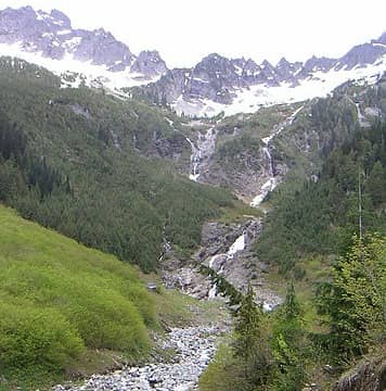
At about 4:00 we decided to meander up the Glacier basin trail( I was wearing bike shoes). The water falls were nice, and the sun was out. Shortly above the falls, the snow patchs started and we found a nice spot at the lower part of the basin, to have dinner. After the meal and soaking in the sights, we decided to head back to the town and our bikes ( they were still there!). On the way down, we frolicked around the falls and enjoyed the last bit of sunshine!
Riding down the road in the dusk was fun although we were both fairly tired at that point. We arrived back at the S-10( it was still there!) by 8:30 and drove home feeling beat up, yet fulfilled by another great time in the hills! 
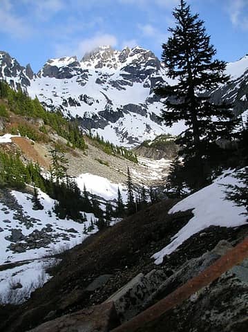 Glacier basin 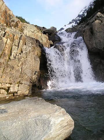 glacier water fall
|
| Back to top |
  
|
|
-lol-
Member

Joined: 17 Dec 2001
Posts: 767 | TRs | Pics
|
|
-lol-
Member
|
Sun May 08, 2005 1:03 pm |
|
|
|
| Back to top |
|
|
wildernessed
viewbagger

Joined: 31 Oct 2004
Posts: 9275 | TRs | Pics
Location: Wenatchee |
Nice, very nice. I like waterfalls, looks like a good place to stop for a dip.
wildernessed 
Living in the Anthropocene
Living in the Anthropocene
|
| Back to top |
|
|
Jeff R
Closet hiker.

Joined: 10 Apr 2005
Posts: 972 | TRs | Pics
Location: Everret |
|
Jeff R
Closet hiker.
|
Sun May 08, 2005 1:23 pm |
|
|
Thanks guys! The road is in good shape and smooth,with a couple sloppy sections, still driveable if you have the gate key from the commitee.
Is the twin bridges part, where the road was washed out, right after the gothic basin trail head? if so there is about 8/12 inchs of water there. There is two(2) blue I beams across the crick, aswell as a wood plank brige by the car ford.
|
| Back to top |
|
|
Snowshoe Hare
Defunct lagomorph

Joined: 03 Dec 2004
Posts: 1185 | TRs | Pics
|
| Hichen wrote: | | Thanks guys! The road is in good shape and smooth,with a couple sloppy sections, still driveable if you have the gate key from the commitee.
Is the twin bridges part, where the road was washed out, right after the gothic basin trail head? if so there is about 8/12 inchs of water there. There is two(2) blue I beams across the crick, aswell as a wood plank brige by the car ford. |
The "twin bridges" are at the Sauk River, just after the Gothic Basin trailhead. I haven't been up there in a couple years but the last I heard those two blue beams (I think from the old low West Seattle Bridge) were to be part of a replacement bridge(s) over the Sauk, which has a history of eating up and spitting out bridges there. I bet work on it was delayed yet again by recent year's flooding. I'm not sure if it's being done just by volunteers with the Monte Cristo Preservation Association or with help from Snohomish County.
http://www.whidbey.com/mcpa/events.html
|
| Back to top |
|
|
Plinko
Member
Joined: 22 Apr 2003
Posts: 214 | TRs | Pics
Location: Seattle-ish |
|
Plinko
Member
|
Mon May 09, 2005 1:26 am a few more...
|
|
|
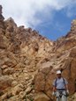
Here's a few more photos...I hiked in late Saturday night (07 MAY 2005) and came out Sunday afternoon. The threat of rain kept me off Del Campo, so I made my way Monte Cristo, then up Poodle Dog Pass and Silver Lake, back down to Monte Cristo and up to Glacier Basin, then back out to the car. Weather was generally overcast with a few light sprinkle. Poodle Dog Pass still has a while before it melts out, despite being 300 vert ft lower than Glacier Basin. Snow at Glacier Basin was pretty thin to nonexistant, and you could make it almost the whole way without having to walk on snow (if you're creative in spots). While there at Glacier Basin I ran into a gentleman who was filling a 7-gallon jerry can with "glacier water" beacuse he didn't trust the stuff in his tap. He had no map, no knowlegde of the area, and somehow made it up to Glacier Basin. For those too lazy to do the math, 7 gallons of water is 58.31 pounds (plus additional pack contents, the pack itself and the big jug). That's about 70 pounds!  and the trail to Glacier Basin is not paticularly tame and the trail to Glacier Basin is not paticularly tame 
 Arsenic Creek 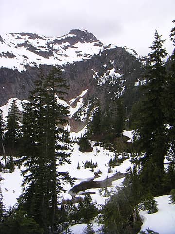 Silver Lake / Silver Pk 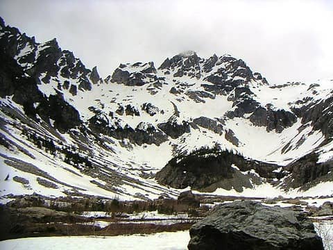 Glacier Basin
|
| Back to top |
|
|
|
|
You cannot post new topics in this forum
You cannot reply to topics in this forum
You cannot edit your posts in this forum
You cannot delete your posts in this forum
You cannot vote in polls in this forum
|
Disclosure: As an Amazon Associate NWHikers.net earns from qualifying purchases when you use our link(s). |


