| Previous :: Next Topic |
| Author |
Message |
Gimpilator
infinity/21M


Joined: 12 Oct 2006
Posts: 1684 | TRs | Pics
Location: Edmonds, WA |
August 17
Mount Robie Reid - 6873'
Steven and I decided to start with Mount Robie Reid. This impressive peak rises abruptly between Golden Ears and Judge Howay. A few reports suggested 4th class or low 5th so we brought a rope. It was oppressively hot and humid, even in the early morning. I was quickly down to just shorts, but still sweating profusely. We hoped the clouds would clear in the afternoon, but it was not to be.
We followed the road down, losing a lot of elevation until we found the climbers path above Alouette Lake. We followed the path to the base of the mountain. There were some unnecessary fixed lines along the way. From the base of the mountain to the summit was roughly 6400 feet of gain, mostly in the forest. It was steep.
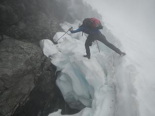 crossing the moat 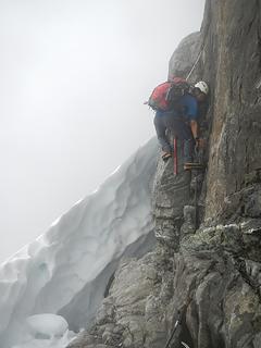 class 4 step 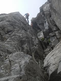 Steven leading 2nd crux 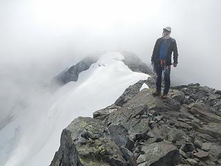 Robie Reid summit 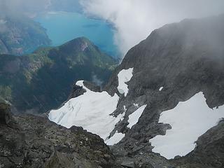 Stave Lake below 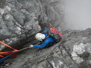 1st rappel 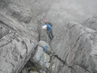 2nd rappel 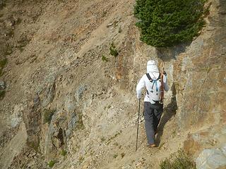 steep traverse 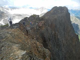 Microwave Ridge 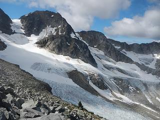 Birkenhead 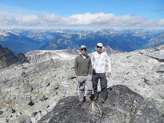 summit 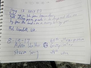 Rob! 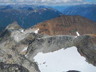 Birkhorn and Microwave 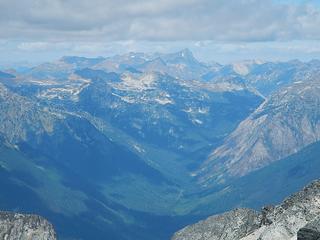 Truax 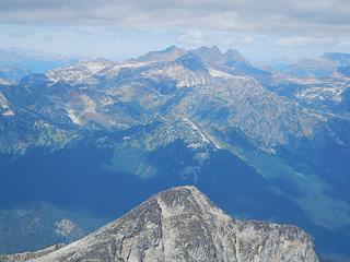 Gandalf, Aragorn, Chism, Plutus, Cadwallader 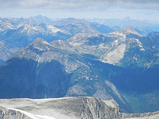 Sampson 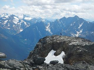 Matier, Slalok, Cirque, Cayoosh 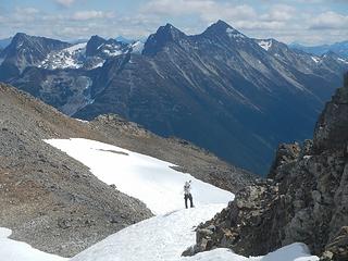 Nequatque, Marriot 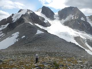 Birkenhead 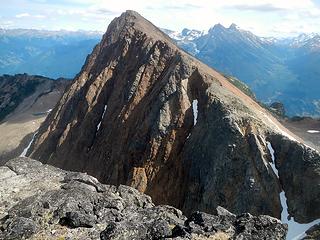 Microwave from Birkhorn 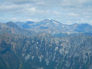 Whitecap 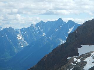 Crystal 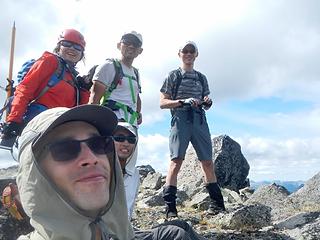 Birkhorn summit 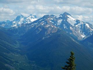 Joffre, Matier, Cayoosh 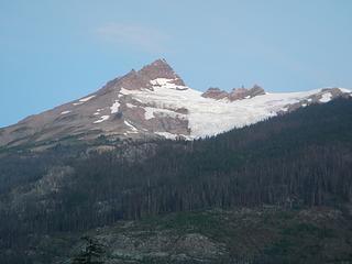 Pylon Peak and Devastation Glacier 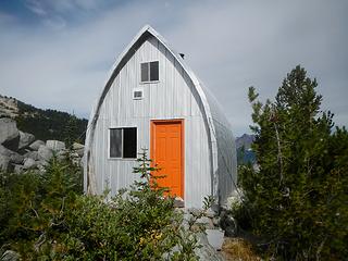 Julian Harrsion hut 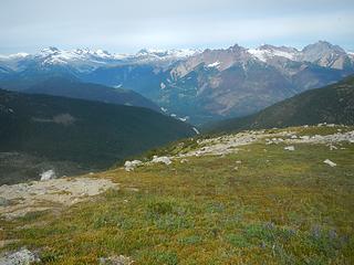 Obelia, Polychrome, Devastator, Pylon, Job, Meager 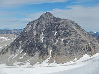 Overseer west face 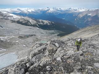 Frozen Boot northwest ridge 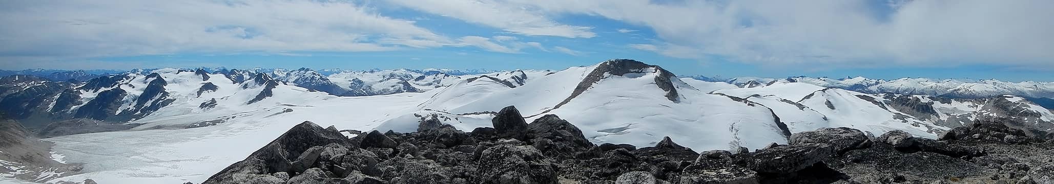 summit pano with Zygo 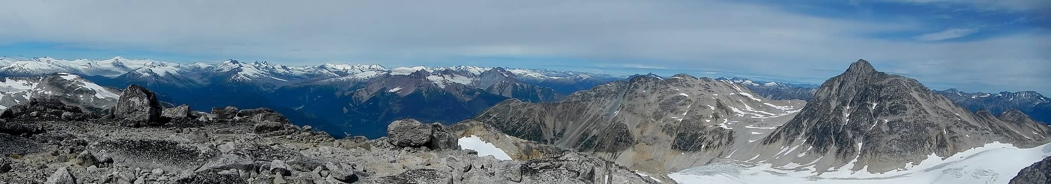 summit pano with Uriah's Heap and Overseer 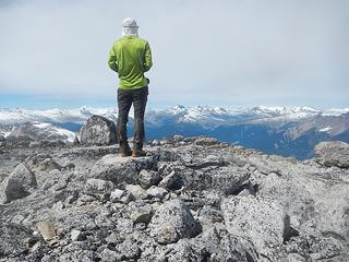 Frozen Boot summit 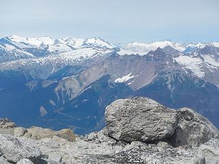 Dalgleish, Lillooet, Mu, Pilon, Magaera, Alecto 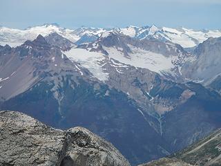 Pilon, Magaera, Alecto, Bridge 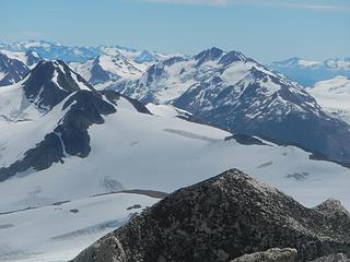 Longspur, 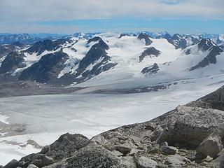 Golden Calf 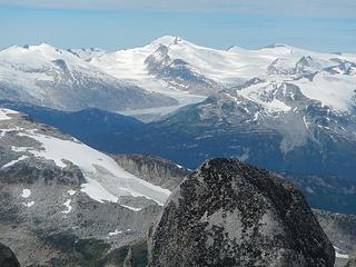 Elaho 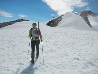 Zygo approach 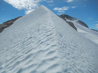 northeast ridge 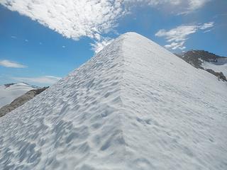 a real pleasure 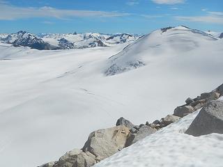 Pemberton Icecap 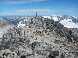 Zygo summit 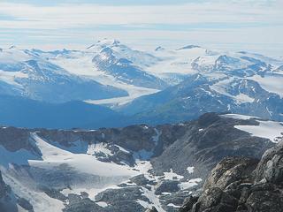 Elaho 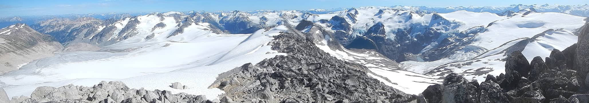 Zygo summit pano 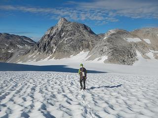 crossing the Madhorse Glacier 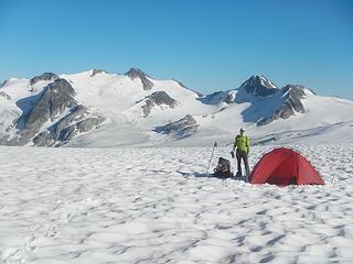 camping on the icecap with Golden Calf Peak in the distance 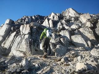 Madhorse Mountain west ridge 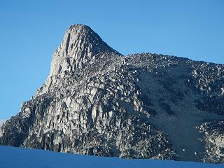 Overseer summit block 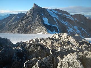 Overseer 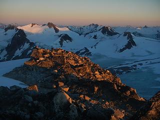 waited for sunset on the summit of Madhorse 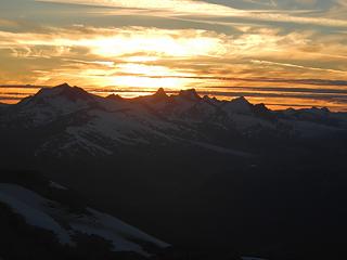 Manatee, Dugong, Serenia, Wahoo Tower, Oluk, Dolphin 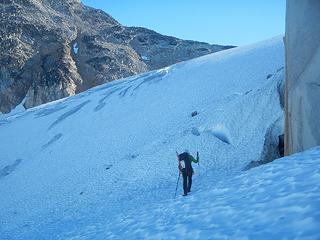 approaching the southeast ridge 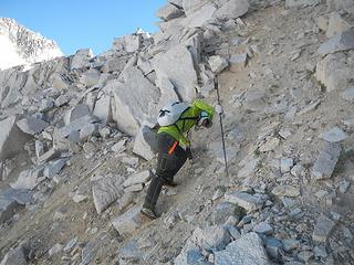 terrible choss to reach the ridge 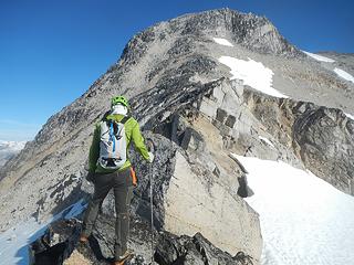 knifey and exposed in places 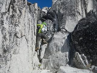 class 4 and low 5 avoidable if you go less direct 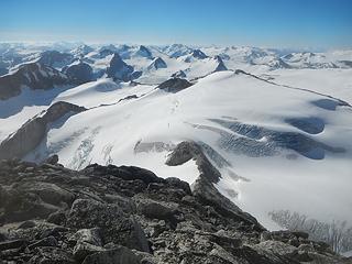 endless mountains, overwhelming 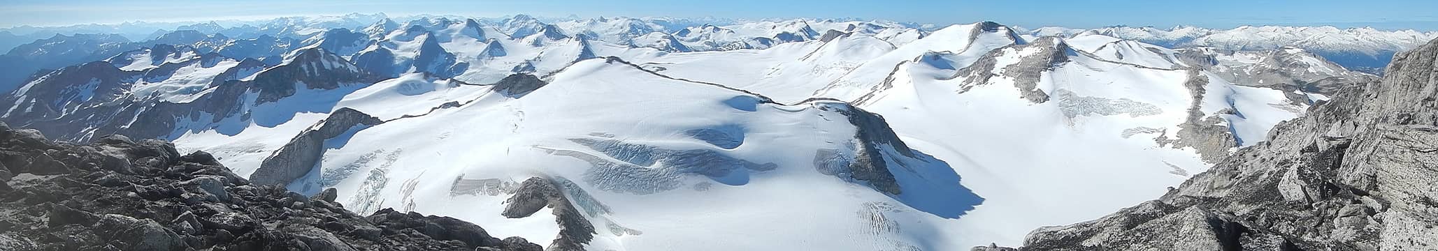 Pemberton Icecap 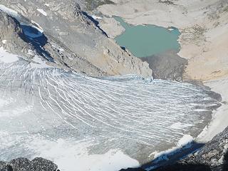 overlooking the standard approach which we skipped 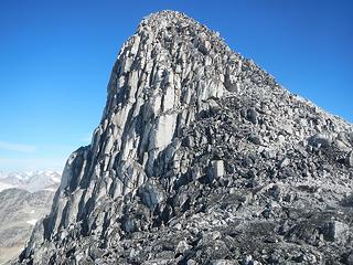 Overseer summit block 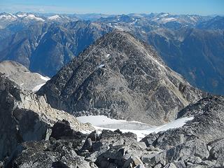 Spidery Peak 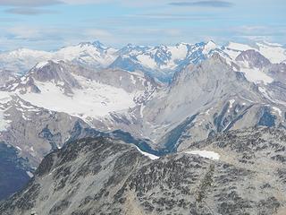 Meager foreground 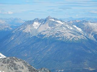 Athelstan 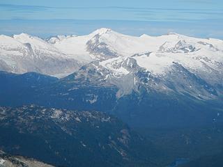 Elaho 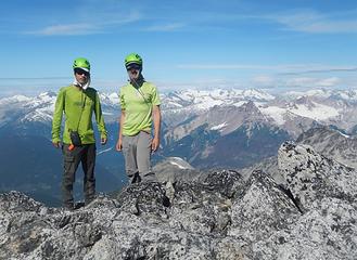 dressed for success with matching colors on Overseer summit  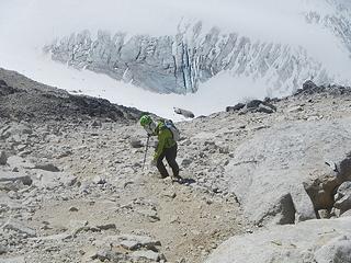 descending choss 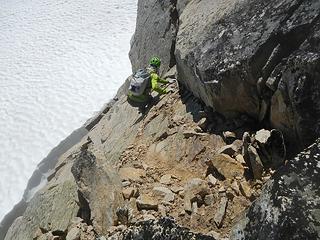 sketchy class 4 section on dirty slabs with a deep moat below 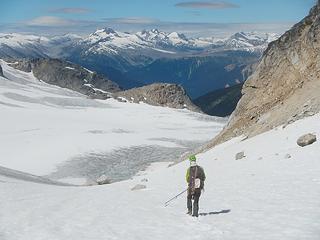 descending below the west face 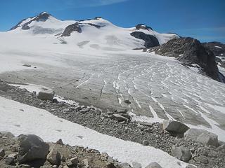 northeast side of Frozen Boot
|
| Back to top |
  
|
|
Gimpilator
infinity/21M
Joined: 12 Oct 2006
Posts: 1684 | TRs | Pics
Location: Edmonds, WA |
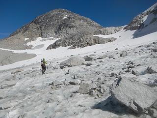
Spidery Peak - 8780'
After Overseer we returned to the glacier and contoured around the base of the mountain to access Spidery Peak. This was a big drop with substantial gain to get up and over a large moraine wall. The south ridge of Spidery was chossy at the bottom but really nice clean granite above that. We found a register, but no pencil.
 Spidery 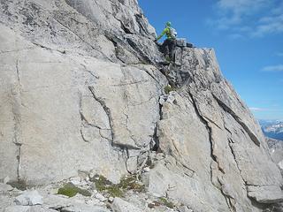 mostly good rock 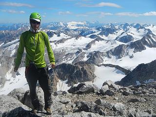 Steven on Spidery summit 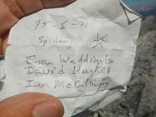 Spidery summit register with no pencil 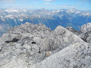 Pebble, Luxuria, Delilah, Sessel, Sampson 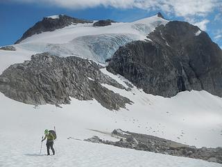 Overseer north face 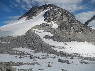 Spider west face 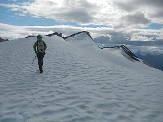 approaching Uriah's Heap 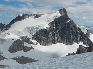 Overseer 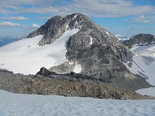 Spidery 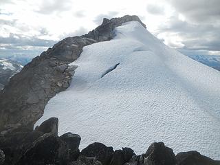 Uriah's Heap 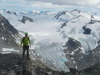 Uriah's Heap summit 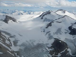 Frozen Boot and Zygo on the right 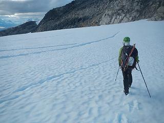 final glacier crossing 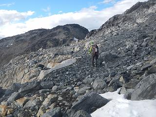 nearing Pika Peak 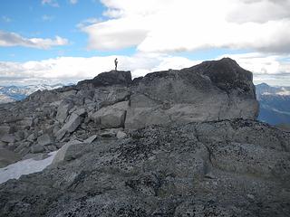 Pika summit 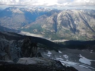 Athelstan, Gothrum, Icemaker, Blockhead, Spindrift 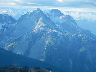 Meager, Plinth 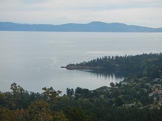 Baker barely visible 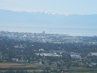 Olympus beyond the city of Victoria 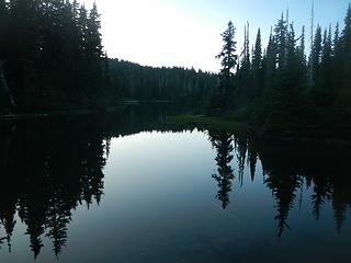 Arnica Lakes 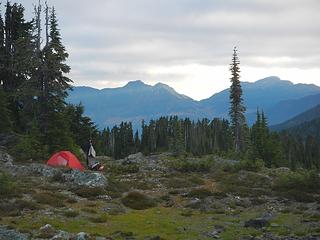 lower Phillips Ridge camp 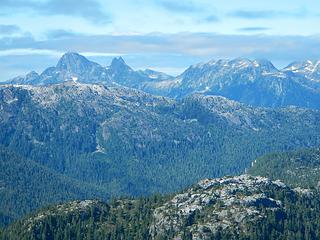 Matchlee 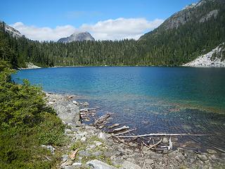 Carter Lake 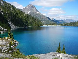 Golden Hinde above Schjelderup Lake 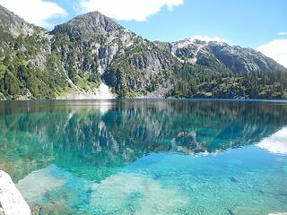 Schjelderup Lake 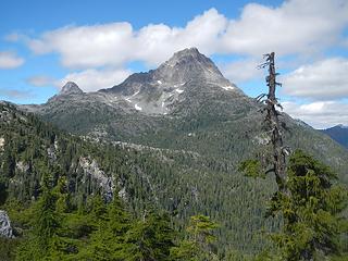 The Beehinde and Golden Hinde 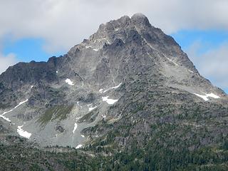 Golden Hinde with diagonal ascent gully visible 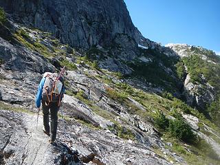 traversing slabs to Burman Ridge camp 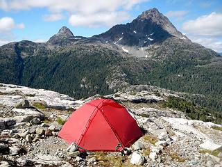 Burman Ridge camp 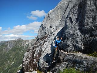 Steven took a direct 5th class route up Burman, but I traversed around it becuase it was wet in the crux 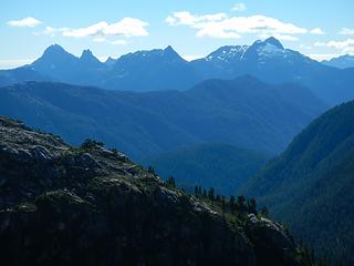 Matchlee and Ms 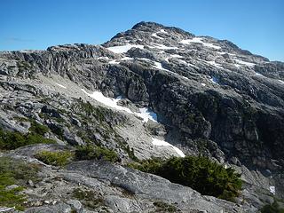 Burman 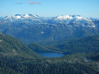 Tom Taylor, Big Interior 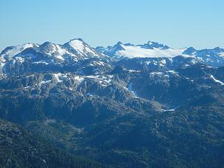 Thelwood and Mariner 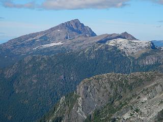 McBride, Morrison Spire, Limestone Cap 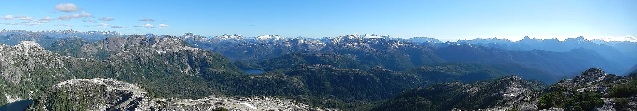 Burman summit pano south 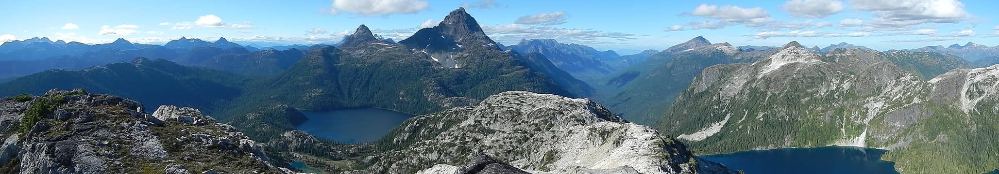 Burman summit pano north 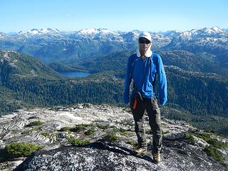 Steven on Burman summit 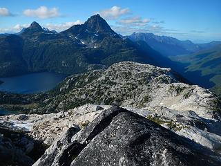 tomorrow 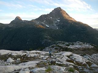 first light on "the hinde" 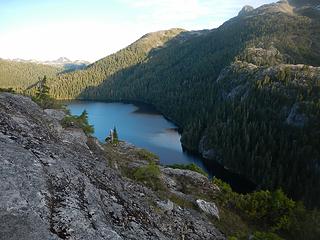 Burman Lake 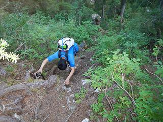 descending into Burman Chasm 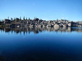 climbers tarn 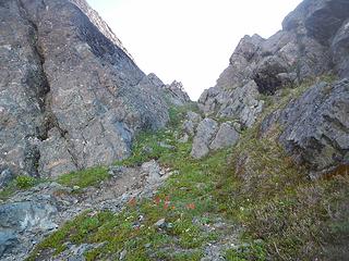 notch where the traverse starts 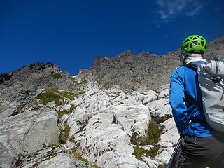 white rock at the base of the diagonal gully 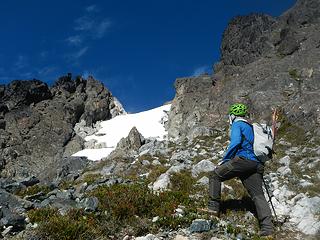 permanent snowfield 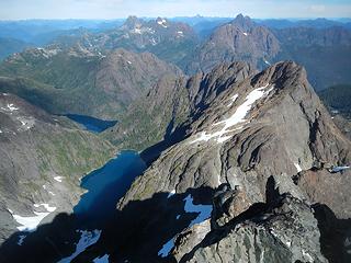 summit view north, naming nearest first and furthest last, DeVoe, Piveto, Rambler, Colonel Foster, Elkhorn, Victoria 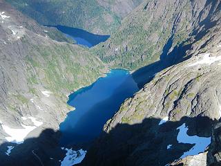 nice lakes 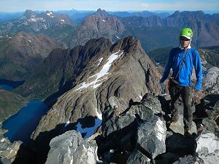 Steven on Golden Hinde summit 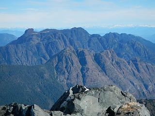 Haig-Brown, Cobb, Filberg 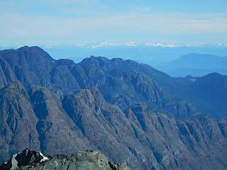 Mount Waddington!!!  Holy F**k 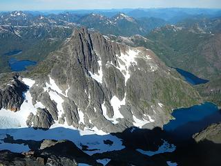 The Beehinde 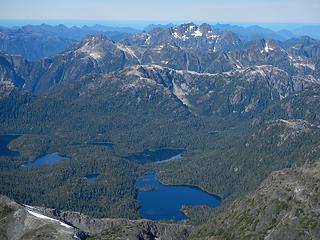 Matchlee and the ocean 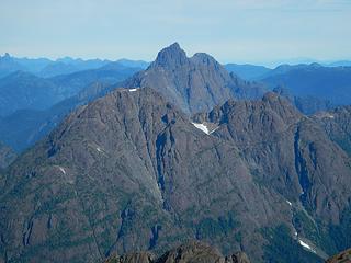 Elkhorn only a few meters lower than Golden Hinde 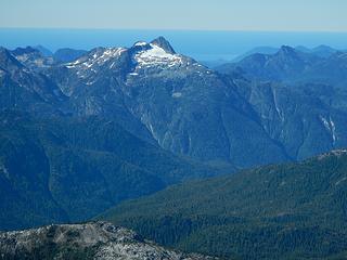 Splendor and the ocean 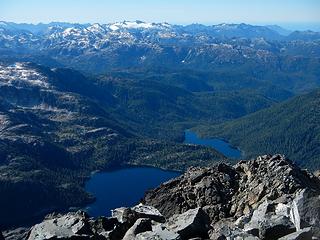 Mariner 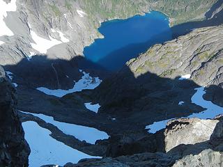 northwest face routes below 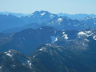 Rosseau 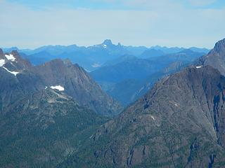 Victoria 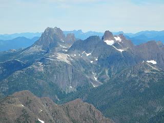 Colonel Foster 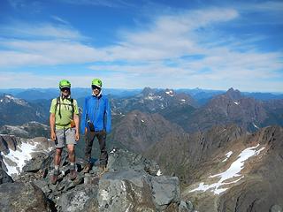 Golden Hinde summit 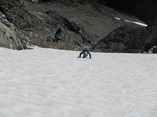 downclimbing 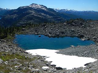 climbers tarn with Burman behind 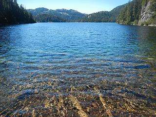 Burman Lake 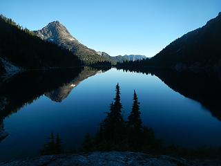 Schjelderup Lake 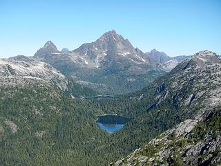 The Beehinde and golden Hinde from Philips Ridge 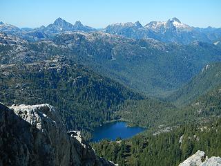 Matchlee and Ms 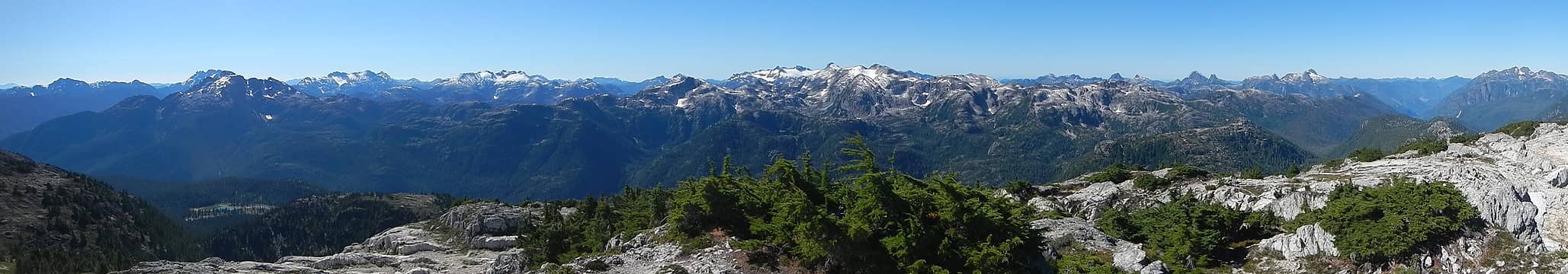 Phillips summit pano 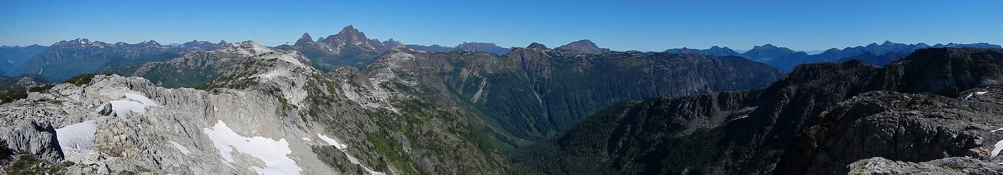 Phillips summit pano 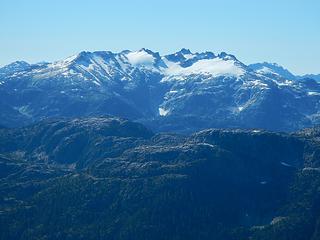 Big Interior 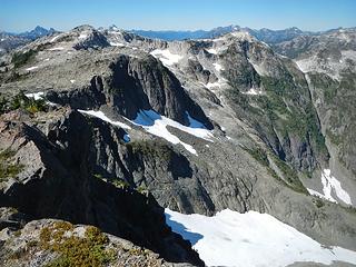 Phillips main peak seen from Phillips south peak 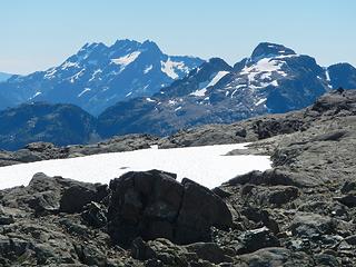 Rosseau and Myra 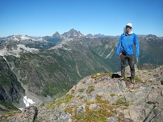 Steven on Phillips south peak summit
|
| Back to top |
|
|
Gimpilator
infinity/21M
Joined: 12 Oct 2006
Posts: 1684 | TRs | Pics
Location: Edmonds, WA |
August 29
Our original plans for the next peaks were stymied by road closures due to wildfire risk. The alternative we chose was Quadra Island. An easy day with easy hikes to rest up sounded great. We took another ferry and started the day at Rebecca Spit. I was sitting in the car eating when I heard the unmistakable sound of whales spouting nearby. I dropped my food and ran out to the beach. Humpbacks! I was ecstatic. I tried to wake Steven from his nap, but he was groggy and hardly interested.
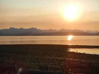 Rebecca Spit sunrise 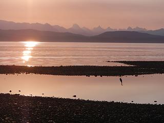 Coastal Range peaks 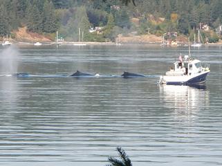 Humpbacks! 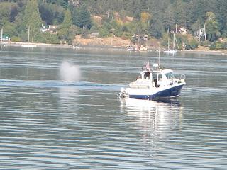 spout 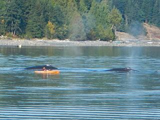 close encounter 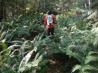 dumpster diving 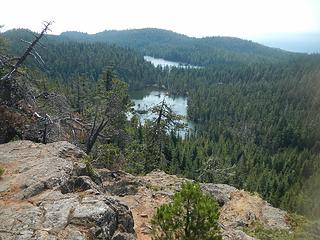 Nugedzi Lakes have leeches 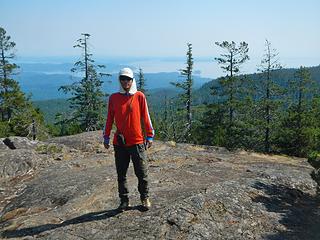 Seymour summit  bushwhacking  no parking 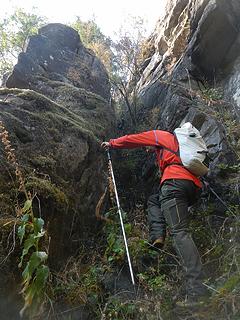 class 4 moss crux 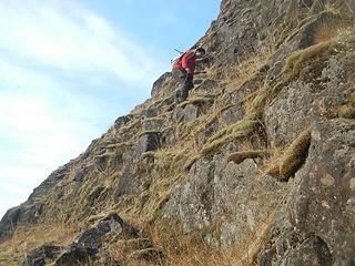 class 2 and 3 moss 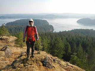 Steven on Mount Lolo 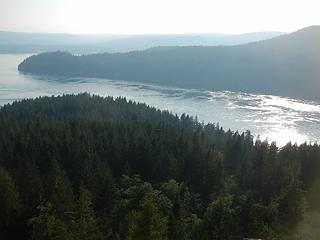 Seymour Narrows 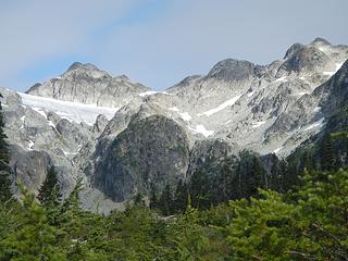 Brandywine summit at left 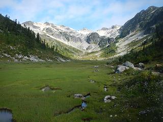 Brandywine Meadows 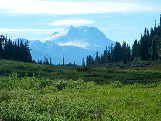 Garibaldi 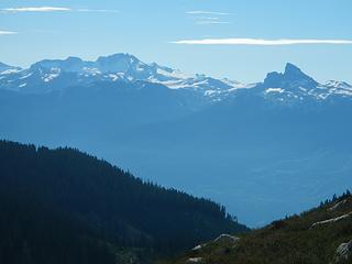 Castle Towers, Black Tusk 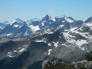 Tricouni with Alpha, Serratus, and Tantalus behind 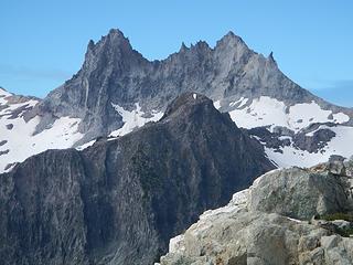 Mount Fee 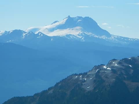 Garibaldi 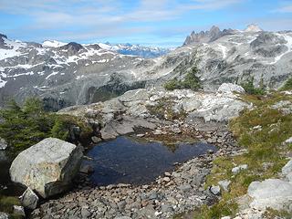 Ashlu 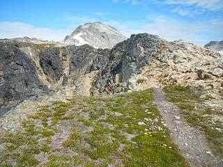 Brandywine summit ahead 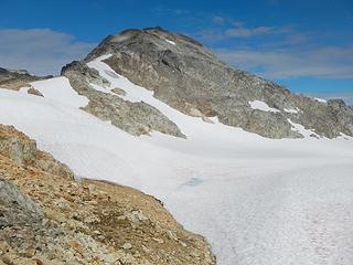 Brandywine 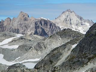 Pyroclastic Peak and Mount Cayley 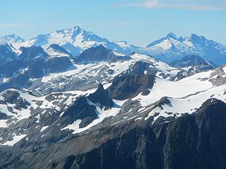 Serratus, Tantalus, Pelion, Ossa 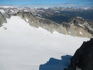 the southeast glacier 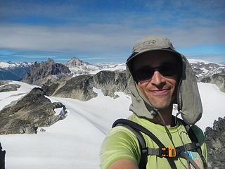 Brandywine summit 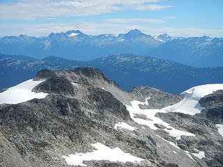 Weart, Wedge, James Turner 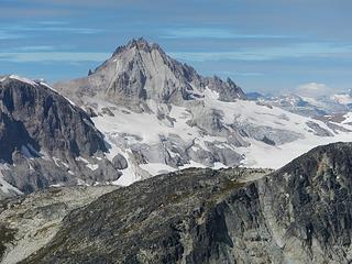 Cayley 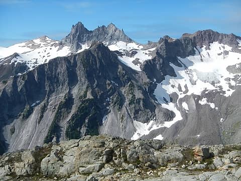 Fee 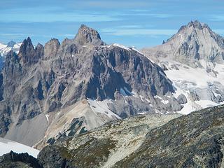 Vulcan's Thumb, Pyroclastic Peak, Cayley 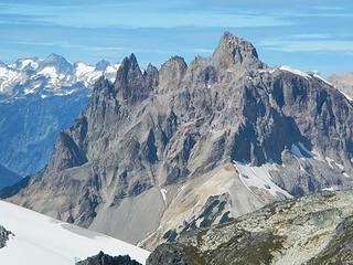 Vulcan's Thumb is reported to be compacted volcanic ash and pyroclast material, too steep to hold snow in winter and impossible to protect with current climbing tools 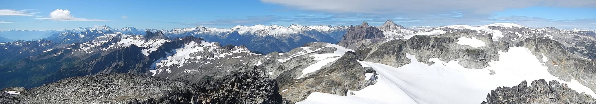 Brandywine summit pano southwest 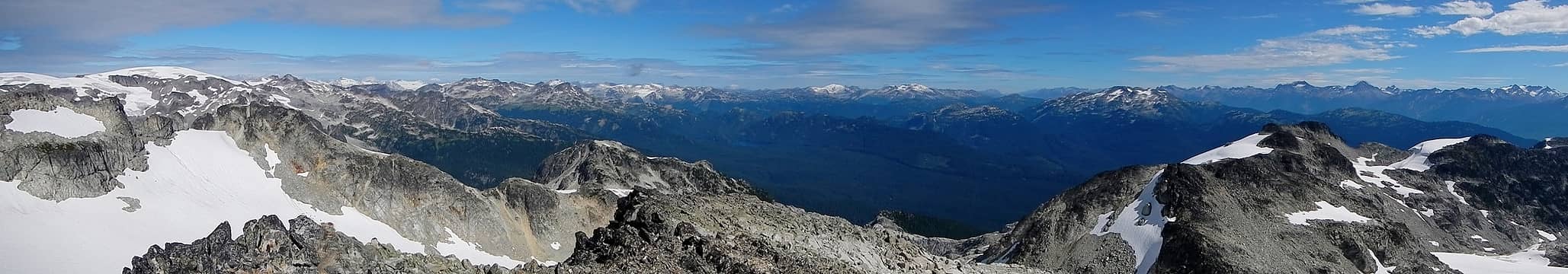 Brandywine summit pano northeast 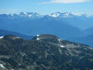 Rhododendron and Ipsoot 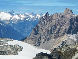 gnarly 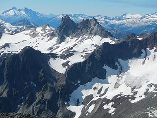 Fee with Pelion and Ossa behind on left 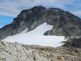 Brandywine west face 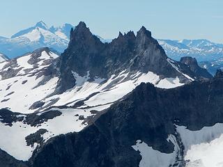 Fee 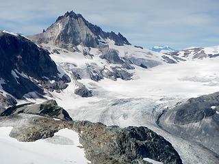 a closer look at Caylee 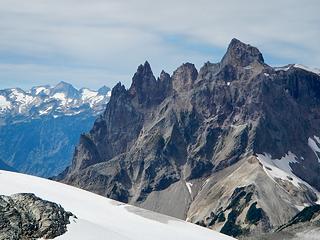 a closer look at Vulcan's Thumb and Pyroclastic Peak 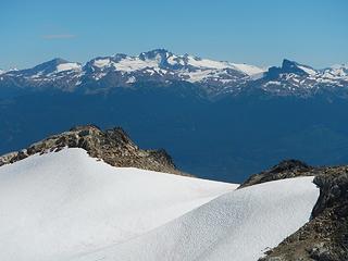 Castle Towers, Black Tusk  almost made myself sick 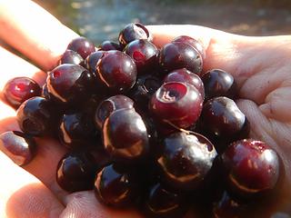 the red ones tasted like fruit punch 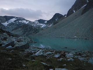 Wedgemount Lake predawn 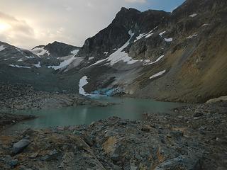 Parkhurst above the upper lake 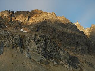 Rethel northeast face 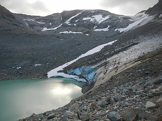 glacier feeding upper lake 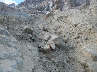 route crux, took me 20 minutes to climb 50 feet of this stuff 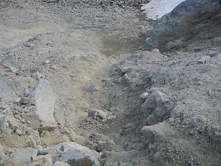 looking down, everything falls out 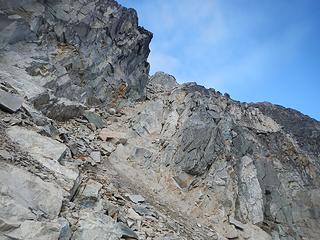 key ramp to Parkhurst/Rethel col 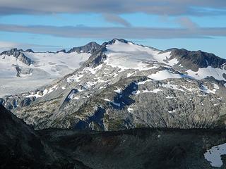 Phalanx 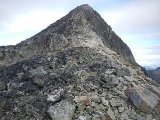 Rethel 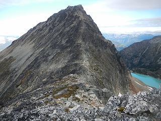 Rethel 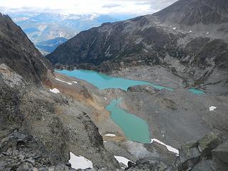 Wedgemount Lakes below 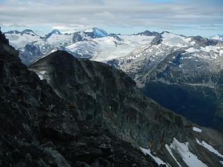 Spearhead traverse peaks 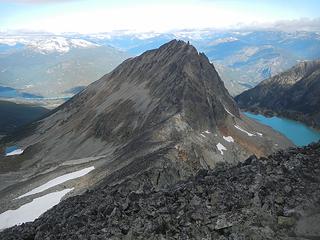 Rethel from Parkhurt 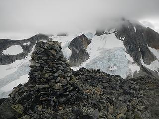 Parkhurst summit with Wedge in the clouds 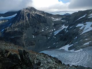 Weart partially cloud hidden 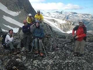 Birthday surprise! I can't believe it. 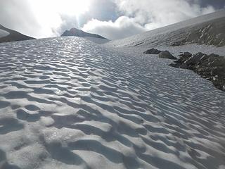 leading up hard snow with micros, everyone else had crampons 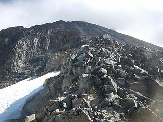 Wedge west ridge 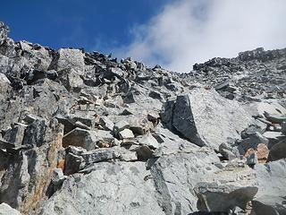 more loose blocks 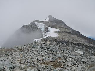 summit in clouds 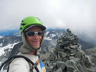 35! 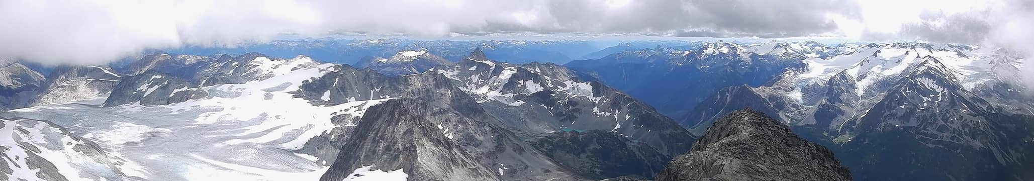 summit pano during brief clearing 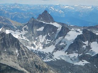 James Turner 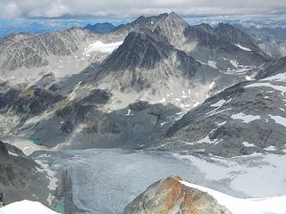 Weart 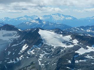 Black Tusk with Alpha, Serratus and Tantalus behind 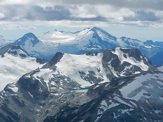 Garibaldi 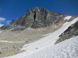 Wedge west wall below the west ridge 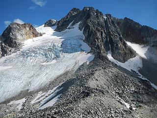 Wedge north face 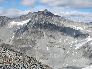 Weart from Parkhurst summit 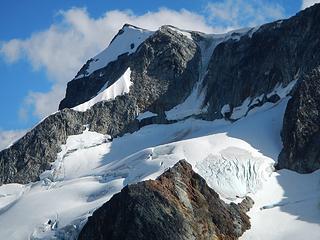 Wedge summit zoom 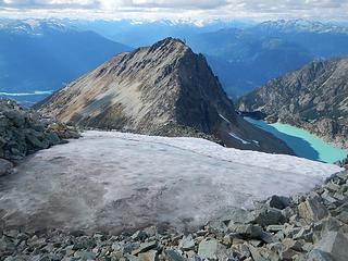 Rethel tempting me 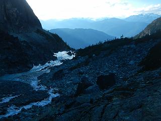 Wedgemount Lake outlet
|
| Back to top |
|
|
raising3hikers
Member

Joined: 21 Sep 2007
Posts: 2344 | TRs | Pics
Location: Edmonds, Wa |
those are some nice looking mtns up there! thanks for sharing 
|
| Back to top |
|
|
Jim Dockery
Member

Joined: 12 Sep 2007
Posts: 3092 | TRs | Pics
Location: Lake Stevens |
Way to get after it, that's a whole lotta peaks!
|
| Back to top |
|
|
RichP
Member

Joined: 13 Jul 2006
Posts: 5634 | TRs | Pics
Location: here |
|
RichP
Member
|
 Tue Sep 05, 2017 6:57 pm |
|
|
Excellent. 
|
| Back to top |
|
|
olderthanIusedtobe
Member
Joined: 05 Sep 2011
Posts: 7708 | TRs | Pics
Location: Shoreline |
Wow, you saw a lot of amazing places up there it looks like! I know I don't know Canada very well...but I'm just at a loss trying to take it all in. If you run out of peaks in Washington to climb our neighbors to the north can keep you busy for quite a while.
|
| Back to top |
|
|
awilsondc
Member

Joined: 03 Apr 2016
Posts: 1324 | TRs | Pics
|
|
| Back to top |
|
|
Fletcher
Member

Joined: 29 Jul 2009
Posts: 1870 | TRs | Pics
Location: kirkland |
|
Fletcher
Member
|
Tue Sep 05, 2017 8:44 pm |
|
|
|
| Back to top |
|
|
Gimpilator
infinity/21M
Joined: 12 Oct 2006
Posts: 1684 | TRs | Pics
Location: Edmonds, WA |
| olderthanIusedtobe wrote: | | Wow, you saw a lot of amazing places up there it looks like! I know I don't know Canada very well...but I'm just at a loss trying to take it all in. If you run out of peaks in Washington to climb our neighbors to the north can keep you busy for quite a while. |
The feeling of being at a loss is exactly what I experience every time I go up there. It's totally baffling how much there is to explore in the Coastal Range. It really drives home the point of how short life is.
Imagine the best of the North Cascades. Imagine what it must have been like hundreds of years ago when large glaciers still flowed down into valleys. Now add to that numerous icecaps and multiply the total land area by 100. That's the Coastal Range. A lot of peaks in remote areas have very few or no ascents and would require real expeditions.
Now here is the kicker. For someone living in the Seattle area, many of the good peaks in the southern end of the range require less driving time than going to the east side of the Cascades. Something to think about.
|
| Back to top |
|
|
xuanxier
Member

Joined: 09 May 2017
Posts: 80 | TRs | Pics
Location: Vancouver, BC |
|
xuanxier
Member
|
Sat Sep 09, 2017 12:00 pm |
|
|
Thanks for the great trip Adam. Once the rain really starts to fall hopefully I can catch my own trip reports up.
Just came back from a successful ascent of the Japanese Route on Mt. Alberta (Alpine V, 5.6).. By no doubt the biggest prize of the 11,000ers of Canadian Rockies. Will have to work on that trip report first though..
|
| Back to top |
|
|
Snidely Whiplash
Member

Joined: 16 Jun 2008
Posts: 9 | TRs | Pics
Location: Mercer Island, Washington |
That is just inspirational! Wedge, Parkhurst, Rethel in a day???? I don't know how you do it, but my hat's off to you. Great views. Makes me jealous about Brandywine. We couldn't see nearly what you could due to all of the smoke. That's been the name of the game this summer I guess.
|
| Back to top |
|
|
Snowdog
Member

Joined: 21 Jul 2006
Posts: 1028 | TRs | Pics
Location: on (& off) the beaten path |
|
Snowdog
Member
|
Mon Sep 11, 2017 9:05 am |
|
|
Terrific report! I would have been with Matt, Don, Carla & co. if I hadn't just been up there a few days prior. You are so right about the Coast range- so heavily glaciated compared to our N. Cascades. So many mountains, so little time!
And your pics are great too! Every.single.one.
Thanks for the write up!
'we don't have time for a shortcut'
'we don't have time for a shortcut'
|
| Back to top |
|
|
tekewin
Member

Joined: 06 Jul 2014
Posts: 15 | TRs | Pics
|
|
tekewin
Member
|
Wed Sep 13, 2017 8:04 pm |
|
|
More awesome reporting on awesome trips! Thanks for putting this together. The Overseer, what a peak!
The report was so good, I am going to ask you do more reporting work. Have you ever thought about aggregating all of your nwhikers reports in some kind of index? It would be really useful to everyone that follows your adventures or wants to follow in your footsteps. Maybe an alphabetical page that links the related nkhikers forum page?
Something to do if you get bored or stuck at home.
Thanks again!!
|
| Back to top |
|
|
silence
Member

Joined: 25 Apr 2005
Posts: 4420 | TRs | Pics
|
|
silence
Member
|
Thu Sep 14, 2017 3:31 pm |
|
|
PHOTOS
FILMS
Keep a good head and always carry a light bulb. Bob Dylan
|
| Back to top |
|
|
|
|
You cannot post new topics in this forum
You cannot reply to topics in this forum
You cannot edit your posts in this forum
You cannot delete your posts in this forum
You cannot vote in polls in this forum
|
Disclosure: As an Amazon Associate NWHikers.net earns from qualifying purchases when you use our link(s). |


