Previous :: Next Topic |
Author |
Message |
Matt Tea, Earl Grey, Hot
Joined: 30 Jan 2007 Posts: 4307 | TRs | Pics Location: Shoreline |
|
Matt
Tea, Earl Grey, Hot
|
Thu Aug 15, 2019 2:41 pm
|
|
|
Dates: July 20-22, 2019 (technically ending 12:50am July 23)
Destination: Indecision 7945 (USGS Arriva) & Outpost 7910 (USGS Logan)
Party: Matt, Carla (Dicey), Don (PeakJunkie)
Two rarely visited peaks with great views but some difficult terrain along the way.
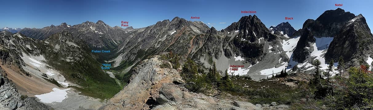
First half of our trip, viewed from Spectacular Ridge (Easy Pass, Natal Creek, and Indecision) 
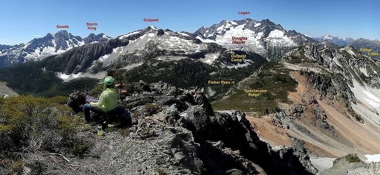
Second half of our trip, viewed from Spectacular Ridge (Fisher Pass, Outpost Peak, and Douglas exit) 
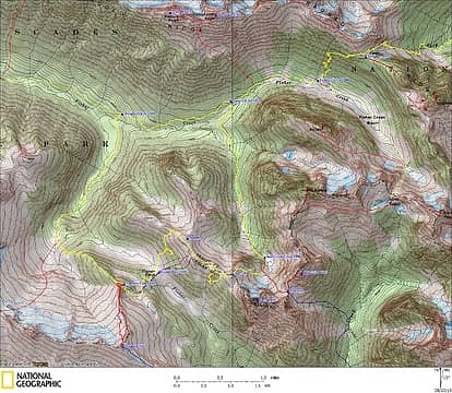
GPS Track (solid yellow and red lines are this trip, dotted lines are from past trips)
Itinerary
Saturday: Hike over Easy Pass and down Fisher Creek to 4800, cross the creek, then follow "Natal Creek" uphill to camp in the basin at 5990.
Sunday: Ascend Indecision via its southwest ridge. Cross "Spectacular Ridge" (on the Skagit/Chelan county line) to Fisher Pass, then camp at base of Outpost Ridge.
Monday. Ascend Outpost. Descend ridge to "Douglas Glacier Creek," descend to Fisher Creek, hike back out over Easy Pass.
The Good, The Bad, The Great, The Brushy, & The Late
Good: Hiking up Stefan's valley to camp in the basin below Indecision.
Great: Entertaining scramble and fine views from Indecision summit.
Very Good: Hiking up "Spectacular Ridge" west of Indecision.
Bad: Descending Spectacular Ridge to Fisher Pass – steep meadows, rock bands, and brush.
Good: Ascending back up to a fine camp on the north shoulder of Outpost.
Great: Views from Outpost summit.
Horrible: Relentless brush exiting down "Douglas Glacier Creek"
Very Late: Back at Easy Pass trailhead at 12:45am.
Saturday
Easy Pass Trailhead to Natal Basin (9:45am – 6:00pm)
We started by hiking up Easy Pass, down to Fisher Creek, and further down the trail to about 4800 feet. As always, the views on the far side of Easy Pass were wonderful – big peaks, a deep green valley, and flowery meadows.
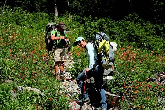
Unusually abundant columbine on the hike up to Easy Pass. 
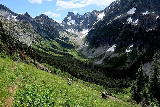
the view up Fisher Creek to Fisher Peak 
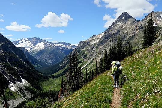
The view down Fisher Creek to Logan 
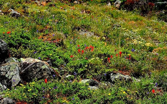
Verdant flower meadows 
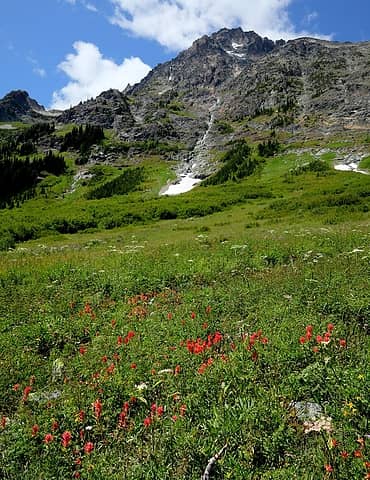
Paintbrush below Mesachie
At 4800 feet, we crossed Fisher Creek on a log and ascending on the east (lefthand) side of the creek that drains Natal basin, which I'll call "Natal Creek." Stefan recommended this approach, and it was a great way to get the basin. Lower down was mostly open forest. Midway was some brush, but we could avoid it by swinging farther left at the edge of rock fields. Higher up were meadows along the creek. We finished by crossing to the righthand side of the creek for a briefly steep scramble alongside a waterfall.
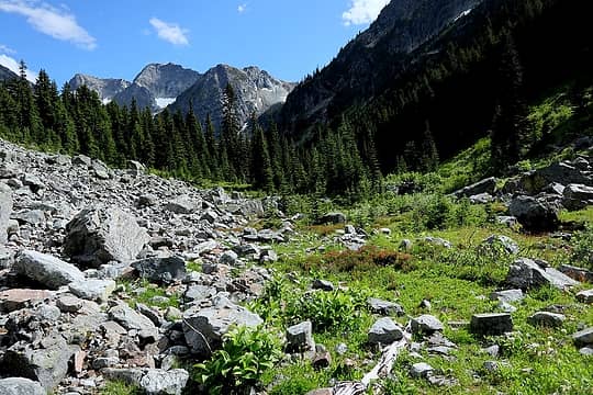
Following the edge of rock fields up Natal Creek.
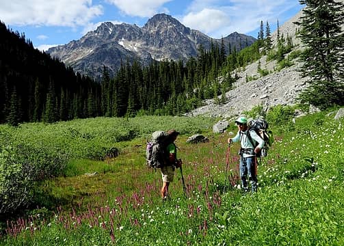
 Meadows higher up 
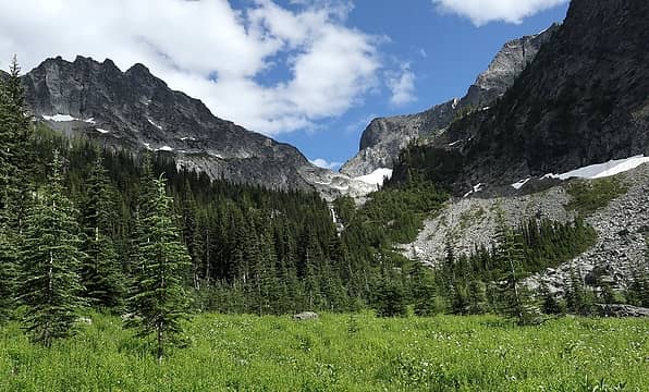
The final waterfall step up to Natal basin, with Indecision Peak on the left.
Stats: 9.7 miles, 4190 gain, 1940 loss
Evening in Natal Basin Camp
Above the waterfall, we camped circa 5950 feet in a wide flat basin of grassy meadows between large rocks.
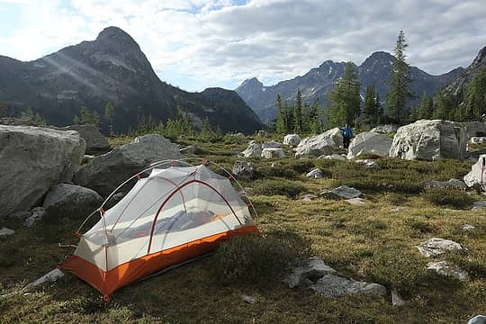
Looking back toward Ragged Ridge from our camp 
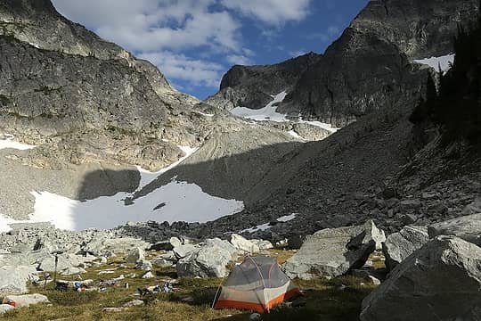
Looking up toward the col between Indecision & Natal 
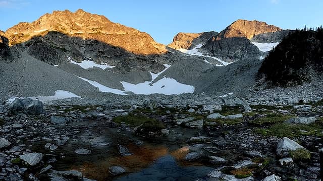
Sunset on Indecision & Natal 
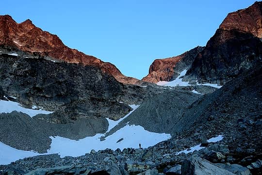
Don standing on a moraine to watch the sunset
Sunday
Indecision Peak (5:50-10:35am)
The route up Indecision is quite straightforward – hike up the basin to the Indecision-Natal col, then scramble up Indecision's south ridge to the summit. For the basin, we first angled rightward to avoid loose junk in the middle of the basin, then angled back over to the col. The ridge was never more than class 3, and mostly class 2. We stayed on the ridge crest at the beginning, slightly right of the crest most of the way, and made one steep move back left near the top.
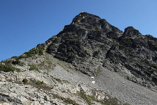
Route up Indecision, viewed from the Indecision-Natal col 
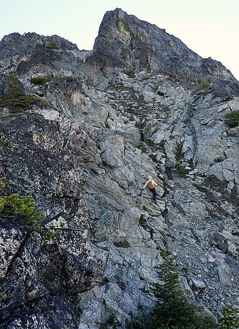
Scrambling up a gully 
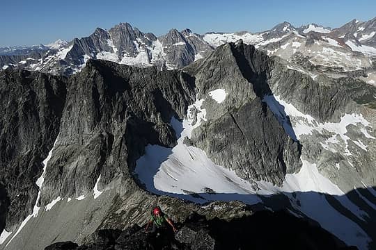
Looking down the ridge from near the summit; you can see that the lower part is mostly easy travel. 
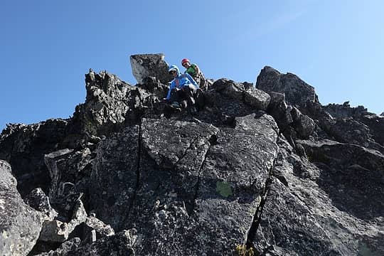
Carla & Don on a rockier part near the top
The summit had great views from a rarely seen perspective.
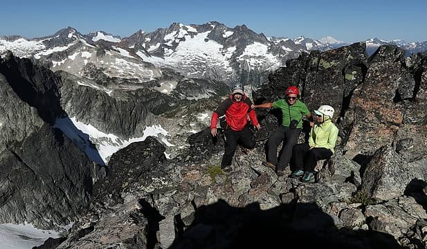
Summit group with Logan in the background 
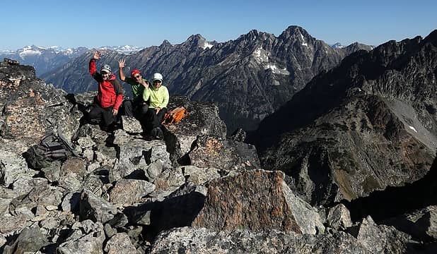
Summit group with Ragged Ridge in the background
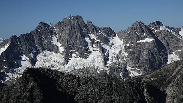
 Goode & Storm King 
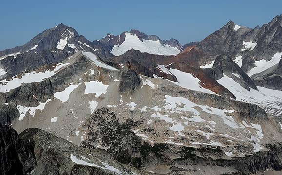
Buckner, Sahale & Boston, with Outpost in the foreground 
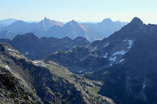
Looking through the Arriva gap to Silent Lakes, with Golden Horn, Hardy & Tower in the distance 
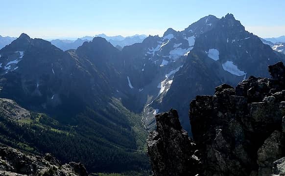
Looking up Grizzly Creek to Fisher, Arriva, & Repulse
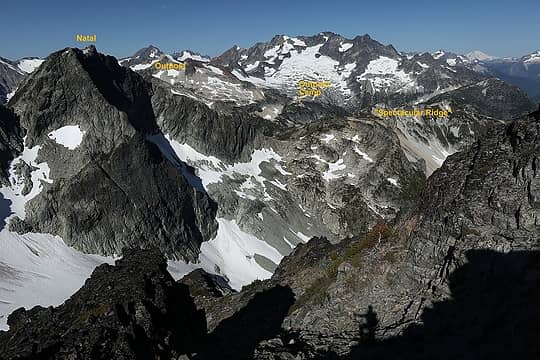
 Our goal later in the day – over Spectacular Ridge to camp on Outpost Ridge
A couple other peaks nearby:
"Muelefire" is the next bump north, with a cairn visible on top, but it's just slightly lower and some steep stuff in between. Its name derives from the first ascent by the Muelemans and Fireys.
"Natal" stands south of the col we visited, but we didn't bring gear for the 5th class climbing it requires.
Indecision should be a much more popular scramble. I think it's been obscure because most parties have approached from Arriva (steep nasty gully) or Grizzly Creek (long approach). However, Stefan's route up "Natal Creek" is straightforward, has a good camp, and the peak is a fine scramble – just challenging enough to feel like you're really climbing something, but nothing too difficult, and great summit views.
Round trip 2.2 miles, 1960 gain, 4:45 hours (including lots of time on summit)
Natal Basin Camp to Outpost Camp via Spectacular Ridge & Fisher Pass (11:15am – 8:15pm)
Now we wanted to move to a camp near Outpost, by ascending up the ridge east of us, down to Fisher Pass, and back up to the next ridge running north from Outpost.
The first part went easily, hiking up from our camp basin and onto Point 7135. Then our route ran northward along the easy ridge crest. We later learned that earlier travelers had named feature "Spectacular Ridge." It easily merits that name. It's a fine rolling ridge crest with spectacular views of all the surrounding peaks from a rarely-seen perspective. And any of the saddles with snow patches would make fine campsites.
Looking back at the approach from Fisher Creek and our camp and scramble earlier today Sitting on Point 7135 looking ahead at our future travel toward Outpost 
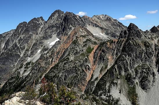
Mt Arriva and the nasty gully one would have to descend to approach Indecision from there 
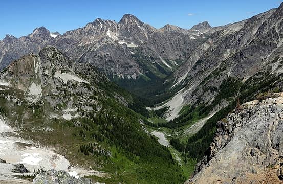
Looking down at the approach up "Natal Creek," just follow the verge of talus on the climbers left (east side) to avoid brush lower down, and the upper basin is meadows
But now we had to find a way off Spectacular Ridge down to Fisher Pass, 1500 feet below. The map showed lots of steep irregular contours, and Google Earth showed cliffs. We knew that the terrain looked better farther north on the ridge, but got suckered into descended steep meadows from the col just north of Point 7135. That cliffed out after descending 600 feet, so we had to ascend back up to the crest.
We continued along the crest past Point 6985 and descended again. The meadows turned into steep grass that was slippery enough that two of us wore crampons for a couple hundred feet. Soon we had to angle more southward to line up with Fisher Pass, which worked okay until we hit thick brush. Exploring back and forth didn't find any way to escape the brush. Some of the group sanely suggested giving up and camping on the beautiful crest, but I really wanted to visit Outpost and insisted on thrashing straight down the brush, even though we couldn't see what was below it. Luckily we found a narrow creek bed, which provided a path where one could back down while holding the brush on both sides for hand rails. Even more luckily, the creek led to an opening through lower brush that led us down to meadows and Fisher Pass.
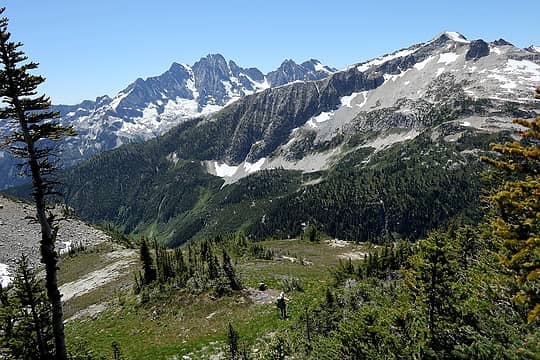
Hiking along the crest of Spectacular Ridge 
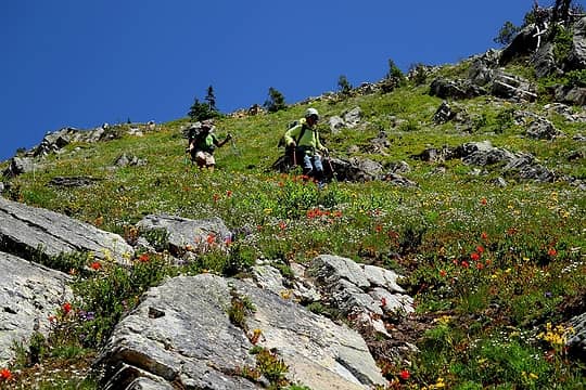
Descending steep upper meadows mixed with flowers and rocks. 
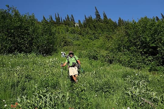
Emerging from the brush band a couple hundred feet above Fisher Pass 
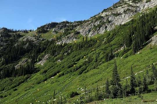
Looking back at the route we came down, barely dodging rock bands and brush 
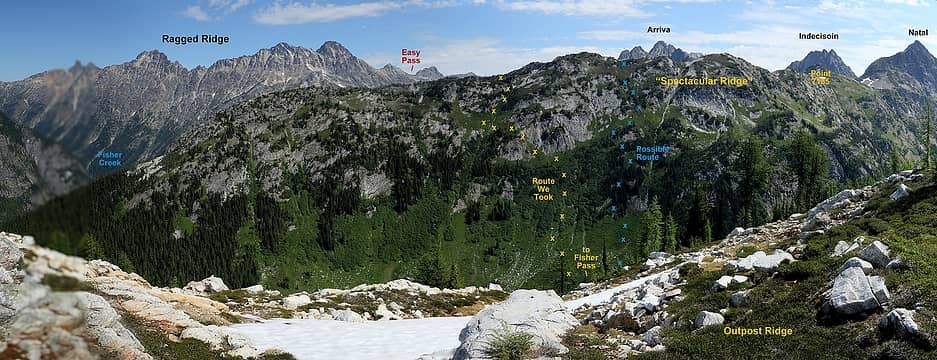
Later view of Spectacular Ridge from Outpost Ridge, showing our route and another possible route
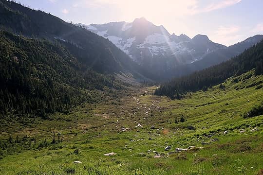
Fisher Pass has an oddity of topographical naming, because there two different Fisher Creeks on each side of it. Southeast of Fisher Pass, the more minor Fisher Creek flows down to Grizzly Creek. Northwest of Fisher Pass, a tributary flows down to Douglas Glacier Creek and the major Fisher Creek, the one that begins at Fisher Peak, with the Fisher Creek trail alongside it. Anyway, the pass itself has beautiful meadows of meandering streams, and many mosquitos.
The route up out of Fisher Pass was straightforward, a relief to us as the day grew late. We hiked up a small water fall and meadows to a wide talus basin that angled upward to a 6500-foot col where Outpost's north ridge bends to northwest. A few tarns made a pleasant surprise at the bottom of the talus basin.
On the crest near the col, we found multiple good camp spots. We picked one that had flat soft grass for the tents and a wide flat rock for a communal table.
Fisher Pass 
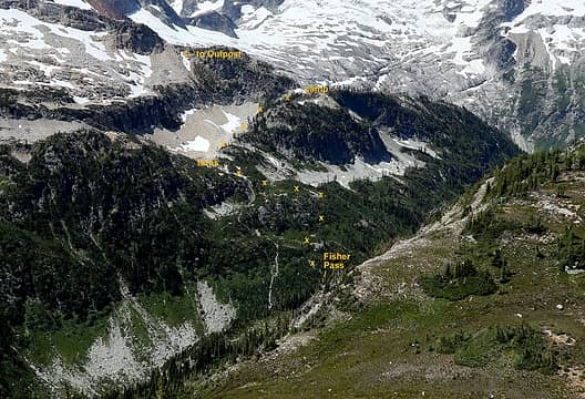
Our route out of Fisher Pass (which is hidden at the bottom of the photo) 
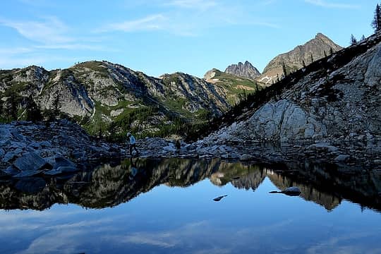
Spectacular Ridge reflecting in a tarn along the way
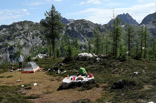
 Outpost Ridge Camp 
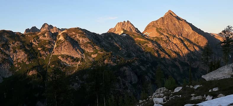
Evening light on Spectacular Ridge, with Arriva, Indecision & Natal behind
Stats: 5.6 miles, 3300 gain, 2800 loss (includes 600-foot error and return)
After dinner I joked that our first day had taken 8 hours and our second day had taken 14 hours, so at that rate our third day would take 20 hours. Cue the ominous foreshadowing here.
Monday
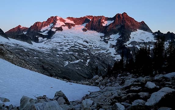
Morning alpenglow on Logan 
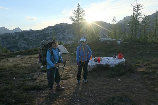
Departing camp just as the sun crests Spectacular Ridge
Outpost Round Trip (6:10-10:50am)
The route to Outpost basically just followed the crest upward. Right above the col, two rocky outcrops required a bit of scrambling, right of the first and left of the second. Farther up it was easy scrambling past larches on the crest or up snowfields right of the crest. We made a register out of an orange matches case and left it on the summit.
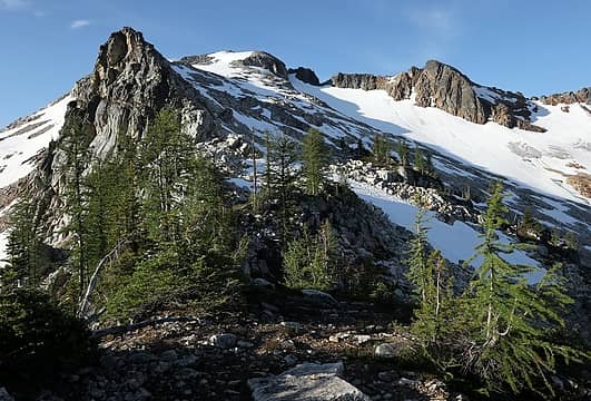
Larches and easy terrain beyond the first two steps 
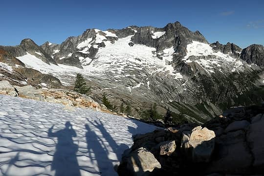
Shadows getting ready to hike up the snow 
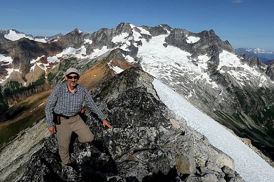
Me on Outpost summit 
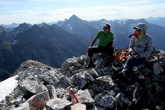
Don & Carla on Outpost summit
Outpost's summit again offered grandstand views, especially to the peaks west of us. Logan showed the huge expanse of granite slabs where the Douglas Glacier has retreated over time. Goode & Logan showed a magnificient wall rising above Bridge Creek, classic Cascades vertical terrain of rock spires, icy glaciers, green shoulders, and waterfalls tumbling to the creek far below.
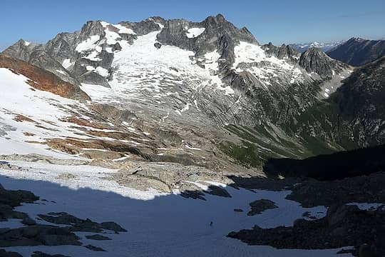
Logan's Douglas Glacier (plus Don hiking up the snow at bottom) 
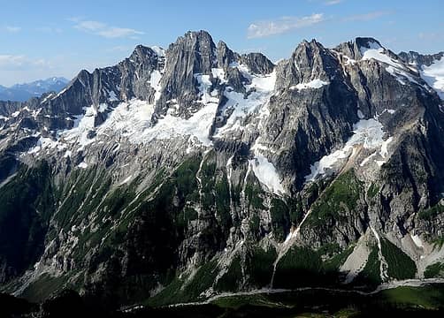
Goode & Stormking above North Fork Bridge Creek 
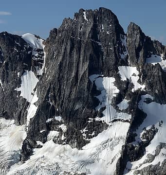
Goode Northeast Buttress 
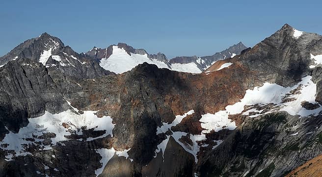
Buckner, Sahale, Boston, & Forbidden peeking around the shoulder of Logan 
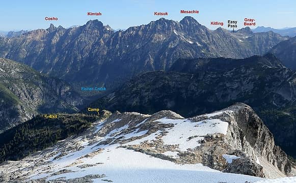
Ragged Ridge, and the trek back to Easy Pass 
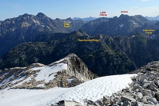
Spectacular Ridge, and the trek in from Easy Pass
Hiking down went easily, especially with a thousand feet of sun-softened snow to ease the descent.
Outpost Round Trip: 2.5 miles, 1460 gain
Exit via Douglas Glacier Creek, Fisher Creek, & Easy Pass (11:35am – 12:50am)
Our exit started out fairly promising, following Outpost's north ridge down to about 5400 feet and then angling off westward to meet "Douglas Glacier Creek" (the unnamed creek running from Douglas Glacier to Fisher Creek) at about 4700 feet. The ridge crest ran pretty well on the upper parts, then became steeper, but game trails led us on a workable zigzagging path downward. Where we arrived, the terrain upstream was beautiful green meadows below myriad waterfalls on the glacier-polished slabs.
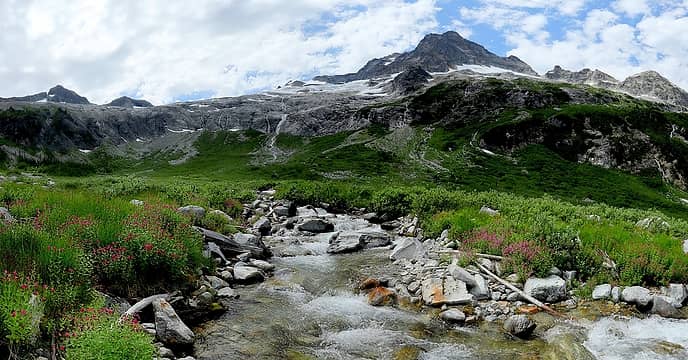
Waterfalls from Logan into upper Douglas Creek meadows.
The terrain downstream was a much worse story. I had camped here in spring 2008, when I did Logan's Douglas Glacier route, and snow covered much of this valley. I knew it would be brushy without the snow, but vastly underestimated how brushy it was. It was wall-to-wall thick high brush with no breaks or openings. You literally had to push through it one step at a time. It was also too thick to see through and too high to see over, so it was just blindly thrashing downstream. Every single step was an effort to push branches aside and move forward without falling down. I became separated from Carla and Don, so continued till I found a gravel bar below Fisher Pass, where I sat and blew a whistle for 45 minutes till they emerged from the brush. It had taken two hours to travel the first 0.6 miles. We continued through about another miles of brush, occasionally following creek beds that angled into the main stream, then finally entered forest where we could make better progress. Where the valley flattened, we traversed at about 3900 feet till we reached Fisher Creek. All told, it took 4:20 hours to travel 2.8 miles.
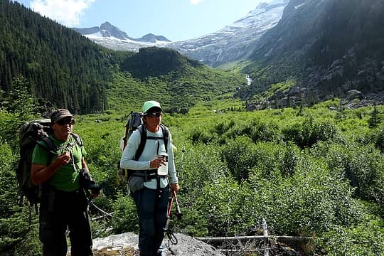
A brief rest amid the brush. Never go up this valley after the snow melts.
We forded Fisher Creek, since we were too tired to go looking for a log. Back on the trial, we made sure our headlamps were ready. By the time I reached the turn uphill to Easy Pass, the last light was fading from the summits. I finally reached the trailhead about 12:50am.
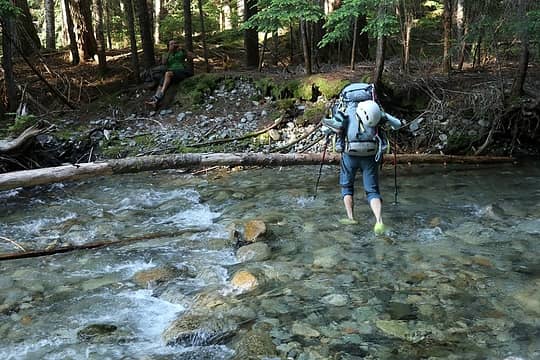
Fording Fisher Creek, very relived to be almost back on the trail 
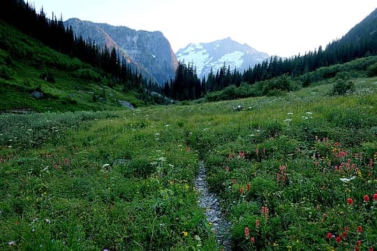
Twilight view back down Fisher Creek to Logan and the steep nose of Spectacular Ridge 
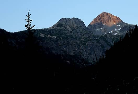
Last light on Graybeard, with Easy Pass already dark at left 
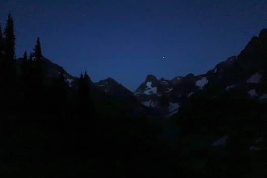
First star over Fisher Peak, on the way up Easy Pass 
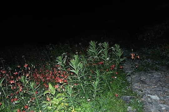
Columbines by headlamp, descending Easy Pass 
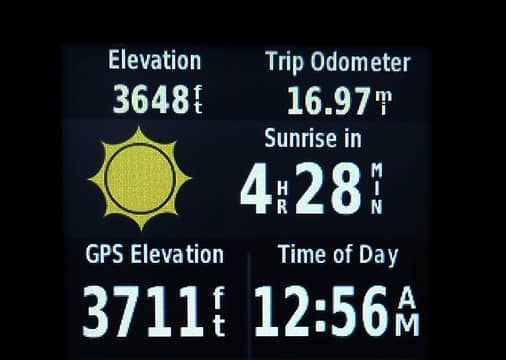
Hey, it's only 4.5 hours to sunrise!
Exit stats: 13.5 miles, 2780 gain, 5560 loss, 13:15 hours
Total trip: 33.5 miles, 13720 gain
The drive home was painful in the dark, though at least it was light already by the end. Even at 4am, traffic was already starting to build in Marysville when we dropped Don off. Carla reports that when she set her pack down in her apartment, her morning alarm went off to wake up and prepare for going to the gym. During the day, I tried to get up a couple times to go work, but just went back to bed each time.
One other topographical oddity: Indecision, Spectacular Ridge, Fisher Pass, our Outpost Camp, and Outpost peak all lie on the Skagit-Chelan county line.
These peaks were numbers 990 & 991 on my informal goal to visit 1000 different peaks before my 60th birthday.
History & Route Options
Even with the horrible exit, I'd do it again for the sake of visiting these rare and beautiful places. However, there are probably better options.
John Roper found an excerpt in Summit magazine from the 1970 party that named Spectacular Ridge, traversing in the opposite direction from Fisher Pass. He also has the first ascent of Natal Peak in 1981.
For Indecision alone, I'd go in and out via Easy Pass and "Natal Creek." It's a straightforward approach with almost no brush, and an enjoyable scramble with just a tad of challenge, great views, and a rarely visited location. It can combine with Natal if you're up for some 5th class climbing. You could also camp higher than we did up on Spectacular Ridge. Big thanks to Stefan for suggesting this approach.
For Outpost alone, I'd do it in spring when the brush in "Douglas Creek" is snow-covered, or at least not leafed-out yet. It could be a good combo with the Douglas Glacier route for Logan. You could probably traverse high between the if you have the time and energy.
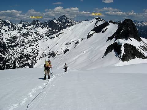
Outpost viewed from Logan's Douglas Glacier route in spring 2008.
But what if you want to combine both?
Well, first here's some history of other trips.
John Roper found an article in Summit Magazine from a 1970 trip that named "Spectacular Ridge."
If you want to include Natal, Stefan Feller and the Helmingers approached from Arriva (bad gully) and Stefan exited via the much better "Natal Creek."
https://www.nwhikers.net/forums/viewtopic.php?t=8017385
Mike Torok and Mitch Blanton did all three peaks on a completely different approach. They came in from Last Chance Pass north of Benzarino, down to Grizzly Creek, and up to the Natal-Indecision col. They exited down Outpost's southwest ridge, which looks to run very smoothly all the way down to the trail at North Fork Bridge Creek. 9/11/99
https://peakware.com/peaks.php?pk=644&view=logs&log=12372&login=1
Dave Creeden visited Outpost Peak via North Fork Bridge Creek and Outpost's southwest ridge. He reports some difficulties at lower part of the ridge.
https://www.nwhikers.net/forums/viewtopic.php?p=1070748
If I wanted to try these peaks again, I'd probably come in Creeden's route from North Fork Bridge Creek, carry over Outpost, then finish the loop in the reverse direction from this summer's trip, go east across Fisher Pass, ascend and camp on Spectacular Ridge, scramble Indecision, and exit via "Natal Creek" and Easy Pass. That would avoid the Douglas creek brush and let one see the steep side of Spectacular Ridge before ascending it.
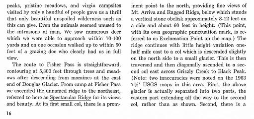
Summit Magazine "Spectacular Ridge" excerpt 
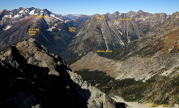
view from Benzarino near Last Chance Pass, looking to Outpost & Natal 
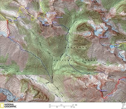
Torok & Blanton's approximate route (blue lines)
“As beacons mountains burned at evening.” J.R.R. Tolkien
Now I Fly
“As beacons mountains burned at evening.” J.R.R. Tolkien
Now I Fly
|
Back to top |
|
|
raising3hikers Member
Joined: 21 Sep 2007 Posts: 2344 | TRs | Pics Location: Edmonds, Wa |
i love this TR! thanks for sharing your trip, such a great area you guys went to
|
Back to top |
|
|
neek Member
Joined: 12 Sep 2011 Posts: 2337 | TRs | Pics Location: Seattle, WA |
|
neek
Member
|
Thu Aug 15, 2019 4:27 pm
|
|
|
Thanks for convincing me to put Indecision on the list - couldn't quite make up my mind about that one (groan).
|
Back to top |
|
|
iron Member
Joined: 10 Aug 2008 Posts: 6392 | TRs | Pics Location: southeast kootenays |
|
iron
Member
|
Thu Aug 15, 2019 9:35 pm
|
|
|
'tis a fine spot. we really enjoyed it. wish we had rallied to do outpost + logan while there, but our trip a few years later is probably a better story anyway.
|
Back to top |
|
|
Jake Robinson Member
Joined: 02 Aug 2016 Posts: 521 | TRs | Pics
|
Thanks so much for all the history!
|
Back to top |
|
|
puzzlr Mid Fork Rocks
Joined: 13 Feb 2007 Posts: 7220 | TRs | Pics Location: Stuck in the middle |
|
puzzlr
Mid Fork Rocks
|
Sat Aug 17, 2019 9:32 pm
|
|
|
Fun report to read, mostly because I didn't have to do all the bushwhacking. Great photos, including markups, and thanks for the context of other trips and routes. This is really what nwhikers is about.
|
Back to top |
|
|
ozzy The hard way
Joined: 30 Jul 2015 Posts: 476 | TRs | Pics Location: University place, wa |
|
ozzy
The hard way
|
Sun Aug 18, 2019 4:52 pm
|
|
|
Awesome effort for these 2! Ive been wanting to go get Indecision for a while now. Thanks for the good beta!
“I don’t know what’s gonna happen, but I wanna have my kicks before the whole shithouse goes up in flames”-Mr Mojo Risin
|
Back to top |
|
|
trent Suffering fool
Joined: 02 Oct 2006 Posts: 65 | TRs | Pics Location: Stanwood |
|
trent
Suffering fool
|
Sun Aug 18, 2019 8:45 pm
|
|
|
Your route seems a lot better than ours. We did Indecision as a day trip from Silent Lakes with Arriva thrown in, but it was a brush bash! But getting Muelefire as well was pretty straightforward coming this direction. TR
Spectacular Ridge looks pretty, well, spectacular. Thanks for the great TR and pictures.
And 1000 different peaks; you have been busy!
It's all downhill from here!
|
Back to top |
|
|
cascadetraverser Member
Joined: 16 Sep 2007 Posts: 1407 | TRs | Pics
|
|
Back to top |
|
|
awilsondc Member
Joined: 03 Apr 2016 Posts: 1324 | TRs | Pics
|
|
Back to top |
|
|
pula58 Member
Joined: 13 Aug 2009 Posts: 589 | TRs | Pics
|
|
pula58
Member
|
Wed Aug 28, 2019 3:24 pm
|
|
|
Did you need to use ice axe and or crampons for Indecision peak??
|
Back to top |
|
|
freddyfredpants saucy
Joined: 08 Jul 2018 Posts: 40 | TRs | Pics Location: Seattle |
Wow that looks like a great trip, thanks for sharing. Agreed that the area is worth the schwack.
On the horrible exit down Douglas Creek, if I understand correctly that you stayed in the stream bed or near by all the way to Fisher Creek I could see how it would be really tough. In case an alternate description helps kindle enthusiasm to return, I'll mention that I got Logan a couple of years ago around Labor Day using that drainage. I crossed Fisher Creek about a quarter mile east of where it meets Douglas Creek (or at least where the USGS map marks it) and found the first mile or so to be decent travel on animal trails in mostly open forest, though gradually nearing the creek. Between ~4000-4300' was definitely slow-going bushwhacking around overgrown boulders, logs, and in deep alder patches. It's unavoidable, but maybe just an hours worth of flail. My GPS track coincides with the stream marking ~3900-4100', but I know I was mostly at least a couple hundred feet to the east of its actual position.
- Fred
|
Back to top |
|
|
Matt Tea, Earl Grey, Hot
Joined: 30 Jan 2007 Posts: 4307 | TRs | Pics Location: Shoreline |
|
Matt
Tea, Earl Grey, Hot
|
Wed Aug 28, 2019 9:50 pm
|
|
|
There was a bit of steep snow going up to the col where the ice axe was reassuring. Didn't need crampons.
“As beacons mountains burned at evening.” J.R.R. Tolkien
|
Back to top |
|
|
|
You cannot post new topics in this forum You cannot reply to topics in this forum You cannot edit your posts in this forum You cannot delete your posts in this forum You cannot vote in polls in this forum
|
Disclosure: As an Amazon Associate NWHikers.net earns from qualifying purchases when you use our link(s).
|