| Previous :: Next Topic |
| Author |
Message |
awilsondc
Member


Joined: 03 Apr 2016
Posts: 1324 | TRs | Pics
|
This trip was inspired by Jake and Paul Robinson. In 2012 I did a trip with them up to NW Warrior with a camp at the cirque below the peaks. Years ago Paul had climbed Inner Constance from this cirque and it was always a route that had piqued Jake's interest. Plus, we had failed to get the true summit on Warrior so I knew I'd be back some day. Well, last week it was "some day"... 9 years after my first trip to this area I headed back for a new adventure and some unfinished business.
The Approach
I got a late start after returning from a family vacation. I drove up to the Upper Dungeness Trailhead and was hiking by 5:20pm. It's a long way up to the cirque, about 9.5 miles and 3800ft gain, so I knew I'd need a solid pace to get up there before it was dark (sunset was at 9). The good news is that the trail up is about as easy of a trail as you could ask for. The first 3 miles are fairly flat as the trail follows the Dungeness River up to Camp Handy. I was enthralled with the evening light in the forest. Deep blue long shadows, soft warm light through the trees, a hint of turquoise in the water, and a cool breeze to accentuate the ambiance. What an awesome section of forest! Of course I had to stop for some photos along the way.  Past camp Handy there was a fork in the trail with a sign for Marmot Pass. Not wanting to go to Marmot pass, I went the other way. It was the wrong way, but I quickly diagnosed my mistake after a tenth of a mile and got back on track. Past camp Handy there was a fork in the trail with a sign for Marmot Pass. Not wanting to go to Marmot pass, I went the other way. It was the wrong way, but I quickly diagnosed my mistake after a tenth of a mile and got back on track.
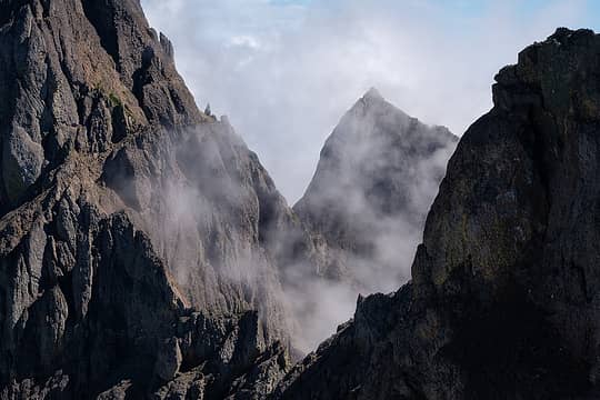
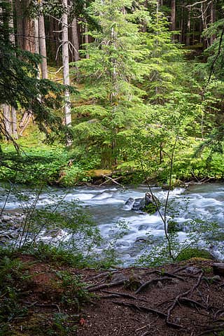 Dungeness River 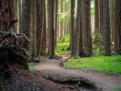 Enchanting 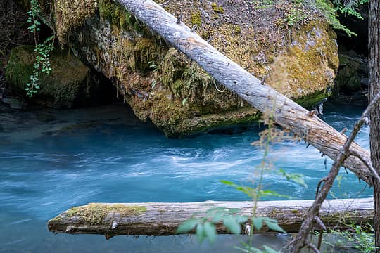 So blue! 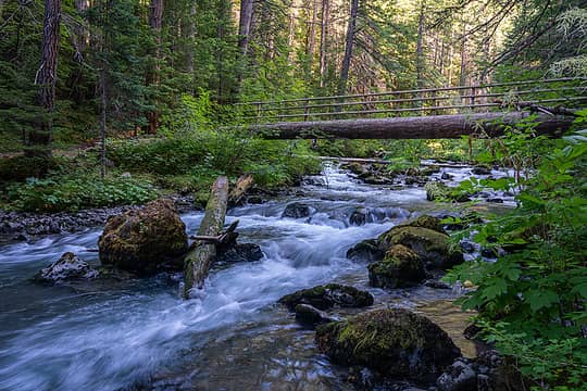 Second foot bridge 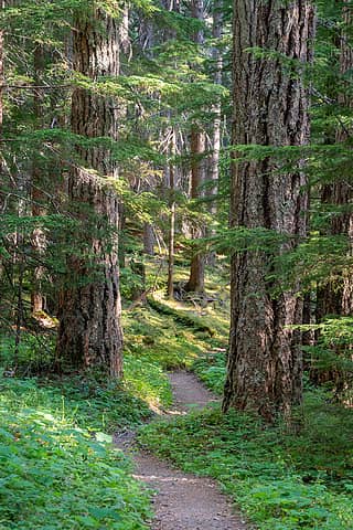 Magical forest 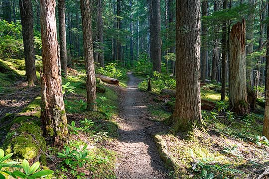 I love this lighting! 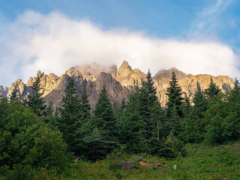 Evening light on Warrior 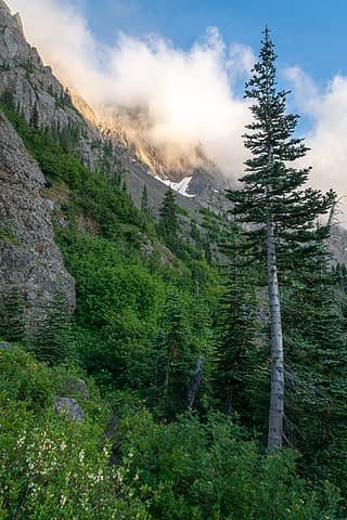 Fun ambiance 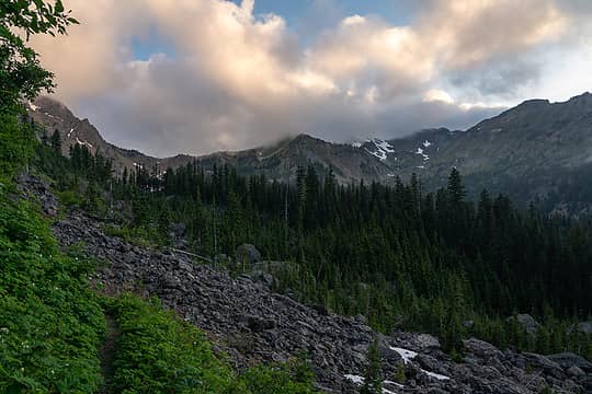 Entering the boulder field 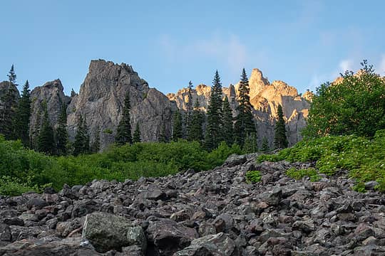 Views from the boulder field 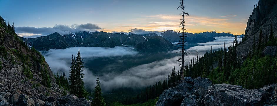 Dusk over the Home Creek valley 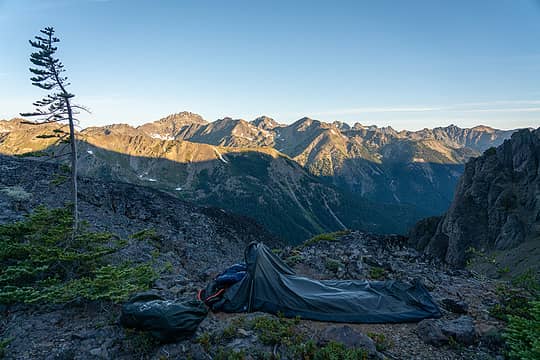 My bivy 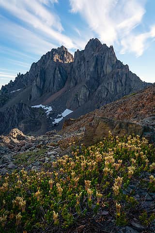 The Mighty Warrior 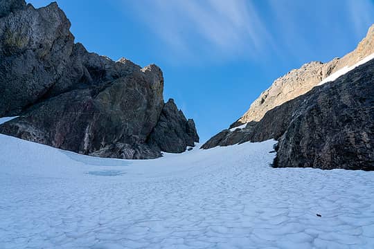 Snow up to the col 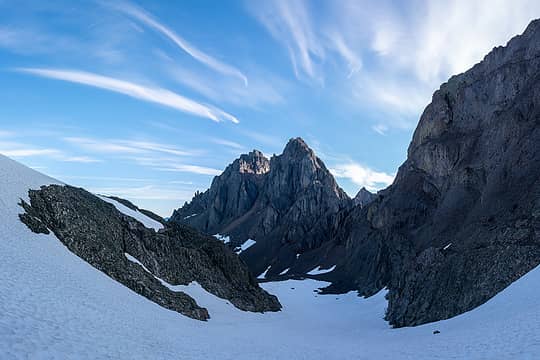 Looking down at Warrior 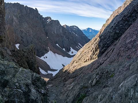 At the saddle 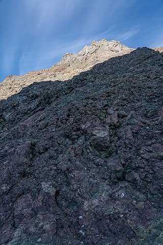 Initial slopes from the saddle 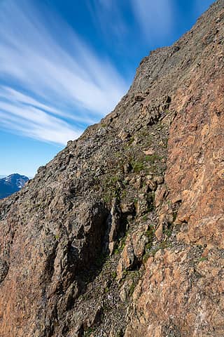 Dirty ramp 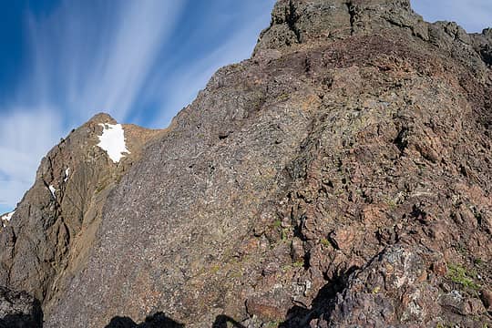 7447, cliffs, and a ledge up high 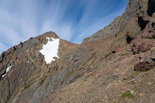 Traverse this 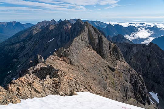 looking back at the route, traverse ledge on the right 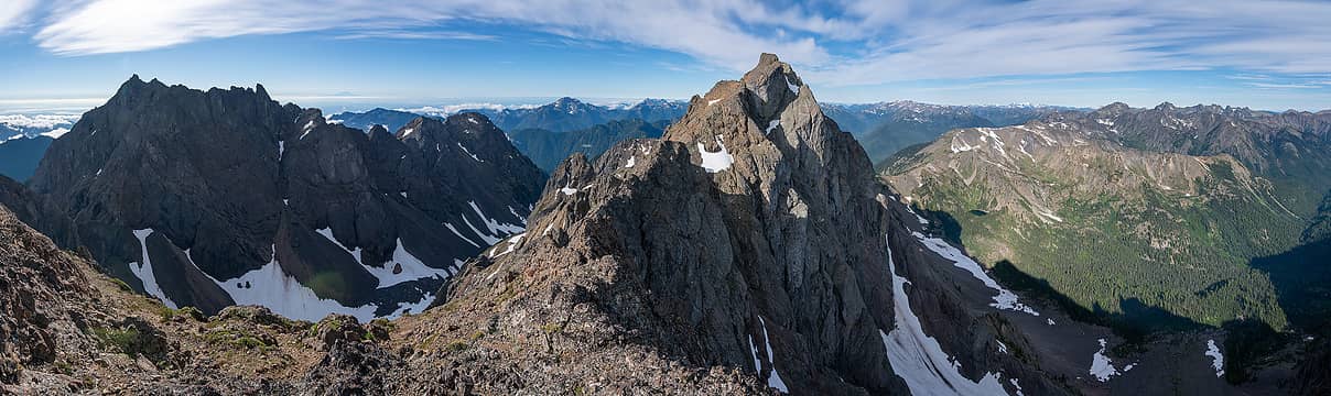 Constance and Inner Constance from Peak 7447 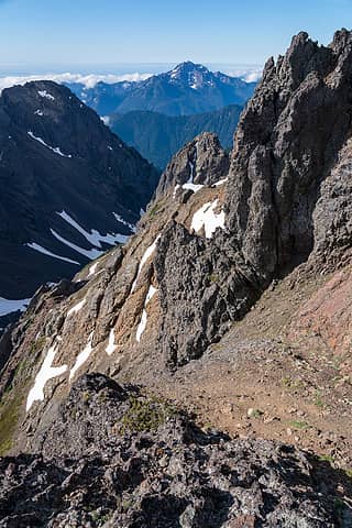 Only shot I took on descent, Brothers behind 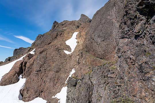 Traverse this ledge 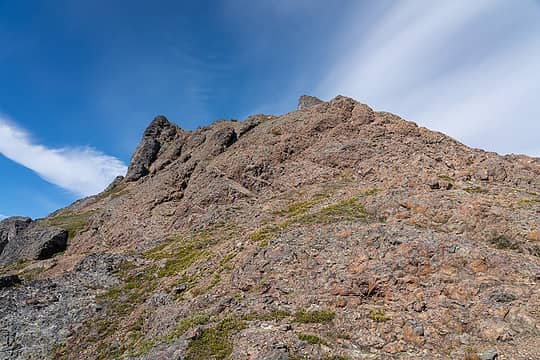 Easier slopes to the summit block 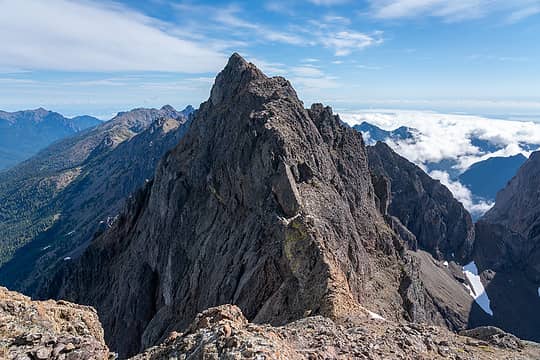 Looking back at Peak 7447 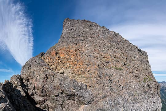 Inner Constance summit block 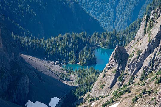 Lake Constance 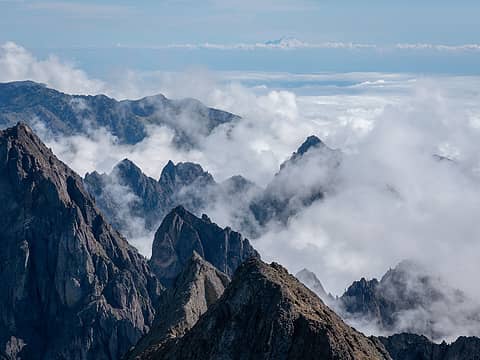 Warrior Arm engulfed in clouds 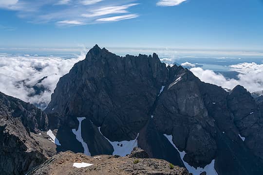 Mount Constance 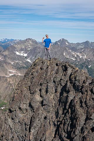 Selfie from the summit 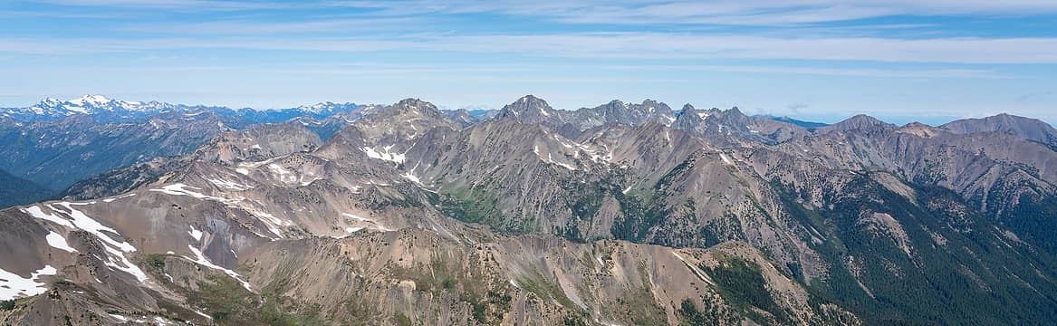 From Olympus to Gray Wolf Ridge 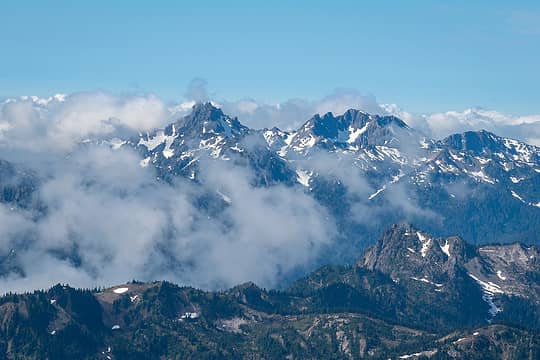 Stone and Skokomish 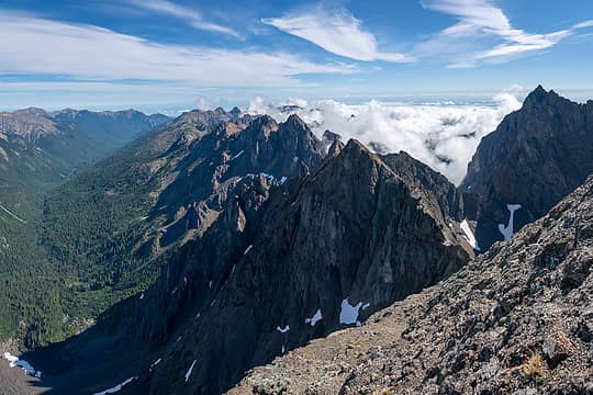 Warrior and Home Creek valley 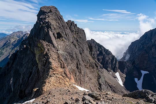 Base of 7447, starting the ledge traverse back 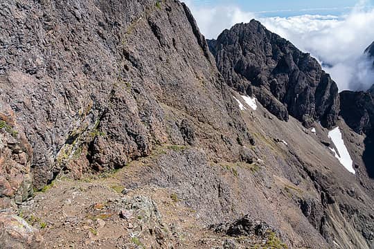 Traversing ledges 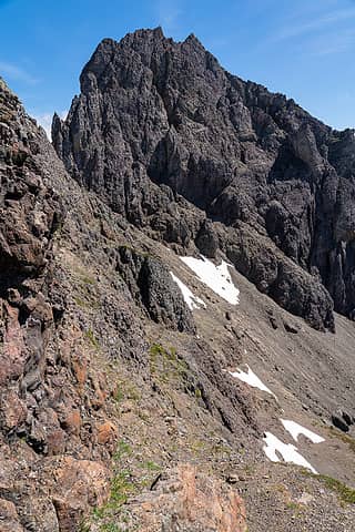 More easy traversing, Desperation Peak behind 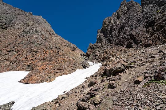 Choss back to the saddle  I took the message and bailed. That's 2 failed attempts on Warrior now, and some incentive to re-visit this area in the future, something I am already looking forward to. I took the message and bailed. That's 2 failed attempts on Warrior now, and some incentive to re-visit this area in the future, something I am already looking forward to.
 Beautiful, yet ominous 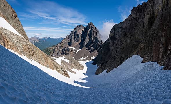 Descending from the saddle, Warrior below 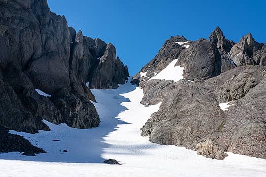 Looking back up at the saddle 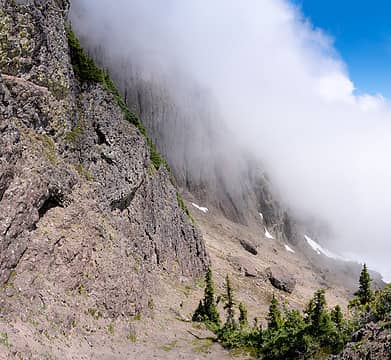 I bailed on Warrior after seeing this 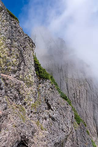 Those cliffs! 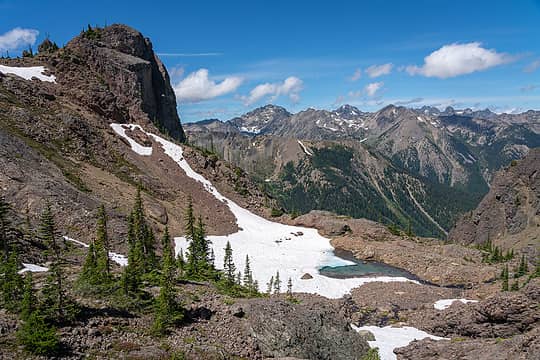 Cirque, bivy area 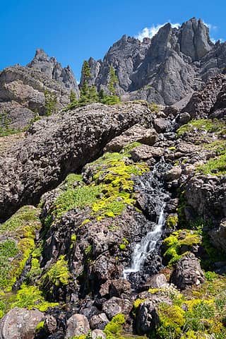 Olympic paradise 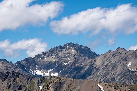 Mystery 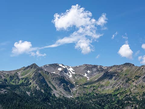 Fun clouds 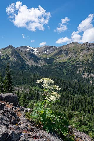 Last views from up high 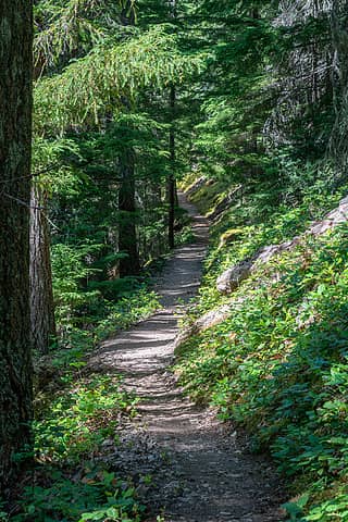 Back into the forest 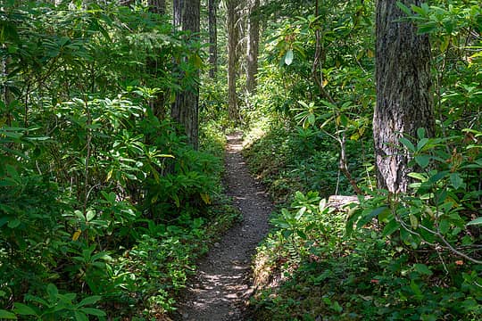 Olympic jungle 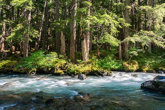 Dungeness River, I love this spot! 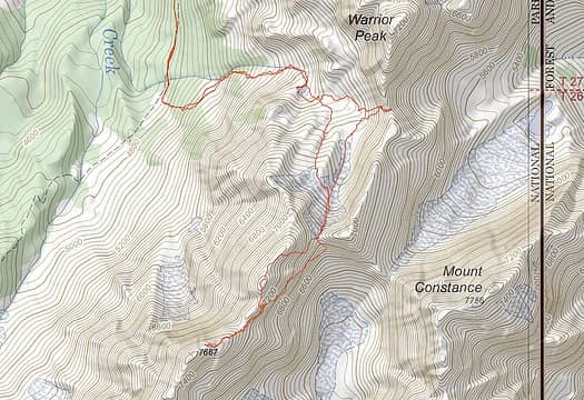 Route map
 Prosit, Frodo Barefoot, Nancyann, Hesman, JasonK806, Route Loser, raising3hikers, RAW-dad, hapemask, rstoddard24, IanB, silence, geyer, ozzy, reststep, RichP, rubywrangler, Tom, kite Prosit, Frodo Barefoot, Nancyann, Hesman, JasonK806, Route Loser, raising3hikers, RAW-dad, hapemask, rstoddard24, IanB, silence, geyer, ozzy, reststep, RichP, rubywrangler, Tom, kite  zimmertr, KascadeFlat zimmertr, KascadeFlat
Prosit, Frodo Barefoot, Nancyann, Hesman, JasonK806, Route Loser, raising3hikers, RAW-dad, hapemask, rstoddard24, IanB, silence, geyer, ozzy, reststep, RichP, rubywrangler, Tom, kite zimmertr, KascadeFlat |
| Back to top |
  
|
|
contour5
Member

Joined: 16 Jul 2003
Posts: 2963 | TRs | Pics
|
|
contour5
Member
|
 Sun Jul 25, 2021 7:13 pm |
|
|
Ledges? I dont see no stinking ledges!
Great trip report and photos, especially the magic forest shots.
awilsondc
awilsondc |
| Back to top |
|
|
Midnight Slogger
'Schwack Job

Joined: 04 Aug 2017
Posts: 96 | TRs | Pics
Location: Greater Cascadia |
Really exciting to see a trip report for this route--great photos and descriptions!
awilsondc
awilsondc |
| Back to top |
|
|
rubywrangler
Member

Joined: 04 Aug 2015
Posts: 511 | TRs | Pics
|
Nice trip, great photos! I especially like the forest shots (which you seem to have mastered, I'm jealous) and "Olympic Paradise".
| awilsondc wrote: | | dang that looks like some serious exposure on such a tiny ledge but then actually being on them they felt fairly broad and really not that bad at all. |
I love it when that happens 
| awilsondc wrote: | Dungeness River, I love this spot! |
Me too! I took almost the exact same photo a couple years ago.
awilsondc
awilsondc |
| Back to top |
|
|
ozzy
The hard way

Joined: 30 Jul 2015
Posts: 476 | TRs | Pics
Location: University place, wa |
|
ozzy
The hard way
|
Mon Jul 26, 2021 5:27 am |
|
|
Dooood! What perseverance, especially solo which changes things a lot! Thanks for the priceless beta on this route! I've always wanted to hit inner constance from here since I bivied up there when I did the warrior peaks. That has to be one of my favorite bivy spots...that cirque is beautiful! How did the route up Desperation pk look? I'm surprised you didn't bag that one too lol. Congrats man! 
I dont know whats gonna happen, but I wanna have my kicks before the whole shithouse goes up in flames-Mr Mojo Risin
awilsondc
I dont know whats gonna happen, but I wanna have my kicks before the whole shithouse goes up in flames-Mr Mojo Risin
awilsondc
|
| Back to top |
|
|
Gimpilator
infinity/21M

Joined: 12 Oct 2006
Posts: 1684 | TRs | Pics
Location: Edmonds, WA |
Enjoying your reports as always.
I have failed attempts on both IC and Warrior main. Those are tough peaks.
|
| Back to top |
|
|
silence
Member

Joined: 25 Apr 2005
Posts: 4420 | TRs | Pics
|
|
silence
Member
|
Mon Jul 26, 2021 6:57 am |
|
|
PHOTOS
FILMS
Keep a good head and always carry a light bulb. Bob Dylan
awilsondc
|
| Back to top |
|
|
geyer
Member

Joined: 23 May 2017
Posts: 463 | TRs | Pics
Location: Seattle |
|
geyer
Member
|
Mon Jul 26, 2021 12:41 pm |
|
|
Nice trip! I never knew you had gone there with the Robinsons.
Man, all these pics are great, but I'm really liking these two
| awilsondc wrote: | Enchanting The Mighty Warrior |
awilsondc
awilsondc |
| Back to top |
|
|
awilsondc
Member
Joined: 03 Apr 2016
Posts: 1324 | TRs | Pics
|
Thank you for the nice comments on the photography! I've really been working on developing my eye for forest scenes, so I'm glad to have the positive feedback. I appreciate it a lot, thank you!
| ozzy wrote: | | How did the route up Desperation pk look? |
Well... take a look.
| awilsondc wrote: | More easy traversing, Desperation Peak behind |
Hahaha, pretty gnarly!  Honestly I didn't even consider this peak at all during the trip. Sounds like most go up from Crystal Pass (to the right of this photo). There was one peakbagger report I just looked at detailing a mulit pitch 5th class route from the Warrior cirque area, but doesn't look like there is a workable a scramble route from that direction. It's steep! Honestly I didn't even consider this peak at all during the trip. Sounds like most go up from Crystal Pass (to the right of this photo). There was one peakbagger report I just looked at detailing a mulit pitch 5th class route from the Warrior cirque area, but doesn't look like there is a workable a scramble route from that direction. It's steep!
 ozzy ozzy
ozzy |
| Back to top |
|
|
NWtrax
Member

Joined: 27 Apr 2008
Posts: 638 | TRs | Pics
|
|
NWtrax
Member
|
Tue Jul 27, 2021 11:46 am |
|
|
Congrats on the summit. That pano of Home Creek Valley is absolutely stunning!!! 
awilsondc
awilsondc |
| Back to top |
|
|
|
|
You cannot post new topics in this forum
You cannot reply to topics in this forum
You cannot edit your posts in this forum
You cannot delete your posts in this forum
You cannot vote in polls in this forum
|
Disclosure: As an Amazon Associate NWHikers.net earns from qualifying purchases when you use our link(s). |


