| Previous :: Next Topic |
| Author |
Message |
MangyMarmot
Member


Joined: 06 Apr 2012
Posts: 474 | TRs | Pics
|
I had plans to do a loop in the Pasayten with a friend. Unfortunately these plans fell through a couple of days before we were scheduled to leave. Not wanting to waste a good weather window, I decided to do a different loop inspired by Fletcher and Bluebird's loop in the neighborhood or Peepsight mountain. Andrew ~ Amos ~ Freds ~ Peepsight ~ 5/22-23/21
I had a few things to do Wednesday morning so I got on the road a bit late. I ended up getting to the Andrews Creek trailhead at about 5PM. I quickly got my stuff together and hit the trail. The trail was in excellent condition. The creek crossing was low enough that you can easily just jump across on rocks. There were no blowdowns. Things were going great until I got to the turn off to the Peepsight Creek trail. There was no obvious turn off. I went quite a ways past where the turn off was supposed to be on the map and nothing. I doubled back looking more carefully to see if I missed it. Still no trace. Finally I set off toward the creek climbing over the dense blowdowns. I got across the creek and a ways up the hillside where the trail was supposed to be, but still no sign of it. At some point, I slipped off a high log and broke one of my trekking poles in the fall. At this point it started to get dark so I found a flat spot and made camp.
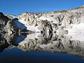
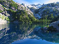
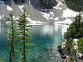
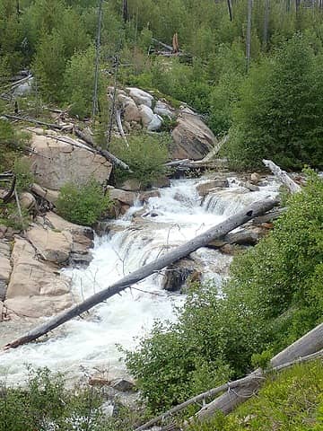 Andrews Creek 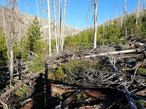 Going up the Peepsight Creek valley 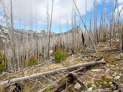 First view of Peepsight 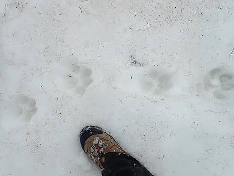 Some creature was here recently 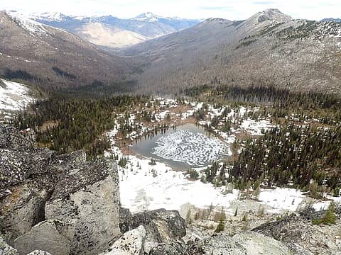 Peepsight Lake 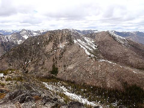 Flaming Peak from Newland Point 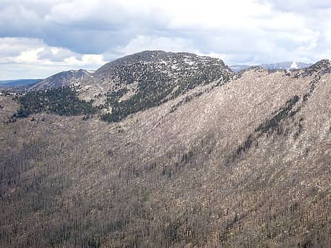 Freds Mountain from Flaming Peak 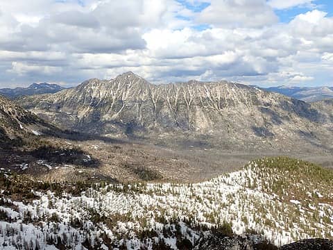 Remmel from Peepsight 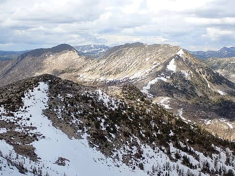 Amos and Andrews from Peepsight 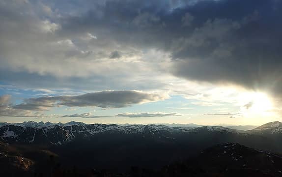 Clouds before sunset 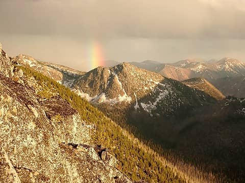 Rainbow over Newland Point 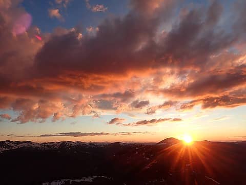 Sunset 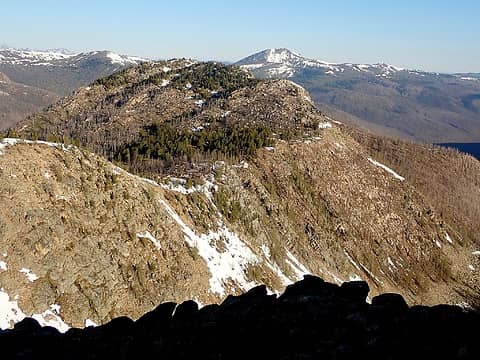 Van Peak 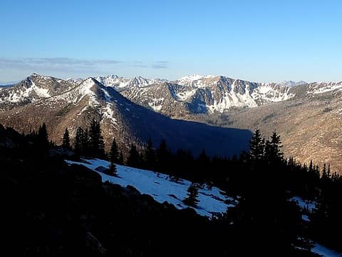 Snowy Pasayten Peaks 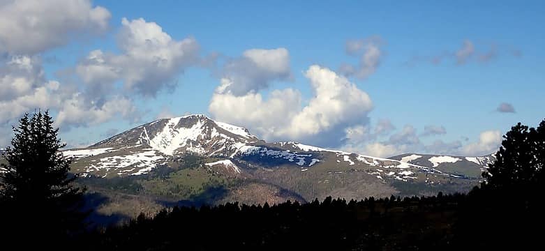 Sheep Mountain 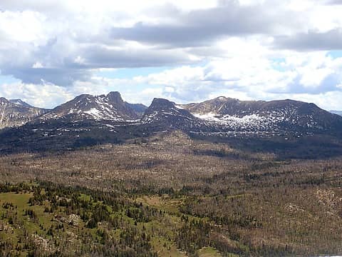 Cathedral and Amphitheater 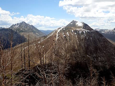 Amos and Remmel 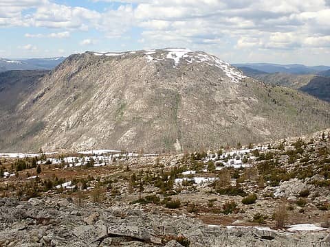 Bald from Amos 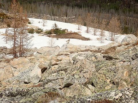 Ptarmigan? 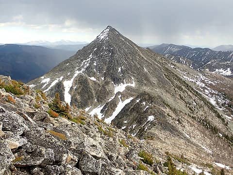 Andrews from Amos 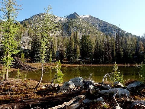 Andrews and Rock Lake 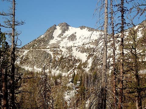 Peepsight from Rock Lake 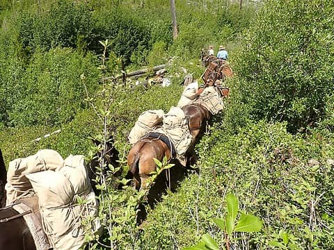 Horses
 reststep, Now I Fly, Nancyann, ozzy, jstern, Gimpilator, Randito, Tom, sooperfly, jaysway, Bramble_Scramble, RichP, neek reststep, Now I Fly, Nancyann, ozzy, jstern, Gimpilator, Randito, Tom, sooperfly, jaysway, Bramble_Scramble, RichP, neek  KascadeFlat, awilsondc KascadeFlat, awilsondc
reststep, Now I Fly, Nancyann, ozzy, jstern, Gimpilator, Randito, Tom, sooperfly, jaysway, Bramble_Scramble, RichP, neek KascadeFlat, awilsondc |
| Back to top |
  
|
|
sooperfly
Member

Joined: 04 May 2003
Posts: 1234 | TRs | Pics
Location: North Central Wa. |
Thanks for the report!
Sorry you missed the turnoff... it's pretty messy down to the creek from Andrews. This year I'm sure it's even worse. The sign used to be on a standing tree, and then the last time I was there it was on the end of a log.
Must have got knocked off by another blowdown. I'll be sure to look for it next time I'm up that way.
|
| Back to top |
|
|
kitya
Fortune Cookie

Joined: 15 Mar 2010
Posts: 842 | TRs | Pics
Location: Duvall, WA |
|
kitya
Fortune Cookie
|
 Tue Jul 05, 2022 10:32 am |
|
|
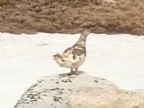
| MangyMarmot wrote: | Ptarmigan? |
It is a bit hard to see. Any other photos? I suspect it could be grouse, not ptarmigan, ptarmigans are more slender usually. Could be Sooty Grouse, Dusky or Ruffed? Sadly, I'm not an expert!
|
| Back to top |
|
|
Fletcher
Member

Joined: 29 Jul 2009
Posts: 1870 | TRs | Pics
Location: kirkland |
|
Fletcher
Member
|
Tue Jul 05, 2022 11:13 am |
|
|
|
| Back to top |
|
|
Tom
Admin
Joined: 15 Dec 2001
Posts: 17853 | TRs | Pics
|
|
Tom
Admin
|
Tue Jul 05, 2022 11:43 am |
|
|
| kitya wrote: | | It is a bit hard to see. Any other photos? I suspect it could be grouse, not ptarmigan, ptarmigans are more slender usually. Could be Sooty Grouse, Dusky or Ruffed? Sadly, I'm not an expert! |
I think you may be right, I pulled up the original size and compared to one of my pics of a ptarmigan in late summer plumage.
 100% crop 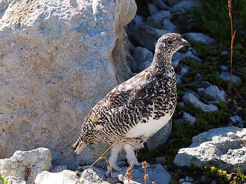 Traversing Below The Citadel (Sep 2013)
|
| Back to top |
|
|
MangyMarmot
Member
Joined: 06 Apr 2012
Posts: 474 | TRs | Pics
|
sooperfly: I made two passes looking for the trail on the way in, and I also looked for it as I passed by on the way out and no luck. If this sign was out there, I think I would have found it one of those times. Is the location of the trail accurate on the map? Sometimes maps are outdated or just incorrect and trails are actually somewhere else.
kitya: You're probably right. I'm no bird expert. I have a few other photos but these are all of the birds in the rocks. When these guys are in the rocks, they are almost invisible. They have excellent camouflage. Tom's grouse photo looks really close. I bet it is a grouse.
|
| Back to top |
|
|
Tom
Admin
Joined: 15 Dec 2001
Posts: 17853 | TRs | Pics
|
|
Tom
Admin
|
Tue Jul 05, 2022 12:31 pm |
|
|
To clarify, the first pic is a crop of your image at 100% resolution. My comparison pic is a ptarmigan.
|
| Back to top |
|
|
Tom
Admin
Joined: 15 Dec 2001
Posts: 17853 | TRs | Pics
|
|
Tom
Admin
|
Tue Jul 05, 2022 12:41 pm |
|
|
Actually, it may be a breeding male white tailed ptarmigan. See here:
| Quote: | | Smaller, stocky grouse with a short bill and tail. Breeding males are mottled gray and brown with a white belly and a red eyebrow (not always visible). |
https://www.allaboutbirds.org/guide/White-tailed_Ptarmigan/id
(not sure why they refer to them as grouse - maybe that's a generic term for bird)
|
| Back to top |
|
|
sooperfly
Member
Joined: 04 May 2003
Posts: 1234 | TRs | Pics
Location: North Central Wa. |
| MangyMarmot wrote: | | sooperfly: I made two passes looking for the trail on the way in, and I also looked for it as I passed by on the way out and no luck. If this sign was out there, I think I would have found it one of those times. Is the location of the trail accurate on the map? Sometimes maps are outdated or just incorrect and trails are actually somewhere else. |
It might be completely smashed under a new blowdown/s. The map is a little off - the junction is lower down than the maps I've looked at show. Maybe at one time the trail was higher? Check your PM's!
MangyMarmot
MangyMarmot |
| Back to top |
|
|
|
|
You cannot post new topics in this forum
You cannot reply to topics in this forum
You cannot edit your posts in this forum
You cannot delete your posts in this forum
You cannot vote in polls in this forum
|
Disclosure: As an Amazon Associate NWHikers.net earns from qualifying purchases when you use our link(s). |


