HitTheTrail
Member


Joined: 30 Oct 2007
Posts: 5455 | TRs | Pics
Location: 509 |
I have to admit this trip was inspired by one that cascadetraverser posted last year besides I had never been all the way up the Chiwawa and Steve wanted to check for old sheep camps and hike up to the Red Mt. mine. The trail is getting impassable by horse traffic and peakbaggers going to Fortress, Chiwawa, or Red have better ways in from the other side so there is not a lot of traffic in there now.
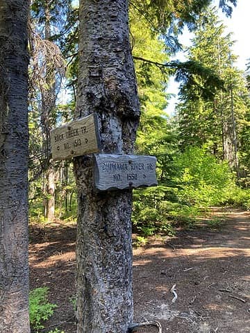 We met several parties, including a FS trail crew who told us Buck Creek is almost dangerous to cross now since it is very high just above a falls.  Don't go to Red on this trail-more on that below. 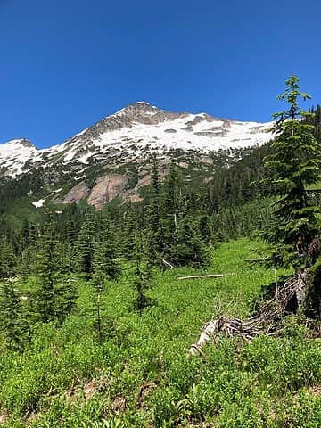 Chiwawa from our camp 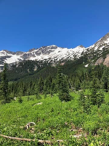 Fortress from our camp 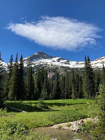 view from our camp. 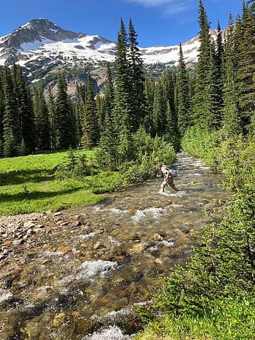 Steve heading off to explore. 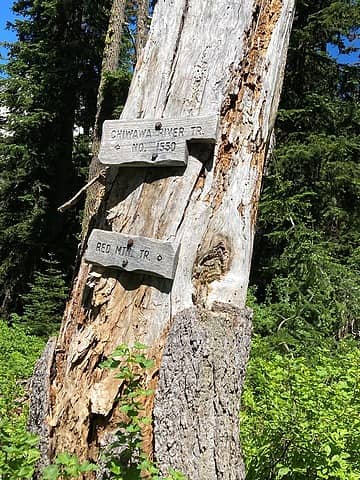 Don't go to Red this way unless you like slide alder tunnels and high rushing water while you are at it. 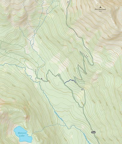 better to use the short cut in blue on this map. It is actual gaia track I recorded. 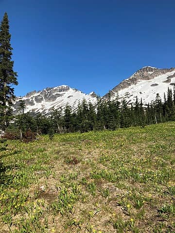 lots of nice meadows on Red 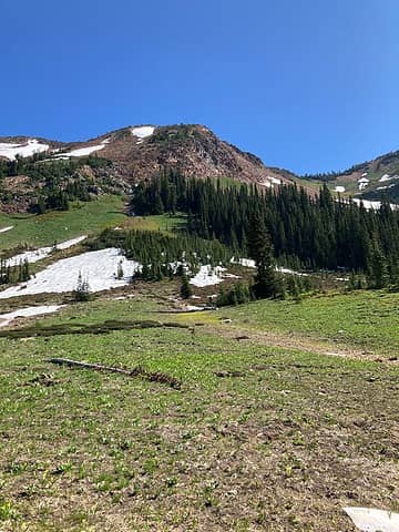 meadows on Red 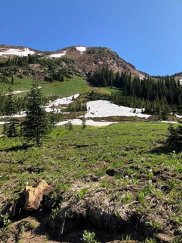 more on Red 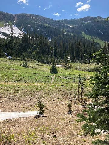 The trail going over to Phelps Creek up on the flank of Red. 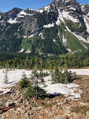 Looking down on our camp from Red. 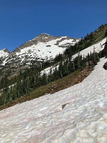 The old road going out to the mine on Red. 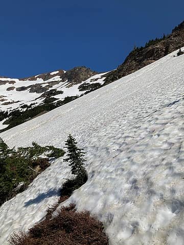 The mine tailings can be seen at the bottom of the foreground slide and the mine portal is at the top of the slide. We didn't have ice axes so we didn't attempt to cross. 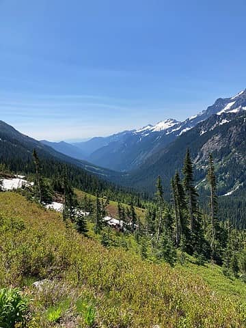 Looking down the Chiwawa.
 Obi Tony Kenobi, silence, Get Out and Go, raising3hikers, contour5, dave allyn, ejain, RichP, rubywrangler Obi Tony Kenobi, silence, Get Out and Go, raising3hikers, contour5, dave allyn, ejain, RichP, rubywrangler
Obi Tony Kenobi, silence, Get Out and Go, raising3hikers, contour5, dave allyn, ejain, RichP, rubywrangler |


