| Previous :: Next Topic |
| Author |
Message |
raising3hikers
Member


Joined: 21 Sep 2007
Posts: 2344 | TRs | Pics
Location: Edmonds, Wa |
Tombstone Pk 7895'
Tombstone Pk is located about a mile East of Mt Spickard in the Chilliwacks. It has been on my radar since seeing it from the trip to Devils Tongue a few years ago. I drove out Friday evening to get as close to the Depot Cr TH as I could. I decided to take my old truck out there since I remember the Chilliwack Lake road to be terrible. It was the same as before but the Depot Cr road had changed. It had been improved due to logging but many drainage ditches crossed the road that made me glad I brought my high clearance truck. It was getting dark so I chickened out about 3/4 of a mile from the border. I went to sleep to get a few hours of rest before an early start hiking.
I started hiking Saturday morning before 530am on the new logging road. After a little while, I found a compact car that had made it to the best possible start for the Depot Cr trail. It was then just a couple hundred feet to the border swath after leaving the road that kept going. The Depot creek trail is a mess for the 1st mile or so, tons of blowdowns and very brushy. I lost the trail several times but eventually found it. The 2nd mile was a bit better but fast travel couldn't be had cuz there was always another blowdown. The 3rd mile was better but the waterfall area was going to be tough as I could hear a lot of water coming down. The trail through the devils club and alder was good to the old slide alder crossing above the creek. I think this is the only spot I ever like to see slide alder. From there, the mist was soaking everything to the hand lines at the base of the falls. If not for these ropes, those slabs are too wet to be safe. I took a shower on those ropes but was soon to the side of the falls looking for the trail upwards. From there, the trail is as steep as I remember but easy to follow, finally. I reached the flatter part of the trail but still had much boulder hopping to do to get to the upper basin. While taking a higher route, I saw 3 climbers hiking out near the creek. The partly cloudy views were opening up and I headed up towards Silver Pass before taking a right towards the route to Spickard.
There was consistent snow to the Spickard saddle and I put crampons on cuz it got steep. It looks like a well used goat path but I didn't see any. At the saddle, I had to descend to the East by losing 1000' to the Spickard/Tombstone saddle. After what seemed like a slow travel day, this went a bit quicker. The clouds cleared and I could see my goal.
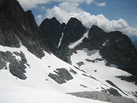 Tombstone Pk 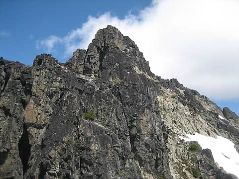 the 1st of the double summit 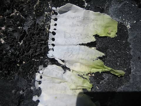 Tombstone register 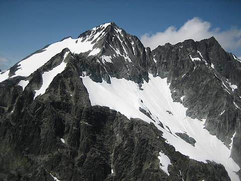 Spickard from Tombstone 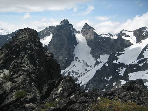 The Mox Pks 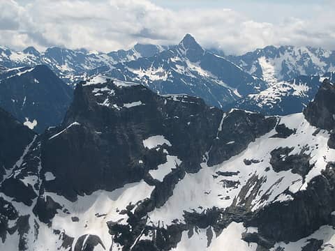 Luna 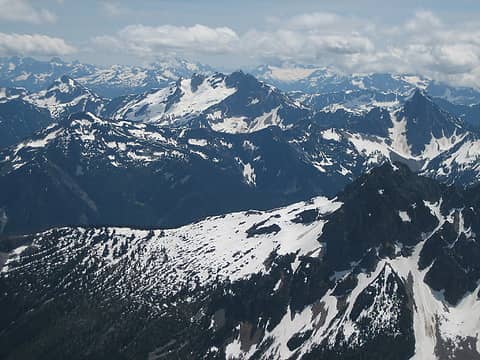 Prophet 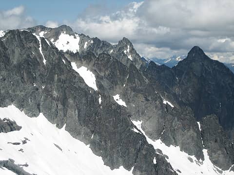 Rahm and Devils Tongue 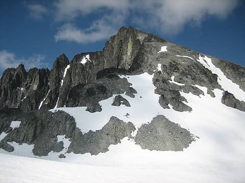 Spickard 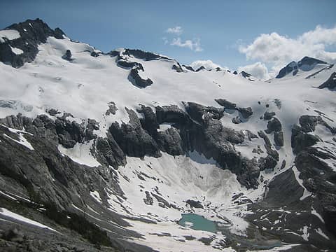 Redoubt glacier above Ouzel lake 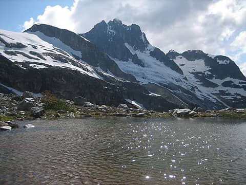 Redoubt above a tarn 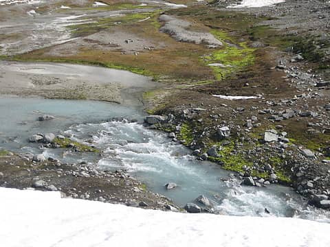 Depot Creek 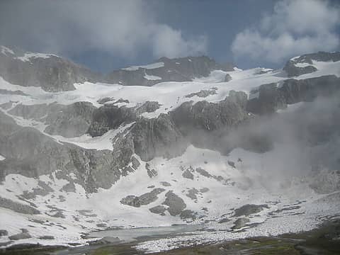 last look at Easy Mox before the clouds came in
Eric Eames
 Justus S., LukeHelgeson, ozzy, rstoddard24, zimmertr, SeanSullivan86, RichP, KascadeFlat Justus S., LukeHelgeson, ozzy, rstoddard24, zimmertr, SeanSullivan86, RichP, KascadeFlat
Eric Eames
Justus S., LukeHelgeson, ozzy, rstoddard24, zimmertr, SeanSullivan86, RichP, KascadeFlat
|
| Back to top |
  
|
|
Fletcher
Member

Joined: 29 Jul 2009
Posts: 1870 | TRs | Pics
Location: kirkland |
|
Fletcher
Member
|
 Sun Jul 17, 2022 9:36 pm |
|
|
Really awesome Eric. That must have been a really special summit!
|
| Back to top |
|
|
ozzy
The hard way

Joined: 30 Jul 2015
Posts: 476 | TRs | Pics
Location: University place, wa |
|
ozzy
The hard way
|
Sun Jul 17, 2022 9:49 pm |
|
|
Obscurity at it's finest!  Looks amazing up there, can't wait to get up there myself someday. Cheers and keep em comin! Looks amazing up there, can't wait to get up there myself someday. Cheers and keep em comin! 
I dont know whats gonna happen, but I wanna have my kicks before the whole shithouse goes up in flames-Mr Mojo Risin
I dont know whats gonna happen, but I wanna have my kicks before the whole shithouse goes up in flames-Mr Mojo Risin
|
| Back to top |
|
|
iron
Member

Joined: 10 Aug 2008
Posts: 6392 | TRs | Pics
Location: southeast kootenays |
|
iron
Member
|
Sun Jul 17, 2022 10:19 pm |
|
|
really nice. i know another guy that was jonesing for this one too...
|
| Back to top |
|
|
Gimpilator
infinity/21M

Joined: 12 Oct 2006
Posts: 1684 | TRs | Pics
Location: Edmonds, WA |
Fun report. Nice to have some details for this one. Bummer to see the register in that shape.
|
| Back to top |
|
|
Stefan
Member

Joined: 17 Dec 2001
Posts: 5093 | TRs | Pics
|
|
Stefan
Member
|
Mon Jul 18, 2022 8:52 am |
|
|
Whoa!!!!!
In a day!!!
holy moly!!! I be talking to you about some info!!!
|
| Back to top |
|
|
Route Loser
Member

Joined: 24 Jul 2012
Posts: 199 | TRs | Pics
Location: Whidbey Island |
Damn, I was hoping that register was still intact. Thanks for the report. Nice grab.
|
| Back to top |
|
|
|
|
You cannot post new topics in this forum
You cannot reply to topics in this forum
You cannot edit your posts in this forum
You cannot delete your posts in this forum
You cannot vote in polls in this forum
|
Disclosure: As an Amazon Associate NWHikers.net earns from qualifying purchases when you use our link(s). |


