| Previous :: Next Topic |
| Author |
Message |
Dolph Lundgren
Dolph Lundgren


Joined: 06 Apr 2022
Posts: 24 | TRs | Pics
Location: Tacoma |
This one is a couple weeks old
Date: 04 JUN 2022
Start Time: 0615
West Fork Buttermilk TH: 3,975
Okanogan-Wenatchee National Forest
Lake Chelan - Sawtooth Wilderness
Twisp River Rd
Total Time: 13:09:15
Moving Time: 09:58:33
Stopped Time: 03:10:41
Total Distance: 13.25 m
Total Elevation Gain: 4,762
I arrived at the W Fork Buttermilk TH at about 0520, two members of my party had slept there the night before, and the last two would arrive shortly after myself.
The trail crosses the creek very quickly, we used a solid tree to cross. The trail should be cruiser, but its in such poor condition from the fires, and blowdowns slowed our progress and made movement insufferable. I remember it took us a little over 3 hours to hit the point at where we turned off the trail, so like 4.5 miles and only 1500 maybe? On the way back for fun, I counted 351 downed trees that forced us to go up/over/around, or basically deviate from the trail, but I probably missed a bunch because I started late so we figured maybe around 400 each way. 800 downed tress. It was brutal.
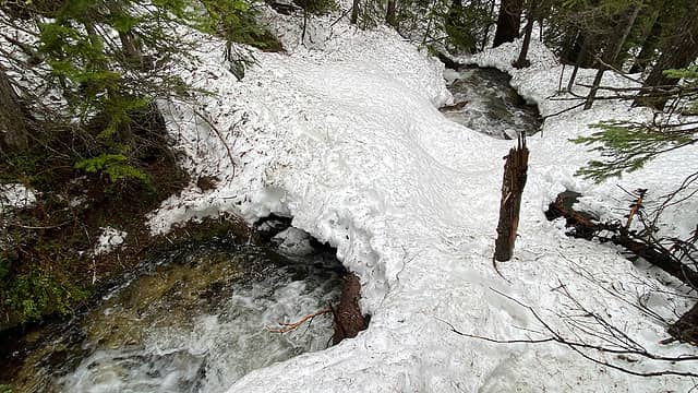
I started out in runners, and the snow started a lot earlier than I was anticipating based on Big Craggy and Abernathy, I think it was around 5k but could have been lower. I switched to my boots, which was a pain because when we hit the shortcut point to move off trail, the snow disappeared on the spur, and ascending steep dirt and root in those things is pretty terrible. We figured we could wait a while to find a more advantageous area to cross the creek/drainage, and around 6200 I found a snow bridge, while the others crossed a log. At this point we put on showshoes and continued up to Lake 6936. We traversed west along the spur and intersected the Oval Peak Trail, which was indeterminate due to snow cover.
This section had us weaving in and out of trees, snow cover kept things navigable. At the trail intersection just south of the lake, we side-hilled around on the 7000 contour line and continue NW until about 7450 where we realized we had gone too far, so we button-hooked back and climbed to meet the ridge at 7560.
We paused at the saddle, where I dropped my pack. The walk up the ridge was mostly snow covered, but had large sections of exposed rock, some areas which had some faint climbers path. Conditions continued to be white out, and it had been slightly snowing/raining/sleeting on us for most of the day.
We reached the summit, found the survey marker and summit register, signed in and enjoyed the break. It looked as if the sun wanted to come out and party, and it even warmed up slightly, which I thought was bizarre. Unfortunately no views until coming back down on the ridge, I could make out East Oval Lake and and Buttermilk Ridge.
We cut off the button-hook section, did some glissading, and had a decent walk back down to the main trail. Some sections of post-holing, but I thought it went quick and wasnt too painful.
We arrived back to the cars, extremely thankful to be done with the W Fork Buttermilk Trail, and had all decided we probably wouldnt be doing Star/Courtney anytime this year, though I may reconsider at the end of this year if I run out of options.
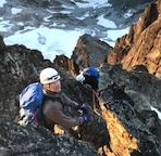
 Where I crossed the creek 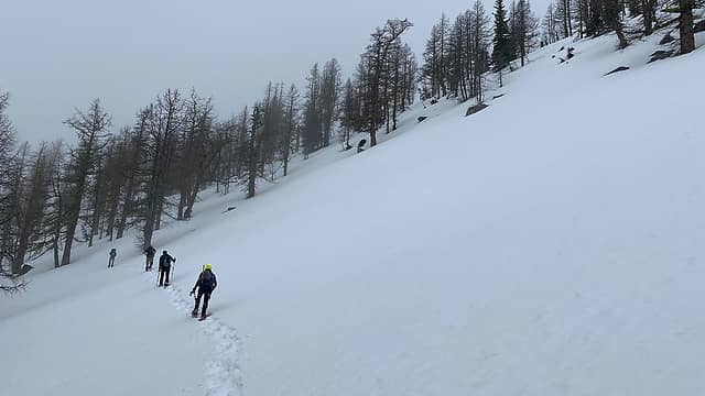 Button-hooking back South to then move up to the saddle 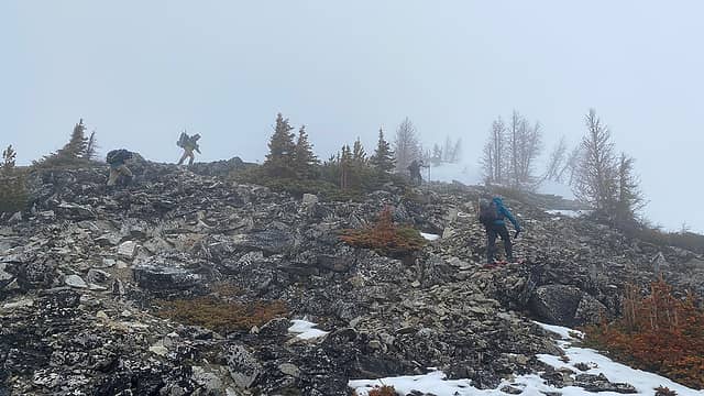 Moving up the ridge 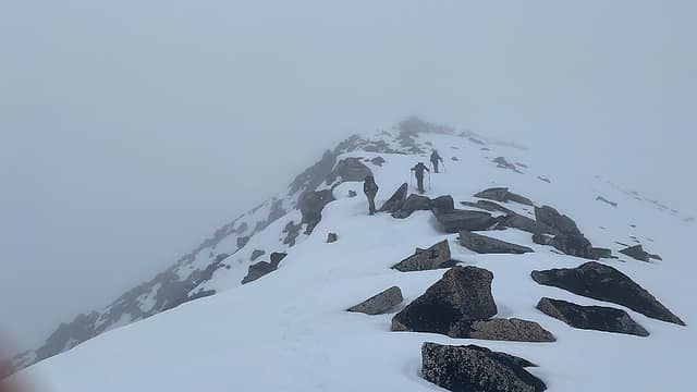 Continuing up 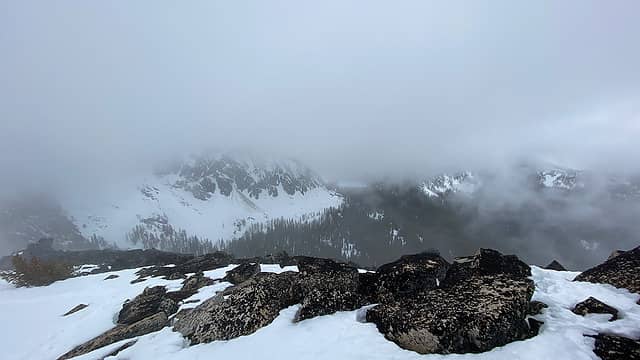 Best views of the day
 zimmertr, ozzy, Theboywhocriedroute, Now I Fly, rocknclimb, awilsondc, KascadeFlat, RichP zimmertr, ozzy, Theboywhocriedroute, Now I Fly, rocknclimb, awilsondc, KascadeFlat, RichP
zimmertr, ozzy, Theboywhocriedroute, Now I Fly, rocknclimb, awilsondc, KascadeFlat, RichP |
| Back to top |
  
|
|
Sculpin
Member

Joined: 23 Apr 2015
Posts: 1383 | TRs | Pics
|
|
Sculpin
Member
|
 Fri Jul 22, 2022 7:53 am |
|
|
Anyone have any fresh beta on whether the West Fork Buttermilk has been cleared? I will call the Ranger Station but have had mixed results with that in the past! 
Between every two pines is a doorway to the new world. - John Muir
Between every two pines is a doorway to the new world. - John Muir
|
| Back to top |
|
|
JeremyJ
Less gear, more beer
Joined: 24 Jul 2018
Posts: 14 | TRs | Pics
Location: Renton, WA |
|
JeremyJ
Less gear, more beer
|
Sat Jul 23, 2022 2:14 pm |
|
|
Lucky for you I do! We were there yesterday 7/22. Blowdowns are prevalent miles 2-4. Paths mostly over, under or around. Slowed us down about 10 min per mile going up in the dark, but somehow seemed worse on the way out after climbing Star, Courtney, Buttermilk, and Oval.
|
| Back to top |
|
|
|
|
You cannot post new topics in this forum
You cannot reply to topics in this forum
You cannot edit your posts in this forum
You cannot delete your posts in this forum
You cannot vote in polls in this forum
|
Disclosure: As an Amazon Associate NWHikers.net earns from qualifying purchases when you use our link(s). |


