| Previous :: Next Topic |
| Author |
Message |
rubywrangler
Member


Joined: 04 Aug 2015
Posts: 511 | TRs | Pics
|
The OMCG lists two Class 1 routes for Mt Steel:
I hoped to use these routes to make a loop with a summit camp, and visit a few other new places along the way. But I could only find one previous climb that used Route 2 - a 2011 CC report that says something to the effect of: at first glance everything on the west side looked to be class 4 so we rapped off the summit, but there is probably an easier route we didn't see.
This seemed like a reasonable conclusion to me since the OMCG says Class 1.
And while I know the OMCG has a reputation for sandbagging... the route is rated Class 1... I mean really, how hard could it be??
    Sunday 9/11
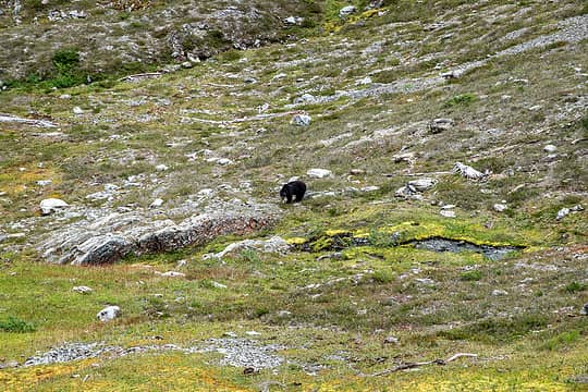
Bears: 1
I arranged a permit during the Steelers game and left Seattle as soon as overtime ended. Started hiking from Staircase just before 5pm. Within 45 min of leaving the trailhead, I encountered bear #1 - a teenager upslope of the trail. By the time I sputtered a surprised "hi!", it had already scrambled up a log into the forest and disappeared. I arrived at Camp Pleasant ~7:15 and had it all to myself.
Monday 9/12
Bears: 4
The bushwhack from the Skokomish trail to Nine stream basin sounds pretty terrible in some reports on this site - so bad that I had to really talk myself into doing it at all, let alone solo. 12 hours to go 3.5 miles! Yuck. But, as with most places I've been in the Olympics, it turns out there is a TRAIL almost the entire way. Following the route from previous TRs, I hiked upriver past the Eight stream bridge and left the trail heading southwest. I screwed up at first (too far west, not enough south) and had trouble finding a way through cliffs about 200' above the trail. Eventually I got where I needed to be and climbed a steep mossy slope at the nose of the ridge. The ridge was initially brushy but eventually a game trail materialized. That took me up another 1000' to where the ridge gets steeper, and I found yet another trail. This one seemed to be of the man-made variety - wide, switchbacks, etc. I was pretty elated. This reputedly hellacious bushwhack was going swimmingly so far...
Sunday 9/11
Bears: 1
I arranged a permit during the Steelers game and left Seattle as soon as overtime ended. Started hiking from Staircase just before 5pm. Within 45 min of leaving the trailhead, I encountered bear #1 - a teenager upslope of the trail. By the time I sputtered a surprised "hi!", it had already scrambled up a log into the forest and disappeared. I arrived at Camp Pleasant ~7:15 and had it all to myself.
Monday 9/12
Bears: 4
The bushwhack from the Skokomish trail to Nine stream basin sounds pretty terrible in some reports on this site - so bad that I had to really talk myself into doing it at all, let alone solo. 12 hours to go 3.5 miles! Yuck. But, as with most places I've been in the Olympics, it turns out there is a TRAIL almost the entire way. Following the route from previous TRs, I hiked upriver past the Eight stream bridge and left the trail heading southwest. I screwed up at first (too far west, not enough south) and had trouble finding a way through cliffs about 200' above the trail. Eventually I got where I needed to be and climbed a steep mossy slope at the nose of the ridge. The ridge was initially brushy but eventually a game trail materialized. That took me up another 1000' to where the ridge gets steeper, and I found yet another trail. This one seemed to be of the man-made variety - wide, switchbacks, etc. I was pretty elated. This reputedly hellacious bushwhack was going swimmingly so far...
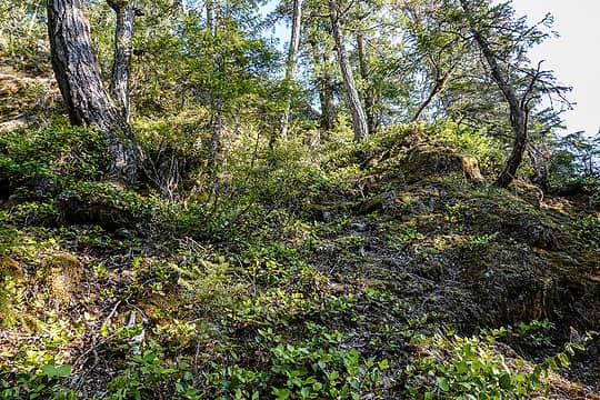 steep, mossy nose of the ridge 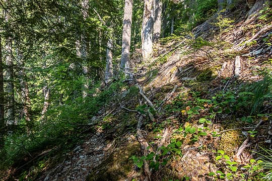 trail! 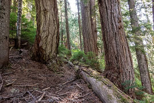 nice trees out here in the middle of nowhere 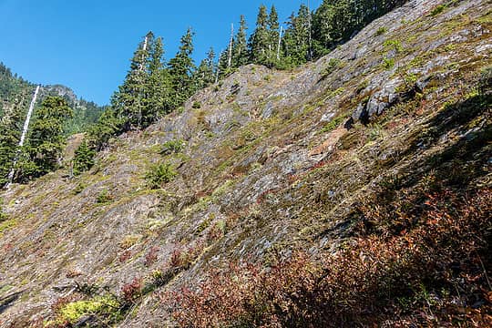 steep rock guarding the ridge 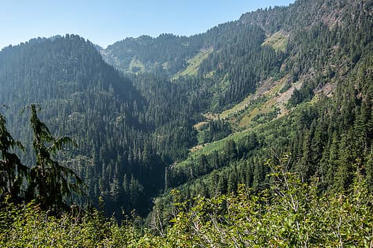 south fork eight stream 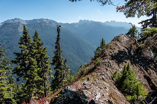 on the ridge 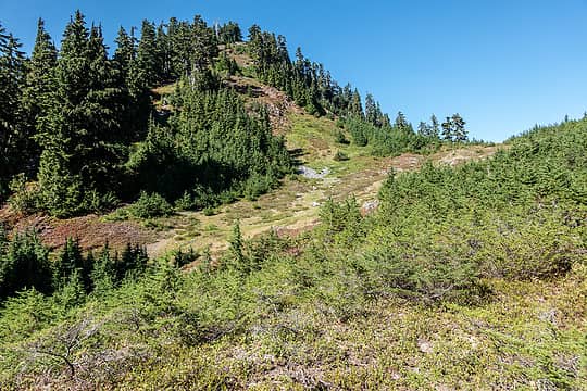 off the ridge 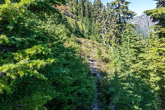 trail! 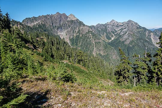 across the valley to hopper, the brothers, stone and skokomish 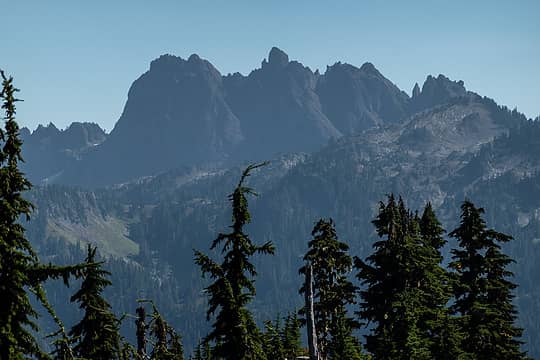 cruiser 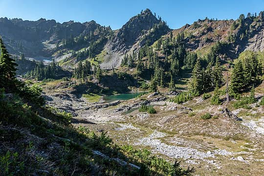 nine stream basin 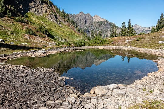 nine stream basin 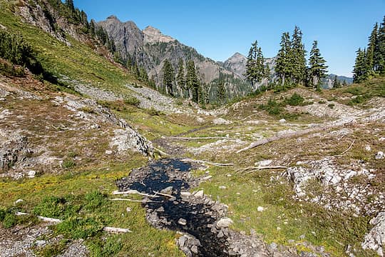 nine stream basin 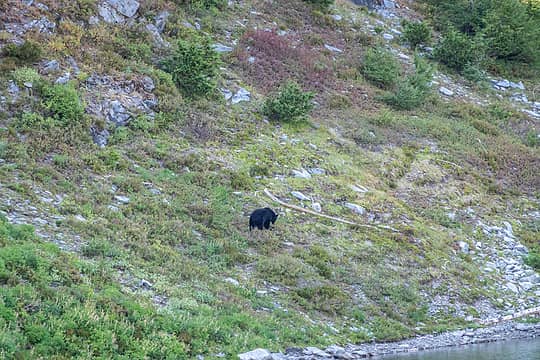 bear #3 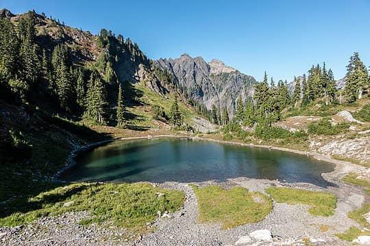 nine stream basin 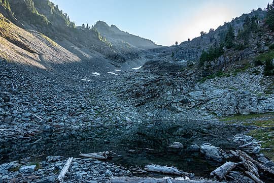 nine stream basin 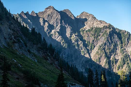 duckabush  steel 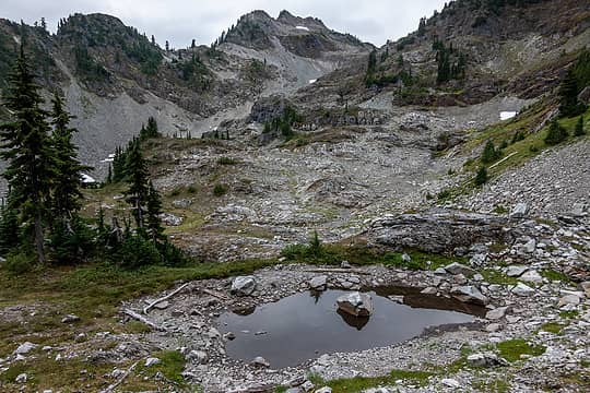 nine stream basin 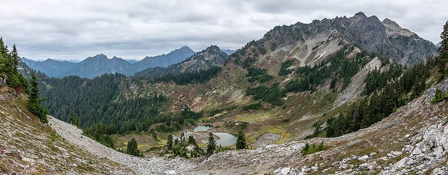 lake ben pano 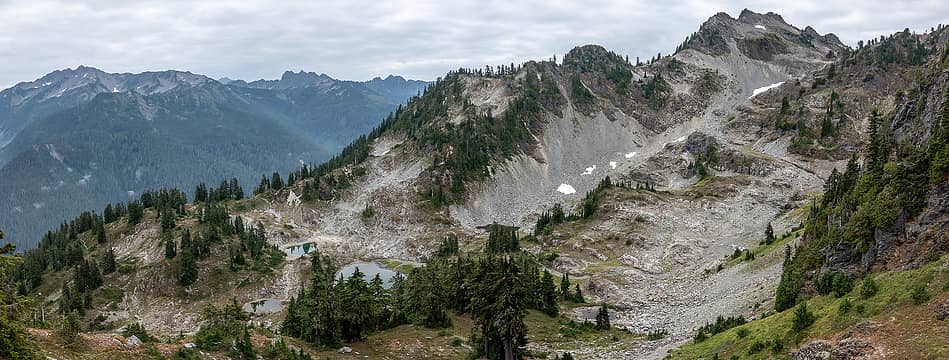 nine stream basin pano 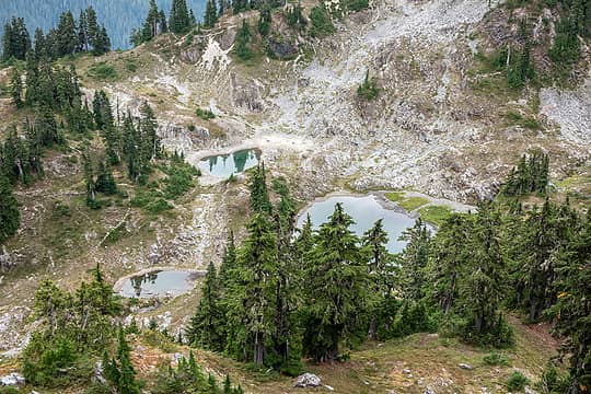 nine stream basin 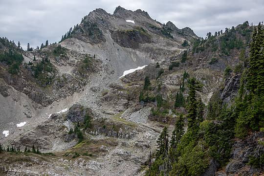 bumbershoot and scrambler 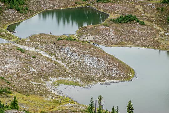 bear #6 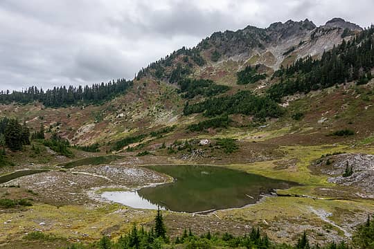 lake ben 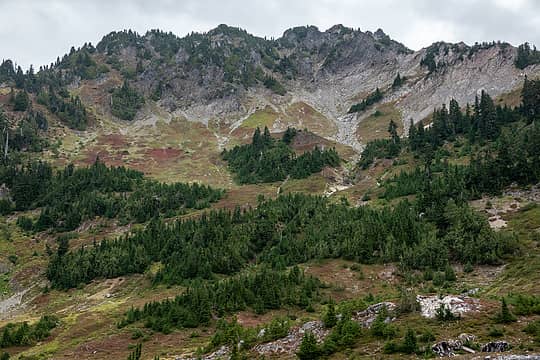 backside of duckabush arm 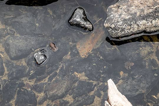 frogs 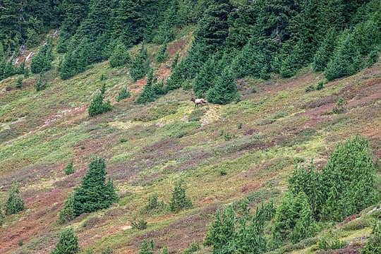 lone bull 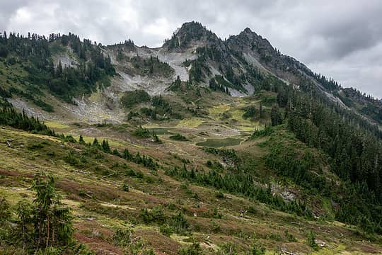 looking back to lake ben 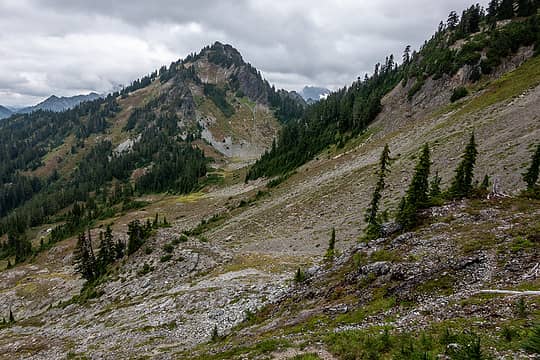 on route again 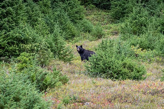 bear #8 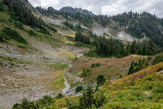 looking back, en route to o'neill pass 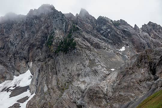 duckabush 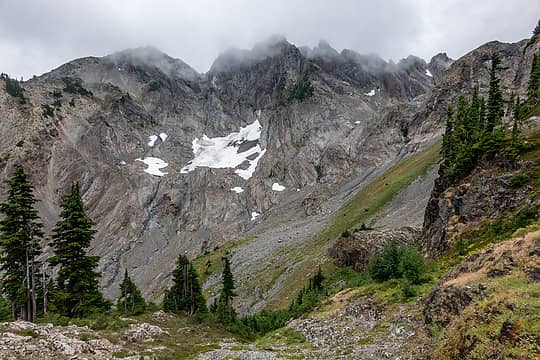 duckabush 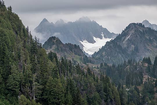 anderson zoom 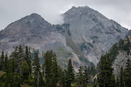 steel  nwhikers effect? yikes. nwhikers effect? yikes.
 bear #12 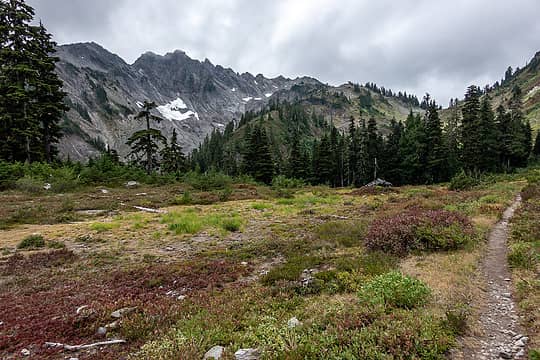 oneill pass trail 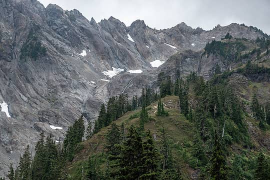 duckbush outlet falls  mossy gully to trail 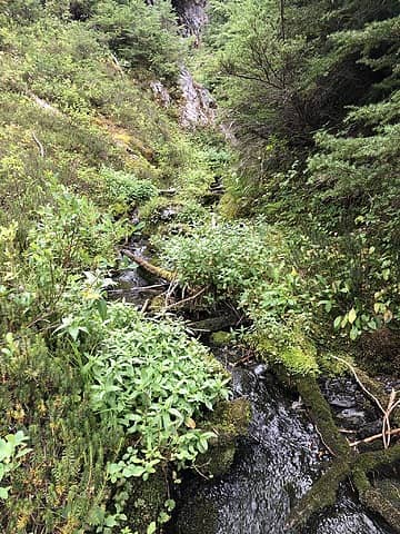 crossing the stream (thanks trail) 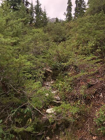 trail! 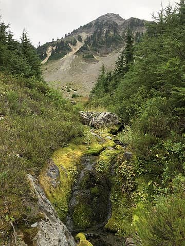 almost to the the "amphitheater" 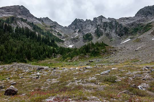 amphitheater 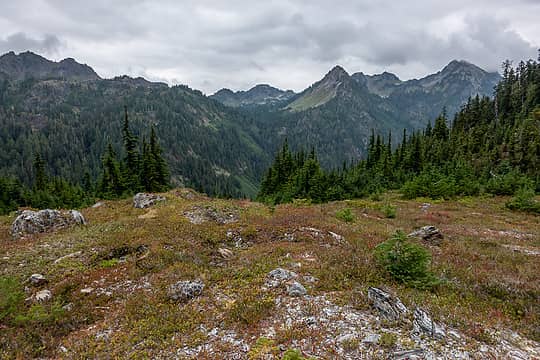 across the duck to lacrosse basin 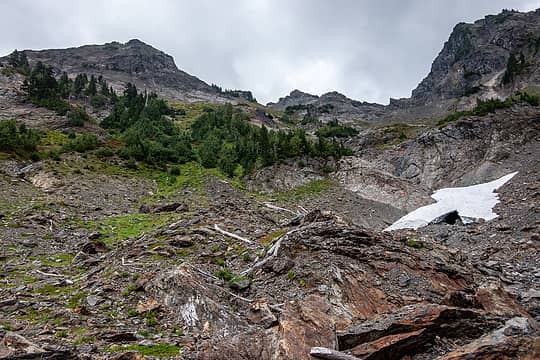 went up the green slope @ center, came down on the left (better) 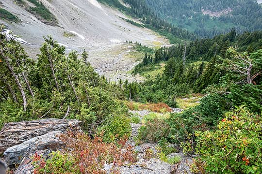 looking back down 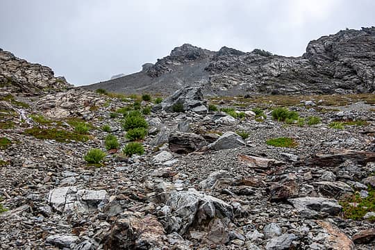 looks almost friendly from here... 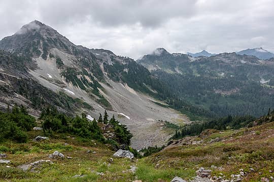 looking back 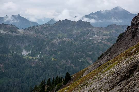 hart lake 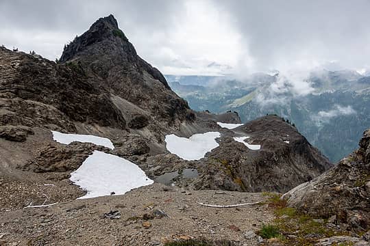 keep this spot in mind for later... 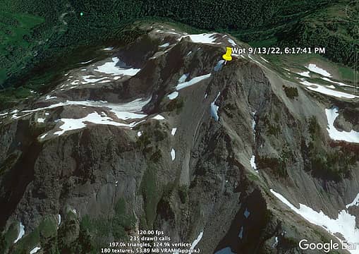 oof 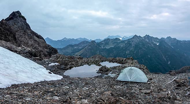 pretty sweet spot 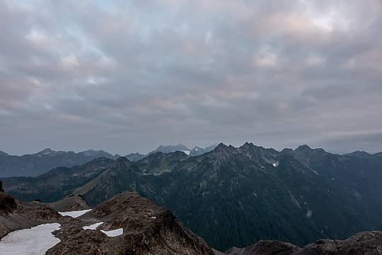 almost sunrise color 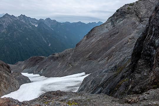 steel west slopes 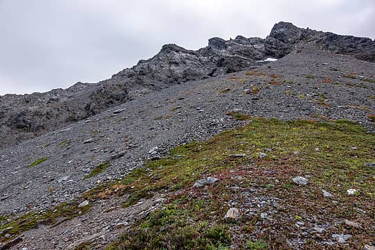 ascent ridge; drops off left to a snowfield with a huge moat 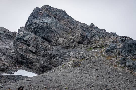 photo does not convey the misery 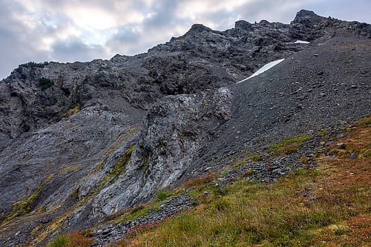 steel west slopes 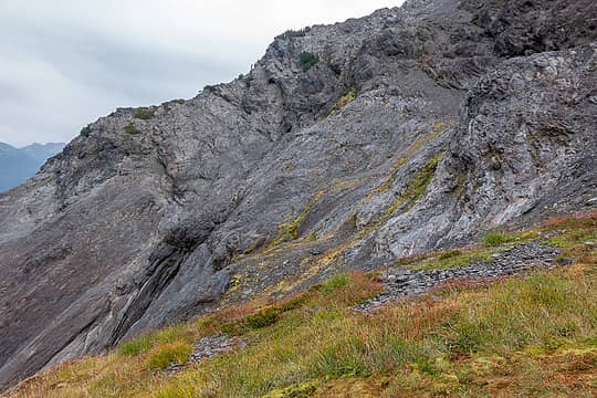 steel west slopes 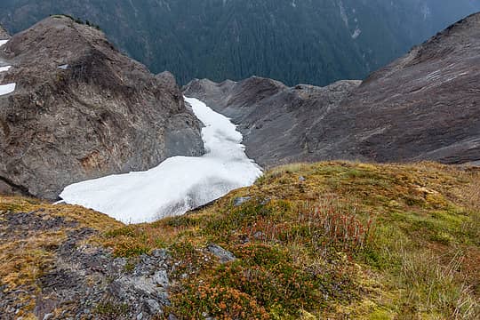 steel west slopes 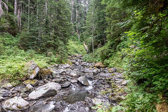 duck 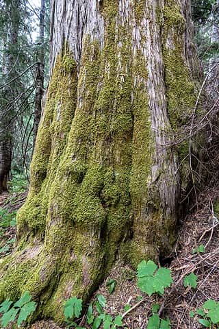 awesome trees along the upper duck 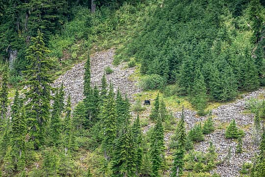 bear #16 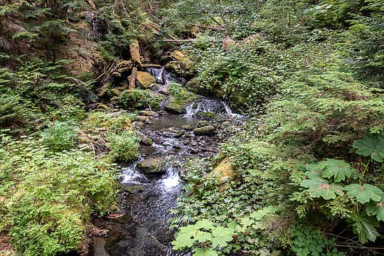 eight stream 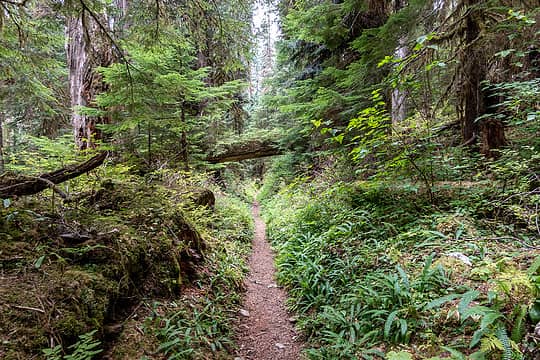 lovely forest 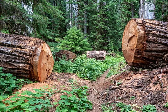 now THAT is trail maintenance 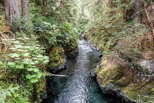 looking upstream from the bridge above big log 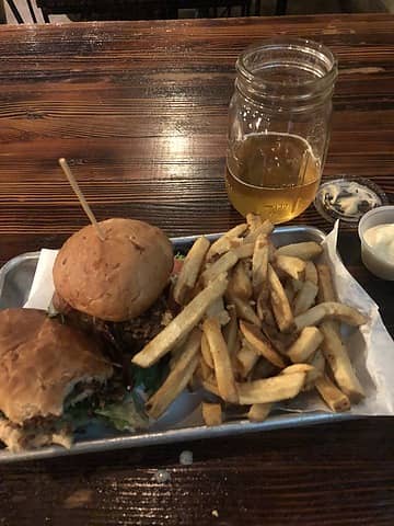 fried chicken blt sliders, garlic fries, pay to play pale ale  Totals:
73 hours
~35 miles
~11k gain
16 bear sightings
Totals:
73 hours
~35 miles
~11k gain
16 bear sightings
 Eric Gilbertson, williswall, Midnight Slogger, Brushbuffalo, RodF, DWB27, Bootpathguy, bbqiguana, Nancyann, Pyrites, Gimpilator, geyer, chiwakum, kite, neek, fffej50, half fast, HitTheTrail, John Mac, Prosit, RAW-dad, IanB, raising3hikers, contour5, Hesman, RichP, meck, reststep Eric Gilbertson, williswall, Midnight Slogger, Brushbuffalo, RodF, DWB27, Bootpathguy, bbqiguana, Nancyann, Pyrites, Gimpilator, geyer, chiwakum, kite, neek, fffej50, half fast, HitTheTrail, John Mac, Prosit, RAW-dad, IanB, raising3hikers, contour5, Hesman, RichP, meck, reststep  silence silence
Eric Gilbertson, williswall, Midnight Slogger, Brushbuffalo, RodF, DWB27, Bootpathguy, bbqiguana, Nancyann, Pyrites, Gimpilator, geyer, chiwakum, kite, neek, fffej50, half fast, HitTheTrail, John Mac, Prosit, RAW-dad, IanB, raising3hikers, contour5, Hesman, RichP, meck, reststep silence |
| Back to top |
  
|
|
reststep
Member

Joined: 17 Dec 2001
Posts: 4757 | TRs | Pics
|
|
reststep
Member
|
 Sat Sep 17, 2022 4:52 pm |
|
|
Great report and pictures. Thanks for sharing. That is interesting about finding an easier route to Nine Stream Basin. If I go there I hope I can find it.
"The mountains are calling and I must go." - John Muir
rubywrangler
"The mountains are calling and I must go." - John Muir
rubywrangler
|
| Back to top |
|
|
RAW-dad
Member

Joined: 07 Jul 2017
Posts: 119 | TRs | Pics
Location: Oregon |
|
RAW-dad
Member
|
Sat Sep 17, 2022 11:24 pm |
|
|
rubywrangler |
| Back to top |
|
|
rubywrangler
Member
Joined: 04 Aug 2015
Posts: 511 | TRs | Pics
|
reststep, feel free to PM me if you decide to go to nine stream basin - I have some more waypoints I can share.
|
| Back to top |
|
|
Gimpilator
infinity/21M

Joined: 12 Oct 2006
Posts: 1684 | TRs | Pics
Location: Edmonds, WA |
You saw 16 bears in one trip!
My annual average is 2, and I think the record in a year is 8.
|
| Back to top |
|
|
Stefan
Member

Joined: 17 Dec 2001
Posts: 5093 | TRs | Pics
|
|
Stefan
Member
|
Mon Sep 19, 2022 4:07 pm |
|
|
| rubywrangler wrote: | | I hiked upriver past the Eight stream bridge and left the trail heading southeast. I screwed up at first (too far south, not enough east) and had trouble finding a way through cliffs about 200' above the trail. Eventually I got where I needed to be and climbed a steep mossy slope at the nose of the ridge. |
I am trying to follow you. Do you mean NORTHWEST or SOUTHWEST where you said "southeast" ???? Because if you went southeast from the North Fork Skokomish river, wouldn't you end up in the North Fork Skokomish river from the trail heading towards Mount Henderson and Mount Gladys area?
|
| Back to top |
|
|
Stefan
Member
Joined: 17 Dec 2001
Posts: 5093 | TRs | Pics
|
|
Stefan
Member
|
Mon Sep 19, 2022 4:25 pm |
|
|
| rubywrangler wrote: | | I considered going up Duckabush arm to see the lake again, but decided to check out the other side. Spent too long lingering here, taking photos and trying to discern whether the OMCG route to Duckabush's main summit would be doable, but I don't think I had a view of the correct ridge from where I was. Has anyone tried to get up there? |
Yes, I know of two different parties who have been up Mt. Duckabush....I can't seem to figure out if they believe the east or west peak of Mt. Duckabush is higher.
|
| Back to top |
|
|
rubywrangler
Member
Joined: 04 Aug 2015
Posts: 511 | TRs | Pics
|
| Stefan wrote: | | Do you mean NORTHWEST or SOUTHWEST where you said "southeast" ???? |
southwest! thanks for catching that. fixed it. map
ETA: map was hand-drawn prior to the trip and doesn't reflect my actual route
|
| Back to top |
|
|
bbqiguana
Member

Joined: 24 Mar 2022
Posts: 5 | TRs | Pics
|
From the map and route description it sounds like you were more successful at staying on the ridge line than we were a couple weeks back. It sounds like a better way to go, thanks for sharing!
|
| Back to top |
|
|
Tomlike
Member

Joined: 22 Jun 2010
Posts: 407 | TRs | Pics
|
|
Tomlike
Member
|
Tue Sep 20, 2022 7:49 am |
|
|
| rubywrangler wrote: | | And while I know the OMCG has a reputation for sandbagging... the route is rated Class 1... I mean really, how hard could it be?? |
the climber's guide is great for starting emergency fires
I enjoyed this report! I've camped at Lake Ben (after startling a herd of elk) and have also bivied on top of Mt Steel - fabulous corner of the park. Impressive bear count too! We saw 10 + 2 cubs last week while thrashing around the NF Soleduck/Boulder Peak area
rubywrangler
rubywrangler |
| Back to top |
|
|
Stefan
Member
Joined: 17 Dec 2001
Posts: 5093 | TRs | Pics
|
|
Stefan
Member
|
Tue Sep 20, 2022 10:39 am |
|
|
the map is super helpful in understanding. thanks!
|
| Back to top |
|
|
Brushbuffalo
Member

Joined: 17 Sep 2015
Posts: 1887 | TRs | Pics
Location: there earlier, here now, somewhere later... Bellingham in between |
Rubywrangler, that was a fabulous report, but yours always are...detailed, lightly humorous, great pictures.
I have only seen 16 bears in about the past 5 years total. What fortune you had! ( I also talk to bears, asking for their permission to come forward. They usually ignore me too. We need to learn better bear language).
Climbing Mt. Steel when in Boy Scouts is what got me into climbing back in 1963. Mom directed me to the Tacoma Mountaineers climbing course before I went and got into trouble of the mountain sort. Worked so far!
Passing rocks and trees like they were standing still
silence
Passing rocks and trees like they were standing still
silence
|
| Back to top |
|
|
rubywrangler
Member
Joined: 04 Aug 2015
Posts: 511 | TRs | Pics
|
Thanks Doug! And glad to know I'm not the only aspiring bear-whisperer among us 
|
| Back to top |
|
|
silence
Member

Joined: 25 Apr 2005
Posts: 4420 | TRs | Pics
|
|
silence
Member
|
Wed Sep 21, 2022 8:52 am |
|
|
I just read your trail report a 2nd time because it's so great. I really admire your independence and determination, not just on this trip, but on all you do. Plus, your photos, descriptions and observations are not only informational, but also inspirational. Keep it up girl and stay safe. BTW, we're also bear whisperers. It's worked so far after many encounters over the years.
PHOTOS
FILMS
Keep a good head and always carry a light bulb. Bob Dylan
IanB, RodF  rubywrangler rubywrangler
PHOTOS
FILMS
Keep a good head and always carry a light bulb. Bob Dylan
IanB, RodF rubywrangler
|
| Back to top |
|
|
Eric Hansen
Member
Joined: 23 Mar 2015
Posts: 866 | TRs | Pics
Location: Wisconsin |
+1 to Silence's comments
Off trail rambler
rubywrangler
Off trail rambler
rubywrangler
|
| Back to top |
|
|
|
|
You cannot post new topics in this forum
You cannot reply to topics in this forum
You cannot edit your posts in this forum
You cannot delete your posts in this forum
You cannot vote in polls in this forum
|
Disclosure: As an Amazon Associate NWHikers.net earns from qualifying purchases when you use our link(s). |


