Forum Index > Trip Reports > Buckner Summit Survey Plus Booker, Sept 3, 2022
 Reply to topic
Previous :: Next Topic
Author Message
Eric Gilbertson
Member
Member


Joined: 04 Jul 2018
Posts: 188 | TRs | Pics
Location: Seattle
Eric Gilbertson
Member
PostSun Sep 04, 2022 9:30 pm 
Buckner Mountain (9,112ft) and Booker Mountain (8,280ft) Sept 3, 2022 25 miles, 11kft gain 3am to 7:30pm Summary of results: Inconclusive whether SW or NE summit is higher. Within error of 5x sight level. More precise measurements are needed. Buckner Mountain is the 14th highest peak in Washington, the highest point in Skagit County, and one of the few 9,000ers in the state. However, as far as I've researched, the location of the true summit of Buckner is not known with complete certainty. Buckner has two summits separated horizontally by about 600 feet, and both lie within the same 9080ft-9120ft contour lines on the USGS quad. The northeast summit is surveyed as 9112ft on the quad but the southwest summit is not surveyed.
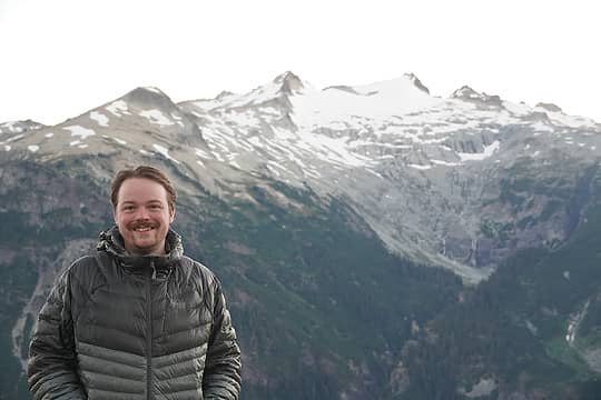
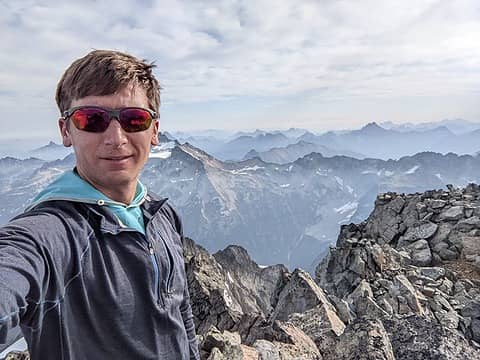
On Buckner SW summit
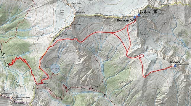
The route
The route
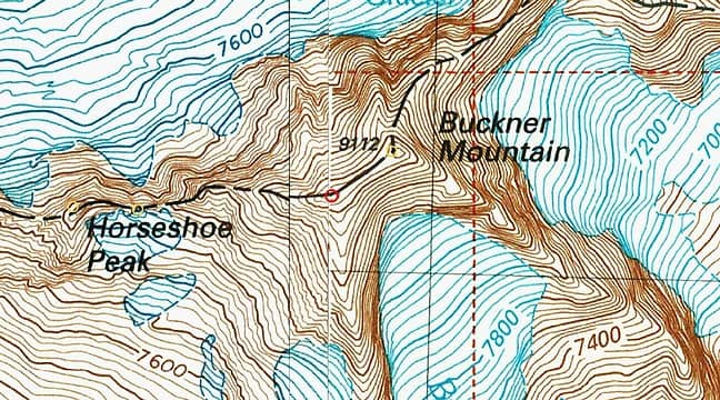
The quad showing summit locations (image from peakbagger.com)
As I’ve discovered in the past (on a trip to Buck Mountain), the surveyed location on the quad is not necessarily the summit location. It may just be a location with favorable line-of-sight view to another surveyed point. So the quad does not necessarily indicate the true summit. The two summits are very close to the same height, and the only way to know for certain which is the true highpoint is to take measurements. Interestingly, it is not trivial to get between them. The standard and easiest route to Buckner tops out on the SW summit. But it is a 3rd class scramble with a bit of exposure to continue to the NE summit. If there is snow on the ridge it can get more difficult. In practice almost all climbers stop at the SW summit without tagging the NE summit. As far as I’ve researched, there have only been three instances of measurements taken to try to settle the controversy. Edward Earl analyzed a picture taken from the SW summit looking toward the NE summit. By knowing elevations of peaks in the background and the distance between the peaks he could estimate the angle between the camera and the NE summit, and then estimate the height difference. He estimated the NE summit was 1ft shorter. In 2018 Greg Slayden and Jobe Wymore took 5x sight levels to Buckner. From the SW summit looking at the NE summit they both measured the NE summit a little shorter. Greg scrambled to the NE summit and backsighted the SW summit and measured the SW summit a little higher. He estimated 1-2ft. (Jobe didn’t back sight). At face value this sounds definitive, that the SW summit is higher. But I wasn’t completely convinced. In my experience with 5x sight levels it’s possible to at best resolve about 0.1-0.2 degrees of angular inclination or declination. With a 600ft horizontal distance, using a bit of trigonometry, a 0.1-0.2 degree angular declination results in a 1-2ft height difference. So the measured difference is right at the border of the resolution of the measuring device. But, without a proper tripod mount, a 5x sight level is a bit more prone to error from hand vibrations and roll angular error. That could be significant when operating very close to the resolution. As far as I’ve heard, the photo analysis was only in one direction – SW looking towards NE summit. I would have much more confidence in this measurement if it were backed up by one from the NE looking at the SW summit, and if error bounds were given. I would also have more confidence if more than one sight level measurement with backsighting measured the SW summit higher, since it is so close to the resolution of the device. Or if more precise measurements were taken.
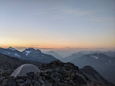
Sunrise from Sahale camp
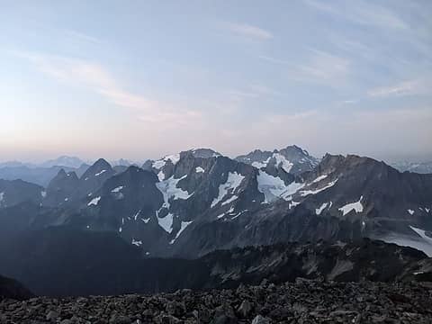
View towards Formidable, Spider, Gunsight, Agnes
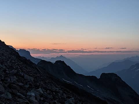
More sunrise views
More sunrise views
John Roper was also not entirely convinced, and he encouraged me to go collect more data, since it is such a significant peak. I’ve done quite a few measurements of peaks over the past few years, using a variety of tools. I’ve used a Trimble Geo 7x to survey two highpoint candidates in Saudi Arabia, concluding Jabal Ferwa is the true country highpoint (not Jabal Sawda as previously thought). I’ve brought a Trimble GeoXR with Zephyr 2 antenna to west africa to survey country highpoint candidates in Togo, Ghana, Benin, Guinea, Guinea-Bissau, Senegal, Ivory Coast, and Gambia. This unit is capable of 1 inch vertical accuracy if a one-hour measurement is taken with good overhead visibility. On this trip I found new, previously unknown, true highpoint locations for Togo, Gambia, and Guinea-Bissau. I’ve used a sight level to find the true summit of Lenin Peak, a 7000m peak in Kyrgyzstan (the summit marker is in the wrong place). And in Washington I’ve used a sight level to measure and update the true summit locations of Sherpa Peak (balanced rock is 2ft shorter), Buck Mtn, Mt Berge, and Armstrong mountain. Unfortunately I don’t currently have access to the Trimble units, so could only bring my 5x and 1x sight levels. So it was unlikely I could definitively measure which summit was highest, given the resolution of the devices. But, at the very least, if my measurements were consistent with the other measurements, that would increase confidence that the SW summit is higher. If they were not consistent that would strengthen my resolve to acquire better measuring equipment and return for more measurements. I’d already climbed Buckner in 2018, my final peak on the Bulger list, but hadn’t thought to take measurements then. Last fall I told John I’d take measurements, but I was thwarted by marginal weather in September and October. If I was going to go all the way in there I wanted a reasonable chance of being able to see from one peak to the other to actually take a measurment. Then it started snowing and I knew I’d have to wait. I wanted to measure the height of the highest permanent rocks, not the height of seasonal cornices. By June when the summit cornices would likely melt off I had to leave for a summer expedition, so this September was my first real opportunity. The weather looked good, summits were likely snow free, and I had a day free, so I decided to do a day-trip and re-climb Buckner and take some measurements. Based on my past experience it didn’t seem like it would take all day, so I decided if I was feeling strong after Buckner and still had time I’d continue and tag Booker. Booker is a top 200 peak I needed farther along the ridge, and it makes sense to do this time of year. I hadn’t done a day trip this long since K2 summit push over a month ago, though, so there was still a little uncertainty how my body would hold up and whether I was fully recovered.
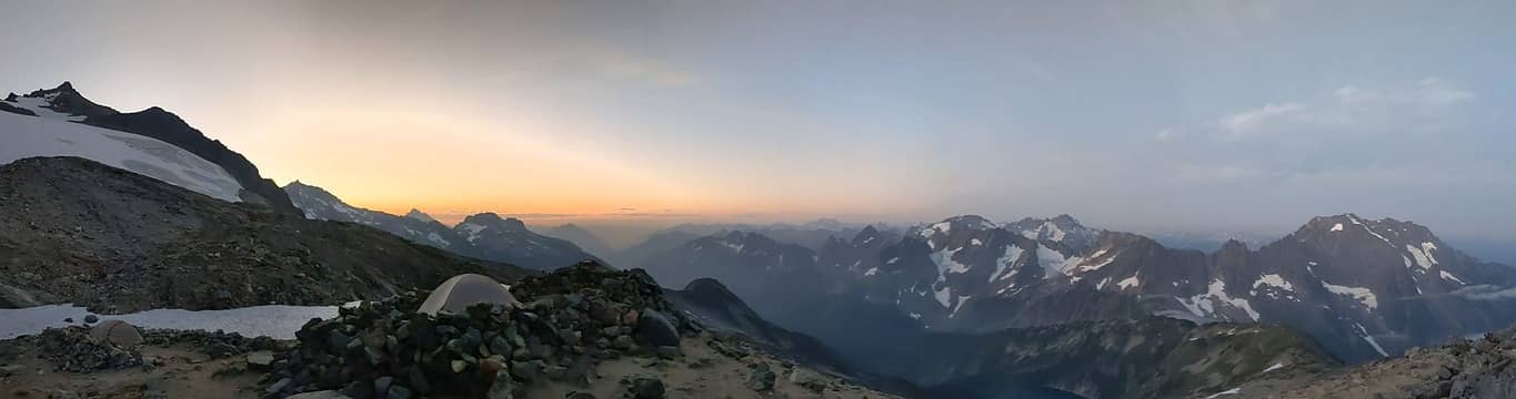
Panorama from Sahale camp
I researched some excellent beta on Booker from John Porter and Eric Eames, and was ready to go. I would follow the standard route up Sahale Arm for the approach. This was the same route I took in 2018, so I was very familiar with it. I expected the route to be mostly snow-free, but brought my aluminum crampons and whippet just in case. I remembered a steep snow section just past Sahale Camp in late August 2018 that had warrented crampons. I would bring trail runners since most of the route was off-snow, though. Friday night I drove to the Cascade Pass trailhead to sleep. I hadn’t been on Cascade River Road since January when Duncan and I had snowmobiled in to climb Forbidden. It was fun driving the road now and comparing all the memorable sections to winter. I particularly wanted to see the remains of the big 6ft diameter tree that had stopped us on the snowmobile around MP 15. But all evidence was completely gone even from the side of the road! Maybe it was just covered by undergrowth. I was asleep in the back of the truck by 10pm, then up and moving by 3am. I wanted to time things so I would reach Sahale camp around sunrise so I could navigate the off-trail section in the daylight and so I would see a good sunrise view. I made good time up the trail, and passed through many fresh spider webs. As expected I made it to Sahale camp a little before sunrise and was treated to great views to the south. I think the haze from distant forest fire smoke makes for more colorful sunrises. I traversed through the camp, then scrambled down to the east to the edge of a permanent snowfield. I recalled last time I had donned crampons here and downclimbed the slope. But this time I managed to get around it without putting on crampons. I scrambled down the skiers right side where it met the top edge of a cliff. Then I delicately traversed a narrow sliver of melted out rock between the base of the snow and cliff. I used my whippet as a dagger placement in the snow to my left, and made it across.
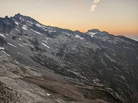
The view from the rib - Buckner on the left, Booker on the right
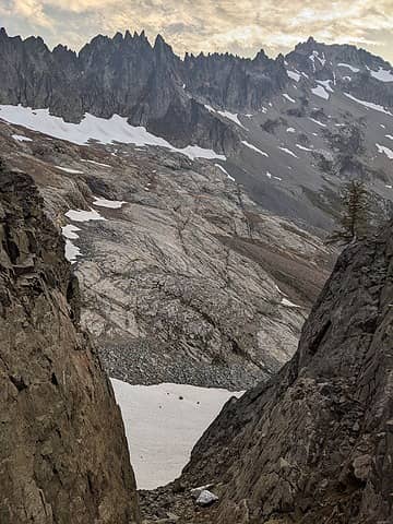
Looking down the descent gully with Buckner on the right
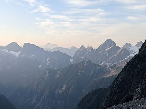
Bonanza in the distance
I then made it to the southeast rib and scrambled down some 3rd class blocks to the snow finger gully. It was snow-free this time of year, so I descended on loose talus and scree, then crossed the low-angle snowfield on the other side. From the snowfield I ascended slightly to gain a flat shoulder at 6600ft. I followed this until it ended at an old mine with tailings beneath. From there I made a gradually rising traverse until I hit the gullies between cliff bands coming down the southwest slope of Buckner. The leftmost gully had a snow-free route, which I took. It was a little annoying to clamber up through the scree, but I didn’t want to put my crampons on for the longer snow gully on the right. I soon reached the main summit ridge and dropped my poles and extra gear. I decided to first visit the NE summit, so when I came to the SW summit I could write my findings from both measurements in the summit register. The route to the NE summit looks a little intimidating at first, but I would say isn’t actually that bad. I would rate it class 3 if you follow my route, and class 4 if you stay exactly on the ridgecrest the whole time. There is significant exposure to the north face, but this is avoidable by my route. I started along the ridge and crested the first rise in the ridge, then descended right onto the southeast face on ledges to get around a few intermediate gendarms. I had to traverse around a rib on ledges, then gained a col and scrambled up to the last peak, which was the summit. It took about 10 minutes.
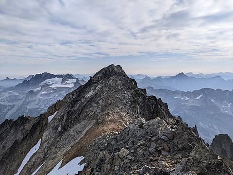
Looking along the ridge towards the NE summit
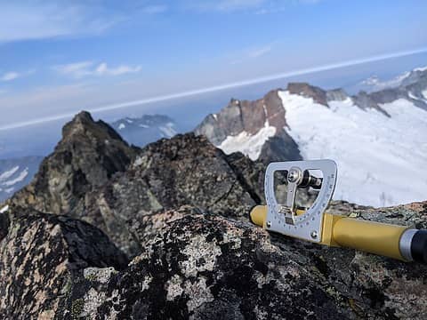
Looking from the NE summit to the SW summit
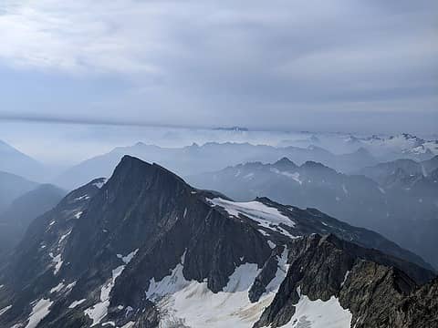
Good views of Booker
The summit was marked by a small rock cairn. The cairn is to the side of the highest rock and shorter, so doesn’t increase the apparent height. The farther summit beyond the cairn is lower (as I verified with my sight level). I dropped my pack and whipped out my 5x sight level. I set it to zero degrees, layed it on the highest permanent rock (not the cairn), then pointed it towards the SW summit. I find this is the best way to start a measurement, just verifying whether the opposite peak is higher or lower first, before measuring an exact angle. But I measured the SW summit exactly level with the NE summit. When the line in the viewfinder was on the top of the summit it lined up with the middle of the bubble with the tilt set exactly to 0 degrees. So there was zero degrees inclination or declination. I looked away then took the measurement again two more times and got the same result. This was surprising. I expected to measure it a little taller like Greg Slayden had. But there were more measurements to take before I trusted this. I took out my 1x sight level and also measured a zero degree inclination/declination. I took three measurements with the 1x level and they were all the same. This was making me lose confidence that the SW summit was higher, though I still had to back sight to verify this.
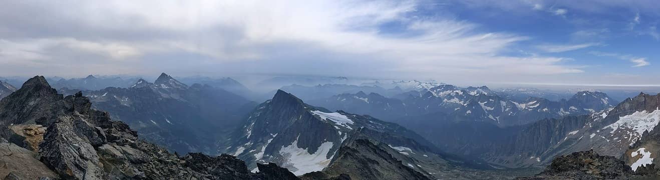
Panorama from SW summit
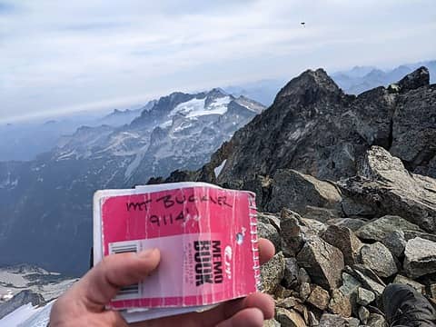
I packed up my bag and started back, but then returned to the NE summit. If I were going to report these findings I had to be absolutely certain. So I again whipped out each sight level and took two more measurements with each. Still, I measured the SW summit exactly level with the NE summit. I then packed up for real and retraced my route scrambling back. I scrambled up to the SW summit and again whipped out my sight levels. I started with the 5x as before and measured a 0 degree inclination/declination angle looking towards the NE summit. I also measured 0 degrees with the 1x sight level. I repeated the measurements for a total of five measurements with each device, and always got 0 degrees. This was surprising and a little bit intriguing. It doesn’t necessarily mean they are the exact same height. It means the height difference is within the resolution of the measuring device. If I assume the smallest measurable angle with these sight levels is 0.1 degrees, then since the two peaks are separated by 600ft, the smallest measurable height difference is 600*tan(0.1 deg) = 1.0 ft. This means, based on my measurements, the peaks are within 1.0ft in height, but I can’t definitively say which is higher.
On the SW summit
On the SW summit
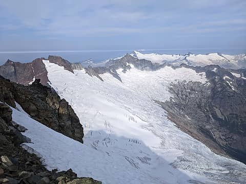
Looking north across the Boston Glacier towards Forbidden, Eldo, and Baker
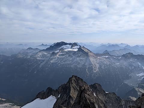
Mt Logan in the distance
Given that no more precise tool than a 5x sight level has been used on Buckner, I would say it is still unclear which peak is the true summit. Until a more precise measurement is made, I would personally only feel comfortable claiming a Buckner summit after visiting both contenders. Measurements need to be made with <1.0ft vertical accuracy, and ideally accuracy within a few inches. I know if I took a Trimble Geo XR with zephyr 2 antenna up and mounted the tripod setup on each summit for an hour I should be able to get about 1 inch vertical accuracy. But I don’t currently have access to one of those units (they can be rented for ~$200/day, but I’m not sure I want to invest that in this project yet). Alternatively, a hose level could get 1 inch accuracy, but that is not practical because it would be way to0 heavy to lug so much water up to fill a 600ft long hose. If anyone has access to a different measuring device with the necessary accuracy I’d be happy to haul it back up and take more measurements. I took a break then to eat a snack and sign in on the register. The views were great to Boston and Forbidden to the north and Logan and Goode to the east. It was only 9:45am then and I was feeling strong with plenty of daylight, so I decided I’d go tag Booker also. I descended the same way, then at the bottom of the scree gully I started angling down to the left. I crossed easy scree and talus slopes to hit the next ridge at a 6500ft shoulder as mentioned by John P and Eric E. I then rounded the corner and scrambled up talus in the next gully. This was snow free and provided an excellent water source. At the top of the gully I crossed a flat snow slope and then hiked up the slope to the right. It looked tempting to just gain the Buckner-Booker ridge and follow that directly to the summit, but I was concerned about getting cliffed out. From Buckner this had looked like a good route, but it wasn’t possible to be sure. I figured if the route looked good from Booker looking back I would take it as a shortcut back. But I would follow the longer known route to get to the summit.
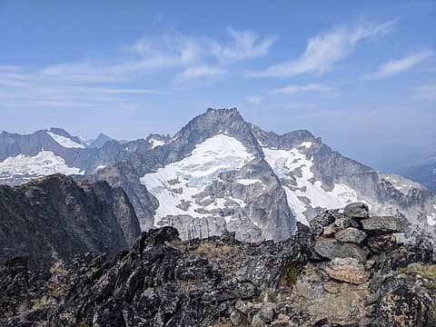
The view of Buckner from on top of Booker. You can clearly see the SW summit on left and NE summit on right
Drying out the register
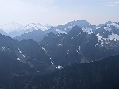
Looking across at Trapper Lake
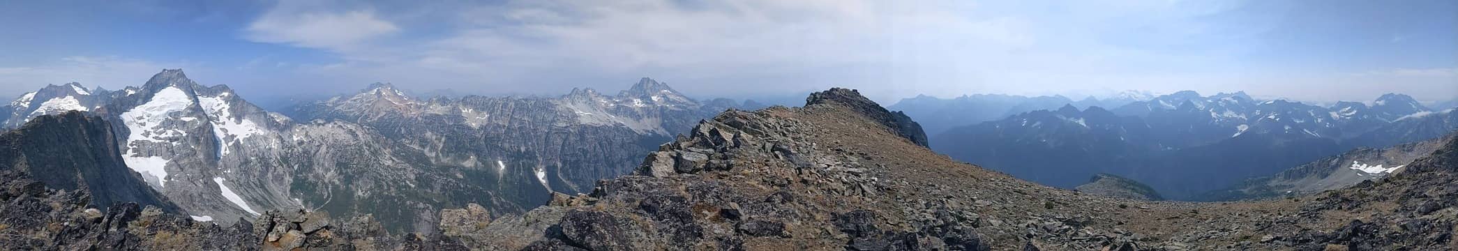
At the bench above the snowfield I turned right and rounded a small rib, then made a gradual descent on grassy slabby terrain to meet the south ridge at 7000ft. The south ridge is flanked by cliffs on the east except for this one spot that allows passage. I crossed over, then scrambled down a narrow ledge and got past the cliff band. There the terrain eased, and I crossed snowfields, scrambled talus, and walked up slabs in a beeline directly for Booker. In the gully below the col to the west of the summit I scrambled a short 3rd class section, before cutting right to gain low-angle talus and scree slopes. I then followed these to the summit by 1pm. The summit is the highest maximum on the west end of the summit ridge. It looked like the maximum on the east end of the ridge might be higher, but I measured it significantly lower with my sight level. (I didn’t feel the need to back sight when the angular difference is >0.5 degrees, which is much more than the resolution of the device).
Summit panorama
Summit panorama
I stopped there for a longer break. The summit register was soaked, so I took out all the pages to air them out. There hadn’t been any sign ins this year, but I think Josh Henderson did climb it in July. So I’m probably the second summiter of the year. Not a popular peak! I had thought Buckner felt remote, but Booker is even more so. This makes it a more appealing peak in my mind. Unfortunately I couldn’t stay too long, though, since I needed to be back home in Seattle at a reasonable hour that night. By 1:30pm the pages were all dried out, so I signed in and carefully inserted them back in the register. I then retraced my route down, making a few detours to boot glissade and save some time. I traversed across Horseshoe Basin at 6500ft and made it back to the rib coming down from Sahale camp.
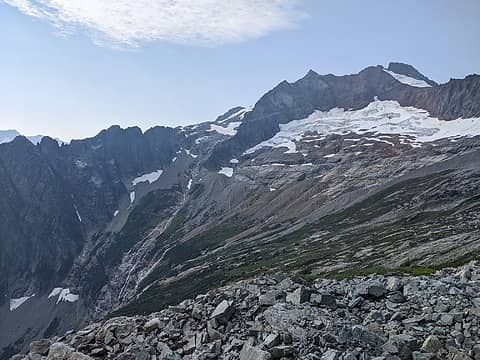
Looking back across Horseshoe basin
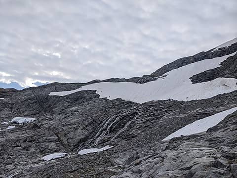
The snowfield to get past below Sahale camp
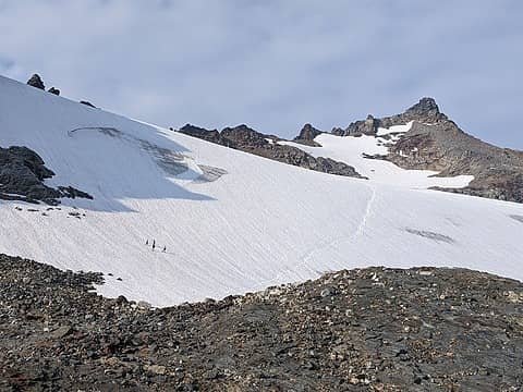
Looking back up at Sahale
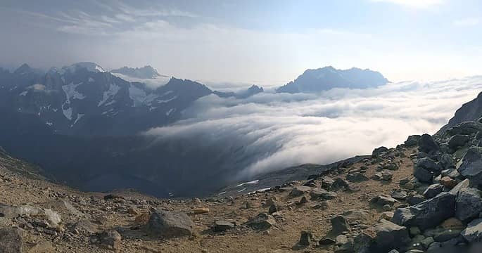
The sea of clouds flowing over Cascade Pass
After eating a snack I scrambled up the rib, then across the narrow ledge below the snowfield and up to Sahale Camp. Somehow I was still feeling strong and energetic, and I considered tagging Sahale Peak just to get another summit for the day. Maybe there’s a tiny bit of K2 acclimation still left in me. But I started doing the math and that would put me home after midnight, which was too late. So instead I stopped briefly to admire the view. It was actually pretty amazing. A sea of clouds filled the cascade river valley and was pouring through cascade pass like a waterfall into the clear valley on the other side. Johannesberg and Formidable were sticking out of the undercast clouds like islands. I took some pictures, then headed down. I soon dropped below the clouds and it got windy and dark. I jogged down to make better time, and reached the trailhead at 7:30pm, in time to get home at a reasonable hour. Video of clouds streaming through cascade pass (10x speed):

wallorcrawl, tomahawksplitter, geyer, zimmertr, Bluebird, vk, raising3hikers, ozzy, glenoid, Josh Journey, RichP, hikergirl1234  ~*CutebutChossy69*~, Gimpilator, awilsondc
Back to top Reply to topic Reply with quote Send private message
Worthington
Member
Member


Joined: 23 Jun 2021
Posts: 80 | TRs | Pics
Worthington
Member
PostSun Sep 04, 2022 9:54 pm 
If someone spent 30 minutes removing the highest rocks from the SW summit, and another 30 minutes stacking rocks up around the NE summit, wouldn't that be enough to make the difference and settle the matter? Is that kind of thing frowned upon?

Alden Ryno
Back to top Reply to topic Reply with quote Send private message
Paul Mayes
Member
Member


Joined: 03 Sep 2022
Posts: 2 | TRs | Pics
Paul Mayes
Member
PostMon Sep 05, 2022 7:19 am 
This calls for another trip up Buckner! I was tired after Horseshoe and didn't tag the NE summit when I was up there in July. At the time, I was satisfied with the previous measurements. I have also looked for the remains of that big tree at MP 15, but I think the NPS probably moved it with an excavator or other heavy equipment that they took up there for road work. The root ball was blocking the ditch and part of the road.
I took this looking your way on Saturday at 11:42am from Sahale. You're in there somewhere, but it's a low quality photo.

Back to top Reply to topic Reply with quote Send private message
RichP
Member
Member


Joined: 13 Jul 2006
Posts: 5634 | TRs | Pics
Location: here
RichP
Member
PostMon Sep 05, 2022 7:31 am 
I can just hear the sigh of relief of all those who can still claim they have climbed the highpoint of Buckner (so far). Very entertaining read, Eric. He Devil and She Devil could be two more candidates for such treatment. As far as I know, it's still unresolved which is higher.

Alden Ryno
Back to top Reply to topic Reply with quote Send private message
SeanSullivan86
Member
Member


Joined: 25 Jul 2009
Posts: 681 | TRs | Pics
Location: Seattle, WA
SeanSullivan86
Member
PostMon Sep 05, 2022 10:30 am 
FWIW, I recall that EE's photo analysis app did output error bounds. I believe they were related to the angular resolution of a pixel in the image and/or the errors observed by using all-but-one of the known summits in the image to estimate the angle/elevation of another known summits. The atmospheric effects seem like the main issue with that visual technique.

Back to top Reply to topic Reply with quote Send private message
glenoid
Member
Member


Joined: 30 Oct 2012
Posts: 307 | TRs | Pics
glenoid
Member
PostMon Sep 05, 2022 1:16 pm 
Nice TR!! Refreshed my memory of my trip there in early July 1978. Went the exact same way to Buckner. The weather seemed about the same also. Watched the clouds roll in over Cascade Pass from a campsite below Sahale, but they never got near our route under Ripsaw ridge to Buckner. (Back then, no one else was around. Pure solitude...)

~*CutebutChossy69*~
Back to top Reply to topic Reply with quote Send private message
Eric
Peak Geek


Joined: 21 Oct 2002
Posts: 2062 | TRs | Pics
Location: In Travel Status
Eric
Peak Geek
PostMon Sep 05, 2022 6:42 pm 
Eric Gilbertson wrote:
As far as I’ve researched, there have only been three instances of measurements taken to try to settle the controversy. Edward Earl analyzed a picture taken from the SW summit looking toward the NE summit. By knowing elevations of peaks in the background and the distance between the peaks he could estimate the angle between the camera and the NE summit, and then estimate the height difference. He estimated the NE summit was 1ft shorter. In 2018 Greg Slayden and Jobe Wymore took 5x sight levels to Buckner. From the SW summit looking at the NE summit they both measured the NE summit a little shorter. Greg scrambled to the NE summit and backsighted the SW summit and measured the SW summit a little higher. He estimated 1-2ft. (Jobe didn’t back sight). At face value this sounds definitive, that the SW summit is higher. But I wasn’t completely convinced. In my experience with 5x sight levels it’s possible to at best resolve about 0.1-0.2 degrees of angular inclination or declination. With a 600ft horizontal distance, using a bit of trigonometry, a 0.1-0.2 degree angular declination results in a 1-2ft height difference. So the measured difference is right at the border of the resolution of the measuring device. But, without a proper tripod mount, a 5x sight level is a bit more prone to error from hand vibrations and roll angular error. That could be significant when operating very close to the resolution. As far as I’ve heard, the photo analysis was only in one direction – SW looking towards NE summit. I would have much more confidence in this measurement if it were backed up by one from the NE looking at the SW summit, and if error bounds were given. I would also have more confidence if more than one sight level measurement with backsighting measured the SW summit higher, since it is so close to the resolution of the device. Or if more precise measurements were taken.
Without combing through all of the old emails I believe that Edward ran the pixel analysis on a photo that Greg took on their summit of Buckner together in 2008. I recall he came up with a figure of 9.6 inches that the SW peak would be higher using his pixel analysis though that does not quite align with Greg's later email. I am certain Greg and Roper were on these email chains too, they may have it more readily available. Anyway, in 2018, Greg returned and his email states: Also, in 2008 I had taken a photograph of the NE peak from the SW peak that was analyzed by Edward Earl’s “GeoPix” program. This program used background points and their known latitude, longitude, and elevations to estimate that the SW summit was approximately 2.32 feet higher than the NE summit. When I visited the NE summit, I took a photo back to the SW summit, and when I got home I ran the GeoPix program on the new photo with its background points The results from the new photo were that the NE summit is about 2.24 feet lower than the SW one. The newer photo was at a lower resolution and the confidence level was not as high as before, but I believe that the consistency of the two results shows that GeoPix is a valid tool for this kind of analysis. If anyone is interested, I can share the 2 photos, the input and output files, the GeoPix code, and its documentation. I would be happy to answer any questions about these results. So it sounds like 3 photos were analyzed with two from the SW and one back to the NE between the two trips. It also appears that Greg maintained, at least as of four years ago, the code and was willing to share it so perhaps some of the photos taken here could be utilized for that purpose. (they can be rented for ~$200/day, but I’m not sure I want to invest that in this project yet). I imagine there are interested parties in the COHP community as well as Roper, Greg, myself and many others since this also impacts a great number of Bulger finishers as it seems the majority of folks only go to the SW summit. I will match whatever Roper donates to the cause up to a $100 bucks! wink.gif Of course the harder part is lugging it back up the mountain. I won't be helping with that!
Eric Gilbertson wrote:
Alternatively, a hose level could get 1 inch accuracy, but that is not practical because it would be way to0 heavy to lug so much water up to fill a 600ft long hose.
I had the opportunity to join Edward and Greg once for an effort to hose level the summit of Indian Rock. It was very interesting to see but we used a shorter hose and did loops as best we could, but it likely reduced the accuracy a bit. {Someone else later took professional WA DOT surveying equipment up there too!} Agree with your point, in practice the weight is a lot and brush and rocks proved problematic and that was on a flat plateau. The Trimble seems like the best option, until we get LiDAR or something better.

Alden Ryno
Back to top Reply to topic Reply with quote Send private message
raising3hikers
Member
Member


Joined: 21 Sep 2007
Posts: 2344 | TRs | Pics
Location: Edmonds, Wa
raising3hikers
Member
PostMon Sep 05, 2022 7:43 pm 
Nice work, glad you're recovering from your K2 trip

Eric Eames

Eric Gilbertson
Back to top Reply to topic Reply with quote Send private message
Eric Gilbertson
Member
Member


Joined: 04 Jul 2018
Posts: 188 | TRs | Pics
Location: Seattle
Eric Gilbertson
Member
PostWed Sep 07, 2022 7:59 pm 
Quote:
If someone spent 30 minutes removing the highest rocks from the SW summit, and another 30 minutes stacking rocks up around the NE summit, wouldn't that be enough to make the difference and settle the matter? Is that kind of thing frowned upon?
Haha, I heard something like that happened on two Colorado 14ers. Seems like it was Mt Harvard and Mt Columbia but I might be remembering wrong and now I can't find detail about it online. One group would build a big cairn on one so it was highest, then next weekend another group would knock the cairn over and build a bigger one on the other peak so it was highest. I'm pretty sure most peakbaggers only count natural rock, not human-piled rocks, as the true top, though.
Quote:
Also, in 2008 I had taken a photograph of the NE peak from the SW peak that was analyzed by Edward Earl’s “GeoPix” program. This program used background points and their known latitude, longitude, and elevations to estimate that the SW summit was approximately 2.32 feet higher than the NE summit. When I visited the NE summit, I took a photo back to the SW summit, and when I got home I ran the GeoPix program on the new photo with its background points The results from the new photo were that the NE summit is about 2.24 feet lower than the SW one. The newer photo was at a lower resolution and the confidence level was not as high as before, but I believe that the consistency of the two results shows that GeoPix is a valid tool for this kind of analysis. If anyone is interested, I can share the 2 photos, the input and output files, the GeoPix code, and its documentation. I would be happy to answer any questions about these results. So it sounds like 3 photos were analyzed with two from the SW and one back to the NE between the two trips. It also appears that Greg maintained, at least as of four years ago, the code and was willing to share it so perhaps some of the photos taken here could be utilized for that purpose.
Yes, Greg gave me the code and I'm looking through it now. Looks to me like the output is actually SW 2.24 ft higher than NE, and NE 0.8ft shorter than SW, if I'm interpreting it correctly. There are many correction factors for atmospheric effects for things like temperature, pressure, wind, haze, etc, which all sound like potential sources of error to me. I'll have to dig into the code more to understand it better though and see what the error bounds are. At least for me a standard angular declination/inclination measurement seems the most trustworthy and confidence-inspiring. I think a theodolite is probably the way to go. They can get 1 arcsecond angular resolution with 30x magnification. That translates to 0.03 inches at 600ft horizontal distance!
Quote:
I took this looking your way on Saturday at 11:42am from Sahale. You're in there somewhere, but it's a low quality photo.
Nice photo! I think I'm at the red circle:

geyer
Back to top Reply to topic Reply with quote Send private message
Gimpilator
infinity/21M


Joined: 12 Oct 2006
Posts: 1684 | TRs | Pics
Location: Edmonds, WA
Gimpilator
infinity/21M
PostThu Sep 08, 2022 11:10 am 
Thanks Eric. This has been a long contentious issue, brining much debate. In light of your findings, I'm even more satisfied having only visited the SW summit.

Back to top Reply to topic Reply with quote Send private message
zimmertr
TJ Zimmerman


Joined: 24 Jun 2018
Posts: 1227 | TRs | Pics
Location: Issaquah
zimmertr
TJ Zimmerman
PostMon Oct 17, 2022 6:31 pm 
If you ever felt up to it, I think it is also contested whether or not the two Enchantment Peak summits are of equal elevation. And one is significantly easier than the other.

Flickr | Strava

awilsondc
Back to top Reply to topic Reply with quote Send private message
   All times are GMT - 8 Hours
 Reply to topic
Forum Index > Trip Reports > Buckner Summit Survey Plus Booker, Sept 3, 2022
  Happy Birthday Traildad!
Jump to:   
Search this topic:

You cannot post new topics in this forum
You cannot reply to topics in this forum
You cannot edit your posts in this forum
You cannot delete your posts in this forum
You cannot vote in polls in this forum