| Previous :: Next Topic |
| Author |
Message |
Now I Fly
Member

Joined: 07 Jun 2018
Posts: 465 | TRs | Pics
|
Thought we might get this in before yesterday's system came through. This trip is best when views of the Stuart range are clear. Cloudbase dropped before we reached the high country, but I think we still enjoyed the day.
Great to travel in winter conditions again!
Access the Point 5018 Ridge directly across the road from the Stafford Creek trailhead parking lot. It's surprisingly open from the start.
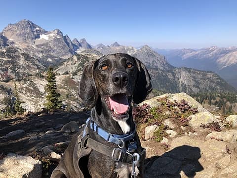
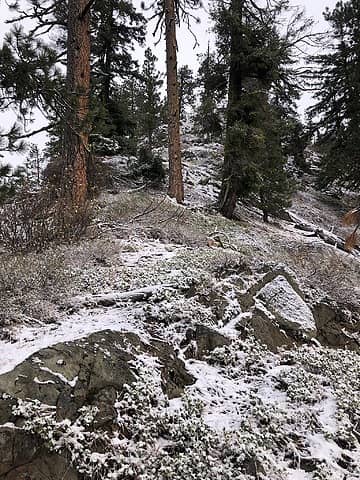 Access the ridge near the Stafford Creek trailhead. 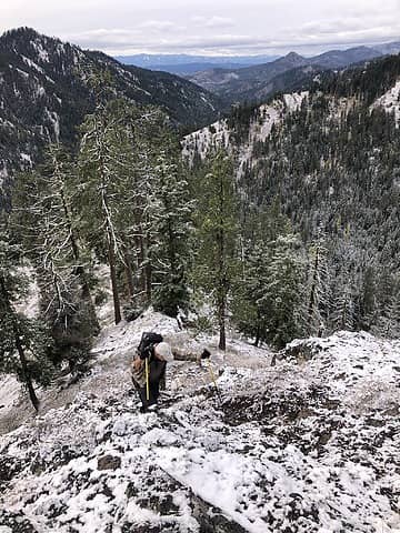 Bryan working through the first challenge. 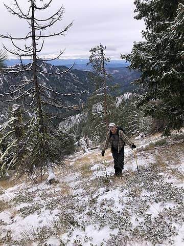 Wonderful traveling for much of this route, with a few small puzzles to work through. 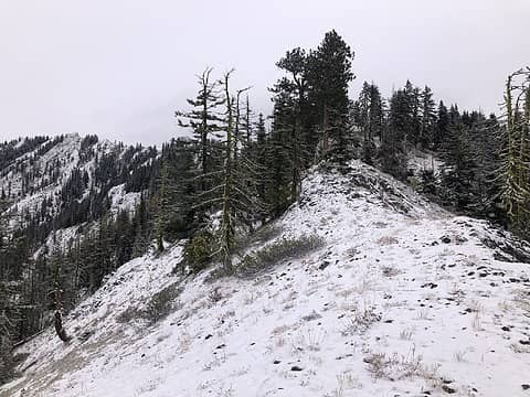 Following the ridge towards Point 5,018. After passing it we continued along the ridge to the left. 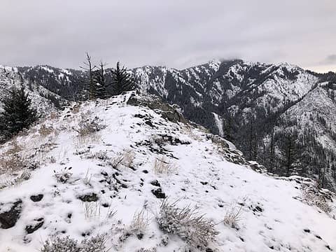 Point 5,018 and cloud-capped Miller Peak beyond. 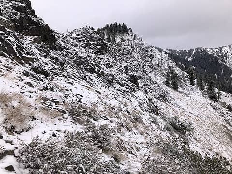 Following the path of least resistance. 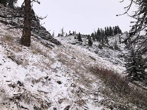 Once at the saddle cross over the ridge and traverse along its West side. Regain the ridge once beyond this rocky section. 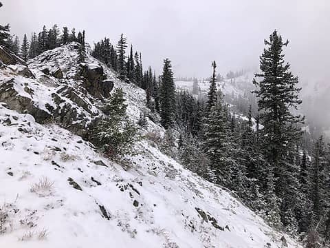 Stay as close to the top of the ridge as is convenient, crossing over when needed. 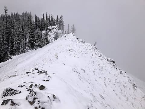 Approaching the County Line. 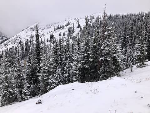 Views of Freedom Peak and the "County Line" appear. 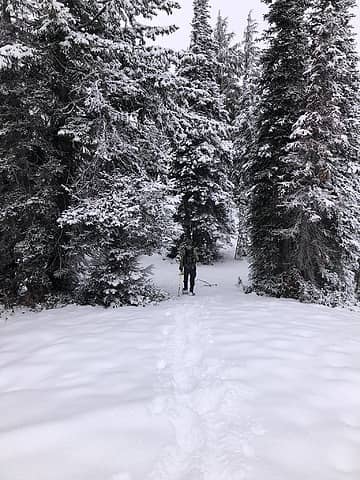 Didn't stay in the snowshoes for long. 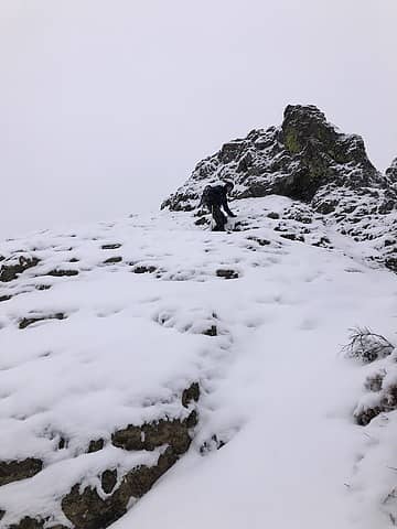 Working the ups and downs along the County Line. 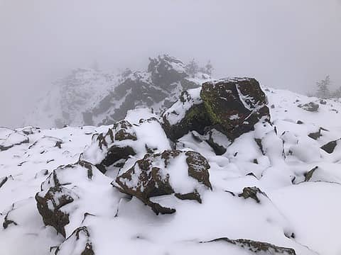 The weather did move in. 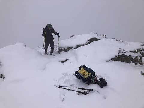 Freedom Summit!  9 miles (+/-)
4,000 ft. (+/-) elevation gain
6:48 Elapsed time
5:04 moving time
9 miles (+/-)
4,000 ft. (+/-) elevation gain
6:48 Elapsed time
5:04 moving time
 zimmertr, jaysway, Sculpin, brewermd, Bramble_Scramble, Matt, awilsondc, LukeHelgeson, RichP zimmertr, jaysway, Sculpin, brewermd, Bramble_Scramble, Matt, awilsondc, LukeHelgeson, RichP
zimmertr, jaysway, Sculpin, brewermd, Bramble_Scramble, Matt, awilsondc, LukeHelgeson, RichP |
| Back to top |
  
|
|
Sculpin
Member

Joined: 23 Apr 2015
Posts: 1384 | TRs | Pics
|
|
Sculpin
Member
|
 Sun Nov 06, 2022 2:54 pm |
|
|
| Now I Fly wrote: | | Access the Point 5018 Ridge directly across the road from the Stafford Creek trailhead. |
I'm interested in this route but am confused by your description. You took the ridge that runs parallel to the Stafford Creek trail to the east, right? That would be on the same side of the road as the trailhead. There is a ridge to the south that is "across the road" but it would be a loooooong way to get to Freedom Peak that way. 
Between every two pines is a doorway to the new world. - John Muir
Between every two pines is a doorway to the new world. - John Muir
|
| Back to top |
|
|
penquin
Member

Joined: 31 Mar 2008
Posts: 27 | TRs | Pics
Location: The Wild Yonder |
|
penquin
Member
|
Sun Nov 06, 2022 8:45 pm |
|
|
Sculpn: We left the Stafford Creek trail a few hundred feet from the trailhead and took the ridge all the way to the top of Freedom Peak. Here is a screenshot of our route.
Now I Fly
Now I Fly |
| Back to top |
|
|
Now I Fly
Member
Joined: 07 Jun 2018
Posts: 465 | TRs | Pics
|
You are right, I should have said across the road from the parking lot.
Thanks for pointing that out.
|
| Back to top |
|
|
|
|
You cannot post new topics in this forum
You cannot reply to topics in this forum
You cannot edit your posts in this forum
You cannot delete your posts in this forum
You cannot vote in polls in this forum
|
Disclosure: As an Amazon Associate NWHikers.net earns from qualifying purchases when you use our link(s). |


