Matt Lemke
High on the Outdoors


Joined: 15 Jul 2010
Posts: 2052 | TRs | Pics
Location: Grand Junction |
|
Matt Lemke
High on the Outdoors
|
 Sat Jan 21, 2023 12:03 pm |
|
|
Stats:
SAN PEDRO - 9908'
ATITLAN VOLCANO - 11604'
ACATENANGO VOLCANO - 13041'
TAJUMULCO VOLCANO - 13845'
I am happy to be back into action after a relatively inactive 2022 year for climbing and travelling. Due to a work trip I needed to take in Guatemala from January 5-12th, I decided to take a week over new years with Bri to explore Guatemala and hike some of the volcanoes. After a fairly quick flight to Guatemala City from Bozeman we met with our pre-arranged private driver who too us all the way to San Pedro on the southwest side of Lake Atitlan where we would stay at Refugio del Volcan for the next week. We arrived late at 9pm and quickly went to sleep as we wanted to hike up the San Pedro Volcano the following morning.
Our host, who was am American who started the entire AirBB which included small cabins and a beautiful terraced plat of land with excellent lake views was very helpful and gave us a tip that we can avoid the San Pedro enterance fee at the standard trailhead for San Pedro at the 1800 meter contour on road SQL-4 (the bad road leading towards Santiago de Atitlan) if we start walking up from a small dead end road off of Calle Finca (the road that leads east from town along the lake towards Refugio del Volcan). I marked this location on the map below (our route in red is approximate). A small series of farmers trails head south up the slopes, weaving through old coffee and banana fields before eventually meeting up with a larger trail that ascends up and leftward. A bit of bushwhacking was needed to reach this larger trail, but when you reach it, we turned right and descended a hundred feet or so and met the main trail that leads to the summit of San Pedro at a dry stream bed where a sign indicates the main trail heads climbers right. We ascended about 1200 feet from the Calle Finca road before meeting the main trail. This allowed us to bypass the enterance booth, but did add an additional 600 feet of elevation gain as most people will just take a Tuk Tuk up the road to the main trailhead.
Bri and I then continued hiking up the steep trail at a brisk pace, passing numerous parties on the trail. There was a sweet tire swing a ways further up that we stopped at for some fun. It did not take us long to reach the summit where a beautiful view of the Atitlan Volcano, and the town of Santiago de Atitlan way below us came into view. We ran the entire way down the trail and blazed past the enterance booth out to the road where we were able to pick up snacks and more water/juice at a small tienda along the road. Not wanting to walk the paved road back to town we hopped in a Tuk Tuk to get back to the center of townfor lunch and we met with my longtime friend Kelly who was making the trip with Lorin in their campervan driving down from the US through Central America and eventually all the way to Patagonia. It was just by chance they were also in the Lake Atitlan area the same time we were there. Kelly took a boat across from Panajachel to San Pedro and we explored the town a bit and went swiming in the lake. We then made plans to meet in Santiago de Atitlan early the next morning to hike the Atitlan Volcano. Bri and I felt sore that evening since that was the first fast and steep hike either of us had done in a few months. The photos below show some of the views we had from our AirBB and the hike up and back from San Pedro. This volcano actually rises directly above the town of San Pedro and is an extinct volcano where the top is still largely covered in jungle. The summit elevation of 9908 feet is not high enough to breach treeline but there are a few spots with rocky perches that offer great views.
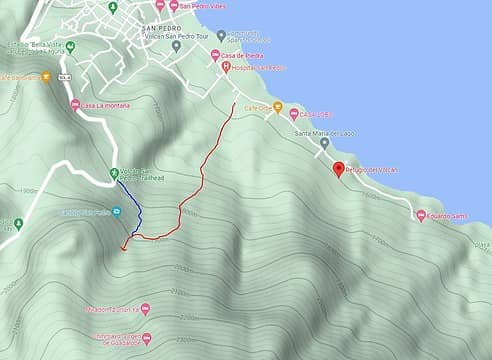 Our initial route up to avoid the fee 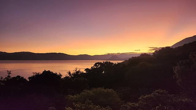 Our first sunrise from Refugio del Volcan 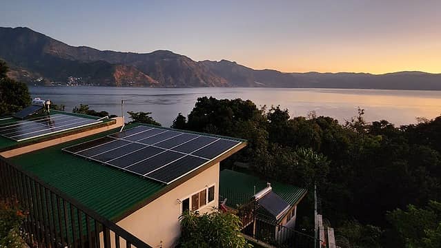 Lake Atitlan Sunrise 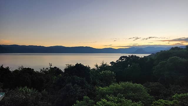 Lake Atitlan 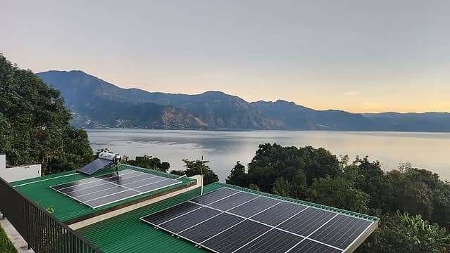 Refugio del Volcan (entirely on solar) 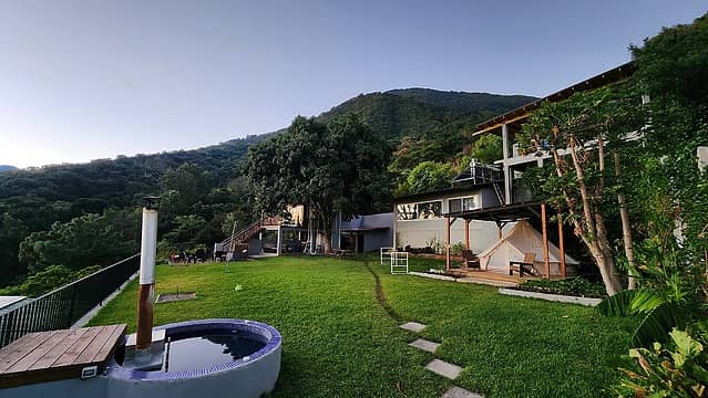 Hot tub and hangout field at Refugio del Volcan 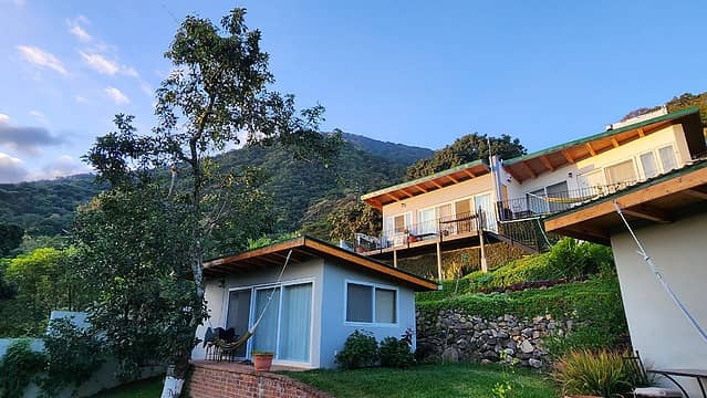 Refugio del Volcan cabins 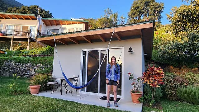 Our homestay for the next week 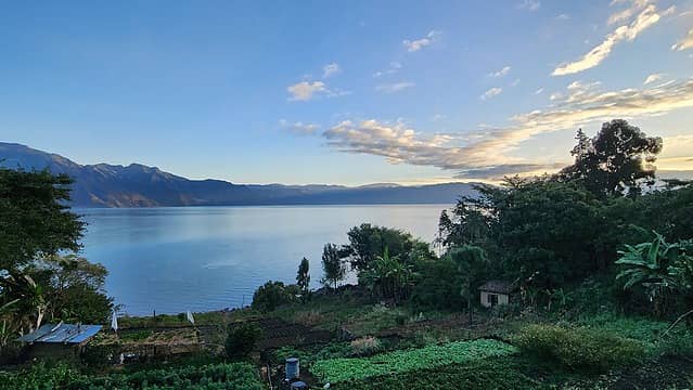 Lake Atitlan 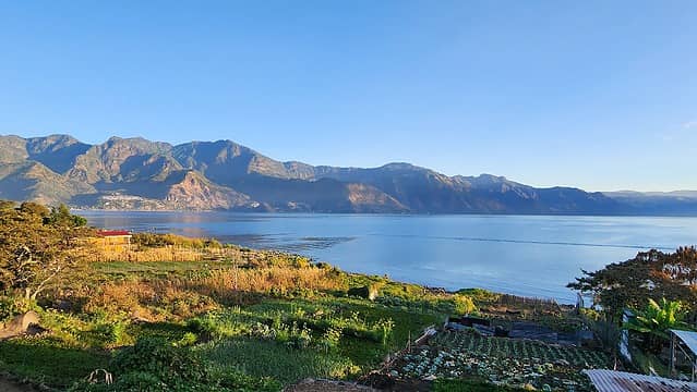 First rays of sun 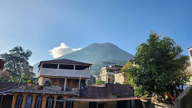 San Pedro Volcano looming above 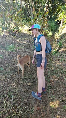 Starting up thru the fields 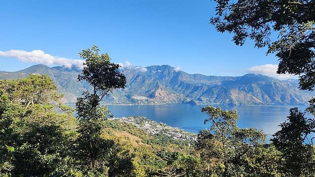 View north across the lake 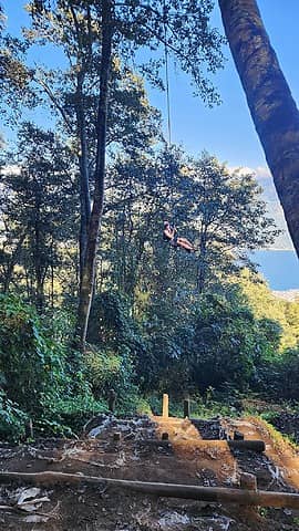 Tire swing 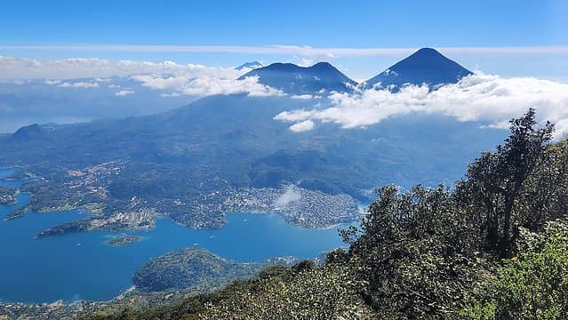 Atitlan Volcano (right) and Toliman (left) 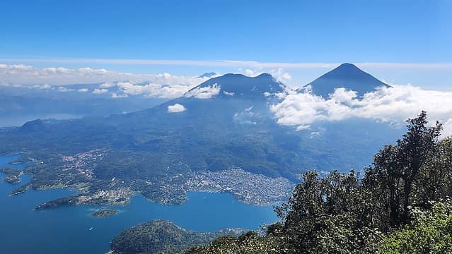 View of Santiago and Atitlan Volcano from the top 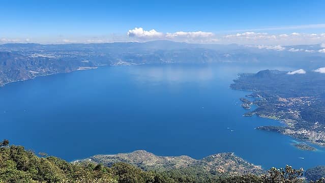 Lake Atitlan 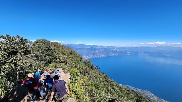 Other hikers 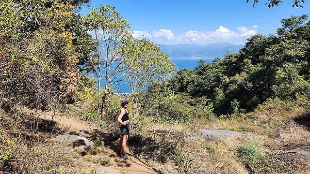 Heading back down the trail 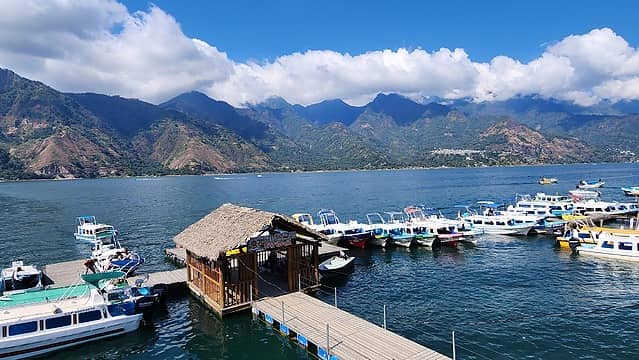 Boat dock in San Pedro 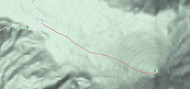 Our route up Atitlan Volcano 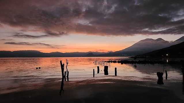 Twilight on Lake Atitlan 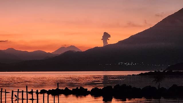 Ash plume from Fuego 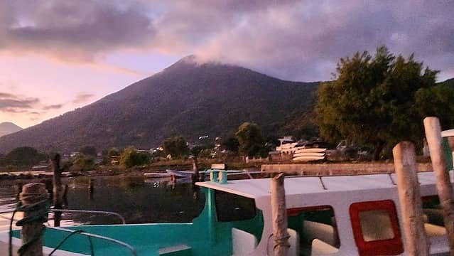 Twilight on San Pedro Volcano 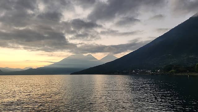 Toliman and Atitlan from the boat 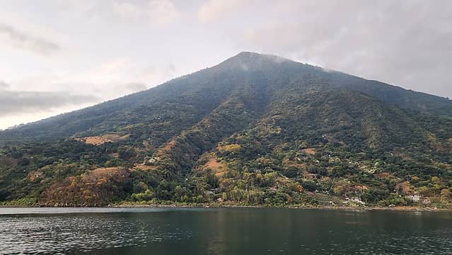 San Pedro Volcano from the boat 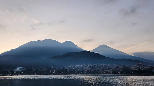 View from the boat 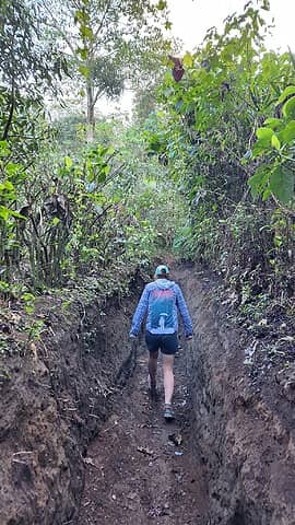 Starting up the trail 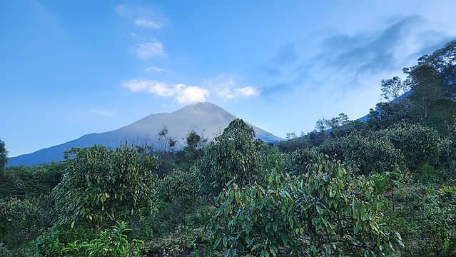 Atitlan Volcano 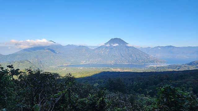 San Pedro Volcano 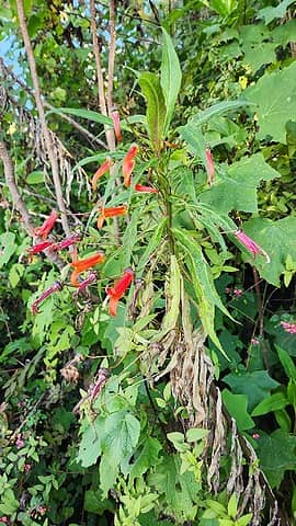 Tropical flowers  Nearing treeline 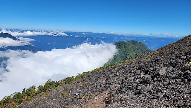 Toliman 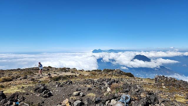 Summit view 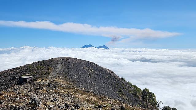 Acatenango and Fuego from Atitlan 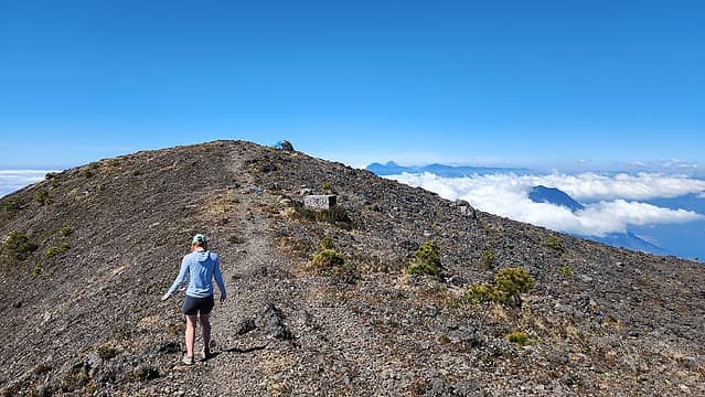 Exploring the summit area 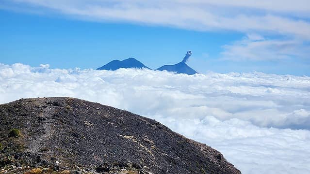 Plume from Fuego 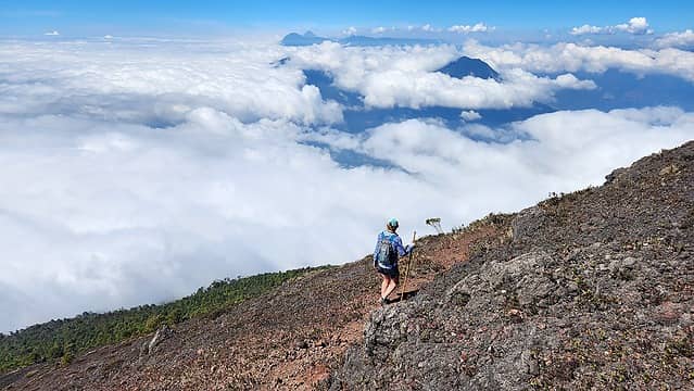 Starting the descent above the clouds 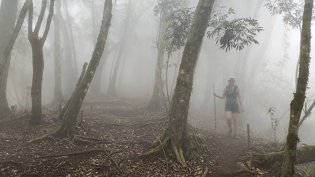 Cloud Forest
|


