| Previous :: Next Topic |
| Author |
Message |
Now I Fly
Member

Joined: 07 Jun 2018
Posts: 467 | TRs | Pics
|
This is such a great trip!
Not sure why I had yet to get up Green Mountain. I tossed the idea out to Penguino and he said sure.
He had done Green before and thought we might try a different route. We agreed to follow a trip report he found here,
http://www.willhiteweb.com/washington/green_mountain/north_bend_hiking_390.htm
You'll find good route descriptions there. I won't try to improve on it. I will reiterate, after leaving the road and heading up the appropriate ridge, veer right (3,300 ft.) as the ridge steepens into a rocky outcropping. If you find yourself spooked at all you're not on route.
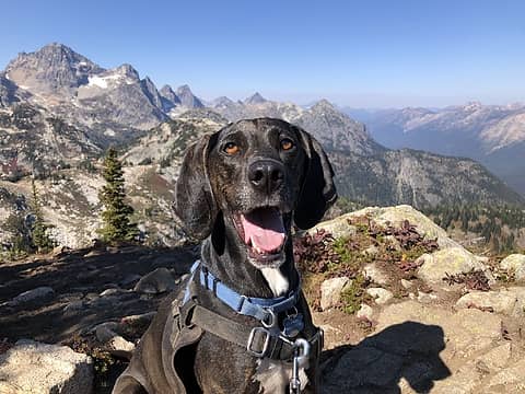
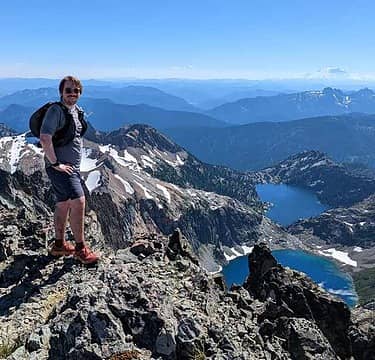
This route is a Classic shoeshoeing adventure that left us all smiles and plenty tired.
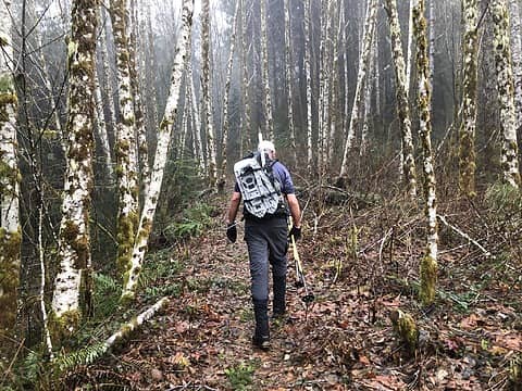 The Sitka Trail 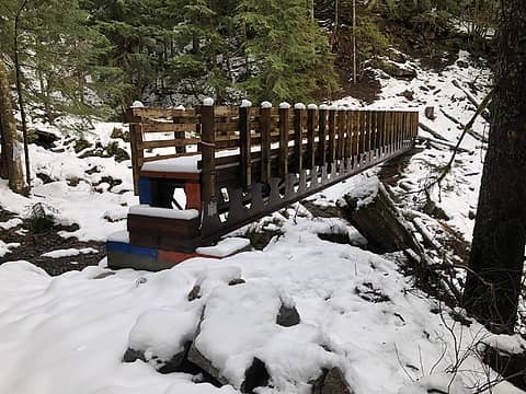 The new bridge 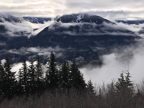 Mailbox 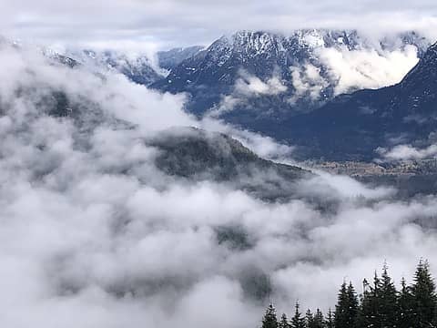 The Middle Fork! 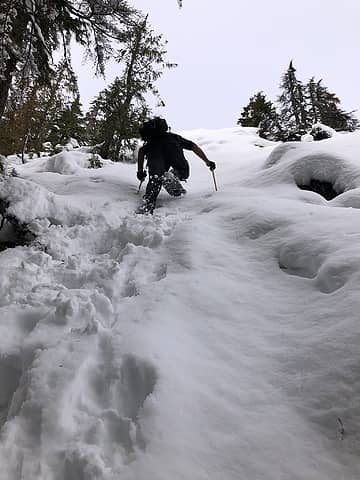 bad idea 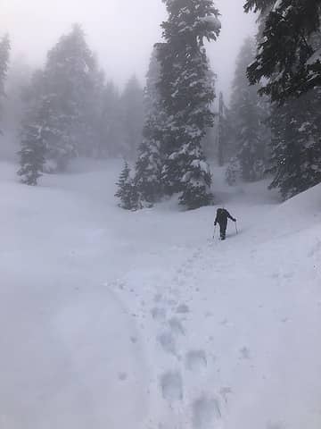 Back on track. 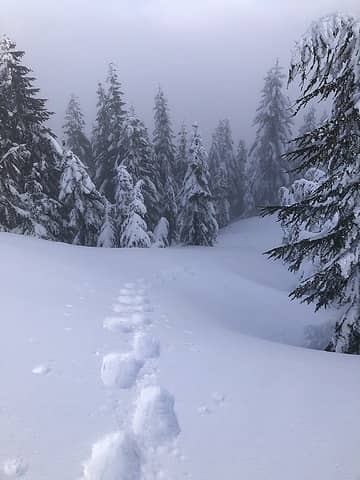 .Looking back from the saddle 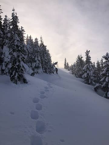 hiking the road from the saddle 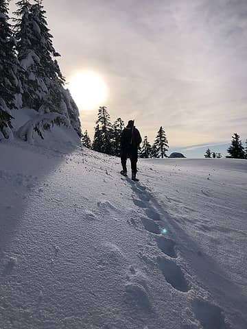 hiking the road from the saddle 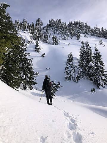 Summit push from the road 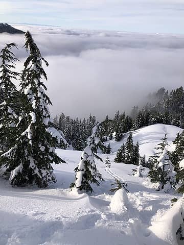 summit push 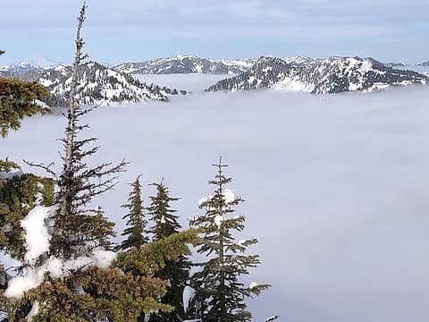 Mooloch, Bessemer 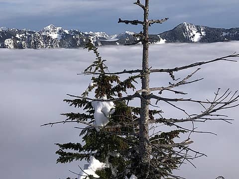 Revolution on the right, Granite just left of the tree. 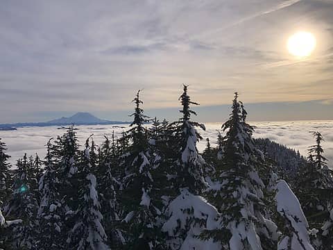 Distant Rainier 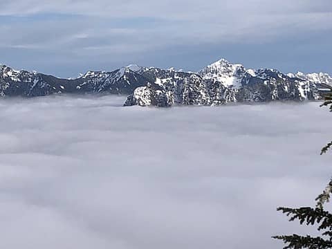 Russian Butte and Kaleetan 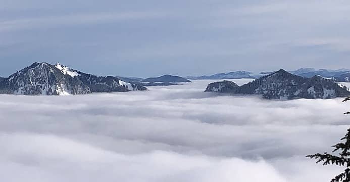 North Web, Web, Dirty Pete's, McClellans, Dirtybox, Mailbox. 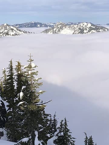 shadows and glory.
 Fedor, Randito, BarbE, RichP, rubywrangler, fourteen410, ALW Hiker, Cyclopath, zimmertr, awilsondc, peter707 Fedor, Randito, BarbE, RichP, rubywrangler, fourteen410, ALW Hiker, Cyclopath, zimmertr, awilsondc, peter707
Fedor, Randito, BarbE, RichP, rubywrangler, fourteen410, ALW Hiker, Cyclopath, zimmertr, awilsondc, peter707 |
| Back to top |
  
|
|
zimmertr
TJ Zimmerman
Joined: 24 Jun 2018
Posts: 1228 | TRs | Pics
Location: Issaquah |
|
zimmertr
TJ Zimmerman
|
 Thu Jan 26, 2023 1:12 pm |
|
|
I noticed from your Strava track you were off what I thought was the normal route. Based on your tracks it looks like you had much better snow conditions than Neek and I did on South Bessemer last Sunday. Looks awesome, I think I might try and tackle Green this winter as well. I will definitely need to shoot for good snow though because sinking 12-18" in fresh powder was quite a sufferfest.
|
| Back to top |
|
|
ALW Hiker
lakebagger
Joined: 27 Jul 2021
Posts: 120 | TRs | Pics
Location: Redmond, WA |
|
ALW Hiker
lakebagger
|
Thu Jan 26, 2023 2:26 pm |
|
|
Nice trip and photos! I need to get up to Green Mountain sometime.
Where is the new bridge you saw? Based on the snow, I'm assuming it's not where the Sitka Spruce trail crosses Brawling Creek at the bottom.
I read on the DNR web site that there is a project to build new trails and/or improve existing ones up on Green Mountain. If that bridge is over Brawling Creek on the higher section, that would make sense. The web site doesn't provide much detail, but there is an email address where you can request more info.
They're also planning a connector trail from the Mount Teneriffe TH over to the CCC trail, so I'm guessing that will be the "approved" route to Green Mountain. Probably longer than Sitka Spruce by a couple miles each way.
Now I Fly
Now I Fly |
| Back to top |
|
|
Now I Fly
Member
Joined: 07 Jun 2018
Posts: 467 | TRs | Pics
|
| ALW Hiker wrote: | | If that bridge is over Brawling Creek on the higher section, that would make sense. |
Yes, this bridge crosses Brawling Creek, on the trail to the "Absolute Last Promontory".
Also, I wonder if parking, or lack of it, is the main reason to remove the Sitka trail? There is good parking on the south side of the bridge over the Middle Fork. I love the Sitka Spruce trail.
|
| Back to top |
|
|
puzzlr
Mid Fork Rocks

Joined: 13 Feb 2007
Posts: 7220 | TRs | Pics
Location: Stuck in the middle |
|
puzzlr
Mid Fork Rocks
|
Thu Jan 26, 2023 9:20 pm |
|
|
The reasons I've heard about removing the Sitka Spruce trail are 1) unsuitable clay soils in the first 1/2 mile and 2) reducing human presence in that area to avoid wild life impact. Based on the response to comments, including some opposing it's removal I don't think there will be any concrete actions taken to remove it.
AFAIK, four new bridges were installed in this area in 2022 by the DNR. Three on the CCC trail and one on the trail to Absolute Last Promontory. The approaches have not been completed on these yet, but some work has been done.
In the coming year the DNR hopes to fix up the east junction of the CCC trail and the Bessemer road where the mud flow came down in February 2020. It's still a mess of mud and debris, but it's solidified enough that it's easy to walk across.
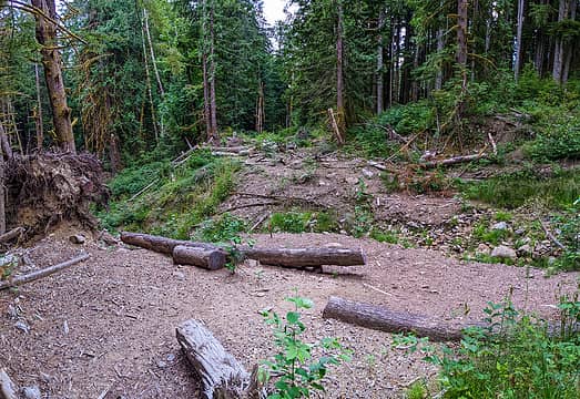 CCC mud flow crossing
|
| Back to top |
|
|
ALW Hiker
lakebagger
Joined: 27 Jul 2021
Posts: 120 | TRs | Pics
Location: Redmond, WA |
|
ALW Hiker
lakebagger
|
Sat Jan 28, 2023 1:47 pm |
|
|
Thanks for the info puzzlr! I hadn't seen your post from 2020 with those cool pictures of the mud flow on Bessemer - pretty amazing. It's also interesting to read about the talus mining up at Moolock - I had wondered what the point of that weigh station was, since the road above the waterfall seems to be unused since the mudflow.
Nice to hear they are going to fix up the CCC / Bessemer junction you mentioned. For what it's worth, it looked pretty easy to get across now, as most of the water seems to be running in the new alternate channel rather than the one the mud went down. Kind of funny to see the original CCC trail sign all askew in a heap of mud, though!
|
| Back to top |
|
|
kitya
Fortune Cookie

Joined: 15 Mar 2010
Posts: 842 | TRs | Pics
Location: Duvall, WA |
|
kitya
Fortune Cookie
|
Sun Jan 29, 2023 11:58 pm |
|
|
The "Sitka Spruce" trail is closed in order to prevent the trampling and compacting of soil around the roots of the Sitka Spruce, which will kill the Sitka Spruce. So, don't start up immediately after the Middle Fork road crosses the river. Instead, drive an extra 2 miles or so and park at the Blowout Creek Trailhead (a.k.a the Bessemer trail head or the CCC Road trail head). It makes for a longer day, but it is important to preserve the rare Sitka Spruce trees."
This is from Seattle Mountaineers.
|
| Back to top |
|
|
Now I Fly
Member
Joined: 07 Jun 2018
Posts: 467 | TRs | Pics
|
this is a quote from another thread,
"Phase 1a: Decommission and restore West Green Mtn Summit (1.2 mi), Main Green Mtn Summit (1 mi), and Spruce Trail (1.2 mi), totaling 3.4 miles of non-designated trail decommission efforts. Continue field monitoring of decommission and restoration efforts, allocate resources and leverage partnerships for assistance with labor, signage, education and enforcement, and external communications and messaging with partner organizations, to ensure success of closure efforts over time."
|
| Back to top |
|
|
BarbE
Member

Joined: 28 Jul 2006
Posts: 1153 | TRs | Pics
|
|
BarbE
Member
|
Thu Feb 02, 2023 5:29 pm |
|
|
| Now I Fly wrote: | shadows and glory. |
Youre lucky to see a Brocken Spectre! 
|
| Back to top |
|
|
|
|
You cannot post new topics in this forum
You cannot reply to topics in this forum
You cannot edit your posts in this forum
You cannot delete your posts in this forum
You cannot vote in polls in this forum
|
Disclosure: As an Amazon Associate NWHikers.net earns from qualifying purchases when you use our link(s). |


