| Previous :: Next Topic |
| Author |
Message |
pula58
Member


Joined: 13 Aug 2009
Posts: 589 | TRs | Pics
|
|
pula58
Member
|
 Fri Jan 27, 2023 3:33 pm |
|
|
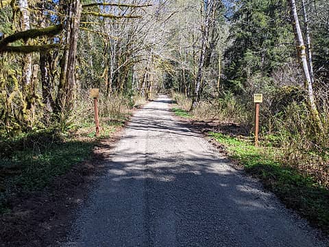
We're looking for a low elevation hike for an overnight snow backpacking trip. I keep driving by this road and have wondered about it. The road starts just west of the main Granite lakes trailhead area, just South of a bridge over the middle Fork Snoqualmie..
Decent place for an overnight snow camp?
|
| Back to top |
  
|
|
flatsqwerl
Member
Joined: 23 Feb 2010
Posts: 1049 | TRs | Pics
Location: tacoma |
No snow there now. It used to be gated with a private property keep out sign I think..
|
| Back to top |
|
|
Mike Collins
Member
Joined: 18 Dec 2001
Posts: 3097 | TRs | Pics
|
| flatsqwerl wrote: | | It used to be gated with a private property keep out sign I think.. |
It is private property. If you walk up the road far enough you will go past a now abandoned house that was used as a meth lab. It was on a toxic waste clean-up site list but I think that was completed in 2006. That road was my approach route for a successful climb of Russian Butte. Along the way up you will go past an improvised sign made from shotgun shells hammered into a tree spelling out "KEEP OUT". This link take you to the EPA cleanup site that seem to have been completed. https://ofmpub.epa.gov/frs_public2/fii_query_detail.disp_program_facility?p_registry_id=110038699049
 Dave Workman Dave Workman
Dave Workman |
| Back to top |
|
|
mosey
Member

Joined: 18 Dec 2018
Posts: 163 | TRs | Pics
|
|
mosey
Member
|
Sat Jan 28, 2023 4:26 pm |
|
|
It's all been acquired by king county parks, with the exception of two parcels that the road passes through in the beginning. There's a possibility this is in a trust to eventually donate to the forest lands. The northern road, SE 116th, is entirely owned by King County Parks now.
https://blue.kingcounty.com/Assessor/eRealProperty/Dashboard.aspx?ParcelNbr=1123099020
https://blue.kingcounty.com/Assessor/eRealProperty/Dashboard.aspx?ParcelNbr=1123099026
That parcel seems to be for sale occasionally, and is listed at the moment as vacant land. The owner is listed as an LLC. Note: the price is ridiculous because north bend (local area for the computer generated price) has skyrocketed in the last decade.
https://www.redfin.com/WA/North-Bend/53420-Se-116th-St-98045/home/22572797
Either way there's nothing of interest up there imo, I've walked the roads and it's just typical lowland second growth. There is the superfund site and lots of rusting car carcasses. It's possible, although unpleasant, and probably dangerous during avalanche seasons since it's a funnel at the bottom of the Russian Buttes, to get to Gifford Lakes that way but it wouldn't save much time vs going up and over the easy trail to Thompson Point from the same trailhead.
What's much more interesting is that a rich pharma exec wanted to construct a mansion with complete sports club facilities out there. I bet that tower would have had a great view of the Buttes and Garfield.
https://www.seattleweekly.com/news/mansion-in-the-woods/
| Quote: | | According to documents filed with the county, the couple plans to construct a four-bedroom home topped by a tower, along with tennis courts, a 5,000-square-foot activity center, four parking stalls, and heated passageways between the estates three buildings. |
Comma, zimmertr, Fedor
Comma, zimmertr, Fedor |
| Back to top |
|
|
flatsqwerl
Member
Joined: 23 Feb 2010
Posts: 1049 | TRs | Pics
Location: tacoma |
1.2 million for less than 2 acres in the woods..wtf
|
| Back to top |
|
|
Fedor
Member
Joined: 06 May 2009
Posts: 126 | TRs | Pics
|
|
Fedor
Member
|
Sat Jan 28, 2023 9:33 pm |
|
|
I hiked here once last summer. I didn't notice any private property signs. It was relatively clear road for the first mile or so with surprisingly few blowdowns. After that it became covered in tall brush, mostly salmonberry, with an obvious singletrack bootpath running through. Looking at my gps track, I veered off the road for some reason, but I can't remember why.
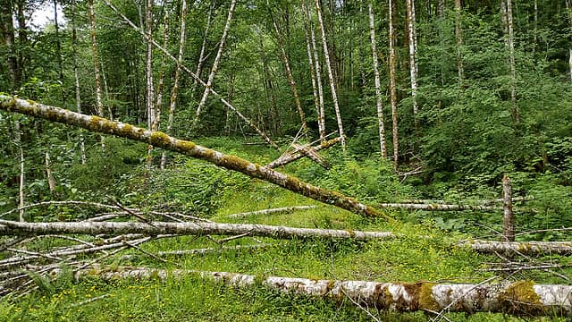 very few blowdowns other than these 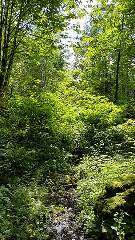 salmonberry jungle after the first ~mile
RichP, mosey
RichP, mosey |
| Back to top |
|
|
flatsqwerl
Member
Joined: 23 Feb 2010
Posts: 1049 | TRs | Pics
Location: tacoma |
Fedor, looks like you did a fair distance through what had to be very brushy terrain. Looks like a trip I need to do now.
Fedor
Fedor |
| Back to top |
|
|
puzzlr
Mid Fork Rocks

Joined: 13 Feb 2007
Posts: 7220 | TRs | Pics
Location: Stuck in the middle |
|
puzzlr
Mid Fork Rocks
|
Mon Jan 30, 2023 12:55 pm |
|
|
Mosey, parcels 9020, 9021 and 9026 were owned by Bruce Keith McCaw (under the name South Cove Ventures). He died in 2003 and as part of the estate settlement these properties transferred to his wife (under the name 53420 SE 116TH LLC). Keith McCaw never entertained offers to sell the land even when King County purchased most of the surrounding parcels for the Natural Area. Recently his wife has considered selling and paid to have the road through those parcels cleared and freshly graveled in the spring of 2021. The price so far has been higher than agencies are willing to pay but hope it comes through some day. I'm not privy to any of the details. The signs indicate the McCaw private property boundary but AFAIK it's legal to walk through on the King County road.
[edit] catsp corrected me that Keith McCaw is the one connected to these parcels, not Bruce.
 04/21/2021 Fresh gravel on McCaw properties 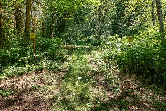 Same spot about three years earlier in 2018 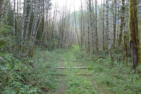 04/22/2015 Gifford Creek road decommissioning 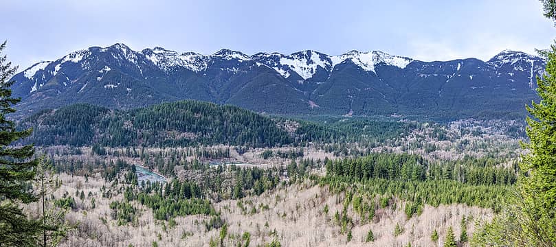 Gifford Balcony panorama 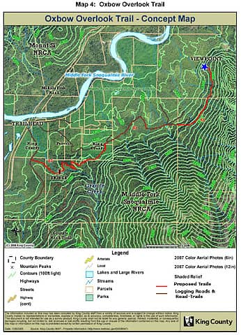 King County Oxbow Overlook map
|
| Back to top |
|
|
tlake
Member
Joined: 22 Aug 2004
Posts: 118 | TRs | Pics
|
|
tlake
Member
|
Mon Jan 30, 2023 5:05 pm |
|
|
When that area was subdivided the property owners further in the development area had easement's to their properties. I checked a few years ago (had to pay the County.) and the easement's were still valid, wouldn't stand to reason we could access county, state or federal lands through that easement? At the gate there was a no trespassing sign a few years ago. I queried King County about the sign and the
next I knew the sign was gone.
|
| Back to top |
|
|
puzzlr
Mid Fork Rocks
Joined: 13 Feb 2007
Posts: 7220 | TRs | Pics
Location: Stuck in the middle |
|
puzzlr
Mid Fork Rocks
|
Sat Feb 11, 2023 3:04 pm |
|
|
Here's a timely article about the properties being discussed in this thread. The part about the "last private inholdings in the Middle Fork Snoqualmie River Valley" can't be right if all the properties are inside the red oval on the map. There are still private holdings around Upper Granite Lake, Quartz Creek and at the top of Bessemer Peak too (and a few others). Let's hope the sale goes through. I don't see anything on Forterra's website yet, but that's not surprising because it's not completed yet. Another odd thing is that if King County is purchasing the land then how does it become part of the DNR's Middle Fork NRCA? The properties are surrounded by King County Natural Area land. Maybe that part only applies to the parcel on top of Grouse Ridge near the Fire Training Center.
Snoqualmie Valley Record - Land acquisition near Snoqualmie River would protect trout habitat, recreation areas
| Quote: | | King County aims to acquire the last private inholdings in the Middle Fork Snoqualmie River Valley.
...
The remaining 50 acres are located adjacent to the Middle Fork Snoqualmie River and the Middle Fork Snoqualmie Natural Area. ... Preventing the development of these parcels for residential or other types of recreational development is important to avoid conflict, according to the county.
Forterra, a local nonprofit committed to fighting climate change with land-based solutions, is assisting with a buy and hold agreement, but has not yet acquired the property. The appraisal work has already been completed and the county is currently negotiating with the property owner. Once acquired, these parcels will be added to the Middle Fork Snoqualmie Natural Area. |
|
| Back to top |
|
|
Randito
Snarky Member

Joined: 27 Jul 2008
Posts: 9513 | TRs | Pics
Location: Bellevue at the moment. |
|
Randito
Snarky Member
|
Sat Feb 11, 2023 4:42 pm |
|
|
I think the properties within the red oval are ones where the likelihood of residential development in the next decade is fairly high. Stuff farther up and accessed only by primitive roads are much less at risk of having a subdivision spring up.
rossb
rossb |
| Back to top |
|
|
fourteen410
Member

Joined: 23 May 2008
Posts: 2629 | TRs | Pics
|
Attempted to visit the balcony today but got tired of brush bashing and turned around after 1.5 mi. It's gotten pretty gnarly up there.
Now I Fly, JimK, Fedor
Now I Fly, JimK, Fedor |
| Back to top |
|
|
Brucester
Member
Joined: 02 Jun 2013
Posts: 1102 | TRs | Pics
Location: Greenwood |
Is this the road by the bridge? Big metal gate? NT signs high up in trees?
We were tempted to see but those pesky NT signs said not that day.
Curious now, are there still abandoned cars there? Always cool to see for some weird reason.
Should be the site of a grand hotel of the MidFork National Park!
Trails up the butte, Via ferrata and a tramway?
|
| Back to top |
|
|
fourteen410
Member
Joined: 23 May 2008
Posts: 2629 | TRs | Pics
|
It is.
No cars left at ye olde meth lab. Didn't see any NT signs this time. See tlake's comment upthread about the easement.
ArcDome
ArcDome |
| Back to top |
|
|
puzzlr
Mid Fork Rocks
Joined: 13 Feb 2007
Posts: 7220 | TRs | Pics
Location: Stuck in the middle |
|
puzzlr
Mid Fork Rocks
|
Wed Feb 14, 2024 2:06 pm |
|
|
tlake said last year "I queried King County about the sign and the next I knew the sign was gone."
I don't know what signs you meant, but there was still a "Private Property. Keep Out" sign on a tree just past the Granite Creek bridge on Jan 27, 2024. I believe that because there are multiple property owners along that road and it's platted as "SE 116th St" the signs don't apply if you just walk on the road.
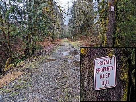 Private Property. Keep Out.
|
| Back to top |
|
|
|
|


