| Previous :: Next Topic |
| Author |
Message |
rubywrangler
Member


Joined: 04 Aug 2015
Posts: 511 | TRs | Pics
|
Recently returned from annual snowbird adventures in AZ/NV and wanted to share some trips that haven't been posted here before and some updated info for a couple others. Thanks much to John Morrow and Adam and other folks for posting so many southwest trips and Eric Hansen for suggestions and tips via PM! I'm a little surprised the CR-V got me to some of these, see details below. In reverse chronological order...
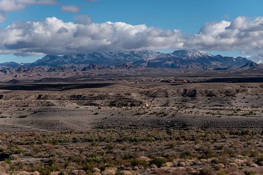
Boyscout canyon, Lake Mead NRA 2.26.23
John posted this one previously and I agree with his assessment that it's a "must do" but wanted to note a couple things. The road to the trailhead is a wash and the gravel is deep. I drove in the morning after a night of torrential rain which helped, but getting out after it had a chance to dry was a little sketchy. Driving in the muddy mountains and Kofa desensitized me I think. 4wd required. Anyway, I was stopped by rocks sticking up in the wash about a mile from the TH.
A cairned route leaves the wash at a wide bend, but it's hard to see if you go past the bend to the first 30' pouroff. Once on the ridge, there is a short bootpath that dead-ends at a spot with a cliffs on the left and a wash on the right. It took me a little while to figure out that I needed to downclimb the cliff side, and then another little while to figure out how to do it. After the first 20' or so a fixed rope is visible in the correct chute below. Below the chute, the route descends left following a faint path for a short distance, then contours around and over a small ridge, then passes a cairn and descends another chute on the right. If you descend *at* the cairn, you will end up cliffed out above a series of falls. Once out of this gully it is pretty much a straight shot down to the canyon floor near the hot spring, or you can continue up and over another ridge straight ahead, and drop into the canyon downstream closer to the river. This bypasses a narrow, slippery spot in the canyon with another fixed rope. The hot spring likely gets less traffic than AZ hot spring nearby, but it's also much smaller and seemed a little cooler. There is an overly detailed and somewhat confusing route description for this on hikinglasvegas.com.
 snow on the muddies 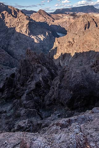 looking down on ridge descent 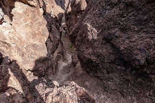 fixed rope @ center 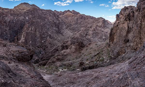 over little ridge in the middle 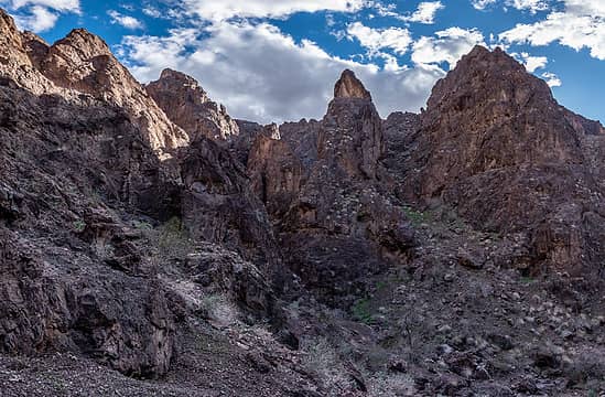 looking back from below second chute 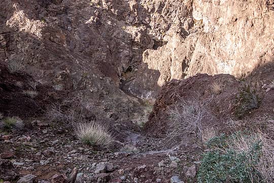 final descent to boyscout; hikers visible below 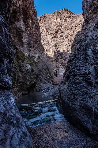 hot spring 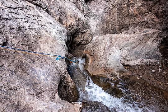 heading downstream  mouth of boyscout  good dog  mine in lowell wash  entering the narrows 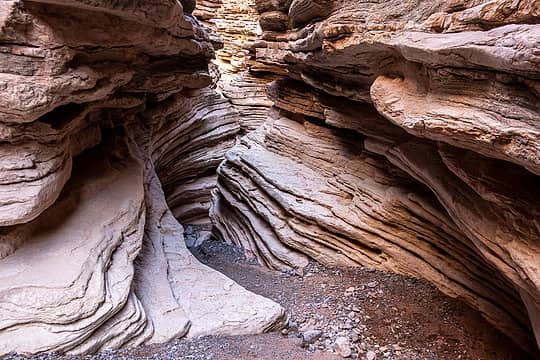 anniversary narrows 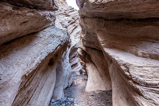 anniversary narrows 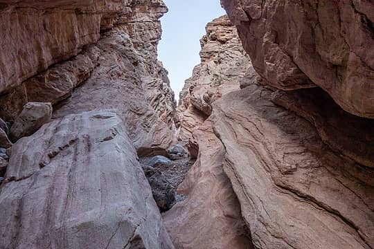 anniversary narrows 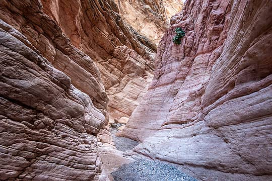 anniversary narrows 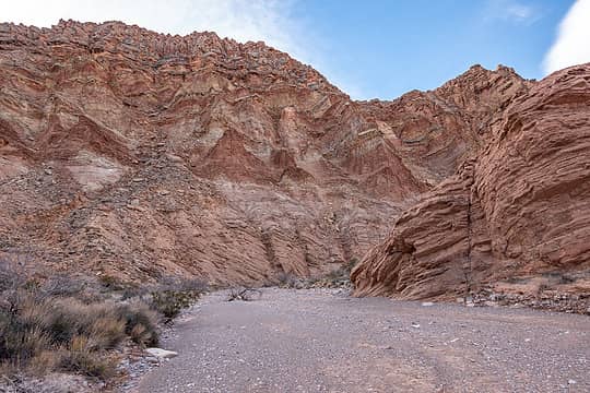 main wash 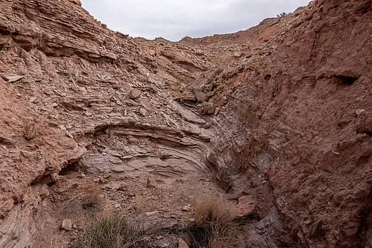 winding side wash 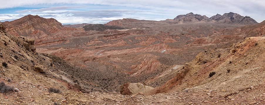 views to muddies from saddle 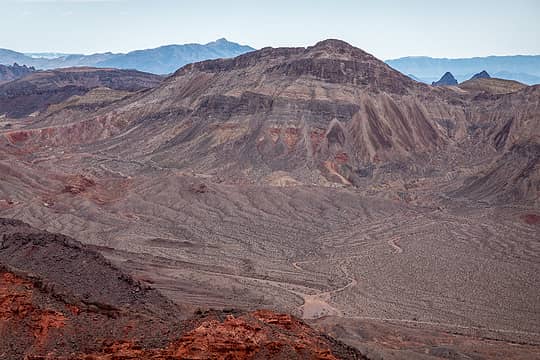 northshore peak 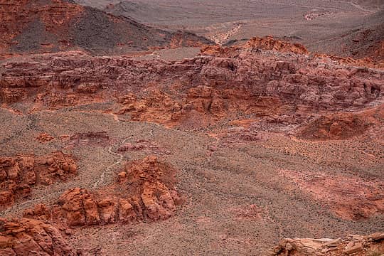 BoF 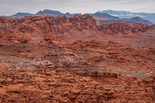 BoF 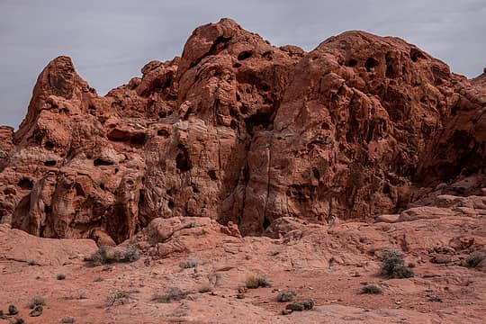 BoF 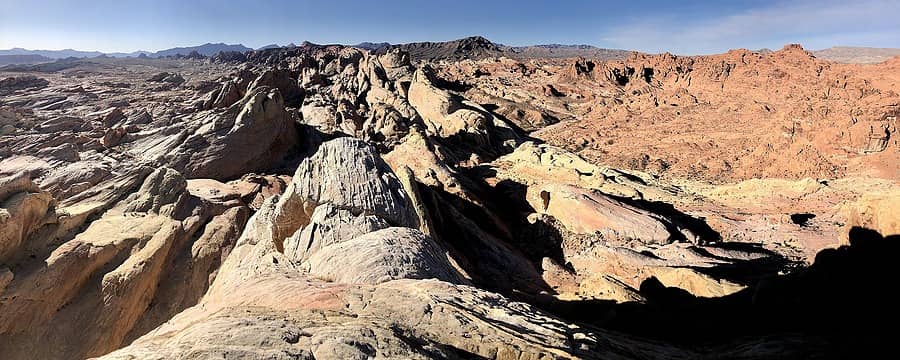 w. white dome summit view 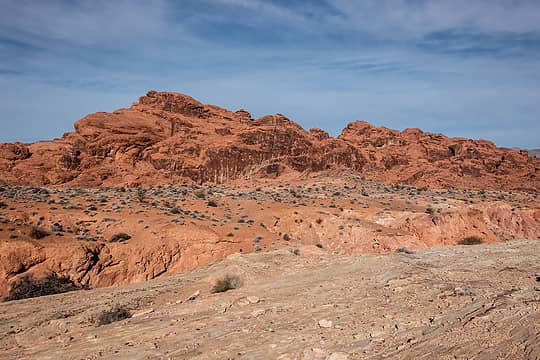 the orphan 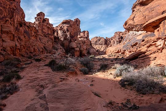 the orphan ahead on left 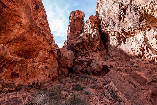 ramp on right or under the boulder works 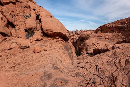 one of the zigs on the route (came up center, continued up weakness on left) 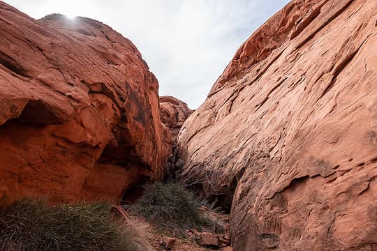 looking up from bottom of gully 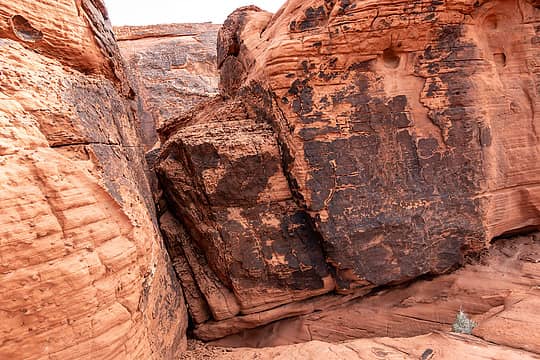 took crack on left to summit 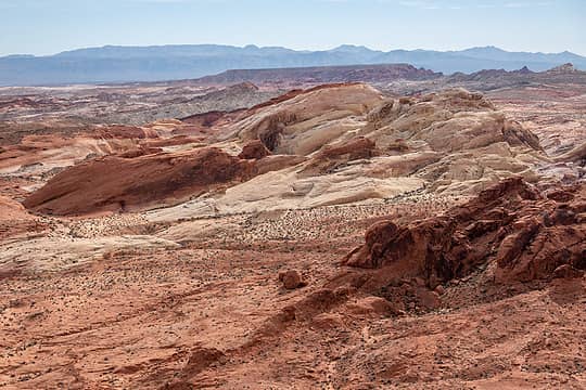 white domes from summit  Shortly after the slot, I climbed a slickrock ridge and then continued weaving my way upward. There are cairns in a few key spots and choose your own adventure in between. My route had a few class 3 spots, and one harder move that I think could be bypassed on the left (but I didn't notice that option until I passed it on the way down). Once you crest the ridge, it's just a short walk to the summit. I followed this route description. More photos Shortly after the slot, I climbed a slickrock ridge and then continued weaving my way upward. There are cairns in a few key spots and choose your own adventure in between. My route had a few class 3 spots, and one harder move that I think could be bypassed on the left (but I didn't notice that option until I passed it on the way down). Once you crest the ridge, it's just a short walk to the summit. I followed this route description. More photos
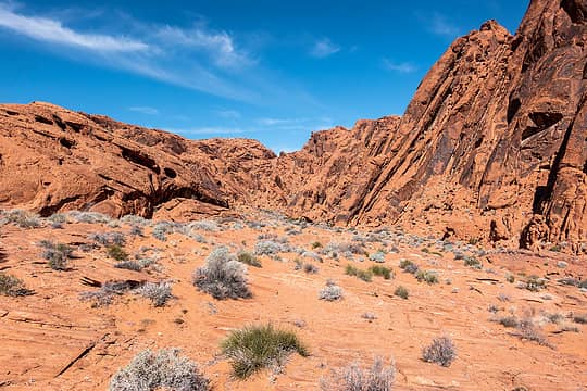 entering fire canyon wash 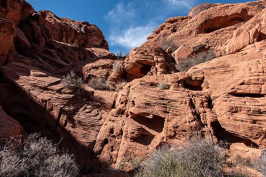 first obstacle within 1/4 mi, bypassed on left 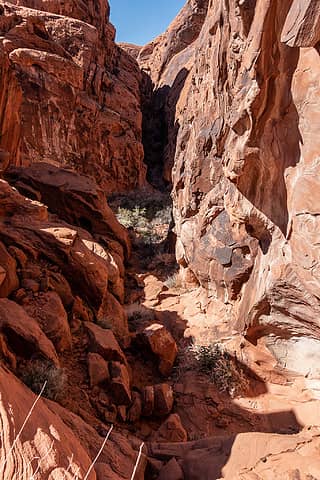 looking up canyon from the top of the third obstacle. bypassed on the left 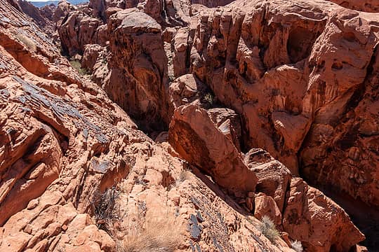 down a convenient crack to the rock in the center 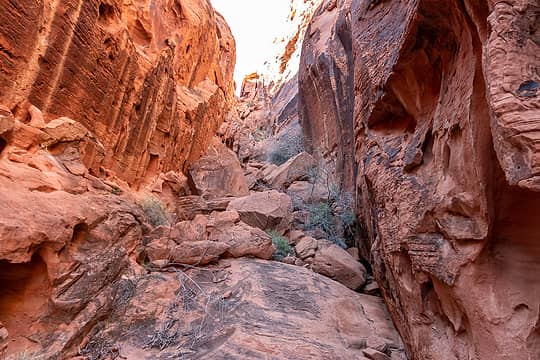 climbing up a gully 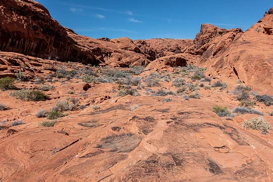 fire canyon wash 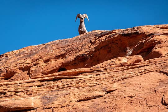 buddy watching me 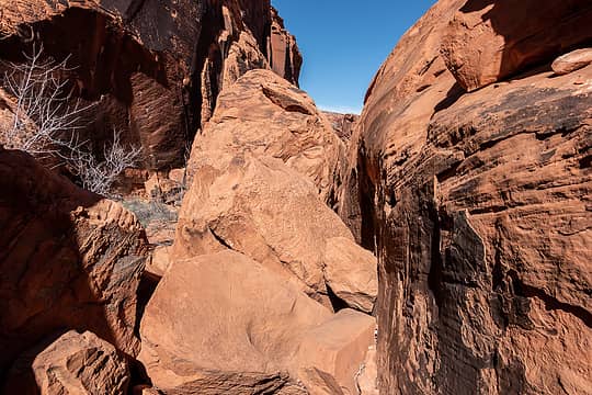 boulder jam 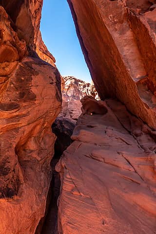 little squeezy 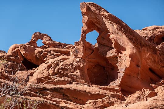 doble arch 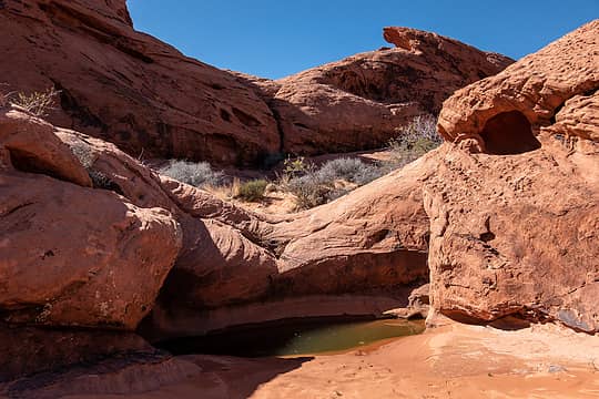 little pool 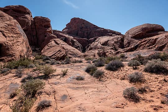 vof peak, the crack right of center is wrong way 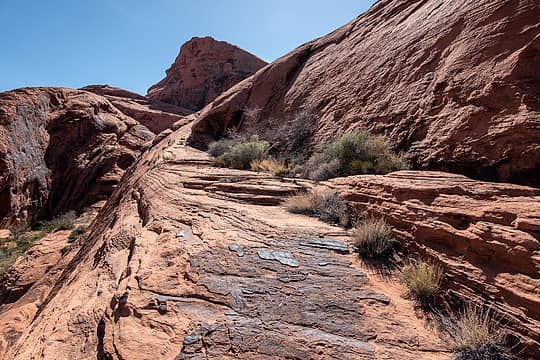 off route but nice slabs 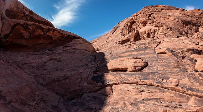 the correct gap 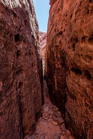 skinny slot 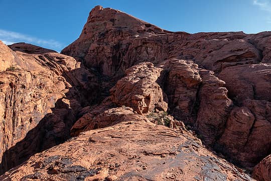 follow the ridge and ignore wandering footprints... 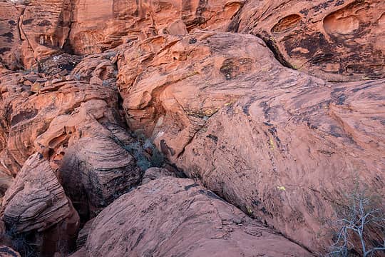 lower crack = probable bypass of the harder cl3 section along the upper crack 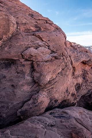 easy class 3 section 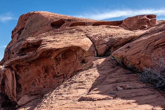 so close 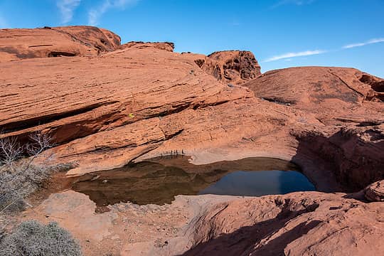 home stretch, summit upper left 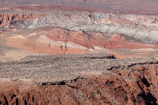 vof peak summit views 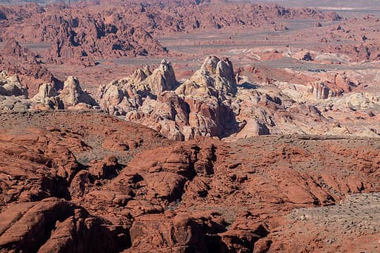 white domes 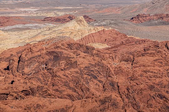 silica dome maybe? 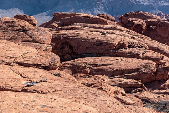 no helicopter deliveries today 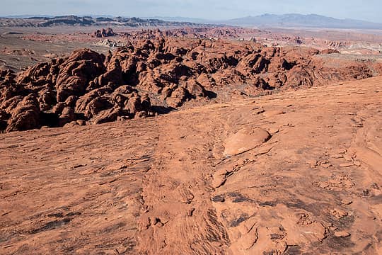 descending 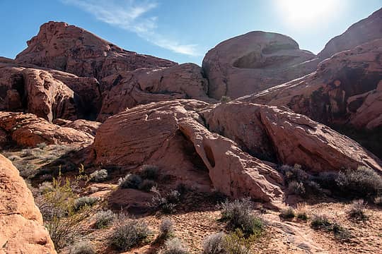 looking back - correct notch upper right, wrong notch center 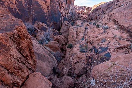 high bypass of boulder jam on the right 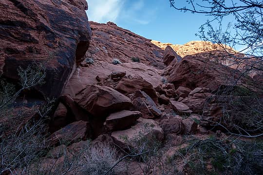 up the boulder pile to the convenient crack
 Matt, Now I Fly, neek, Nancyann, geyer, raising3hikers, Prosit, Tom, jaysway, RichP, NWtrax, jstern, fourteen410 Matt, Now I Fly, neek, Nancyann, geyer, raising3hikers, Prosit, Tom, jaysway, RichP, NWtrax, jstern, fourteen410  Gimpilator, Anne Elk, GaliWalker Gimpilator, Anne Elk, GaliWalker
Matt, Now I Fly, neek, Nancyann, geyer, raising3hikers, Prosit, Tom, jaysway, RichP, NWtrax, jstern, fourteen410 Gimpilator, Anne Elk, GaliWalker |
| Back to top |
  
|
|
GaliWalker
Have camera will use

Joined: 10 Dec 2007
Posts: 4929 | TRs | Pics
Location: Pittsburgh |
|
GaliWalker
Have camera will use
|
 Wed Mar 22, 2023 12:44 pm |
|
|
|
| Back to top |
|
|
Eric Hansen
Member

Joined: 23 Mar 2015
Posts: 866 | TRs | Pics
Location: Wisconsin |
+1! Amazing scenery and great trip reporting and photos.
|
| Back to top |
|
|
geyer
Member

Joined: 23 May 2017
Posts: 463 | TRs | Pics
Location: Seattle |
|
geyer
Member
|
Fri Mar 24, 2023 7:54 am |
|
|
If I've learned anything over the years it's that there are no limits to where a (preferrably pre-2007) Honda CR-V can take you!!
...unless there's a boulder more than 8" tall, that'll get ya
CRV GaNG 
 rubywrangler rubywrangler
rubywrangler |
| Back to top |
|
|
NightOwl
Member
Joined: 01 Sep 2022
Posts: 115 | TRs | Pics
|
|
NightOwl
Member
|
Fri Mar 24, 2023 12:51 pm |
|
|
Very nice pictures. I'm amazed that bighorn sheep can survive in that environment. Brutal heat, little water and food -- seems like they would have migrated out of there ages ago.
|
| Back to top |
|
|
neek
Member

Joined: 12 Sep 2011
Posts: 2337 | TRs | Pics
Location: Seattle, WA |
|
neek
Member
|
Sat Mar 25, 2023 11:39 am |
|
|
stunning! looks like we covered some of the same ground only a couple weeks apart.
|
| Back to top |
|
|
|
|
You cannot post new topics in this forum
You cannot reply to topics in this forum
You cannot edit your posts in this forum
You cannot delete your posts in this forum
You cannot vote in polls in this forum
|
Disclosure: As an Amazon Associate NWHikers.net earns from qualifying purchases when you use our link(s). |


