| Previous :: Next Topic |
| Author |
Message |
boomheist
Member


Joined: 25 Jul 2009
Posts: 55 | TRs | Pics
Location: tacoma |
I made a trip with Rod F about a week after the initial loop through the Northern Olympics with Jeff, this time to head for Cedar Lake, a traverse across to Cameron Basin, and then out the Grand Valley. Rod and I planned to be out six to seven days. The weather remained iffy - we thought we'd leave on a Saturday and put it off until a Monday due to rains.
Day 1: Met Rod at his house in Sequim and we drove in my car to Deer Park. Rod had left a truck at Obstruction Point. We thought maybe we'd complete the Cameron Traverse then do the Lake Lillian traverse back to Grand Ridge but it all depended on the weather and our energy. On this first day I carried a shoulder bag with my food, some dry clothes, and a one man tent, using my fishing pole as a walking stick, and we dropped down off Deer Park to Three Forks Shelter, then picked up the GrayWolf Trail and within a couple of hours we arrived at Camp Ellis and I retrieved my cached pack.
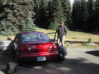 Rod as we started out - see my pole and pouch which I carried until we reached my pack at Camp Ellis 7 miles in 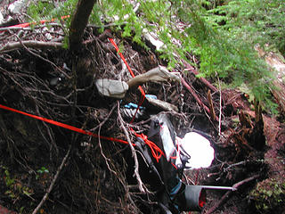 Jeff and Rod Northern Park 195 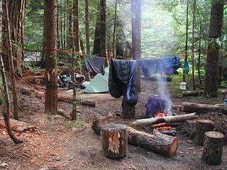 Drying out my pack at Camp Ellis 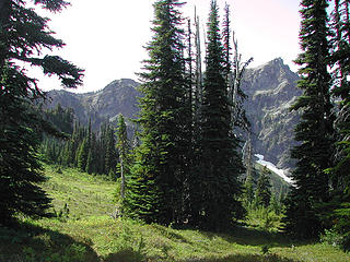 Jeff and Rod Northern Park 068 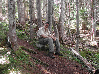 Jeff and Rod Northern Park 210 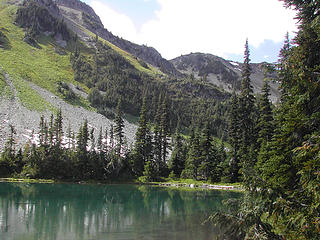 Cedar Lake - out campsite to the right. We climbed up the rocks and meadows to the left then worked around to the right to that low point. 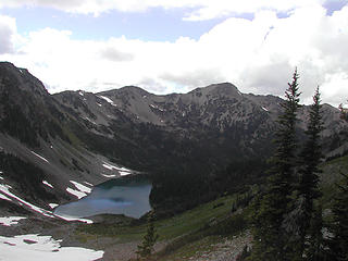 Looking back at Cedar Lake from upper way trail over to Graywolf Basin 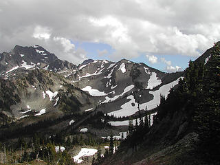 View from pass between Cedar Lake and GrayWolf Pass showing GrayWolf basin 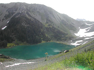 Looking back at Cedar Lake as we started our climb toward the traverse 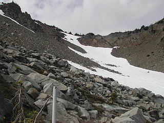 Last snowfield on the way to the notch above Cedar Lake leading to Cameron Traverse 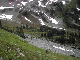 Rod dropping from the notch above Cedar Lake into the Cameron traverse 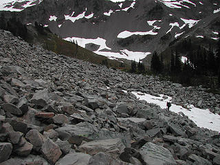 Rod working down the boulder field on the Cameron traverrse 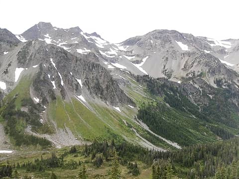 Inner Basin Route 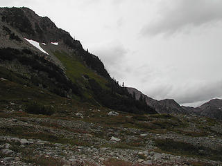 We traversed around that slope that lies ahead 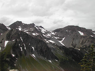 View from the notch above Cedar lake showing the Cameron Traverse basin, sidehill we had to work around, and far away the moraine and ridge to Cloudy Pass - about five miles away 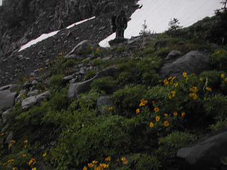 Rod working uphill after the sidehill in heavy rain. 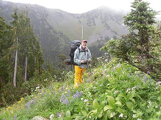 Long traverse 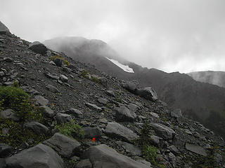 Working up the steep slope by the gulley - even a spring flower here in September 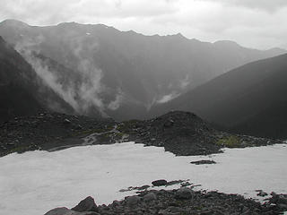 The top of our climb beside the gulley to the glaciers 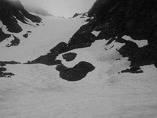 A Cameron glacier - we worked across the snow to the right to get to the little notch that led to our high camp. The top of our climb beside the gulley to the glaciers 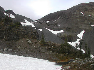 From our upper camp looking at the moraine and ridge line we had to climb to get to Cloudy Pass 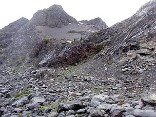 This is the tricky move to get to the upper camp. Rod found a way to the elft; I came over those rocks in the center and nearlyt fell thirty feet. Sketchy From our upper camp looking at the moraine and ridge line we had to climb to get to Cloudy Pass 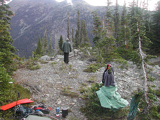 Rod at our high traverse camp, trying to dry out in the morning before departing From our upper camp looking at the moraine and ridge line we had to climb to get to Cloudy Pass 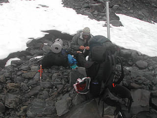 Rod having a snack before we tackled the moraine and ridge 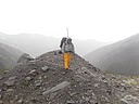 It was raining hard but fortunately warm 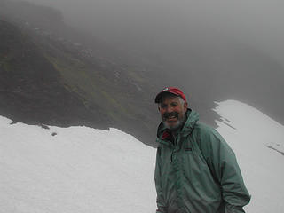 Taking a break on the climb up the moraine. I have no idea why I was smiling. 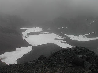 The moraine and ridge we climbed toward Cloudy Pass 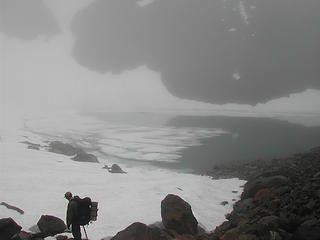 Rod starting off to work up the rocks beside the steep snowfield, which we had to avoid 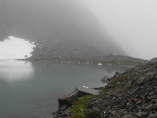 Lake at 6350 feet just below Cloudy Pass still mostly covered in snow and ice 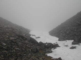 Near the pass looking back at the snowfield drop-off to the ice-covered tarn 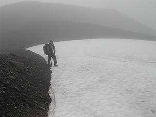 Rod just below the crest of Cloudy Pass 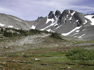 Upper Cameron Basin - you can see Cloudy Pass in the left center, still looking damn steep 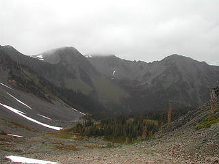 Upper Cameron Basin 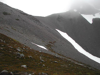 Cloudy Pass from upper Cameron Basin 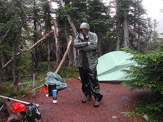 Typical dinner weather 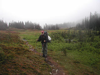 Getting ready to leave Cameron basin for Grand Valley 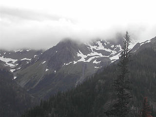 Our traverse from the Grand Valley trail. Our traverse from the Grand Valley trail. 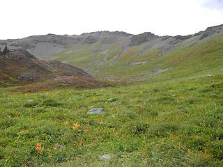 The meadows just south of Grand Pass 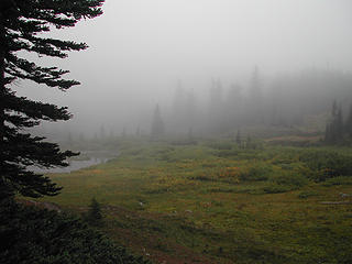 Jeff and Rod Northern Park 382 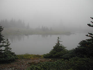 Gladys Lake Grand Valley Jeff and Rod Northern Park 382 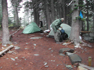 Another night of rain at Gladys Lake in Grand Valley 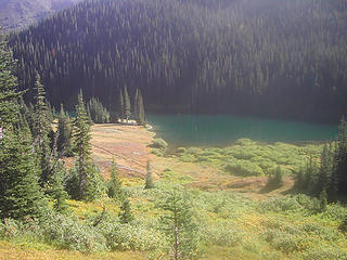 Moose Lake - nobody at all in Grand Valley except Lily the ranger 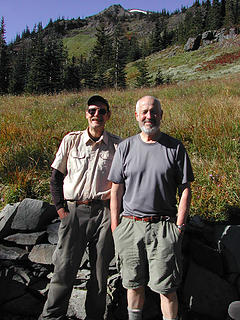 Lily the ranger took our picture on our last day as we left Grand Valley. 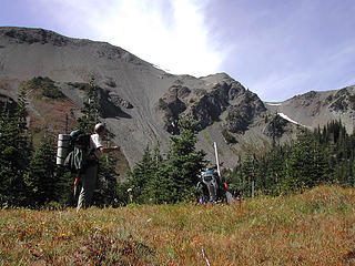 Rod as we came out of Grand Valley onb the last day 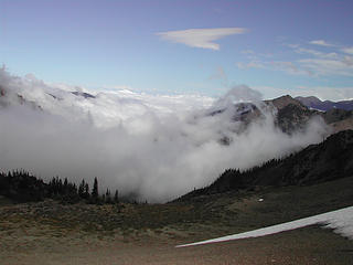 Last day we had sun all day but clouds thick everywhere else 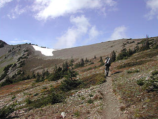 Rod on the last climb out of Grand Valley 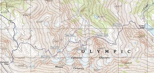 This is a map Rod prepared of the route we took. The traverse is actually very self-explanatory, there's really only one clear route.
|
| Back to top |
  
|
|
Magellan
Brutally Handsome

Joined: 26 Jul 2006
Posts: 13116 | TRs | Pics
Location: Inexorable descent |
|
Magellan
Brutally Handsome
|
 Mon Sep 27, 2010 9:50 pm |
|
|
Very nice part two. 
|
| Back to top |
|
|
bobbi
stillaGUAMish

Joined: 13 Jul 2006
Posts: 8012 | TRs | Pics
Location: olympics! |
|
bobbi
stillaGUAMish
|
Mon Sep 27, 2010 9:53 pm |
|
|
great stuff, guys
your weather was about the same when i did this last summer, minus the cameron traverse.
i am curious to see what the way trail to cedar lake looks like because it was a bit icky when i was on it. maybe there was more maintenance since i was there. that sure is a pretty lake. caught my first fish there.
bobbi ૐ
"Today is your day! Your mountain is waiting. So
get on your way!" - Oh, the Places Youll Go! By Dr. Seuss
bobbi ૐ
"Today is your day! Your mountain is waiting. So
get on your way!" - Oh, the Places Youll Go! By Dr. Seuss
|
| Back to top |
|
|
reststep
Member
Joined: 17 Dec 2001
Posts: 4757 | TRs | Pics
|
|
reststep
Member
|
Mon Sep 27, 2010 10:06 pm |
|
|
Great job and not in the best of weather. It sure looks like some amazing country.
When I see reports like yours and Danes and Lucs it makes me realize how much of the Olympics I have not been to yet.
Thank you for sharing.
"The mountains are calling and I must go." - John Muir
"The mountains are calling and I must go." - John Muir
|
| Back to top |
|
|
mdvaden
M.D. Vaden of Oregon

Joined: 15 Oct 2009
Posts: 38 | TRs | Pics
Location: Oregon |
|
mdvaden
M.D. Vaden of Oregon
|
Mon Sep 27, 2010 10:55 pm |
|
|
Nice color in that lake.
Any idea what kind of depth it has?

|
| Back to top |
|
|
Dave Weyrick
Member

Joined: 16 Dec 2001
Posts: 311 | TRs | Pics
Location: Poulsbo, WA |
How was the fishing in Cedar Lake? Grand lake? The reproducing RB in Cedar were averaging about 10" when I visited in July 2003 and the reproducing Brook Trout were a bit larger in Grand when I was there in 2005. I think in Grand they were larger than when I caught a bunch of skinny brookies in about 1975 because of the presence of a river otter.
If I'd known ya was gonna use bait I wouldn't a brought ya!
If I'd known ya was gonna use bait I wouldn't a brought ya!
|
| Back to top |
|
|
ethorson
Member

Joined: 07 Jun 2007
Posts: 114 | TRs | Pics
Location: Port Townsend |
|
ethorson
Member
|
Tue Sep 28, 2010 6:53 pm |
|
|
Great trip report! I am glad that you accomplished your objectives in spite of the snow and weather. When I did it the route it was taxing even with perfect weather and normal snow conditions. The area really has some interesting topography and challenging route finding.
|
| Back to top |
|
|
ScottM
Member

Joined: 18 Apr 2007
Posts: 363 | TRs | Pics
Location: The Olympics |
|
ScottM
Member
|
Tue Sep 28, 2010 8:34 pm |
|
|
Very nice trip guys. It seems to me as I was sitting next to Cedar Lake having lunch with RodF a couple of years ago he mentioned something about this traverse. Too bad about the weather but at least you had a few good days.
|
| Back to top |
|
|
NWtrax
Member
Joined: 27 Apr 2008
Posts: 638 | TRs | Pics
|
|
NWtrax
Member
|
Tue Sep 28, 2010 8:46 pm |
|
|
Rough way to start a trip and even tougher to soldier through those less than optimal condtitions. Spectacular scenery none the less and an impressive finish to two great weeks in the Olympics. Thanks for your report!
|
| Back to top |
|
|
Dane
Other

Joined: 14 Mar 2006
Posts: 2466 | TRs | Pics
Location: Seattle |
|
Dane
Other
|
Wed Sep 29, 2010 12:20 am |
|
|
Yes, way to persevere and navigate through that weather
This is one I hope to do someday. Geez, so many possible traverses!
In 2009 I was hoping to traverse Cameron on the ridgeline, but I've never gotten a good look at that or seen pictures of the terrain up there. Doesn't look too bad on the map.
Without judgement what would we do? We would be forced to look at ourselves...
-Death
Without judgement what would we do? We would be forced to look at ourselves...
-Death
|
| Back to top |
|
|
silence
Member

Joined: 25 Apr 2005
Posts: 4420 | TRs | Pics
|
|
silence
Member
|
Wed Sep 29, 2010 6:23 am |
|
|
PHOTOS
FILMS
Keep a good head and always carry a light bulb. Bob Dylan
|
| Back to top |
|
|
Eaglecadd
Member

Joined: 05 Feb 2010
Posts: 185 | TRs | Pics
Location: Kailua Kona, HI |
Oh, OK I see the map. Yeah where these guys tarversed by their 5400 traverse note, we went North, camped on the hillside at two flat areas and then Farther North crossing the stream and down along the creek to the valley and then up to lake at 5115
|
| Back to top |
|
|
|
|
You cannot post new topics in this forum
You cannot reply to topics in this forum
You cannot edit your posts in this forum
You cannot delete your posts in this forum
You cannot vote in polls in this forum
|
Disclosure: As an Amazon Associate NWHikers.net earns from qualifying purchases when you use our link(s). |


 now off to read your other tr .. which i missed??