| Previous :: Next Topic |
| Author |
Message |
Mega-Will
country bumpkin


Joined: 22 Dec 2006
Posts: 655 | TRs | Pics
Location: Olympic Peninsula |
|
Mega-Will
country bumpkin
|
 Fri Jan 02, 2015 2:38 am |
|
|
So. It's been a looong time since I've posted much on here. But I certainly haven't stopped hiking. I moved to Alaska in the summer of 2008 and have learned a lot about the state and the outdoor activities that can be done here. Perhaps some of that information will be useful or at least interesting to some of you.
Of course, no one knows everything about this place, so what follows should be thought of as an always lengthening journal of experiences and ideas. Though I make a point of getting around the state as much as I can, I have still focused on the two parts of the state where I have lived: Southcentral (Anchorage and the Mat-Su), and Delta (the Eastern Alaska Range). I know these areas very well, but it should be assumed that my knowledge of the other areas discussed is sparse, my maps incomplete, and my photos unrepresentative.
But where to begin.. I'm not really quite sure how to organize all this, so I suppose I'll just dive in and figure it out as I go along.
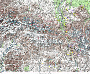
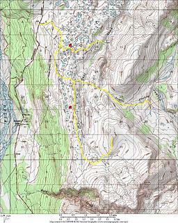
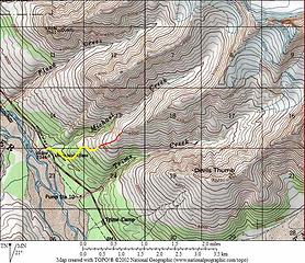
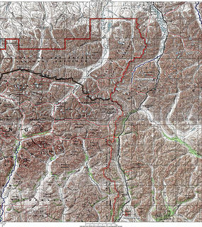
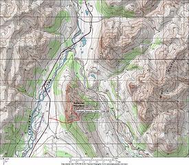
Here's a map of the good hiking areas, along the road system, in Alaska. (click, then enlarge). The yellow outlines show areas where hiking is primarily on established trails, while the red outlines show areas where there is good access to cross country hiking (meaning minimal bushwhacking, good game trails, hunting trails, etc). As you can see, the densest concentration of trail hiking is located near Anchorage and the northern Kenai Peninsula. And this is indeed the best location for a hiking oriented first visit to Alaska, unless you have something specific you want to see.
For the rest my maps in this thread, black lines indicate roads, yellow are established trails, red are potential routes, blue are generally float trips (although I think I used blue for climbing routes on some older maps), and purple are climbing routes on the newer maps.
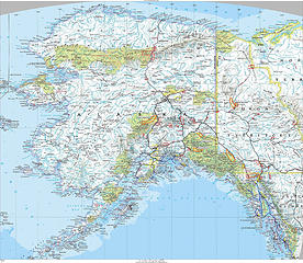 Alaska road accessible hiking areas Alaska road accessible hiking areas  034 (4)  Portage Glacier  125 (3) 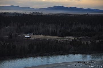 441 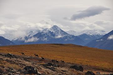 020 (3) 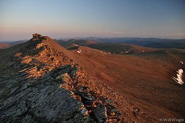 100 (8) 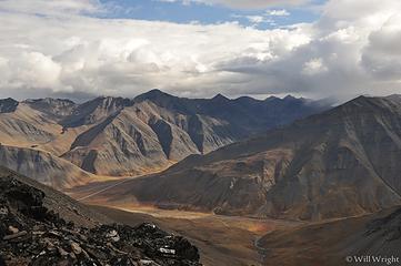 View from James Dalton Mountain
 zimmertr zimmertr
zimmertr |
| Back to top |
  
|
|
Mega-Will
country bumpkin
Joined: 22 Dec 2006
Posts: 655 | TRs | Pics
Location: Olympic Peninsula |
|
Mega-Will
country bumpkin
|
Fri Jan 02, 2015 2:38 am |
|
|
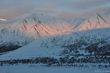
Eastern Alaska Range
 Eastern Alaska Range Eastern Alaska Range 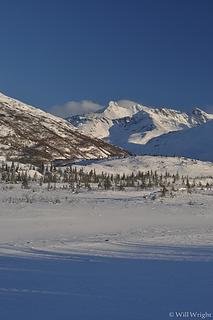 Alaska Range, Richardson Highway (15) 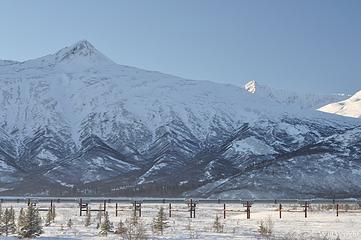 Alaska Range, Richardson Highway (16) 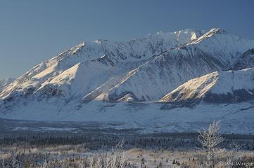 Alaska Range, Richardson Highway (17) 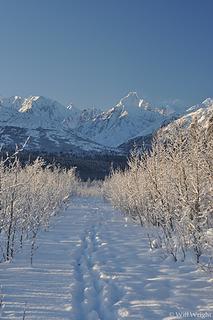 Alaska Range, Richardson Highway (18) 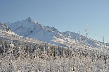 Alaska Range, Richardson Highway (19) 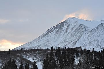 Alaska Range, Richardson Highway 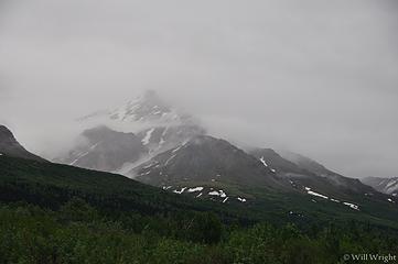 Along the road south of Delta 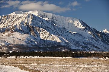 Black Rabids, Richardson Highway, Alaska Range 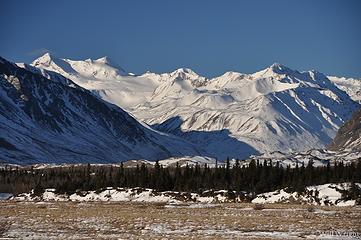 Black Rapids (2) 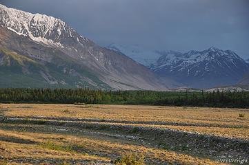 Black Rapids, south of Delta 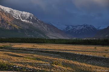 Black Rapids 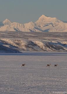 Caribou on Summit Lake, Alaska Range 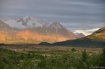 Rainbow Mountain, near Delta 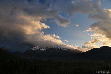 Near Black Rapids 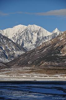 Near Black Rapids, Alaska Range 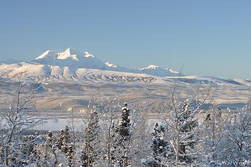 Mt. Hayes from Richardson Highway 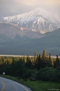 Moose along Richardson Highway, south of Delta  Eastern Alaska Range at night 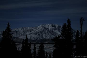 Eastern Alaska Range at night (5) 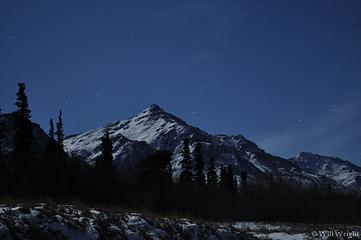 Eastern Alaska Range at night (4) 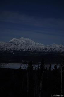 Eastern Alaska Range at night (3) 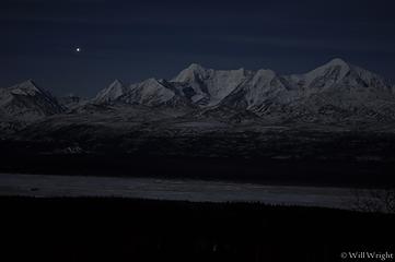 Eastern Alaska Range at night (2) 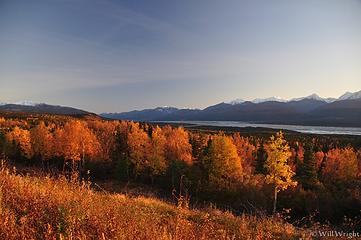 Delta River Valley, Alaska Range 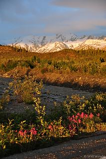 Richardson Highway through the Alaska Range 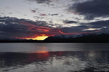 Summit Lake, Alaska Range 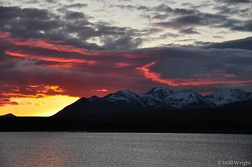 Summit Lake, Richardson Highway 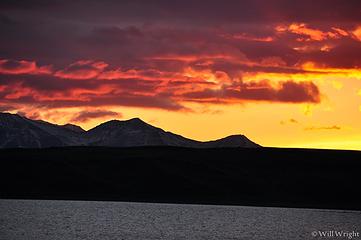 Sunset from Summit Lake, Richardson Highway 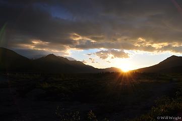 Sunset near Black Rapids, Delta 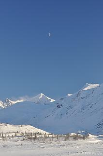 White Princess from Richardson Highway (2) 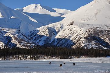 004 (2)  188 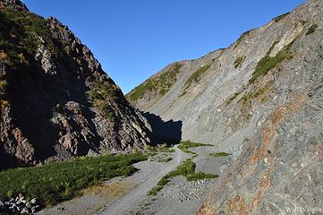 029 (2) 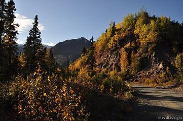 024 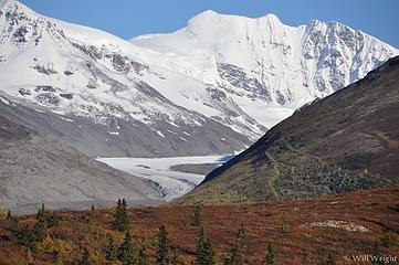 015 (3) 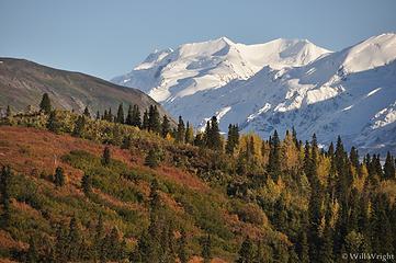 017 (2) 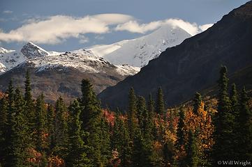 103 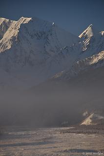 106 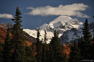 107 (2) 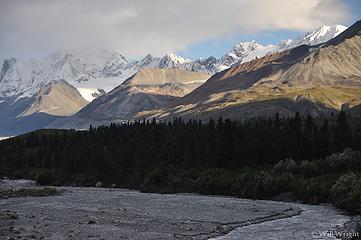 107 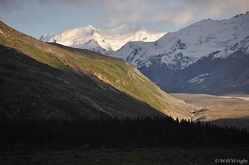 110 (2) 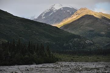 111 (3) 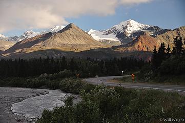 113 (5) 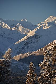 113 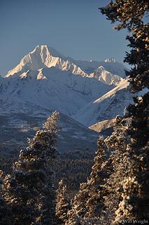 114 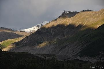 119 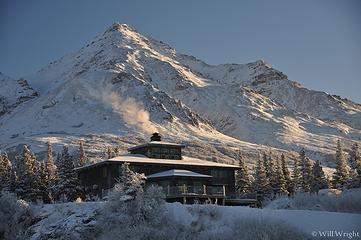 120 (6) 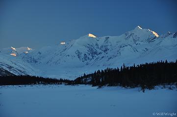 124 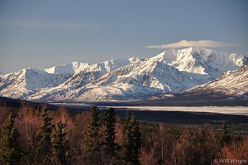 Alaska Range near Delta 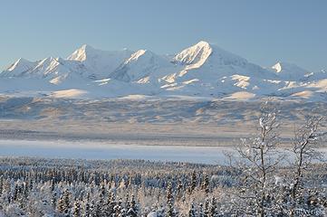 Alaska Range from Richardson Highway  388 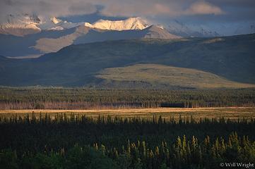 186 (2) 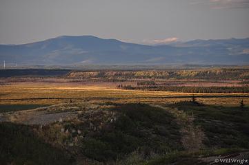 174 (2) 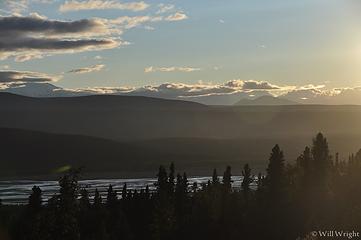 164 (3) 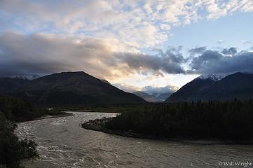 153 (3) 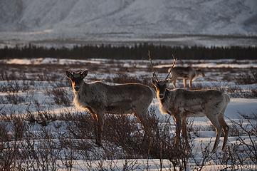 149 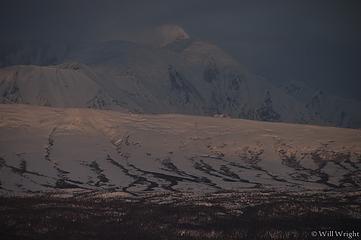 143 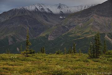 133 (3)  126 (2) 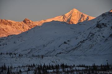 125 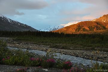 Alaska Range, Richardson Highway (2) 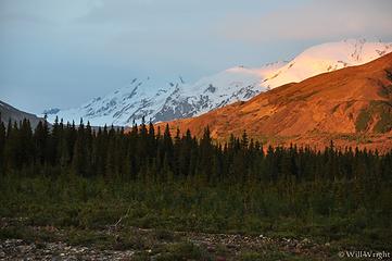 Alaska Range, Richardson Highway (3) 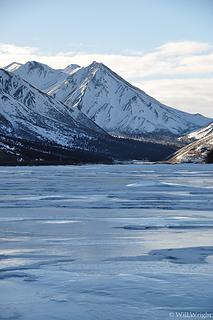 Alaska Range, Richardson Highway (4) 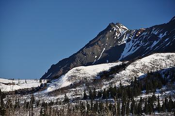 Alaska Range, Richardson Highway (5) 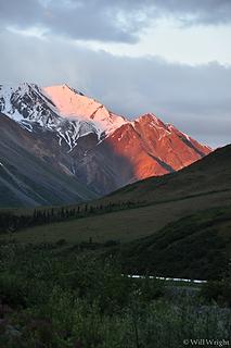 Alaska Range, Richardson Highway (6) 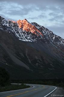 Alaska Range, Richardson Highway (7) 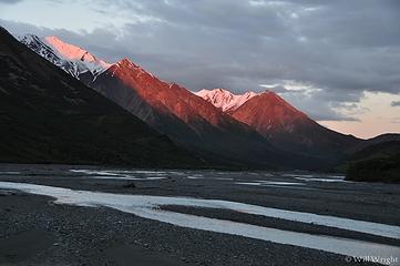 Alaska Range, Richardson Highway (8) 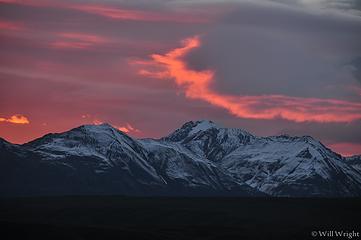 Alaska Range, Richardson Highway (9) 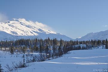 Alaska Range, Richardson Highway (11) 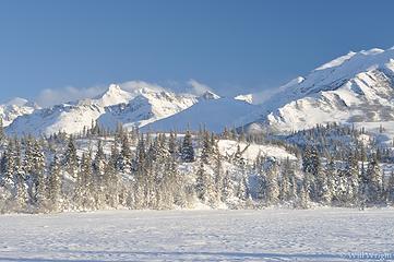 Alaska Range, Richardson Highway (12) 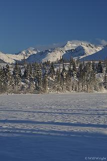 Alaska Range, Richardson Highway (13) 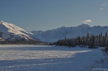 Alaska Range, Richardson Highway (14) 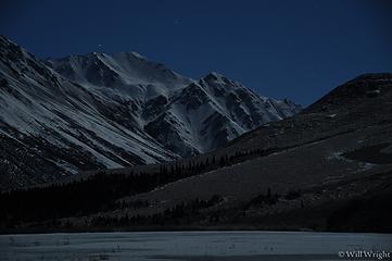 022 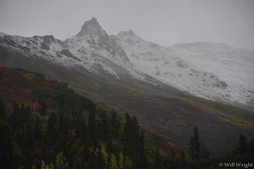 023 (3) 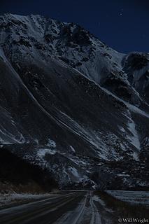 025 (7) 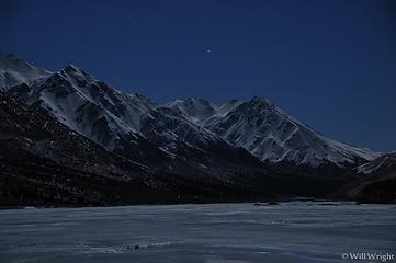 026 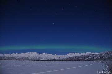 033 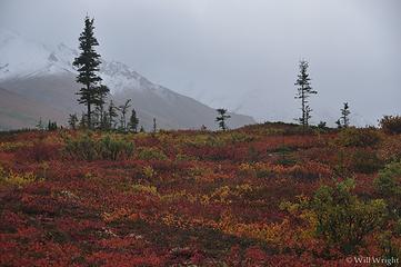 034 (3) 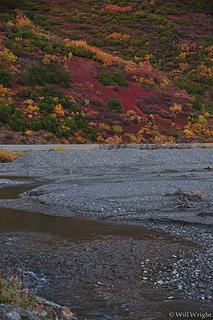 037 (3) 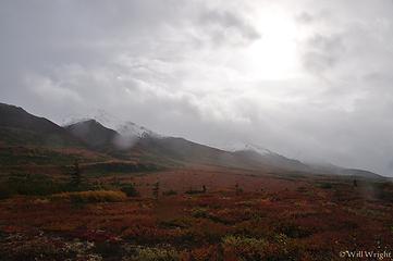 037 (5) 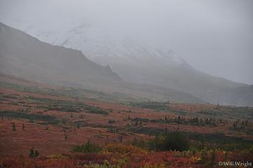 040 (7) 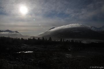 042 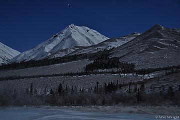 043 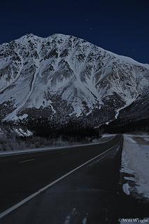 044 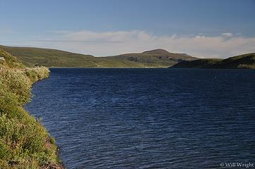 072 (3) 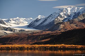 071 (4) 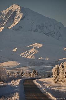 071 (3) 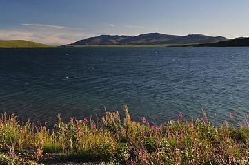 068 (2) 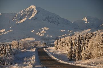 067 (5) 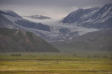 060 (2)  059 (3)  054 (2) 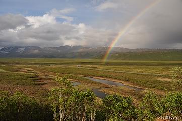 050 (4) 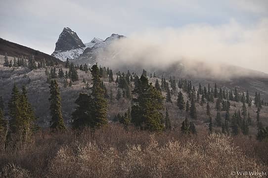 049  049 (2) 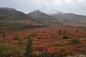 047 (5) 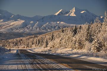 073 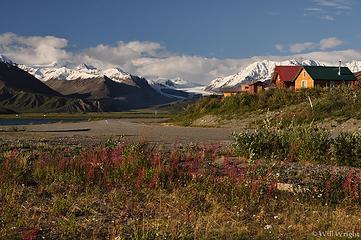 077 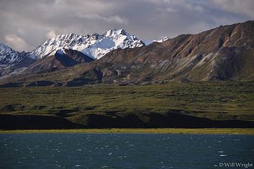 084 (4)  086 (2) 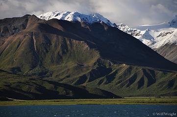 089 (2) 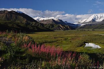 091 (3) 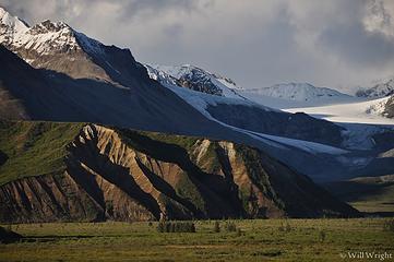 093 (2) 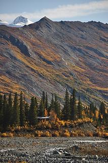 093 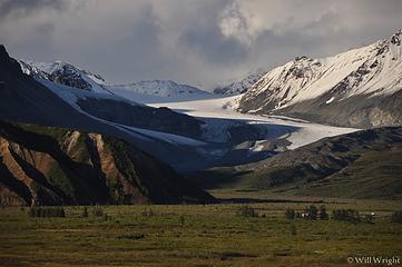 094 (4) 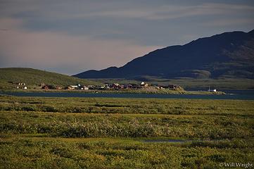 100 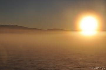 101 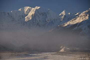 102 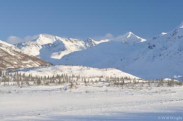 White Princess from Richardson Highway 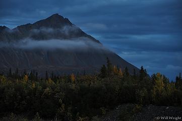 022 (2) 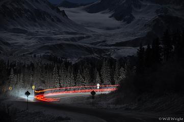 019 (4) 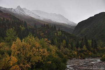 019 (3) 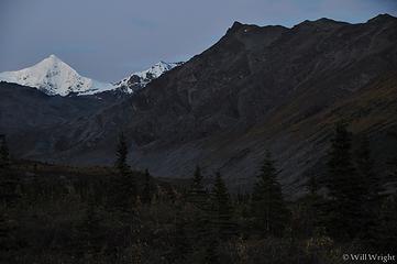 019 (2) 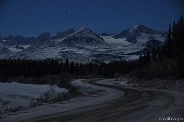 017 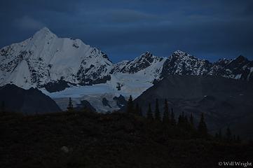 016 (6) 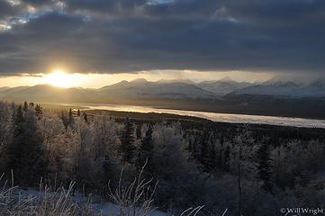 015 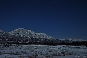 015 (2) 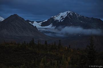 013 (2) 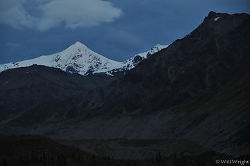 007 (6) 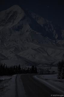 005 (2) 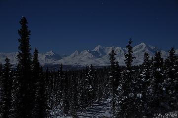 001
zimmertr
zimmertr |
| Back to top |
|
|
Mega-Will
country bumpkin
Joined: 22 Dec 2006
Posts: 655 | TRs | Pics
Location: Olympic Peninsula |
|
Mega-Will
country bumpkin
|
Fri Jan 02, 2015 2:39 am |
|
|
Bear Creek (Eastern Alaska Range)
Coming from Delta, this is the first potential hike that's fully in the mountains - Donnelly Dome to the north is more of a large outlying foothill. Bear Creek is a signed crossing between Ruby Creek to the north and Darling Creek to the south (about 33 miles south of Delta Junction). You wouldn't guess it from the wall of brush, but there are decent footpaths that begin on both sides of the bridge. Both are a bit faint, but both provide access through nice open woods to the subalpine and, with some minor off trail difficulties, to the alpine tundra above. From there, a huge expanse of dwarf tundra and scree can be explored, with a little scrambling, all the way up to the Jarvis Glacier divide if one chooses. Personally I prefer the south trail which accesses the alpine with some very minor brushy routefinding, and leads to a more prominent highpoint. The north trail is worthwhile as well though, where the alpine is accessed via some easy, dirty scrambling. Both trails provide nice views of Bear Creek Canyon, which can also be followed if you're into canyons.
Round Trip: about 5 miles (south trail to high point)
Elevation Gain: 2400ft.
 Bear Creek 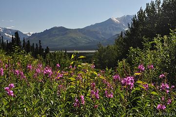 115 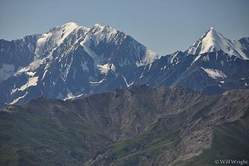 026 (2) 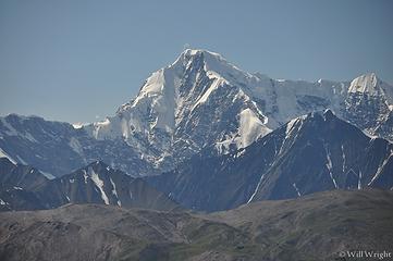 028 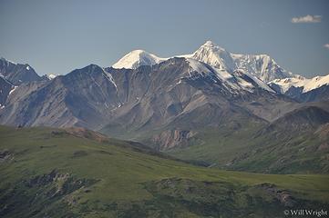 031 (3) 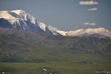 033 (2) 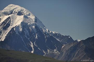 034 (3) 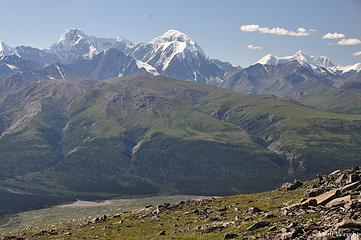 039 (2) 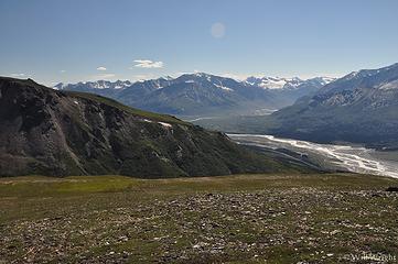 045 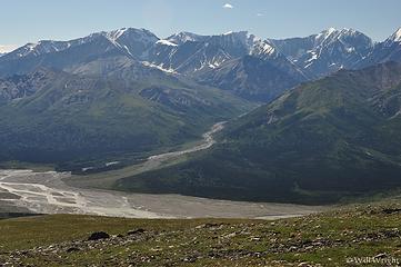 051  113 (3) 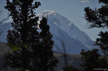 111 (2) 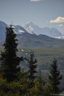 102 (3) 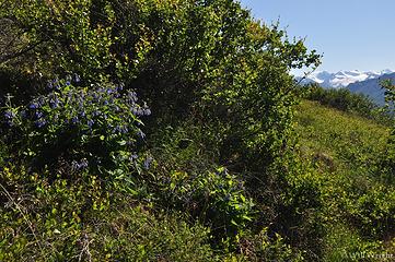 094 (2) 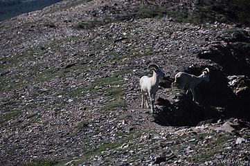 081 (3) 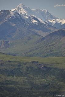 072 (2) 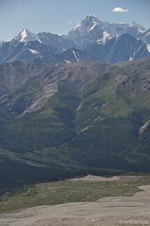 066 (2) 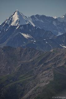 063 (2) 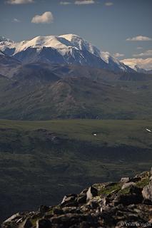 059 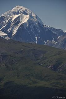 056 (3) 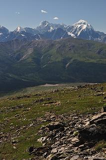 054 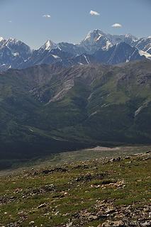 053 (3)
|
| Back to top |
|
|
Mega-Will
country bumpkin
Joined: 22 Dec 2006
Posts: 655 | TRs | Pics
Location: Olympic Peninsula |
|
Mega-Will
country bumpkin
|
Fri Jan 02, 2015 2:39 am |
|
|
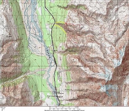
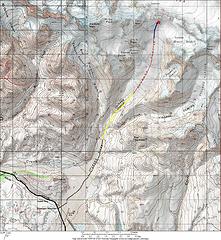
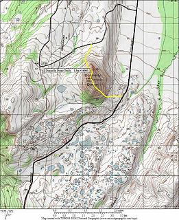
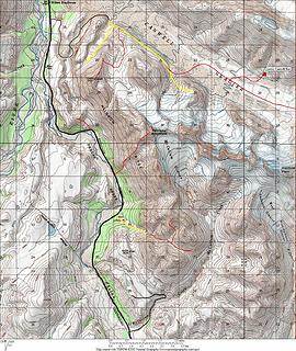
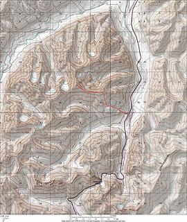
Castner - Fels Glacier Divide
This is one of the most spectacular dayhikes from a paved road in Alaska and it shows almost no sign of human traffic. Though a little bit of bush pushing and some substantial routefinding are required down low, if one stays on the correct path, this one's pretty reasonable. And once brushline is reached, you are treated to a nearly endless gradual alpine staircase which sneaks non climbers in above the high jumbled cliffs and glaciers of the Alaska Range.
The trailhead is located at a pulloff on the north side of Lower Miller Creek. If you're in luck, the braided glacial river will be running mostly along its south bank, allowing easy travel along the gravelbar. If not, any substantial distance through the brush down here would make this hike much more difficult. It's a little hard to describe the exact route, so I will attach a google earth screenshot. When leaving the old riverbed, you will be looking for a large game trail shooting straight up the slope. This leads to a patch of tundra. Take a right here until you see another obvious game trail leading down into the brush, aiming for a small lake. Once in the bottom near the lake follow the path of least resistance near the shore toward the big brushy mountainside to the northeast. Scan the slope looking for the lowest brush. From what I've seen, it's best to head back left along the toe of the slope for a bit before turning up. Regardless, this is the worst bushwhacking of the route and it's steep as well. After maybe 500 vertical feet of this, the ridgeline is reached and the brush and routefinding are over. As a sudden bonus, a spectacular view of Castner Glacier opens up.
From here, enjoy the broad ridge as it leads you into the sky. There is at least one tarn on top of the ridge in early and mid summer that would allow decent camping, and snowpatches can probably be found through the summer most years. To me though, this is best as a long dayhike. Any of the highpoints (4226, 5390, 7000+, or 7368) is a worthy turnaround point. The last one does require a significant descent though, and the view isn't that much better. Just recently, I noticed that the next large ridge to the south, between Fels and Canwell Glaciers, has a real lake right on top. That's a definite camping trip for next summer, though the level of bushwhacking remains to be seen.
Round Trip: At least 4.6 miles, up to 14 miles.
Elevation Gain: At least 1900ft. Up to 5200ft.
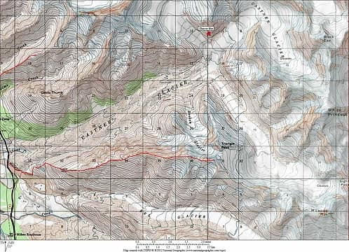 Castner, Fels Divide 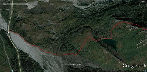 Castner, Fels Divide Google Earth 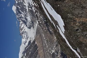 515 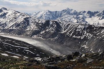 088 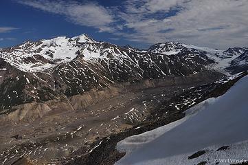 103 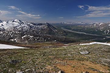 105 (2)  113 (2)  114 (2)  114  115 (3)  117 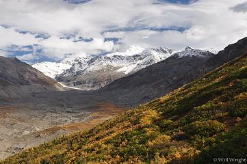 118 (2) 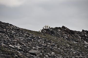 118 (3) 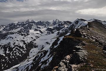 121 (2) 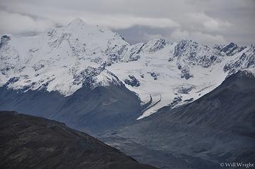 124 (2) 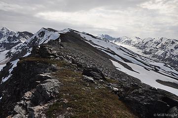 126 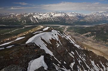 128 (2) 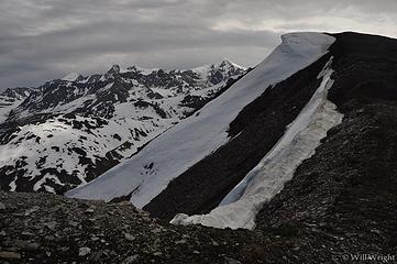 132 (2) 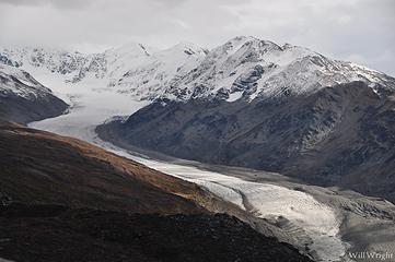 137  138  140 (2)  143 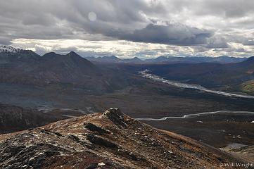 144 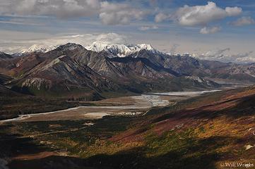 146 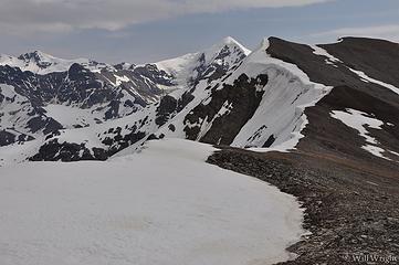 149 (2) 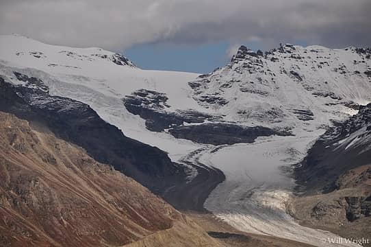 160 (2) 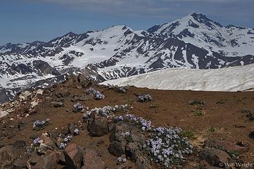 160 (3) 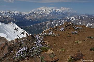 161 (2) 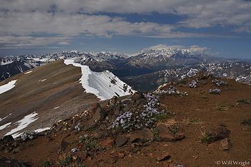 162 (2) 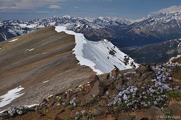 163 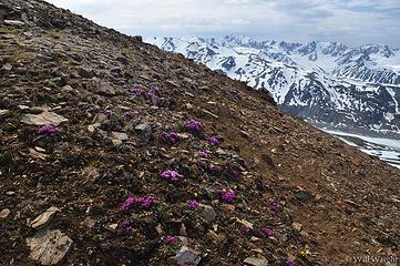 164 (2) 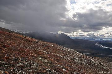 167 (2) 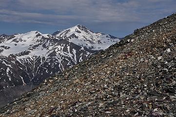 167 (3) 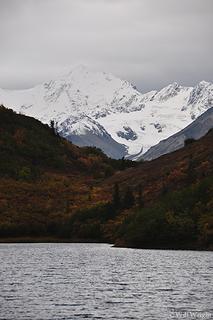 168 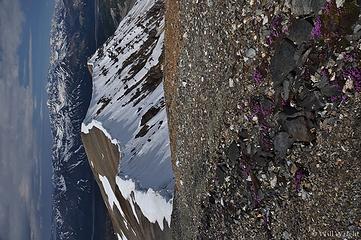 169 (2) 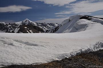 171 (2) 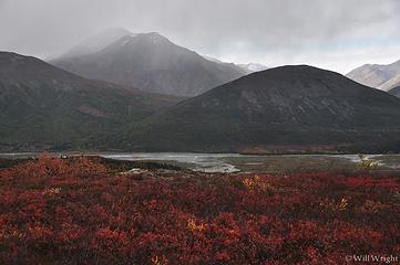 171 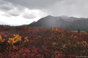 172 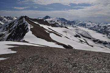 173 (2) 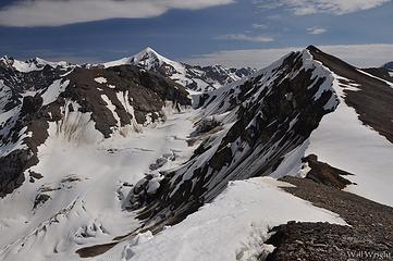 175 (2) 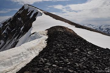 178 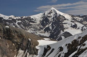 183 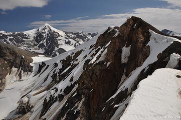 184 (2) 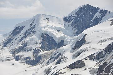 186 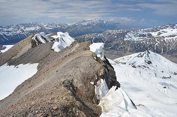 213 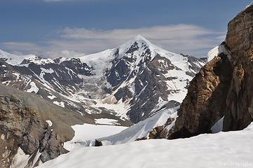 219 (2) 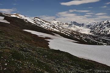 227 (2) 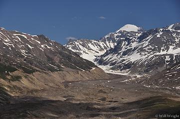 478 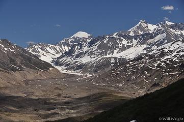 479 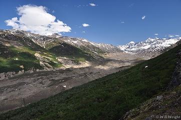 481 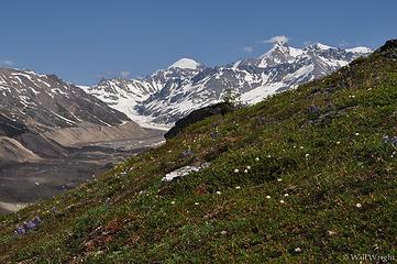 484  487  500  502  503 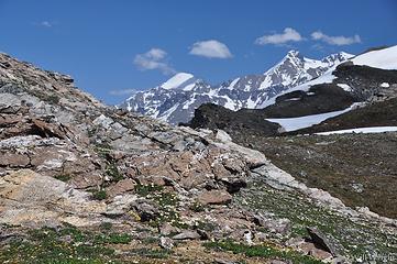 506 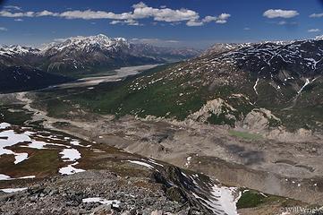 507 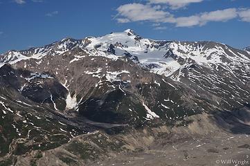 513 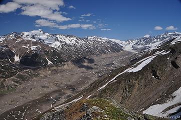 514
|
| Back to top |
|
|
Mega-Will
country bumpkin
Joined: 22 Dec 2006
Posts: 655 | TRs | Pics
Location: Olympic Peninsula |
|
Mega-Will
country bumpkin
|
Fri Jan 02, 2015 2:40 am |
|
|
Coal Mine Road
Though this route is maybe a bit boring for a hike in summer, I'll mention it since going part way out to a public use cabin at Coal Mine Lake #5 makes a great snowshoe or cross country ski in winter, and going further out the road is an excellent mountain bike trip in summer. The second half of the ride is right on top of a moraine above brush line, with expansive views of the Delta Valley and the Alaska Range. There is a second public use cabin further out the trail.
Drive about 24 miles south from Delta on the Richardson Highway and park at the signed pull-off. Much of this road can be driven by 4-wheel drive, high clearance vehicles, but it doesnt generally see a whole lot of traffic in this quiet area, far from population centers.
Coal Mine Lake #5
4.2 miles round trip
+350 feet
End of road
15.4 miles round trip
+850 feet
 Coal Mine Road 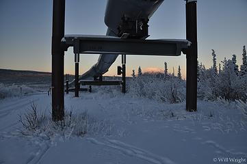 159 (2) 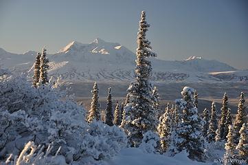 134 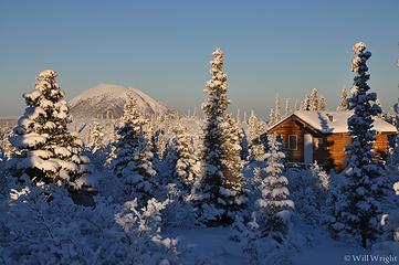 141 (5) 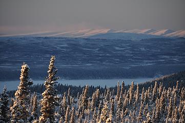 156
|
| Back to top |
|
|
Mega-Will
country bumpkin
Joined: 22 Dec 2006
Posts: 655 | TRs | Pics
Location: Olympic Peninsula |
|
Mega-Will
country bumpkin
|
Fri Jan 02, 2015 2:40 am |
|
|
Gulkana Glacier
Every April, the biggest hillbilly party of the year happens out here in the remote Eastern Alaska Range. Several thousand motorheads from all over the state come to watch races and participate in the festivities. Food carts, beer gardens, and live music, all in the snow.. And for good reason, Isabel Pass provides some of the best snowmobiling in the world. For the rest of the year, this is really a quiet place, affording a nice relatively easy hike at the end of a bumpy road. I must say that the snow rally organizers do an admirable job of picking up the garbage after the event. You really would never know.
The access turnoff is just south of the signed Richardson Monument at Isabel Pass, about 68.5 miles south of Delta. Turn east onto the gravel road and watch it deteriorate into a jeep trail. 4wd isn't necessary, but without a little clearance, this hike might not be much fun since the road wouldn't be enjoyable to walk. Start walking when it's obvious you shouldn't drive any more. Quickly, College Creek is crossed on an awesomely rickety looking wild west suspension bridge. The sometimes faint and very rocky trail continues uneventfully to the toe of the glacier. It should go without saying, but people have died straying onto lingering snow on top of the glacier and falling into crevasses. Only venture onto the ice if you know what you're doing.
Round Trip: about 4 miles.
Elevation Gain: 500 ft.
 Gulkana Glacier 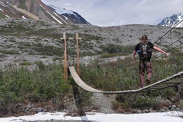 070 (2) 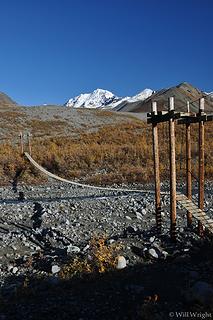 079 (3) 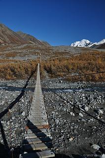 085 (3) 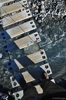 086
|
| Back to top |
|
|
Mega-Will
country bumpkin
Joined: 22 Dec 2006
Posts: 655 | TRs | Pics
Location: Olympic Peninsula |
|
Mega-Will
country bumpkin
|
Fri Jan 02, 2015 2:41 am |
|
|
Gunnysack Peak
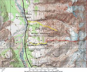
The hike to Gunnysack Peak is the only hike in the Eastern Alaska Range where an actual trail ascends all the way to the summit of a substantial mountain. The catch however is that this hike lies entirely within Black Rapids army training area. In order to hike here, one must contact the office and make sure no training is going on, and then stop by to check in and check out. This will deter many, but the hike is worth it. When checking in, ask about the best place to park. In any case, the hike begins on grassy ski slope trails. There are several ways to go -- the trails converge at the lift tower at the top. The trail furthest to the north, skirting the gorge of Gunnysack Creek, is probably the quietest. From the top of the ski slope, a fairly obvious two track trail continues up and slowly turns into a hiker only path. The trail mostly disappears for a pitch up a steep meadow, but appears again when the ridge becomes more defined. Some minor exposure and talus hopping eventually leads to the summit, marked by a memorial to fallen soldiers. Very nice views overlook most of the Delta River Valley and right up Black Rapids Glacier.
There is also a hike that starts right across Gunnysack Creek to the north, behind Black Rapids Lodge, entirely outside the army training area. The folks there are friendly and will point you in the right direction. Apparently, this path is flagged all the way to brush line, but I have not been up there yet myself.
Drive about 40 miles south from Delta on the Richardson Highway. Black Rapids Training Area is an obvious compound on the left, just past the Lodge at Black Rapids. Check in at the training area office.
Round trip: about 6 miles, but it depends on where you park.
Elevation gain: 3700ft.
 Black Rapids Training Area 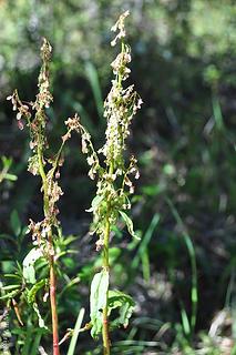 101 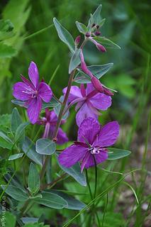 202 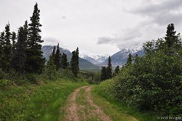 203 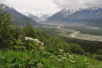 201 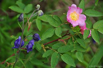 197 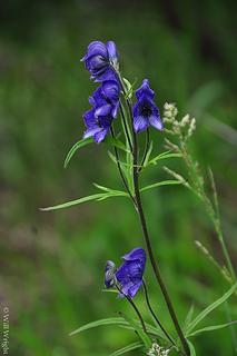 199 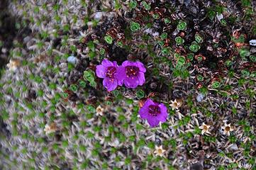 163 (2) 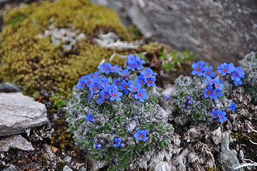 174 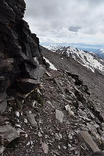 172 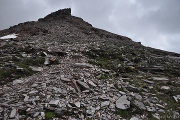 176 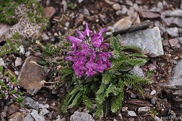 180 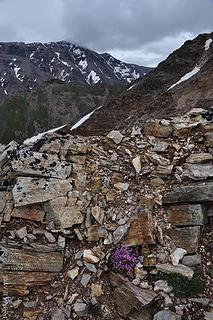 186 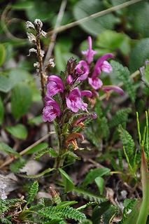 192  191  190  189  195  193  165  161  162 (2) 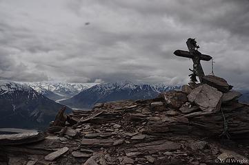 158 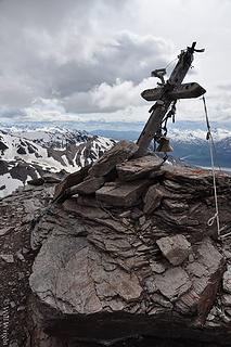 159 (2)  149  148 (2)  138 (2)  140  130 (2)  121 (2)  116 (2)
|
| Back to top |
|
|
Mega-Will
country bumpkin
Joined: 22 Dec 2006
Posts: 655 | TRs | Pics
Location: Olympic Peninsula |
|
Mega-Will
country bumpkin
|
Fri Jan 02, 2015 2:41 am |
|
|
Michael Creek
This is another surprising "wall of brush" footpath along the Richardson Highway in the Eastern Alaska Range between Delta and Glennallen. The signed creek crossing is about 46 miles south of Delta and there are trails that push into the brush on both sides of the bridge. On the north side, trails lead to a couple private cabins. The trail you want is on the south side of the bridge. There are a couple confusing junctions; for the time being you can follow the red ribbons tied around shrub branches. If you reach a large river-rock cabin, you've missed a right turn. When the path reaches a grassy meadow, it's not obvious but you need to take a sharp left back away from the meadow, up the hill.
From here, the trail leads steeply up onto a tundra bench where the tread temporarily disappears. Follow the path of least resistance (generally up and to the right) and the trail will reappear through a last band of brush. Once through this, there are some fine views from rock outcrops overlooking the Delta River region. This is a decent turnaround point, but it's rewarding and simple enough to climb higher, on up the tundra. Eventually a vertical ridge step halts easy progress, and this is as far as I've gone. It's likely possible however, to skirt the gendarme on the right and continue up the ridge into high alpine rock and snow, up towards the Jarvis Glacier divide.
Round Trip: about 3.5 or 4 miles
Elevation gain: 1700ft.
 Michael Creek 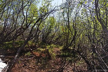 455  392 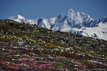 393 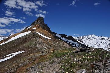 402 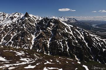 412 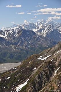 420 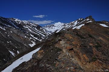 429 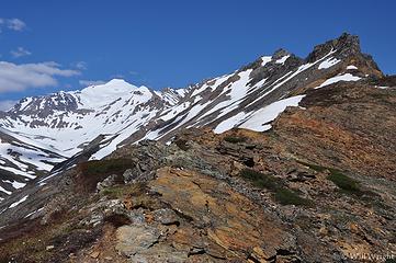 431 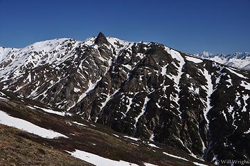 433 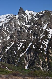 447 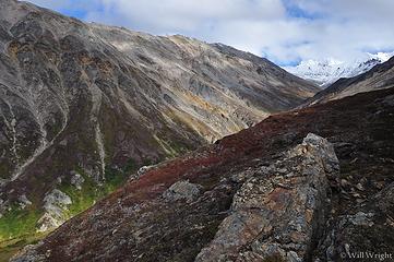 200 (4) 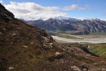 202 (2)
|
| Back to top |
|
|
Mega-Will
country bumpkin
Joined: 22 Dec 2006
Posts: 655 | TRs | Pics
Location: Olympic Peninsula |
|
Mega-Will
country bumpkin
|
Fri Jan 02, 2015 2:42 am |
|
|
Donnelly Dome
As you can see, I have pictures depicting a wide variety of conditions on this hike. Ive been up here many, many times since it serves much the same purpose as Tiger Mountain for Puget Sound residents, just with considerably better scenery and worse weather. Im particularly grateful for this geographic anomaly 20 miles south of where I live since the rest of the region here north of the Alaska Range is rather gentle. I think Id end up getting fat without Donnelly Dome. Of course, there arent any trailhead signs here or anything, and most of the hill is on military land. The army doesnt seem terribly bothered by people tromping around in this area though, particularly on the south side, accessed from non-military land along the Richardson Highway. If you want to be official, pick up a recreation pass at the visitors center at Fort Wainwright in Fairbanks, or at Fort Greely in Delta on weekdays. There are two main trails here, one on the south side which climbs steeply up an open and wind blasted slope. Another trail climbs the north side, accessed from Dome Road on military land. Its just as steep and a bit brushier but the ridge walk to the summit is really cool. Ive generally stopped going that way, and sometimes drop part way down the ridge from the other side to extend the workout a bit.
One unexpected quality of this hill is its availability as a surprisingly reasonable winter hike. Like I mentioned, the open south slope is frequently blasted with the warm Chinook winds funneling out of the Delta River Valley, and is often mostly clear of snow. The shrubby tundra at the base of the Dome gets heavily drifted, but generally isnt too terrible to walk. In addition, big steep slopes in the mountains are almost always much warmer (often as much as 30 degrees, even when its not windy) than the interior valley bottoms.
Drive just less than 20 miles south from Delta on the Richardson Highway, and park at a pull-off on the west side of the highway. There are a couple parking spots from which the trail can be accessed, the best one is just past the top of the hill rising up from the Donnelly Flats straightaway. The first part of the trail can be driven with 4wd, hc. Look for a footpath heading toward the mountain after a half mile or so. The open, upper slopes have several indistinct trails.
3 miles round trip
+1660 feet elevation gain
 Donnelly Dome 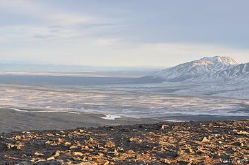 View from Donnelly Dome 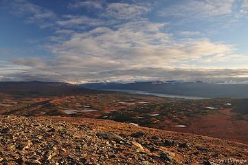 003 (5) 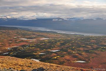 005 (4) 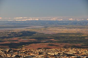 006 (4)  024 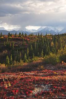 030 (2) 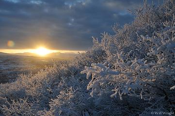 032 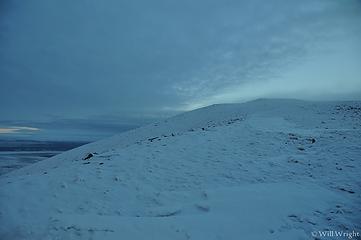 047 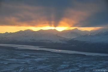 049 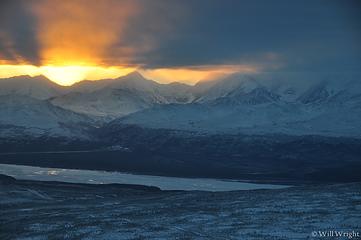 050 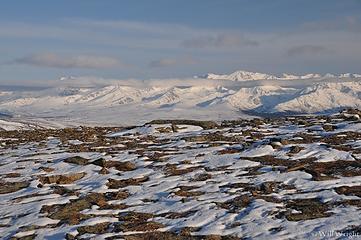 051 (2) 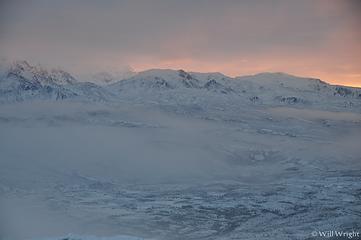 052 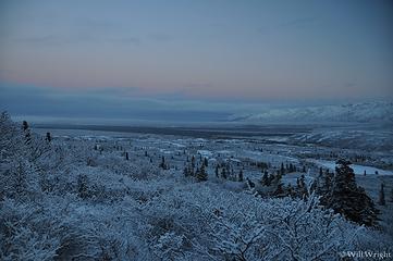 060 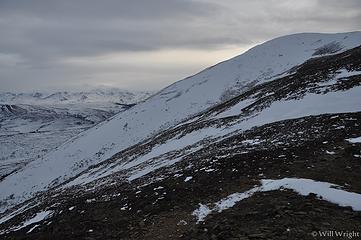 074 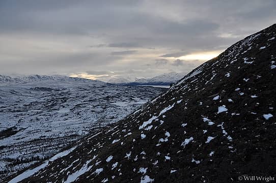 083  337  Alaska Range from Donnelly Dome 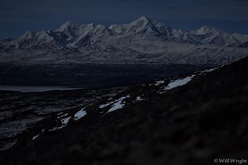 Eastern Alaska Range at night (6) 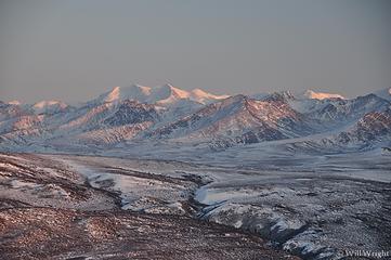 far eastern AK Range from Donnelly Dome 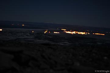 Fort Greely from Donnelly Dome at night 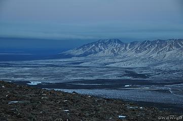 Granite Mountains from Donnelly Dome 2 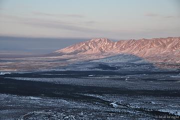 Granite Mountains from Donnelly Dome 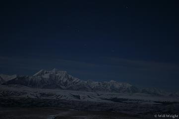 Mt. Hayes from Donnelly Dome at night 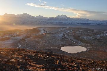 016 (4) 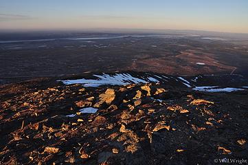 012 (3) 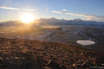 005 (3) 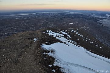 060 (3) 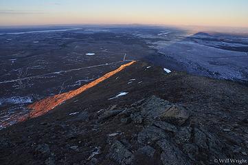 045 (3) 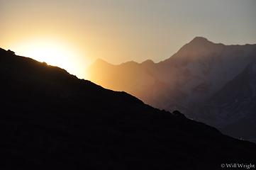 044 (3) 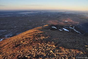 029 (3)  026 (2)  080 (2) 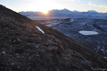 054 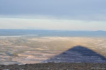 shadow of Donnelly Dome 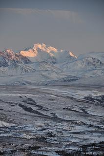 Mt. Silvertip from Donnelly Dome
|
| Back to top |
|
|
Mega-Will
country bumpkin
Joined: 22 Dec 2006
Posts: 655 | TRs | Pics
Location: Olympic Peninsula |
|
Mega-Will
country bumpkin
|
Fri Jan 02, 2015 2:42 am |
|
|
Rainbow Ridge
This is a small mountain range along the Richardson Highway, lower and closer to the main river valley than the icy main range of the Delta Mountains. Its name is inspired by the multi-hue cliffs and scree slopes seen dramatically from the highway, 4,000 feet below the crest of the ridge. Hiking in these mountains can be done from several access points. The Redrock Canyon (local name) access gives the option to gain much of the elevation on an ATV trail (expect motorized traffic on weekends especially). The road up McCallum Creek edges up to the brush line on the opposite side of Rainbow Ridge (no trail), and the other two trailheads, along the highway itself are really just narrow spots in the brush where hikers have previously found a way up into the high country. One is a pullout at the big bend at MP 209.5, and another at a gravel pit at MP 206.5.
 Rainbow Ridge 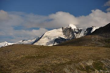 Hiking in the Alaska Range south of Delta 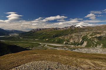 Hiking south of Delta 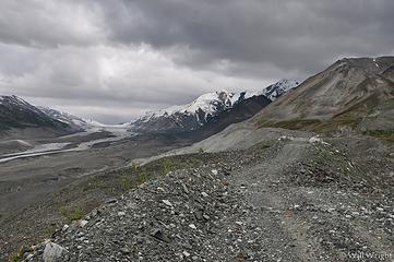 Jeep track, Rainbow Mountains 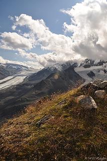 Rainbow Mountains Hike (2) 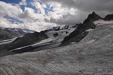 Rainbow Mountains Hike (3) 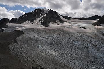 Rainbow Mountains hike (4) 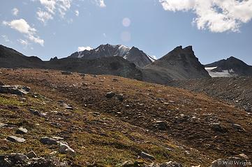 Rainbow Mountains hike (5) 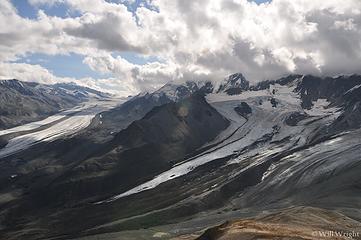 Rainbow Mountains hike, south of Delta 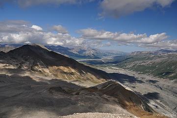 Rainbow Mountains hike 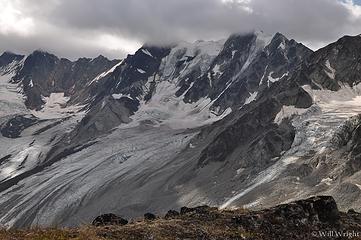 Rainbow Mountains 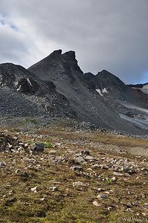 Rainbow Ridge Hike (2)  Rainbow Ridge Hike 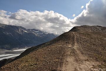 4-wheeler trail south of Delta 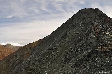 024 (6) 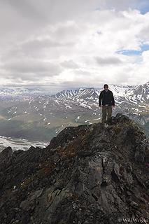 054 (3) 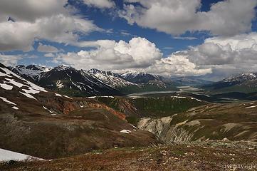 011 (2) 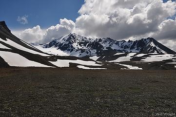 016 (9) 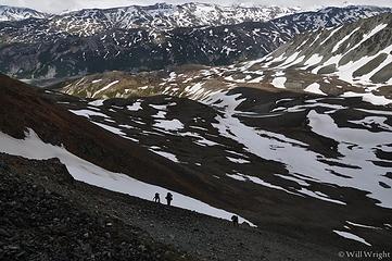 022 (9) 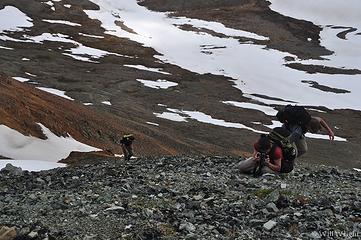 031 (7) 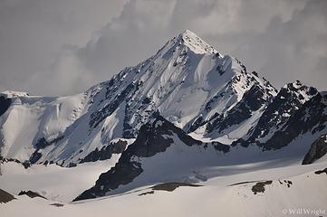 033 (6) 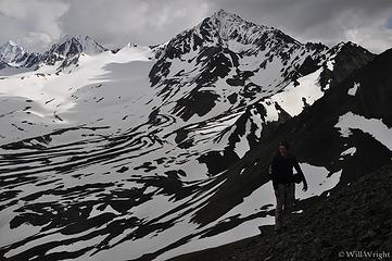 035 (4) 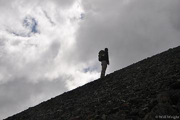 039 (6) 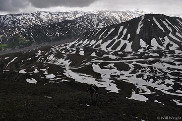 044 (4) 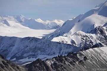 087 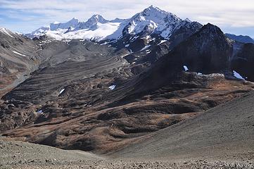 071 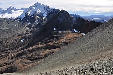 069 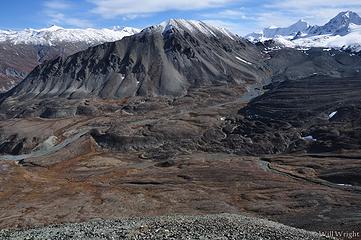 047 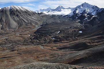 045 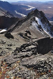 121 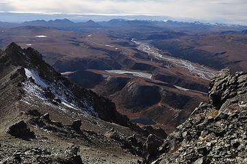 114 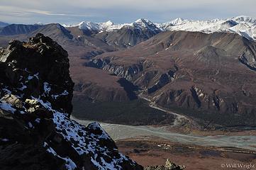 107 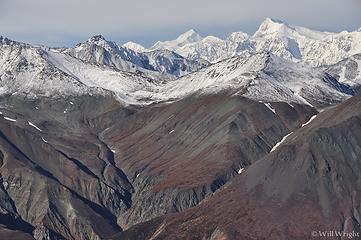 105 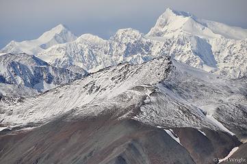 101 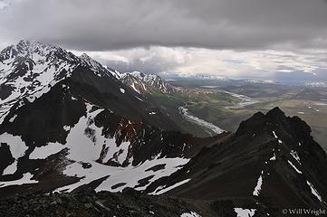 047 (4) 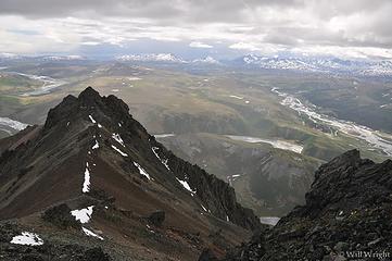 045 (5) 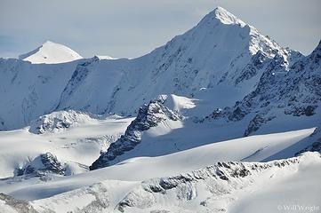 090 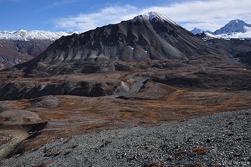 024 (2) 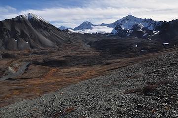 027 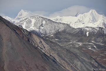 034 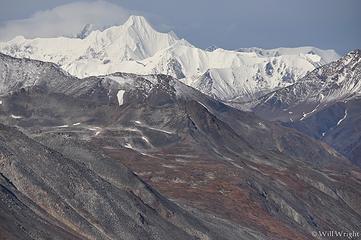 037 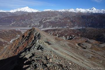 041 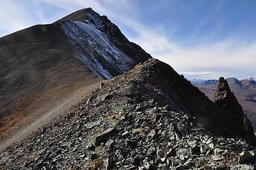 042 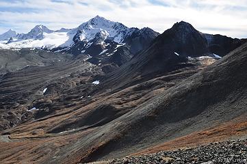 044 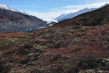 001 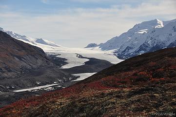 005 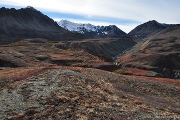 008 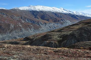 013 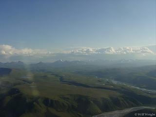 Rainbow Ridge Hike, Delta (2) 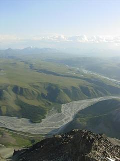 Rainbow Ridge Hike, Delta (3) 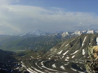 Rainbow Ridge Hike, Delta (4) 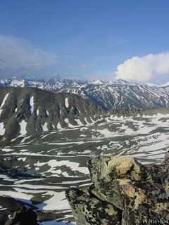 Rainbow Ridge Hike, Delta (5) 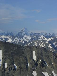 Rainbow Ridge Hike, Delta (6) 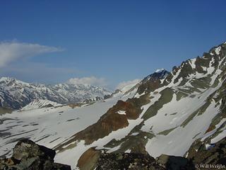 Rainbow Ridge Hike, Delta (7) 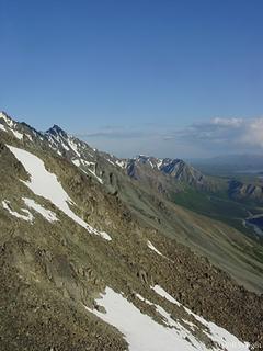 Rainbow Ridge Hike, Delta (8) 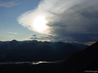 Rainbow Ridge Hike, Delta (9) 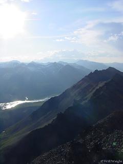 Rainbow Ridge Hike, Delta 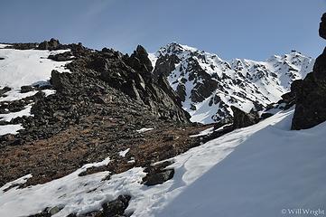 058 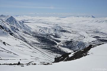 130 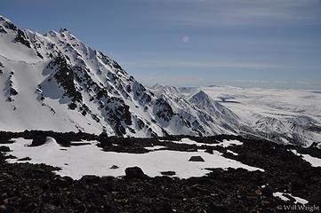 105 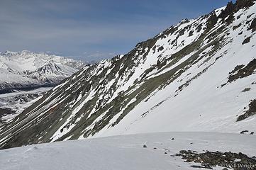 099 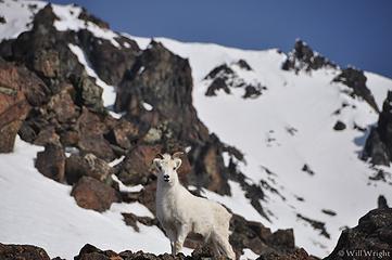 089 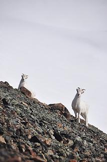 071 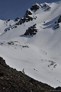 068 (2) 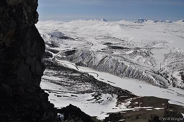 060 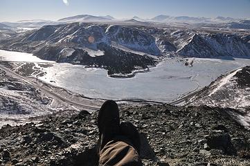 015 (2)
|
| Back to top |
|
|
Mega-Will
country bumpkin
Joined: 22 Dec 2006
Posts: 655 | TRs | Pics
Location: Olympic Peninsula |
|
Mega-Will
country bumpkin
|
Fri Jan 02, 2015 2:43 am |
|
|
Suzie Q Creek
I stumbled upon this great hike just poking around one day and Ive never really heard of anybody else hanging out up here, except maybe sheep hunters. The hike doesnt really have a name but it follows Upper Suzie Q Creek in its lower stretches, so Ill go with that. Its accessed from a comm. tower road from MP 225 Richardson Highway. Just before the tower is a pullout and faint ATV trail heading east. Hike out this trail across beautiful Sound of Music style flowery tundra. The trail gets a little tough to follow in spots and ends pretty quick, but generally stay parallel to the creek. Theres a bit of brush around where the slope steepens, but you should be able to weave your way around the clumps and get on a rockier ridge. A little light scrambling leads up to an otherworldly pasture of teletubby-green dryas. The ridge beyond is generally hikeable, with some tougher scrambling in spots, but the views dont significantly improve for awhile, so call this a short hike, or devote a full day to it. The ridge eventually leads up to the main Delta-Jarvis divide, up at about 7,000 feet, though I havent been that far yet. Looking at Google Earth though, the close up view of 9000+ foot Mt. Silvertip from there would be extraordinary, not to mention the rest of the spectacular Delta River region. Ive taken a couple people on this hike now, and theyve been totally blown away by the scenery and surprised at the easy access highly recommended.
Note: This hike is within the army's Black Rapids Training Area. In the past, this section has been little used, and I didn't use to bother to check in. They have begun using the area more however, and it is a good idea to check ahead and see if it's being used. They want recreational users to check in and out in person, but that honestly doesn't seem necessary.
Drive about 42 miles south from Delta on the Richardson Highway and take a left on a gravel road immediately before Suzy Q Creek. Wind up onto the windblown tundra and park either at the AT&T tower, or at a small pullout where the trail actually takes off.
Round Trip: about 4 miles to high viewpoint. Can continue much further.
Elevation gain: 1800ft. to high viewpoint.
Black Rapids Training Area 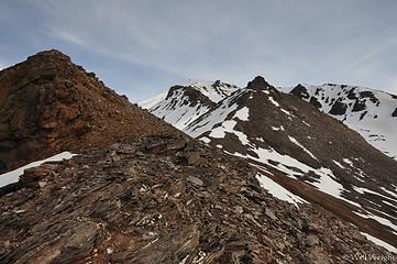 McHugh Peak Hike (3) 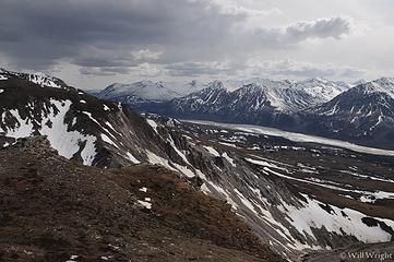 Black Rapids Hike, Alaska Range (2) 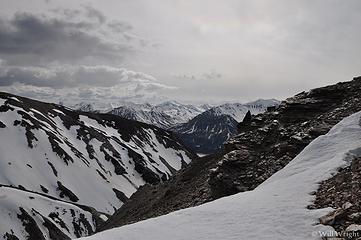 Black Rapids Hike, Alaska Range 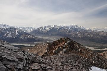 Black Rapids Hike, Richardson Highway 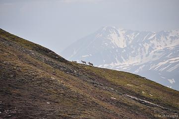 Dall Sheep from Alaska Range Hike 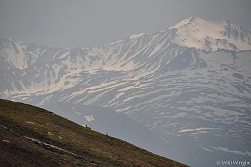 In the Eastern Alaska Range, south of Delta
|
| Back to top |
|
|
Mega-Will
country bumpkin
Joined: 22 Dec 2006
Posts: 655 | TRs | Pics
Location: Olympic Peninsula |
|
Mega-Will
country bumpkin
|
Fri Jan 02, 2015 2:43 am |
|
|
Top of the World
As you can see from the pictures, this route makes for a good winter snowshoe outing. The area is worthwhile in summer as well, although the top of the plateau is boggy with a rutted ATV trail. The clear, beautiful upper portion of the Delta River is on the other side of this plateau, but this is probably best enjoyed as a float trip from Tangle Lakes. The parking pullout is about 61.5 miles south of Delta. The pipeline crosses the river here and makes a conspicuous beeline up a steep slope with a gravel road on its right side. Follow this road up to the top of the plateau and then cut off to the left up the moderate ridge leading to Pt. 4364. There is lots of room to explore up here among rolling tundra mountains with the big peaks of the Alaska Range in the near distance.
Round Trip: About 6.5 miles
Elevation Gain: 1600ft.
 177 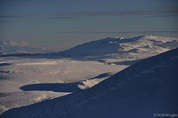 091 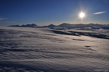 093 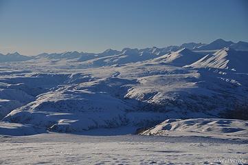 096 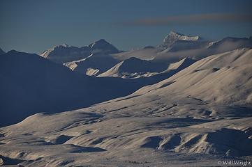 102 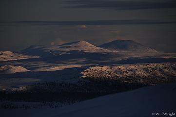 117 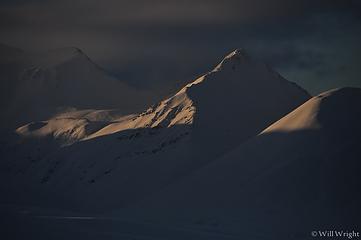 120 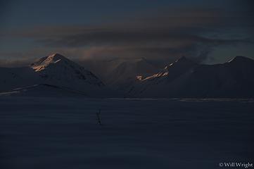 123 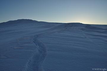 131 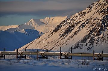 135 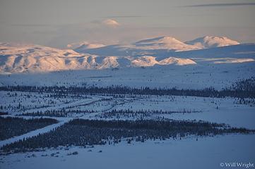 141 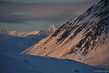 153 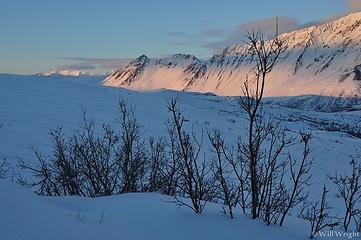 162 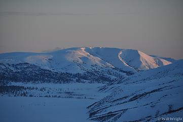 167 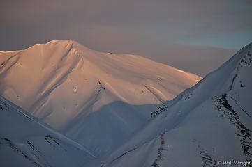 169 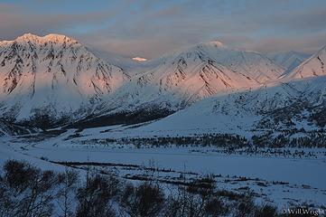 172 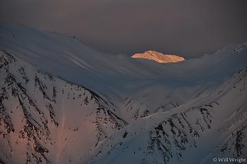 174
|
| Back to top |
|
|
Mega-Will
country bumpkin
Joined: 22 Dec 2006
Posts: 655 | TRs | Pics
Location: Olympic Peninsula |
|
Mega-Will
country bumpkin
|
Fri Jan 02, 2015 2:44 am |
|
|
Dalton Highway
Of all the winding, gravel highways that radiate out from Fairbanks, this one is unquestionably king. The only road extending into the vast northern half of Alaska, the Dalton traverses the endless rolling hills of the interior, crosses the enormous Yukon River, winds through the rocky, impossibly harsh, and eventually treeless landscape over the highest road pass in the state, and then extends endlessly across the tundra of the north slope, leading to the Arctic Ocean. The majority of this region is not really good for hiking. Bogs, mosquitoes, and uninspiring terrain take much of the fun out of it. A couple regions along the way, Finger Mountain for instance, offer terrain high, open, and dry enough for hiking, but the main attraction is the Brooks Range. Although there are few established trails, they're hardly needed here, and the options are truly endless.
Lacking the heavy glaciation typical of the coastal mountains, rivers in the Brooks range run mostly clear. Aside from the main rivers, most streams are typically small and cross-able on foot. The catch is that the permanently frozen ground responds quickly to rainfall and even small streams can be totally inaccessible for several days after a heavy rain. Likewise, the peaks here are ragged, but mostly not extreme. This combination of factors leads to a landscape perfect for long distance hiking / packrafting traverses. Though very good trips can be begun from the road, it is also popular to fly in to remote locations for hiking, and to float rivers like the North Fork Koyokuk, the Alatna, the Noatak, etc.
 Brooks Range Brooks Range  Dalton Campsite  Dalton Highway (2)  Dalton Highway, Chandalar Shelf  Dalton Highway, Glabraith Lake 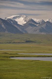 Dalton Highway, near Galbraith Lake 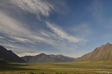 Dalton highway, north slope (2) 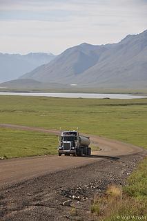 Dalton Highway, north slope (3) 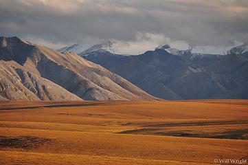 Dalton Highway, north slope 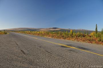 Dalton Highway  Fireweed along the Dalton Highway  Galbraith Lake, Dalton Highway (2)  Galbraith Lake, Dalton Highway 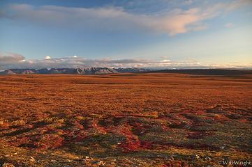 North Slope, Dalton Highway (2) 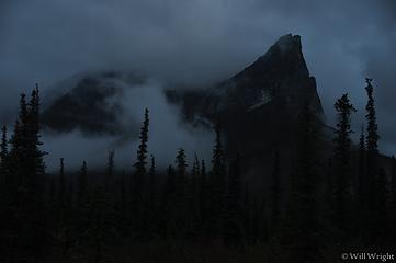 Mt. Sukakpak 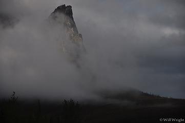 Mt. Sukakpak 4 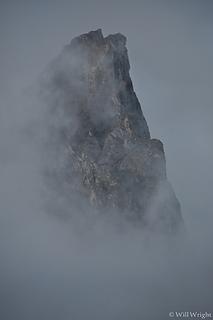 Mt. Sukakpak 3 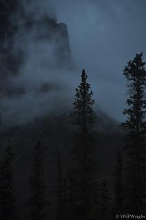 Mt. Sukakpak 2 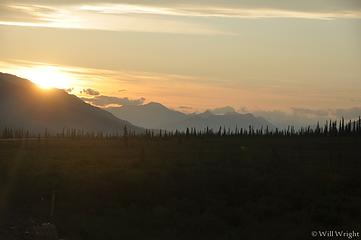 Midnight sun in the arctic 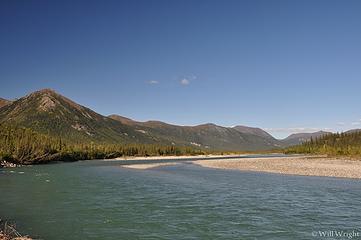 Koyokuk River in Wiseman 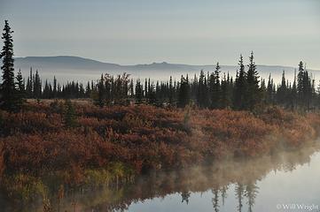 Kanuti River 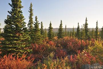 Kanuti River, Dalton Highway 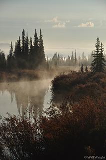 Kanuti River, along the Dalton 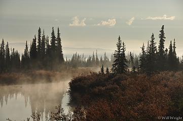 Kanuti River along the Dalton 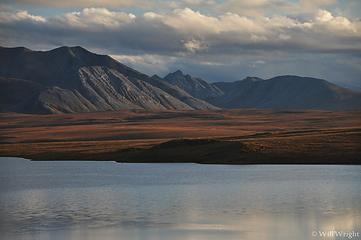 Galbraith Lake 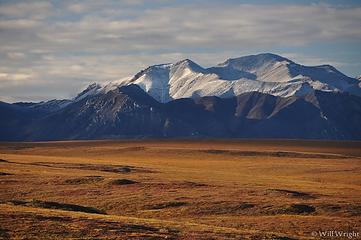 North Slope, Dalton Highway (3) 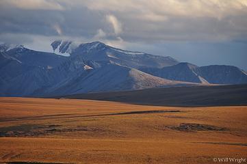 North Slope, Dalton Highway 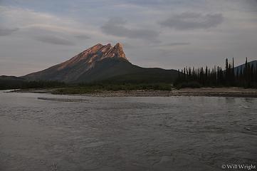 Sukakpak (3) 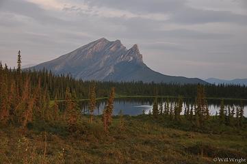 Sukakpak (4) 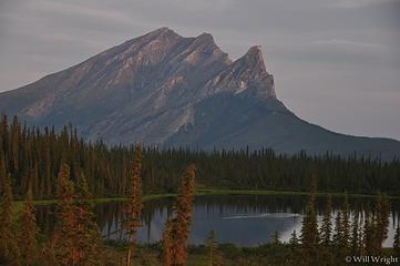 Sukakpak (5) 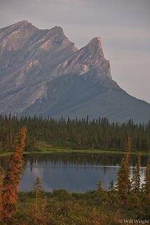 Sukakpak (6) 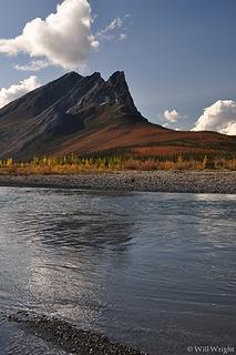 Sukakpak Mountain over the Koyokuk River 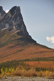 Sukakpak Mtn 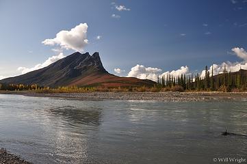 Sukakpak 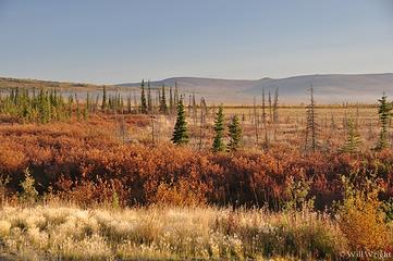 view from Dalton Highway  Wiseman 2  Wiseman 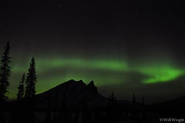 156 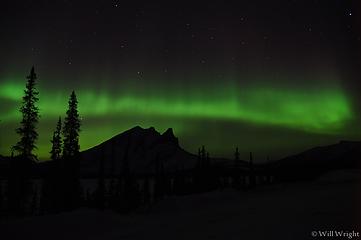 157 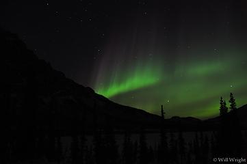 158 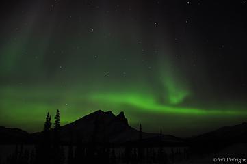 160 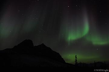 161 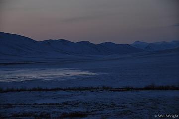 164 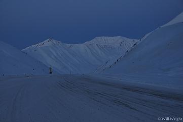 173 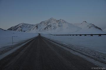 182 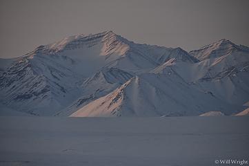 190 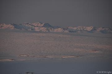 194 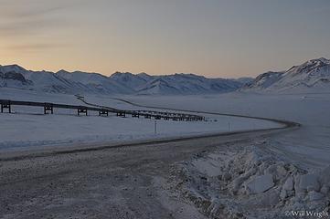 202 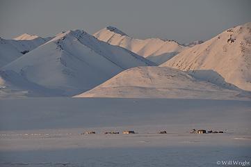 204  278  272  268 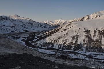 267 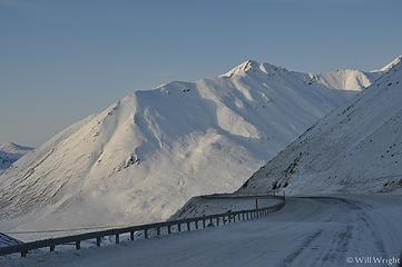 261 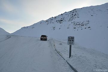 253 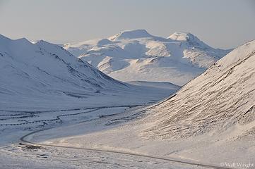 251 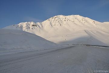 239 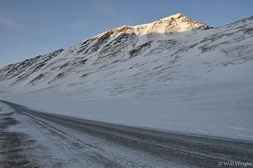 227 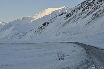 222  214 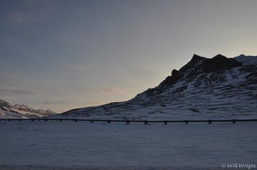 210 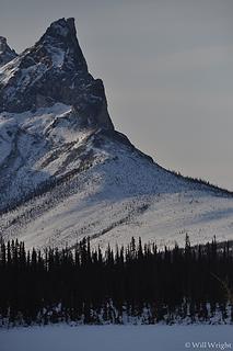 281 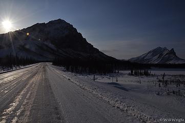 285 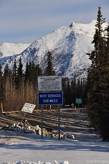 288 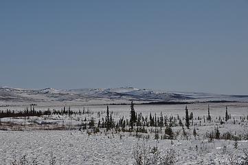 312 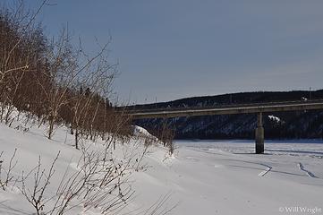 315 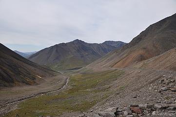 Atigun Pass, Dalton Highway  Brooks Range from the Dalton  Brooks Range, Dalton Highway (2)  Brooks Range, Dalton Highway 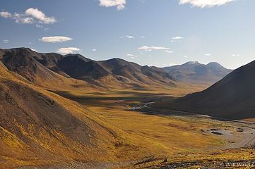 Chandalar Shelf, Brooks Range 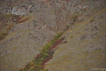 Dall Sheep in the Brooks Range 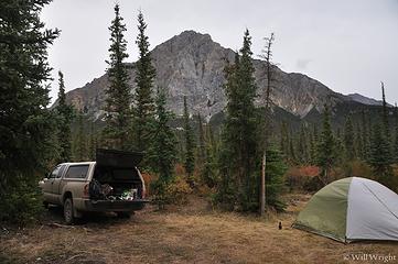 Dalton Campsite 2 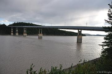 Yukon River Bridge, Dalton Highway 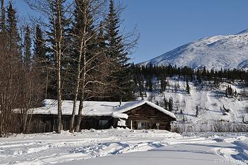 026 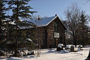 029 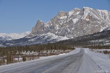 043 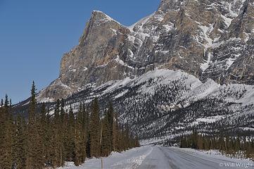 048 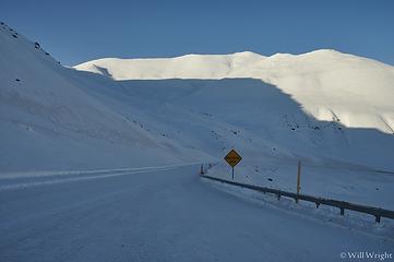 063 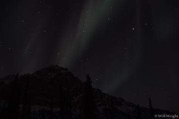 155 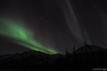 154 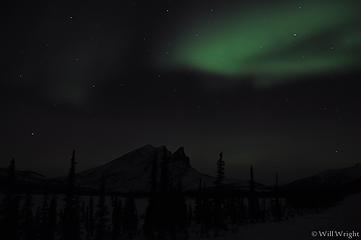 152 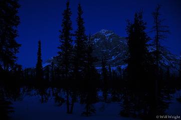 146 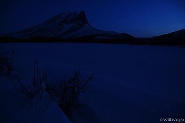 140 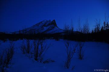 133 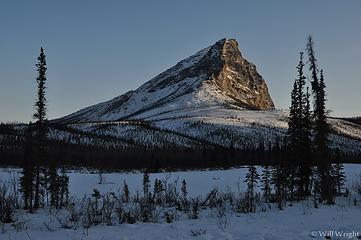 113 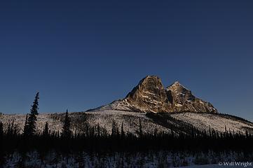 105 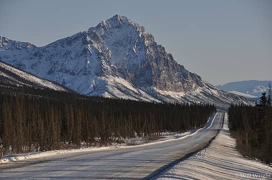 092  087 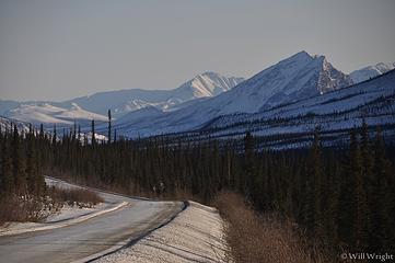 084  080
 geyer geyer
geyer |
| Back to top |
|
|
Mega-Will
country bumpkin
Joined: 22 Dec 2006
Posts: 655 | TRs | Pics
Location: Olympic Peninsula |
|
Mega-Will
country bumpkin
|
Fri Jan 02, 2015 2:45 am |
|
|
James Dalton Mountain
One could talk almost endlessly about the unbounded wilderness of the Brooks Range, but most of it takes a great deal of time and/or money to reach. This is one of those places where much of the wildlife never has and never will see a human being, and its comforting just to know its there. But! When eyeing the Alaska Highway map, one cant help but notice the thin line pointing north like a sore thumb, all the way to the Arctic Ocean, right through the middle of the Brooks Range. This is the Dalton Highway, the Haul Road, built to service the pipeline from the north slope oil fields, and eventually opened to the public. Though most of it passes through impressively empty, but ultimately forgettable country, the section through the mountains is one of the greatest road-accessible mountain playgrounds in North America. The Brooks Range lacks the enormous icefields and truly extreme big-wall topography of the coastal ranges, and trees are absent, aside from the lowest valleys on the south slope, but these shortcomings are more than compensated for by accessibility. This is steep, spectacular country, but almost all the peaks can be scrambled, the valleys hiked, and the non-glacial mountain streams can usually be safely crossed. Bob Marshalls book, Alaska Wilderness beautifully describes his delight at being able to explore a new valley or a new peak almost every day for his months spent in the North Fork Koyokuk Country, just west of todays Dalton Highway.
Geologically speaking, the mountains are the furthest north extension of the Rockies, and they have a character similar to the Front Ranges of the Canadian Rockies, such as the area around Banff, except without trees of course. Steep, cliffy north faces, gentle scree-covered south slopes, fascinating mountain shapes, waterfalls, gorges, karst topography, and an overwhelming emptiness, sum up what youll find here. Though there are endless options, probably the best backpacking sampler of the country would be to hike west into the area of Mt. Doonerak and the North Fork Koyokuk and make some sort of loop. A relatively cheap way to have an extended trip would be to have a food re-supply flown into a gravel bar by Coyote Air out of Coldfoot. Or, its entirely possible to mail food to Anaktuvuk Pass (a rare high mountain native village), and loop-hike through there. If youre fascinated by the idea of packrafting, the North Fork Koyokuk, the Tinayguk, and the John Rivers are all classics which lead to scheduled air service from the bush-town of Bettles. Like I said endless, and Ill shut up now.
Of course I havent actually done any of this. So far Ive managed only a couple day hikes from the highway. The first is James Dalton Mountain, picked out, as much as any other reason, because it was about the only named feature in the vicinity of Atigun Pass. Its also one of the higher summits next to the highway and has a commanding view, though I was hit by a snow squall (in late August) about 10 minutes before reaching the summit. The hike itself is really quite pleasant, and on unusually solid ground for the arctic. The hike is recommended, but one of many options here, picked almost at random.
Round Trip: 6.6 miles.
Elevation gain: 3700ft.
 James Dalton Mountain View from James Dalton Mountain 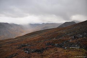 James Dalton Hike 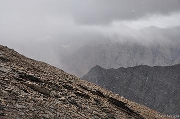 James Dalton Mountain (2) 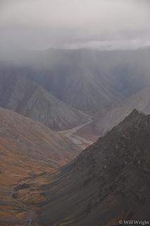 James Dalton Mountain (3) 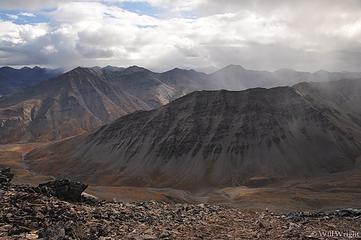 James Dalton Mountain hike (2) 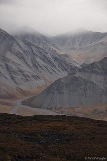 James Dalton Mountain hike (3) 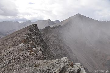 James Dalton Mountain hike, Dalton Highway, in the arctic 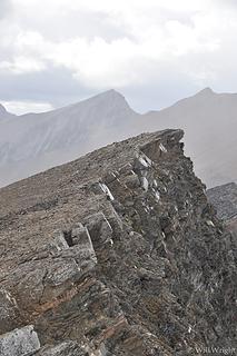 James Dalton Mountain hike 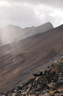 James Dalton Mountain
|
| Back to top |
|
|
Mega-Will
country bumpkin
Joined: 22 Dec 2006
Posts: 655 | TRs | Pics
Location: Olympic Peninsula |
|
Mega-Will
country bumpkin
|
Fri Jan 02, 2015 2:45 am |
|
|
Sukakpak Mountain
The nearly vertical west face of this peak makes for quite a sight along the Dalton Highway north of Coldfoot in the Middle Fork Koyokuk Valley. Surprisingly though, the more mellow side makes an excellent half day scramble. Park at the MP 203 turnout along the Dalton and start hiking east. Theres not even a faint boot path here, but the ground is firm and theres almost no brush in this dry almost-arctic spruce stand. Aim for the prominent rockslide at the south end of the wall, and pretty much head right up it, taking care to avoid a recently active section of the rock slide. From a notch, I turned north and headed up the broad south ridge. This way starts steep and annoyingly loose, and gets positively treacherous higher up I dont recommend it. Instead, drop down a little and climb up the southeast ridge instead (I came down this way). The steepness of Sukakpak and its isolated position give it a spectacular view, though most of the immediate country isnt as steep as what youre standing on. I summitted Sukakpak at about 10:30PM in July, under full daylight. Its hard to think of a better way of celebrating the midnight sun than on a precipice far above the Arctic Circle.
Round Trip: about 5 miles.
Elevation Gain: 3000 feet.
 Sukakpak Mountain 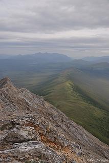 View from Sukakpak 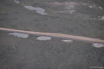 My car from top of Sukakpak 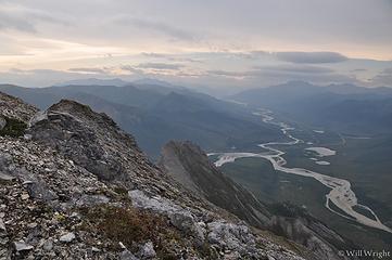 Sukakpak (2) 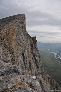 Sukakpak Mountain in the arctic 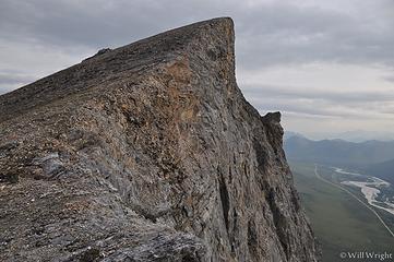 Sukakpak Mountain 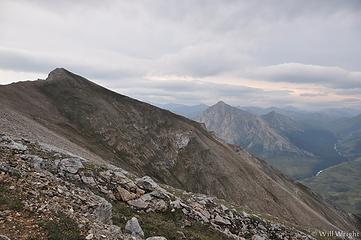 Summit of Sukakpak Mountain 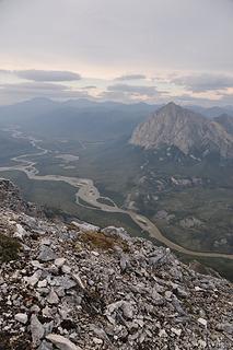 View from Sukakpak (2) 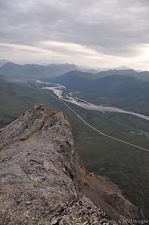 View from Sukakpak Mountain along the Dalton Highway 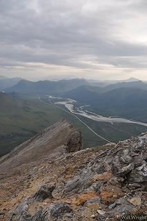 View from Sukakpak Mountain
|
| Back to top |
|
|
|
|
You cannot post new topics in this forum
You cannot reply to topics in this forum
You cannot edit your posts in this forum
You cannot delete your posts in this forum
You cannot vote in polls in this forum
|
Disclosure: As an Amazon Associate NWHikers.net earns from qualifying purchases when you use our link(s). |


