| Previous :: Next Topic |
| Author |
Message |
RayD
the griz ate my pass

Joined: 20 Aug 2005
Posts: 1763 | TRs | Pics
Location: Vacaville |
|
RayD
the griz ate my pass
|
 Wed Aug 23, 2006 8:45 pm |
|
|
I got a late start from Spokane, got to the Little Giant Pass trailhead, waded the Chiwawa (an easy ford) and camped out. I'd never been into the Napeequa via this route and wanted to get an early start for the 3800 ft climb.
The trail starts off through woods with gentle switchbacks but gradually gets much more serious on the climb to the pass. Nearing the Pass I was slowed down considerably by the ripe huckleberries. Hah! That was a good excuse for frequent breaks!
Then I saw a party of three coming down the Pass and since I love to chat with other hikers (and I needed another break), I waited for them at a nice sitdown spot near more berry bushes. Turns out they were completing 14 years of doing segments of the PCT! The 67 year old woman said "no more!" but her 70 year old hubby looked ready for more adventures. Then they went and scared me with stories of how bad the trail was going down to the Napeequa! "Straight down with some dangerous spots!.
Well, I expected something like the Massie Lake Trail and girded my loins and had a swig of my liquid pain killer. Turns out that the trail had actual switchbacks and while being narrow on a steep hillside, wasn't such a bad 2000 ft drop.
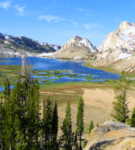
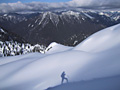
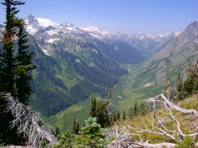 Lower Napeequa Valley as seen from Little Giant Pass  The lovely slide alder of the lower Napeequa 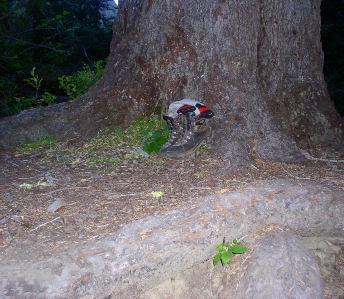 Old growth shoe tree and root bench to sit on 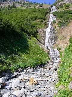 There is a nice camp site on the Napeequa River Trail with a view of these falls on Louis Creek 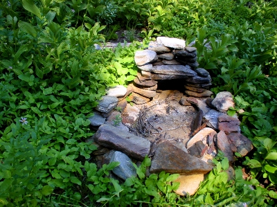 An ancient Sasquatch fire pit. 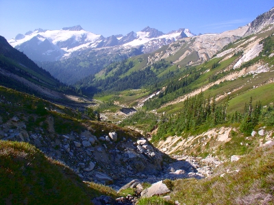 The Upper Napeequa (North Fork) from the route to High Passs 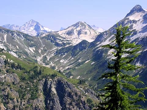 The beautiful and alder free upper valley of the North Fork of the Napeequa 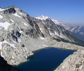 Triad Lake at High Pass and Glacier Peak peeking up over the ridge 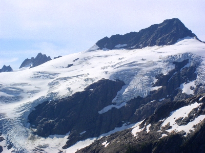 Richardson Glacier on Clark Mountain 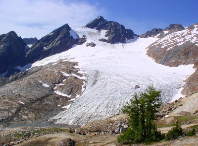 Pilz Glacier on Clark Mountain 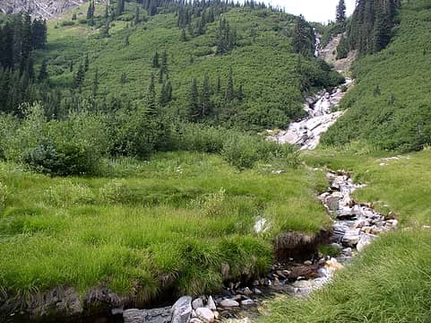 The North Fork of the Napeequa cascades down into the lower valley 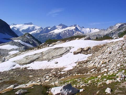 View towards Clark from High Pass 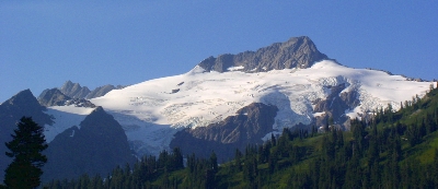 Richardson Glacier on Clark Mountain 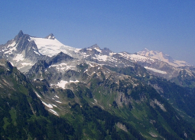 Clark Mountain from Little Giant Pass 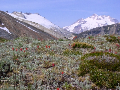 Above the west fork of the Napeequa is a beautiful flat area at about 7200 feet. Butterfly Glacier and Glacier peak. 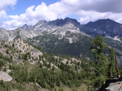 Looking east from Phelps Ridge 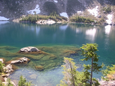 A view of Massie Lake 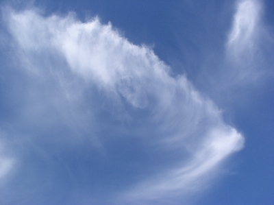 A fishy cloud 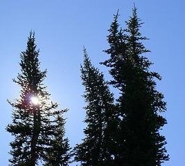 Evening tango 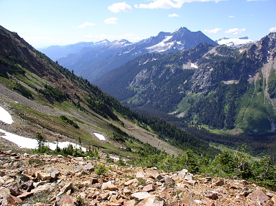 Chiwawa basin and Buck Mountain
don't believe everything you think
 Apheta Apheta
don't believe everything you think
Apheta
|
| Back to top |
  
|
|
Slugman
Its a Slugfest!

Joined: 27 Mar 2003
Posts: 16874 | TRs | Pics
|
|
Slugman
Its a Slugfest!
|
Wed Aug 23, 2006 8:53 pm |
|
|
Sweet! Fabulous! Too bad I'm the world's biggest brush wuss, so I'll never see that area personally, but at least I can go there vicariously, so thanks. I wonder if the cinnamon bear you saw is the same one I saw in the Buck creek valley just north of the junction with the Chiwawa on Aug 20th.
|
| Back to top |
|
|
RayD
the griz ate my pass
Joined: 20 Aug 2005
Posts: 1763 | TRs | Pics
Location: Vacaville |
|
RayD
the griz ate my pass
|
Wed Aug 23, 2006 9:06 pm |
|
|
| Slugman wrote: | | Sweet! Fabulous! Too bad I'm the world's biggest brush wuss, so I'll never see that area personally, but at least I can go there vicariously, so thanks. I wonder if the cinnamon bear you saw is the same one I saw in the Buck creek valley just north of the junction with the Chiwawa on Aug 20th. |
Walking into the Chiwawa meadows I saw something grazing the greenery at the edge of pines that I first thought was a cow! It raised its head and I saw it was a bear and estimating its weight from 300 lb humans I've known. I'd say the bear was 400 lbs. A beauty, for sure! Yeah, it could have a range that crosses the ridge across from Massie Lake.
don't believe everything you think
don't believe everything you think
|
| Back to top |
|
|
torn_hike
Member

Joined: 22 Jun 2005
Posts: 24 | TRs | Pics
Location: Seattle |
RayD
Thanks for the report. I have been to Little Giant before and always wondered what the upper Napeequa valley looked like. This satisfied my curiosity.
|
| Back to top |
|
|
Quark
Niece of Alvy Moore

Joined: 15 May 2003
Posts: 14152 | TRs | Pics
|
|
Quark
Niece of Alvy Moore
|
Thu Aug 24, 2006 8:13 am |
|
|
How did you gird your loins? Other than the crossing of the Chiwawa, which you already answered, that is my question.
I love those waterfalls!
Nice pics of a beautiful place with a mysteriously half-built/half-sheep trail leading to it. Ain't that last switchback up to the pass wierd? I know why it's there, to save the slopoe, but odd that they didn't spend time building trail through those meadows.
Nice built trail from the Chiwawa, then miles of sheep driveway, then the massively eroded and grooved driveway of the meadows, then that wonderful built switchback.
"...Other than that, the post was more or less accurate."
Bernardo, NW Hikers' Bureau Chief of Reporting
"...Other than that, the post was more or less accurate."
Bernardo, NW Hikers' Bureau Chief of Reporting
|
| Back to top |
|
|
wildernessed
viewbagger

Joined: 31 Oct 2004
Posts: 9275 | TRs | Pics
Location: Wenatchee |
Awesome ! 
Living in the Anthropocene
Living in the Anthropocene
|
| Back to top |
|
|
Tom
Admin
Joined: 15 Dec 2001
Posts: 17854 | TRs | Pics
|
|
Tom
Admin
|
Thu Aug 24, 2006 11:30 am |
|
|
Nice pics Ray. Any reason you uploaded small ones?
|
| Back to top |
|
|
RayD
the griz ate my pass
Joined: 20 Aug 2005
Posts: 1763 | TRs | Pics
Location: Vacaville |
|
RayD
the griz ate my pass
|
Thu Aug 24, 2006 4:46 pm |
|
|
| Tom wrote: | | Nice pics Ray. Any reason you uploaded small ones? |
Yup.....The pain of being on dialup.
don't believe everything you think
don't believe everything you think
|
| Back to top |
|
|
Tazz
Member

Joined: 27 Apr 2005
Posts: 7902 | TRs | Pics
|
|
Tazz
Member
|
Thu Aug 24, 2006 5:20 pm |
|
|
 dial up! great tr and superb pics! dial up! great tr and superb pics!
|
| Back to top |
|
|
Andrew
Member

Joined: 24 Oct 2003
Posts: 1175 | TRs | Pics
Location: Arlington |
|
Andrew
Member
|
Thu Aug 24, 2006 11:35 pm |
|
|
Wow, the view of Clark from Little Giant Pass is refreshing. It has a much different character than from the typical High Pass perspective. Thanks for the report and beautiful (if small) pictures.
|
| Back to top |
|
|
Apheta
Old Goat
Joined: 22 Mar 2023
Posts: 4 | TRs | Pics
Location: Vashon, WA |
|
Apheta
Old Goat
|
Wed Mar 22, 2023 10:22 am |
|
|
Hey RayD! I see you haven't made any trip reports for a while, but I hope you are still kickin and get this reply. Fantastic trip report, very helpful! I'm planning a September counterclockwise loop up Phelps Creek and over Spider Gap, then around over High Pass and down into the Napeequa Valley, and out via Little Giant. Your description and photos are very helpful. You mentioned going up the West fork of Napeequa and had photos of Clark Mtn; no trail showing on my map, how was the going? I was contemplating going up that way and then going off trail over the shoulders of Luahna and Clark to ford the Napeequa at Louis Falls. Looks doable by Google Earth, but, CAN I ford the Napeequa. What did the river look like at Louis Falls?
Thanks a mil
Wherever you are, that's your starting point.
Wherever you are, that's your starting point.
|
| Back to top |
|
|
|
|


