| Previous :: Next Topic |
| Author |
Message |
MountainMan
Member


Joined: 15 Jul 2008
Posts: 365 | TRs | Pics
Location: San Diego |
Yes this is my first time up Si. I've been back into hiking for about eight months now, but since BC has done Si several times and we always go new places, I've never been up there. I haven't done much Solo hiking either, so this is also my first major solo hike. Part of what inspired this trip was reading the Solo thread. Also, I've realized for awhile now that I'll probably have to go out on my own, if I ever want to go to all these places that she and others I hike with have already been. It's been kind of scary for me for some reason, not sure why, I used to go out in the woods alone all the time when I was a kid.
After such a beautiful day on Thursday, I decided I'm going out Friday while the weather is still good. I've wanted to knock off Si for quite awhile now. I've also been intrigued by Dixie, so I figured if I'm feeling okay and have time I'll continue on and do that too.
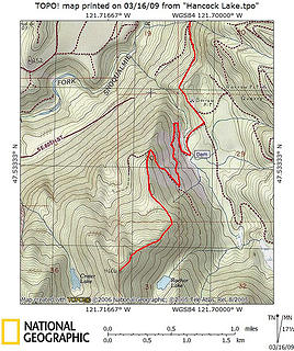
Here's the topo for my trip:
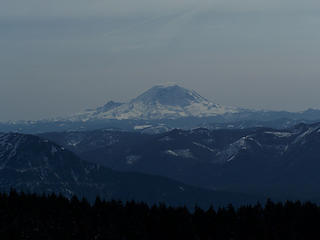
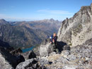
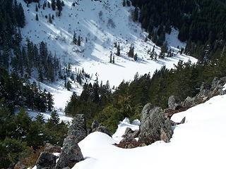
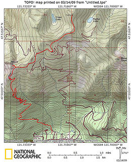 Si and Dixie 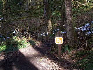 Start of Mt Si trail. 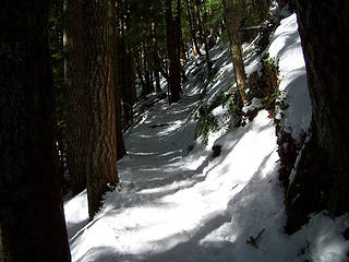 Si trail 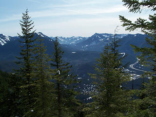 View at 3.5 mi. 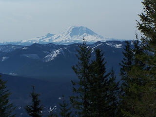 Mt Rainier from Haystack Basin. 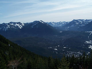 View from Haystack Basin. 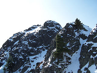 Looking up at Haystack. 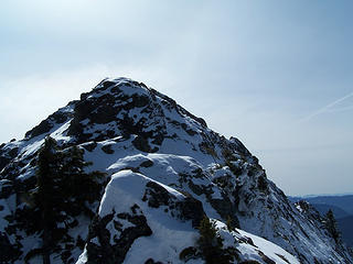 Haystack from ridge. 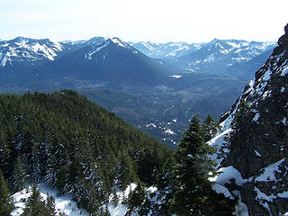 Looking south from Haystack ridge. 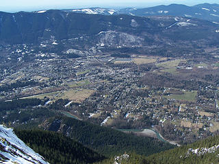 North Bend from Si. 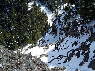 Looking down 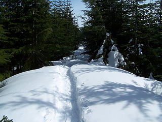 Snowshoe path following the road leading from Si. 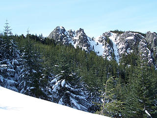 Mt. Si. 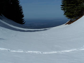 View to the west. 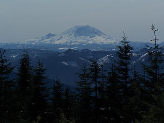 Mt Rainier 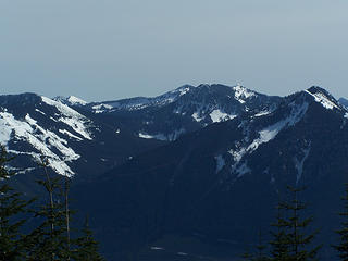 Views from the ridge above Si. 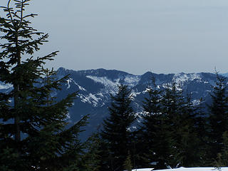 Views from the ridge above Si. 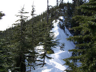 Narrow section of the ridge. 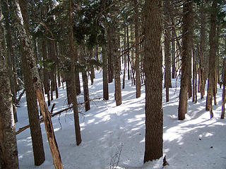 Heading through the trees along the ridge to Dixie. 
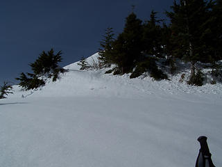 Coming out of the trees and starting up the last part of the ridge towards Dixie. 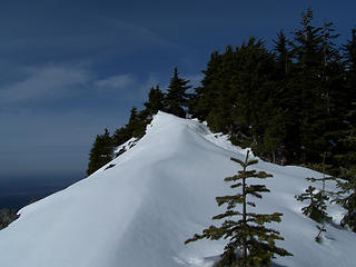 Ridge leading to Dixie. 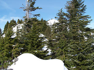 Top of Dixie peaking through the trees.  After that it was a short few minutes to the top. After that it was a short few minutes to the top.
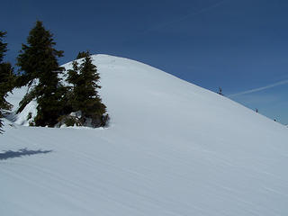 Almost to the top. 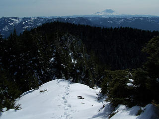 Looking back down the ridge to the south.   I couldn't see the lakes from the top but I was able to see crater lake later from a little south of the summit. I took a bunch of pics, had a quick snack and headed back down at about 3 p.m. I couldn't see the lakes from the top but I was able to see crater lake later from a little south of the summit. I took a bunch of pics, had a quick snack and headed back down at about 3 p.m.
 Mt Rainier from Dixie. 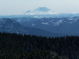 Mt Rainier from Dixie. 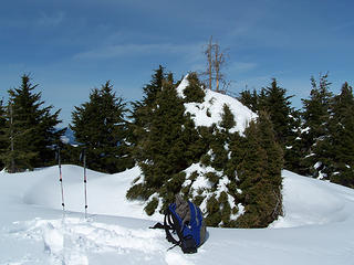 The Summit. 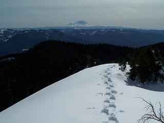 Looking south from Dixie. 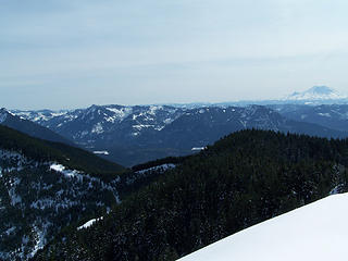 Views from the top of Dixie. 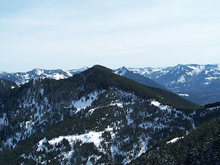 Views from the top of Dixie. 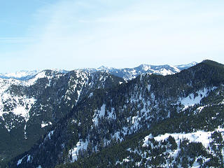 Views from the top of Dixie. 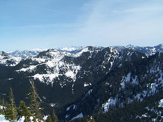 Views from the top of Dixie. 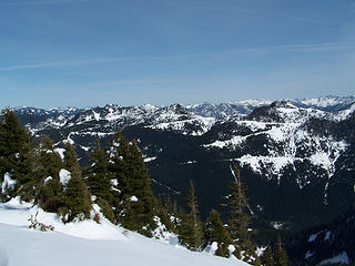 Views from the top of Dixie. 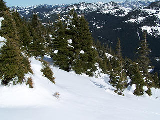 Looking down to NE. 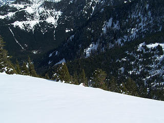 Rachor Lake should be down there somewhere. 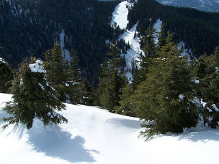 Looking down to the West. 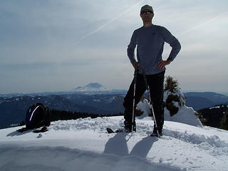 Me on the summit. 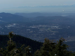 Looking West from the summit. 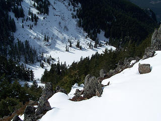 Crater Lake from the ridge to the south of Dixie. 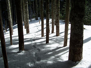 My tracks through the trees along the ridge. 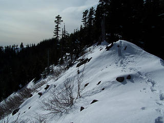 My tracks along the ridge. 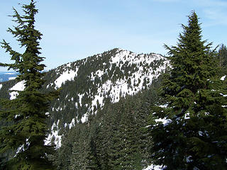 Looking back at Dixie. 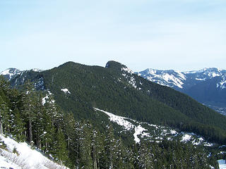 Mt Teneriffe. 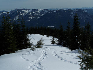 Back to the road and multiple showshoe tracks. 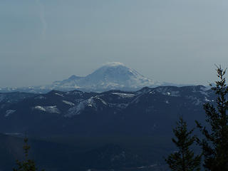 Mt Rainier  I got to her place a little after 6 p.m. and made us a nice chicken curry dinner. I got to her place a little after 6 p.m. and made us a nice chicken curry dinner.  Then we planned the next days hike, finally settling on two options near Yakima in an attempt to avoid the nasty weather (which was successful) and also to find a new place to go that didn't have road closures.
One more thing. Thank you EastKing for your encouragement the other day. Then we planned the next days hike, finally settling on two options near Yakima in an attempt to avoid the nasty weather (which was successful) and also to find a new place to go that didn't have road closures.
One more thing. Thank you EastKing for your encouragement the other day.
Slow down, take notice, savor the moment, appreciate the world around you and everything that you have.
Slow down, take notice, savor the moment, appreciate the world around you and everything that you have.
|
| Back to top |
  
|
|
Ingunn
Hiking Viking
Joined: 01 Feb 2008
Posts: 1751 | TRs | Pics
Location: Redmond |
|
Ingunn
Hiking Viking
|
 Mon Mar 16, 2009 5:51 pm |
|
|
Congratulations on your first solo hike! 
|
| Back to top |
|
|
Kat
Turtle Hiker
Joined: 05 Oct 2003
Posts: 2560 | TRs | Pics
|
|
Kat
Turtle Hiker
|
Mon Mar 16, 2009 5:58 pm |
|
|
Nice TR, great route details with the photos -thanks. And also congrats on the solo
|
| Back to top |
|
|
Bloated Chipmunk
Cock Rock Searcher

Joined: 29 Jan 2007
Posts: 2993 | TRs | Pics
Location: Margaritaville |
Home is where the hiking is.
"Peaks that have come and gone four times should halt a man in his steps." -- William O. Douglas
A balanced diet is a margarita in each hand.
|
| Back to top |
|
|
tigermn
Member

Joined: 10 Jul 2007
Posts: 9242 | TRs | Pics
Location: There... |
|
tigermn
Member
|
Mon Mar 16, 2009 6:24 pm |
|
|
Yea finishing this up is on my short list. I was debating on whether to approach from Si or the Teneriffe road slog.
This was the best "route report" I have seen to date on this, showing things more along the way.
The furthest I went a while back was to the spot where you have to lose a little elevation.
I gather the previous tracks from others were washed away/covered by all the recent snow.
Did the next peak beyond "Dixie" look worth visiting? It appears to be about .2 miles from Dixie and maybe 50-60 feet lower.
|
| Back to top |
|
|
MountainMan
Member
Joined: 15 Jul 2008
Posts: 365 | TRs | Pics
Location: San Diego |
| Bloated Chipmunk wrote: |  what they said. what they said.  Though I've hiked Si several times I've never done Dixie, so you're a step ahead of me there. Though I've hiked Si several times I've never done Dixie, so you're a step ahead of me there.  |
Thanks everbody.
BC, maybe we can bike to the dam and try this route when the snow melts:
 Dixie from Spur 10 | tigerman wrote: | | I gather the previous tracks from others were washed away/covered by all the recent snow.
Did the next peak beyond "Dixie" look worth visiting? It appears to be about .2 miles from Dixie and maybe 50-60 feet lower. |
tigerman, there were no tracks after the first mile (and after the snow this weekend, I'm sure there's no tracks at all). Also, I believe you're referring to the high spot just to the NE. The trees were blocking views to the north, so I don't know. It could be that you could see more from that spot, but it's likely tree covered.
Slow down, take notice, savor the moment, appreciate the world around you and everything that you have.
Slow down, take notice, savor the moment, appreciate the world around you and everything that you have.
|
| Back to top |
|
|
Magellan
Brutally Handsome

Joined: 26 Jul 2006
Posts: 13116 | TRs | Pics
Location: Inexorable descent |
|
Magellan
Brutally Handsome
|
Mon Mar 16, 2009 9:26 pm |
|
|
Good on ya for getting in your first solo. A worthy TR indeed!
|
| Back to top |
|
|
EastKing
Surfing and Hiking

Joined: 28 Mar 2007
Posts: 2082 | TRs | Pics
Location: 77 miles from Seattle! |
|
EastKing
Surfing and Hiking
|
Mon Mar 16, 2009 10:08 pm |
|
|
| Quote: | | Did the next peak beyond "Dixie" look worth visiting? It appears to be about .2 miles from Dixie and maybe 50-60 feet lower. |
Definitely!!! It has much better northern views!!! Congrads Jason and getting out solo and enjoying the mountains. Just remember, you have a lot of talent in this sport and a strong possibility for much larger mountains (like Rainier, Orizaba, Chimborazo, etc.).
YouTube | SummitPost
Saw the depths of despair. Now I am salvaging what time I have left on Earth.
YouTube | SummitPost
Saw the depths of despair. Now I am salvaging what time I have left on Earth.
|
| Back to top |
|
|
Obi Tony Kenobi
Waterfall Crazy!

Joined: 25 Jun 2007
Posts: 1899 | TRs | Pics
Location: Marysville, WA |
Cool trip report, I have never been up to Mt Si, I guess it's because it's so "peoplelized" for a lack of a better word.
One of these days I'll go up there. Love the pic of Crater Lake. Can you see Rachor Lake by any chance?
Congrats on your first Solo!
|
| Back to top |
|
|
Redwic
Unlisted Free Agent

Joined: 23 Feb 2009
Posts: 3292 | TRs | Pics
Location: Going to the Prom(inence) |
|
Redwic
Unlisted Free Agent
|
Mon Mar 16, 2009 10:16 pm |
|
|
I agree with EastKing. He & I did this peak together two weeks ago. The views from the northern false summit of Dixie Peak are MUCH more spectacular and far-ranging than from the true summit. A must do!!!
The false summit has no tree-cover... You just have to pass by some trees immediately after the true summit, descend a little, and then ascend a little to a rocky false summit.
Again, HIGHLY recommended to visit the false summit.
60 pounds lighter but not 60 points brighter.
60 pounds lighter but not 60 points brighter.
|
| Back to top |
|
|
Redwic
Unlisted Free Agent
Joined: 23 Feb 2009
Posts: 3292 | TRs | Pics
Location: Going to the Prom(inence) |
|
Redwic
Unlisted Free Agent
|
Mon Mar 16, 2009 10:20 pm |
|
|
| Obi Tony Kenobi wrote: | | One of these days I'll go up there. Love the pic of Crater Lake. Can you see Rachor Lake by any chance? |
Judging from firsthand experience, I don't think Rachor Lake is visible from the top of Dixie Peak. Crater Lake is definitely viewable... especially now when it is snow-covered and ice-covered.
Speaking of Crater Lake, I also recommend a trek to Crater Lake Mountain, to the west of Dixie Peak and Crater Lake. It doesn't have the views of Dixie Peak (or its false summit), but it offers a location rarely visited by hikers. Just something to think about.
Congrats, by the way, to MountainMan, for a good summit trip, report, and photos!!!
60 pounds lighter but not 60 points brighter.
60 pounds lighter but not 60 points brighter.
|
| Back to top |
|
|
Yet
Member

Joined: 23 Apr 2005
Posts: 2634 | TRs | Pics
Location: Happily Ever After |
|
Yet
Member
|
Mon Mar 16, 2009 10:59 pm |
|
|
Nice job, MountainMan.
|
| Back to top |
|
|
tigermn
Member
Joined: 10 Jul 2007
Posts: 9242 | TRs | Pics
Location: There... |
|
tigermn
Member
|
Tue Mar 17, 2009 7:00 am |
|
|
| Obi Tony Kenobi wrote: | | Cool trip report, I have never been up to Mt Si, I guess it's because it's so "peoplelized" for a lack of a better word.
One of these days I'll go up there. Love the pic of Crater Lake. Can you see Rachor Lake by any chance?
Congrats on your first Solo! |
Go on a weekday morning or afternoon and it's much less peoplized however I suspect it may be impossible to not run into anybody. Or take the old trail for even more isolation. I took this during the week and probably saw about 6 people (at least until I joined up with the main trail just before the rocks).
I ran into a guy a while back who said he has been up and down Si at all hours of the day/night/morning and never failed to see at least someone else on the trip. Even at like 2AM.
|
| Back to top |
|
|
MountainMan
Member
Joined: 15 Jul 2008
Posts: 365 | TRs | Pics
Location: San Diego |
| Redwic wrote: | | I agree with EastKing. He & I did this peak together two weeks ago. The views from the northern false summit of Dixie Peak are MUCH more spectacular and far-ranging than from the true summit. A must do!!!
The false summit has no tree-cover... You just have to pass by some trees immediately after the true summit, descend a little, and then ascend a little to a rocky false summit.
Again, HIGHLY recommended to visit the false summit. |
Man, now I wish I had tried to go down there. I tried to look down that way because we've been talking about doing a trip approaching from that direction and I wanted to get an idea of the conditions that way, but it was really hard too see anything. Anyway, checking out the false summit gives me that much more reason to go back!!
Also, Tony no I couldn't see Rachor Lake, but here's a slightly closer pic of Crater Lake:
 Crater Lake from the ridge south of Dixie.
Slow down, take notice, savor the moment, appreciate the world around you and everything that you have.
Slow down, take notice, savor the moment, appreciate the world around you and everything that you have.
|
| Back to top |
|
|
gone
Member

Joined: 08 Feb 2008
Posts: 1051 | TRs | Pics
|
|
gone
Member
|
Tue Mar 17, 2009 5:17 pm |
|
|
Well done! And a great report, with lots of details and pics to pour over!
|
| Back to top |
|
|
|
|
You cannot post new topics in this forum
You cannot reply to topics in this forum
You cannot edit your posts in this forum
You cannot delete your posts in this forum
You cannot vote in polls in this forum
|
Disclosure: As an Amazon Associate NWHikers.net earns from qualifying purchases when you use our link(s). |


