| Previous :: Next Topic |
| Author |
Message |
RichP
Member


Joined: 13 Jul 2006
Posts: 5634 | TRs | Pics
Location: here |
|
RichP
Member
|
 Wed Sep 10, 2008 4:55 pm |
|
|
This is my second longish trip this summer in the Pasayten. This time I got together with my neighbors who know that I like hiking and who had never done a long backpack before. I chose this area for the high roaming on ridges and access to several high lakes to give them a broad sampling of the backcountry.
After the 5 hour drive from Seattle, we arrived at the Billy Goat Trailhead at the late hour of 4:30 pm. The climb to Billy Goat Pass starts off right away, and with food stuffed packs, we only got in five miles of walking before setting up camp along Drake Creek for the night.
On day two we reached the high country beyond Larch Pass
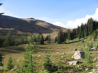 Entering high country in McCall Gulch. 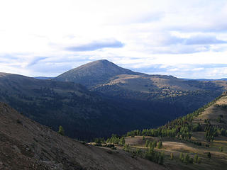 First views north to Sheep Mtn. 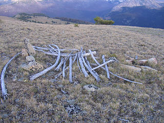 Ruins of old sheepherder's camp at 7800'. 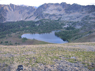 Looking down to Corral Lake from near Point 7821.' 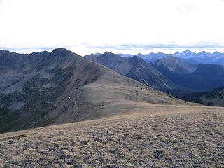 Looking southwest before dropping to Corral Lake. 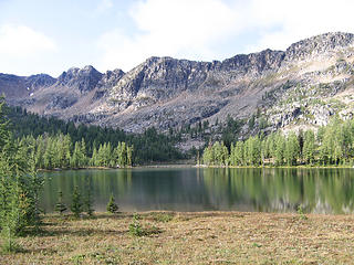 Corral Lake 7182.' 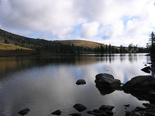 Evening at Corral Lake. 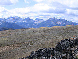 The "Pasayten Peaks" Ptarmigan, Lago, et al. 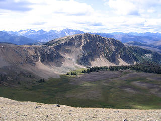 Ashnola Mtn 7780' and Whistler Basin from Sand Ridge. 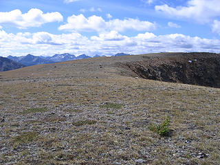 Miles of ridgerunning at around 7500.' 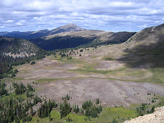 Whistler Basin, Sand Ridge, and Sheep Mtn from near Ashnola Mtn. 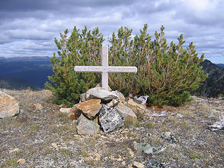 Memorial for horseman "Happy Chappy" along Sand Ridge. 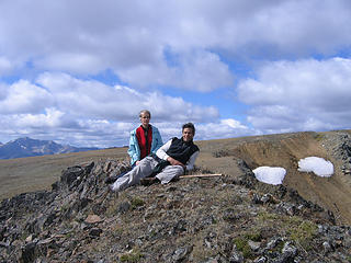 Neighbors enjoying their first summit together dubbed "Cacao Nibs Peak" 7848'. 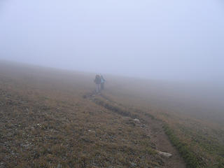 Neighbors in the mist near Pass 7500' above Corral Lake. 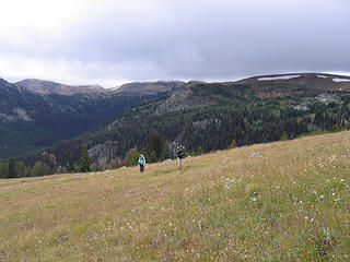 Easy cross country from Peave Pass.  Scree and talus slope we descended to Sheep Lake on cross country route from Peave Pass. 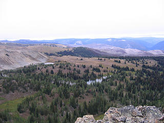 Ramon Lakes from northeast ridge of Sheep Mtn. 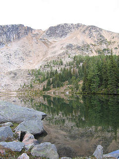 Sheep Lake 7100' and slopes of Sheep Mtn. 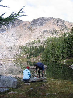 Breakfast at Sheep Lake. 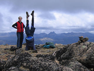 Summit follies on Sheep Mountain 8274'. 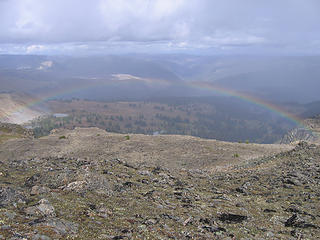 Rainbow over the basin of Ramon Lakes. 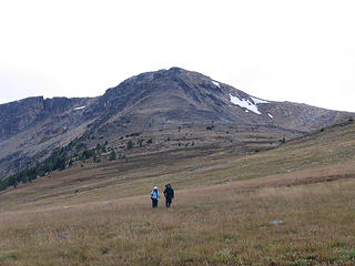 Hiking down the northeast ridge of Sheep Mtn. 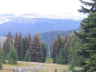 On the international boundry north of Park Pass. 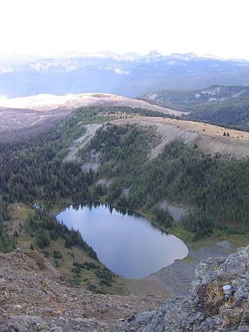 Border Lake (B.C.) from Border Lake Peak. Note logging roads and clear cuts a stone's throw from the border. 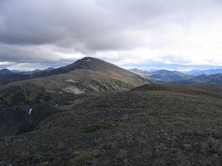 View South from Border Lake Peak 7718', 0.4 mi. N of International Boundry.  Upper Ramon Lake and Sheep Mtn. 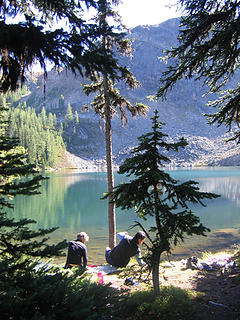 Lunch after a cold dip in Quartz Lake 6747'.. 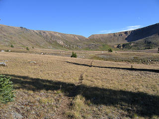 Entering Whistler Basin from the north. Whistler Pass is the notch in the center. 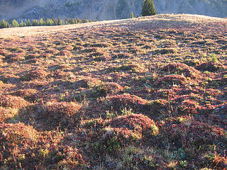 "Humps" on floor of Whistler Basin. 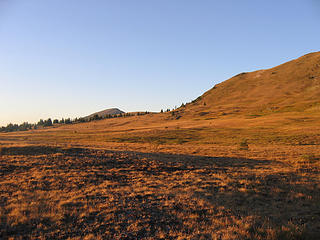 Evening light looking north from Whistler Basin. 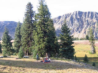 Camp at north edge of Whistler Basin.  Morning in Whistler Basin looking towards Ashnola Mtn.
|
| Back to top |
  
|
|
wildernessed
viewbagger

Joined: 31 Oct 2004
Posts: 9275 | TRs | Pics
Location: Wenatchee |
Awesome Rich, alot of nice open high country. What a treat for your neighbors, there's no turning back now. 
Living in the Anthropocene
Living in the Anthropocene
|
| Back to top |
|
|
mntsun
Wunderer
Joined: 08 Jul 2007
Posts: 206 | TRs | Pics
Location: Squaresville |
|
mntsun
Wunderer
|
Wed Sep 10, 2008 6:52 pm |
|
|
Great job, looks like a fun rambling trip.
As if there was any doubt about them being your neighbors, they broke out the headstand. Nice! 
|
| Back to top |
|
|
Flower Sniffer
Sniffer of flowers

Joined: 12 Jun 2006
Posts: 977 | TRs | Pics
Location: Snohomish, WA |
Wow, that's cool! One of these days I'm going to have to get into the Pasayten. I am trying to imagine any of my neighbors accompanying me, and it's just not working! Looks like they had fun. Well done!
If you don't know where you're going, any road will take you there.
If you don't know where you're going, any road will take you there.
|
| Back to top |
|
|
RichP
Member
Joined: 13 Jul 2006
Posts: 5634 | TRs | Pics
Location: here |
|
RichP
Member
|
Thu Sep 11, 2008 8:51 am |
|
|
Anyone hoping to visit the Pasayten before all the forest below 7,000' is dead, should do it soon. The only areas spared from the plague going on over there are the subalpine and Larch zones. I guess those beetles don't like altitude.
|
| Back to top |
|
|
Flower Sniffer
Sniffer of flowers
Joined: 12 Jun 2006
Posts: 977 | TRs | Pics
Location: Snohomish, WA |
Wow, they're really that bad?
If you don't know where you're going, any road will take you there.
If you don't know where you're going, any road will take you there.
|
| Back to top |
|
|
Hiker Mama
Member

Joined: 25 Jun 2006
Posts: 3451 | TRs | Pics
Location: Lynnwood |
|
| Back to top |
|
|
franko1946
Member

Joined: 13 Aug 2008
Posts: 6 | TRs | Pics
|
Ah, memories. In 1975 I soloed from Billy Goat Corral through Eightmile pass, Hidden Lakes, Tatoosh Buttes, and up the Pasayten river to the Parson Smith tree on the border. Came back through Dollar Watch pass, Three Fools pass, and Billy Goat pass. 6 days, 5 nights without seeing a soul until I spotted some horse packers on a nearby trail as I went through 3 fools pass on the last day. It's still one of my favorite memories. Thanks for posting the great pics.
|
| Back to top |
|
|
|
|


