| Previous :: Next Topic |
| Author |
Message |
Opus
Wannabe


Joined: 04 Mar 2006
Posts: 3700 | TRs | Pics
Location: The big rock candy mountain |
|
Opus
Wannabe
|
 Sat Feb 14, 2009 9:45 pm |
|
|
What's black and white and red all over? Red Mountain (Salmon La Sac) on a cloudy day! Okay so we had some blue thrown in there too. What better peak for Valentines day than Red mountain?
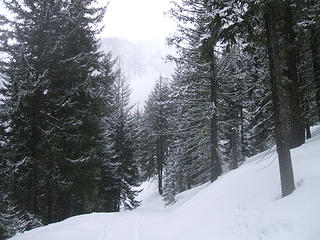
After securing a Snopark pass (we didn't know if we needed or not but better to be safe) we parked on the shoulder of the highway across the Cooper lake bridge and set out down the groomed snowmobile trail. After about 1.5 miles we came to the Red Mountain trailhead and started up the hill. Snowshoes went on right away and stayed most of the trip. Snow conditions varied wildly over the day from hard pack icy crust to deep fluffy powder and a slidey layer on top of an old crust.
The climbing was pretty steep through the trees and the heel elevator bars of the snowshoes helped greatly. We were especially nice and let Barry do most of the work, even though he had no gaiters. In the open areas of deeper steep snow Barry and Suzanne floated up quickly while Jim and I floundered, too heavy to make solid steps in the slidey snow. We all eventually regrouped below a short steep section above the trees to remove snowshoes. Out came the ice axes and Microspikes. Thankfully it was short and higher we were again on soft snow. Back on with the snowshoes.
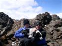
Nearing the top we swichbacked up a steep slope towards the final section. I took one step forward and immediately slid 12 feet back. After some tiring short switchbacks Jim and I caught up. We ate our lunch surveying the last steep slope to the top before again trading snowshoes for Microspikes and ice axes. Barry led the way while Suzanne and I kicked deeper steps for our descent. Views from the top were limited but still pretty with the billowing clouds and snowy trees. Across the valley towards Jolly Mountain the sky began to clear. We'd hoped to traverse over to the middle summit but it was already 2pm, 4.5 hours since leaving the car. Snow conditions were not so good so we opted to just descend.
The snow was much better going down, great for plunge stepping. I managed a very short glissade before the deep powdery snow stopped my fun. Aside from a brief encounter with a tree hole we made it back down to the groomed road in blistering time. Stepping through the little ditch along the road and onto its surface Jim was hit with severe leg and arm cramps, trapping him in the ditch. We of course had a deadline to get this report published so we pushed on. If anyone is heading up there in the near future pack an extra sandwich for him.
While we didn't set a speed record with our 4.5 hour ascent the snow conditions we made it down in less than 2 hours! Pretty good I think for the difficult snow conditions. Great Valentines day out in the mountains with friends, especially lacking a valentine myself.
Click here for all the photos.
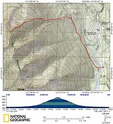 GPS tracks 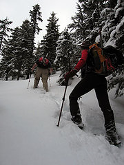 Steep 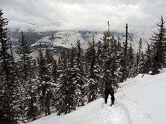 Climbing higher 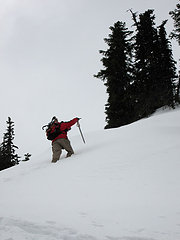 Steep slope 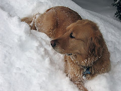 Tired Gusto  Second wind  Snow shapes 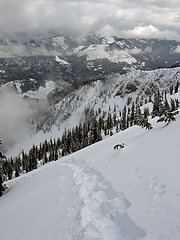 Looking back 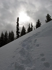 Sunbreak 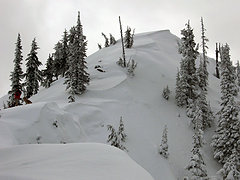 Summit  Going up 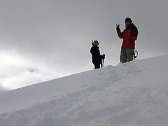 V for Valentine 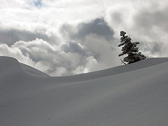 Cloudy tree  Ridge  Heading down 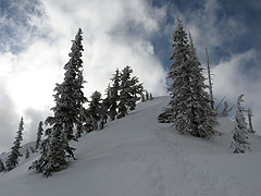 Sunny summit  Edge of the world  Summit panorama
|
| Back to top |
  
|
|
GeoTom
Member
Joined: 19 May 2005
Posts: 3215 | TRs | Pics
Location: Earth |
|
GeoTom
Member
|
Sat Feb 14, 2009 9:52 pm |
|
|
 Like "Edge of the World'
|
| Back to top |
|
|
TrailPair
Member

Joined: 17 Apr 2005
Posts: 1699 | TRs | Pics
|
You guys had to work hard for tha summit...good job! And Jim, don't make fun of Bob's cramps 
This thing called work is interfering with my play
This thing called work is interfering with my play
|
| Back to top |
|
|
JimK
Member

Joined: 07 Feb 2002
Posts: 5606 | TRs | Pics
Location: Ballard |
|
JimK
Member
|
Sat Feb 14, 2009 9:59 pm |
|
|
Hmm.... reading that report and looking at the pictures it sounds like I didn't make the summit. Oh, and I have a lousy Internet connection down in this ditch.
Bob, I will never make fun of your cramps. Seriously painful.
|
| Back to top |
|
|
John Morrow
Member

Joined: 03 Apr 2007
Posts: 1526 | TRs | Pics
Location: Roslyn |
One of my favorite skis in the right conditions. Jake and I almost headed there instead heading for near Snoqualmie pass where we thought the new snow would be a bit deeper on Humpback Mtn.
http://www.turns-all-year.com/skiing_snowboarding/trip_reports/index.php?topic=12301.0
Would have been great to have just "run into" you all up there!
Glad you had a fun one. Love the view from the top and that pretty basin!
John
Tell me, what is it you plan to do with your one wild and precious life?-Mary Oliver
A nation that continues year after year to spend more money on military defense than on programs of social uplift is approaching spiritual doom.
― MLK Jr.
Tell me, what is it you plan to do with your one wild and precious life?-Mary Oliver
A nation that continues year after year to spend more money on military defense than on programs of social uplift is approaching spiritual doom.
― MLK Jr.
|
| Back to top |
|
|
Middle E
no more moustache

Joined: 10 Feb 2008
Posts: 432 | TRs | Pics
Location: Seattle, WA |
|
Middle E
no more moustache
|
Sat Feb 14, 2009 10:15 pm |
|
|
It was a good trip, but I would have enjoyed it more if I had not forgotten those gaiters! Fortunately it was not too cold, and the exertion kept the feet warm (mostly)...
 Road crossing 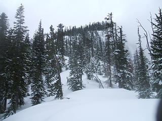 Summit ridge in the distance 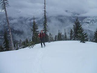 Suzanne on the ridge 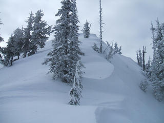 Last bit to the summit of Red 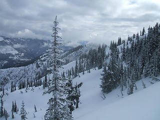 Clouds lightening 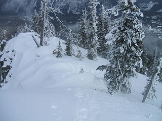 Ridgeline 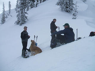 Lunch below the summit 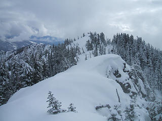 Gee, that one looks a little higher 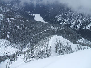 Cooper Lake from Red Mtn. 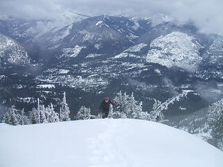 Other Teanaway peaks in the clouds
pithy yet insightful signature
pithy yet insightful signature
|
| Back to top |
|
|
Sadie's Driver
Sadie's Driver

Joined: 24 Apr 2006
Posts: 1763 | TRs | Pics
Location: Welcome Pass |
|
Sadie's Driver
Sadie's Driver
|
Sat Feb 14, 2009 10:56 pm My Valentine's
|
|
|
 Valentine heart  - all four of them - on Valentine's Day?!
David covered all the main points - here's my photo collection for the day. Great Trip! - all four of them - on Valentine's Day?!
David covered all the main points - here's my photo collection for the day. Great Trip!  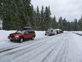 Crowd joins us! 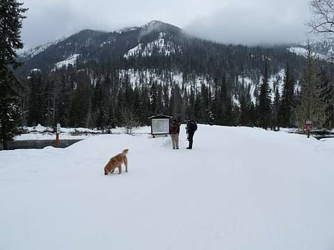 Our destination off in the distance 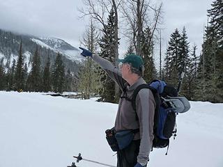 Man describing the destination 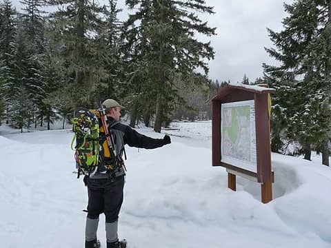 Man with a destination 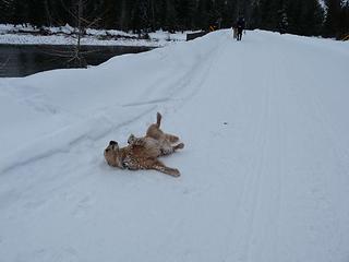 Soooo happy! Feb. 14, 2009 - heading to Red Mountain 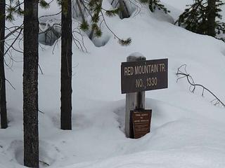 Our destination 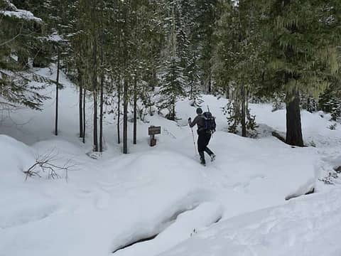 Crossing the creek 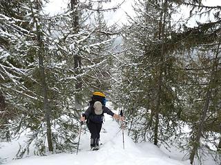 Shifting "sands" of sugary snow
(say that five times!) 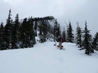 False summit ahead 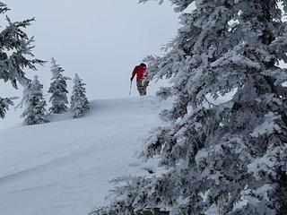 Barry heads to the sub-summit 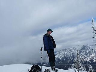 Sub-summit footwear debate 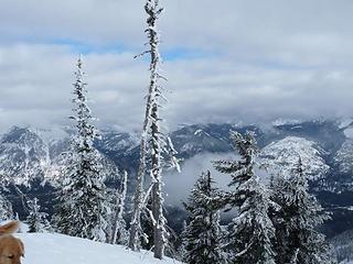 Blue peeking through to the north 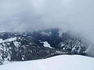 Cooper Lake to the north 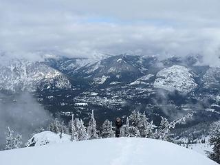 David just about to summit - valley below 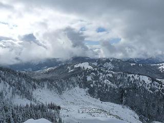 Looking south/southwest from summit 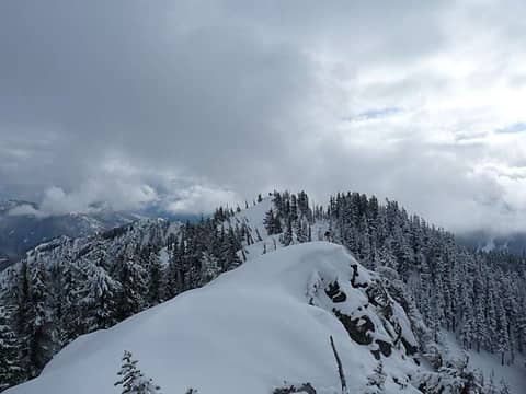 Looking South to the other summit 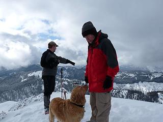 The boys on the summit 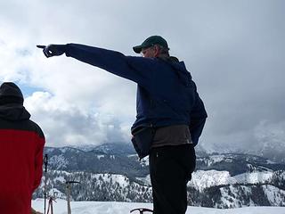 Oh yes, Jim K DID summit - and the pointer still works! 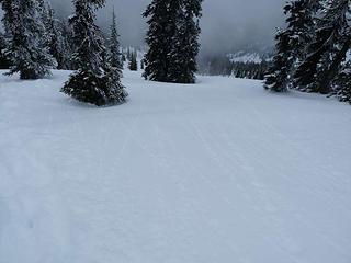 Tracks of snowballs running down the mountain 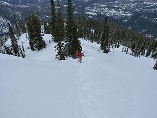 Fairly steep little hill! 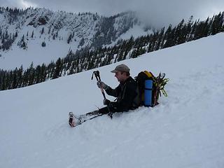 Slow glissade for David 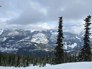 1 label Jolly Mountain across the valley to the east 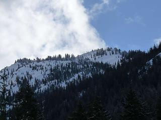 Red, White and Blue!
Four-paw buddy lets me tag along!
Four-paw buddy lets me tag along!
|
| Back to top |
|
|
EastKing
Surfing and Hiking

Joined: 28 Mar 2007
Posts: 2082 | TRs | Pics
Location: 77 miles from Seattle! |
|
EastKing
Surfing and Hiking
|
Sun Feb 15, 2009 1:35 am |
|
|
Great TR and photos!!! Is the road clear to head to Jolly Mountain. That will be my destination next week to finish off what I started in December.
YouTube | SummitPost
Saw the depths of despair. Now I am salvaging what time I have left on Earth.
YouTube | SummitPost
Saw the depths of despair. Now I am salvaging what time I have left on Earth.
|
| Back to top |
|
|
gone
Member

Joined: 08 Feb 2008
Posts: 1051 | TRs | Pics
|
|
gone
Member
|
Sun Feb 15, 2009 3:18 am |
|
|
"Red, White and Blue!"  That really is a steep little hill. Wandered around the bottom of it last fall, will have to climb it for sure this summer. Can't imagine kicking up it with snowshoes through that much snow and that much steep, though. Nice work!
|
| Back to top |
|
|
JimK
Member
Joined: 07 Feb 2002
Posts: 5606 | TRs | Pics
Location: Ballard |
|
JimK
Member
|
Sun Feb 15, 2009 8:57 am |
|
|
Yeah, it's a bit steep. The first 1 1/2 miles of road gains 300'. From there it's only 2 miles to the summit gaining 3200'.
|
| Back to top |
|
|
Opus
Wannabe
Joined: 04 Mar 2006
Posts: 3700 | TRs | Pics
Location: The big rock candy mountain |
|
Opus
Wannabe
|
Sun Feb 15, 2009 9:47 am |
|
|
| EastKing wrote: | | Great TR and photos!!! Is the road clear to head to Jolly Mountain. That will be my destination next week to finish off what I started in December. |
You can drive as far as the Salmon la Sac snopark, beyond that it's snowed in so you will be on snowshoes from the start. We went up Jolly last May on snow pretty much the whole way and it's a real haul. In snow like we had on Red it would be even harder. Bring a lot of recruits to break trail!
Trip report from last year with route info here.
|
| Back to top |
|
|
tigermn
Member

Joined: 10 Jul 2007
Posts: 9242 | TRs | Pics
Location: There... |
|
tigermn
Member
|
Sun Feb 15, 2009 11:35 am |
|
|
| Opus wrote: | | EastKing wrote: | | Great TR and photos!!! Is the road clear to head to Jolly Mountain. That will be my destination next week to finish off what I started in December. |
You can drive as far as the Salmon la Sac snopark, beyond that it's snowed in so you will be on snowshoes from the start. We went up Jolly last May on snow pretty much the whole way and it's a real haul. In snow like we had on Red it would be even harder. Bring a lot of recruits to break trail!
Trip report from last year with route info here. |
Yea I'd call 6+ miles one way and 4800 climbed a pretty good haul especially in the snow. Do you have the actual GPS data/tracks still hanging around somewhere?
|
| Back to top |
|
|
Opus
Wannabe
Joined: 04 Mar 2006
Posts: 3700 | TRs | Pics
Location: The big rock candy mountain |
|
Opus
Wannabe
|
Sun Feb 15, 2009 6:18 pm |
|
|
| tigerjr wrote: | | Yea I'd call 6+ miles one way and 4800 climbed a pretty good haul especially in the snow. Do you have the actual GPS data/tracks still hanging around somewhere? |
We even wore Gusto out on that trip. The map in the trip report I linked shows my GPS tracks but I do have the data file if anyone wants it. Most of the route is pretty self explanatory - up the road, then follow the ridges to the top.
|
| Back to top |
|
|
Highwalker's Daughter
Member
Joined: 12 Aug 2006
Posts: 1575 | TRs | Pics
Location: Bothell, WA |
Fantastic pictures - looks like a great trip even for the tired doggy.
|
| Back to top |
|
|
Sadie's Driver
Sadie's Driver
Joined: 24 Apr 2006
Posts: 1763 | TRs | Pics
Location: Welcome Pass |
Four-paw buddy lets me tag along!
|
| Back to top |
|
|
|
|


