| Previous :: Next Topic |
| Author |
Message |
MountainMan
Member


Joined: 15 Jul 2008
Posts: 365 | TRs | Pics
Location: San Diego |
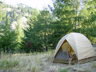
We picked Carne Mtn. for Sunday since it seems fairly close to Duncan Hill, our Saturday trip. However, as we discovered, even with cutting through on forest roads, the driving time is close to three hours between trailheads!  So, after doing Duncan Hill on Saturday, we turned off of the Entiat River Rd onto Mad River Rd and then onto FR 5800 and found a place to camp a ways in on a spurr rd. In the morning we woke up to a nice sunny day & great views of nearby hills. So, after doing Duncan Hill on Saturday, we turned off of the Entiat River Rd onto Mad River Rd and then onto FR 5800 and found a place to camp a ways in on a spurr rd. In the morning we woke up to a nice sunny day & great views of nearby hills.
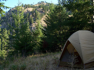 Our campsite 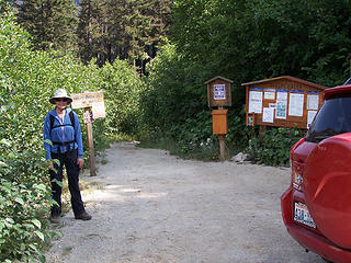 BC at the TH 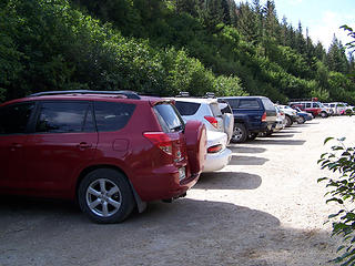 We got the 3rd spot down! 
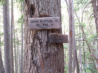 Junction sign 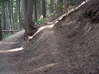 Start of Carne Mtn Trail 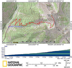 Carne Mtn. topo
8 miles RT
3600' gain 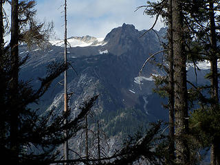 Early views 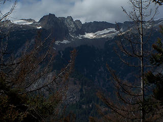 Early views 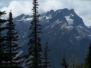 Buck Mtn 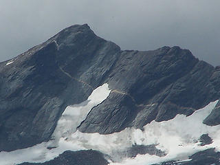 I thought the white line was a trail at first 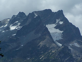 Buck Mtn 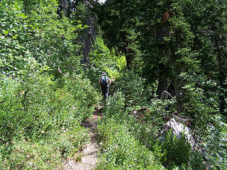 Headed up the trail 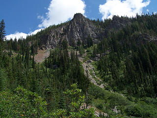 Small pk near Carne 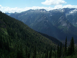 Views along the trail 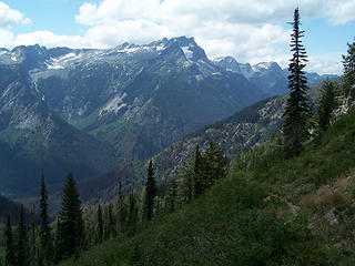 Views along the trail 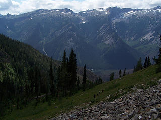 Day hikers headed down from Carne Mtn. 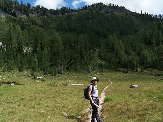 BC in the basin 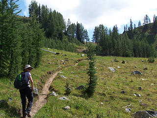 BC heading up through the basin 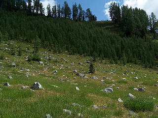 Saddle below Carne 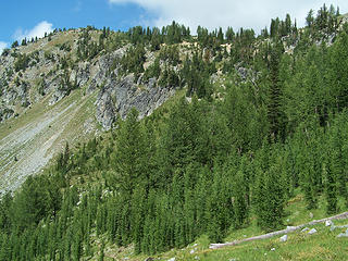 Carne Mtn from basin below 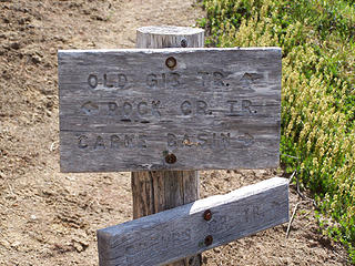 Junction 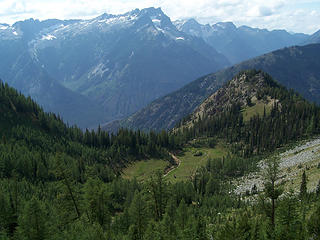 Looking down at the basin 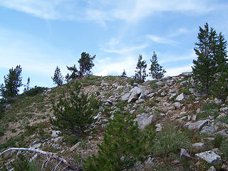 Close to the summit  We took tons of pictures and looked at our map trying to put names to all the mountains around us. The most impressive nearby mtn. is Mt Maude, which we've added to our list. We took tons of pictures and looked at our map trying to put names to all the mountains around us. The most impressive nearby mtn. is Mt Maude, which we've added to our list.  We then had a quick snack, got our group pics, searched for a summit register (but didn't find any) and all to soon had to go back down. We then had a quick snack, got our group pics, searched for a summit register (but didn't find any) and all to soon had to go back down. 
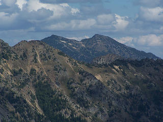 Duncan Hill from Carne Mtn. 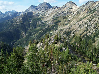 Looking north towards Mt Maude. 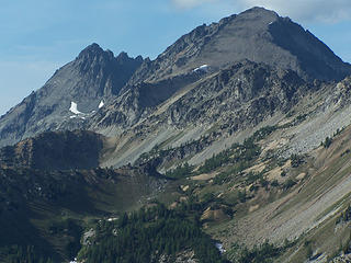 Seven Fingered Jack and Mt Maude 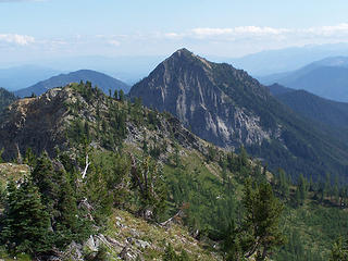 Old Gib Mtn 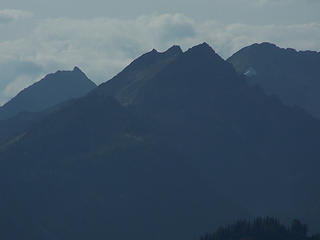 Silhouettes 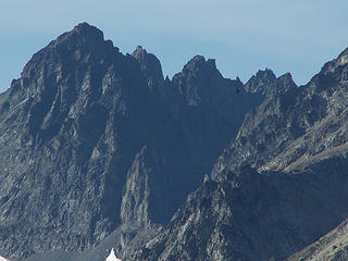 Zoom of Seven Fingered Jack 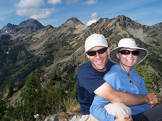 MM and BC on Carne Mtn 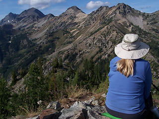 BC taking in the views 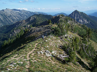 BC heading down from the summit 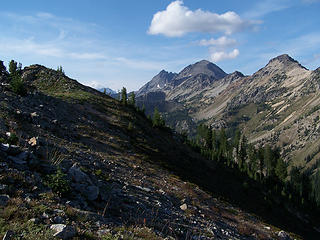 Carne summit and Mt Maude 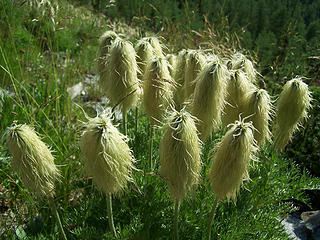 Fluffy 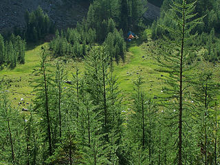 Backpackers camping in the meadow 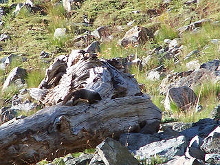 Marmot 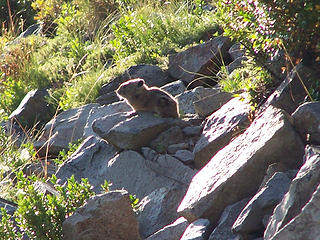 Pika 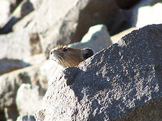 Pika 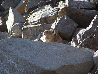 Pika  
Slow down, take notice, savor the moment, appreciate the world around you and everything that you have.
Slow down, take notice, savor the moment, appreciate the world around you and everything that you have.
|
| Back to top |
  
|
|
Bloated Chipmunk
Cock Rock Searcher

Joined: 29 Jan 2007
Posts: 2993 | TRs | Pics
Location: Margaritaville |
What a nice peak w/awesome views!!  Here are my pics from the hike: Here are my pics from the hike:
 Camp 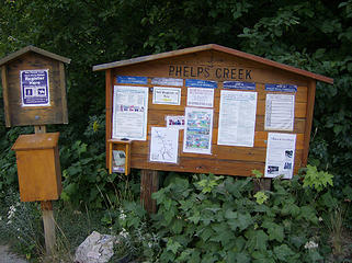 Phelps Crk. TH 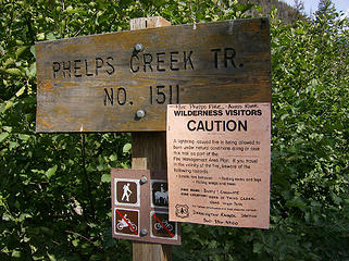 TH sign 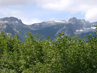 Views from parking area 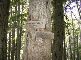 Junction 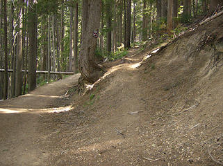 Go to the right for solitude, left to join the masses 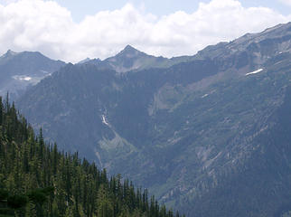 Views open up 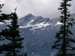 Peaks across the way 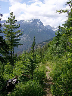 Nice views 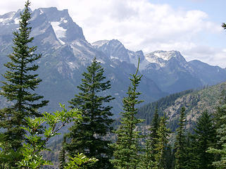 Buck & others 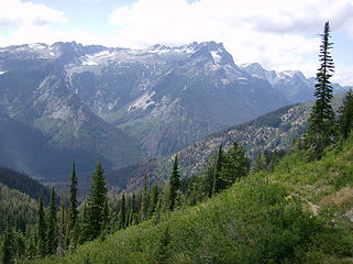 Scenic trail 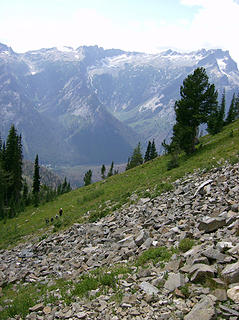 Hikers heading down 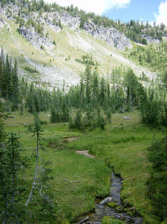 Carne Basin 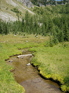 Lil' stream 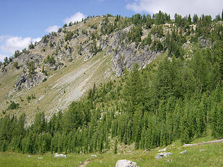 Carne summit up there somewhere... 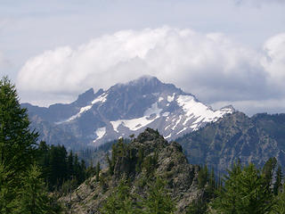 Fortress Mtn. 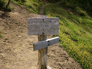 Junction w/the Old Gib trail 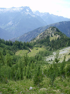 Carne Basin 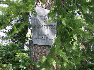 GPW sign 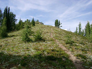 Approaching the summit 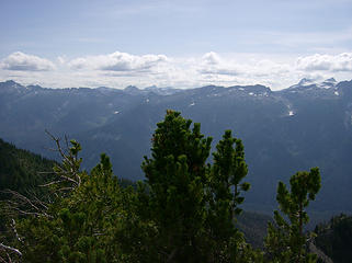 Looking across @ Chiwawa Ridge 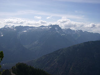 Views from on top 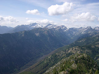 Views from on top 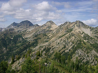 Views from on top 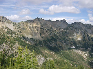 Views from on top 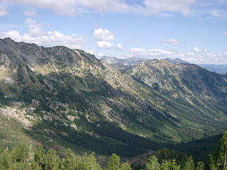 Views from on top 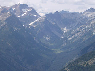 Spider Meadows & Gap 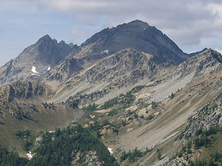 Seven Fingered Jack & Mt. Maude 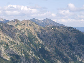 Duncan Hill in the distance 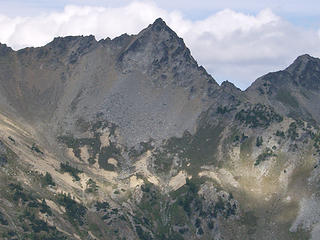 Spire next to Pt. 7968'(?) 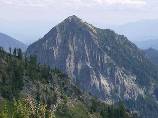 Old Gib Mtn. to the south 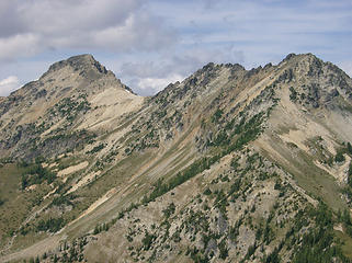 Pt. 8112' & 7811' 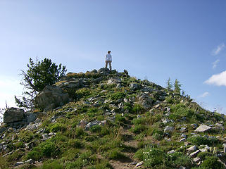 MM on top of Carne Mtn. 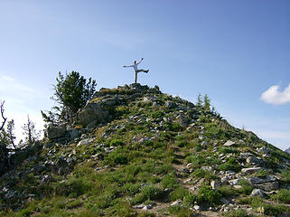 Pulling a Bingram 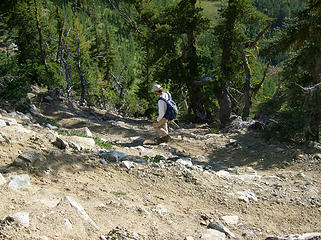 Headed down the steep short switchbacks 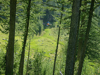 Peeps camped in the basin below 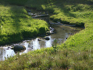 Back to the lil' stream
Home is where the hiking is.
"Peaks that have come and gone four times should halt a man in his steps." -- William O. Douglas
A balanced diet is a margarita in each hand.
Home is where the hiking is.
"Peaks that have come and gone four times should halt a man in his steps." -- William O. Douglas
A balanced diet is a margarita in each hand.
|
| Back to top |
|
|
Galadriel
Member

Joined: 17 Jun 2003
Posts: 249 | TRs | Pics
|
Thanks for the informative trail report. I'm planning an overnight trip in October to see the larches. Looks like the basin is a perfect camp site.
|
| Back to top |
|
|
raz2sea
Daddy RAZ

Joined: 04 Dec 2007
Posts: 1060 | TRs | Pics
Location: Seattle |
|
raz2sea
Daddy RAZ
|
 Thu Aug 13, 2009 7:36 pm |
|
|
Nice trip you two!! You were so lucky to find parking right up front, go back about 300 yds to where the cars were on both sides of the road and you would have found my car...
|
| Back to top |
|
|
Magellan
Brutally Handsome

Joined: 26 Jul 2006
Posts: 13116 | TRs | Pics
Location: Inexorable descent |
|
Magellan
Brutally Handsome
|
Thu Aug 13, 2009 9:26 pm |
|
|
Nice TR guys.
Can anyone do some labeling on the panos for me? Please.
|
| Back to top |
|
|
Opus
Wannabe

Joined: 04 Mar 2006
Posts: 3700 | TRs | Pics
Location: The big rock candy mountain |
|
Opus
Wannabe
|
Fri Aug 14, 2009 12:02 am |
|
|
You should go up into Leroy Creek basin and do the old trail that runs from there out to Carne and back down that trail for the full loop. You could camp in Chipmunk creek basin too.
|
| Back to top |
|
|
EastKing
Surfing and Hiking

Joined: 28 Mar 2007
Posts: 2082 | TRs | Pics
Location: 77 miles from Seattle! |
|
EastKing
Surfing and Hiking
|
Fri Aug 14, 2009 3:26 pm |
|
|
YouTube | SummitPost
Saw the depths of despair. Now I am salvaging what time I have left on Earth.
|
| Back to top |
|
|
|
|


