| Previous :: Next Topic |
| Author |
Message |
Jeb
Summit Driven

Joined: 21 Jul 2012
Posts: 251 | TRs | Pics
Location: Seattle |
|
Jeb
Summit Driven
|
 Sun Dec 08, 2013 4:32 pm |
|
|
View larger size in new window
On Saturday I had some afternoon plans in Shelton, so Colin and I decided to hit up the Olympics for some early morning peak-bagging. Thanks to some recent beta from a few NW Hikers Colin and I were able to make a confident attempt at Mount Washington. We drove through Hoodsport around 6:30 as the morning light crept in. After turning left on road 2419 a small coyote(or possibly a fox?) leaped onto the road and began running up it as if we were in hot pursuit. We followed behind in amusement as it sprinted up the road with no apparent intention to head for the woods on either side. After a minute or so we backed off to give the road-running coyote a chance to leave the road, but when we continued on a few minutes later we quickly caught up as it caught it's breath and then finally decided to retreat into the brush. I misread the trail's location just north of the junction for road 014 to the Mount Ellinor Trailhead. Instead we took the turn, realizing the mistake as we stopped to admire the pre-dawn light just before arriving at the trailhead.
Conditions:
The last 2 miles of forest road had an inch of compact snow and ice in the ruts. Microspikes were useful from the get go, there were several thick cascades of ice covering the trail before the basin. The trail itself was pretty overgrown but well traveled and easy to read. We mostly followed someone's path where it wasn't covered in drifting snow, opting for the frozen creek bed over the snowy bushwhack for some of the section just above the basin. Near the top was less than 6" of snow, except for a few small fields which were several feet deep. We found very little firm snow above 4000 feet. If it were much deeper some movement seemed very possible. Most of the summit block was dry, with a light dusting on the West face. Loose snow above exposure blocked the bootpath ~60 feet below the summit. The dog stopped there, but we managed to scramble up the exposed West face.
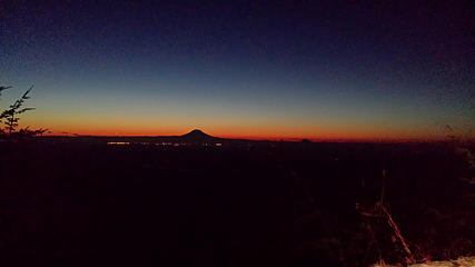
The trail before and after the basin was some of the most painful travel over tons of blowdowns and through thick snow-covered brush. A few peaks on the Ellinor-Washington Ridge were bathed in alpenglow when we reached the basin. However, neither summit is visible from there. We came armed with a great route description but ended up following what looked like a single pair of tracks, which stayed on the bootpath wherever it was visible. Above the four small peaks South of the main ridge we carefully crossed 3 steep slopes exposed slopes, the second and third of which had only a few feet of run-out before a long vertical drop. Rainier, Adams, and Saint Helens were barely visible between the low sun and some haze, but from the saddle the Olympics were clear as day.
Maverick needed a boost and some encouragement a few times to make it across the final traverse below the summit, but to continue with him would have been far too dangerous. Just past the overhung bivy spot on the bootpath ~60 feet below the summit to the SE we stopped where a deep snow bank covered the path above some serious exposure. Colin back-tracked a bit and found an exposed scramble route up the West face that I thought was only a little sketchy, and mostly due to the loose snow scattered around. The summit register is a collection of notebooks and loose paper, but there is a working pen!
We traded off visiting the top and hanging with the dog and then hurried down to make it back to Kapowsin Air Sports before sunset. A group of six were making their way up as we crossed paths after leaving the ridge top. We made it down to the truck less than 2 hours after leaving the top and had just enough time to stop in Shelton for a quick skydive before heading home. This epic adventure concludes my time with aDam the Fazed beaver. He is now off to Massachusetts for some new scenery.
 Pre-dawn at the Mount Ellinor Trailhead 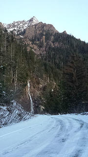 Mount Washington form the unofficial trailhead 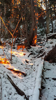 Morning alpenglow 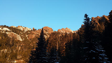 Alpenglow on Mount Washington 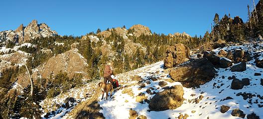 Mount Washington Bootpath 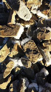 Hoar frost 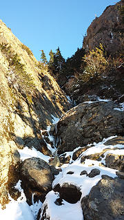 Gully above the basin 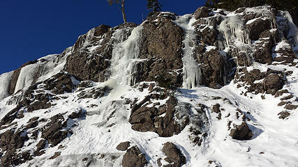 Icefalls 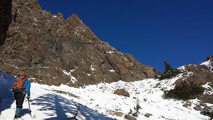 Just below the ridge top 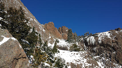 The route ahead 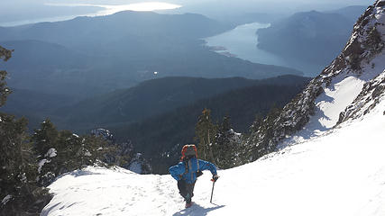 Colin ascending above Mount Cushman 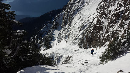 Colin crossing an exposed section 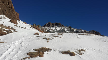 Mount Washington's summit 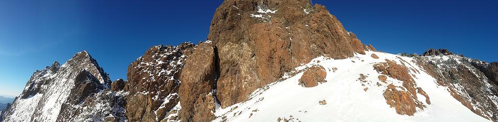 Ridge to Mount Ellinor on left, Mount Washington Summit right 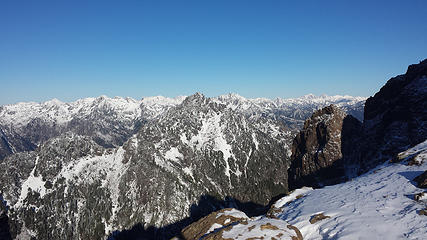 Olympic National Forest 2 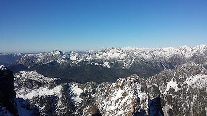 Olympic National Forest 1 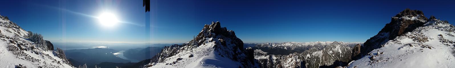 Saddle Pano 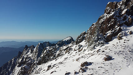 Mount Ellinor from the Saddle 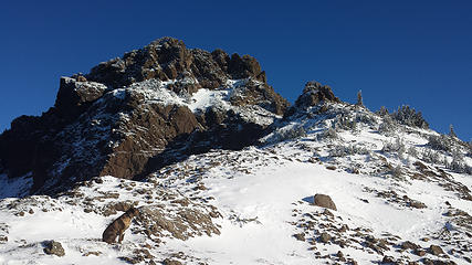 Mount Washington's summit 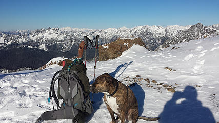 aDam and Maverick at the Saddle 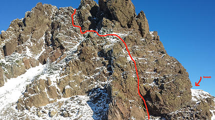 Our route up the West face 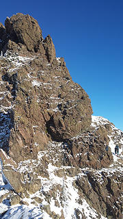 Colin on the bootpath just below summit 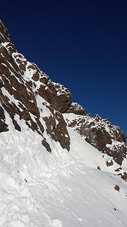 Snow covered bootpath 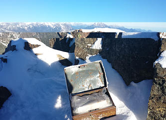 Summit register 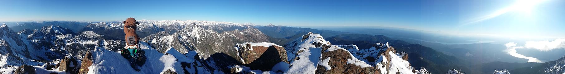 Summit Pano 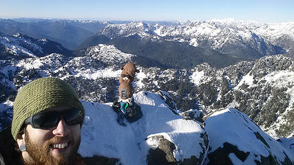 With aDam on Mount Washington's summit 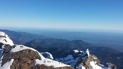 Hood Canal, Seattle, The Cascades 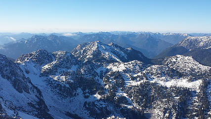 Copper Mountain 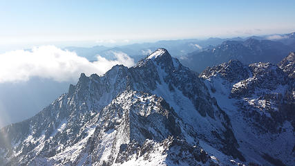 Mount Ellinor 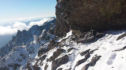 Shelter below summit 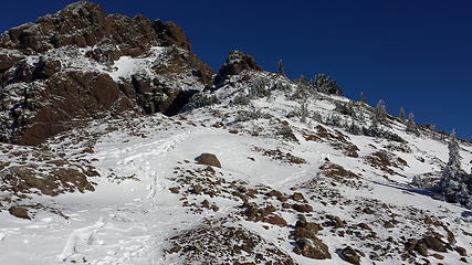 Mount Washington summit 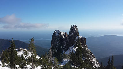 Small Peaks south of Mount Washington's summit 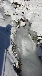 Frozen creek 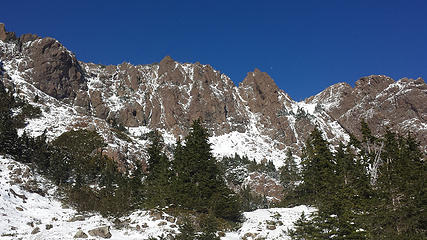 Mount Washington 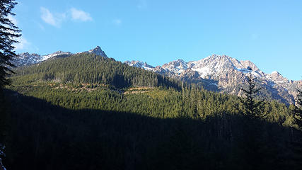 Mount Ellinor and Mount Washington from the access road 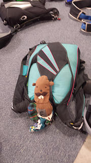 aDam, meet Talon
|
| Back to top |
  
|
|
RichP
Member

Joined: 13 Jul 2006
Posts: 5634 | TRs | Pics
Location: here |
|
RichP
Member
|
Sun Dec 08, 2013 4:53 pm |
|
|
Looks like a perfect day in the mountains.
I can't imagine how cold a skydive must have been.
|
| Back to top |
|
|
weflybye
Guest

|
|
weflybye
Guest
|
Tue Dec 10, 2013 6:57 pm |
|
|
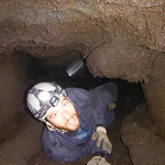
We were part of the group that passed you - one of our group members snapped this picture of you three 
|
| Back to top |

|
|
Jeb
Summit Driven
Joined: 21 Jul 2012
Posts: 251 | TRs | Pics
Location: Seattle |
|
Jeb
Summit Driven
|
Thu Dec 12, 2013 7:52 am |
|
|
thanks!, glad to hear you made it up and down safely!
|
| Back to top |
|
|
|
|
You cannot post new topics in this forum
You cannot reply to topics in this forum
You cannot edit your posts in this forum
You cannot delete your posts in this forum
You cannot vote in polls in this forum
|
Disclosure: As an Amazon Associate NWHikers.net earns from qualifying purchases when you use our link(s). |


