| Previous :: Next Topic |
| Author |
Message |
Tom
Admin

Joined: 15 Dec 2001
Posts: 17854 | TRs | Pics
|
|
Tom
Admin
|
 Sat Oct 30, 2021 10:45 pm |
|
|
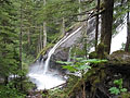
Nice, I don't recall Upper Twin being turbid. Maybe from recent slide activity?
|
| Back to top |
  
|
|
xallas
Member

Joined: 05 Feb 2017
Posts: 17 | TRs | Pics
Location: Seattle |
|
xallas
Member
|
Sun Oct 31, 2021 8:08 pm |
|
|
Did another hike this Sunday, it was a crime not to do anything in that kind of weather!
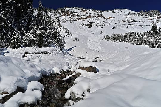
Tried going up the Sourdough via diablo lake trailhead, unfortunately had to turn around when we no longer could find a way around avy debris fields and very obviously loaded and ready to go slopes.
Snow started and we put on microspikes around 4400ft, followed somebody's very deep postholes until camp area, after which no more tracks. Switched to snowshoes and we were able to get to roughly 5400ft before we run into avy slopes all over the place, snow starting from the camp was soft to the point I was postholing with my snowshoes. Need to research winter route from now on, this much snow(waist deep) is not going away anytime soon.
 Cyclopath Cyclopath
Cyclopath |
| Back to top |
|
|
zephyr
aka friendly hiker

Joined: 21 Jun 2009
Posts: 3370 | TRs | Pics
Location: West Seattle |
|
zephyr
aka friendly hiker
|
Sun Oct 31, 2021 8:52 pm |
|
|
Whoaaaa buddy. Yikes!
Great that you got to see as much as you did. That sky looks incredibly clear. ~z
|
| Back to top |
|
|
Chief Joseph
Member

Joined: 10 Nov 2007
Posts: 7709 | TRs | Pics
Location: Verlot-Priest Lake |
That's way cool and makes me jealous that you got up to Twin lakes before the big snows hit Xallas...but there's no way I would go there this late, I want to go when there are bugs and fish rising to them. Just like the Mariners and probably the Seahawks, maybe next year. 
Go placidly amid the noise and waste, and remember what comfort there may be in owning a piece thereof.
Go placidly amid the noise and waste, and remember what comfort there may be in owning a piece thereof.
|
| Back to top |
|
|
xallas
Member
Joined: 05 Feb 2017
Posts: 17 | TRs | Pics
Location: Seattle |
|
xallas
Member
|
Sun Oct 31, 2021 9:27 pm |
|
|
We actually saw a bald eagle, it might be the same bald eagle we saw at river crossing down at the Monte cristo swooping just over our heads and it somehow followed us. But It was fighting some nasty wind up there. We were not expecting it to be that bad.
https://photos.app.goo.gl/ZVLyuQASJeFRX99r8
Chief Joseph
Chief Joseph |
| Back to top |
|
|
neek
Member

Joined: 12 Sep 2011
Posts: 2338 | TRs | Pics
Location: Seattle, WA |
|
neek
Member
|
Mon Nov 01, 2021 8:57 am |
|
|
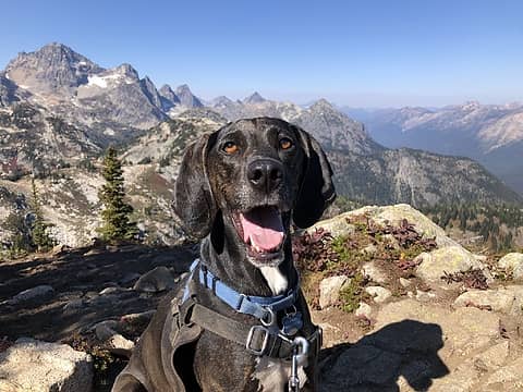
Copper Ridge loop (clockwise) over the weekend. First snowshoe of the season! Camped on snow at Copper Lake. We were the only ones to venture past Hannegan Pass and could be the last party of the season. Cable car over the Chilliwack was fun; crotch-deep ford downstream not so much! Snowshoes worn above 4600'. 36 mi 9000' over 2 days.
 Just beyond Hannegan Pass 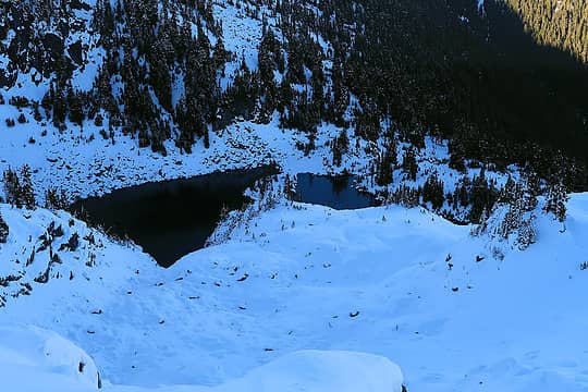 Copper Lake 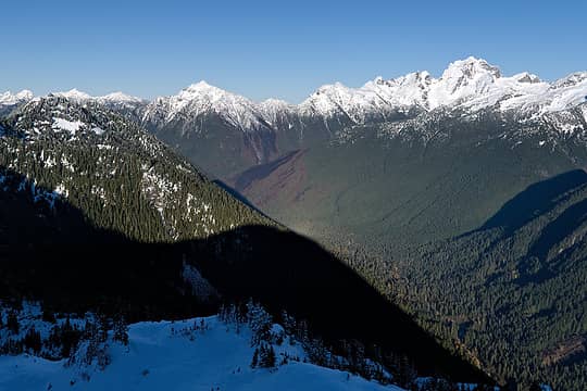 Bear Creek burn 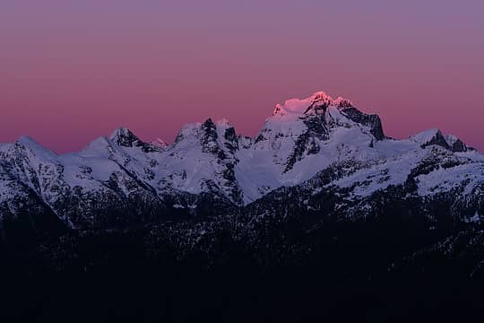 Redoubt sunset 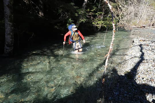 Crossing the first (easiest) Chilliwack. The second one we dubbed Chilliwillywack 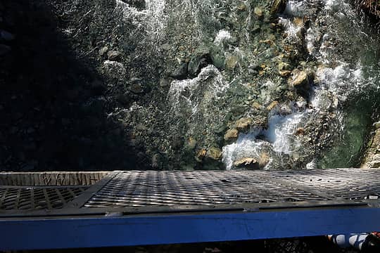 Looking down from cable car
Cyclopath, Anne Elk, cascadetraverser, abkoch3, Slim, reststep, Silas, NBL, hikerbiker, Tom, Route Loser, awilsondc, xallas, kitya, pjhorst  KascadeFlat KascadeFlat
Cyclopath, Anne Elk, cascadetraverser, abkoch3, Slim, reststep, Silas, NBL, hikerbiker, Tom, Route Loser, awilsondc, xallas, kitya, pjhorst KascadeFlat |
| Back to top |
|
|
timberghost
Member
Joined: 06 Dec 2011
Posts: 1332 | TRs | Pics
|
|
| Back to top |
|
|
RichP
Member

Joined: 13 Jul 2006
Posts: 5634 | TRs | Pics
Location: here |
|
RichP
Member
|
Wed Nov 24, 2021 7:15 pm |
|
|
Made the little hike up to Fuller Mountain on The North Fork Snoq today. The trail is actually very easy to follow except for close to the tippy top and I brought some tools along to do a bit of work. I cleaned up some storm debris off the trail and cut some trees that were problematic to step over. A sizable tree is down right at the start of the trail which was more than I could handle on this outing.
The current log crossing over Ten Ck appears to be different from the old one based on pics I've seen. It has some new chicken wire and nails to help with footing and is located a few yards north of what appear to be the old footings. It looks more narrow but I had no trouble crossing it the wet.
Nice viewpoint from the overlook near the summit. 10 bucks for the day use permit from Campbell Global.
Edit to add 11/26 I returned today with reinforcement troops and we removed the tree that was blocking the trailhead. Nice and open now. Sprung for the 60.00 annual family permit which is good through March 31 since I can bag some dumpster peaks in the area through the winter and poke around here a bit more. A steady stream of what I assume to be hunters were coming and going through the gate today given all the camo. Way more fun than shopping!
Cyclopath, Fedor, Nancyann, Fletcher, raising3hikers
Cyclopath, Fedor, Nancyann, Fletcher, raising3hikers |
| Back to top |
|
|
Malachai Constant
Member

Joined: 13 Jan 2002
Posts: 16093 | TRs | Pics
Location: Back Again Like A Bad Penny |
North shore Oahu did some waterfall hikes  surfs up saw some nice competitions 85, ack soon surfs up saw some nice competitions 85, ack soon  . .
"You do not laugh when you look at the mountains, or when you look at the sea." Lafcadio Hearn
"You do not laugh when you look at the mountains, or when you look at the sea." Lafcadio Hearn
|
| Back to top |
|
|
Now I Fly
Member
Joined: 07 Jun 2018
Posts: 467 | TRs | Pics
|
|
| Back to top |
|
|
zephyr
aka friendly hiker
Joined: 21 Jun 2009
Posts: 3370 | TRs | Pics
Location: West Seattle |
|
zephyr
aka friendly hiker
|
Thu Dec 02, 2021 9:25 pm |
|
|
| Now I Fly wrote: | | whoa, lazy. |
Beautiful photos--especially that last one looking towards Mt. Stuart from Navaho Peak. You definitely picked a great day to do that hike.
There's not much snow at all in the beginning. Was this trip recent?
~z
|
| Back to top |
|
|
Now I Fly
Member
Joined: 07 Jun 2018
Posts: 467 | TRs | Pics
|
| zephyr wrote: | | There's not much snow at all in the beginning. Was this trip recent? |
This was on Monday, 11-29. Didn't see a soul, or any fresh tracks, all day. I was surprised there were no tracks at all from Navaho's summit down to the pass. Below the pass had seen a few folks in recent days/week.
|
| Back to top |
|
|
RichP
Member
Joined: 13 Jul 2006
Posts: 5634 | TRs | Pics
Location: here |
|
RichP
Member
|
Sat Dec 11, 2021 3:42 pm |
|
|
Did a short hike up the North Fork of Asotin Creek yesterday in the Asotin Ck Wildlife Area. The road is gated about 1/2 mile before the trailhead to protect winter wildlife habitat. About 3 miles in I turned up the ridge and looped back down to the trailhead over Bracken Point. Fires ripped through here last summer and mostly just cleared some underbrush but did take some of the forest as well.
Saw some bighorns while approaching Bracken Point but couldn't get a clear pic with the cell phone from a distance. They were long gone when I got up there.
This area will be closed to human entry starting Dec 1st until April 1st in order to assist wildlife after the fires. Details here:
https://lmtribune.com/northwest/asotin-creek-area-to-close/article_f2e4234f-7b43-5a06-90f2-862fa5635204.html
Cyclopath, Fedor, awilsondc, JimK
Cyclopath, Fedor, awilsondc, JimK |
| Back to top |
|
|
zephyr
aka friendly hiker
Joined: 21 Jun 2009
Posts: 3370 | TRs | Pics
Location: West Seattle |
|
zephyr
aka friendly hiker
|
Sat Dec 11, 2021 7:12 pm |
|
|
Such a great hike this looks to be. I love the perspective on this one. ~z
|
| Back to top |
|
|
some names
Member

Joined: 08 Jan 2012
Posts: 244 | TRs | Pics
|
We remember The Knoll. It was very nice. It seems like a very attractive NW hiker place! A very prominent great lunch spot! This is late, we havent been posting much lately . . . we are still working on some lingering knee replacement issues. Doing well, patience is the key! Puzzlr, thanks for your post thanks for mentioning us, its a reminder of how much we enjoy this hiking stuff.
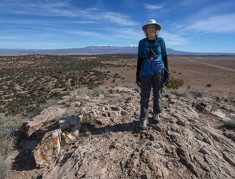 On The Knoll, "Plateau" Benchmark just in front of Tish's foot 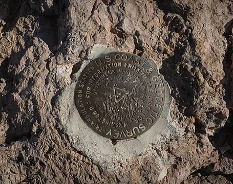 "Plateau" Benchmark at The Knoll 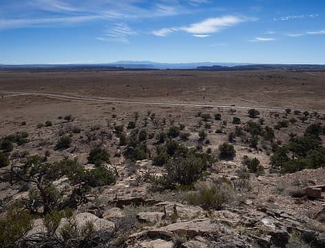 View SW from The Knoll - Henry Mtns in far distance. Convenient parking along road to Deadhorse SP in view 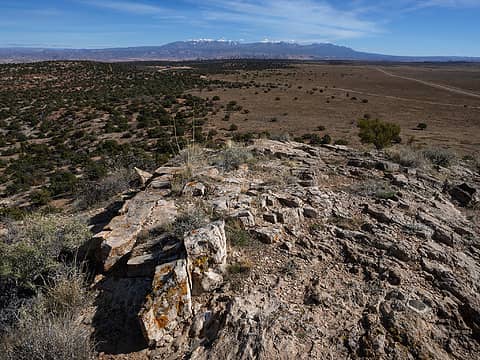 View SE to the La Sal Mtns from The Knoll 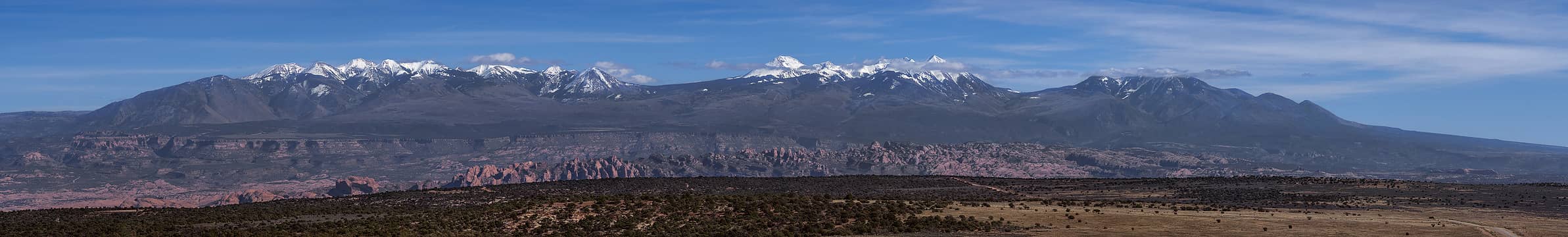 A closer look at the La Sal Mtns from The Knoll  Saw this at the base of The Knoll . . .
somesignaturehere and somesignaturethere
somesignaturehere and somesignaturethere
|
| Back to top |
|
|
|
|
You cannot post new topics in this forum
You cannot reply to topics in this forum
You cannot edit your posts in this forum
You cannot delete your posts in this forum
You cannot vote in polls in this forum
|
Disclosure: As an Amazon Associate NWHikers.net earns from qualifying purchases when you use our link(s). |


