| Previous :: Next Topic |
| Author |
Message |
zephyr
aka friendly hiker


Joined: 21 Jun 2009
Posts: 3370 | TRs | Pics
Location: West Seattle |
|
zephyr
aka friendly hiker
|
 Wed May 31, 2023 2:45 pm |
|
|
These are gorgeous (especially if you click to enlarge). ~z
 Now I Fly Now I Fly
Now I Fly |
| Back to top |
  
|
|
Cyclopath
Faster than light

Joined: 20 Mar 2012
Posts: 7727 | TRs | Pics
Location: Seattle |
|
Cyclopath
Faster than light
|
Sat Jun 03, 2023 9:34 pm |
|
|
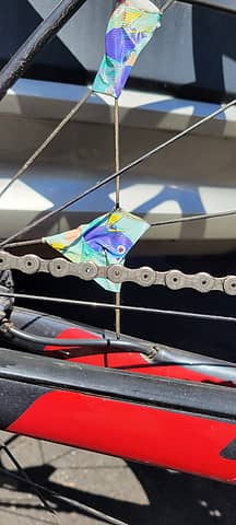 Popped a spoke, immobilized it for the descent with Finding Nemo tape
mike, reststep, Pef, KascadeFlat, zimmertr, rossb, jaysway, mosey, Now I Fly, HitTheTrail
mike, reststep, Pef, KascadeFlat, zimmertr, rossb, jaysway, mosey, Now I Fly, HitTheTrail |
| Back to top |
|
|
rossb
Member

Joined: 23 Sep 2002
Posts: 1679 | TRs | Pics
|
|
rossb
Member
|
Thu Jun 08, 2023 10:51 am |
|
|
Went up Dickerman yesterday. No snow at the waterfall crossing, but snow a little while later. I would not recommend the winter route. I went on the summer route and there was intermittent snow of various depths. Even though I've done the hike at least a dozen times in the snow, I liked having a GPS handy (measure twice, cut once). Some of the pathways up top are messy (they no longer "go") so following old tracks isn't always the best thing.
KascadeFlat, Now I Fly
KascadeFlat, Now I Fly |
| Back to top |
|
|
Nancyann
Member

Joined: 28 Jul 2013
Posts: 2318 | TRs | Pics
Location: Sultan Basin |
|
Nancyann
Member
|
Tue Jun 13, 2023 9:29 am |
|
|
Green Mountain
Deep snow covers the trail in the basin, turned around here.
One of two bears we saw.
JimK, contour5, mike, olderthanIusedtobe, klar, jaysway, Cyclopath, fourteen410, mosey, KascadeFlat, awilsondc, Roly Poly
JimK, contour5, mike, olderthanIusedtobe, klar, jaysway, Cyclopath, fourteen410, mosey, KascadeFlat, awilsondc, Roly Poly |
| Back to top |
|
|
Dick B
Member
Joined: 06 Jun 2013
Posts: 345 | TRs | Pics
Location: Redmond, Or |
|
Dick B
Member
|
Sun Jun 18, 2023 2:47 pm |
|
|
To celebrate father's day, my wife and I took a short walk out in the Badlands east of Bend. We hoped to find an abundance of desert flowers, but only found a few scattered here and there. If you are ever in this area and have a couple of hours to spare, I would recommend a visit to the Badlands. Lots of old growth juniper and rock outcrops. The area is pretty much like it was when Stephen Meek led the
lost wagon train thru here in 1845.
mike, klar, Nancyann, jaysway, Now I Fly, Cyclopath, meck, runup
mike, klar, Nancyann, jaysway, Now I Fly, Cyclopath, meck, runup |
| Back to top |
|
|
awilsondc
Member

Joined: 03 Apr 2016
Posts: 1324 | TRs | Pics
|
Grindstone Mountain
 Morning 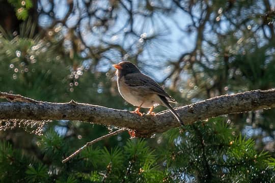 Tweet  Pass 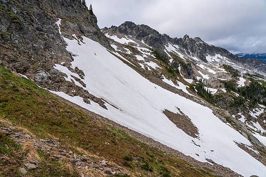 Traverse 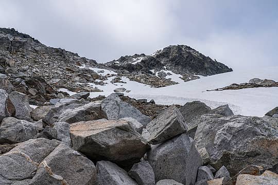 Destination 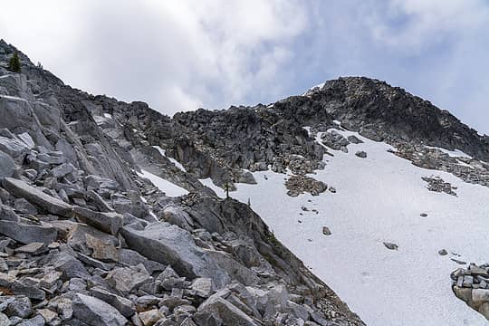 Summit 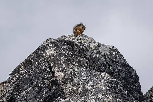 Guardian 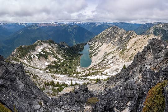 Sylvester 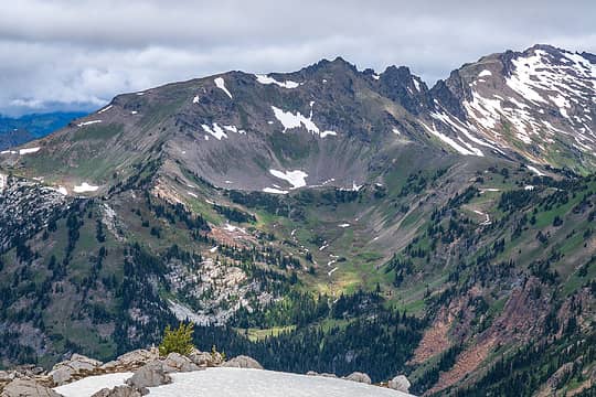 Ladies 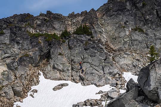 Scramblers 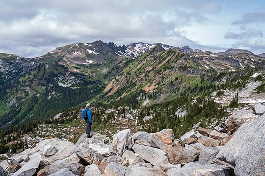 Snowgrass 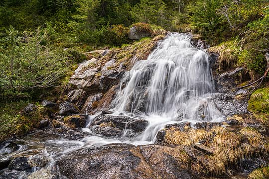 Cascade 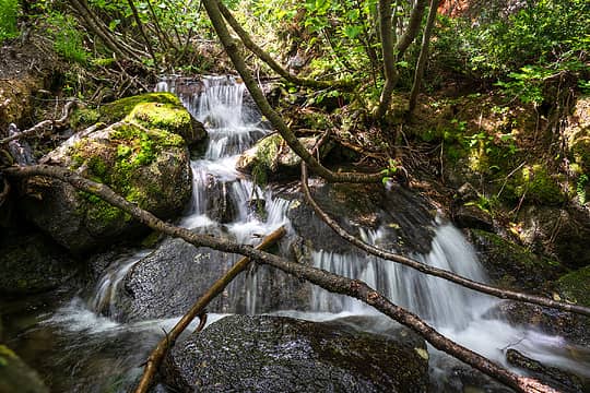 Stream 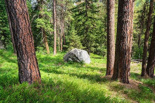 Summer
ALW Hiker, contour5, Nancyann, jaysway, abkoch3, mosey, mike, olderthanIusedtobe, RichP, JimK, zimmertr
ALW Hiker, contour5, Nancyann, jaysway, abkoch3, mosey, mike, olderthanIusedtobe, RichP, JimK, zimmertr |
| Back to top |
|
|
Dick B
Member
Joined: 06 Jun 2013
Posts: 345 | TRs | Pics
Location: Redmond, Or |
|
Dick B
Member
|
Sat Jun 24, 2023 2:54 pm |
|
|
A friend & I did a hike yesterday, along the old Santiam Wagon Road, from the Fish Lake Remount Depot. Central Oregon is the land of disappearing lakes. Several fill with snow runoff in the spring and are mostly dry by late summer. Fish Lake as pictured is an example. The picture with water was yesterday and the other was sometime late summer when it becomes a very nice meadow.
contour5, jaysway, mosey
contour5, jaysway, mosey |
| Back to top |
|
|
mike
Member
Joined: 09 Jul 2004
Posts: 6397 | TRs | Pics
Location: SJIsl |
|
mike
Member
|
Sat Jun 24, 2023 6:10 pm |
|
|
| Dick B wrote: | | The area is pretty much like it was when Stephen Meek led the lost wagon train thru here in 1845. |
Unmarked grave along the Meek Cutoff near there.
And a marked grave.
|
| Back to top |
|
|
olderthanIusedtobe
Member
Joined: 05 Sep 2011
Posts: 7708 | TRs | Pics
Location: Shoreline |
| awilsondc wrote: | Guardian |
What is that little guy doing up there? I imagine that is quite a bit above the treeline. Not really it's normal habitat.
I seem to recall seeing a pika just below the summit of Vesper one time. Also encountered a marmot on the summit of the highest peak in the Bitterroots in Montana, 10,000+.
 awilsondc awilsondc
awilsondc |
| Back to top |
|
|
Cyclopath
Faster than light
Joined: 20 Mar 2012
Posts: 7727 | TRs | Pics
Location: Seattle |
|
Cyclopath
Faster than light
|
Sat Jun 24, 2023 8:16 pm |
|
|
Mowich Lake
Now I Fly, reststep, jaysway, zimmertr
Now I Fly, reststep, jaysway, zimmertr |
| Back to top |
|
|
RichP
Member

Joined: 13 Jul 2006
Posts: 5634 | TRs | Pics
Location: here |
|
RichP
Member
|
Sat Jun 24, 2023 8:46 pm |
|
|
A little Idaho scenery. Lemonade Peak in the St Joe Divide above Calder.
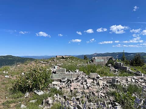 Lookout remains 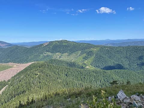 Next up, 5620. 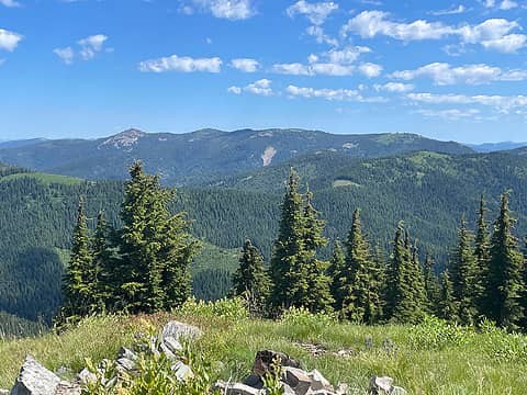 Kellogg Peak area 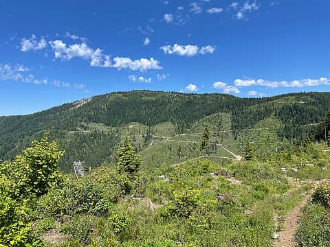 5620 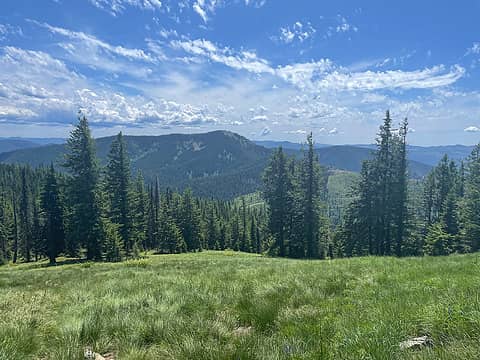 Lemonade from 5620 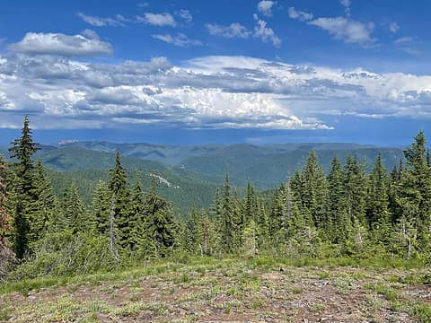 St Joe Mtns
contour5, Nancyann, Now I Fly, jaysway, mike, mosey, Cyclopath
contour5, Nancyann, Now I Fly, jaysway, mike, mosey, Cyclopath |
| Back to top |
|
|
rubywrangler
Member

Joined: 04 Aug 2015
Posts: 511 | TRs | Pics
|
Hibox was a popular destination today, four other parties. Holy crap the trail is steep! Definitely anticipating some DOMS in the quads tomorrow from that descent. Jury is still out on the iphone 14 pro camera.
JimK, Prosit, ALW Hiker, RichP, contour5, Slim, awilsondc, jaysway, Nancyann, Now I Fly, Cyclopath, reststep
JimK, Prosit, ALW Hiker, RichP, contour5, Slim, awilsondc, jaysway, Nancyann, Now I Fly, Cyclopath, reststep |
| Back to top |
|
|
jaysway
Member

Joined: 16 Jul 2020
Posts: 347 | TRs | Pics
|
|
jaysway
Member
|
Mon Jun 26, 2023 11:23 am |
|
|
That is an incredible view! Thanks for sharing.
Prosit, contour5, rubywrangler, Now I Fly
Prosit, contour5, rubywrangler, Now I Fly |
| Back to top |
|
|
A. Hall
Member
Joined: 17 Mar 2021
Posts: 12 | TRs | Pics
Location: Sammamish |
|
A. Hall
Member
|
Mon Jun 26, 2023 6:54 pm |
|
|
Just thought I'd give an update on the iron cap loop in the ALW. I've been a lurker for awhile so I'd like to give back a little.
Note: This was actually plan c because of weather so I had a day to do research. With more prep, this trip could probably be done more efficiently.
This is also my first trip report so please bare with me.
Made camp just under la bohn gap friday after work. Camped on dry land. No bugs here really. The trail was pretty cruiser up to here. Only ran into a group of back country skiers who might have done Hinman.
Woke up early Saturday, tagged la bohn via the Gulley that puts you at la bohn ridge. Used crampons and ice axe for this. No snow on the ridge to the summit.
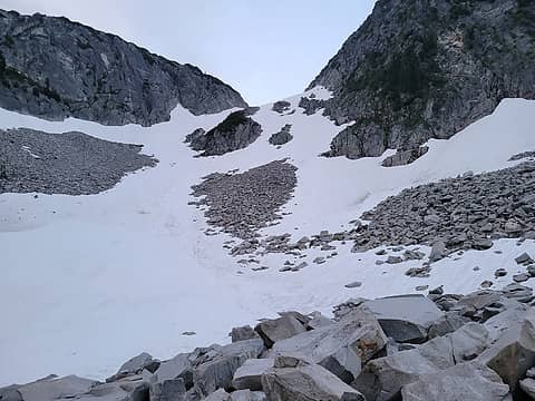 Gulley we used to get up to labohn ridge 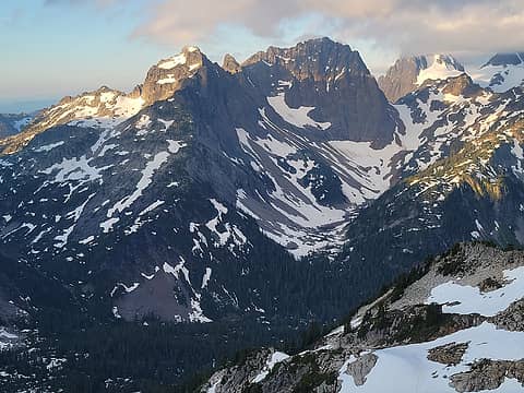 Little Big Chief? 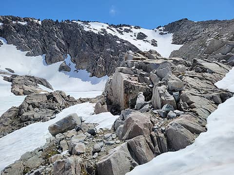 iron cap lake 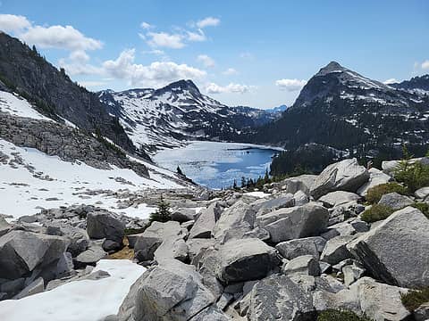 chetwoot lake, tourmaline peak, and wild goat I think? 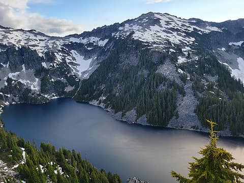 camp robber? 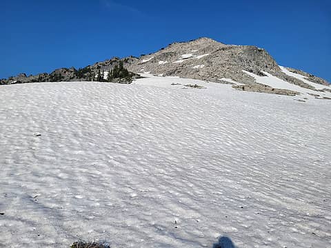 camp robber 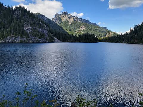 malachite? 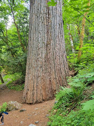 obligatory tree shot
Now I Fly, jaysway, Prosit, JimK, Dustin R, ALW Hiker, nuclear_eggset, RichP, Tom, rubywrangler awilsondc
Now I Fly, jaysway, Prosit, JimK, Dustin R, ALW Hiker, nuclear_eggset, RichP, Tom, rubywrangler awilsondc |
| Back to top |
|
|
nuclear_eggset
Member

Joined: 02 Jul 2006
Posts: 2206 | TRs | Pics
Location: Eastside |
I love your bike in the pictures. Trusty companion!
Cyclopath
Cyclopath |
| Back to top |
|
|
|
|
You cannot post new topics in this forum
You cannot reply to topics in this forum
You cannot edit your posts in this forum
You cannot delete your posts in this forum
You cannot vote in polls in this forum
|
Disclosure: As an Amazon Associate NWHikers.net earns from qualifying purchases when you use our link(s). |


