| Previous :: Next Topic |
| Author |
Message |
meck
Member


Joined: 31 Dec 2010
Posts: 920 | TRs | Pics
|
|
meck
Member
|
 Sun Jun 21, 2015 11:10 pm |
|
|
March Peak, Lenten Peak, and Peak 5345, 21 June 2015, ONF (in the vicinity of Tunnel Creek/Mt Constance)
Elevation Gain: not sure
Round trip Distance: maybe ~12ish miles round trip (8 on trail, 4ish off trail)
IanB posted some nice trip reports from these peaks in 2011 and 2012. I wanted to go up April Peak today, but made a wrong turn (followed the wrong branch of the South Fork of Tunnel Creek) and ended up in the basin just south east of March and Lenten peaks instead, oh well looks like Ill be climbing those first instead! I left the TH ~0925.
The trail was in great condition, though for some reason this particular trail always gives me the creeps. Based on the sign-in log it has been very busy the last couple of weekends.
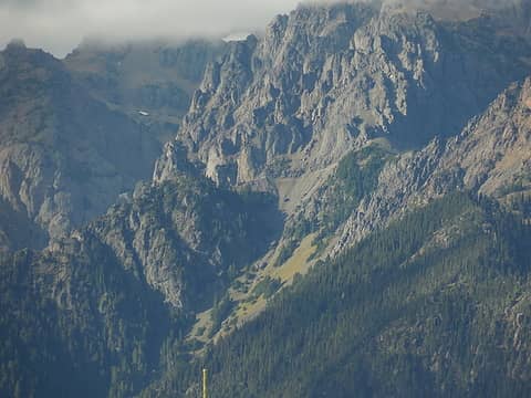
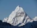
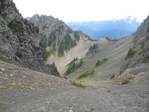
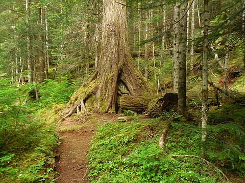 Tunnel Creek trail (north section) 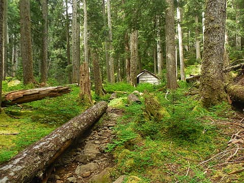 Tunnel Creek Trail and Shelter 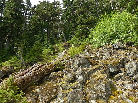 Up the boulder field to the upper basin 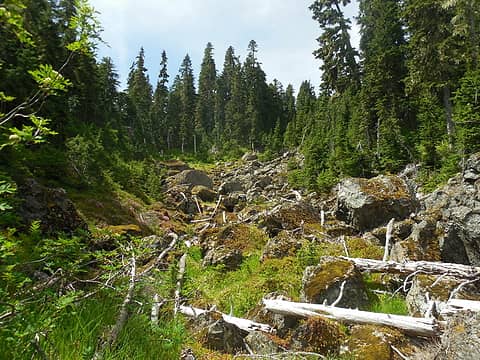 Up this drainage to the upper Tunnel Creek basin 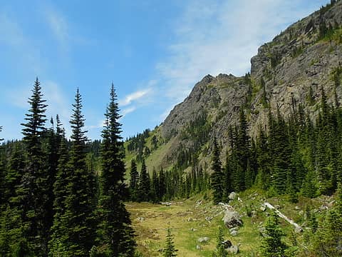 April and March Peaks from the south saddle 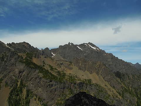 Mt Constance from March-Lenten ridge 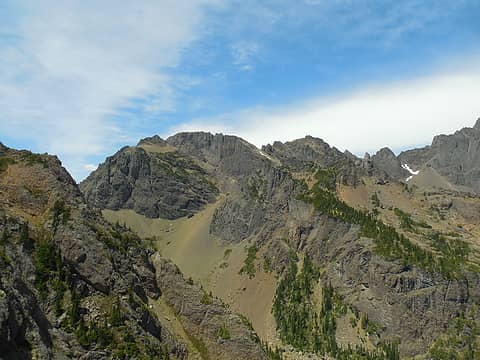 Peak 7022 from March-Lenten ridge 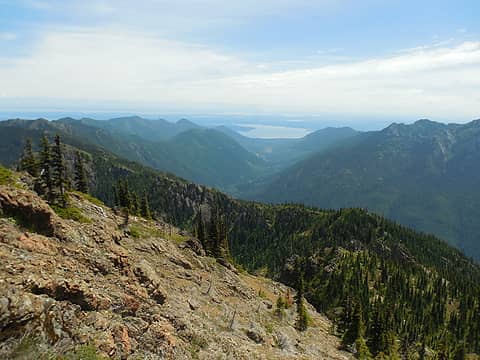 Dose-Tunnel Creek ridge 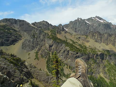 3 labels Mt Constance Boot Shot from March Peak 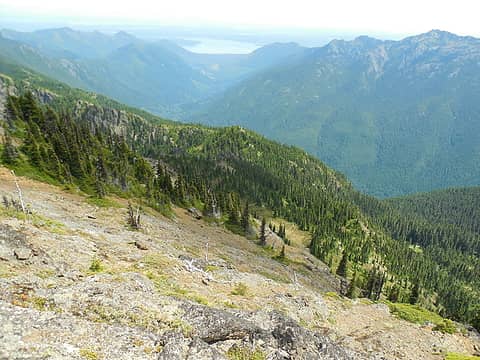 Heading down from March Peak 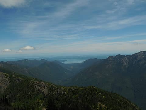 Hood Canal in the distance down the Dosewallips river drainage 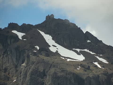 Mt Constance Summit & block 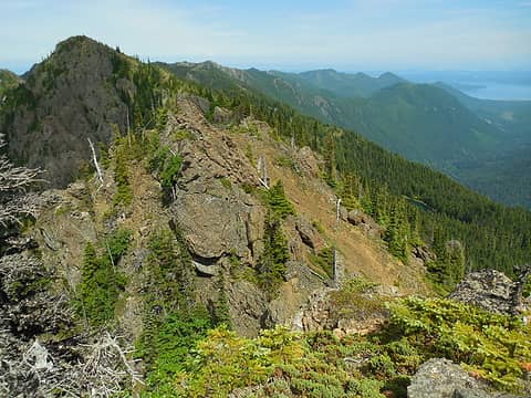 Pt 5345 (Valhalla Peak?) in the distance 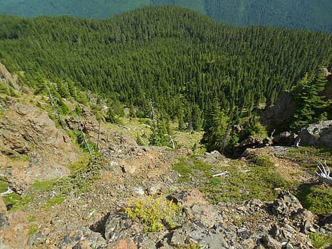 Cliffed out, darn! 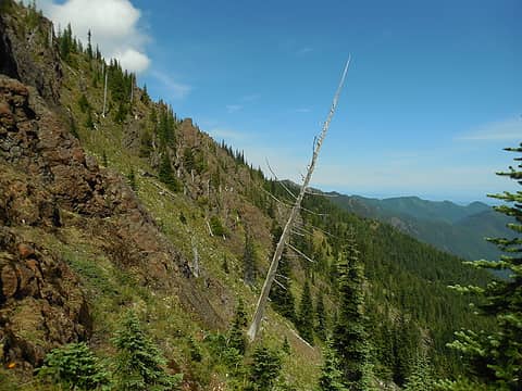 1 label Ridge traverse, stay below the buttresses! 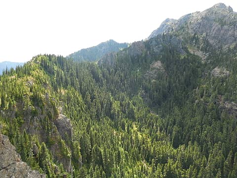 1 label Upper basin of the south branch, south fork Tunnel Creek 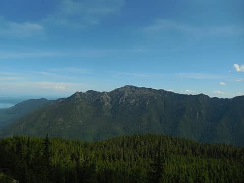 Mt Jupiter from the ridge traverse 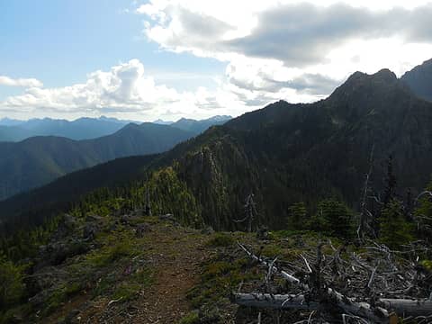 Ridge traverse from Peak 5345 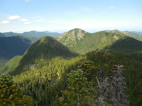 Harrison Lake from Peak 5345 (east)
*Just say NO to Rent-Seeking, don't give up the concept of "ownership"*
*Just say NO to Rent-Seeking, don't give up the concept of "ownership"*
|
| Back to top |
  
|
|
IanB
Vegetable Belayer

Joined: 21 Jul 2010
Posts: 1061 | TRs | Pics
Location: gone whuljin' |
|
IanB
Vegetable Belayer
|
Mon Jun 22, 2015 1:00 pm |
|
|
Nice to see your photos - looks like a fun day! Wish I had tagged Lenten while I was up on March.
I'm still confused about what the OMCG calls February Peak (5301'). If they don't mean Valhalla (5345'), then is it supposed to be the micro-summit that you "cliffed out" on? (Both times I approached it from the west, it wants to sucker me into going up and over, but I keep reminding myself that the downclimb on the east side may be more than I am comfortable with.) It requires a hundred feet loss or so on the south side - sketchy if you cut across the buttresses rather than drop all the way below.
That's the only bump that seems to require dropping much off the ridge. There's one other that just let's you squeak by through the hemlocks on the north side.
"Forget gaining a little knowledge about a lot and strive to learn a lot about a little." - Harvey Manning
"Forget gaining a little knowledge about a lot and strive to learn a lot about a little." - Harvey Manning
|
| Back to top |
|
|
rambln
Member
Joined: 28 May 2013
Posts: 37 | TRs | Pics
Location: Kitsap |
|
rambln
Member
|
Mon Jun 22, 2015 1:04 pm |
|
|
Nice  I have that area on my list for this summer. April, March, February, Lenten and Cunningham basin/pass.
Would love to find a way over to Lake Constance too.
Thanks for the labels. Probably the most descriptive report I've read on those peaks.
Hope your ankle is ok!
I have that area on my list for this summer. April, March, February, Lenten and Cunningham basin/pass.
Would love to find a way over to Lake Constance too.
Thanks for the labels. Probably the most descriptive report I've read on those peaks.
Hope your ankle is ok!
|
| Back to top |
|
|
meck
Member
Joined: 31 Dec 2010
Posts: 920 | TRs | Pics
|
|
meck
Member
|
Mon Jun 22, 2015 5:38 pm |
|
|
IanB: Your TRs were a big help in visiting this spot, thank you for posting them back in 2011 and 2012! I too was pretty confused by which peak is February and which is Lenten. I think I visited Lenten, because the OMCG says its 6100' too, and there was a slight dip in the ridge over to March, so maybe it counts as a separate peak? (the next rocky point east is quite a bit lower and appears to be a much higher climbing grade than 3, must be 'The Nun' peak). As for February Peak, I think your guess regarding the woody point south and east of Lenten, from your TRs, looks to be about right. The cliffy ridge I climbed might be February, but it looked like it was at least 100' lower or so than Valhalla (I forgot to check my altimeter). The east side of the ridge I cliffed out on dropped at least 25-30 feet back to the ridge, and I saw no goat tracks (a sure sign that it it near impassible!). I generally tried to stay off the north side since it looked so precipitous (I found myself even questioning the stability of the rock given all the rock debris in the basin below).
rambln: Thank you for reading the TR! I was looking at the topo map and terrain, I'm not sure you're gonna do much better than passing through Cunningham Pass and over the Constance Ridge (south chute) to get to Lake Constance from Cunningham Basin. I scoped out the south end of the Constance Ridge from Mt Jupiter last October and it looks kind of rough, though maybe, just maybe its not so bad (all depends on how steep scree slope is).
 1 label south end of Mt Constance from Mt Jupiter 20151019 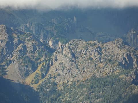 6 labels March and Lenten Peaks from Mt. Jupiter_20141019 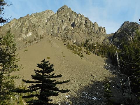 1 label Possible pass on south side of Mt Constance_20131231, from east side of Lake Constance
*Just say NO to Rent-Seeking, don't give up the concept of "ownership"*
*Just say NO to Rent-Seeking, don't give up the concept of "ownership"*
|
| Back to top |
|
|
NWtrax
Member
Joined: 27 Apr 2008
Posts: 638 | TRs | Pics
|
|
NWtrax
Member
|
Mon Jun 22, 2015 8:10 pm |
|
|
i get a creepy feeling in that valley for some reason too. nice report, thanks.
|
| Back to top |
|
|
seekapeak
Member
Joined: 25 Jun 2014
Posts: 264 | TRs | Pics
|
Glad your ankle is healing! Great detailed report - thanks! We would love to do an Autumn backpack trip in there.
|
| Back to top |
|
|
IanB
Vegetable Belayer
Joined: 21 Jul 2010
Posts: 1061 | TRs | Pics
Location: gone whuljin' |
|
IanB
Vegetable Belayer
|
Tue Jun 23, 2015 9:48 am |
|
|
That connection to Lake Constance is on my wish list as well. I can't remember where, but I recall reading that it goes. (Maybe it was in Chris Morgenroth's autobiography?) Anyway, between the topo maps and your photos, it certainly looks doable.
Also, RPBrown alluded to "Bull Elk Pass" in his post about Tubal Cain:
| RPBrown wrote: | | Jack Whiskers Conrad was a very notable character in early Quilcene history. He built his cabin at Sink Lake to trap marten and chase cougars. I think he built the cabin in the late 20s and spent a lot of time living in it. My aunt knew him very well and said he mainly lived in the mountains to stay away from booze. As the story goes, whenever he came into Quil for supplies hed be pretty intoxicated the whole time. A cousin found one of his marten traps in the big timber around Sink Lake many years ago with the brass tag Conrad. Whiskers led the Army troops to the B-18 crash on Mt. Constance September of 1941. They went in via Tunnel Creek, up near Bull Elk Pass. A real local legend that guy! |
On the map, the contour lines down Bull Elk Creek are so tight they make Constance Creek look almost level by comparison. It would seem the only reason to travel through that gap, (and name it), would be if it did in fact allow passage to the lake and Avalanche Canyon.
And take good care of the ankle! Looking forward to your next report!
"Forget gaining a little knowledge about a lot and strive to learn a lot about a little." - Harvey Manning
"Forget gaining a little knowledge about a lot and strive to learn a lot about a little." - Harvey Manning
|
| Back to top |
|
|
rambln
Member
Joined: 28 May 2013
Posts: 37 | TRs | Pics
Location: Kitsap |
|
rambln
Member
|
Tue Jun 23, 2015 7:43 pm |
|
|
Thanks meck and Ian
Very informative posts.
I'm pretty sure there has been some talk on here before about accessing Lake Constance from Tunnel Creek. Perhaps between Ian, Abert and Ancient Ambler?
I wouldn't mind if any one of you beat me to it. For some good beta of course 
|
| Back to top |
|
|
meck
Member
Joined: 31 Dec 2010
Posts: 920 | TRs | Pics
|
|
meck
Member
|
Wed Jun 24, 2015 11:00 am |
|
|
Thanks all for reading the TR. Figured I post one or two more beta shots. These are from a visit to Cunningham Pass and the peak just SW of it (a bit east from south Mt Constance ridge proper). That is some pretty neat historical info IanB! (pretty tempting info to base some exploring around)
 2 labels "April Peak Pass" from Cunningham Pass, 20130902
*Just say NO to Rent-Seeking, don't give up the concept of "ownership"*
*Just say NO to Rent-Seeking, don't give up the concept of "ownership"*
|
| Back to top |
|
|
|
|
You cannot post new topics in this forum
You cannot reply to topics in this forum
You cannot edit your posts in this forum
You cannot delete your posts in this forum
You cannot vote in polls in this forum
|
Disclosure: As an Amazon Associate NWHikers.net earns from qualifying purchases when you use our link(s). |


