| Previous :: Next Topic |
| Author |
Message |
puzzlr
Mid Fork Rocks


Joined: 13 Feb 2007
Posts: 7220 | TRs | Pics
Location: Stuck in the middle |
|
puzzlr
Mid Fork Rocks
|
 Sun Oct 30, 2016 12:35 am |
|
|
RichP and I attempted Crosby Mountain via it's long east ridge as described in Mike Collins' 2001 WTA TR. We didn't make it for two reasons; 1) we lost an hour by mistakenly going too high on Bing's south ridge and 2) we ran out of time on this short winter day. But there are many things to like about this route and now that we know it I think we'll be back to finally bag the summit. My stats show 10 hours, 6.2 miles RT and 4800' of gain (without our mistake, which adds 600'). The full trip to the summit will probably be close to 6000' of gain with all the ups and downs.
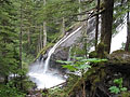
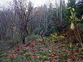
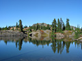
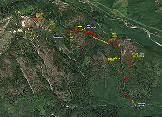 Crosby Mountain 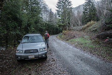 Starting out at 7:45am. The old logging road switchbacks up about 300' 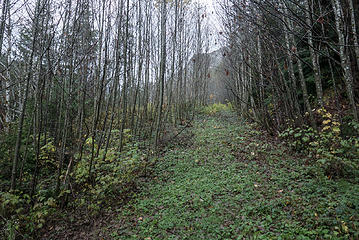 Old logging road, doesn't go very high 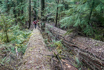 A fallen giant serves as a forest sidewalk 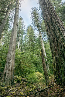 Truly huge trees near the valley floor 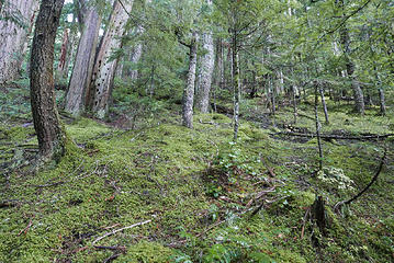 Part of the understroy on this slope was mostly moss. Higher up it was mostly sallal. 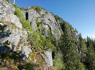 Cliffs that stopped our progress. We turned around and descended 600' for a course correction. 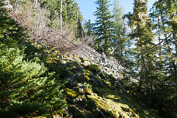 Losing 600' of elevation to find a place to cross the dry creek 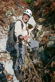 In the dry stream we ran across a heavy duty synthetic rope with significant hardware on it. Our best guess was firefighting equipment somehow left behind. 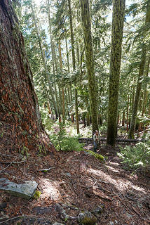 Big trees and almost no understory 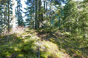 4200' saddle. We came up a steady and reasonable slope, but the other side of the pass is almost vertical cliffs 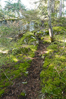 On the ridge we came across an old intermittent fishing trail and followed it as well as we could to Cement Lake 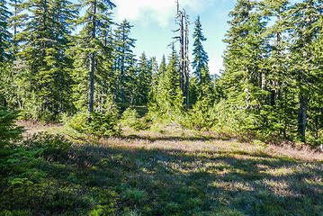 Pleasant alpine meadows on the ridge top 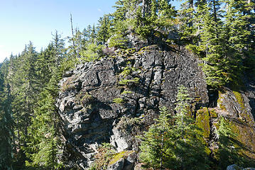 After walking through flat meadows for a while it was a surprise to come across this sudden gap in the ridge line. We passed it on the left. 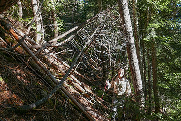 Passing the rocky gap in the ridge line 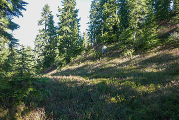 After the gap we passed over Pt 4494 and then dropped down a series of meadowy steps 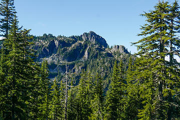 Crosby summit and tiers of cliffs 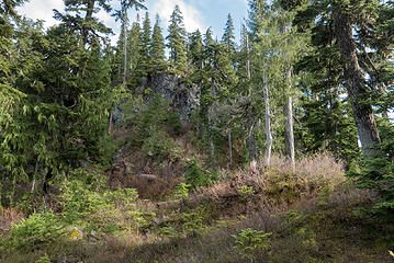 A cliff between Pt 4494 and Cement Lake that we had to come down. Fortunately the faint path we were following showed a way down. 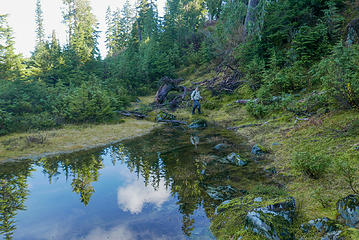 One of many small tarns on the way to Cement Lake 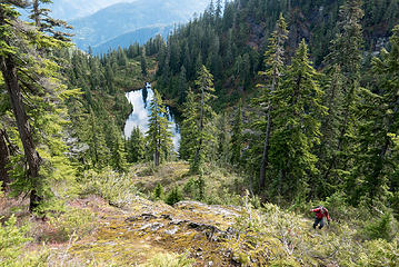 Climbing above Cement Lake 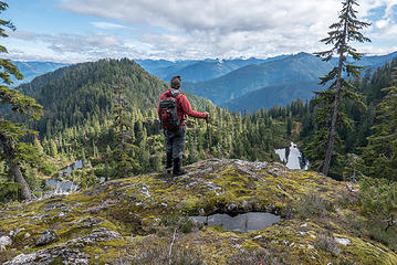 Richard at our high point at 4400' 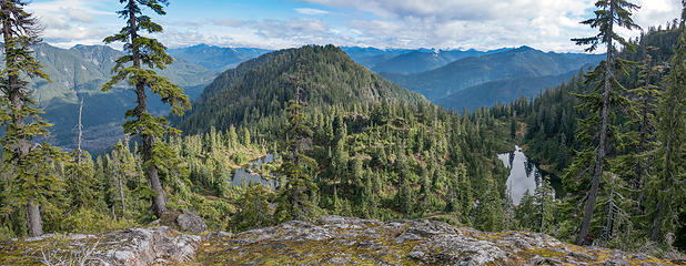 Cement Lake on the right, Cement "Pots" on the left. The high point in the center is Bing 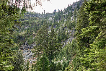 The cirque of cliffs below Boner Lake. These looked too complicated to tackle with limited time on a short winter day. 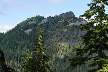 Palmer Mountain 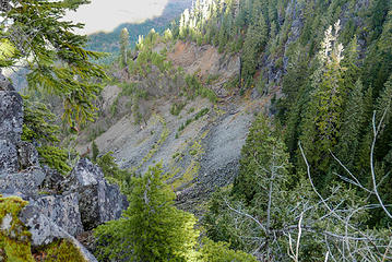 Old mining operation below Pt 4494 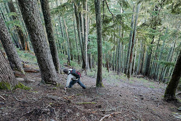 Descending open forest below the 4200' saddle 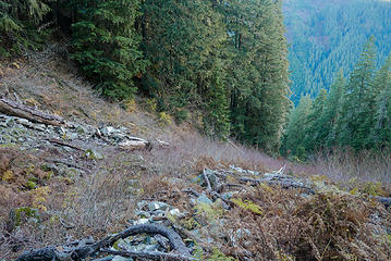 Crossing the dry creek at 3200' 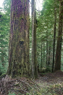 A truly big tree. No person for scale.
|
| Back to top |
  
|
|
Tom
Admin
Joined: 15 Dec 2001
Posts: 17851 | TRs | Pics
|
|
Tom
Admin
|
Sun Oct 30, 2016 12:52 am |
|
|
There's a fairly simple route up to Boner from the Cement outlet. A little steep at first but then easy walking. That's probably the way I would go up. Plus why go all that way just to bag a peak and not savor Boner Lake or poke around for the BT-13 wreckage. 
|
| Back to top |
|
|
puzzlr
Mid Fork Rocks
Joined: 13 Feb 2007
Posts: 7220 | TRs | Pics
Location: Stuck in the middle |
|
puzzlr
Mid Fork Rocks
|
Sun Oct 30, 2016 1:04 am |
|
|
Thanks, Tom. Now that you point that starting point out I can see a reasonable route that avoids the lower cliff bands surrounding the opposite end of Cement Lake. Got any photos of Boner Lake?
|
| Back to top |
|
|
RichP
Member

Joined: 13 Jul 2006
Posts: 5634 | TRs | Pics
Location: here |
|
RichP
Member
|
Sun Oct 30, 2016 8:50 am |
|
|
I really enjoyed the ridge walk once we got up there. There is some huge old growth on the lower slopes close to Money Ck Rd. I sure would like to return and visit Boner Lake which was just out of reach on this short day. Maybe we'll try Tom's suggestion on our third attempt of this elusive summit.
We got back to the car right before dark so I'm glad we didn't push it beyond where we did as there are some route finding challenges on this one.
If anyone has an idea of why the old trail is on top of the ridge, we'd be interested in its origen. It sure helped as it weaved through some cliffy sections that looked impassable otherwise.
 Starting off on logging spur along Money Ck Rd. 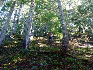 The hike up to the ridge is steep but never difficult. 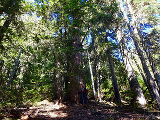 Old growth while heading up. 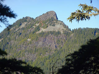 A view of Palmer Mtn from ridge top. 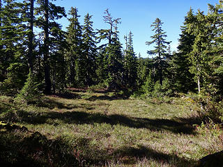 Pleasant hiking along ridge. 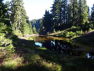 One of several tarns west of Bing Peak. 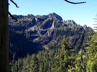 View of Crosby Mtn before dropping to Cement Lake. 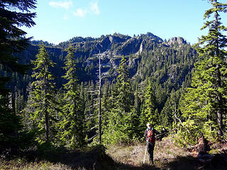 Trying to pick out a feasible route up that. 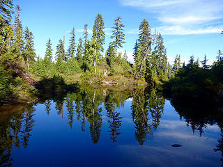 Tarn near Cement Lake. 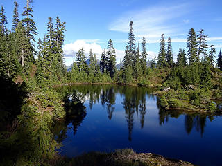 Tarn near Cement Lake. 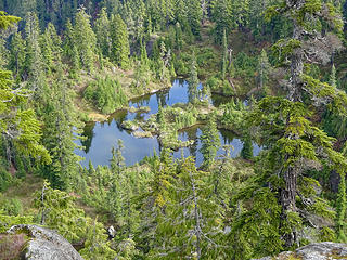 Tarn from our highpoint. 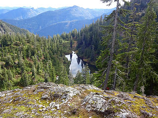 Cement Lake. 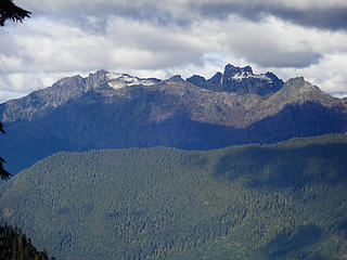 Wild Sky peaks. Gunn in background. 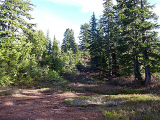 On the way back.
|
| Back to top |
|
|
Type E
Member

Joined: 19 Aug 2006
Posts: 1381 | TRs | Pics
|
|
Type E
Member
|
Sun Oct 30, 2016 8:51 am |
|
|
Give me a shout when you are ready for a rematch ,
|
| Back to top |
|
|
Snowdog
Member

Joined: 21 Jul 2006
Posts: 1028 | TRs | Pics
Location: on (& off) the beaten path |
|
Snowdog
Member
|
Sun Oct 30, 2016 9:55 am |
|
|
me too! I luv *puzzling* out routes with friends
.. 
'we don't have time for a shortcut'
'we don't have time for a shortcut'
|
| Back to top |
|
|
Gimpilator
infinity/21M

Joined: 12 Oct 2006
Posts: 1684 | TRs | Pics
Location: Edmonds, WA |
A lot of people won't post failed attempt reports, but I appreciate them, especially when they include good route beta. Thanks! 
|
| Back to top |
|
|
Bootpathguy
Member

Joined: 18 Jun 2015
Posts: 1790 | TRs | Pics
Location: United States |
Sounds like a great time!
Been wanting to get into that area
Boner looks like another beautiful granite basin lake.
Would love to see it
Thanks for the report
Experience is what'cha get, when you get what'cha don't want
Experience is what'cha get, when you get what'cha don't want
|
| Back to top |
|
|
Backpacker Joe
Blind Hiker

Joined: 16 Dec 2001
Posts: 23956 | TRs | Pics
Location: Cle Elum |
I wonder how where you guys chose to start climbing compares to the location Tom and Dante started climbing?
"If destruction be our lot we must ourselves be its author and finisher. As a nation of freemen we must live through all time or die by suicide."
Abraham Lincoln
"If destruction be our lot we must ourselves be its author and finisher. As a nation of freemen we must live through all time or die by suicide."
Abraham Lincoln
|
| Back to top |
|
|
Tom
Admin
Joined: 15 Dec 2001
Posts: 17851 | TRs | Pics
|
|
Tom
Admin
|
Sun Oct 30, 2016 1:20 pm |
|
|
Same location. But we were able to drive up the spur ~10+ years ago.
|
| Back to top |
|
|
Backpacker Joe
Blind Hiker
Joined: 16 Dec 2001
Posts: 23956 | TRs | Pics
Location: Cle Elum |
I sure am curious about that old trail up there. Where did it originate for example? I cant imagine that area ever got enough traffic to create and maintain a trail. How much of a trail network exists up there?
"If destruction be our lot we must ourselves be its author and finisher. As a nation of freemen we must live through all time or die by suicide."
Abraham Lincoln
"If destruction be our lot we must ourselves be its author and finisher. As a nation of freemen we must live through all time or die by suicide."
Abraham Lincoln
|
| Back to top |
|
|
RichP
Member
Joined: 13 Jul 2006
Posts: 5634 | TRs | Pics
Location: here |
|
RichP
Member
|
Sun Oct 30, 2016 3:41 pm |
|
|
| Backpacker Joe wrote: | | I sure am curious about that old trail up there. Where did it originate for example? |
It may just come up from where we did though we only saw evidence of it just before hitting the ridge top at 4200.' I can't imagine it goes any further east as Point 4500 (Bing) is steep and rocky on that side.., but who knows?
I can tell you that it had some recent flagging so somebody is going up there; maybe to fish the lakes. We also came across a wildlife camera that somebody had obviously taken plenty of time to install in a very secure way, but who would climb up there to hunt? Lots of questions about that place...
|
| Back to top |
|
|
Bootpathguy
Member
Joined: 18 Jun 2015
Posts: 1790 | TRs | Pics
Location: United States |
| RichP wrote: | | . We also came across a wildlife camera that somebody had obviously taken plenty of time to install in a very secure way, but who would climb up there to hunt? Lots of questions about that place... |
Interesting. Most I've seen are labeled with ownership.
This one appear to be official. WDFW, a wildlife foundation, other, etc..?
Or private?
Marijuana grow?
Thanks
Experience is what'cha get, when you get what'cha don't want
Experience is what'cha get, when you get what'cha don't want
|
| Back to top |
|
|
RichP
Member
Joined: 13 Jul 2006
Posts: 5634 | TRs | Pics
Location: here |
|
RichP
Member
|
Sun Oct 30, 2016 4:29 pm |
|
|
| Bootpathguy wrote: | | This one appear to be official. WDFW, a wildlife foundation, other, etc..? |
It was enclosed in a camouflaged, padlocked box with tree texture on it and attached to a tree with heavy duty metal. No identification on it. I suspected it was put there by biologists.
|
| Back to top |
|
|
Mike Collins
Member
Joined: 18 Dec 2001
Posts: 3096 | TRs | Pics
|
Glad to see someone is getting benefit from my reports. Next year you can make it to the top.
|
| Back to top |
|
|
|
|


