| Previous :: Next Topic |
| Author |
Message |
Matt
Tea, Earl Grey, Hot


Joined: 30 Jan 2007
Posts: 4307 | TRs | Pics
Location: Shoreline |
|
Matt
Tea, Earl Grey, Hot
|
 Sun Oct 30, 2016 11:08 pm |
|
|
Dates: September 24-27, 2016
Peaks: Haystack 7303, Pasayten 7850, Buckskin 7815, Devils Backbone 7056, Jim 7062, Tamarack 7290, Windy Buffalo 6980, Slate 7440 (USGS Slate Peak & Pasayten Peak)
Party: Matt, Dicey (Carla)
Summary
Three ridges formed the skeleton of our trip, starting from a base point at Slate Peak:
Gold Ridge took us north over Haystack Mtn and Pasayten Peak to a camp at Lake 6945.
Buckskin Ridge ran from Silver Pass further north out toward Buckskin Point.
Tamarack Ridge took us south from Jim Peak across Tamarack and Windy Buffalo peaks. (Tamarack Ridge isn't an official name, but seemed fitting since it's centered on Tamarack Peak and abundantly decorated with its namesake trees.)
Our pace was governed by weather, occasionally paused or slowed by rain and clouds, then speeding up in sunshine.
Our course was governed by larches, veering off and on the main route to wherever we could see golden autumn treasure filling the basins and topping the ridges.
The planned itinerary would have fit nicely into 4 days:
Day 1: From Slate Peak, follow Gold Ridge over Pasayten Peak and camp at Lake 6945.
Day 2: Make a side trip to Buckskin Ridge & Buckskin Point.
Day 3: Cross the West Fork Methow and go up Devils Backbone.
Day 4: Follow Tamarack Ridge over several summits back to Slate Peak.
But the weather changed that.
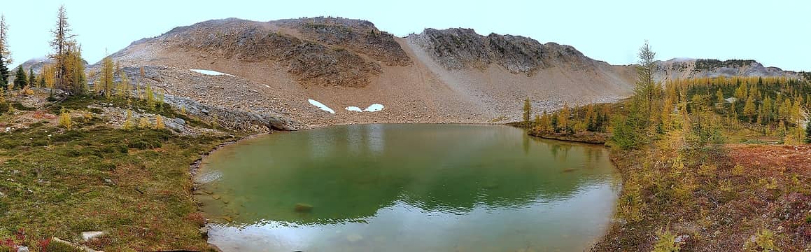
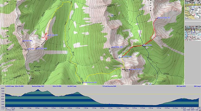
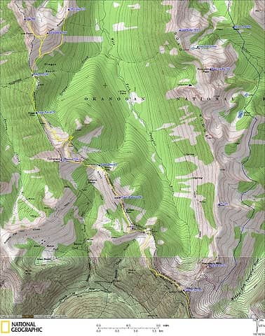
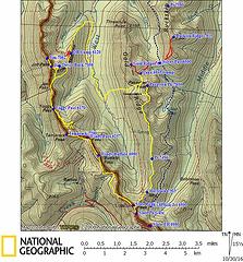 Pasayten-Buckskin-Tamarack GPS Track (low detail) 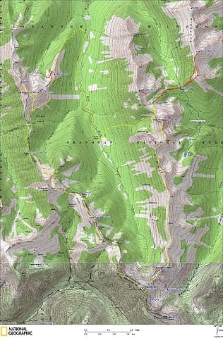 Pasayten-Buckskin-Tamarack GPS Track (high detail). Yellow lines are travel with packs, red lines are side trips. 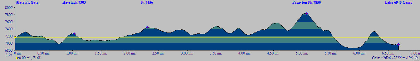 Day 1 Elevation Profile, 2600 feet of elevation gain for a 200 foot net loss - Frosty trees and very colorful meadows at the start
- Slippery wet black lichen on Pasayten Peak
- A beautiful unmapped tarn & larch basin west of Pasayten Peak
- A larger beautiful larch basin under cloudy skies at Lake 6945
Slate Peak to Haystack Mtn (10:30am 11:30am)
Our trip started from Slate Peak, whose distinctive shaved-off summit and lookout tower would remain a landmark anchor throughout the trip, retreating far away as we progressed northward and then approaching closer again as we returned southward.
From the Slate Peak gate, we took the West Fork Pasayten trail a short distance onto Slate's northeast ridge, and then followed the ridge north to Haystack Mtn. Last night's freeze had left a thin coat of frost on the trees, but it melted fast as the day progressed.
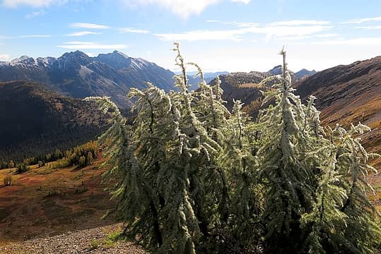 A bit of frost at the start 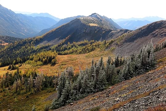 The bright meadow east of Slate Peak 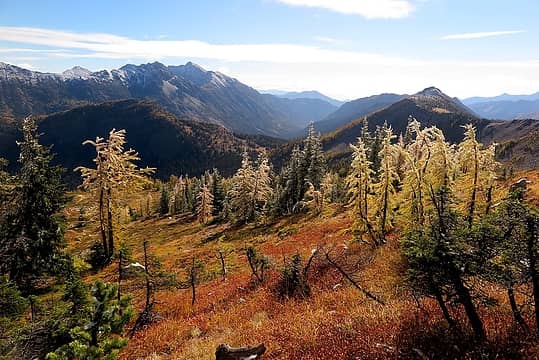 Beautiful colors in the meadows 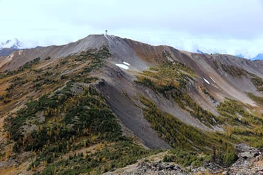 Looking back at Slate Peak from the Haystack 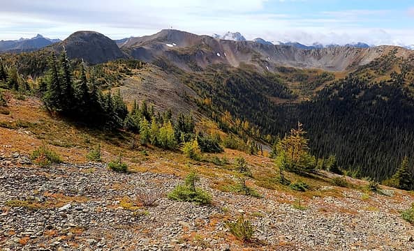 Further along the ridge, looking back at Haystack & Slate 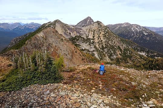 The final three points on the way to Pasayten (with Buckskin off to the right) 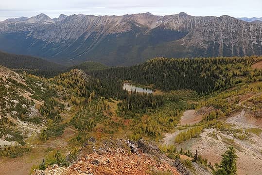 Passing above Silver Lake 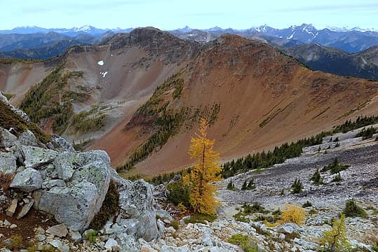 Looking back along some of the points we walked over 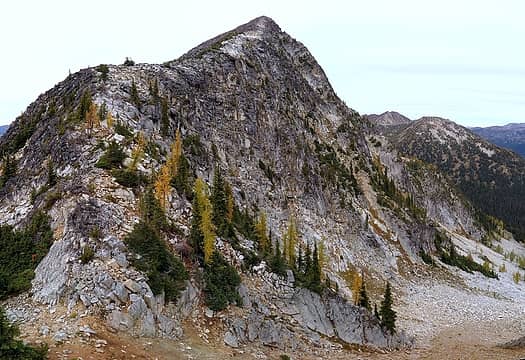 Looking up Pasayten's south ridge 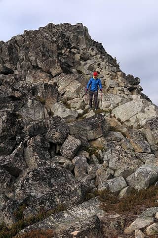 Blocky rocks 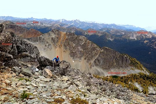 Near Pasayten's summit, with most of the rest of our loop in view 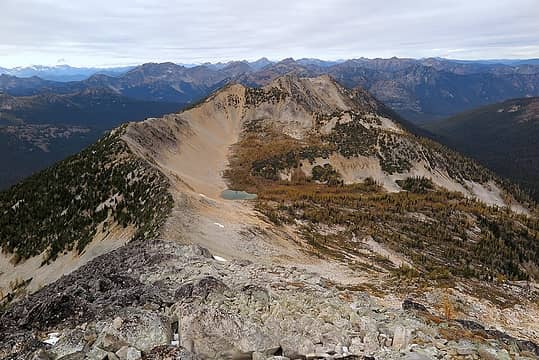 The view ahead to Lake 6945, out destination for tonight 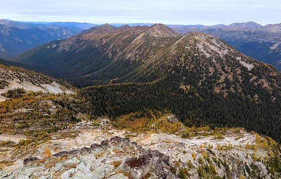 The view ahead to Silver Pass & Buckskin Ridge, out destination for tomorrow 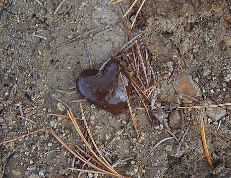 Poop Heart 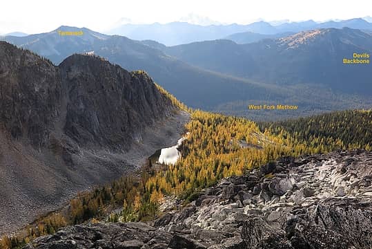 The tarn west of Pasayten 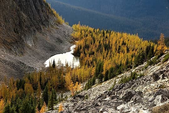 a closer view, but with shadows outracing us to the edge of the tarn 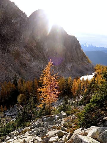 Descending west of Pasayten 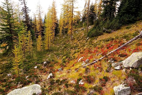 The kind of terrain we came here for 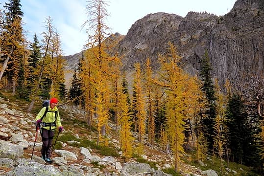 Hiking across the edge of the woods 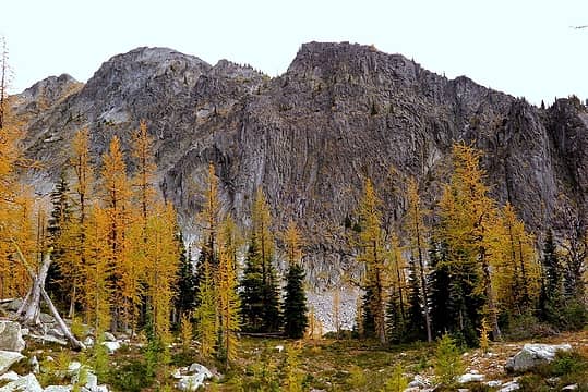 Larches below the wall 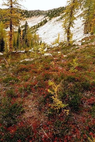 Crossing to the north edge of the basin we'll follow the line of trees in upper center up to the crest 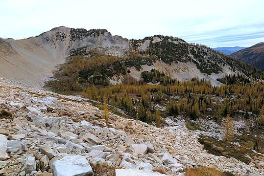 Descending from the saddle 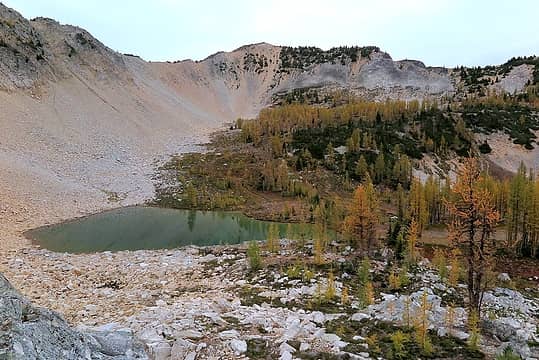 Approaching Lake 6945
As beacons mountains burned at evening. J.R.R. Tolkien
As beacons mountains burned at evening. J.R.R. Tolkien
|
| Back to top |
  
|
|
Matt
Tea, Earl Grey, Hot
Joined: 30 Jan 2007
Posts: 4307 | TRs | Pics
Location: Shoreline |
|
Matt
Tea, Earl Grey, Hot
|
Sun Oct 30, 2016 11:08 pm |
|
|
Day 2: Rain Delay and Gold Point
Day 2 Highlights:
Rain! Clouds! Sunshine! Ptarmigans!
 Cloudy Lake 6945 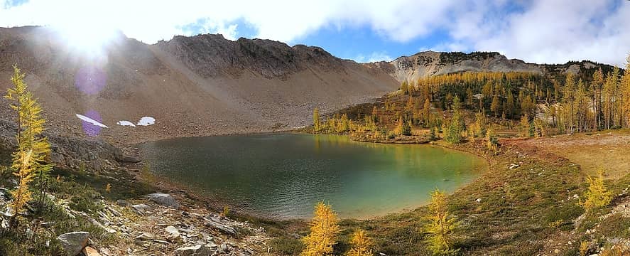 Sunny Lake 6945 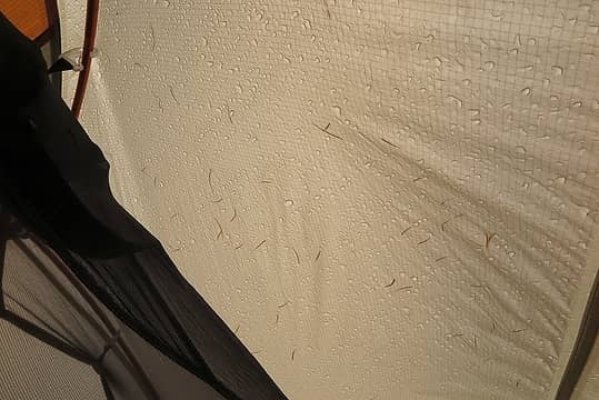 The view from inside the tent 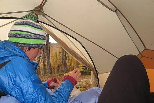 Lunchtime 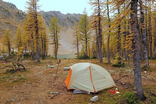 Camping in the drizzle 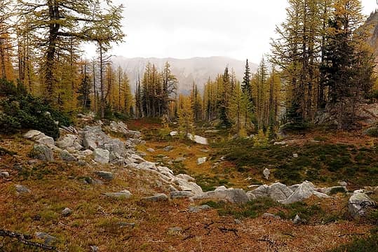 Small tarn downhill from our camp 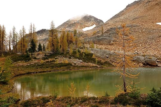 A bit of cloud still on Pasayten Peak 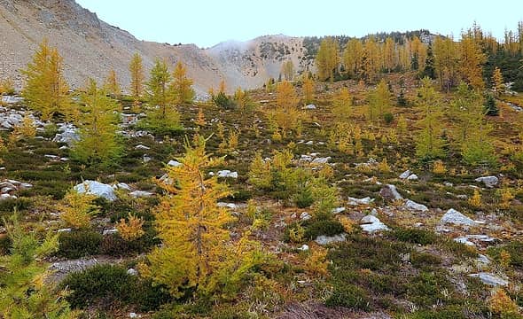 Gardens of little trees 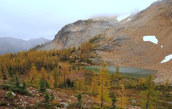 Wandering up above the lake 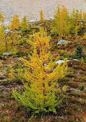 Green going gold 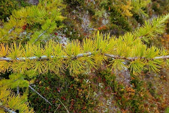 Needles 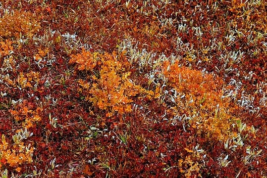 Colors in the grass 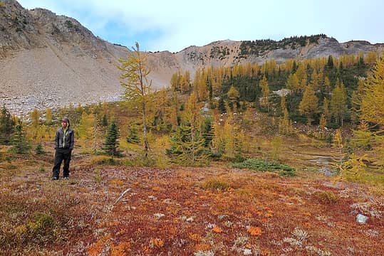 Carla waiting for the weather 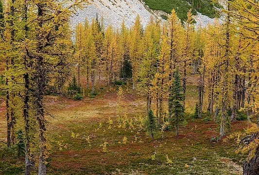 A nursery for tiny trees 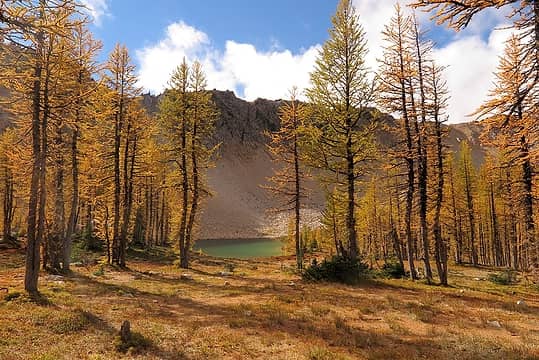 The view from our tent as sunlight finally touches the lake 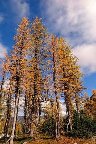 Tall larches in the sun 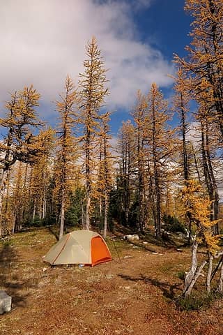 Campsite in the sun 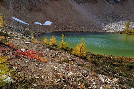 The lake lights up 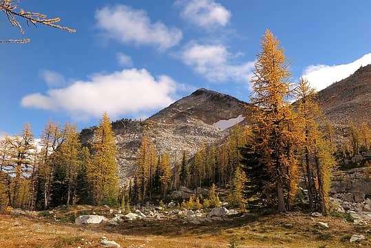 Pasayten Peak finally in sunlight 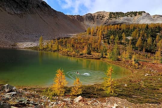 A swim in Lake 6945 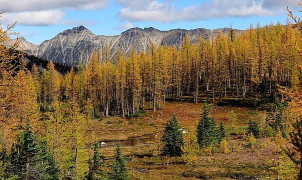 A wall of larches in front of Rolo Peak and Wildcat Ridge 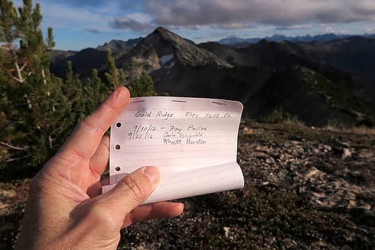 The rather brief summit register 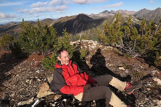 Me on Gold Point 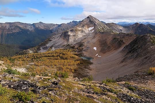 The view back down to Lake 6945 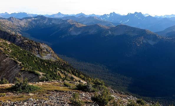 A view up the West Fork Methow to Slate Peak & Tamarack Ridge. Peaks on the horizon are The Needles, Tower, Golden Horn, Azurite, & Ballard 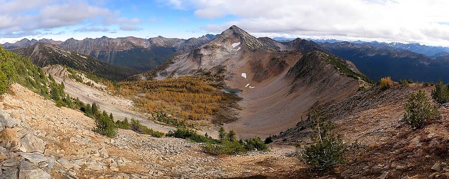 A wider pan from Buckskin Ridge eastward to Tamarack ridge westward 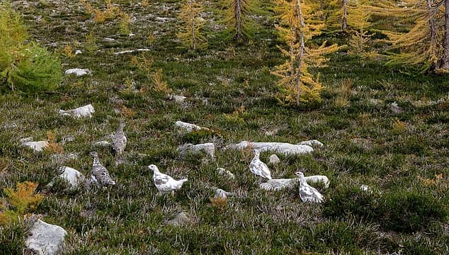 Ptarmigans in the meadow 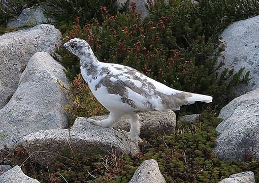 Feathered legs 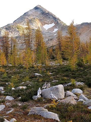 Ptarmigans sharing my view of Pasayten Peak 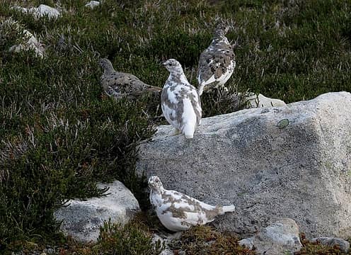 Changing of the seasons
As beacons mountains burned at evening. J.R.R. Tolkien
As beacons mountains burned at evening. J.R.R. Tolkien
|
| Back to top |
|
|
Matt
Tea, Earl Grey, Hot
Joined: 30 Jan 2007
Posts: 4307 | TRs | Pics
Location: Shoreline |
|
Matt
Tea, Earl Grey, Hot
|
Sun Oct 30, 2016 11:08 pm |
|
|
Day 3: Buckskin Ridge & Devils Backbone
Day 3 Highlights:
The Golden Road!
Going to Buckskin Ridge for the day. No, going to Devils Backbone by nightfall.
A surprise in the night sky!
 Day 3 Map & Elevation Profile 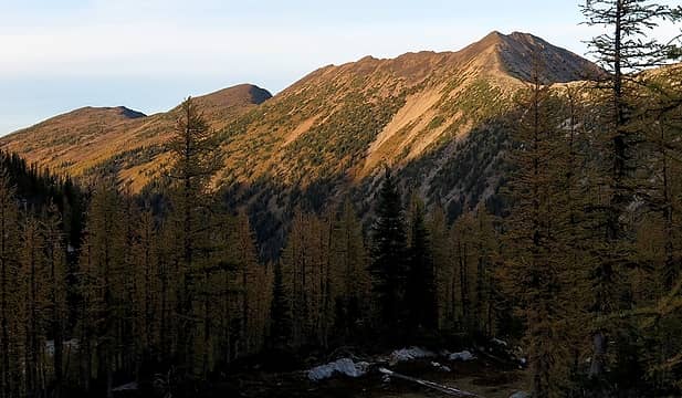 Early morning light on Buckskin Ridge 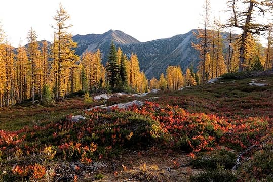 Starting down the Golden Road 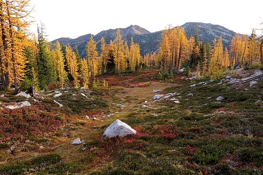 More Golden Road 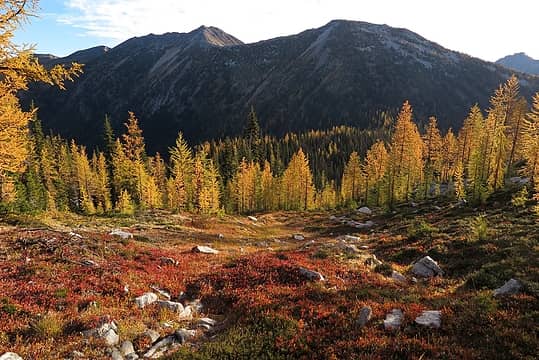 Lower on the Golden Road 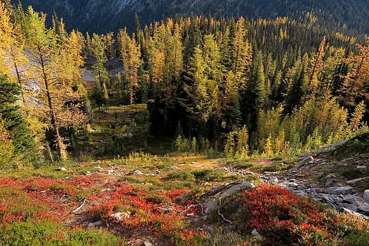 Final section down to Silver Pass 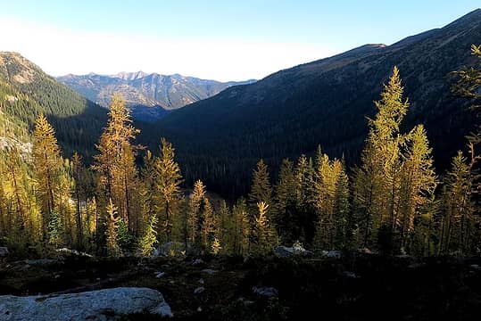 Hiking across Silver Pass, still mostly in shadow 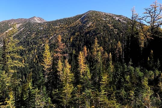 Silver pass (photographed later in the day), Buckskin summit is at upper left 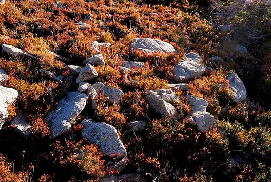 Colorful meadows going up Buckskin 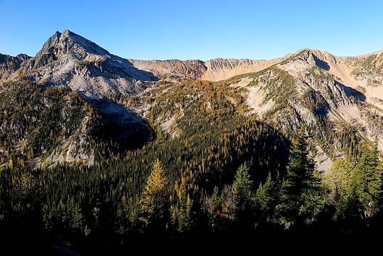 Looking back across Silver Pass to the Lake 6945 basin 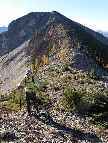 Carla crossing between Point 7632 and the summit 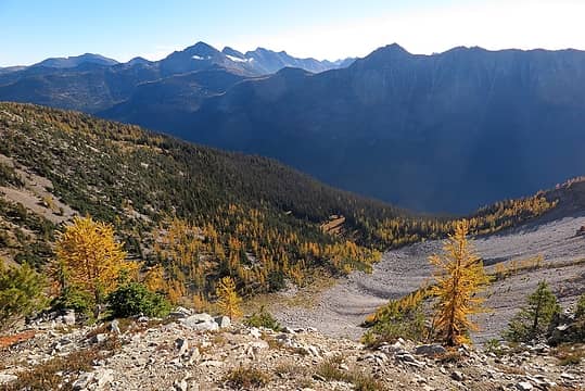 Bright basin eastward, looking out toward the Rolo-Osceola saddle 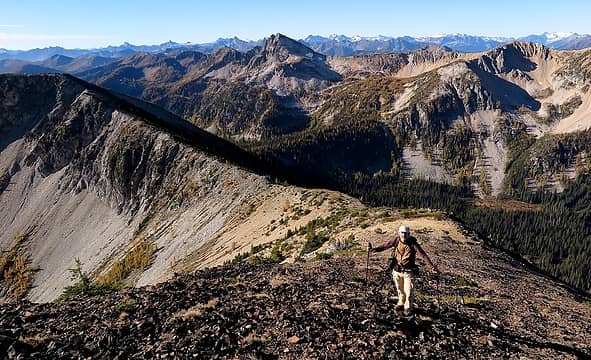 Me approaching Buckskin summit 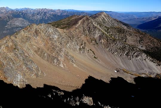 Buckskin Ridge running north toward Buckskin Point 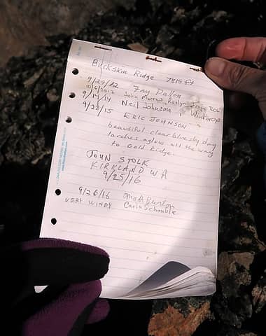 Buckskin summit register 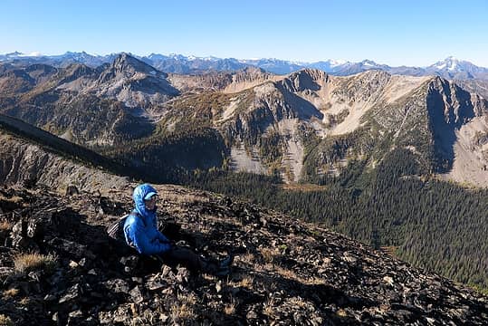 Carla having a snack in the wind 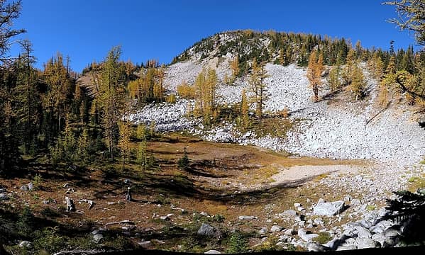 Carla at the base of the Golden Road 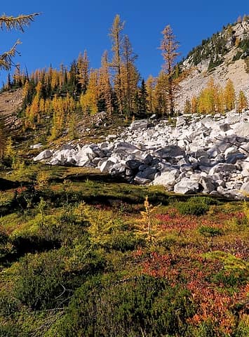 White rock shoulder at the base of the road 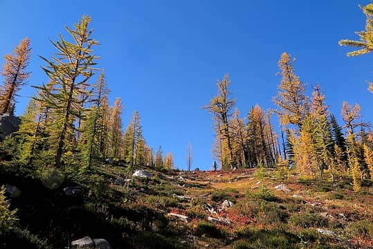 Going up 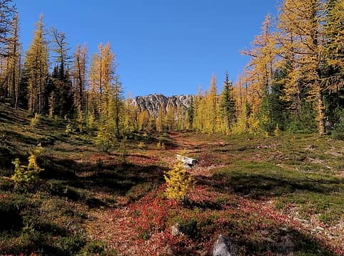 Higher up 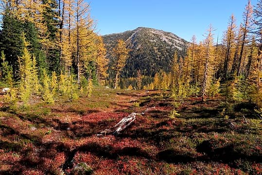 Looking back down 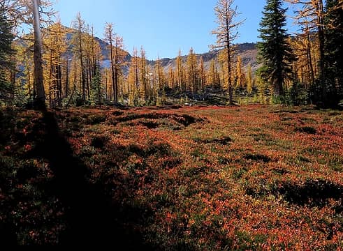 Red carpet 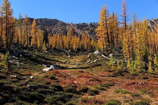 Curving farther upward 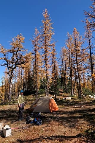 Tall larches and blue skies back at camp 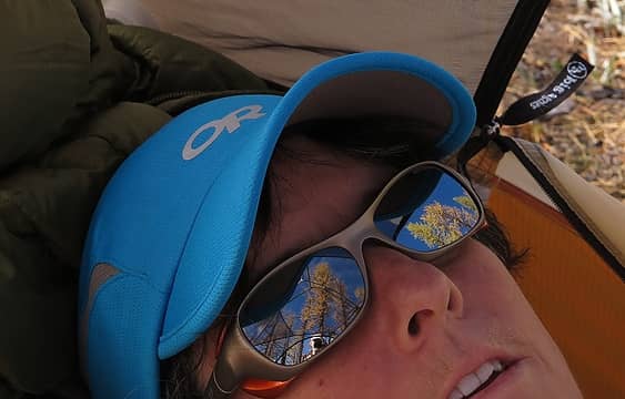 Larches thru the tent roof reflected in Carla's glasses 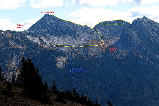 Pasayten Peak exit route 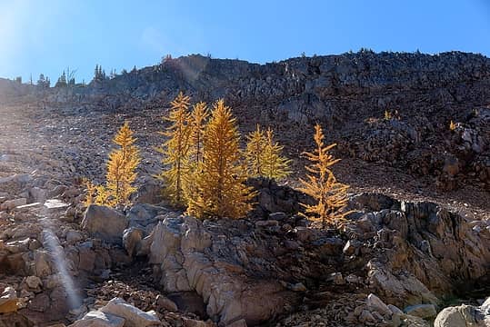 Going back up to the crest on Gold Ridge 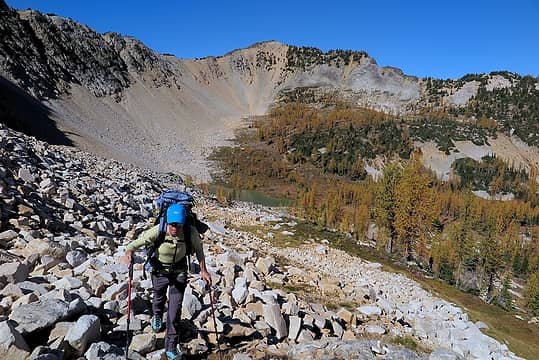 Farther up above Lake 6945 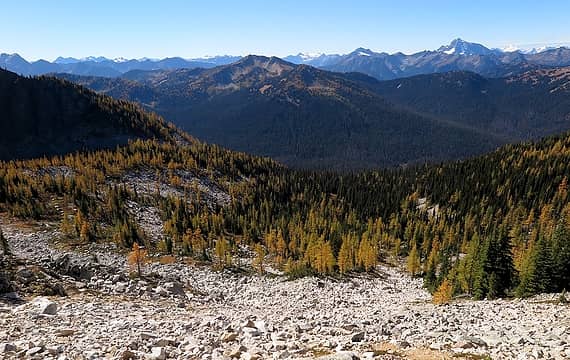 The basin we went down on the west side 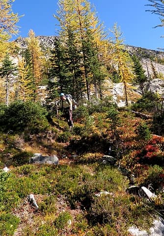 Descending through meadows and forests 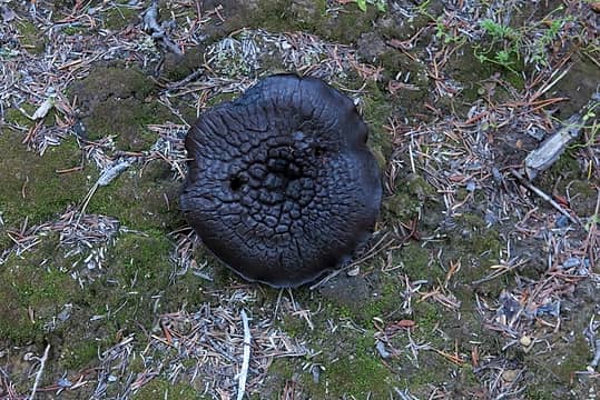 Chocolate mushroom? Don't think I'll taste it find out. 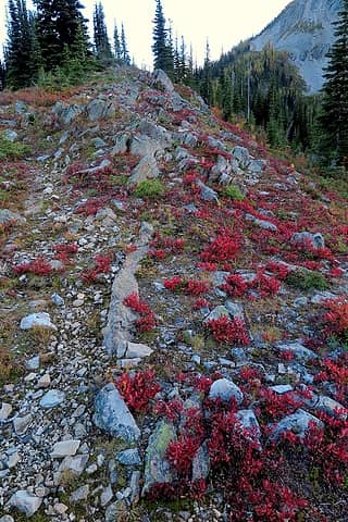 Going up the spine of Devils Backbone 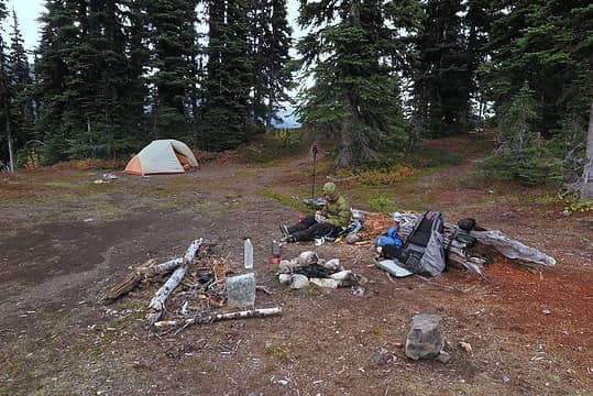 Devils Backbone Camp, photographed the next morning 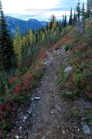 PCT making pretty but excessively long switchbacks downward 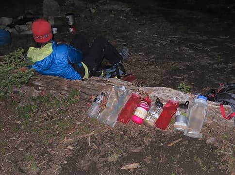 More than enough water 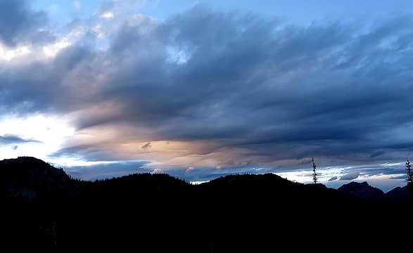 Ominous clouds, 6:35pm 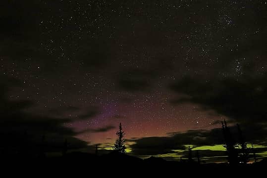 Colors in the northern sky, 8:45pm
As beacons mountains burned at evening. J.R.R. Tolkien
As beacons mountains burned at evening. J.R.R. Tolkien
|
| Back to top |
|
|
Matt
Tea, Earl Grey, Hot
Joined: 30 Jan 2007
Posts: 4307 | TRs | Pics
Location: Shoreline |
|
Matt
Tea, Earl Grey, Hot
|
Sun Oct 30, 2016 11:09 pm |
|
|
Day 4: Jim, Tamarack, Windy Buffalo, & Slate Peaks
Day 4 Highlights:
Meadows! Larches! Meadows & larches together!
Beautiful trail hiking Beautiful ridge hiking!
Cloudy morning light! Bright midday light! Warm afternoon light!
Meadow-harvesting marmots!
Jaw-dropping, stop-you-in-your tracks intense colors! Seriously, some places were so fine that we literally end up standing still and gazing wide-eyed at the stunning scenes, overwhelmed by the beauty surrounding us.
 Day 4 GPS Track Day 4 Elevation Profile 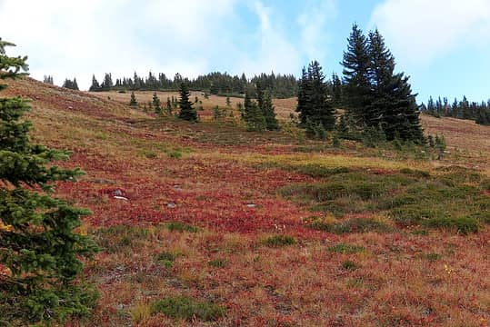 Meadows going up toward Devils Backbone "summit" 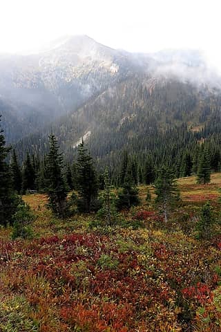 Tamarack Peak through thinning clouds 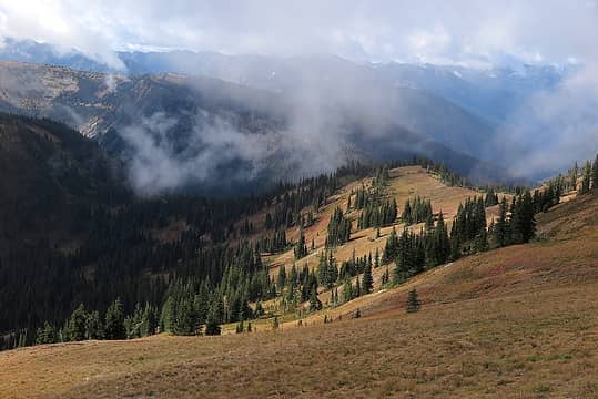 Looking back to cloud-shadowed Jim Pass 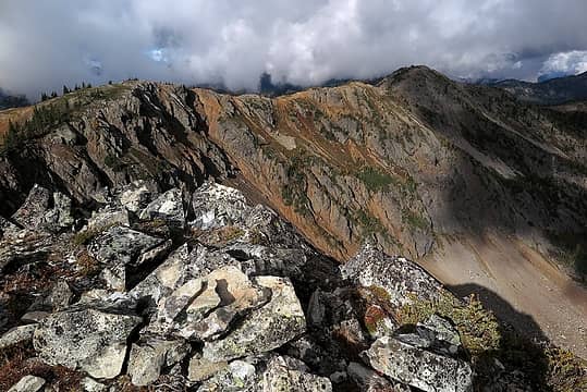 Devils Backbone summit, looking across to Jim & Tall Jim 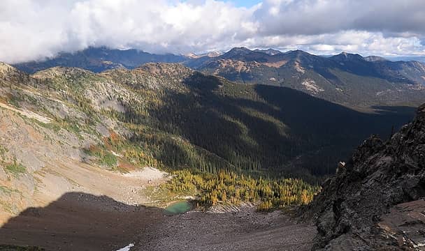 Tarn at the head of Shaw Creek 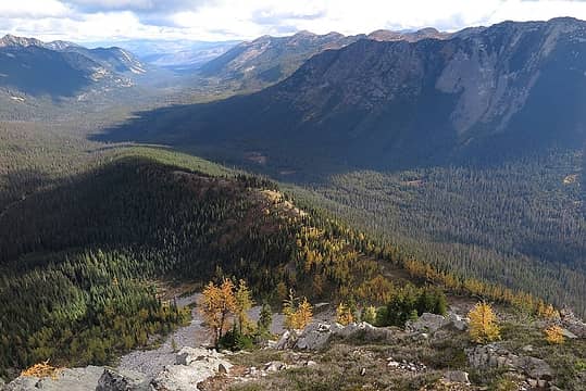 Looking down the spine of the backbone (our camp was on the bulge in the middle) 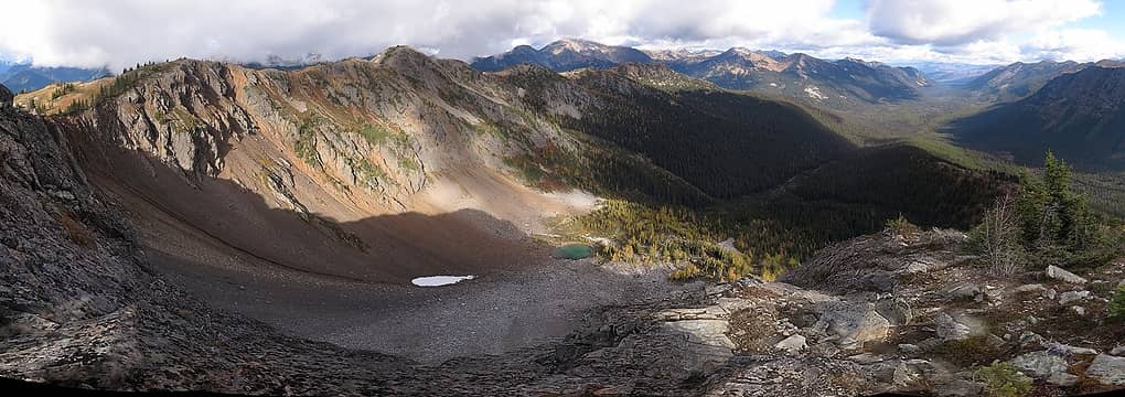 panoramic view northward from Devils Backbone 7033 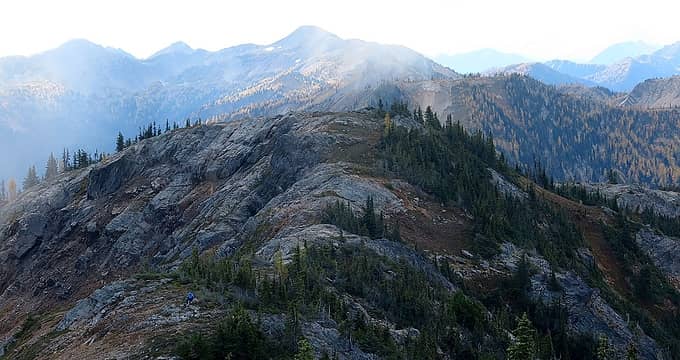 Carla waiting for me between the Jims, while clouds thin around Tamarack farther onward 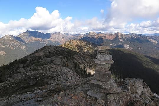 Tall summit cairn on Tall Jim 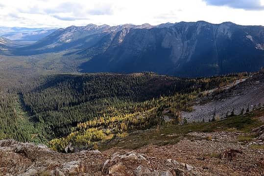 Longer view of Devils Backbone and the West Fork Methow running north 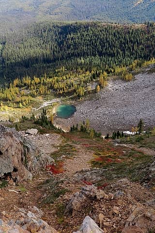 Another view of the Shaw Creek tarn 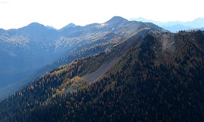 Gold-edged ridges all the way to Slate Peak 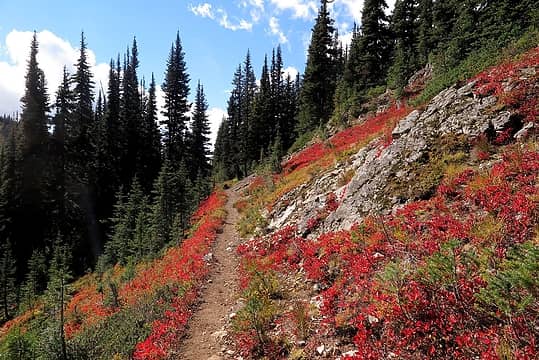 Hiking toward Jim Pass 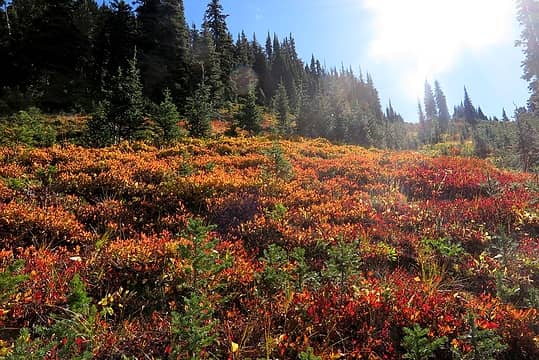 Colors on the back side of Point 6565 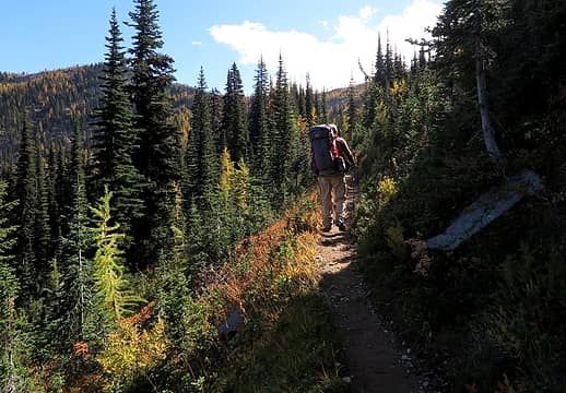 Me on the trail 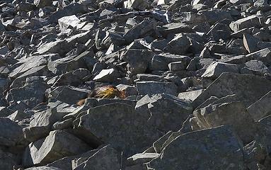 Why is there one clump of grass in the middle of this rock field? 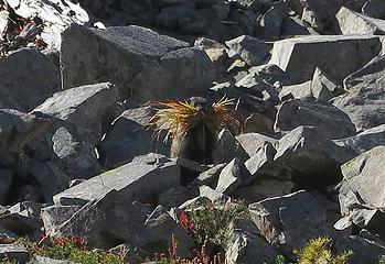 Now it has eyes? 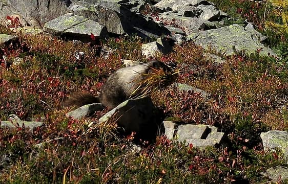 Snack on the move. 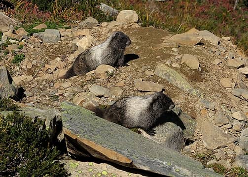 Food safely stored inside, hanging out by the den entrance with your brother or sister 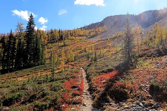 Entering the wonderful basin 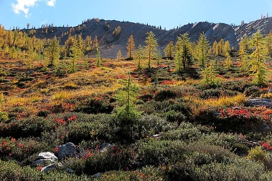 Backlit colors above us 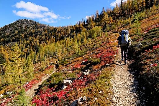 Hiking up the switchbacks 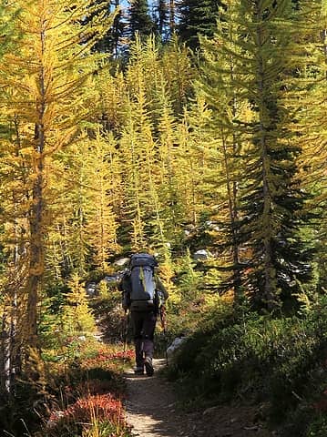 Among the larches 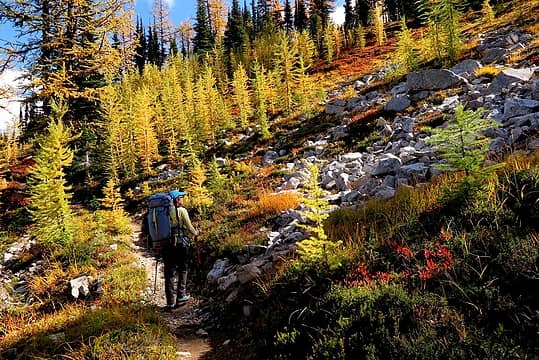 Stopped by the beauty 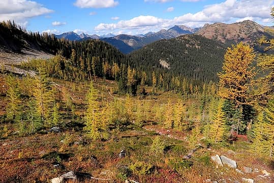 Looking back down the switchbacks and north to Jim Peak 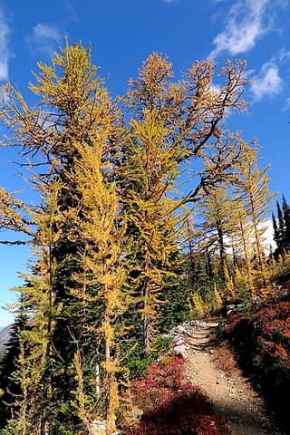 Some bigger larches nearing the saddle 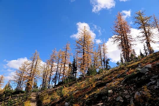 Line of larches on the crest between basins 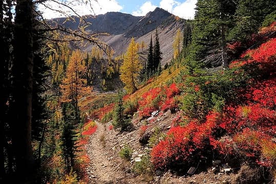 Especially intense colors coming into Tamarack's east basin 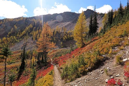 Further into the basin, aiming for the rib that angles up leftward from the center 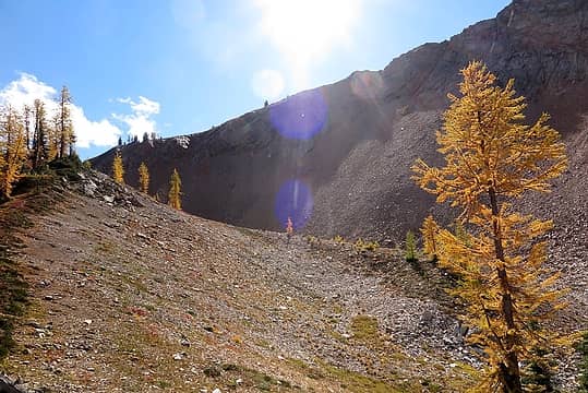 Scattered larches higher on the rib 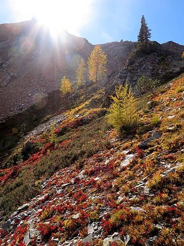 Color coming off the top end of the rib 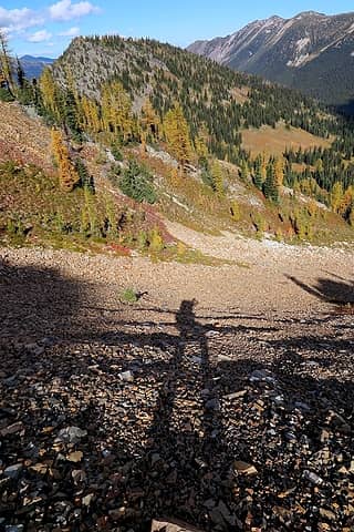 Traversing scree up to the ridge crest. 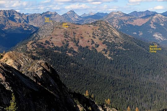 Looking north to Jim Peak and Devils Backbone 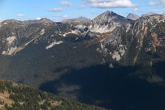 Looking east to Pasayten Peak (and Buckskin Ridge at upper left) 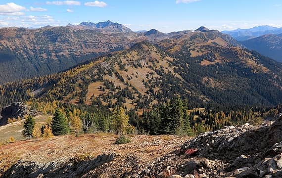 Looking south to Windy Buffalo and Slate Peak 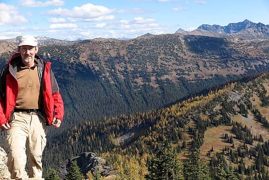 selfie taken too quickly on Tamarack 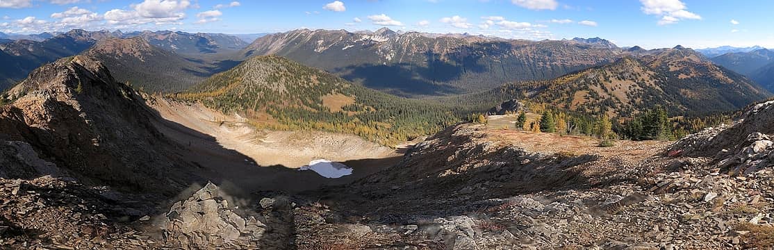 Panoramic view of our trip from Tamarack's summit, from Jim Peak at left to Gold Ridge in the center to Slate Peak at right. 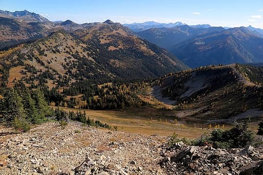 Pretty basins west of Windy Pass 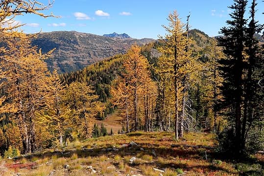 Dropping down meadows to Windy Pass 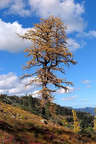 I'm always a sucker for big gnarled larches 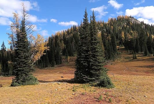 Carla awaiting me at Windy Pass 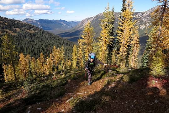 Carla hiking up the lower nose of Windy Buffalo, with Methow valley behind 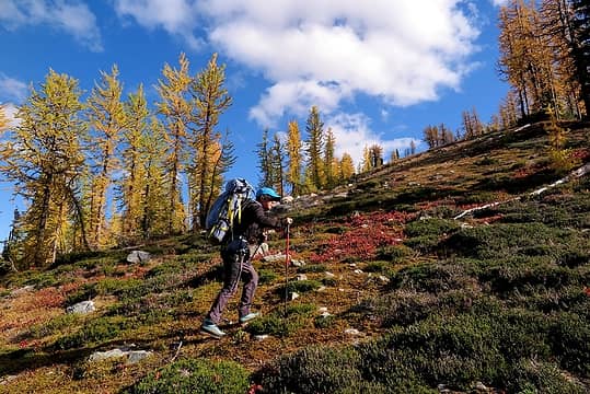 Delightful hiking upward 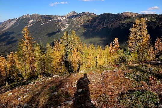 My shadow looking across to Gold Ridge & Pasayten Peak 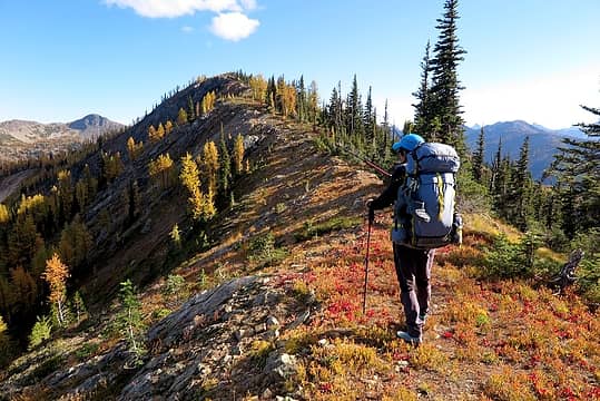 Carla hiking up toward Windy Buffalo's summit, with Slate visible in the distance 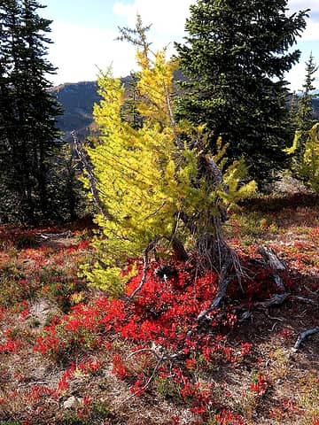 This tree looked like it had a red fire around its base 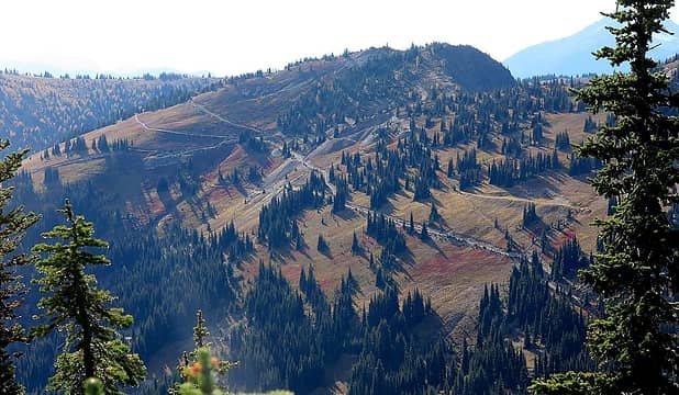 Looking west at the Barron Mine workings 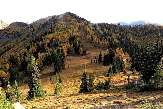 Dropping down to Buffalo Pass 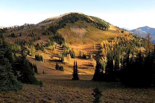 Sunlight and shadows streaming sideways across the meadows as we round another corner (you can see the PCT traversing through the dirt patch in the center of this photo) 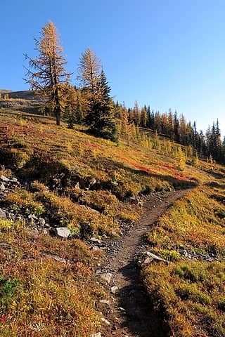 Beautiful traversing southward 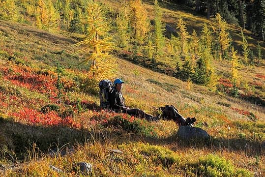 A last break in the meadows 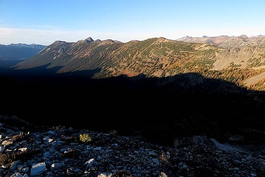 Shadows of Tamarack Ridge stretching across to Gold Ridge 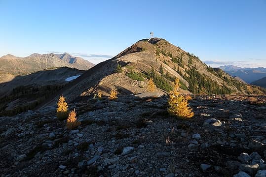 The last section up to Slate Peak 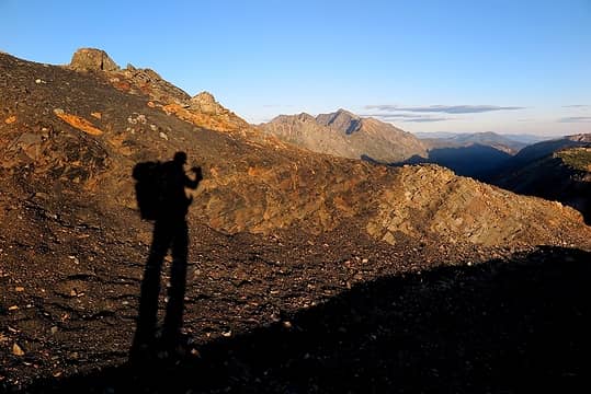 End of the day on Slate Peak 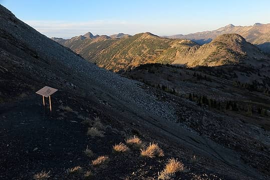 Back where we started, at the trailhead that lead us to Haystack
As beacons mountains burned at evening. J.R.R. Tolkien
As beacons mountains burned at evening. J.R.R. Tolkien
|
| Back to top |
|
|
Backpacker Joe
Blind Hiker

Joined: 16 Dec 2001
Posts: 23956 | TRs | Pics
Location: Cle Elum |
Thanks to Matt and Miss. Dicey for yet another great adventure. Looking forward to reading it.
"If destruction be our lot we must ourselves be its author and finisher. As a nation of freemen we must live through all time or die by suicide."
Abraham Lincoln
"If destruction be our lot we must ourselves be its author and finisher. As a nation of freemen we must live through all time or die by suicide."
Abraham Lincoln
|
| Back to top |
|
|
Sculpin
Member

Joined: 23 Apr 2015
Posts: 1383 | TRs | Pics
|
|
Sculpin
Member
|
Mon Oct 31, 2016 6:55 am |
|
|
| Matt wrote: | | There was a brief bit of brush to avoid a rock band, but the bypass west of Pasayten was all second class terrain. |
I'm going to take that to mean Class 2. I'm not seeing any second class terrain in your images! 
Between every two pines is a doorway to the new world. - John Muir
Between every two pines is a doorway to the new world. - John Muir
|
| Back to top |
|
|
Pyrites
Member

Joined: 16 Sep 2014
Posts: 1884 | TRs | Pics
Location: South Sound |
|
Pyrites
Member
|
Tue Nov 01, 2016 12:16 am |
|
|
Ptarmigan and Pasayten Peak.
Yummy photo.
Keep Calm and Carry On?
Heck No.
Stay Excited and Get Outside!
Keep Calm and Carry On?
Heck No.
Stay Excited and Get Outside!
|
| Back to top |
|
|
olderthanIusedtobe
Member
Joined: 05 Sep 2011
Posts: 7709 | TRs | Pics
Location: Shoreline |
Great ptarmigan pictures from day 2. Some of them seem to be predicting earlier snowfall than the others.
|
| Back to top |
|
|
Backpacker Joe
Blind Hiker
Joined: 16 Dec 2001
Posts: 23956 | TRs | Pics
Location: Cle Elum |
HEY, somebody carries a McHale pack there. Nice. 
"If destruction be our lot we must ourselves be its author and finisher. As a nation of freemen we must live through all time or die by suicide."
Abraham Lincoln
"If destruction be our lot we must ourselves be its author and finisher. As a nation of freemen we must live through all time or die by suicide."
Abraham Lincoln
|
| Back to top |
|
|
D. Inscho
Not bored yet...

Joined: 28 Feb 2010
Posts: 973 | TRs | Pics
Location: Bellingham,WA |
|
D. Inscho
Not bored yet...
|
Thu Nov 10, 2016 7:45 am |
|
|
Fine cross-country travel Matt, and lovely camera documentation.
http://david-inscho.smugmug.com/
The key to a successful trip is to do the planning during work hours. -- John Muir
My most memorable hikes can be classified as 'Shortcuts that Backfired'. --Ed Abbey
http://david-inscho.smugmug.com/
The key to a successful trip is to do the planning during work hours. -- John Muir
My most memorable hikes can be classified as 'Shortcuts that Backfired'. --Ed Abbey
|
| Back to top |
|
|
Matt
Tea, Earl Grey, Hot
Joined: 30 Jan 2007
Posts: 4307 | TRs | Pics
Location: Shoreline |
|
Matt
Tea, Earl Grey, Hot
|
Thu Nov 17, 2016 2:06 am |
|
|
I finally finished this report and added Day 4 above.
As beacons mountains burned at evening. J.R.R. Tolkien
As beacons mountains burned at evening. J.R.R. Tolkien
|
| Back to top |
|
|
RichP
Member

Joined: 13 Jul 2006
Posts: 5634 | TRs | Pics
Location: here |
|
RichP
Member
|
Thu Nov 17, 2016 7:53 pm |
|
|
Awesome trip. Love those long, ambling ridgelines the Pasayten is famous for.
|
| Back to top |
|
|
PorcupinePhobia
Murse
Joined: 04 Mar 2012
Posts: 1002 | TRs | Pics
Location: Hwy20 |
So, so so good
|
| Back to top |
|
|
D. Inscho
Not bored yet...
Joined: 28 Feb 2010
Posts: 973 | TRs | Pics
Location: Bellingham,WA |
|
D. Inscho
Not bored yet...
|
Fri Nov 18, 2016 10:51 am |
|
|
Thanks for the installment Matt; the larchy photos warmed my little house-bound heart. Your TR was worth a complete re-read.
http://david-inscho.smugmug.com/
The key to a successful trip is to do the planning during work hours. -- John Muir
My most memorable hikes can be classified as 'Shortcuts that Backfired'. --Ed Abbey
http://david-inscho.smugmug.com/
The key to a successful trip is to do the planning during work hours. -- John Muir
My most memorable hikes can be classified as 'Shortcuts that Backfired'. --Ed Abbey
|
| Back to top |
|
|
KarlK
Member
Joined: 18 Jun 2009
Posts: 584 | TRs | Pics
|
|
KarlK
Member
|
Wed Nov 23, 2016 9:28 pm |
|
|
First rate; I so love the Pasayten. So much wild stuff there.
|
| Back to top |
|
|
|
|
You cannot post new topics in this forum
You cannot reply to topics in this forum
You cannot edit your posts in this forum
You cannot delete your posts in this forum
You cannot vote in polls in this forum
|
Disclosure: As an Amazon Associate NWHikers.net earns from qualifying purchases when you use our link(s). |


