| Previous :: Next Topic |
| Author |
Message |
vk
Member


Joined: 28 Jul 2021
Posts: 9 | TRs | Pics
Location: Washington |
|
vk
Member
|
 Thu Aug 25, 2022 5:08 pm |
|
|
There are quite a detailed trip reports and tracks already out there for these two peaks but I thought I'd contribute to the beta online about them anyway and share more photos.
Our friends were visiting from Spain and really wanted to backpack and check out the Cascades while they were visiting WA. We were trying to find a good area to take them to, one that would show off surrounding lakes, peaks, with a relatively easy trail, and no permits. Obviously, the possibilities are endless, but somehow we ended up deciding on Silver and Twin Lakes. Given the proximity of the peaks to those lakes, we also decided to squeeze in some climbing  The trail up to Silver Lake via Monte Cristo trail was straightforward. It was fun trying to imagine what it was like to be there when it was still a town. Once we reached Silver Lake, we found a camp spot right above the outlet of the lake, with just enough room for three tents (though only one was on a nice flat area
  ). We had wanted to camp at Twin Lakes but our friends weren't feeling it, but I'd highly recommend camping there instead. The campsites seemed a lot nicer than the few around Silver Tip. ). We had wanted to camp at Twin Lakes but our friends weren't feeling it, but I'd highly recommend camping there instead. The campsites seemed a lot nicer than the few around Silver Tip.
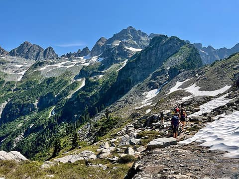
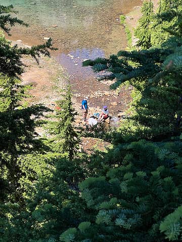 Looking down from our campsite at the best spot to filter water 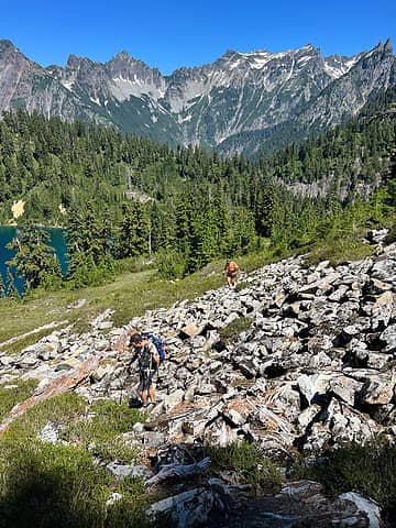 Following the faint trail 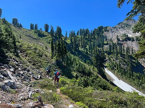 Faint trail. Generally head up towards the talus field up near the ridge, in the left third of the photo 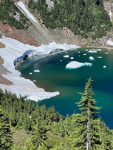 Icebergs in Silver Lake 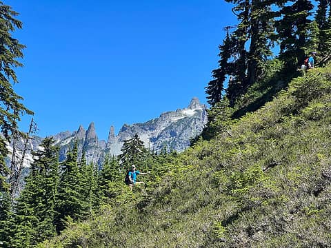 Friends off route + Wilman's 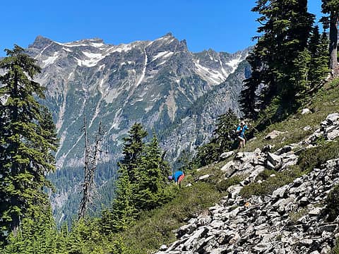 Cadet in background 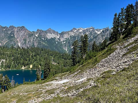 Wider view 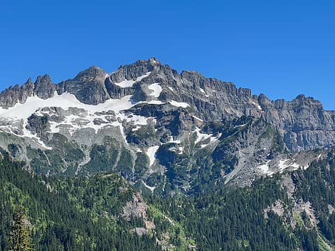 Columbia Peak 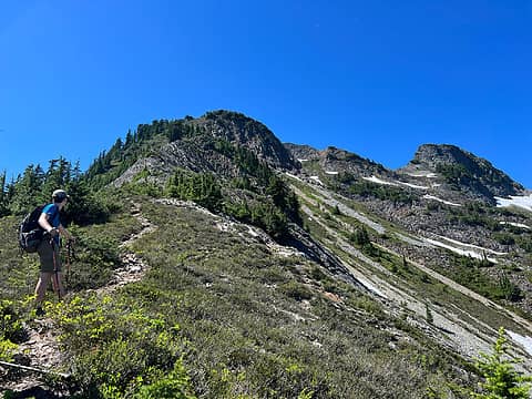 On the ridge 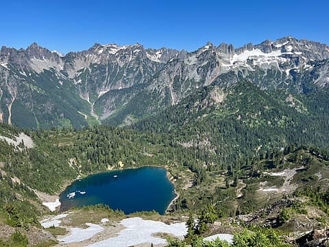 Looking out towards the lake 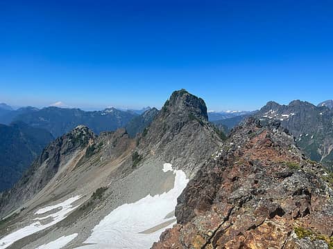 Looking towards Silver Tip the upper ridge 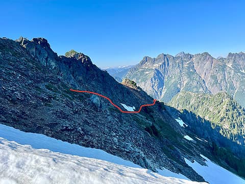 Approx route towards the summit block 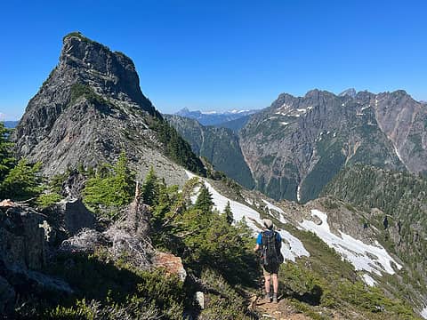 Summit block  There is a handline set up, but I wouldn't trust bearing weight on it as it was rather frayed and suspicious-looking. But as of the time we climbed up, the handline follows the main route. There is a handline set up, but I wouldn't trust bearing weight on it as it was rather frayed and suspicious-looking. But as of the time we climbed up, the handline follows the main route.
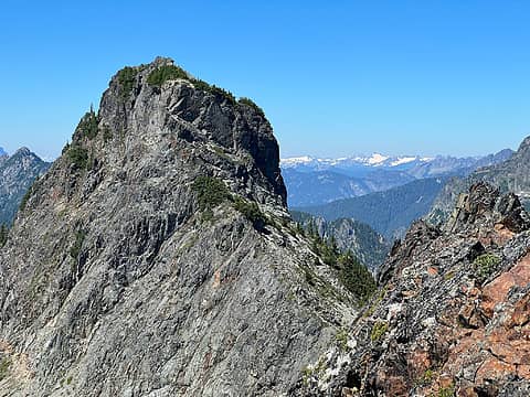 Summit block (taken from when we first gained the upper ridge) 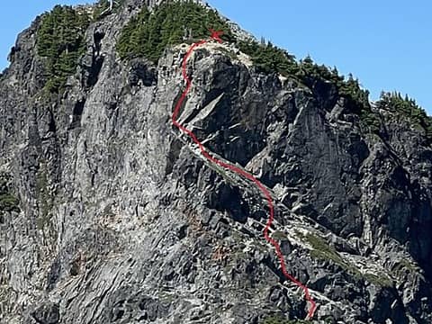 Closer look of the route up to the anchor 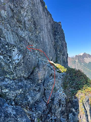 Some 3rd class scrambling up the ledges 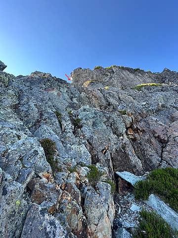 Continue up towards the point indicated by the arrow 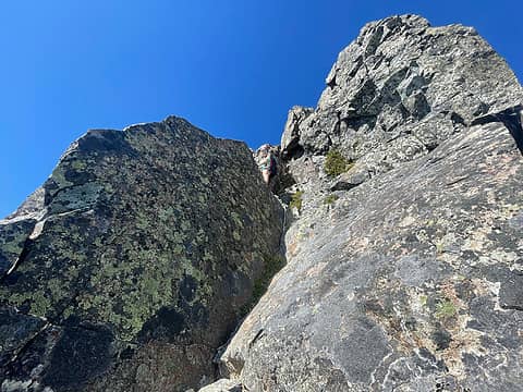 Here's the corner that you need to climb up. Right above this is the 5th class move (behind my head). 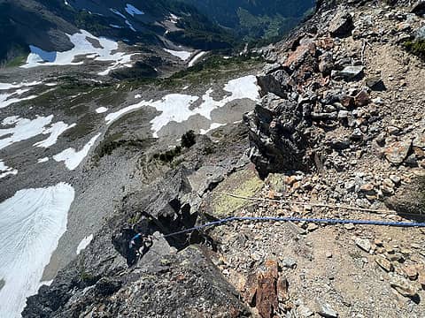 Looking down at the 5th class move (it's still out of view, but it is up the rock with yellow/green lichen) 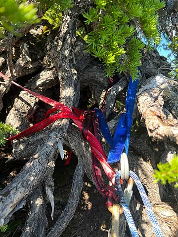 Rap station  (I think around 5600') (I think around 5600')
 Basin we crossed, heading towards the boulder field left of the last snow patch 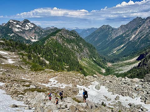 Looking down from the boulder field with a view of Silver Tip 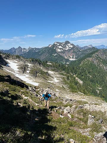 Up heather to the ridge 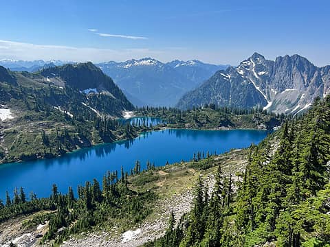 View of Twin Lakes from the ridge 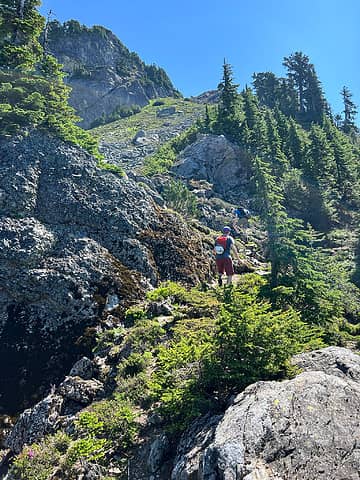 Steep heather 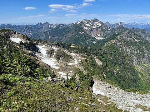 Looking back 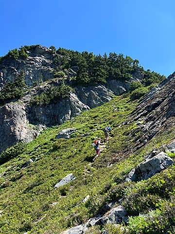 More steep heather 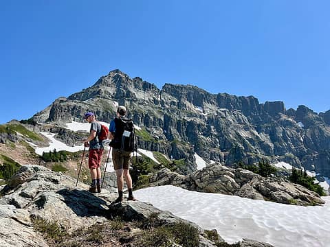 Said view 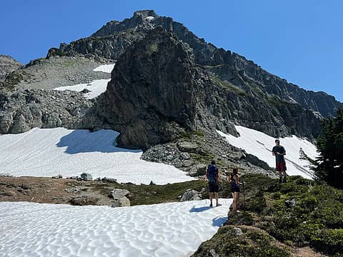 We ascended the snow patch second from the bottom left 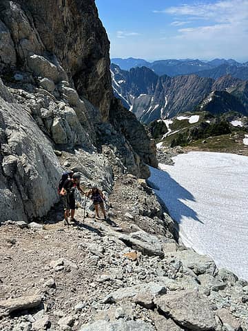 Getting onto talus from snow 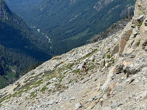 Near the top of talus, right below the cliff band 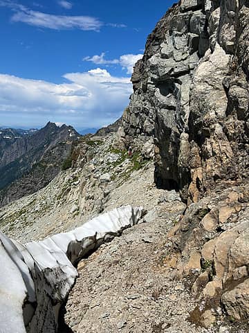 Bench and a view of the moat. If you zoom in, you'll one person walking along the bench (center of photo) and another gaining the bench (a little to the left of the center) 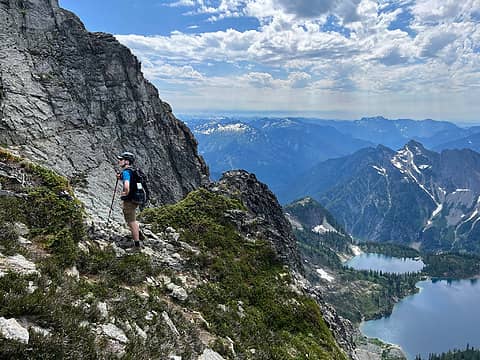 We walked a little ways along the bench here to reach the 4th class step. 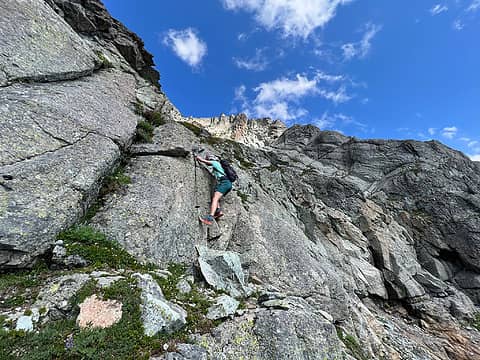 4th class move to get on the rock. I flagged on the downclimb 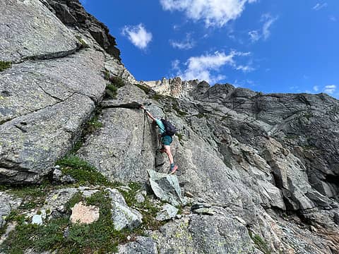 There is a nice rock to step onto but you can see how much I had to extend 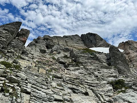 Looking up at a portion of the scramble. Looks nice, but it's loose 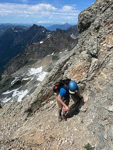 Lots of spots along the route with solid rock to use 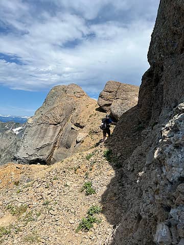 Rounding the loose orange-rock corner 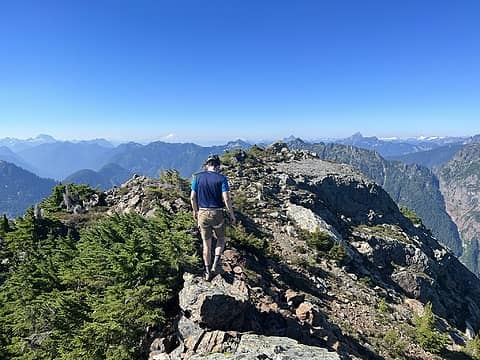 Final ridge walk to the summit of Silver Tip 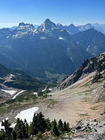 Del Campo + Gothic from summit of Silver Tip 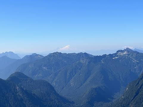 Baker from Silver Tip 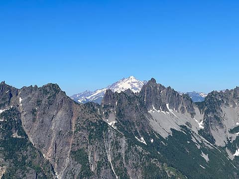 I liked the jagged ridge of Foggy against GP 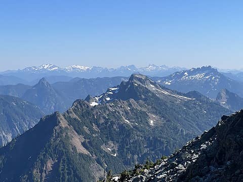 Towards the ALW. I thought Spire Mountain was super cool 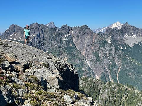 Cool slab on the summit 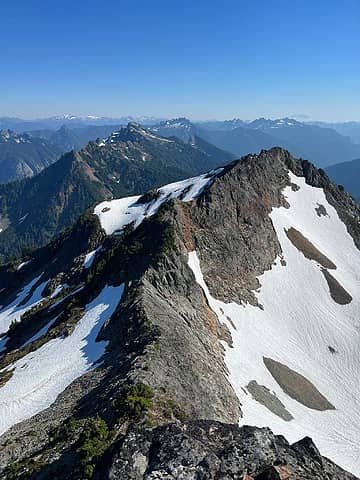 This is the upper ridge of Silver Tip. The traverse is to the left of the ridge 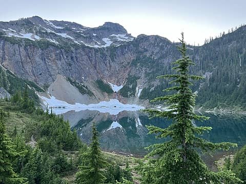 A calm evening 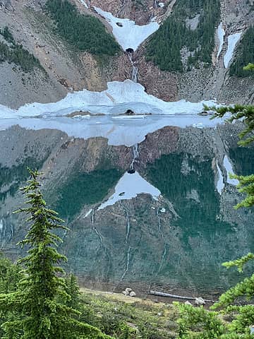 Our friend spotted a volcano in the reflection 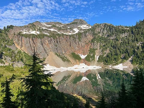 A calm morning and a cool look at Silver Tip 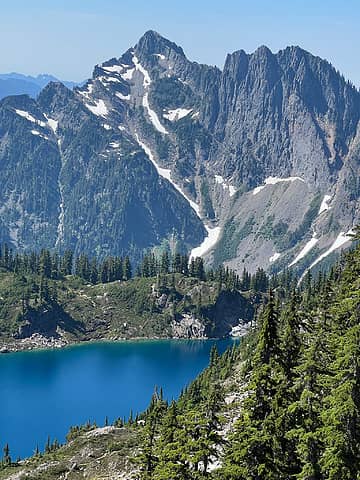 This face of Hubbart looks so cool 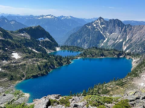 Better view of Twin Lakes 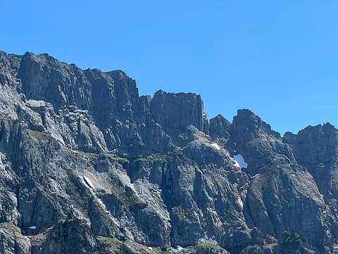 Cliff bands on Columbia 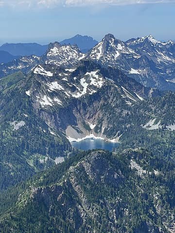 A cool look at Silver Lake + Silver tip 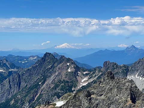 Baker again from Columbia (really digging the 3x zoom on my iPhone) 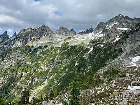 The clouds rolled in and the views got a bit moody. I liked how the waterfalls were illuminated 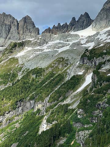 I think these are Wilman's Spires 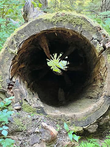 The inside of a fallen tree, full of spikes...looks crazy
 ozzy, Gimpilator, olderthanIusedtobe, Tom, Cyclopath, hikergirl1234, contour5, Bramble_Scramble, mosey, Lightning_bug ozzy, Gimpilator, olderthanIusedtobe, Tom, Cyclopath, hikergirl1234, contour5, Bramble_Scramble, mosey, Lightning_bug
ozzy, Gimpilator, olderthanIusedtobe, Tom, Cyclopath, hikergirl1234, contour5, Bramble_Scramble, mosey, Lightning_bug |
| Back to top |
  
|
|
Monkey Del Mar
Class 2 my ass!
Joined: 04 Sep 2007
Posts: 24 | TRs | Pics
Location: On the wrong gully |
Very nice trip and TR.
I'm considering doing Columbia tomorrow -- did you use bikes to get to Monte Cristo? Or if you walked in, how was the log crossing?
TIA
|
| Back to top |
|
|
vk
Member
Joined: 28 Jul 2021
Posts: 9 | TRs | Pics
Location: Washington |
|
vk
Member
|
Sat Aug 27, 2022 7:17 pm |
|
|
| Monkey Del Mar wrote: | | Very nice trip and TR.
I'm considering doing Columbia tomorrow -- did you use bikes to get to Monte Cristo? Or if you walked in, how was the log crossing?
TIA |
We did not use bikes because not everyone in our party had one. Its a good warmup
The log crossing is really straightforward. There are also flags after you cross to mark where to go.
|
| Back to top |
|
|
Monkey Del Mar
Class 2 my ass!
Joined: 04 Sep 2007
Posts: 24 | TRs | Pics
Location: On the wrong gully |
Great, thank you for the reply!
|
| Back to top |
|
|
awilsondc
Member

Joined: 03 Apr 2016
Posts: 1324 | TRs | Pics
|
vk |
| Back to top |
|
|
olderthanIusedtobe
Member
Joined: 05 Sep 2011
Posts: 7707 | TRs | Pics
Location: Shoreline |
Beautiful. I climbed Columbia almost by accident years ago. Was following the path up from the Twin Lakes overlook. Summiting wasn't my goal, but I ran into a climber on his way down that encouraged me to go for it. It's one of those, it doesn't really look like it has a fairly non technical route up that face, and yet it does. Such an imposing looking mountain, I love that view from that area. The whole trail from Silver Lake to Twin Lakes is pretty cool.
|
| Back to top |
|
|
olderthanIusedtobe
Member
Joined: 05 Sep 2011
Posts: 7707 | TRs | Pics
Location: Shoreline |
| vk wrote: | I think these are Wilman's Spires |
I can't quite tell, but I think these are crags on the ridge near East Wilmans
Here I think you've got Wilmans Peak and part of Wilmans Spires. They rise directly above Glacier Basin, so they're kind of around the corner from Twin Lakes area.
| vk wrote: | The inside of a fallen tree, full of spikes...looks crazy |
I've got a picture of this same log, quite picturesque.
|
| Back to top |
|
|
ozzy
The hard way

Joined: 30 Jul 2015
Posts: 475 | TRs | Pics
Location: University place, wa |
|
ozzy
The hard way
|
Sun Aug 28, 2022 8:01 pm |
|
|
| vk wrote: | The clouds rolled in and the views got a bit moody. I liked how the waterfalls were illuminated |
Wowwweee!!! 76 basin looks killer, badass photo!!  Awesome tr btw! I've always wanted to get up silver tip too. Columbia has to be one of the top scrambles IMHO. Gotta love the montes, cheers! Awesome tr btw! I've always wanted to get up silver tip too. Columbia has to be one of the top scrambles IMHO. Gotta love the montes, cheers!
I dont know whats gonna happen, but I wanna have my kicks before the whole shithouse goes up in flames-Mr Mojo Risin
vk
I dont know whats gonna happen, but I wanna have my kicks before the whole shithouse goes up in flames-Mr Mojo Risin
vk
|
| Back to top |
|
|
olderthanIusedtobe
Member
Joined: 05 Sep 2011
Posts: 7707 | TRs | Pics
Location: Shoreline |
| vk wrote: | Basin we crossed, heading towards the boulder field left of the last snow patch |
Okay, I think East Wilmans on the far left, Columbia obviously on the right, and the towers in question inbetween. Wilmans Spires are definitely further left, out of frame.
|
| Back to top |
|
|
olderthanIusedtobe
Member
Joined: 05 Sep 2011
Posts: 7707 | TRs | Pics
Location: Shoreline |
Oh shoot, the picture Ozzy quoted shows it even better--Columbia and all the various Wilmans Peaks and Spires.
ozzy
ozzy |
| Back to top |
|
|
vk
Member
Joined: 28 Jul 2021
Posts: 9 | TRs | Pics
Location: Washington |
|
vk
Member
|
Wed Aug 31, 2022 8:48 pm |
|
|
| olderthanIusedtobe wrote: | | Oh shoot, the picture Ozzy quoted shows it even better--Columbia and all the various Wilmans Peaks and Spires. |
Ah gotcha! I was trying to figure out what was what using a topo and my photos. Thanks for clarifying!
|
| Back to top |
|
|
|
|
You cannot post new topics in this forum
You cannot reply to topics in this forum
You cannot edit your posts in this forum
You cannot delete your posts in this forum
You cannot vote in polls in this forum
|
Disclosure: As an Amazon Associate NWHikers.net earns from qualifying purchases when you use our link(s). |


