| Previous :: Next Topic |
| Author |
Message |
geyer
Member


Joined: 23 May 2017
Posts: 463 | TRs | Pics
Location: Seattle |
|
geyer
Member
|
 Thu Jul 05, 2018 10:13 pm |
|
|
Date: July 4, 2018
Distance: 26.2 miles
Accum. Elevation Gain: ~ 7000' (+/- 2000 depending on which software computes it)
Total Humans Seen: None outside of the PCT/ Pete Lake
Lemah Mountain has two main approach routes - from Mineral Creek and from Pete Lake - so I thought it would be a nice challenge to connect those two routes into a loop that passed several alpine lakes. The main objective was to summit Lemah (#3) and, if time allowed, give Lemah #1 and Chikamin a run for their money. The route looked great on paper... If only reality were so kind
Tip: If you want to give this route a go, save it for August. I think I could shave 6-8 hours off my time if I were to do it again.
PSA: If you dropped a pair of trekking poles in the Lemah basin, send me a message with brand and defining trait. I picked them up.
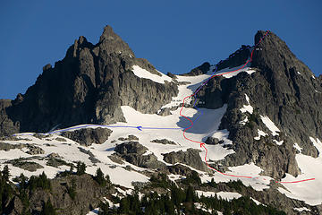 My route on Lemah (Class, not grade. brainfart.) 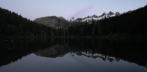 Pete Lake twilight views 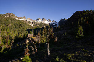 Lemah creek basin first views 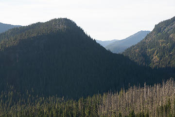 views back to the valley and forest fire remnants 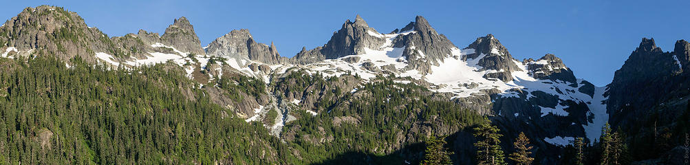 -L-E-M-A-H 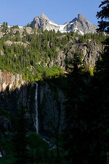 Waterfall + Lemah 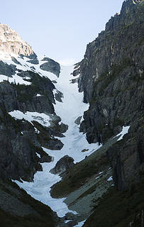 ascent 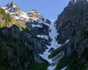 snow finger 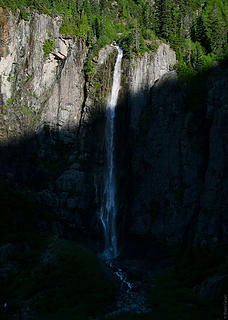 waterfall 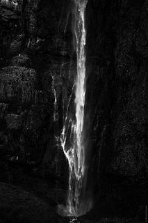 b&w 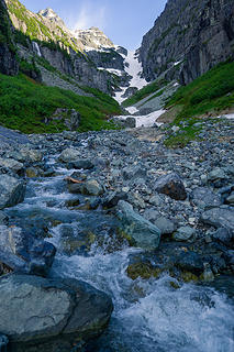 artsy take 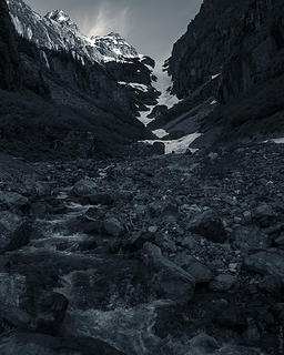 monochrome version 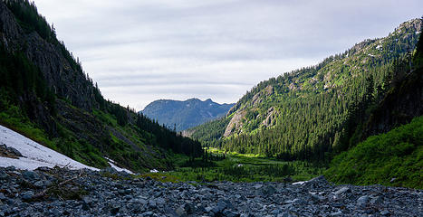 looking back 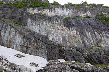 got crack? 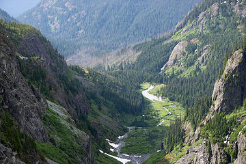 look back 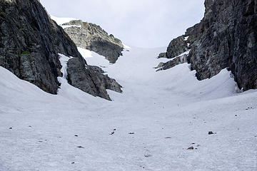 ascent 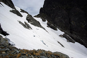 Yep, this is a real glacier with real crevasses 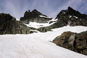 ascent 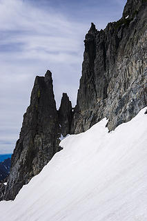 gendarmes 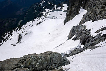 In case you thought I was exaggerating the steepness, here's this 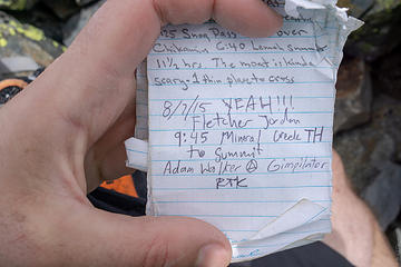 Thanks for the TR, fletcher 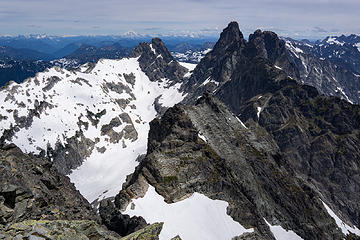 Lemah + Chimney Rock 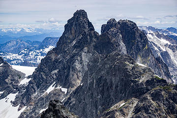 Chimney 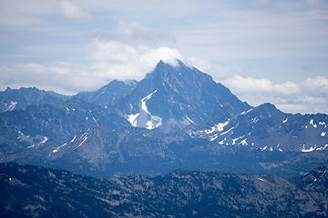 Stuart 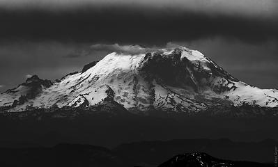 Vitamin R 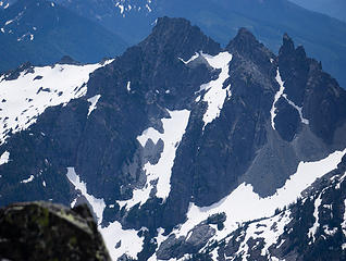 Three Queens 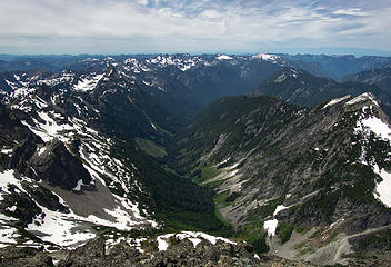 burntboot Creek Valley --> Middle Fork Snoqualmie 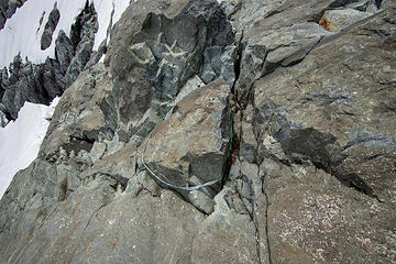 Rappel Sling. Yep, they had the right idea 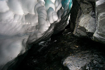 The moat that ate my ice axe 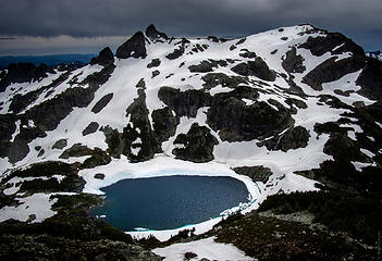 Chikamin Lake + Peak 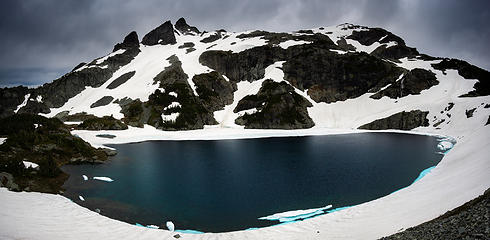 Chikamin 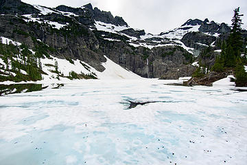 Glacier Lake more frozen than Chikamin, but 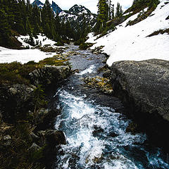 creek views 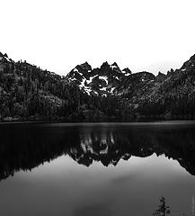 Specacle Lake looking back on Lemah 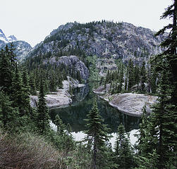 little inlet
|
| Back to top |
  
|
|
awilsondc
Member

Joined: 03 Apr 2016
Posts: 1324 | TRs | Pics
|
|
| Back to top |
|
|
Fletcher
Member

Joined: 29 Jul 2009
Posts: 1870 | TRs | Pics
Location: kirkland |
|
Fletcher
Member
|
Fri Jul 06, 2018 6:41 am |
|
|
Lemah is one of my all time favorite peaks. Nice solo outing 
|
| Back to top |
|
|
neek
Member

Joined: 12 Sep 2011
Posts: 2336 | TRs | Pics
Location: Seattle, WA |
|
neek
Member
|
Fri Jul 06, 2018 7:27 am |
|
|
Wow... thanks for the thorough and honest report. Boots are good. That Chikamin Lake+Peak photo is really dramatic. I think your Four Brothers shot is really Three Queens however.
|
| Back to top |
|
|
Bootpathguy
Member

Joined: 18 Jun 2015
Posts: 1788 | TRs | Pics
Location: United States |
Experience is what'cha get, when you get what'cha don't want
|
| Back to top |
|
|
puzzlr
Mid Fork Rocks

Joined: 13 Feb 2007
Posts: 7220 | TRs | Pics
Location: Stuck in the middle |
|
puzzlr
Mid Fork Rocks
|
Fri Jul 06, 2018 11:24 am |
|
|
I'm glad you got back safe. That's a lot to do any time of year but especially now. Your plan for running shoes would work better in Aug/Sep when there's a lot more rock and heather exposed. Congrats on making the summit.
|
| Back to top |
|
|
geyer
Member
Joined: 23 May 2017
Posts: 463 | TRs | Pics
Location: Seattle |
|
geyer
Member
|
Fri Jul 06, 2018 1:18 pm |
|
|
Aaron- I wish I hadn't taken my hand leash off during ski season. I'd be +1 axe right now  Fletcher- yeah I can see it being much more enjoyable with some company and better conditions
Neek/Puzzlr- boots would have helped in this snow a bit, if for no other reason than the stability they would provide the crampons. Not sure if kick-steps would have been a viable option.
Bootpathguy- that lake deserves more visitation!
Fletcher- yeah I can see it being much more enjoyable with some company and better conditions
Neek/Puzzlr- boots would have helped in this snow a bit, if for no other reason than the stability they would provide the crampons. Not sure if kick-steps would have been a viable option.
Bootpathguy- that lake deserves more visitation!
|
| Back to top |
|
|
wolffie
Member

Joined: 14 Jul 2008
Posts: 2693 | TRs | Pics
Location: Seattle |
|
wolffie
Member
|
Fri Jul 06, 2018 1:24 pm |
|
|
7/26/2014 The moat was the problem. I'd not have had the nerve to go for it if I hadn't seen someone coming down across the moat. Impossible to suss out from below. After I got across it, I saw how tenuous it was; I recall thinking it was OK where we crossed, but really thin snow bridges elsewhere that might have looked OK from below.
I just looked at my TR from 2014, and you should check out b00's comment, which has a significant photo and route modification:
"...when i was there 8-5-2012, the snow looked similar, but we exited perfect snow a lot farther climber's right. the reason, i checked that way, was i saw pictures of others doing the same. so my assumption is, the snow works better farther right most times."
Lemah 7/26/2014
Some people have better things to do with their lives than walking the dog. Some don't.
Some people have better things to do with their lives than walking the dog. Some don't.
|
| Back to top |
|
|
olderthanIusedtobe
Member
Joined: 05 Sep 2011
Posts: 7708 | TRs | Pics
Location: Shoreline |
| geyer wrote: | | that lake deserves more visitation! |
Beautiful lake in a beautiful setting, but hopefully it doesn't go the route of Jade and various others and get overly visited. Just keep Backpacker Magazine away from it and it might be OK.
|
| Back to top |
|
|
Jake Robinson
Member
Joined: 02 Aug 2016
Posts: 521 | TRs | Pics
|
That's one hell of a marathon! Captivating TR - I wish I could write like you.
|
| Back to top |
|
|
DigitalJanitor
Dirt hippie

Joined: 20 May 2012
Posts: 792 | TRs | Pics
|
huge thanks for the trip report and mapping. We're not cool enough to climb Lemah- especially with a 12yo in tow- but Spectacle is on the list, and I'm glad for your more accurate GPS shot + possibility of getting up to Glacier from that direction.
|
| Back to top |
|
|
geyer
Member
Joined: 23 May 2017
Posts: 463 | TRs | Pics
Location: Seattle |
|
geyer
Member
|
Mon Jul 09, 2018 5:58 pm |
|
|
| olderthanIusedtobe wrote: | | Beautiful lake in a beautiful setting, but hopefully it doesn't go the route of Jade and various others and get overly visited. Just keep Backpacker Magazine away from it and it might be OK |
So long as there's not a real trail up there, I think it's safe. Or maybe there already is a trail and it was covered in snow?
| Jake Robinson wrote: | | That's one hell of a marathon! Captivating TR - I wish I could write like you. |
That's that B average high school English at work! 
| DigitalJanitor wrote: | | huge thanks for the trip report and mapping. We're not cool enough to climb Lemah- especially with a 12yo in tow- but Spectacle is on the list, and I'm glad for your more accurate GPS shot + possibility of getting up to Glacier from that direction. |
Wear pants! That brush is a bit thick. I don't remember anything too sketchy, but there is a bit of scrambling to get around the south side of Spectacle. You could always just bring a dry-bag and wade through the lake to avoid it, though. Nothing too deep near the shore from what I could tell. Or better yet, packraft across!
|
| Back to top |
|
|
DigitalJanitor
Dirt hippie
Joined: 20 May 2012
Posts: 792 | TRs | Pics
|
Packraft FTW! We're planning on herfing two boats up. 
|
| Back to top |
|
|
olderthanIusedtobe
Member
Joined: 05 Sep 2011
Posts: 7708 | TRs | Pics
Location: Shoreline |
| geyer wrote: | | So long as there's not a real trail up there, I think it's safe. Or maybe there already is a trail and it was covered in snow? |
At least as good as the trail to Jade Lake, which is getting hammered from what I hear.
|
| Back to top |
|
|
|
|
You cannot post new topics in this forum
You cannot reply to topics in this forum
You cannot edit your posts in this forum
You cannot delete your posts in this forum
You cannot vote in polls in this forum
|
Disclosure: As an Amazon Associate NWHikers.net earns from qualifying purchases when you use our link(s). |


 I saw you climbed Lemah on your Instagram and thought, oh man he climbed Lemah!!! I'm so jealous!
I read the whole report.
I'm not jealous anymore.
I saw you climbed Lemah on your Instagram and thought, oh man he climbed Lemah!!! I'm so jealous!
I read the whole report.
I'm not jealous anymore.  Nice job gettin 'er done!