| Previous :: Next Topic |
| Author |
Message |
Matt Lemke
High on the Outdoors


Joined: 15 Jul 2010
Posts: 2052 | TRs | Pics
Location: Grand Junction |
|
Matt Lemke
High on the Outdoors
|
 Sun Jul 15, 2018 2:55 pm |
|
|
After day hiking Chiwawa Mountain I drove from Coles Corner to Chelan and got on the fast boat Wednesday morning from Fields Point, arrived in Stehekin at 11am, then took the shuttle bus to High Bridge. I started walking at 12:30pm towards the Park Creek Trailhead. The 4 miles to Bridge Creek went fast, then another 1.5 miles to Park Creek. I hiked these miles in my sandals. Switching to my tennis shoes, I started up the Park Creek Trail, elevation 2300 feet, which was in great condition sans a few blowdowns. The first 1000 feet is a steep ascent to get above the gorge where Park Creek dumps into the Stehekin River, then it flattens out and crosses back to the east side of the creek on a nice bridge. This was the worst part of the approach since it was sooo hot. I jumped in the ice cold creek where the trail crossed.
The next 3 miles are essentially pancake flat, gaining only 640 feet net elevation as the trail weaves up and down, and through the Goode burn area until reaching 5 mile and Buckner camps at 4000 feet near the head of the basin. Views of the SE face of Buckner, and the east face of Booker (aka Park Ridge) are extremely impressive. The trail then climbs steeply once again for 2200 feet to Park Creek Pass at 6200 feet. Amazingly the trail was designed to avoid all the slide alder swaths so none was growing over the trail  There was some residual snow in the flat basin at 5750 feet but only a small amount and should be completely gone in a week or so. Park Creek Pass itself is a beautiful, and special spot in the North Cascades. It's certainly remote! A wildlife camera was actually in use at the pass looking for rare carnivores. There was some residual snow in the flat basin at 5750 feet but only a small amount and should be completely gone in a week or so. Park Creek Pass itself is a beautiful, and special spot in the North Cascades. It's certainly remote! A wildlife camera was actually in use at the pass looking for rare carnivores.
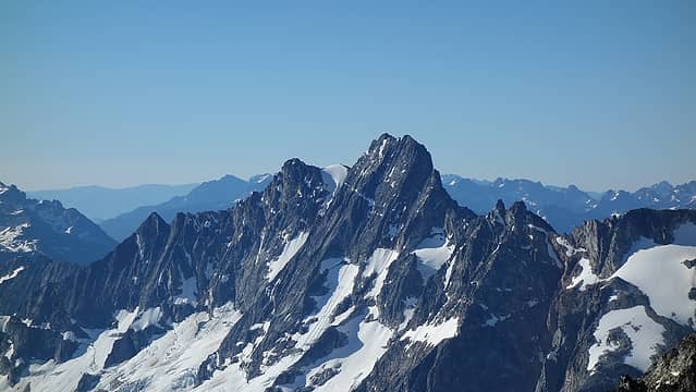
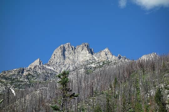 Looking up at Goode 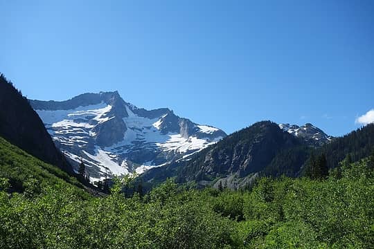 Buckner at the head of the valley 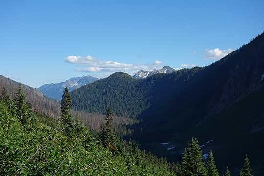 Looking down Park Creek 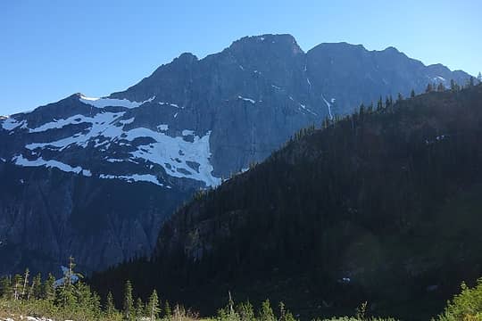 East face of Booker (Park Creek Ridge) 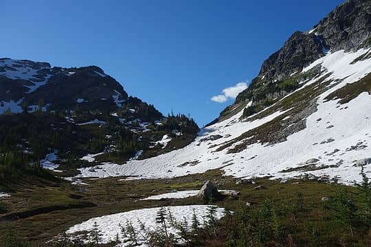 Nearing Park Creek Pass 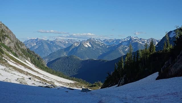 View from the pass 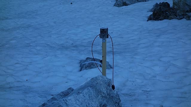 Wildlife camera 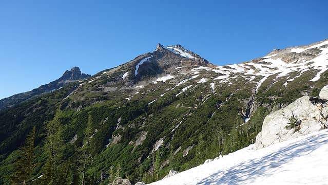 View of the northward traverse from my bivy 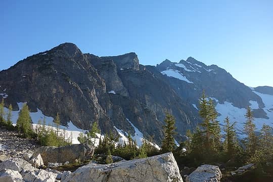 Larch trees from my bivy 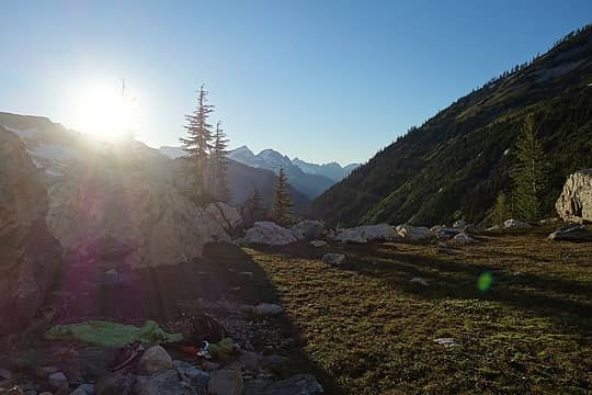 Sun setting 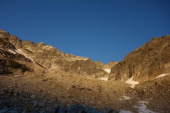 Sunrise 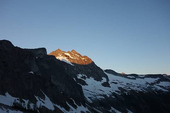 Sunrise on the edge of Buckner 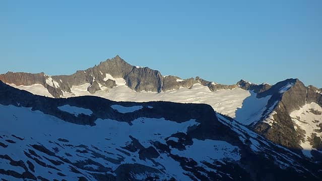 Forbidden 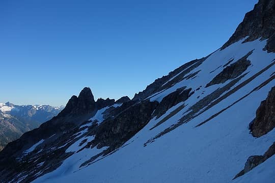 Traverse these snowfields 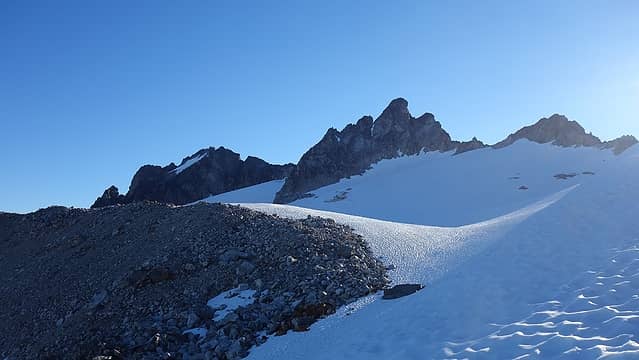 Arriving at the Fremont 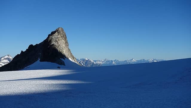 Walking the flat section of Fremont Glacier 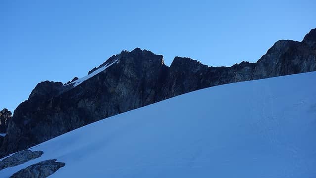 Summit of Logan finally in view  ) but the views were truly remarkable. Goode and Buckner dominated the skyline but Booker, Forbidden and the entire Inspiration Traverse were also prominent, as was Jack, Hozomeen and the volcanoes. The air was so clear actually that I could make out great detail on Rainier! ) but the views were truly remarkable. Goode and Buckner dominated the skyline but Booker, Forbidden and the entire Inspiration Traverse were also prominent, as was Jack, Hozomeen and the volcanoes. The air was so clear actually that I could make out great detail on Rainier!
 Goode from summit 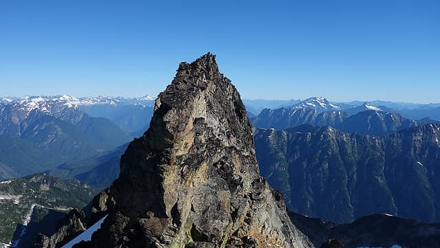 True summit from false summit 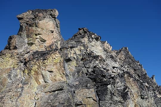 Scrambling terrain on east side of south ridge 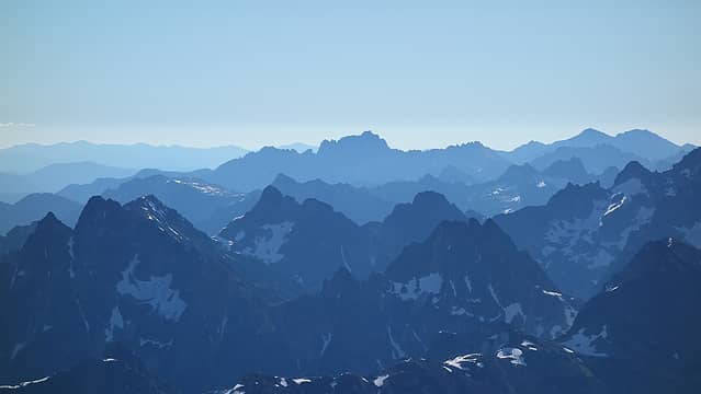 View east 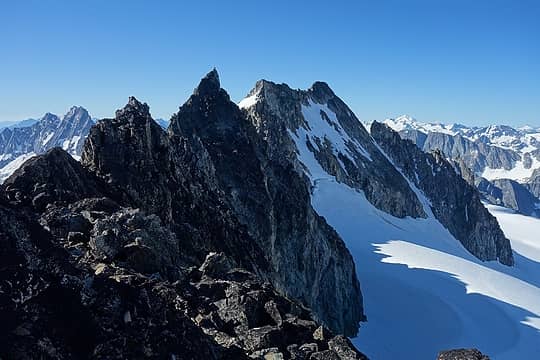 View north taken on descent 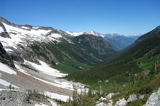 Thunder Creek 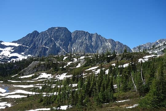 Booker again
|
| Back to top |
  
|
|
RichP
Member

Joined: 13 Jul 2006
Posts: 5633 | TRs | Pics
Location: here |
|
RichP
Member
|
Sun Jul 15, 2018 4:50 pm |
|
|
You make it sound so easy that this is one I might actually try someday.
|
| Back to top |
|
|
rstoddard24
BBQWingz

Joined: 30 Dec 2016
Posts: 74 | TRs | Pics
|
nice! we summited Logan yesterday (7/14), Fremont glacier via Thunder Creek TH. The climbers trail crosses the rib much lower (~6600'), your way is more direct but climbers trail is all easy traversing. We also found the scrambling to be class 2 and 3, with perhaps 1 or 2 class 4 moves just below the summit. We saw 2 parties leaving (who summited) when we were walking in, then 1 party climbing the Banded glacier while we were on the summit - surprised to see so many folks out there going for Logan
|
| Back to top |
|
|
Matt Lemke
High on the Outdoors
Joined: 15 Jul 2010
Posts: 2052 | TRs | Pics
Location: Grand Junction |
|
Matt Lemke
High on the Outdoors
|
Sun Jul 15, 2018 7:28 pm |
|
|
| rstoddard24 wrote: | | nice! we summited Logan yesterday (7/14), Fremont glacier via Thunder Creek TH. The climbers trail crosses the rib much lower (~6600'), your way is more direct but climbers trail is all easy traversing. We also found the scrambling to be class 2 and 3, with perhaps 1 or 2 class 4 moves just below the summit. We saw 2 parties leaving (who summited) when we were walking in, then 1 party climbing the Banded glacier while we were on the summit - surprised to see so many folks out there going for Logan |
Woah I didn't even know there was a trail all the way around that rib from park creek pass. I just saw brush down in that mid 6000s elevation range and thought "no I'll just go higher"
Good to know.
|
| Back to top |
|
|
Mesahchie Mark
A Lerxst

Joined: 10 May 2005
Posts: 700 | TRs | Pics
Location: In Wonderland |
Way to get things done, Matt!
|
| Back to top |
|
|
|
|
You cannot post new topics in this forum
You cannot reply to topics in this forum
You cannot edit your posts in this forum
You cannot delete your posts in this forum
You cannot vote in polls in this forum
|
Disclosure: As an Amazon Associate NWHikers.net earns from qualifying purchases when you use our link(s). |


