| Previous :: Next Topic |
| Author |
Message |
Matt Lemke
High on the Outdoors


Joined: 15 Jul 2010
Posts: 2052 | TRs | Pics
Location: Grand Junction |
|
Matt Lemke
High on the Outdoors
|
 Tue Apr 16, 2019 10:08 pm |
|
|
After attempting Cerro el Plomo and climbing Cerro Placas in the Santiago area in Central Chile, we took a break from climbing for a bit and took the bus east, over to Mendoza to explore the Argentina wine country. We enjoyed some excellent Merlot and other red wines on a self guided bike powered winery tour, and ate some amazing food. I tried the wine flavored ice cream, but wasn't a fan, however like in typical Argentina fashion, all the other sweets were incredible. They have the best sweet desserts and ice creak I've ever had. After a few days we continued north on a long bus ride to Salta, where we once again enjoyed some very fine cuisine, which was different than the rest of Argentina. We ran into a large honoring ceremony for all the police forces, many of which were women, which was cool to see. We hiked up the hill in the middle of the city and had a great view of the surrounding hills. Salta itself sits right at the edge of the more humid and tropical eastern portion of Argentina.
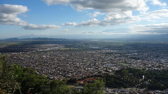 Salta 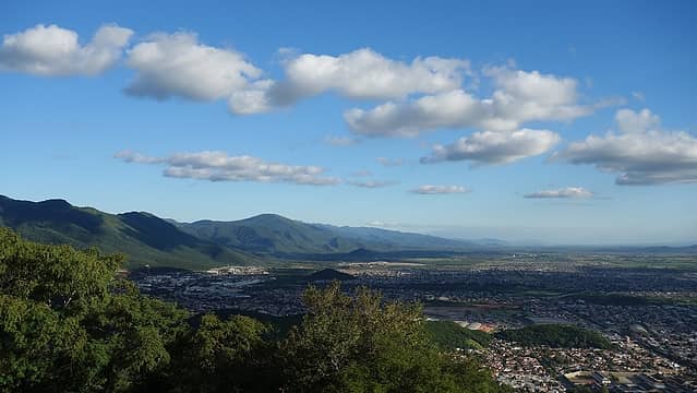 Hills surrounding Salta 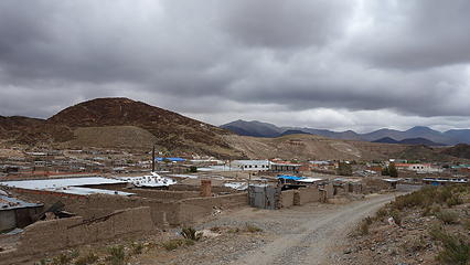 Walking around San Antonio de las Cobres 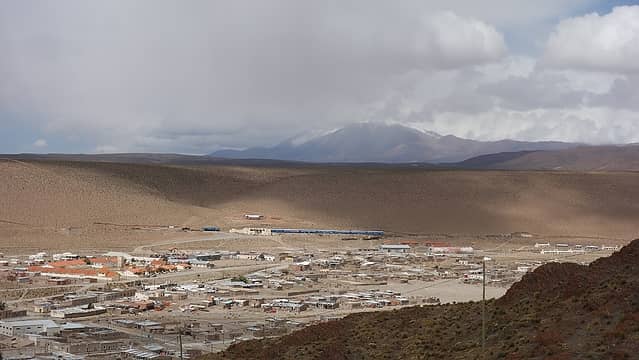 View of San Antonio de las Cobres from the hill above town 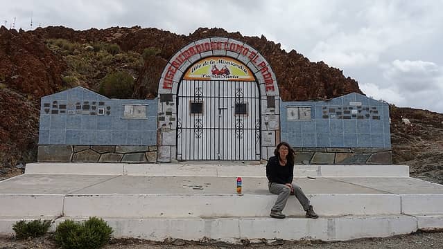 Church atop the hill in town 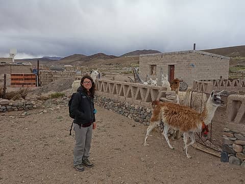 Llamas just outside town 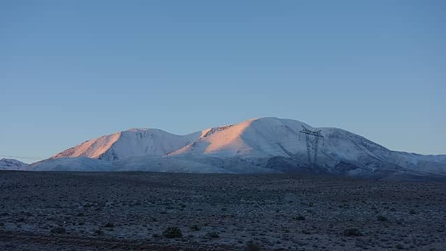 Sunrise on Nevado de Acay after 3 days of stormy weather 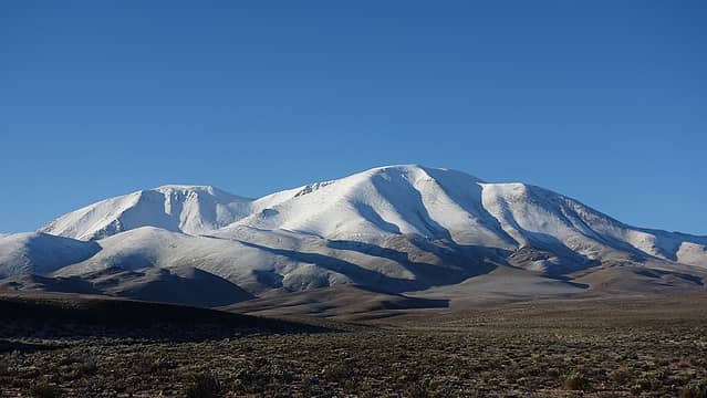 Lots of fresh snow! 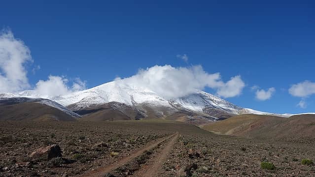 We found an old road! 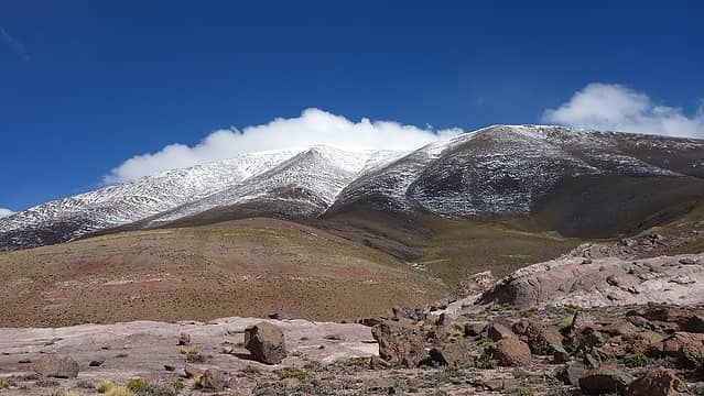 Getting closer to the mountain 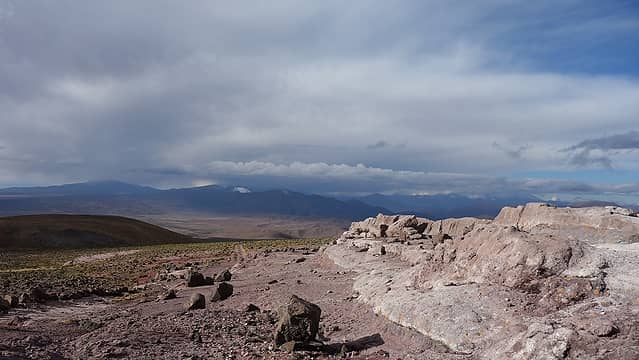 View from our camp 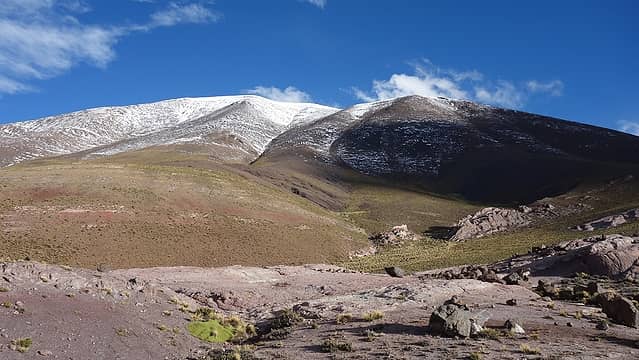 Nevado de Acay from camp 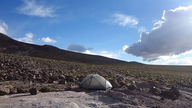 Our tent...I hope it isn't windy 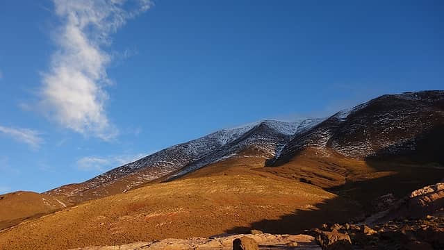 Sunset over Nevado de Acay 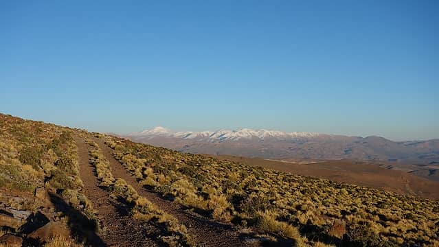 Starting out on a bluebird morning 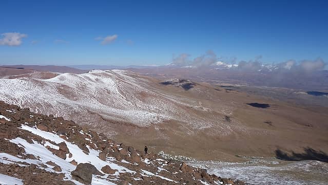 Starting the ascent up the steeper NW ridge 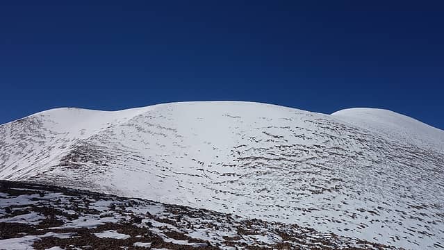 View of the final 150 meters from the 5500 meter elevation flat bench 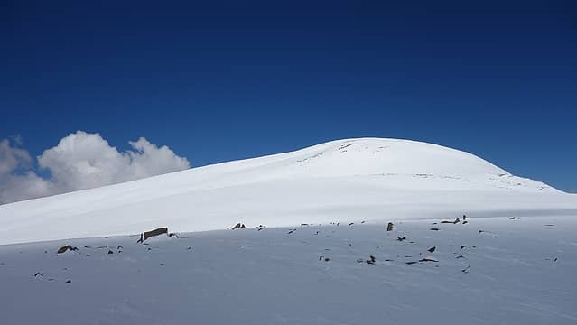 On the summit plateau looking to the highest point 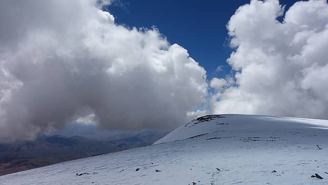 Clouds rolling in 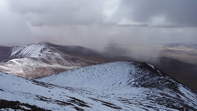 A little virga 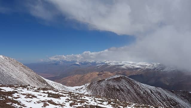 Views on the descent 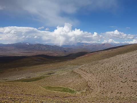 Nearing camp once again 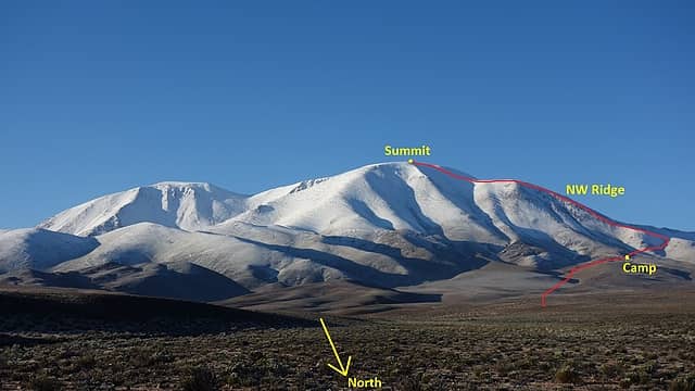 Our route up the Class 2 NW ridge
|
| Back to top |
  
|
|
RichP
Member

Joined: 13 Jul 2006
Posts: 5634 | TRs | Pics
Location: here |
|
RichP
Member
|
Wed Apr 17, 2019 5:40 am |
|
|
Salta is a nice city and maintains much of its colonial character. San Antonio de los Cobres is where El Tren a las Nubes passes in tourist season. We hopped a freight train in Salta that crosses to Chile at Socompa and travels the same route by offering the workers a few $. I remember running from the train to a kiosko in San Antonio de los Cobres to get some food at a stop. I only got a few steps and was winded.
Interestingly, the rail line was designed by American engineer, Richard Maury, who stayed in Argentina and is buried right along the tracks at a station bearing his name. The project apparently was the crown jewel of his work life and he chose to remain a part of it.
https://en.wikipedia.org/wiki/Tren_a_las_Nubes
Your reports have me feeling nostalgic.

|
| Back to top |
|
|
Brian Curtis
Trail Blazer/HiLaker

Joined: 16 Dec 2001
Posts: 1696 | TRs | Pics
Location: Silverdale, WA |
For your local fix of Argentine style ice cream stop by Mora Iced Creamery. They have locations in Poulsbo, Kingston, and Bainbridge Island with more coming to Silverdale and Covington.
that elitist from silverdale wanted to tell me that all carnes are bad--Studebaker Hoch
that elitist from silverdale wanted to tell me that all carnes are bad--Studebaker Hoch
|
| Back to top |
|
|
Matt Lemke
High on the Outdoors
Joined: 15 Jul 2010
Posts: 2052 | TRs | Pics
Location: Grand Junction |
|
Matt Lemke
High on the Outdoors
|
Wed Apr 17, 2019 7:57 pm |
|
|
| Brian Curtis wrote: | | For your local fix of Argentine style ice cream stop by Mora Iced Creamery. They have locations in Poulsbo, Kingston, and Bainbridge Island with more coming to Silverdale and Covington. |
Holy smokes I will just have to try that out! Thanks  Rich, glad you are enjoying them!
|
| Back to top |
|
|
|
|
You cannot post new topics in this forum
You cannot reply to topics in this forum
You cannot edit your posts in this forum
You cannot delete your posts in this forum
You cannot vote in polls in this forum
|
Disclosure: As an Amazon Associate NWHikers.net earns from qualifying purchases when you use our link(s). |


