| Previous :: Next Topic |
| Author |
Message |
freddyfredpants
saucy


Joined: 08 Jul 2018
Posts: 40 | TRs | Pics
Location: Seattle |
Trans-border adventuring was had from Saturday to Monday ticking the easier Bulgers in the area.
After picking up a NCNP permit in Sedro-Wooley around 9 I got to the hard stuff on Depot Creek Road around noon. Feeling overconfident with all the complaints about the road yet thinking "this isn't so bad" I passed a responsible parking spot located about 100 ft off a right-hand spur. I was soon faced with a couple of rocks on which I was not willing to risk destroying an Outback in order to (maybe) pass. By 1 pm I had ended up delicately turning the car around on a road with no turnaround spots and retreated to the parking spot, turns out only a mere 10 minute walk distant. I headed up the road and passed a Jeep that was parked at the last decent spot. I guess that's the trail head. Only later did I realize I should have made a hard left uphill near a clearing.
The wrong road suckered me in and I passed a few people from the jeep with big packs. This filled me with confidence, safety of the herd. We followed flagging until reaching a clearing in open forest when they took a pause, saying something vague about this is as far as they've ever come and that the trail petered out ahead. Nonsense I thought, this goes all the way to the top. I pressed on as the trail petered out. Almost 2 hours after leaving the car I arrived at marker 65, with the added bonus of thrashing about 100 yards east along the boundary mow line. The trail past the NCNP sign was in occasionally good shape but with a few logjams and brushy patches. After half a mile I missed a turn, suckered in this time by an "obvious" straight section which faded after 50 feet or so. On my return I augmented the pile of sticks to "close" it. I think a lot of people miss this hard right turn. I went about a mile in mostly open mossy forest until picking up the trail again. Turns out the section I missed on the up track had at least half a dozen nasty logjams. It stays pretty close to the north bank of Depot Creek and features a huckleberry brush car wash. After reaching the delicious trail I found it pretty obvious to the waterfall, with the occasional brushy overgrown stretch to keep it honest. Above the waterfall was also obvious, and well-cairned where it needed to be. After passing a marsh it was tedious but steady progress to Ouzel Lake, arriving 7 hours after leaving the car.
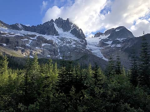 NE face of Redoubt 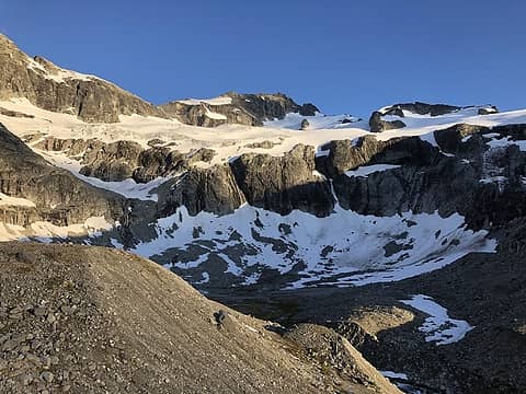 Ouzel Lake and NW Mox 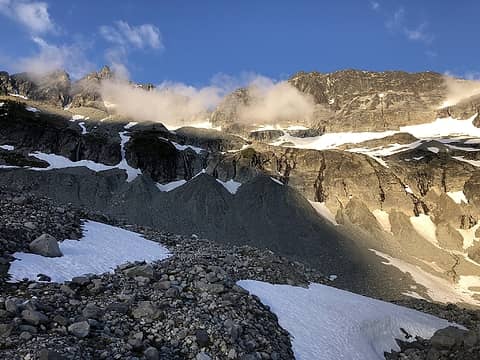 Looking from Ouzel Lake towards Spickard - the direct snow finger is towards left of image. 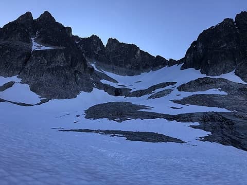 Shaded and chilly side of Spickard 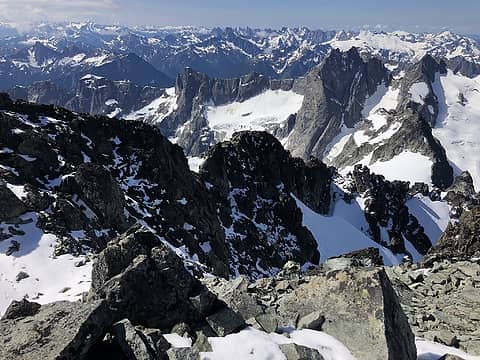 South from top of Spickard 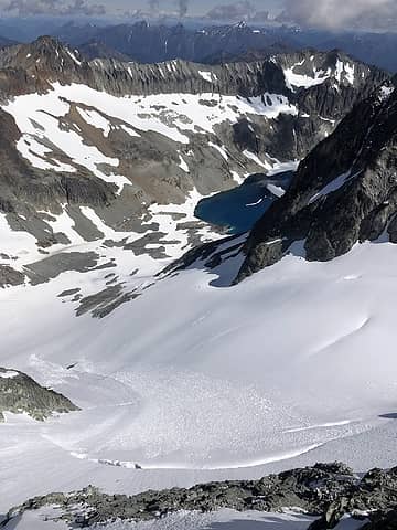 Silver Glacier 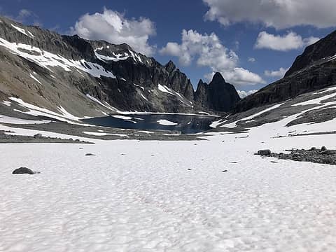 Rahm and Devils Tongue looming over Silver Lake 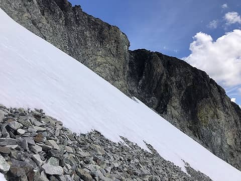 The gully I took on Rahm. Get in there and make a left. Piece of cake. 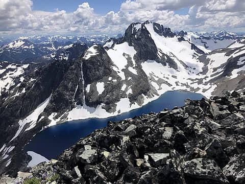 Spickard and Silver Lake 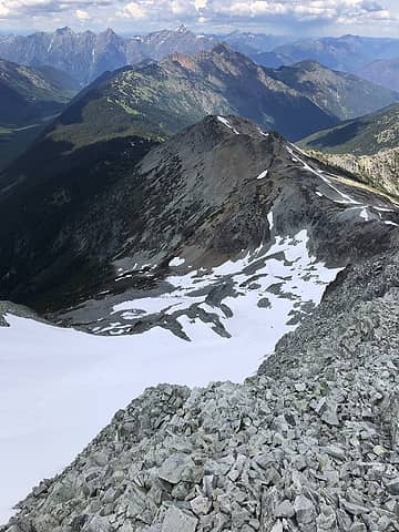 From summit, N face of Rahm 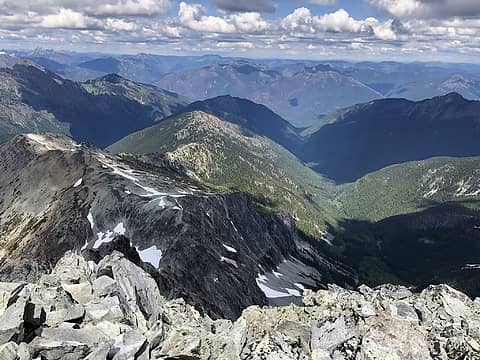 Looking NE from top of Rahm. The broken snowy finger seemed like a possible route to access the upper reaches of McNaugh cirque. 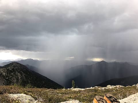 Dammit  Dammit 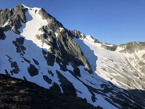 Maselpanik Glacier from N of Rahm 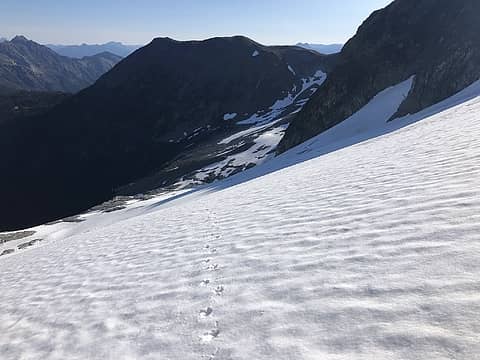 Looking back towards N Ridge of Rahm 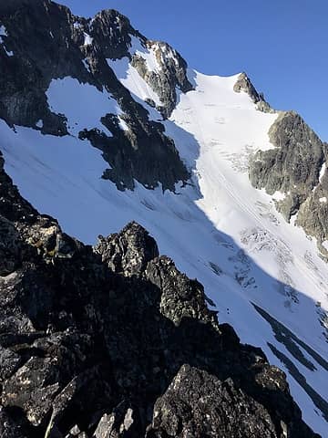 Custer Glacier 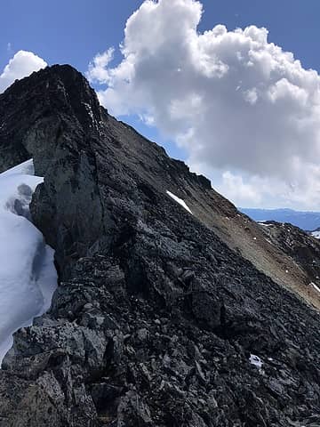 Successful minimization of choss travel was had by using so much glacier. 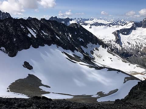 Direct SW bowls from Custer 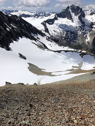 Choss dawgin 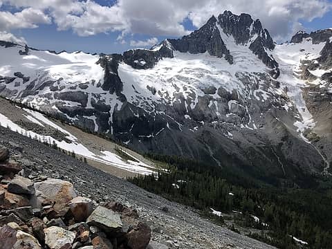 Redoubt watching over final scree slopes returning me to heather and forest
|
| Back to top |
  
|
|
rbuzby
Attention Surplus

Joined: 24 Feb 2009
Posts: 1011 | TRs | Pics
|
|
rbuzby
Attention Surplus
|
 Tue Jul 02, 2019 2:49 pm |
|
|
Nice pics!
TRs like this are the only time I wish Canada did not exist. Not enough suffering on that approach. Back in my day, it was over 20 miles to get up there through Hannegan pass, and it was uphill both ways. And we used to call them "The North Cascades".
Redoubt is such a great mountain. Very important. Beautiful.
|
| Back to top |
|
|
awilsondc
Member

Joined: 03 Apr 2016
Posts: 1324 | TRs | Pics
|
|
| Back to top |
|
|
Jake Robinson
Member
Joined: 02 Aug 2016
Posts: 521 | TRs | Pics
|
|
| Back to top |
|
|
raising3hikers
Member
Joined: 21 Sep 2007
Posts: 2344 | TRs | Pics
Location: Edmonds, Wa |
I like your idea to try and get devil's tongue from that way, sorry it didn't happen. nice trip anyways getting 3 good pks
|
| Back to top |
|
|
|
|
You cannot post new topics in this forum
You cannot reply to topics in this forum
You cannot edit your posts in this forum
You cannot delete your posts in this forum
You cannot vote in polls in this forum
|
Disclosure: As an Amazon Associate NWHikers.net earns from qualifying purchases when you use our link(s). |


