| Previous :: Next Topic |
| Author |
Message |
MangyMarmot
Member


Joined: 06 Apr 2012
Posts: 474 | TRs | Pics
|
It was time to do a bigger day trip. I had a couple of peaks in the Alpine Lakes Wilderness on my mind. St. Agnes Ridge and Otter Point. Looking at the map it looked reasonable to do a loop starting from the West Fork Foss Lakes trailhead, tag St. Andrews Ridge, then drop to Otter Lake, climb up to Otter Point, hike out to the Necklace Valley trailhead, and hike the road back to my car. There would be some unknown terrain, but it would probably go.
The hike had a rocky start. At the trailhead I realized I forgot to download the maps to the area so I drove out almost to highway 2 where I could get reception, downloaded the maps and drove back to the trailhead. This burned about 45 minutes which I would later need. I followed the trail up to Big Heart Lake. This went smoothly. I saw no other hikers on the trail. There were a number of campers milling around camp but nobody actually hiking. The weather was nice and many peaks were in view. I continued on the trail to the Atrium until I found the unofficial side trail to the outlet of Angeline Lake. This trail is not too hard to find if you are looking for it. It's a bit scrambly getting down to the outlet stream. Crossing the outlet was easy. The trail soon started to fade. I found a couple of cairns on the way us St. Agnes Ridge, but the last part was just open country. Little bit of scrambling near the top. There is a small cairn near the summit which holds the summit register. I got here a bit later than I expected. I took some photos as the view was pretty nice.
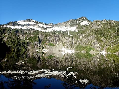 Copper Lake and Benkopp Peak 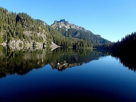 Malachite above Copper Lake 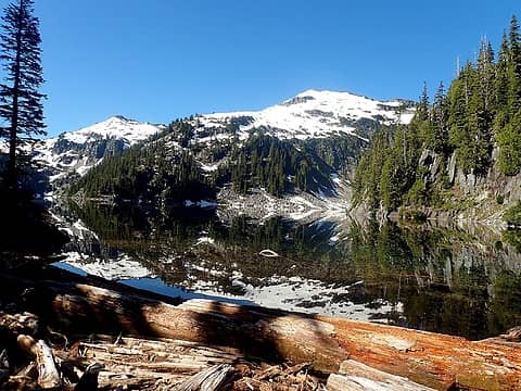 Big Heart Lake, Camp Robber Peak and Tourmaline Peak 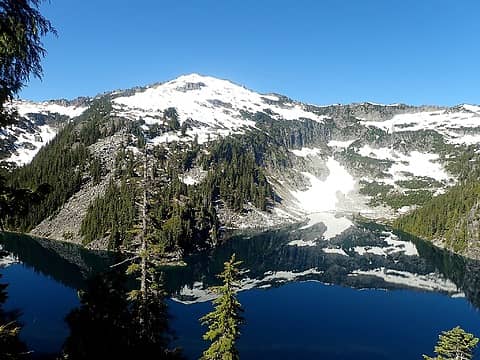 Camp Robber Peak 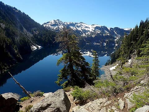 Lake Angeline and Ironcap 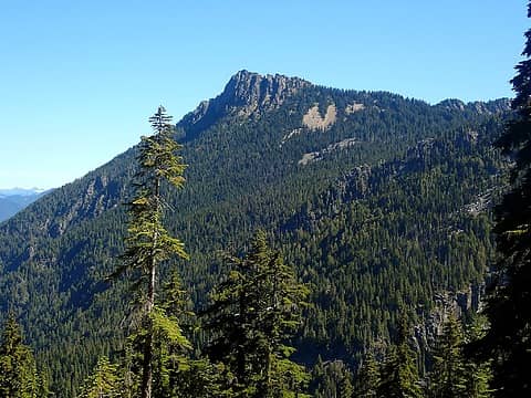 Silver Eagle 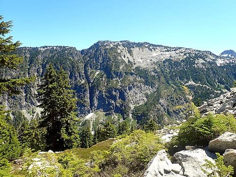 Otter Point from St. Agnes 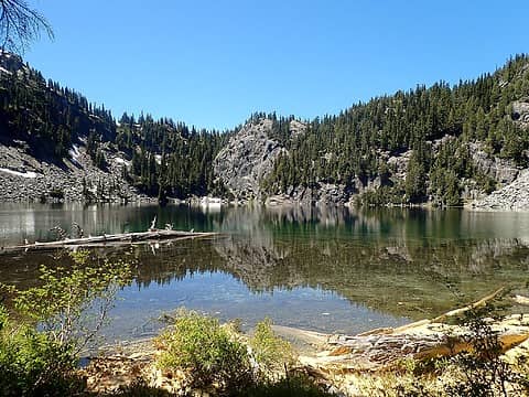 Azurite Lake 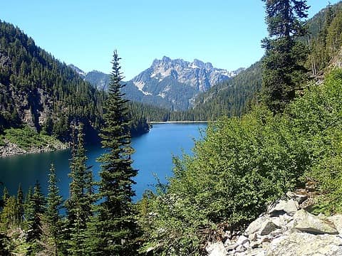 Otter Lake and Malachite 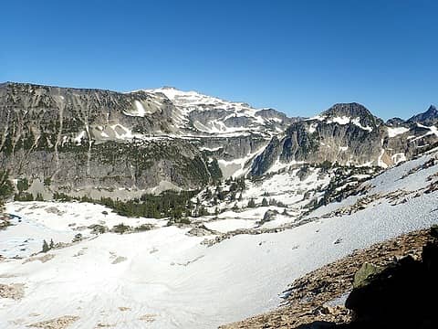 Hinman and La Bohn 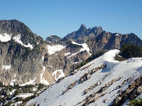 Bears Breast  Shroud 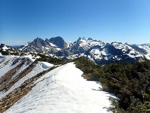 Peaks of the Alpine Lakes crest 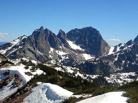 The various Chiefs 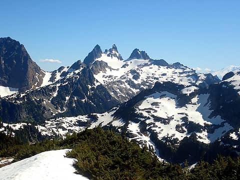 Chimney Rock and Overcoat 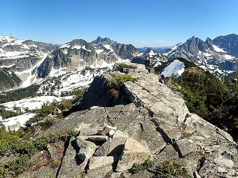 View from Otter Point Summit 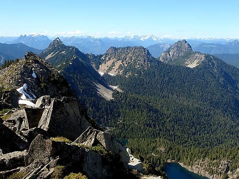 Silver and Bald Eagles 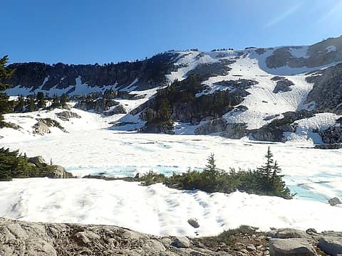 Tahl Lake
 Bootpathguy, Slim, RichP, awilsondc, BarbE, Tom, Nancyann, Now I Fly, mosey, Waterman, Bramble_Scramble, rubywrangler, reststep, Gimpilator, half fast Bootpathguy, Slim, RichP, awilsondc, BarbE, Tom, Nancyann, Now I Fly, mosey, Waterman, Bramble_Scramble, rubywrangler, reststep, Gimpilator, half fast
Bootpathguy, Slim, RichP, awilsondc, BarbE, Tom, Nancyann, Now I Fly, mosey, Waterman, Bramble_Scramble, rubywrangler, reststep, Gimpilator, half fast |
| Back to top |
  
|
|
Fletcher
Member

Joined: 29 Jul 2009
Posts: 1870 | TRs | Pics
Location: kirkland |
|
Fletcher
Member
|
 Fri Jul 22, 2022 5:58 am |
|
|
|
| Back to top |
|
|
Gimpilator
infinity/21M

Joined: 12 Oct 2006
Posts: 1684 | TRs | Pics
Location: Edmonds, WA |
Sounds like you had a similar situation with lake shores as we did recently. It's an interesting area. Thanks for all the good photos. I can now see the views we missed.
|
| Back to top |
|
|
contour5
Member

Joined: 16 Jul 2003
Posts: 2963 | TRs | Pics
|
|
contour5
Member
|
Fri Jul 22, 2022 5:48 pm |
|
|
Thanks for posting. That's an awesome day out!
|
| Back to top |
|
|
Waterman
Member

Joined: 21 Mar 2015
Posts: 590 | TRs | Pics
Location: Big Snow Quadrangle |
|
Waterman
Member
|
Fri Jul 22, 2022 6:24 pm |
|
|
Very impressive dayhike.
Two roads diverged in a wood, and I,I took the one less traveled by. And that has made all the difference.
Robert Frost
Two roads diverged in a wood, and I,I took the one less traveled by. And that has made all the difference.
Robert Frost
|
| Back to top |
|
|
FiresideChats
Member
Joined: 20 Jan 2014
Posts: 365 | TRs | Pics
Location: San Juan Islands |
A beautiful and impressive trip, Marmot. Reminded me of last summer, looking down from Atrium into the strikingly clear turquoise of Angeline where the cliff walls plunge down to unknown depths.
|
| Back to top |
|
|
Bluebird
suffering optional

Joined: 22 Jan 2014
Posts: 199 | TRs | Pics
Location: United States |
|
Bluebird
suffering optional
|
Mon Jul 25, 2022 3:18 pm |
|
|
Geez that's a full day, Dave!
I really enjoy that area. No advice on the otter lake issue since I came from the other side on my Alpine Lakes High Route trip. I particularly enjoyed the view from Otter Point. i descended via Foehn and Tahl lakes to the Tanks and descended the Tank Lakes route as part of another trip.
|
| Back to top |
|
|
|
|
You cannot post new topics in this forum
You cannot reply to topics in this forum
You cannot edit your posts in this forum
You cannot delete your posts in this forum
You cannot vote in polls in this forum
|
Disclosure: As an Amazon Associate NWHikers.net earns from qualifying purchases when you use our link(s). |


