| Previous :: Next Topic |
| Author |
Message |
RichP
Member


Joined: 13 Jul 2006
Posts: 5633 | TRs | Pics
Location: here |
|
RichP
Member
|
 Tue Jul 26, 2022 8:38 am |
|
|
A BCRT with WTA to clear the 8-mile trail on this high ridge in the eastern end of the Salmo-Priest Wilderness. There are several access points to the ridge and we started from the highest trailhead at Bear Pasture which is at the end of a forest road at 5560.' Peakbaggers will recognize this as the shortest way to Gypsy Peak, highpoint of Pend Oreille County and the highest point in eastern Wa. This road is gated yearly 6.5 miles from the end after Aug 15th to preserve grizzly habitat so vehicle access is pretty short in summer.
I arrived early the day before so Holly (our crew leader) and I could hike up to Prouty Peak. Old USGS maps show a trail leaving from Bear Pasture that ascends to the old lookout site just south of the summit. Though unmaintained for many decades the trail still exists. There are some brushy sections but it is indeed still followable for the most part where chest high brush has not swallowed it.
Info from Eric Willhite:
http://willhiteweb.com/fire_lookouts/prouty_peak_lookout/green_mountain_209.htm
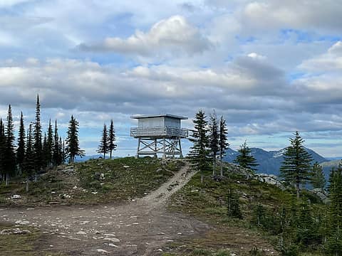
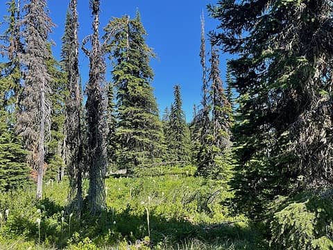 Typical conditions on ridge to Prouty Peak 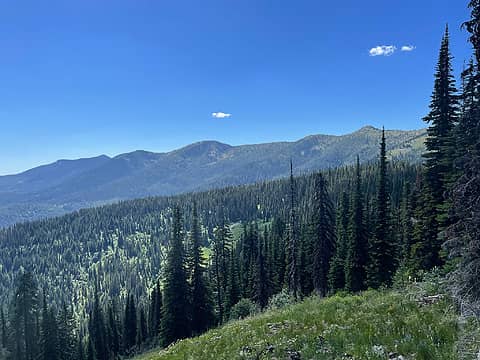 Crowell Ridge from part way up Prouty 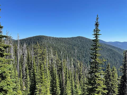 Prouty Peak 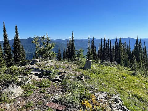 Arriving to the lookout site south of the summit 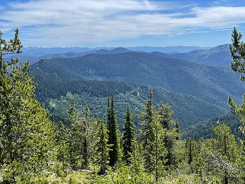 Prouty Peak from Crowell Ridge 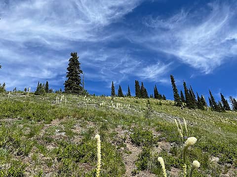 Bear grass and clouds 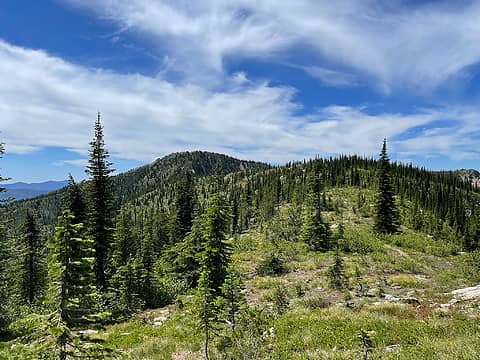 Arriving to the top of Crowell Ridge 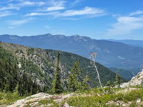 Abercrombie and Hooknose to the west 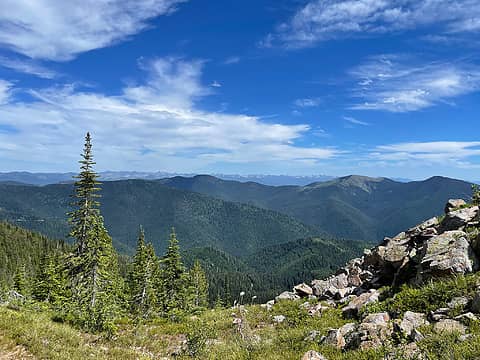 Shedroof Divide and Idaho Selkirks beyond 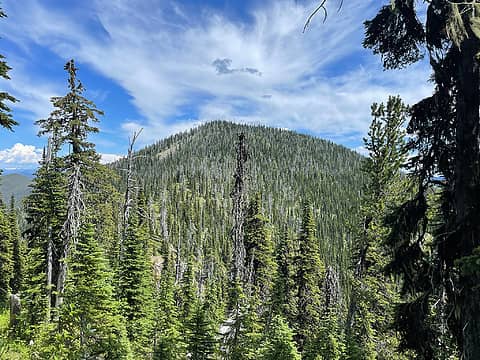 Crowell Ridge Middle Peak 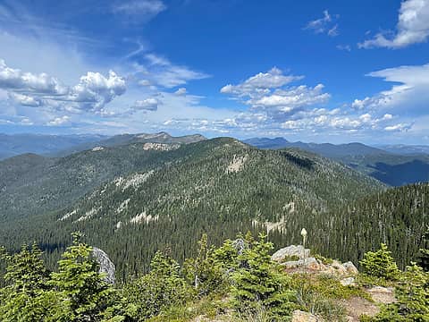 View north toward Gypsy Pk from Crowell Ridge South Peak 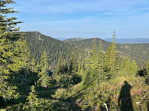 South on Crowell Ridge from our campsite at 6620' 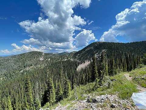 Plastic bag in hand 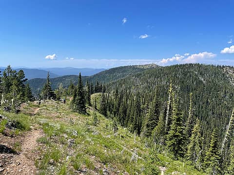 Sullivan Mtn in the distance 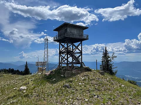 Finally at Sullivan Mountain Lookout on the south end of Crowell Ridge 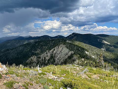 Looking back north toward our camp 4 miles away 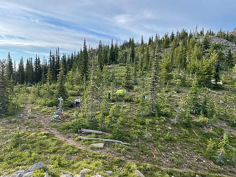 Our ridge top camp at the junction of Crowell Ridge and North Fork Sullivan Ck trails
 Lindsay, HitTheTrail, Bramble_Scramble, awilsondc, Nancyann, Cyclopath, glenoid, jaysway, NWtrax, reststep, Gimpilator Lindsay, HitTheTrail, Bramble_Scramble, awilsondc, Nancyann, Cyclopath, glenoid, jaysway, NWtrax, reststep, Gimpilator
Lindsay, HitTheTrail, Bramble_Scramble, awilsondc, Nancyann, Cyclopath, glenoid, jaysway, NWtrax, reststep, Gimpilator |
| Back to top |
  
|
|
raising3hikers
Member

Joined: 21 Sep 2007
Posts: 2344 | TRs | Pics
Location: Edmonds, Wa |
Thanks for the trail work and good to see a TR from that area
Eric Eames
RichP
Eric Eames
RichP
|
| Back to top |
|
|
Kim Brown
Member
Joined: 13 Jul 2009
Posts: 6899 | TRs | Pics
|
How was the road to Bearsprings trail head? I did that trail from that trail head about a decade ago and it was the 3rd scariest road I had driven - (the first being the day before to Salmo Lookout in a lightning storm). horrible condition, and no where to turn around, so just kept going. The trail was in really good shape then. (but I only went to the lookout site).
"..living on the east side of the Sierra world be ideal - except for harsher winters and the chance of apocalyptic fires burning the whole area."
Bosterson, NWHiker's marketing expert
"..living on the east side of the Sierra world be ideal - except for harsher winters and the chance of apocalyptic fires burning the whole area."
Bosterson, NWHiker's marketing expert
|
| Back to top |
|
|
RichP
Member
Joined: 13 Jul 2006
Posts: 5633 | TRs | Pics
Location: here |
|
RichP
Member
|
Wed Jul 27, 2022 11:09 am |
|
|
The road is a little brushy the last mile or so to Bear Pasture but not in bad shape. Subaru type clearance is fine. The Salmo Lookout is being fixed up as a nightly rental and the road is scheduled to be upgraded to Prius standards soon.
 Salmo Mtn Lookout
|
| Back to top |
|
|
|
|
You cannot post new topics in this forum
You cannot reply to topics in this forum
You cannot edit your posts in this forum
You cannot delete your posts in this forum
You cannot vote in polls in this forum
|
Disclosure: As an Amazon Associate NWHikers.net earns from qualifying purchases when you use our link(s). |


