| Previous :: Next Topic |
| Author |
Message |
gb
Member


Joined: 01 Jul 2010
Posts: 6310 | TRs | Pics
|
|
gb
Member
|
 Tue Aug 09, 2022 6:55 am |
|
|
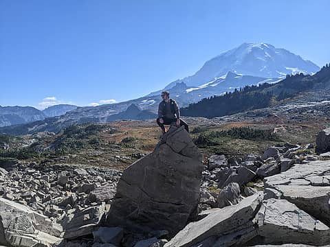
First near Mt. Hood, Goat Rocks, Rainier, Mt.Adams, and Olympics; then later East slopes of Cascades near Snoqualmie-Stevens, Glacier Peak; finally near Rainy Pass, Washington Pass to Canadian border; also Blue Mountains and up along Washington/Idaho border. Only the Olympics may get enough rain barely. LT forecast starting to show rain around Aug 24th....
UW MM5 loop: https://a.atmos.washington.edu/~ovens/wxloop.cgi?wrfd2_wa_pcp1+//84/1
 Tom Tom
Tom |
| Back to top |
  
|
|
gb
Member
Joined: 01 Jul 2010
Posts: 6310 | TRs | Pics
|
|
gb
Member
|
Tue Aug 09, 2022 7:11 am |
|
|
|
| Back to top |
|
|
Malachai Constant
Member

Joined: 13 Jan 2002
Posts: 16092 | TRs | Pics
Location: Back Again Like A Bad Penny |
Heard a TV weather person say, the isolated thunderstorms in Eastern WA will provide welcome relief for firefighters , Idiot
"You do not laugh when you look at the mountains, or when you look at the sea." Lafcadio Hearn
"You do not laugh when you look at the mountains, or when you look at the sea." Lafcadio Hearn
|
| Back to top |
|
|
Lazyhiker
Member
Joined: 08 Jul 2022
Posts: 224 | TRs | Pics
|
Its trying to rain in Wenatchee and on the east slopes right now. I had to hustle to get the lawn mowed.
|
| Back to top |
|
|
Chief Joseph
Member

Joined: 10 Nov 2007
Posts: 7709 | TRs | Pics
Location: Verlot-Priest Lake |
| Malachai Constant wrote: | | Heard a TV weather person say, the isolated thunderstorms in Eastern WA will provide welcome relief for firefighters , Idiot |
Right? There is a fire burning in far eastern WA about 6 miles west of Priest Lake....my Mom, were she still alive would be very nervous. I plan to head there this week, always scary there in late Summer. Last July I was there and there was a big lightning storm, it started over a dozen small fire that were luckily quickly extinguished. We have a very big Engleman Spruce tree next to our house, if that ever gets hit, I'm going to have a problem....plus several birds and squirrels would be homeless.
Go placidly amid the noise and waste, and remember what comfort there may be in owning a piece thereof.
Go placidly amid the noise and waste, and remember what comfort there may be in owning a piece thereof.
|
| Back to top |
|
|
zimmertr
TJ Zimmerman
Joined: 24 Jun 2018
Posts: 1228 | TRs | Pics
Location: Issaquah |
|
zimmertr
TJ Zimmerman
|
Tue Aug 09, 2022 12:25 pm |
|
|
|
| Back to top |
|
|
Joey
verrry senior member

Joined: 05 Jun 2005
Posts: 2798 | TRs | Pics
Location: Redmond |
|
Joey
verrry senior member
|
Tue Aug 09, 2022 3:32 pm |
|
|
And now a red flag warning for Wednesday for some of the west slopes Cascades and Olympics. For details click a red area and follow the link.
View larger size in new window
|
| Back to top |
|
|
timberghost
Member
Joined: 06 Dec 2011
Posts: 1331 | TRs | Pics
|
Its nice when they can pin point it to an area. I guess I will hike just outside of that area and be safe.
|
| Back to top |
|
|
gb
Member
Joined: 01 Jul 2010
Posts: 6310 | TRs | Pics
|
|
gb
Member
|
Wed Aug 10, 2022 7:30 am |
|
|
Interesting Howard Sheckter comment:
| Quote: | | It looks like a couple of very active days and nights for both Inyo and Mono County as Deep Monsoon Moisture remains in place and at the same time, and even more importantly, the aid of the jet stream comes to play. Today Thursday, The RT rear entry of a rather weak upper jet will provide added instability to our region this afternoon and evening. Tomorrow Friday, another upper jet, a bit stronger will provide added lift as we are under its Front left exit region. Both of these jets adds to the more passive terrain driven convection that we experience during the Summer. At the moment, the Friday system seems stronger then todays extra lift. The NWS has Flash flood watches out for Mono and Inyo Counties today, tonight, Friday and Friday evening. As a note, this pattern has the strongest Summertime forcing I have seen in several years!! Highs in Mammoth Thursday |
Looking at the recent/ongoing lightning map, there is a super fetch of thunderstorms running from Nevada through the Oregon Cascades, but in Washington, the Olympics (except immediate NW tip) are just squeaking by with a massive number of strikes just offshore. The forecast, though, still shows a bout of lightning storms hitting the SW to SE part of the Olympics and into Seattle, etc. about mid-day. There have been a few strikes thus far between Adams, St. Helens, and Rainier. The UW MM5 also shows more possibility in the Ross Lake to Pasayten area later today.
Regardless, we will be getting smoke with tons of lightning strikes in the Oregon Cascades and Western Vancouver Island.
|
| Back to top |
|
|
gb
Member
Joined: 01 Jul 2010
Posts: 6310 | TRs | Pics
|
|
gb
Member
|
Wed Aug 10, 2022 7:40 am |
|
|
NWS Portland Discussion this morning:
| Quote: | | Area Forecast Discussion
National Weather Service Portland OR
346 AM PDT Wed Aug 10 2022
.SYNOPSIS...The upper low off the southern Oregon coast will
continue drifting slowly northward, remaining offshore. A few
showers and thunderstorms are possible early this morning north of
Salem, but most likely will remain offshore moving northwest. Marine
clouds have increased with stronger low level onshore flow this
morning, with cooler weather expected today. Dry and seasonal
temperatures returns for the remainder of the week, with warmer
weather likely starting early next week.
&&
.SHORT TERM...(Today through Friday night)...Water vapor satellite
imagery shows the upper level low slowly lifting north just over 100
miles off the northern CA/southern OR coast. Elevated convection
overnight has mostly pushed offshore and moving northwest across the
coastal waters with a few cells containing frequent lightning.
Southerly flow aloft continues through this morning, but mid level
moisture and best synoptic support lifts north. CAMs still have
not picked up on all of the convection, so confidence on where or if
thunderstorms will redevelop across the northern forecast area is
low. But will maintain chance for showers and thunderstorms north of
Salem through early this morning. 06Z RAP MUCAPE has shown CAPE
values of 500 to 1000 J/kg nearest the stronger storms this morning
with bulk shear around 35 kt. Forecast soundings indicate higher
lapse rates between 700mb-500mb, while the subsidence inversion
remains below 850mb. This coincides well with profiler data at
Astoria indicating tops of the marine stratus around 1 km MSL (~3000 |
Cloudtop Water Vapor imagery as of 7:50 AM: https://www.star.nesdis.noaa.gov/GOES/sector_band.php?sat=G18§or=pnw&band=11&length=24
PacNW>Band 11 (single image or animate to loop)
For the bigger picture: US Westcoast>Band11 (single image or animate to loop)
(Cloudtop imagery shows where the most likely thunderstorms are)
|
| Back to top |
|
|
altasnob
Member

Joined: 29 Aug 2007
Posts: 1408 | TRs | Pics
Location: Tacoma |
|
altasnob
Member
|
Wed Aug 10, 2022 7:41 am |
|
|
Cliff Mass says it is actually monsoonal moisture coming up from the SW US (moisture originally from Gulf of Mexico) and not from the Western Pacific, where most of our moisture comes from. It seems this isn't that rare and we seem to get August thunderstorms in Western Washington every other year or so? The increased fire danger sucks but it is kind of a nice treat to have Colorado weather in Western Washington every once in a while.
|
| Back to top |
|
|
philfort
Member
Joined: 02 Sep 2003
Posts: 444 | TRs | Pics
Location: seattle |
|
philfort
Member
|
Wed Aug 10, 2022 9:18 am |
|
|
I hope we get a bit a moisture with all this at least...
|
| Back to top |
|
|
Ski
><((((°>

Joined: 28 May 2005
Posts: 12832 | TRs | Pics
Location: tacoma |
|
Ski
><((((°>
|
Wed Aug 10, 2022 9:20 am |
|
|
"Accuweather" says it's going to rain a bit out on the coast today.
I have it on good authority that Chanterelles are up out on the coast. On Saturday, Adam (yeah... Adam the mushroom guy) referred to them as "buttons".
A little spate of rain will bring them up.
Per my phone conversation a couple minutes ago, a little bit of rain fell between Forks and Kalaloch this morning.
Might be some oysters showing up too. (Usually on the alders.)(Soak them in salt water to get the worms out.)
Remember:
NO rain = NO mushrooms
What's not to like?
Besides, mid-August thunderstorms are an annual event here. Nothin' to get all excited about. The sky is not falling.
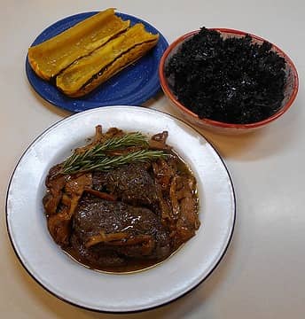 broiled venison medallions with chanterelles with delicata squash and red kale 122321
"I shall wear white flannel trousers, and walk upon the beach.
I have heard the mermaids singing, each to each."
"I shall wear white flannel trousers, and walk upon the beach.
I have heard the mermaids singing, each to each."
|
| Back to top |
|
|
philfort
Member
Joined: 02 Sep 2003
Posts: 444 | TRs | Pics
Location: seattle |
|
philfort
Member
|
Wed Aug 10, 2022 9:30 am |
|
|
| Ski wrote: | | I have it on good authority that Chanterelles are up out on the coast. |
I found some hedgehog and yellowfoot buttons on the coast near Kalaloch a couple of weeks ago. From what I hear things are almost always "up" on the coast - we need some rain closer to me so I don't have to make that long drive.
|
| Back to top |
|
|
Ski
><((((°>
Joined: 28 May 2005
Posts: 12832 | TRs | Pics
Location: tacoma |
|
Ski
><((((°>
|
Wed Aug 10, 2022 9:49 am |
|
|
Just got off the phone with pulmonologist's office - rescheduled appointments so I can get in a couple extra days out on the coast next week.
Poured down rain here for about 30 minutes at Pt. Defiance. Just stopped.
Drive carefully. Roads will be slicker than deer guts on a doorknob.
"I shall wear white flannel trousers, and walk upon the beach.
I have heard the mermaids singing, each to each."
"I shall wear white flannel trousers, and walk upon the beach.
I have heard the mermaids singing, each to each."
|
| Back to top |
|
|
|
|


