| Previous :: Next Topic |
| Author |
Message |
Matt Lemke
High on the Outdoors


Joined: 15 Jul 2010
Posts: 2052 | TRs | Pics
Location: Grand Junction |
|
Matt Lemke
High on the Outdoors
|
 Thu Aug 11, 2022 2:23 pm |
|
|
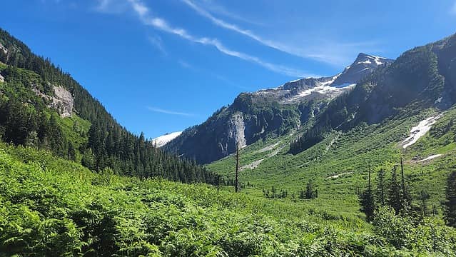
With grand plans to meet up with Josh and Shiona for a northern pickets blowout, I briskly walked up the Hannegan Pass trail leaving the trailhead at about 3pm on Saturday the 6th. After an hour and a half I walked over Hennegan Pass leaving the crowds and most of the bugs behind. By dark about 8pm I had made it to the Brush creek just a few miles before Whatcom Pass. Passed just a few people along the Chilliwack, much less than the bust Hannegan Pass trail.
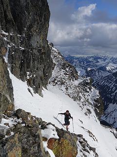
I ate some snacks and put the sleeping bag on the ground in a flat area in the trees near the creek. This part of the trail has seen some rather intense washout/rockslides coming down Brush Creek that have demolished the whole area along the valley floor, but one remaining campsite was found and I got some needed rest. The next morning I made it up to Whatcom Pass in just over an hours walking as the views of Whatcom Peak grew. The pass itself was rather anti-climactic and buggy so I wasted no time starting up the north ridge of Whatcom Peak. Thie fun scramble route took just another hour or so complete, despite having my pack on (since I intended to get all the way to Pickell Pass this day). I was able to skirt around to the right side of all the snow on the north ridge since all I had were Altra running shoes with no traction. Thankfully no steep snow sections required crossing. The rock steepened the final 400 feet but was solid enough to be comfortable. Exposure was noticable, but I didn't think there was much of any 4th class on the route if the easiest line is used. I was on the summit early enough for the morning breeze to wareent my coat, and I enjoyed the views.
I then started plunging down the mellow snow on the south side route down to Perfect Pass. The initial descent down the narrow south ridge was exposed but east class 2+. Perfect Pass was an oasis with small ponds, fresh meltwater and sweet flowers. It was unfortunate I had to continue right away, but I still had a lot of terrain to travel. I started traversing up the Challenger Glacier and had no issues weaving through the few crevasses I passed by. I ascended to the West Challenger Notch and was dumbfounded to see that the drop on the south side of the notch was not trivial! I totally overlooked this small section of the route towards Phantom and Crooked Thumb and did not realize people typically rappel this. I located what looked like would be a low 5th class route down and downclimbed steep blocks, then downclimbed cracks on a steep slab but was not able to downclimb the last 20 feet which dropped steeply into a gaping and bottomless moat on more difficult 5.7+ looking rock. Not a good place to take a fall! Super bummed, I reclimbed the low 5th class terrain I had just downclimbed and sent messages to Josh via Inreach that I would not be able to meet them at Pickell Pass that night which would mean I just hiked 20+ miles to only get Whatcom Peak  I ended up not really mattering as thety didn't make it to Pickell Pass either so I ended up just retreating back to Perfect Pass where I leisurly relaxed for the rest of the day, napping in the warm sun. I reveled in the awesome views and enjoyed a warm night stargazing in total solitude. The next morning I decided to explore the route around the NE flank of Whatcom so I wouldn't have to reclimb the peak and downclimb the steep north ridge. The route around Whatcom ended up being real straightforward, initially requiring only a 200 foot ascent from Perfect Pass then more or less a horizontal traverse across the snow slopes on the east side. Then a descending traverse to about 5200 feet, which was my lowest point to round the base of the NW rib. I was then aboe to continue on the polished glacier slabs below the dying Whatcom glacier, hopping over the many water channels along the way at the 5200-5300 foot level before making a small ascending traverse back to snowfields closer to Whatcom Pass. The final stretch to the pass involved some bushwhacking to locate the boot path leading back to the pass itself, but it was pretty short overall. Once at the pass, i made the 17 hot and muggy miles back to the car in about 6 hours, stopping to dunk myself in water along the trail twice.
It was disapponting to not be able to climb Challenger since I was so close, nor was I able to explore the areas beyond Challenger but I'll be back. There are currently other, more pressing peaks to climb!
I ended up not really mattering as thety didn't make it to Pickell Pass either so I ended up just retreating back to Perfect Pass where I leisurly relaxed for the rest of the day, napping in the warm sun. I reveled in the awesome views and enjoyed a warm night stargazing in total solitude. The next morning I decided to explore the route around the NE flank of Whatcom so I wouldn't have to reclimb the peak and downclimb the steep north ridge. The route around Whatcom ended up being real straightforward, initially requiring only a 200 foot ascent from Perfect Pass then more or less a horizontal traverse across the snow slopes on the east side. Then a descending traverse to about 5200 feet, which was my lowest point to round the base of the NW rib. I was then aboe to continue on the polished glacier slabs below the dying Whatcom glacier, hopping over the many water channels along the way at the 5200-5300 foot level before making a small ascending traverse back to snowfields closer to Whatcom Pass. The final stretch to the pass involved some bushwhacking to locate the boot path leading back to the pass itself, but it was pretty short overall. Once at the pass, i made the 17 hot and muggy miles back to the car in about 6 hours, stopping to dunk myself in water along the trail twice.
It was disapponting to not be able to climb Challenger since I was so close, nor was I able to explore the areas beyond Challenger but I'll be back. There are currently other, more pressing peaks to climb!
 Views on Hannegan Pass Trail 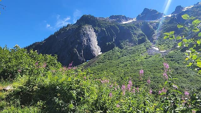 Impressive granite cliff 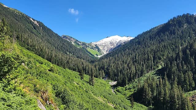 Ruth 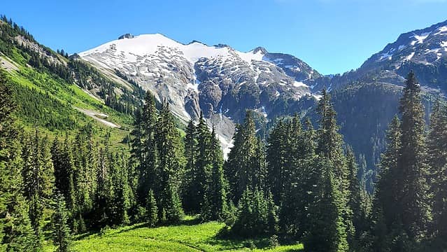 Ruth 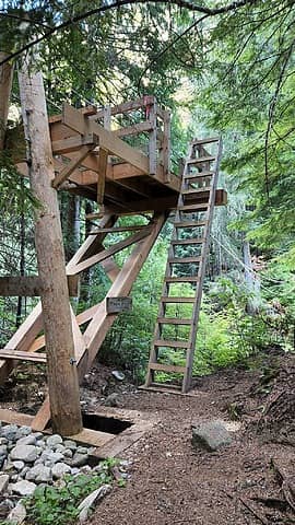 Cable Car 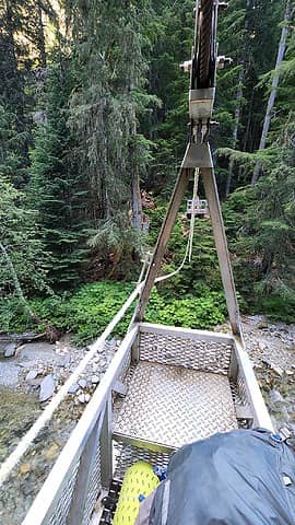 Cable car 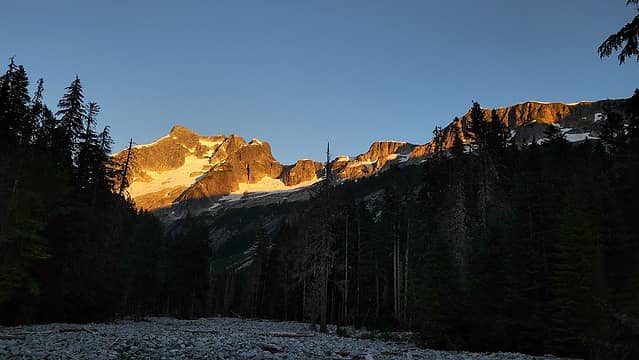 Sunset on Whatcom Peak 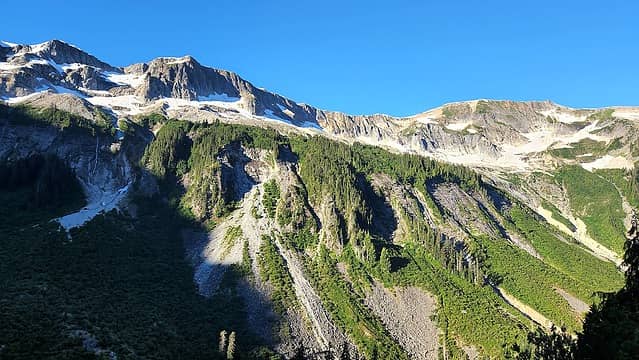 Views from Whatcom Pass Trail 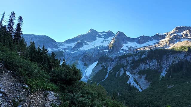 Whatcom Peak west face 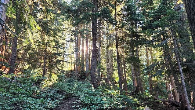 Sunbeams 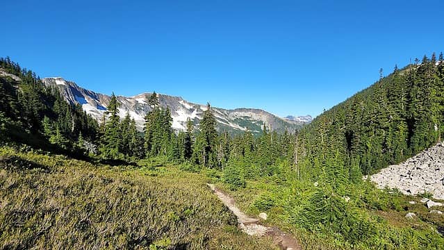 Nearing Whatcom Pass 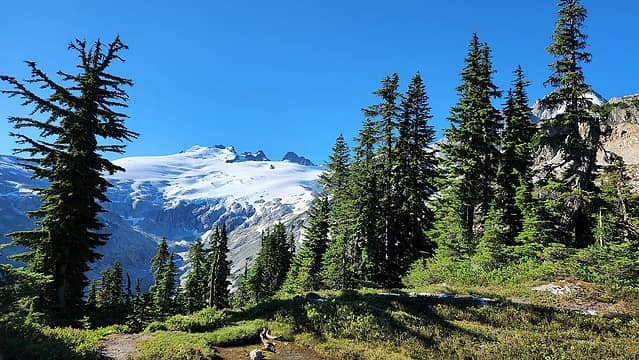 Challenger Glacier from Whatcom Pass 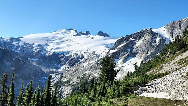 Challenger 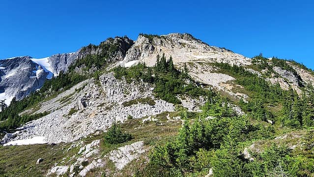 Starting up the N ridge 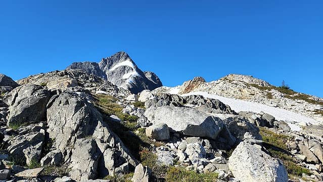 Whatcom Peak 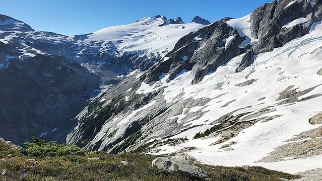 Whatcom Glacier 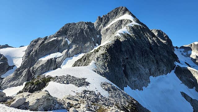 N Ridge with snow I avoided 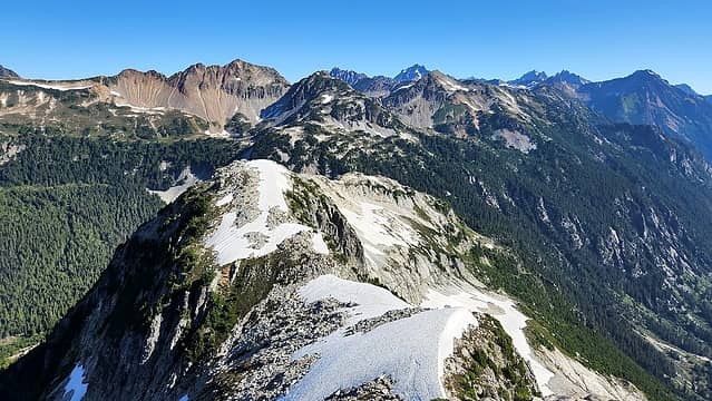 Looking down N ridge 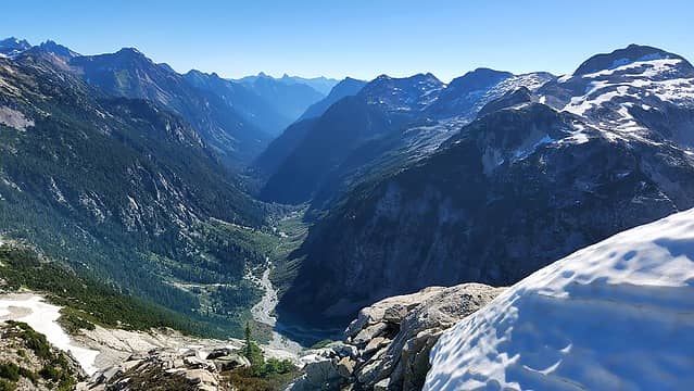 Looking down Little Beaver Valley 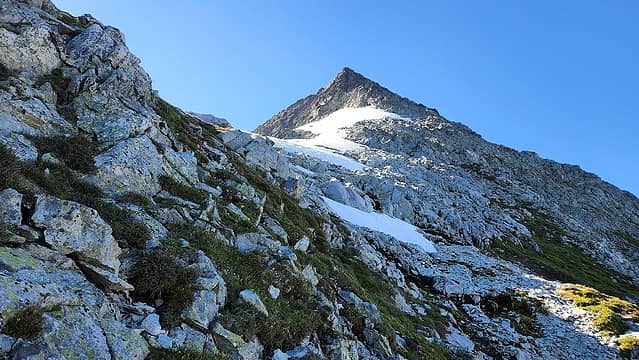 Climbing the N ridge 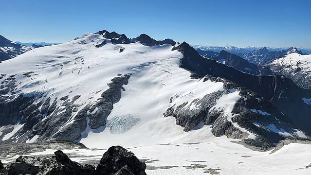 Challenger 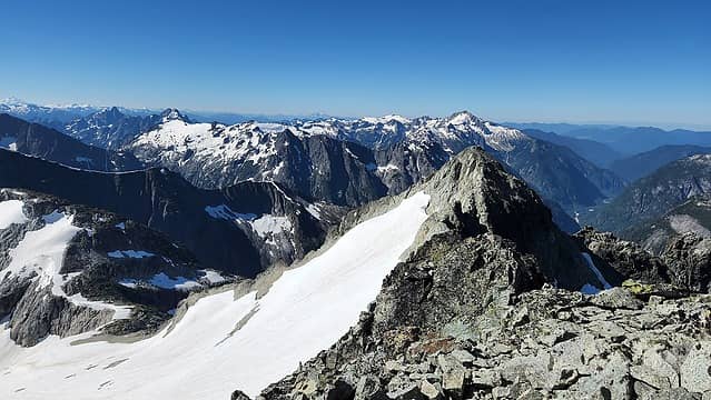 View south from Whatcom summit 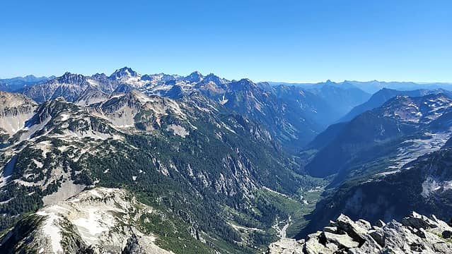 Little Beaver 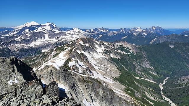 Baker and Shuksan 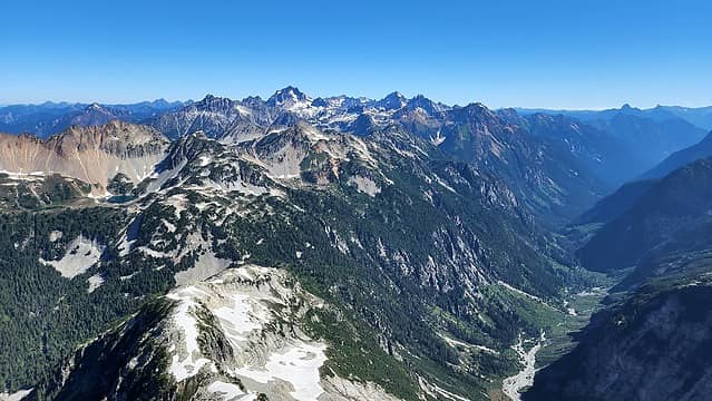 Redoubt and the Chilliwacks 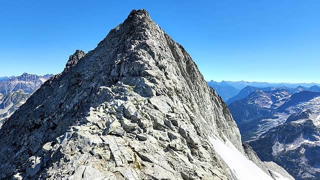 South ridge of Whatcom Peak 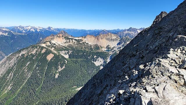 Descending Whatcom 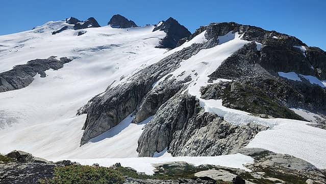 Challenger Glacier 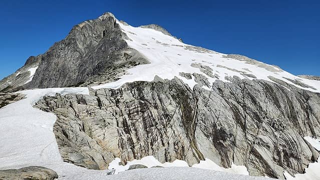 SE side of Whatcom Peak 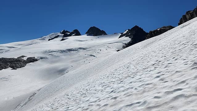 Onthe Challenger glacier 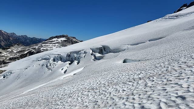 Obvious cracks 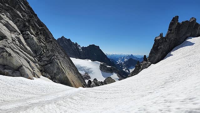 Arriving at West Challenger Notch 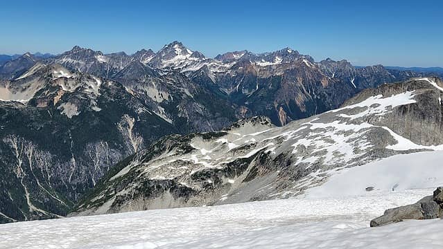 Chilliwacks from the notch 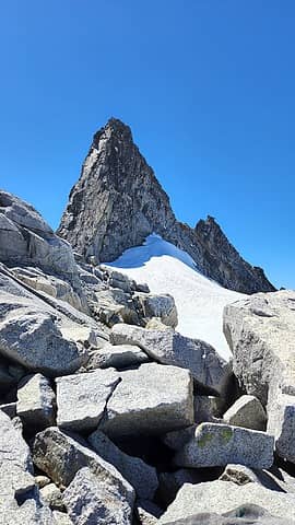 CHallenger 4 I think? 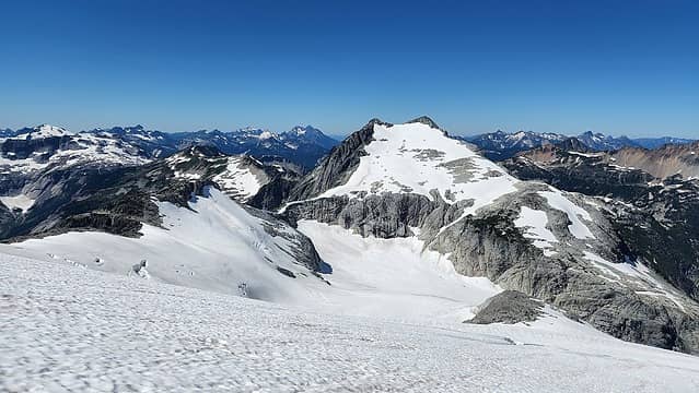 Whatcom Peak 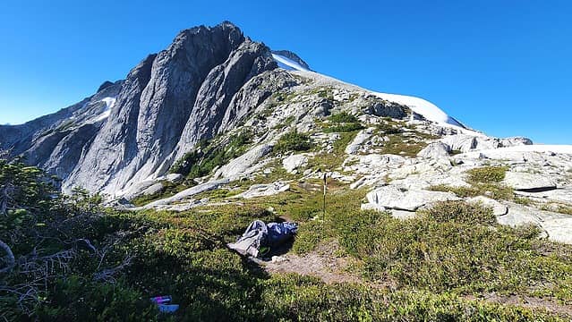 Bivy at Perfect Pass 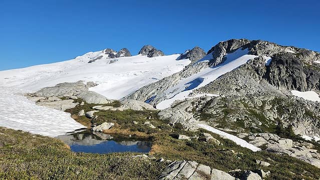 Totally divine! 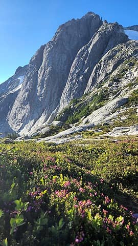 Cliffs guarding the SE side of Whatcom 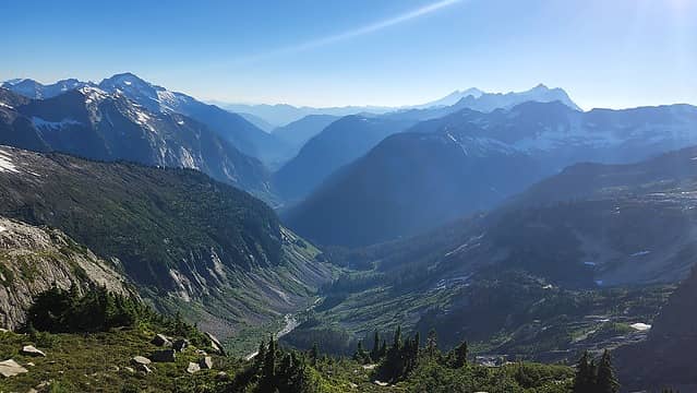 Baker River valley from Perfect Pass 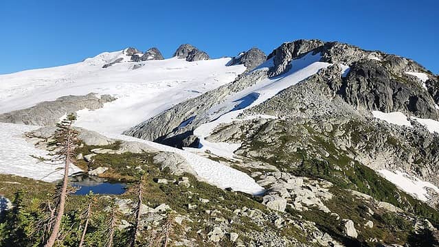 Challenger 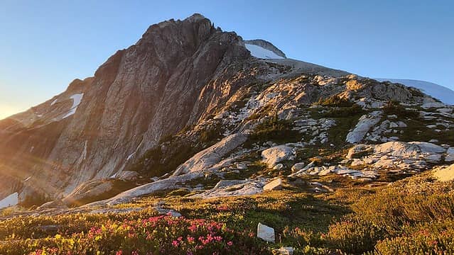 Sunset over Whatcom Peak 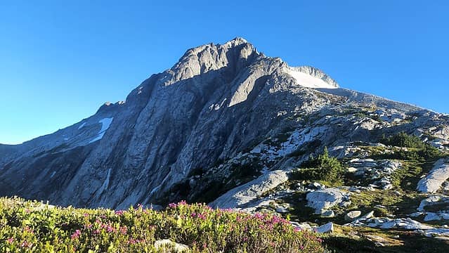 Morning on Whatcom 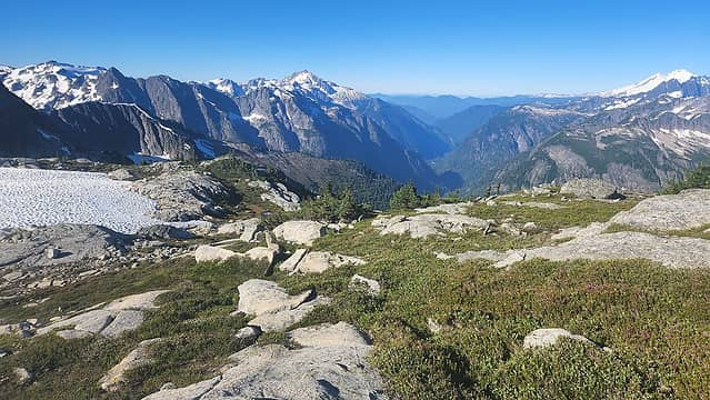 Final views from Perfect Pass 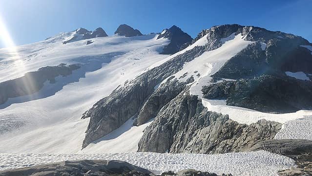 Challenger 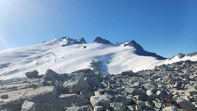 Challenger 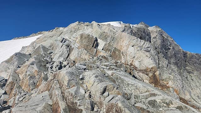 Traversing around Whatcom 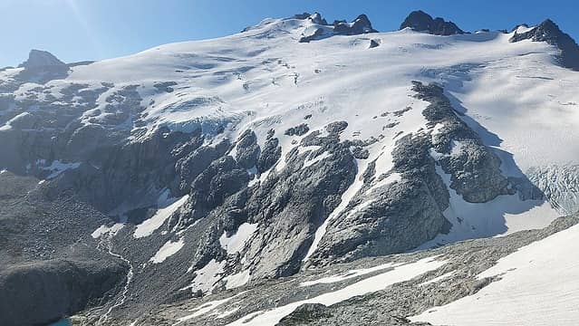 Challenger from the traverse 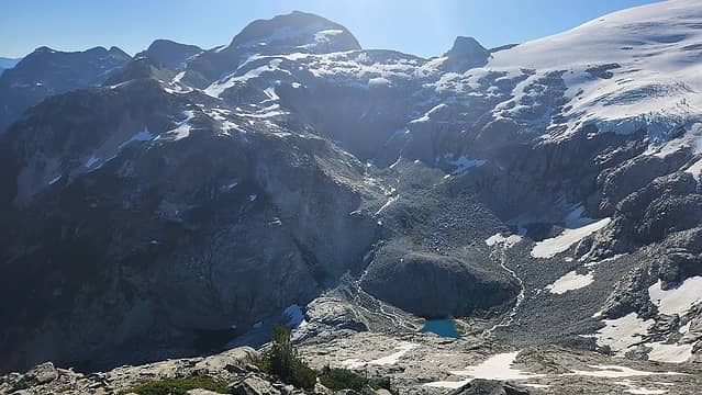 Basin below Challenger glacier 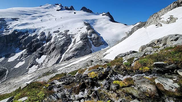 Challenger 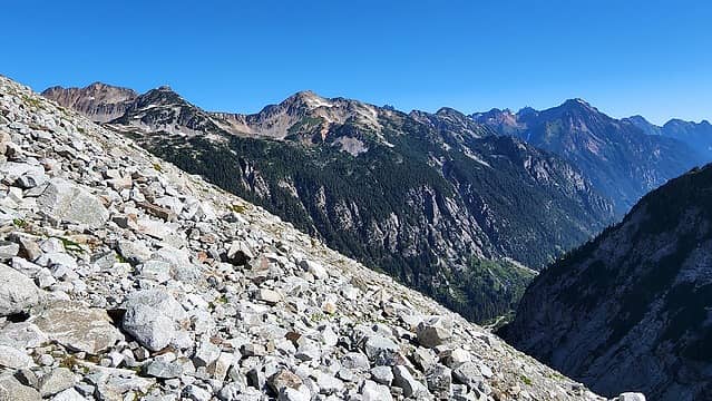 Talus to traverse 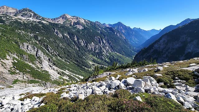 Little Beaver 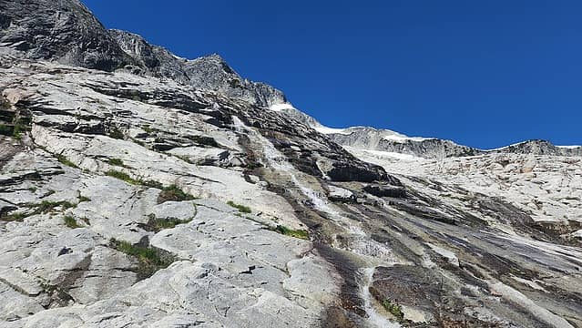 Glacier slabs below Whatcom Glacier 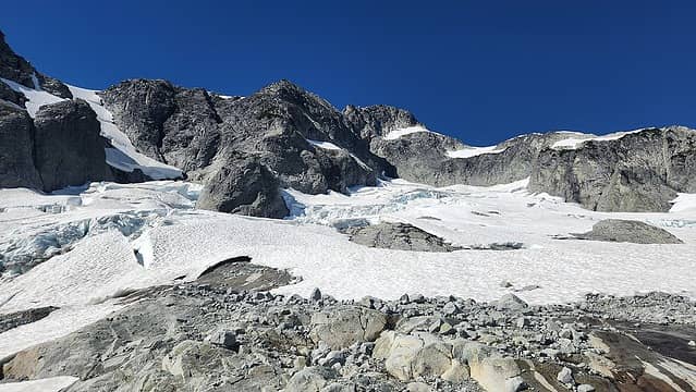 Whatcom glacier from just below 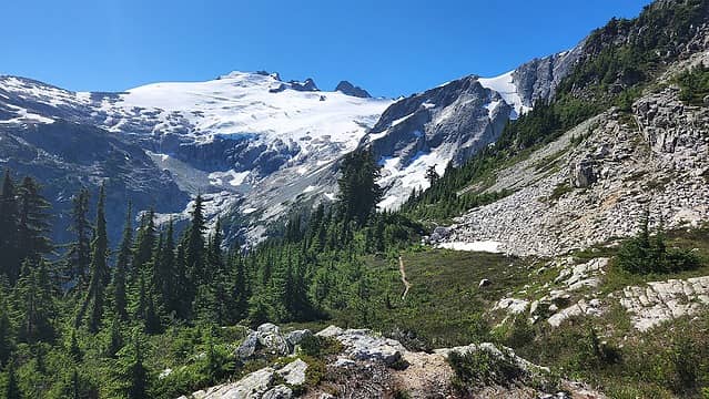 Back at Whatcom Pass
|
| Back to top |
  
|
|
jaysway
Member

Joined: 16 Jul 2020
Posts: 347 | TRs | Pics
|
|
jaysway
Member
|
Thu Aug 11, 2022 3:42 pm |
|
|
| Matt Lemke wrote: | Final views from Perfect Pass Challenger from the traverse |
| Matt Lemke wrote: | | All in all, it was an enjoyable few days even though I hiked nearly 50 miles without much to show for it. |
It's a bummer that you didn't get to complete all of your objectives, but photos like the ones I quoted above contradict your bolded statement. The views that you got looked absolutely amazing. I would love to get out to that area sometime.
|
| Back to top |
|
|
Stefan
Member

Joined: 17 Dec 2001
Posts: 5093 | TRs | Pics
|
|
Stefan
Member
|
Thu Aug 11, 2022 5:12 pm |
|
|
what a walk. Uh. Yeah. I would be frustrated. You have nice pics.
|
| Back to top |
|
|
hedonaut
Member

Joined: 30 Aug 2012
Posts: 2 | TRs | Pics
|
|
hedonaut
Member
|
Fri Aug 12, 2022 1:53 pm |
|
|
Yes, nice pics, and for certain a beautiful area.
FYI, for future reference, there's a way to avoid the section that turned you around. There's a much less technical route by climbing up to and over the col near Challenger's furthest-west peak (this might be called Solar Pass, as it grants access to the small Solar Glacier), and then dropping down and left, eventually circling towards Crooked Thumb, Ghost etc. We used this on our climb of Phantom last summer.
Anyway, hope this might help future folks venturing that way.
 Josh Journey, hikerbiker Josh Journey, hikerbiker
Josh Journey, hikerbiker |
| Back to top |
|
|
Josh Journey
a.k.a Josh Lewis
Joined: 01 Nov 2007
Posts: 4836 | TRs | Pics
|
Didn't know the Challenger col would throw up such a challenge. Will have to try out what hedonaut said for the next traverse. Moats in the southern Pickets also threw in quite the challenge forcing us to re-route our upper barrier crossing. As the chossathon went on I found myself wishing to be climbing something friendlier such as Johannesburg! It's called the Barrier for a reason. Receiving Matt's thunderstorm forecast was the final nail in the coffin for having any hopes to meet up with Matt.
Shiona and I had our own set of challenges that made it tricky to get to Crescent Creek basin. I was happy just to get off the Barrier. Mount Terror was chossy but much more forgiving.
|
| Back to top |
|
|
OwenT
Member

Joined: 24 May 2014
Posts: 277 | TRs | Pics
Location: Moses Lake |
|
OwenT
Member
|
Wed Aug 24, 2022 12:40 am |
|
|
I made a quick trip out there last august hiking all the way in and then back out the next day without even getting the satisfaction of Whatcom Peak. We were going for Challenger but turned back when we saw the state of the glacier. We had decided to go from Whatcom Pass around the E side of the peak as you did on the way out because we assumed going over the peak would be much harder. I think we were wrong. It's interesting to compare the photos from last year, there was certainly a lot less snow at this point.
|
| Back to top |
|
|
|
|
You cannot post new topics in this forum
You cannot reply to topics in this forum
You cannot edit your posts in this forum
You cannot delete your posts in this forum
You cannot vote in polls in this forum
|
Disclosure: As an Amazon Associate NWHikers.net earns from qualifying purchases when you use our link(s). |


