Matt Lemke
High on the Outdoors


Joined: 15 Jul 2010
Posts: 2052 | TRs | Pics
Location: Grand Junction |
|
Matt Lemke
High on the Outdoors
|
 Fri Aug 12, 2022 2:28 pm |
|
|
I finally was able to get up Liberty Cap (not a real peak!) by climbing a classic route when conditions, weather, and good partners were all aligned. My friends John and Stephaie both from Colorado came up to the PNW to enjoy the summer out these parts and the timing was just right to give Ptarmigan Ridge a try, and to finally, after 4 years since finishing the Bulgers, get my butt back on Rainier to summit Liberty Cap (again...NOT a real peak).
If you couldn't tell by now, it is of my strongest opinion that Liberty Cap is not a real peak haha.
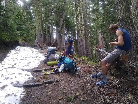
John and I both drove out south towards Rainier, with Stephanie riding with me to the White River ranger station a bit earlier to get our permits. We waited at the ranger station and organized our gear which included numerous items like ice tools, crampons, cams, rope overnight gear etc. After a few hours waiting for John to get through Seattle traffic, he arrived, and we both drove to the White River trailhead where we left my car. We then drove around all the way back to Enumclaw in Johns car, grabbed a huge dinner then proceeded to drive up the Mowich Lake Road up until its closure point shortly past the Spray Park Trailhead nearly 5 miles from Mowich Lake. We ended up just car camping for the night at the OHV parking area a couple miles before the closure gate.
We woke to a large convoy of OHV guys parking and preparing for a day of off roading. We quickly packed up and parked at the closure gate, and under cloudy skies we started walking up the roads. I had my mountain boots in hand with about a 50 pound pack on. Thankfully there is a shortcut trail that bypasses all the long switchbacks in the road and cuts the 5 miles down to about 3.5, so it was barely an hour by the time we reached the lake. We took a quick snack and bathroom break and then started down the WOnderland/Spray Park Trail which to our surprise was quite snow free all the way to about 5500 feet before we started hitting more continuous snowfields. The trail was in good shape and we were really the only ones on it since it was still very early summer. As the trail worked us southward, we reached Eagle Cliff, but had just entered the clouds at this point so did not see any views over the cliff. We continued ascending east, then back northward until about 6000 feet elevation at which point we left the trail and stared cross country walking over firm continuous snow southward towards the base of Ptarmigan Ridge. We walked mellow snow covered slopes for over a mile in a whiteout until we had a couple peak-a-boo views open up and give us a glimpse of the starting slope to Ptarmigan Ridge.
We started ascending steeper slopes from 6000 feet, thankfully the snow was still firm and supportive. Between 7200-7400 feet the slope steepened to about 45 degrees, which was the steepest section of the approach, right before mellowing out as we neared Observation Rock. At this point we passed a weather station, and began to slowly get larger clearings in the whiteout clouds we had been in all morning. We slowly continued up past 8000 feet, then 9000, took a small break on a nice sandy flat spot at 9200 feet, then at aout 9600 feet, we emerged completely above the clouds and saw the final 800 foot slope we needed to ascend to reach our camp. Finally, after a tiring 12 hour day of snow slogging carring 50+ pounds, we reached the flat section of ridge at 10,400 feet where we found a spectacular bivy spot in soft sand. The view of the Seattle/Tacoma metro area was amazing, since we were not under clear skies as we eventually climbed above the clouds. We began excavating the camp spot we found to make it larger to fit all 3 of us. I did not have a tent so I set up my tarp and my sleeping pad right next to the tent John and Stephanie shared and we got started melting snow right away. With the breezy conditions and quickly cooling temperatures, my low efficiency ultralight stove took a long time to melt and boil water. I was also getting sandblasted by the wind which got my sleeping bag and gear all gritty throughout the evening. Eventually, we got about 5 liters of water melted and a couple more boiled for dinner for all of us. About 1000 feet below us, we could see the clouds swiftly flowing over the lower Ptarmigan Ridge which was a cool sight to behold! By dark, we were ready to fall asleep.
 Hiking the Spray Park Trail 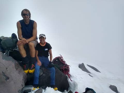 Ascending towards the lower ridge in whiteout 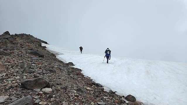 Heading up 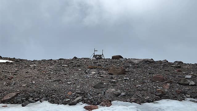 Weather station 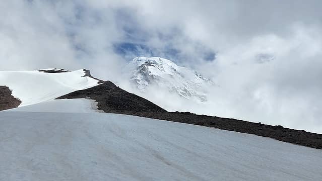 First glimpse of Rainier near Observation Rock 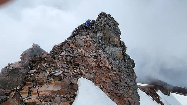 Small gendarme along the ridge 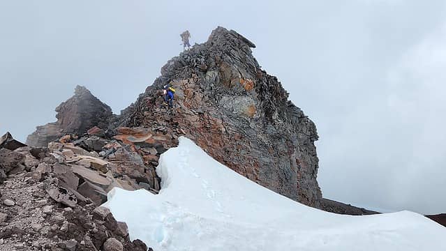 Scrambling over the gendarme 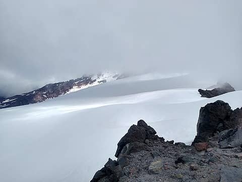 Ascending Ptarmigan Ridge 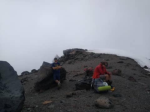 Taking a break at about 9200 feet 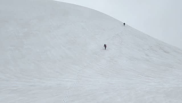 Traversing snow slopes on the ridge 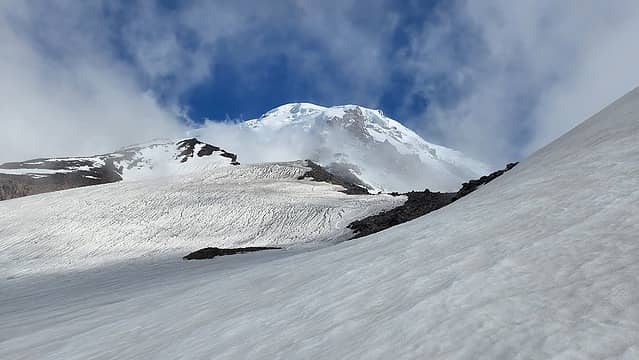 Final slope to reach camp 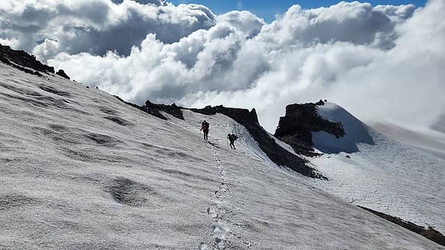 Ascending the final slope 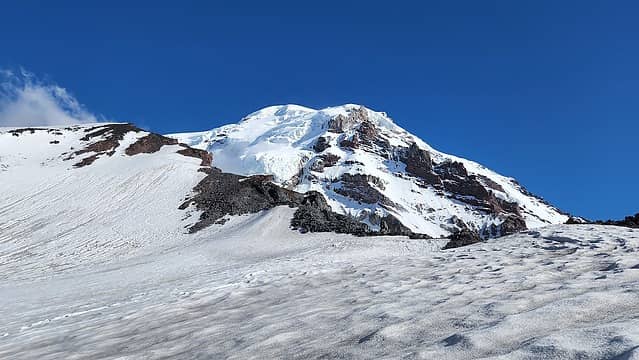 Upper mountain and route coming into view 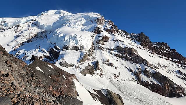 The upper NW face from our camp 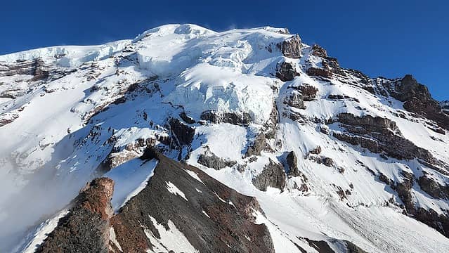 Flat section of Ptarmigan Ridge 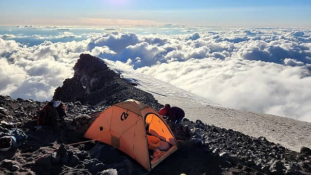 View towards the NW 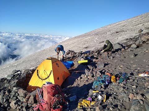 Scenic campsite 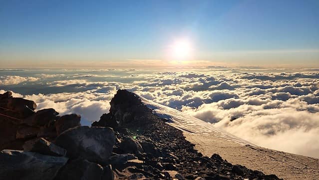 Sunset over Ptarmigan Ridge 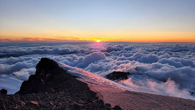 Final rays of light 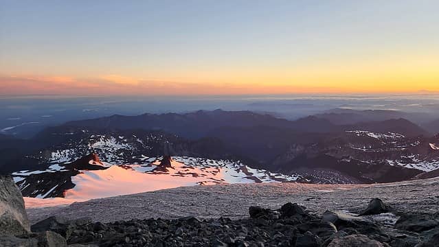 Sunrise from my sleeping bag 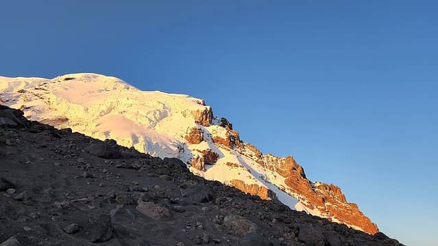 Sunrise over our route 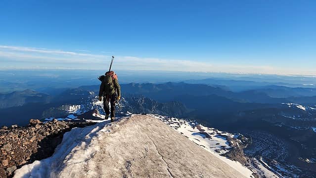 John starting up from camp 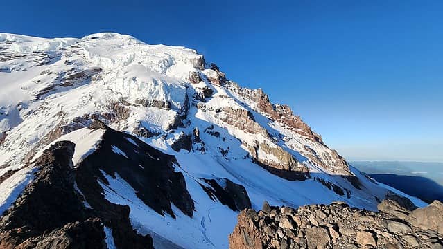 The rightward traverse off the ridge to begin 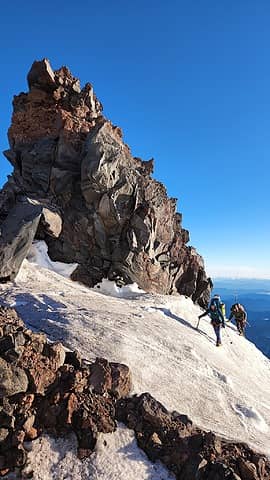 Traversing around a small tower on the flat part of ridge 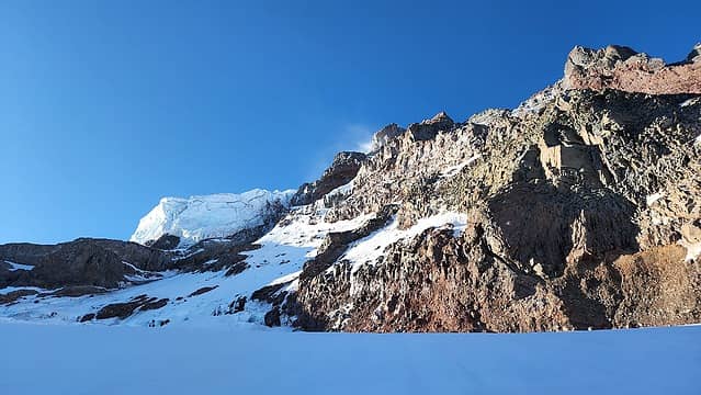 Looking back towards the col from the traverse 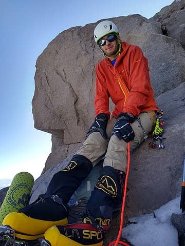 Me taking a break 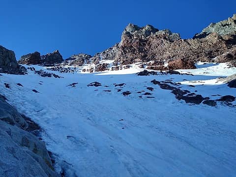 View up the snow slopes 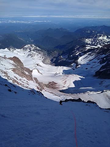 Climbing the initial 45 degree slopes 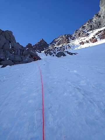 Simul-climbing 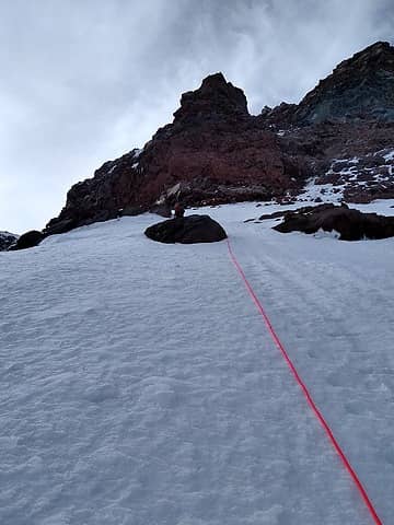 Nearing the leftward steep traverse 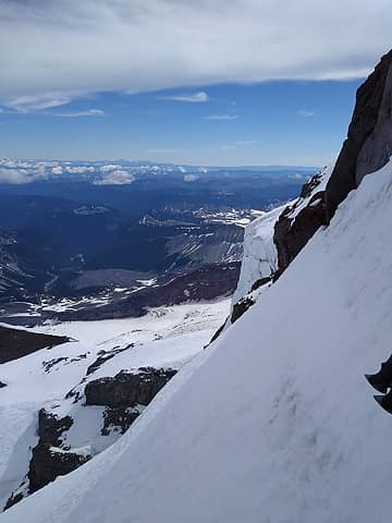 First look at the left traverse 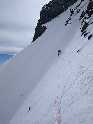 Me forging ahead on the traverse 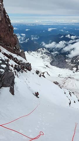 Looking down after the traverse 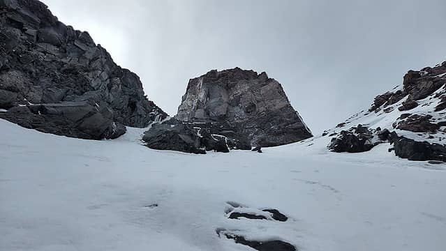 View up from the end of the left traverse 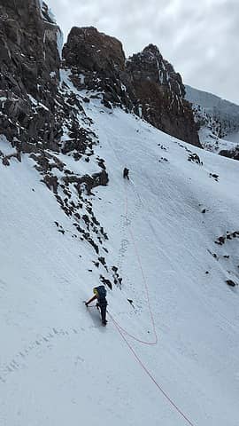 John starting up the final pitch 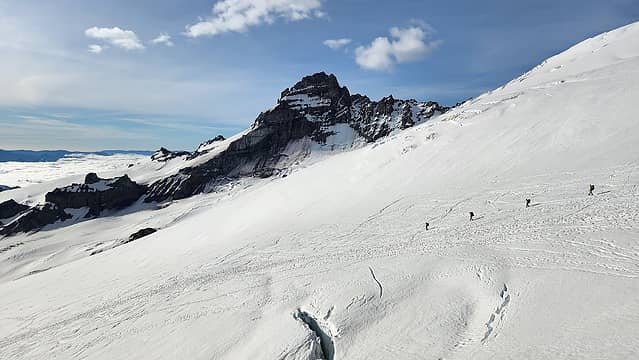 Descending Emmons 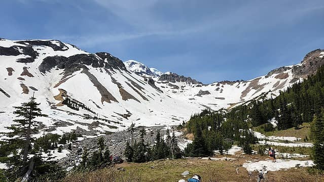 Last views from Glacier Basin 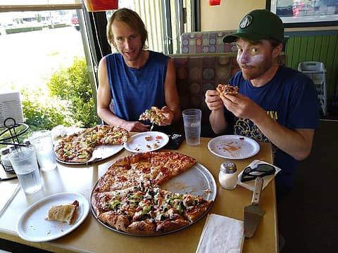 Pizza in Enumclaw 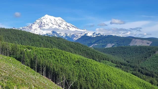 Rainier from Mowich Lake Road
The Pacific coast to the Great Plains = my playground!!!
SummitPost Profile
See my website at:
http://www.lemkeclimbs.com
 Zloi, moonspots, rstoddard24, SeanSullivan86, Eric Gilbertson, Kascadia, awilsondc, flatsqwerl, RichP Zloi, moonspots, rstoddard24, SeanSullivan86, Eric Gilbertson, Kascadia, awilsondc, flatsqwerl, RichP  silence silence
The Pacific coast to the Great Plains = my playground!!!
SummitPost Profile
See my website at:
http://www.lemkeclimbs.com
Zloi, moonspots, rstoddard24, SeanSullivan86, Eric Gilbertson, Kascadia, awilsondc, flatsqwerl, RichP silence
|