| Previous :: Next Topic |
| Author |
Message |
zephyr
aka friendly hiker


Joined: 21 Jun 2009
Posts: 3370 | TRs | Pics
Location: West Seattle |
|
zephyr
aka friendly hiker
|
 Fri Sep 16, 2022 10:41 am |
|
|
Well, it looks like Mt. Rainier is pretty cloudy today and tomorrow. The hike I have planned for months is tomorrow. My schedule is flexible but my hiking partner is less so. I am wondering just how tall the cloud deck might be and how one might know.
When I look at Camp Muir's webcam (10,000'+) I can see the clouds down below. https://www.nps.gov/media/webcam/view.htm?id=81B46411-1DD8-B71B-0B1CC218FB03772F
Sunrise Visitor Center (6400') webcam looks like this: https://www.nps.gov/media/webcam/view.htm?id=81B4638D-1DD8-B71B-0B1092DD4F75978D
We aim to hike to the top of Third Burroughs (7800'). I wonder if we will be above the cloud deck and can see the mountain. That would be a bonus. Otherwise it looks like we are going to be hiking in clouds most of the trip and will miss out on seeing the glaciers, Steamboat Prow, and Skyscraper Mountain, etc. At least I didn't fly across the country to have the experience. haha
I know that RichP was up that way (see latest entry) and in a whiteout. Fun times... ~z
|
| Back to top |
  
|
|
zimmertr
TJ Zimmerman
Joined: 24 Jun 2018
Posts: 1224 | TRs | Pics
Location: Issaquah |
|
zimmertr
TJ Zimmerman
|
Fri Sep 16, 2022 11:40 am |
|
|
This is an interesting problem I've never considered!
Wikipedia says a device called a ceilometer is normally used to determine cloud altitude. I'm not sure if this data is presented in a web application anywhere. But there is a formula you can use to roughly determine altitude.
| Quote: | | Alternatively, the cloud base can be estimated from surface measurements of air temperature and humidity by calculating the lifted condensation level. One method for doing this, used by the U.S. Federal Aviation Administration and often named after Tom Bradbury,[1] is as follows:
Find the difference between the surface temperature and the dew point. This value is known as the "spread".
Divide the spread by 4.4 (if temperatures are in °F) or 2.5 (if temperatures are in °C), then multiply by 1000. This will give the altitude of the cloud base in feet above ground level. Put in a simpler way, 400 feet for every 1°C dew point spread. For metric divide the spread in °C by 8 and multiply by 1000 and get the cloud base in meters.
Add the results from step (2) to the field elevation to obtain the altitude of the cloud base above mean sea level. |
Mountain Forecast says Rainier will be around 35 at 9,000' tomorrow. And Wunderground says the Dewpoint will be ~43 in Ashford. Which is admittedly inaccurate to your intended location and altitude. But this is just a thought experiment so why not!
So the spread would then be ~8. 8/4.4 = ~1.82. 1.82*1000=1820.
Third Burroughs is 7,828', so the approximate cloud altitude will be at 7,828+1,820 = 9,102.
IMO Third Burroughs is so close to the Winthrop/Emmons glaciers and Steamboat Prow you'll probably be able to see them clearly regardless. But that's just a hunch! Good luck!
|
| Back to top |
|
|
Randito
Snarky Member

Joined: 27 Jul 2008
Posts: 9512 | TRs | Pics
Location: Bellevue at the moment. |
|
Randito
Snarky Member
|
Fri Sep 16, 2022 1:00 pm |
|
|
|
| Back to top |
|
|
RichP
Member

Joined: 13 Jul 2006
Posts: 5633 | TRs | Pics
Location: here |
|
RichP
Member
|
Fri Sep 16, 2022 1:22 pm |
|
|
Here's a sneak peak of tomorrow's view.  But seriously, I hope you get a magical clearing.
|
| Back to top |
|
|
zimmertr
TJ Zimmerman
Joined: 24 Jun 2018
Posts: 1224 | TRs | Pics
Location: Issaquah |
|
zimmertr
TJ Zimmerman
|
Fri Sep 16, 2022 1:55 pm |
|
|
I think it's highly variable. I climbed it last year in mid-August and it was both socked in and clear at different parts of the day.
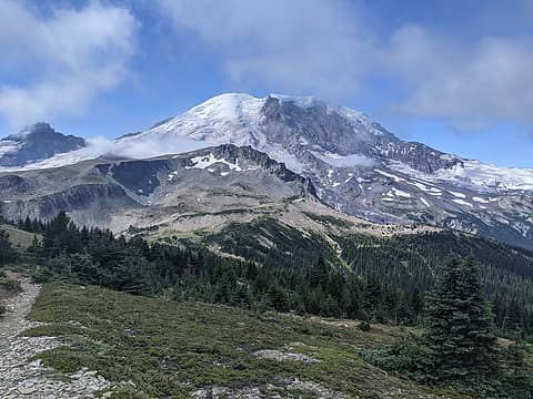 Nearing Skyscraper Pass at 11AM 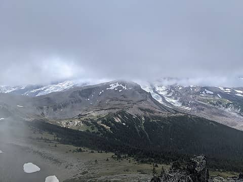 Skyscraper Mountain at 12PM 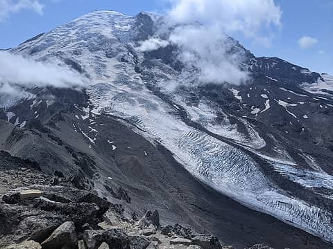 Third Burroughs at 2:30PM
|
| Back to top |
|
|
Cyclopath
Faster than light

Joined: 20 Mar 2012
Posts: 7721 | TRs | Pics
Location: Seattle |
|
Cyclopath
Faster than light
|
Fri Sep 16, 2022 1:57 pm |
|
|
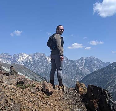
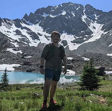
My buddy and I had such an amazing time getting above the clouds on Rainier two weeks ago.
 Anne Elk, RichP Anne Elk, RichP
Anne Elk, RichP |
| Back to top |
|
|
gb
Member

Joined: 01 Jul 2010
Posts: 6308 | TRs | Pics
|
|
gb
Member
|
Fri Sep 16, 2022 4:43 pm |
|
|
There are three sources I might use:
1) Look at web cameras at various mountain sites - ski areas, National Parks, and highways
2) Look at the Skew-T Soundings for Quillayute, Boeing Field, Salem, and Spokane. There should also be one for Vancouver, BC. Where the red and green lines come together to touch the humiidty is near 100% and there is a cloud layer. From the scale on the left, 700mb is about 10,000'.
3) Look at Aviation METARS for various airports. These are made hourly. Try Abbottsford, for example.
Aviation METARS Abbottsford, BC.
Cyclopath
Cyclopath |
| Back to top |
|
|
zephyr
aka friendly hiker
Joined: 21 Jun 2009
Posts: 3370 | TRs | Pics
Location: West Seattle |
|
zephyr
aka friendly hiker
|
Fri Sep 16, 2022 5:39 pm |
|
|
| RichP wrote: | | Here's a sneak peak of tomorrow's view. |
Such a character! haha Love it... That's just what I am afraid of. But I will take the ones with some sky breaks or the above the clouds scenario too. I will report back on how it was.
Talk about community brainpower. We have some smart cookies here.
Thanks for all the suggestions. ~z
|
| Back to top |
|
|
zephyr
aka friendly hiker
Joined: 21 Jun 2009
Posts: 3370 | TRs | Pics
Location: West Seattle |
|
zephyr
aka friendly hiker
|
Sun Sep 18, 2022 10:48 pm |
|
|
Well the actual conditions up at Mt. Rainier on Saturday were much better than originally forecast. The clouds were very high over the summit most of the morning. They descended somewhat around the mountain as the afternoon wore on. But the first half of the hike we had unlimited visibility all across the northern slope and all the glaciers. Steamboat Prow stood out quite dramatically as did Mt. Ruth and Little Tahoma. Goat Island Mountain was crisp and clear as was Skyscraper Peak and the various hills and dales of the Wonderland Trail area. Glacier Peak and Mt. Stuart were visible as were the peaks around Baring.
As we made our way around the various Burroughs ridges we would encounter micro climates of warm, sunny breaks or windy, chilly spots that had us layering and unlayering throughout the day.
When we first entered the park it was dark and dawn was breaking. We could see the alpenglow lighting up Mt. Rainier through the trees from below as we headed toward Sunrise. It must have been splendid up above. Later in the day clouds made the day darker and the horizon less clear. Still all in all the visibility was terrific. Many hikers commented on how lucky we were that day. ~z
RichP  zimmertr zimmertr
RichP zimmertr |
| Back to top |
|
|
|
|


