| Previous :: Next Topic |
| Author |
Message |
ALW Hiker
lakebagger

Joined: 27 Jul 2021
Posts: 120 | TRs | Pics
Location: Redmond, WA |
|
ALW Hiker
lakebagger
|
 Tue Oct 04, 2022 2:29 pm |
|
|
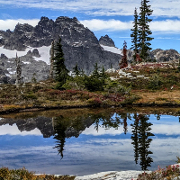
A lake-bagging friend and I made it up to the top of Green Ridge last Sunday en route to the Garfield Mountain Lakes area. We were hoping to reach both Garfield Mountain Lakes and Charlie Brown Lake, but due to time constraints and the slowness of progress, we turned around at Upper Garfield Mountain Lake after lunch.
Nothing too interesting to report about the Green Ridge Trail itself. There are quite a few annoying blowdowns, mostly in the bottom 1000' of the trail. This was my third time on this trail and it seems to get steeper every time I visit.
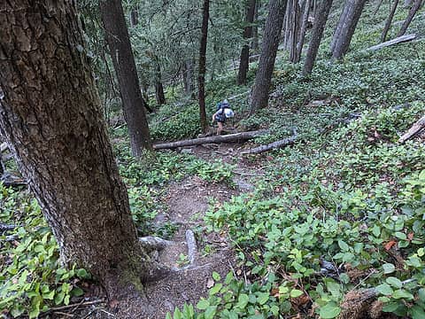 Climbing the steep Green Ridge Trail 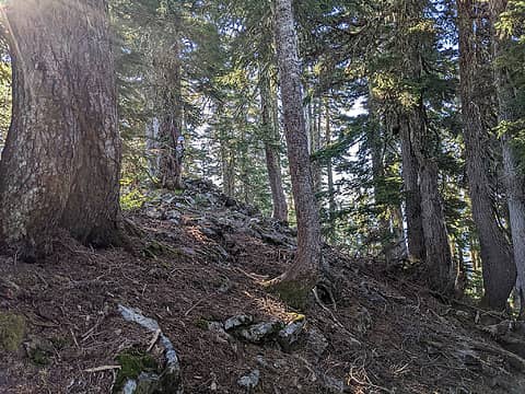 Following the ridge over the 4800' high point 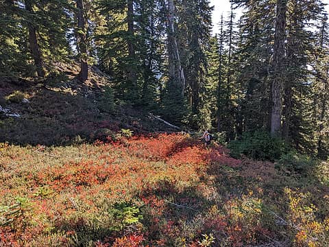 Finally, some meadows in the high point SE of Tarn 4662 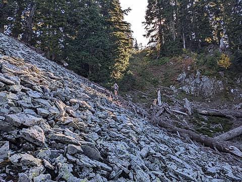 Descending to Tarn 4662 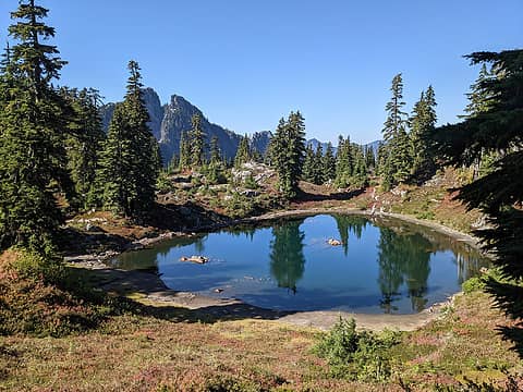 Tarn 4662 and Garfield East 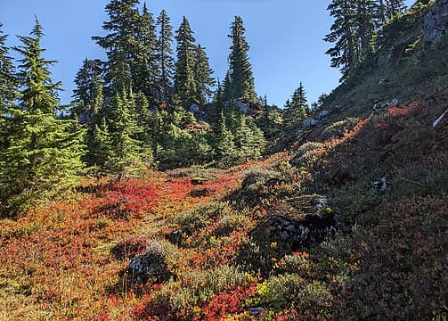 Fall color explosion just below Tarn 4662  Dried-up tarn and Treen Peak 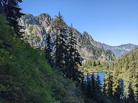 Steep slopes and brush heading down to Upper Garfield Mountain lake 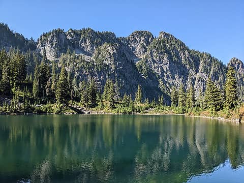 Upper Garfield Mountain Lake and Garfield East 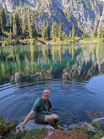 Lake bagging UGM 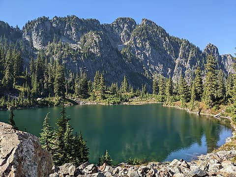 Leaving UGM 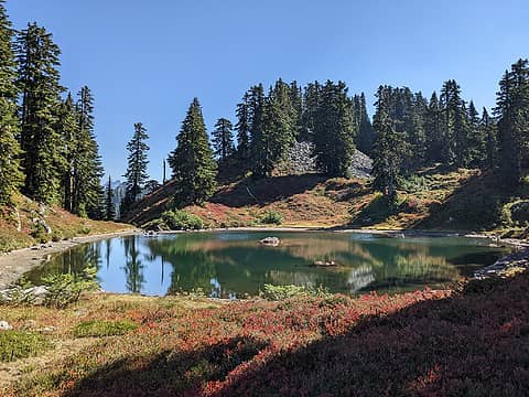 Tarn 4662 again 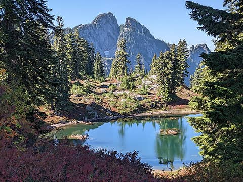 Tarn 4662 and Garfield East 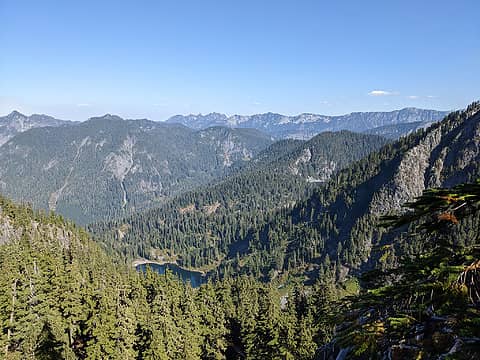 Looking toward Taylor River Valley - we can see Carole Lake, and Nordrum Lake in the distance behind Floating Rock 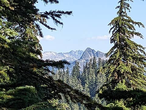 Infrequently-seen view of Hinman, Daniel, and Wild Goat Peak 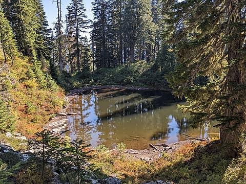 Tarn 4530
 zimmertr, JimK, Now I Fly, Bramble_Scramble zimmertr, JimK, Now I Fly, Bramble_Scramble
zimmertr, JimK, Now I Fly, Bramble_Scramble |
| Back to top |
  
|
|
Nancyann
Member

Joined: 28 Jul 2013
Posts: 2318 | TRs | Pics
Location: Sultan Basin |
|
Nancyann
Member
|
Tue Oct 04, 2022 9:31 pm |
|
|
Cool to see Lake Carole! I was up there in the early 70s but we came straight up Treen Peak from the other side, using an old rope to climb up a waterfall.
ALW Hiker
ALW Hiker |
| Back to top |
|
|
Roly Poly
Member
Joined: 02 Jan 2013
Posts: 713 | TRs | Pics
|
You are tough! And Jill too! Looking forward to your primarily trail hike next week.
ALW Hiker
ALW Hiker |
| Back to top |
|
|
ALW Hiker
lakebagger
Joined: 27 Jul 2021
Posts: 120 | TRs | Pics
Location: Redmond, WA |
|
ALW Hiker
lakebagger
|
Wed Oct 05, 2022 11:39 am |
|
|
| Nancyann wrote: | | Cool to see Lake Carole! I was up there in the early 70s but we came straight up Treen Peak from the other side, using an old rope to climb up a waterfall. |
Impressive! I have no doubt the brush you encountered was pretty severe, as it often is around the Middle Fork. Beckey describes ascending between Treen and Garfield from the Taylor River, but it's not a route I would want to try! To be fair, he does say that route is best done in spring when snow still covers the brush.
For Treen, he says the usual approach is to start at Nordrum Lake and head west past Judy and Carole, but I think he must have written that before the existence or popularity of the Green Ridge Trail.
|
| Back to top |
|
|
Backpacker Joe
Blind Hiker

Joined: 16 Dec 2001
Posts: 23956 | TRs | Pics
Location: Cle Elum |
I remember that area well. Nice to see it again.
"If destruction be our lot we must ourselves be its author and finisher. As a nation of freemen we must live through all time or die by suicide."
Abraham Lincoln
"If destruction be our lot we must ourselves be its author and finisher. As a nation of freemen we must live through all time or die by suicide."
Abraham Lincoln
|
| Back to top |
|
|
|
|
You cannot post new topics in this forum
You cannot reply to topics in this forum
You cannot edit your posts in this forum
You cannot delete your posts in this forum
You cannot vote in polls in this forum
|
Disclosure: As an Amazon Associate NWHikers.net earns from qualifying purchases when you use our link(s). |


