| Previous :: Next Topic |
| Author |
Message |
Mtn Dog
Technohiker


Joined: 01 Aug 2004
Posts: 3336 | TRs | Pics
Location: Bellevue, WA |
|
Mtn Dog
Technohiker
|
 Sun Oct 09, 2022 8:03 pm |
|
|
While hiking with the late Karen Sykes years ago, she recommended a couple of her favorite hikes in Washington to me. One was Cispus Pass in the Goat Rocks and since then I've always wanted to see it for myself (Seven Lakes Basin in the Olympics was the other). I was in the Columbia Gorge with my brother Labor Day weekend so we took that Sunday, Sept 4th, to knock this one off our list. We also took both our cars so we could do a traverse. FWIW: Ignore Google Map and Garmin and stay or FSRd 23 and FSRd 21 as much as you can to access the TH's at Walupt Lake and Snowgrass Flats (between Trout Lake and Packwood). The very west end of FSRd 23 near Randle was closed for a culvert replacement but didn't affect us coming or returning home. Driving up from the Gorge took a couple hours before we dropped my car at Walupt Lake and then got to the Snowgrass Flats TH to start hiking by 11:00 am.
Skies were bright blue and the high temp was 75F that day, perfect for hiking. We saw a lot of backpackers coming down but only passed one couple going up. The trail is very friendly in tread, condition, and gradient. Deep forest opens up to several open meadows as you approach Snowgrass Flats and eventually the PCT. There were still different colored wildflowers in several of these meadows, and I can only imagine how much Karen loved to see them earlier in the season when she hiked here. Following the PCT south ascends around a couple ridges before the valley west of Cispus Pass opens up before you. The ridge, valley, and source of the Cispus River are stunning - the view never gets old as you slowly approach it and continue across it to Cispus Pass. You even cross a sizeable waterfall coming down from above on the way in.
Once you cross the pass, Gilbert Peak and its ridge appear to the left and the PCT is benched against the slope to the right. The Klickitat River valley also flows from its source to the northeast below this ridge. Hexagonal basalt formations are evident above the trail to the south. Eventually the PCT crosses another ridge and reaches Sheep Lake before you fork to head south across Nannie Ridge. Mount Adams lines the horizon above this ridge and dominates the view further along it. A short spur trail climbs to Nannie Peak before dropping down to Walupt Lake. There were a number of thru hikers on the PCT heading north.
We reached Walupt Lake at 5:30 pm and headed out. After driving to Snowgrass Flats TH we parted ways, my brother returning to the Gorge and I continuing on to Bellevue via SR 123 and 410. The Labor Day weekend Street Fair was well underway in Packwood when I came through. A very small fire was also burning near SR 12 and SR 123 but it was nearly under control and we never saw any smoke from it all day. Four days later it expanded to a large inferno, closing both highways for a time, and was still burning last week. It was raining between Greenwater and Enumclaw on the drive home too - also a surprise since I hadn't seen rain since practically June and we saw only a few high clouds later in the day while hiking.
Total mileage: 14.4 miles
Total elevation gain: 2,700' to the pass at 6,400' and a small ascent along Nannie Ridge
And cheers to the memory of Karen!
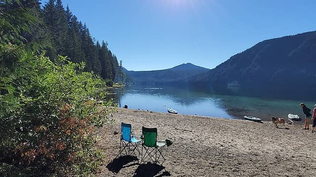 Walupt Lake 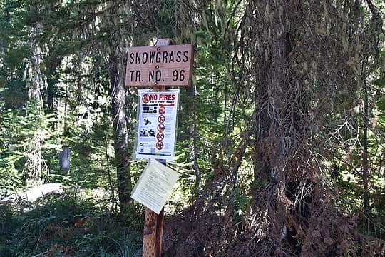 Trailhead Marker 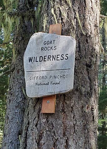 Goat Rocks Wilderness 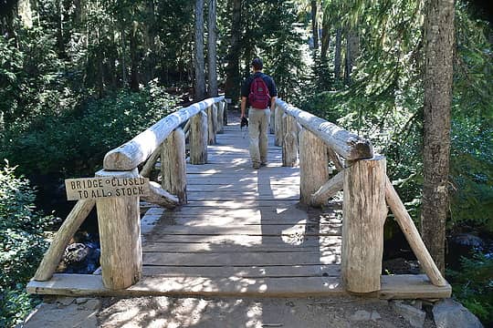 Bridge over Cispus River 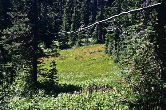 Meadows near Snowgrass Flats before the PCT 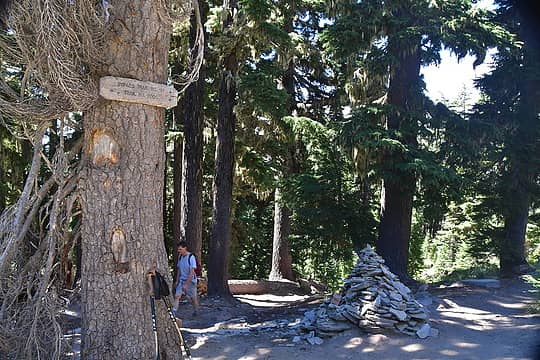 Reaching the PCT 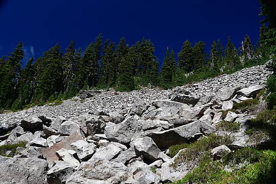 Talus field along the PCT 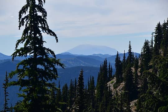 Mount Saint Helens 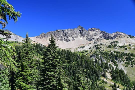 The valley opens up before us 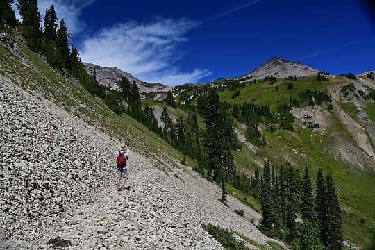 Climbing into the valley toward the pass 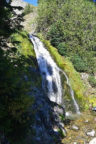 Waterfall crosses the trail 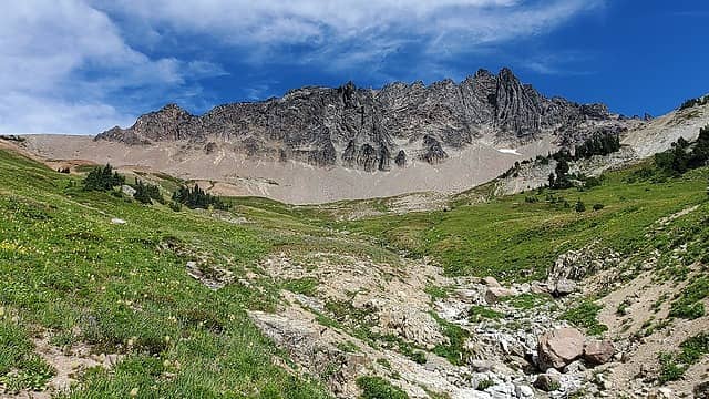 Source of the Cispus River 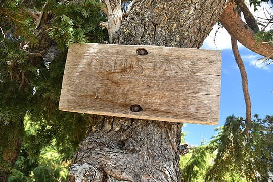 Cispus Pass! 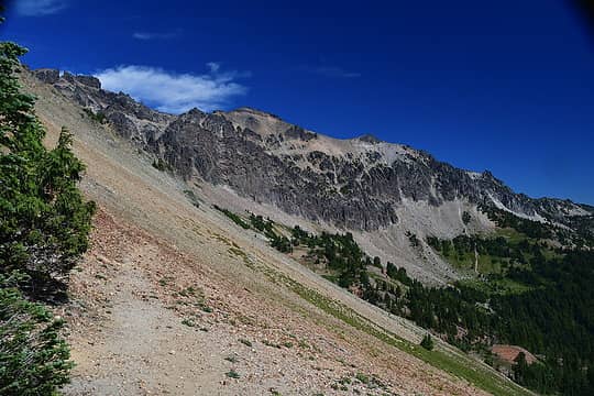 Gilbert Peak 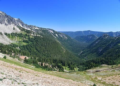 Klickitat River Valley 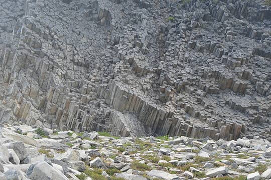 Basalt 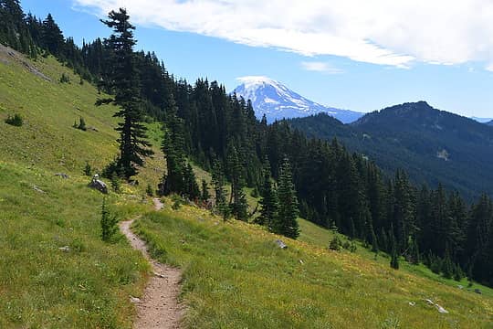 Mt Adams and Nannie Ridge in the foreground 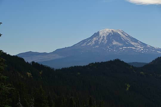 Mt Adams 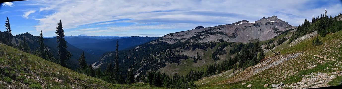 looking back toward Ives Peak 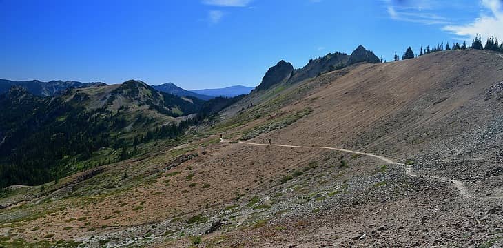 the PCT looking south from Cispus Pass 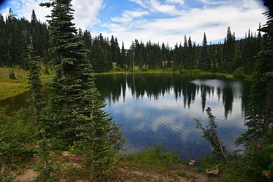 Sheep Lake 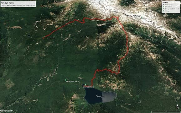 Google Earth Track
Footprints on the sands of time will never be made sitting down.
 runup, HikingBex, RichardJ, Tom, mosey, awilsondc runup, HikingBex, RichardJ, Tom, mosey, awilsondc  KascadeFlat KascadeFlat
Footprints on the sands of time will never be made sitting down.
runup, HikingBex, RichardJ, Tom, mosey, awilsondc KascadeFlat
|
| Back to top |
  
|
|
mosey
Member

Joined: 18 Dec 2018
Posts: 163 | TRs | Pics
|
|
mosey
Member
|
Sun Oct 09, 2022 8:34 pm |
|
|
The shuttle is a good idea. What a neat area! I spent at least two hours in the basin when I visited this summer, taking it in. Such nice jagged peaks and meadows.
|
| Back to top |
|
|
|
|
You cannot post new topics in this forum
You cannot reply to topics in this forum
You cannot edit your posts in this forum
You cannot delete your posts in this forum
You cannot vote in polls in this forum
|
Disclosure: As an Amazon Associate NWHikers.net earns from qualifying purchases when you use our link(s). |


