| Previous :: Next Topic |
| Author |
Message |
zephyr
aka friendly hiker


Joined: 21 Jun 2009
Posts: 3370 | TRs | Pics
Location: West Seattle |
|
zephyr
aka friendly hiker
|
 Fri Oct 21, 2022 5:39 pm |
|
|
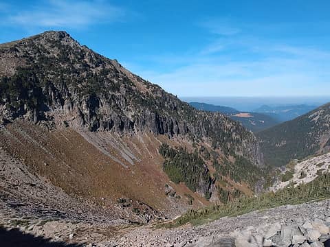
Tuesday this week I had hiked up to Summerland from the Sunrise Road where it crosses Frying Pan Creek. In the early afternoon I went as far as the second log crossing on the trail--up above those falls but still a ways from Panhandle Gap.
I was taking a break and met up with a hiker coming from P.G. He was carrying a heavy pack and yet jogging down the trail. We talked for a bit. He had started the day before in Longmire and was intending to do the Wonderland Trail as a complete loop. He was from the Midwest and visiting the area. He was definitely fit and capable.
We talked weather at one point. He had run into some other day hikers up the trail who had already warned him of the coming weather change. I cautioned him to head down off the mountain if there started to be snow and reduced visibility. I told him that we lose people fairly regularly around this time of year as the season changes.
I seem to recall that he didn't have a GPS but maps. I didn't ask if he had a compass. So that was Tuesday. Do any experienced Wonderland hikers think he could have gotten back to Longmire by this afternoon? Would you say that the WT is easy or challenging to navigate in snow without a GPS? I should think a lot of it would be somewhat featureless in a foot or so of snow. I hope he makes it back safely. ~z
|
| Back to top |
  
|
|
Backpackapalooza
Member

Joined: 06 Aug 2008
Posts: 184 | TRs | Pics
|
Not an expert about the Wonderland at all but if you do the math, it's 90 miles, so at 15 miles a day, it's 6 days total. At 20 miles a day it's 5 days. If he started on Monday, he would best case come out on Friday, but more likely Saturday.
|
| Back to top |
|
|
zephyr
aka friendly hiker
Joined: 21 Jun 2009
Posts: 3370 | TRs | Pics
Location: West Seattle |
|
zephyr
aka friendly hiker
|
Fri Oct 21, 2022 9:28 pm |
|
|
| Backpackapalooza wrote: | | he would best case come out on Friday, but more likely Saturday |
Thanks. I appreciate it. ~z
|
| Back to top |
|
|
Eric Hansen
Member
Joined: 23 Mar 2015
Posts: 866 | TRs | Pics
Location: Wisconsin |
Zephyr, your concerns about this guy are reasonable ones.
|
| Back to top |
|
|
Bruce Albert
Member
Joined: 01 Sep 2007
Posts: 160 | TRs | Pics
|
I cant speak to the time because Im repeatedly boggled by how fast people do that thing, but I doubt a foot of snow would impede navigation provided that a person were fit and equipped to trudge through the stuff.
Most of the Wonderland on from where you had your encounter would be pretty hard to lose, except maybe in upper Spray Park. An awful lot of it is in timber and below current snow levels.
IMO below timberline especially map and altimeter will get you through thick and thin better than map and compass, but to have all three is best.
For an excellent account of a late fall storm epic on the PCT near Glacier Peak
with a happy ending
search for Im Fine on this site a few years ago.
 rossb rossb
rossb |
| Back to top |
|
|
neek
Member

Joined: 12 Sep 2011
Posts: 2337 | TRs | Pics
Location: Seattle, WA |
|
neek
Member
|
Sat Oct 22, 2022 11:52 am |
|
|
| Backpackapalooza wrote: | | Not an expert about the Wonderland at all but if you do the math, it's 90 miles, so at 15 miles a day, it's 6 days total. At 20 miles a day it's 5 days. If he started on Monday, he would best case come out on Friday, but more likely Saturday. |
Longmire to PG is 22 mi; if he did that in a day I'd say he's on a 5 or even 4 day track. At any rate his itinerary should be registered with the park. (We did 5 days and I don't think ever had a 22 mile day.) Paradise webcams (to get a feel for current snow) seem down now unfortunately. Seems like yesterday there was a dusting down to maybe 4000'? I wouldn't be too worried & would be surprised if he didn't have a gps app on his phone. Also it's a popular trail.
|
| Back to top |
|
|
zephyr
aka friendly hiker
Joined: 21 Jun 2009
Posts: 3370 | TRs | Pics
Location: West Seattle |
|
zephyr
aka friendly hiker
|
Sat Oct 22, 2022 2:48 pm |
|
|
| Eric Hansen wrote: | | Zephyr, your concerns about this guy are reasonable ones. |
Thanks, Eric.
| neek wrote: | | At any rate his itinerary should be registered with the park. (We did 5 days and I don't think ever had a 22 mile day.) ...
I wouldn't be too worried & would be surprised if he didn't have a gps app on his phone. |
Thanks, that's helpful to know. I have been looking at the Mt Rainier website to learn about the WT. Surely he would have been registered with the ranger station. I have no idea how closely they monitor the comings and goings of WT hikers. Do they park in a designated area and if no one shows up within a reasonable time--do they reach out to their emergency contacts? If so, we will hear about it soon enough.
Umm regarding a phone. I am pretty sure he told me that he did not bring his phone with him. He also said he had a sister out here. So that was good to hear. He showed me his maps. I think both of them were more descriptive not topos. I guess that they hand one out to you when you pick up your permit.
He did say that his previous conversation with the other day hikers about the weather shift along with my talking about it was giving him some concern. So he was aware of some additional risk. I am also aware that this particular week so many of the ranger stations are closing down for the winter. A lot of the roads are closing. So there will be less people up on the mountain. I sorta think it's a little late in the season to be doing this route. But maybe he has been able to squeak by as the door is closing. I hope so. ~z
|
| Back to top |
|
|
zephyr
aka friendly hiker
Joined: 21 Jun 2009
Posts: 3370 | TRs | Pics
Location: West Seattle |
|
zephyr
aka friendly hiker
|
Sat Oct 22, 2022 2:49 pm |
|
|
| Bruce Albert wrote: | | Most of the Wonderland on from where you had your encounter would be pretty hard to lose, except maybe in upper Spray Park. An awful lot of it is in timber and below current snow levels. |
Thanks, Bruce. ~z
|
| Back to top |
|
|
zephyr
aka friendly hiker
Joined: 21 Jun 2009
Posts: 3370 | TRs | Pics
Location: West Seattle |
|
zephyr
aka friendly hiker
|
Sat Oct 22, 2022 2:58 pm |
|
|
Okay. I kept looking and found a number to the Longmire Museum. The ranger answering the phone told me that all the Wonderland hikers have been accounted for.  Sorry it took so long to figure this thing out.
Thanks for all the info. ~z Sorry it took so long to figure this thing out.
Thanks for all the info. ~z
neek, Joseph, jaysway, hikingpersonnw, philfort, SpookyKite89
neek, Joseph, jaysway, hikingpersonnw, philfort, SpookyKite89 |
| Back to top |
|
|
Joseph
Joseph
Joined: 13 Jun 2018
Posts: 260 | TRs | Pics
Location: Seattle |
|
Joseph
Joseph
|
Sun Oct 23, 2022 7:54 pm |
|
|
that is good news: the transition from fall to winter in the park can be dangerous and a hiker can find themselves in good weather and relatively mild temps one day, and snow the next day. This particular hiker would have a few different areas to bail, but the concern is when you are between those areas (like between Sunrise and Mowich, e.g.) and it starts snowing. One our trip in 2019 we started from Box Canyon and had great weather the first two days, then it started raining (cold rain) and windy, with no letup in sight. So we bailed and did the trip the next year with good weather.
|
| Back to top |
|
|
peter707
Member
Joined: 16 Jun 2022
Posts: 136 | TRs | Pics
Location: Seattle, WA |
|
peter707
Member
|
Mon Jan 16, 2023 11:57 pm |
|
|
(3 months late to the party) I have no context on what the trail is like with snow, but I happened to save the snowtel data for 5500ft from the time. I traveled CCW from Reflection Lakes to White River Campground, on 10/17/2022, my last day on the trail. There were at 1-2 groups going CW that the referenced hiker would have run into on 10/17/2022 or 10/18/2022, although it would be possible that one of those two groups exited at White River Campground. From this description I would have been ~7 hours ahead going the same direction so I didn't see them myself.
Mowich Lake campground & road closed on 10/16/2022, and sunrise was closed since at least 10/14/2022, so he would be facing ~60 miles without a simple exit after White River.[1]
This was the snowtel data for 5500 ft:
https://wcc.sc.egov.usda.gov/nwcc/view
Site Id Date Time AVG.D-1 (degF) SNWD.I-1 (in)
679 2022-10-14 60 0 My Day 1
679 2022-10-15 59 0 My Day 2
679 2022-10-16 59 0 My Day 3
679 2022-10-17 59 0 My Day 4
679 2022-10-18 58 0
679 2022-10-19 59 0
679 2022-10-20 60 0
679 2022-10-21 49 0
679 2022-10-22 35 4
679 2022-10-23 32 5
679 2022-10-24 31 4
679 2022-10-25 33 8
679 2022-10-26 33 -99.9
679 2022-10-27 31 18
679 2022-10-28 35 15
679 2022-10-29 38 13
679 2022-10-30 38 13
If he started on 2022-10-17, there would be 5 days prior to the snow. The 6th day would have had 4 inches of snow @ 5500ft. If a person was to feel the cold snap / low pressure on 10/21/2022, they might push onward to at least Devil's Dream to finish the terrain above 5000' to simplify things on the final day. I am also not sure I would want to cross a suspension bridge labelled '1 person' if it had 4 inches of snow on it, but perhaps that suspension bridge is low enough to mostly get rain?
So I think all 5 days and many 6 day itineraries starting on 2022-10-17 would be fine, although any sort of mobility impairment in the 60-miles-of-no-road would have caused problems. Perhaps being from the mid-west he is prepared for average temperatures of 30 degrees. Glad it turned out well.
[1] There is potential to bail out through skyscraper pass, through part of grandpark, to forest road 73, near Lake Eleanor. But it's not any shorter than turning around and going back to White River Campground, probably 8 miles off the wonderland.
|
| Back to top |
|
|
zephyr
aka friendly hiker
Joined: 21 Jun 2009
Posts: 3370 | TRs | Pics
Location: West Seattle |
|
zephyr
aka friendly hiker
|
Tue Jan 17, 2023 10:45 am |
|
|
| peter707 wrote: | | There were at 1-2 groups going CW that the referenced hiker would have run into on 10/17/2022 or 10/18/2022, although it would be possible that one of those two groups exited at White River Campground. From this description I would have been ~7 hours ahead going the same direction so I didn't see them myself. |
Thanks for all the detailed information peter707. I really appreciate it. ~z
|
| Back to top |
|
|
|
|


