| Previous :: Next Topic |
| Author |
Message |
Eric Gilbertson
Member


Joined: 04 Jul 2018
Posts: 188 | TRs | Pics
Location: Seattle |
Luna Peak, East Fury, West Fury Theodolite Survey
Oct 22 23, 2022
8:30pm Saturday to 11:30pm Sunday (27 hours continuous)
54 miles (45 hiking, 9 boating), 10,000ft gain
Eric, Nick, Talon
Summary of results: East Fury is 45ft taller than Luna and 51 ft taller than West Fury. Elevations: East Fury 8,356ft +/-8ft, West Fury 8,305ft +/-10ft, Luna Peak 8,311ft (from USGS Quad). Detailed analysis at end of report.
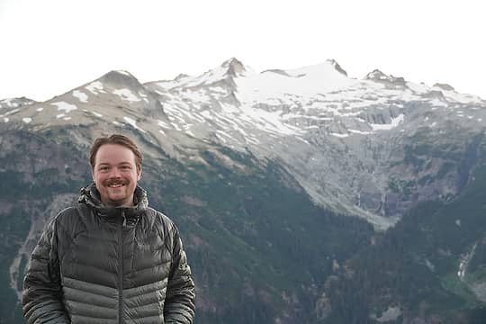
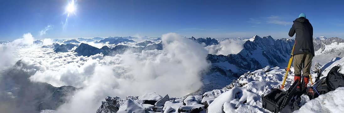 Taking measurements from the false summit of Luna towards East/West Fury (photo by Nick) 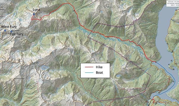 The route 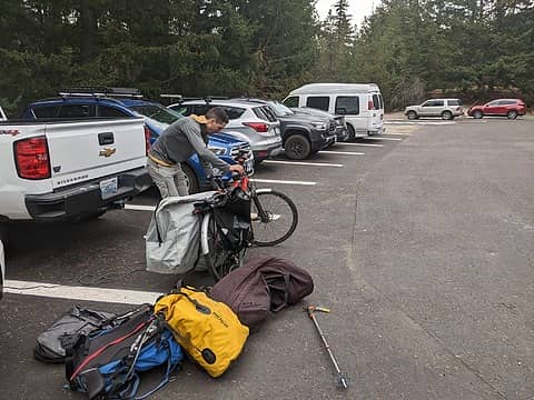 Loading up at Ross Dam trailhead 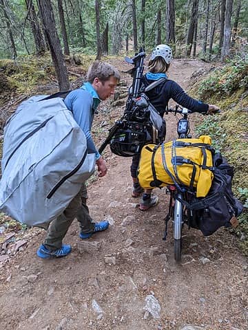 Hauling the boat and motor down the trail 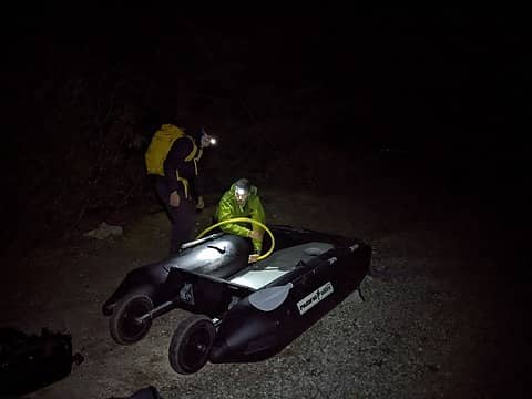 Assembling the boat 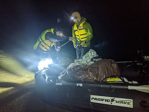 Testing out the jeep lights 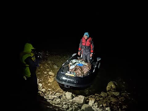 Taking out at Big Beaver at 11pm 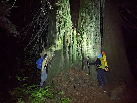 Massive cedar trees 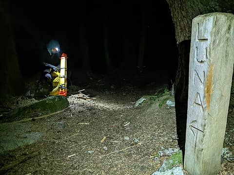 Luna Camp 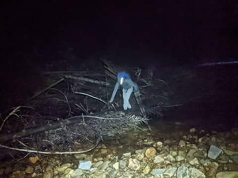 Crossing Big Beaver around 2:30am 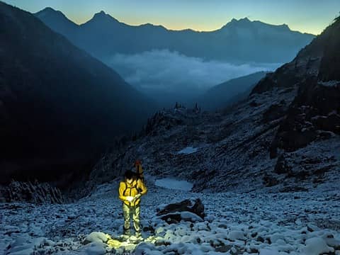 Leaving the access creek drainage at sunrise 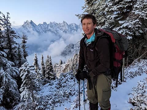 Nice views of the southern pickets (photo by Nick) 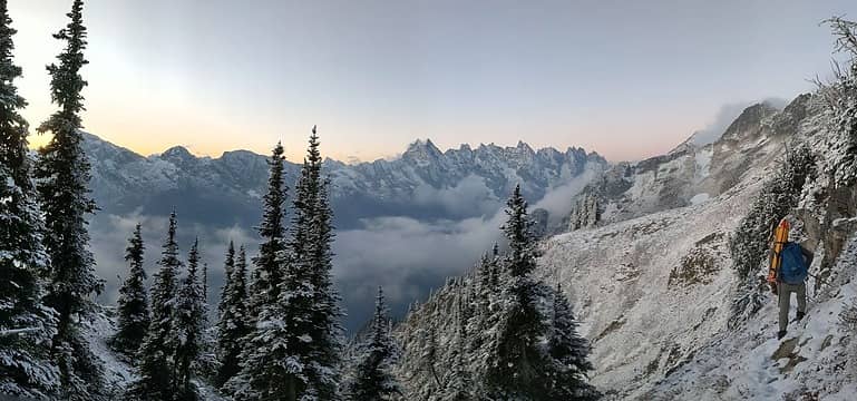 Traversing across the heather slopes 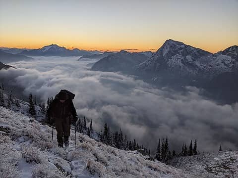 Traversing the south slope of Luna (photo by Nick) 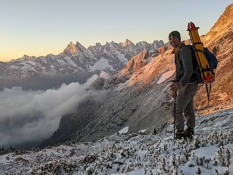 Heading towards Luna 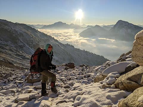 Approacing Luna Col (photo by Nick) 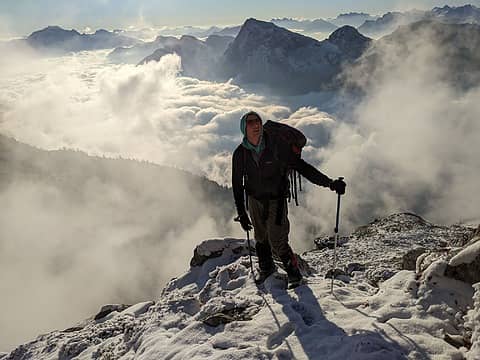 Approaching Luna Col (photo by Nick) 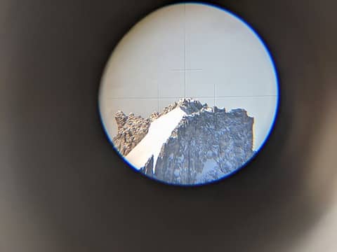 The view of East Fury through the scope 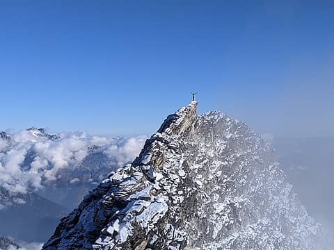 Nick on the true summit 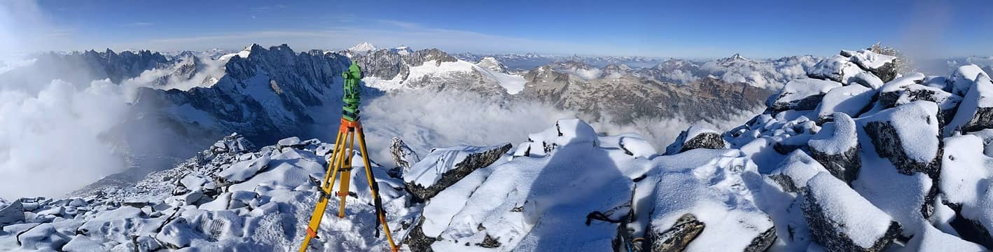 Panorama from false summit 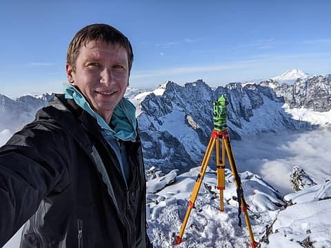 On the false summit 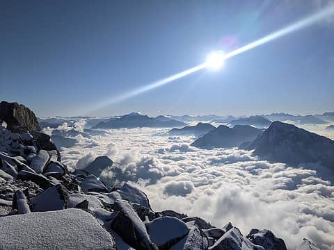 Sunrise to the east 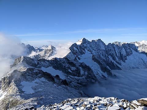 More views of the Furies 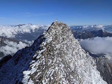 Me on Luna summit (photo by Nick) 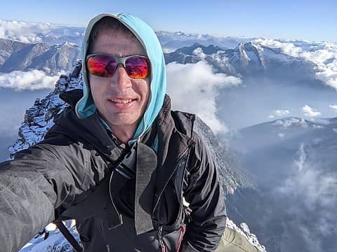 On Luna 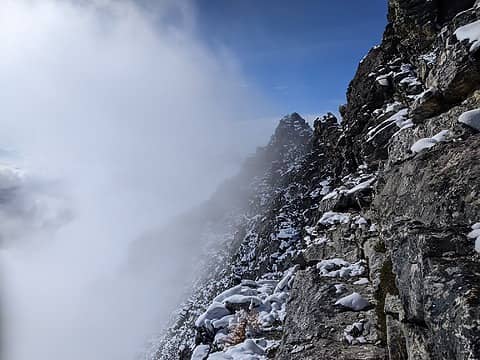 Spicey traverse back 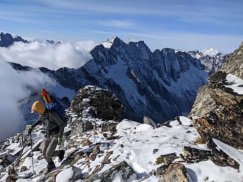 Starting down 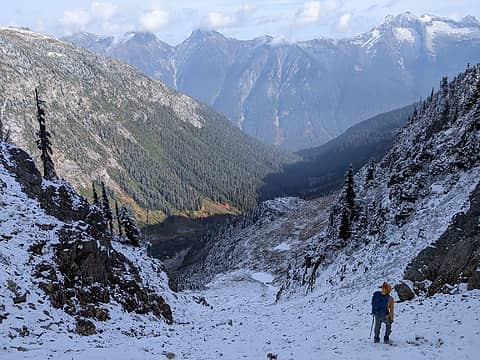 Hiking down 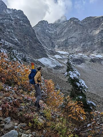 Hiking down 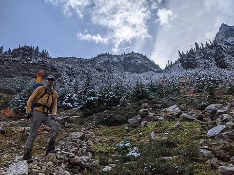 Hiking down 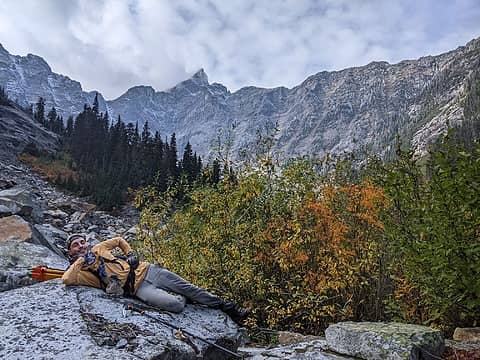 Last view up to Luna 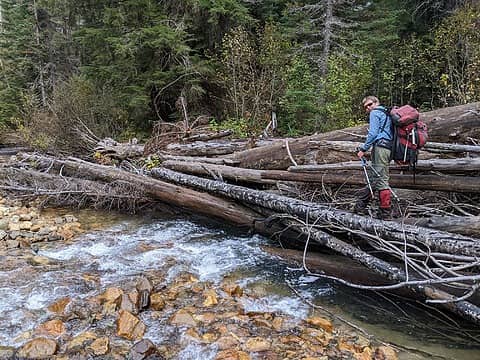 Crossing Big Beaver (photo by Nick) 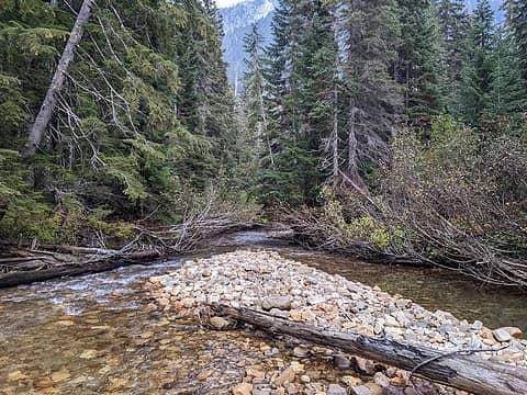 Big Beaver. Not too bad in October 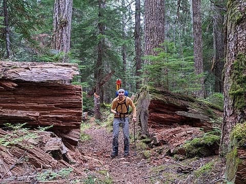 Hiking out 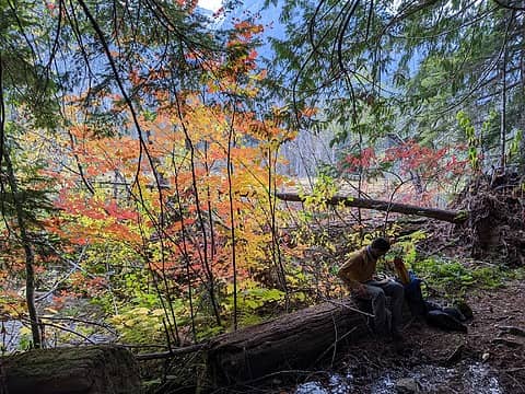 Hiking out 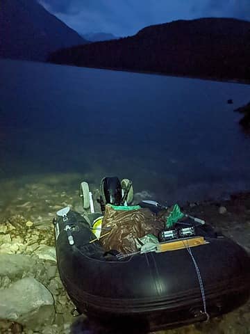 Back to the boat 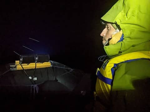 Boating back 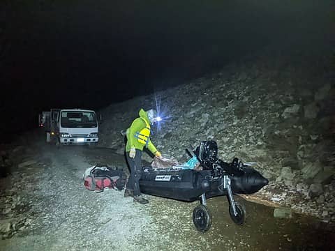 At the takeout, blocked by the trucks 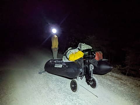 Towing the boat up frontage road 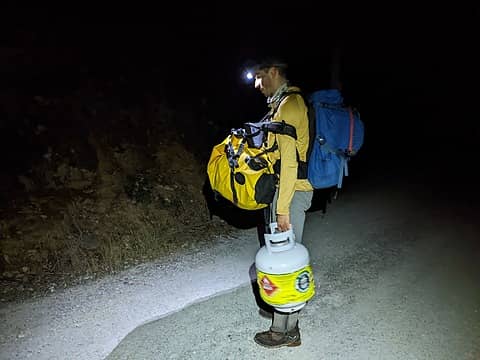 Nick hauling the first load up 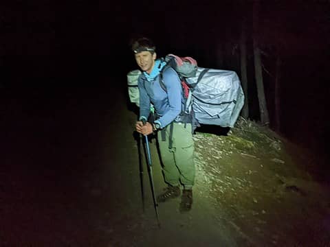 Me hauling the boat up (photo by Nick) 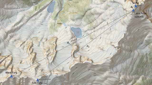 Fig 1. Locations of peaks, survey point, and distances from survey point to peaks 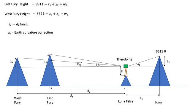 Fig 2. Relationship between distances, angles, and relative heights of peaks 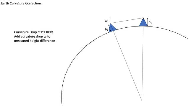 Fig 3. Earth curvature correction
 Bramble_Scramble, peter707, gumby, seawallrunner, Josh Journey, ozzy, Brushbuffalo, joker, RAW-dad, SeanSullivan86, Now I Fly, freddyfredpants, wallorcrawl, dylpickle, Tom, bivouacjack, dave allyn, GaliWalker, RichP, yukon222 Bramble_Scramble, peter707, gumby, seawallrunner, Josh Journey, ozzy, Brushbuffalo, joker, RAW-dad, SeanSullivan86, Now I Fly, freddyfredpants, wallorcrawl, dylpickle, Tom, bivouacjack, dave allyn, GaliWalker, RichP, yukon222  jaysway, rstoddard24, geyer, Alden Ryno jaysway, rstoddard24, geyer, Alden Ryno  SpookyKite89, Slim, belowfellow, rubywrangler, awilsondc, zimmertr SpookyKite89, Slim, belowfellow, rubywrangler, awilsondc, zimmertr
Bramble_Scramble, peter707, gumby, seawallrunner, Josh Journey, ozzy, Brushbuffalo, joker, RAW-dad, SeanSullivan86, Now I Fly, freddyfredpants, wallorcrawl, dylpickle, Tom, bivouacjack, dave allyn, GaliWalker, RichP, yukon222 jaysway, rstoddard24, geyer, Alden Ryno SpookyKite89, Slim, belowfellow, rubywrangler, awilsondc, zimmertr |
| Back to top |
  
|
|
zimmertr
TJ Zimmerman
Joined: 24 Jun 2018
Posts: 1227 | TRs | Pics
Location: Issaquah |
|
zimmertr
TJ Zimmerman
|
 Thu Oct 27, 2022 12:11 am |
|
|
Too cool, Eric! You're doing a huge service to the climbing community with these surveys. This is one of my favorite posts I've ever read on NWHikers.
|
| Back to top |
|
|
Alden Ryno
Member

Joined: 04 Jun 2019
Posts: 150 | TRs | Pics
Location: Issaquah, WA |
Wonderful trip report! A serious push coupled with a consequential result. The boat haul at the end seems defeating after such an effort, but that's the toll for boating (plus you gained valuable experience there).
I'm curious how this will be received and what will transpire. While I have no credentials in the matter, I give a vote of confidence in your results. Without opposing information/data, I think it'd be difficult to uphold a different stance.
This is really awesome, Eric.
Brushbuffalo, Eric Gilbertson
Brushbuffalo, Eric Gilbertson |
| Back to top |
|
|
Eric
Peak Geek

Joined: 21 Oct 2002
Posts: 2062 | TRs | Pics
Location: In Travel Status |
|
Eric
Peak Geek
|
Thu Oct 27, 2022 9:26 am |
|
|
Fascinating report. Thanks for your work here, this is an excellent service to peakbaggers everywhere.
You mentioned the top 100 list but it would seem if accurate that this makes Flora (since it has a BM elevation right at 8320) and some others lower than East Fury. While the Bulger list is an informal club list and quirky in its rules on named peaks and volcanoes, if the list criteria had been applied with this elevation indicated at 8,356' then East Fury would have been included. You mentioned an 8 foot margin of error, I am curious, do we know with what confidence we can say that East Fury's elevation is at least 8321? I'd imagine it is quite high.
What's next on your theolodite adventures? The two summits of the Cradle? Whitehorse/Three Fingers? So many choices.
ozzy, Brushbuffalo, Eric Gilbertson
ozzy, Brushbuffalo, Eric Gilbertson |
| Back to top |
|
|
SeanSullivan86
Member
Joined: 25 Jul 2009
Posts: 681 | TRs | Pics
Location: Seattle, WA |
| Quote: | | It was previously widely accepted that Luna Peak was the highest peak in the range and thus the 99th tallest peak in Washington. But two other peaks East Fury and West Fury are nearby and of very similar elevation. If in fact one of those two peaks is taller than Luna, then Luna would lose its distinction of being a top 100 peak. |
Is that right? Wouldn't Luna just move from 99th to 100th as it would still have ~1300' of prominence (above the Luna-Fury Col, rather than ~3100' of prominence connecting it to Spickard).
Eric Gilbertson
Eric Gilbertson |
| Back to top |
|
|
Gimpilator
infinity/21M

Joined: 12 Oct 2006
Posts: 1684 | TRs | Pics
Location: Edmonds, WA |
Astounding! This is a reshuffle of many important WA lists, as well as historic completion status. Tough news for some folks, undoubtedly.
|
| Back to top |
|
|
Eric
Peak Geek
Joined: 21 Oct 2002
Posts: 2062 | TRs | Pics
Location: In Travel Status |
|
Eric
Peak Geek
|
Thu Oct 27, 2022 9:44 am |
|
|
Yeah Castle rather than Luna would be dropped for Easy Fury. These findings may be more consequential for folks doing P2Ks or P3Ks. As a practical matter the bottom of the top 100 list is uncertain because of all of the 8280+40 summits like Booker, Big Kangaroo, WyEast etc that may or may not be higher than 8311.
It's worth bearing in mind when we talk about lists too that USGS standards are that 90 percent of all surveyed points are within half a contour interval so 20 feet typically in mountainous terrain. At some level we are dependent on USGS info that does have some flaws until LIDAR or other technology steps in but you do have to take it all with a grain of salt. Map errors are infrequent but far from unheard of. Peakbagging lists-- made of stone but not set in it.
Josh Journey, Brushbuffalo, Eric Gilbertson
Josh Journey, Brushbuffalo, Eric Gilbertson |
| Back to top |
|
|
cascadetraverser
Member

Joined: 16 Sep 2007
Posts: 1407 | TRs | Pics
|
What an amazing report. You are doing trips and reports here that I don`t think I could even dream of. Kudos to you!!
Brushbuffalo, Eric Gilbertson
Brushbuffalo, Eric Gilbertson |
| Back to top |
|
|
rstoddard24
BBQWingz
Joined: 30 Dec 2016
Posts: 74 | TRs | Pics
|
Awesome trip and interesting results! Last summer from multiple view points in the pickets it always looked to me like E Fury was higher than W Fury. See below pic from the summit of Himmelhorn looking straight on. Harder to say about E Fury vs. Luna tho.
S pickets could be a good place to validate such important results. There are several surveyed summits to choose from (maybe W Mac is easiest), and could validate method by measuring all 3 summits then comparing Luna measurement result with surveyed result. I don't doubt your height ranking of the 3 peaks, but it seems a 50' difference between E and W fury would be more obvious in the field
|
| Back to top |
|
|
raising3hikers
Member
Joined: 21 Sep 2007
Posts: 2344 | TRs | Pics
Location: Edmonds, Wa |
Very interesting results! That's a lot of work to carry that extra weight up there to measure. Nice work
Eric Eames
Brushbuffalo, Eric Gilbertson
Eric Eames
Brushbuffalo, Eric Gilbertson
|
| Back to top |
|
|
Slim
This space for rent

Joined: 31 Aug 2004
Posts: 560 | TRs | Pics
Location: Falling off a turnip truck |
|
Slim
This space for rent
|
Thu Oct 27, 2022 5:35 pm |
|
|
Well done! The logistics alone make me shudder.
I hope you had an electric pump to inflate/deflate your boat !?!
"Lean mean money-making-machines serving fiends"
Brushbuffalo, Eric Gilbertson
"Lean mean money-making-machines serving fiends"
Brushbuffalo, Eric Gilbertson
|
| Back to top |
|
|
williswall
poser

Joined: 30 Sep 2007
Posts: 1967 | TRs | Pics
Location: Redmond |
Another great report! Now I have to figure out a way to do something in '23 that tops your stats...age adjusted of course.
|
| Back to top |
|
|
Eric Gilbertson
Member
Joined: 04 Jul 2018
Posts: 188 | TRs | Pics
Location: Seattle |
Thanks!
| Quote: | | You mentioned an 8 foot margin of error, I am curious, do we know with what confidence we can say that East Fury's elevation is at least 8321? I'd imagine it is quite high. |
I quoted the one-sigma error as 8 ft based on assuming a normal distribution for those four measurements I took. That's 68% confidence. 8321ft would be more than four sigma away, so if we assume normal distribution that would be over 99% confidence that East Fury is higher than 8321ft. But I doubt it's a perfect normal distribution.
| Quote: | | What's next on your theolodite adventures? The two summits of the Cradle? Whitehorse/Three Fingers? So many choices. |
So many choices! But they will likely have to wait for summer now since the summits are getting covered in snow, which will throw off the measurements.
| Quote: | | Wouldn't Luna just move from 99th to 100th as it would still have ~1300' of prominence (above the Luna-Fury Col, rather than ~3100' of prominence connecting it to Spickard). |
Yeah, that's a good point. I forgot Luna still has over 400ft prominence. So it seems like Luna would get bumped down to 100, and Castle would get bumped off the WA top 100 list. Then East Fury would be number 87.
| Quote: | | As a practical matter the bottom of the top 100 list is uncertain because of all of the 8280+40 summits like Booker, Big Kangaroo, WyEast etc that may or may not be higher than 8311. |
Yes, that's another good point. These peaks probably need proper surveys too! I suspect at least some of them have been hit by recent LiDAR surveys to give more accurate heights. Though if they are sharp (like Big Kangaroo) LiDAR might miss the summit. That would be a good project to comb through the LiDAR data and see. Maybe I'll look into that more.
| Quote: | | S pickets could be a good place to validate such important results. There are several surveyed summits to choose from (maybe W Mac is easiest), and could validate method by measuring all 3 summits then comparing Luna measurement result with surveyed result. I don't doubt your height ranking of the 3 peaks, but it seems a 50' difference between E and W fury would be more obvious in the field |
Yes, I'm all for more validation! But that would require someone hauling survey gear up W Mac. I doubt a 5x sight level would be super helpful at that distance, but couldn't hurt to try. I've started just always bringing my 5x sight level on trips now since it's small.
| Quote: | | I hope you had an electric pump to inflate/deflate your boat !?! |
No, just a foot pump now. I ought to get electric. I was worried about overinflating the boat too easily, but my pump has a release valve at the appropriate pressure for that reason, so I could find a way to hook up an off-the-shelf electic pump to my existing pump perhaps.
|
| Back to top |
|
|
jboealps
Member
Joined: 10 Aug 2006
Posts: 71 | TRs | Pics
Location: Seattle |
|
jboealps
Member
|
Fri Oct 28, 2022 3:42 am |
|
|
Great Trip and Report!
What an improvement over the old Tabor and Crowder pamphlet!!!
Jerry Baillie
|
| Back to top |
|
|
jaysway
Member

Joined: 16 Jul 2020
Posts: 347 | TRs | Pics
|
|
jaysway
Member
|
Fri Oct 28, 2022 12:16 pm |
|
|
This might be the most impressive TR that I've read here, and there are some insane TRs here. Well done! Beyond the measurements, the shots of the Pickets with a fresh coat of snow and clouds in the valleys are breathtaking.
You mention that you climbed Luna in October of 2018, by chance do you have any photos of the larches between Luna and Luna Lake, even from above? I've seen photos of them in the summer but never in the fall with their needles turning. In my head I'm picturing the view from that larch grove looking west towards Challenger in early-mid October with the larches changing and maybe some snow at higher elevations being one of the best scenes that Washington has to offer, among many impressive scenes.
SpookyKite89, Brushbuffalo, zimmertr
SpookyKite89, Brushbuffalo, zimmertr |
| Back to top |
|
|
|
|
You cannot post new topics in this forum
You cannot reply to topics in this forum
You cannot edit your posts in this forum
You cannot delete your posts in this forum
You cannot vote in polls in this forum
|
Disclosure: As an Amazon Associate NWHikers.net earns from qualifying purchases when you use our link(s). |


