| Previous :: Next Topic |
| Author |
Message |
powder blue
Member


Joined: 12 Oct 2022
Posts: 3 | TRs | Pics
Location: Port Townsend |
Planned a shoulder season hike with my long time hiking partner to see some areas of the Olympics we've not yet visited. Was hoping to catch the tail of the subalpine bear and berry season but it was not to be. The trip was executed as planned. The highlights were probably the fall colors and the lack of dew or rain. The hardest part was the lack or running water due to a combination of the trails chosen and the dry weather. We often packed between 4 and 6 liters of water.
Day 1: North Fork Sol Duc TH to shelter.
Hit the trail about 2 PM and got into the shelter with headlights on around 7:30. First crossing was just above the knees. No trouble with route finding during the later crossings even without the benefit of sunlight. Lots of rodent poop on the bunks but thankfully the stocked shelter included a broom head. Great shelter and privy as advertised.
Day 2: North Fork Sol Duc Shelter to Boulder Lake.
Started moving around 9 AM and had little difficulty following the old trail through all the switchbacks shown on the custom correct map to an elevation of around 4,000'. From here we followed the ridge heading uphill in an easterly direction until around 4,700' (just one or two hundred feet below high ridge running perpendicular to our direction of travel) when we jumped on some deer trails heading SSE toward our ridge. Once on the ridge we easily followed it until we met the happy lake trail, where we headed toward Boulder Lake. Arrived at Boulder Lake just after 1 PM, where we stopped for camp.
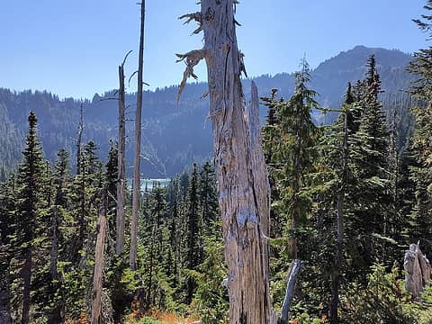 First View of Boulder Lake 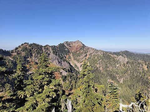 Boulder Peak from Everett Peak 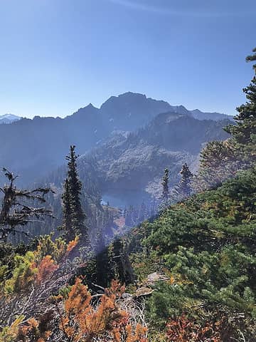 Appleton and Blue Lake from Everett Peak 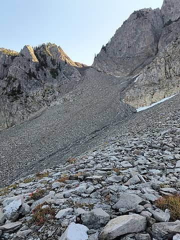 Looking up the the pass we took over the east ridge of Appleton 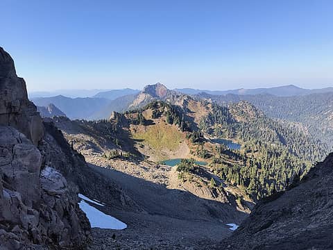 View of Blue lake and upper Blue lake from the pass 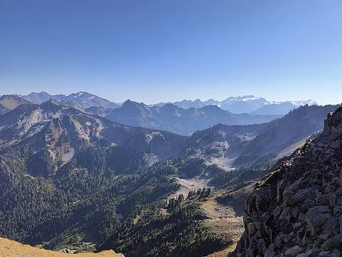 View of Appleton pass and Olympus from the pass 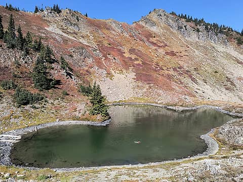 A dip in swimming bear lake 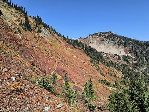 Looking back toward swimming bear lake across hillside above cat basin 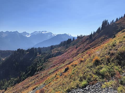 mt. olympus from hillside above cat basin 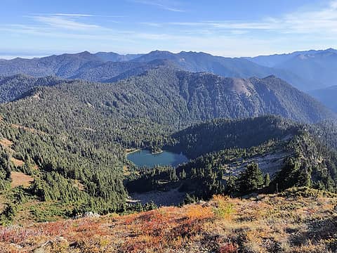 Boulder Lake from Boulder Peak 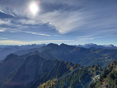 Looking south toward appleton and cottleton from boulder peak 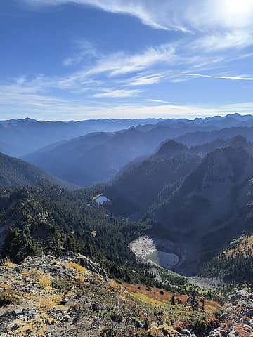 three horse and upper three horse lakes from Boulder peak 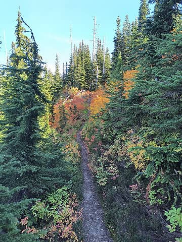 colors on north side of aurora ridge trail 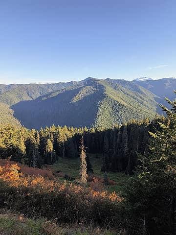 looking south over meadow near aurora peak 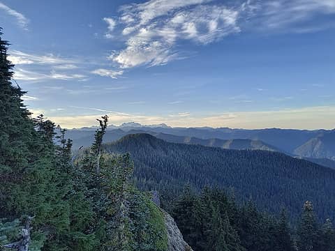 one last view of olympus from sourdough mountain
 Now I Fly, vibramhead, haydenslides, RichP, RodF, Hesman, silence, Tom, rubywrangler, RAW-dad, JonnyQuest Now I Fly, vibramhead, haydenslides, RichP, RodF, Hesman, silence, Tom, rubywrangler, RAW-dad, JonnyQuest  meck meck
Now I Fly, vibramhead, haydenslides, RichP, RodF, Hesman, silence, Tom, rubywrangler, RAW-dad, JonnyQuest meck |
| Back to top |
  
|
|
RAW-dad
Member

Joined: 07 Jul 2017
Posts: 119 | TRs | Pics
Location: Oregon |
|
RAW-dad
Member
|
 Fri Oct 14, 2022 3:40 pm |
|
|
That's an interesting loop. Thanks for sharing!
Except for the N Fork Sol Duc, I've hiked through much of it but way earlier in the season. I can't imagine how dry those ridges north of Boulder Lake must be this time of year! And in this super dry Fall.
|
| Back to top |
|
|
vibramhead
Member
Joined: 16 Mar 2010
Posts: 179 | TRs | Pics
Location: Olympic Peninsula |
Great trip & TR! Does the trail that climbs up to the ridge from the N Fork Sol Duc leave right from the shelter, or from somewhere down the trail from there?
|
| Back to top |
|
|
vibramhead
Member
Joined: 16 Mar 2010
Posts: 179 | TRs | Pics
Location: Olympic Peninsula |
Much thanks! As usual, Rod is the source of all Olympic wisdom.
|
| Back to top |
|
|
powder blue
Member
Joined: 12 Oct 2022
Posts: 3 | TRs | Pics
Location: Port Townsend |
The trail left directly from the shelter, passed through the one tent site directly upstream from the shelter and continued on from there, initially following the river just inside the woods and off the stream bank for several hundred feet before beginning to climb. As I said, we really had no trouble at all following it, which surprised me.
|
| Back to top |
|
|
vibramhead
Member
Joined: 16 Mar 2010
Posts: 179 | TRs | Pics
Location: Olympic Peninsula |
|
| Back to top |
|
|
|
|
You cannot post new topics in this forum
You cannot reply to topics in this forum
You cannot edit your posts in this forum
You cannot delete your posts in this forum
You cannot vote in polls in this forum
|
Disclosure: As an Amazon Associate NWHikers.net earns from qualifying purchases when you use our link(s). |


