| Previous :: Next Topic |
| Author |
Message |
peter707
Member

Joined: 16 Jun 2022
Posts: 136 | TRs | Pics
Location: Seattle, WA |
|
peter707
Member
|
 Sat Oct 29, 2022 9:33 pm |
|
|
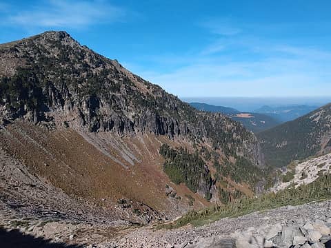
I planned to run the local Snohomish River Run, but with the air quality at the race at 160+ in Snohomish and unlikely to improve, I decided to head to Rainier and make an attempt at the Wonderland Trail. The Wonderland Trail is a 93-mile, 22,000 vertical foot trail that circumnavigates Rainier, which is usually snow-free from August-September. There are three main access points[1] - Longmire, Mowich Lake, and White River campground, each about 32 miles apart.
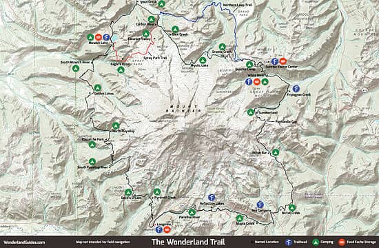 Wonderland Map 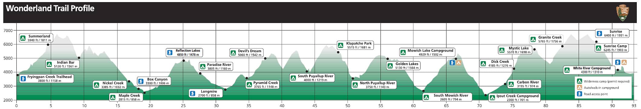 Elevation Profile 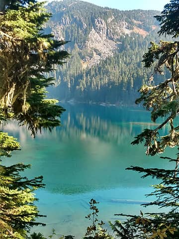 Mowich Lake, 10/15/2022 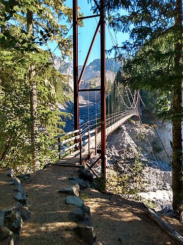 Tahoma Creek Suspension Bridge, 10/16/2022  Indian Henry's Patrol Cabin, 10/16/2022 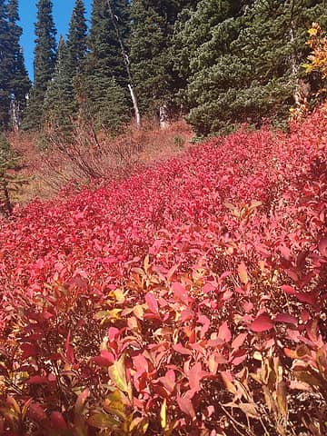 Fall colors heading up to Panhandle Gap, 10/17/2022 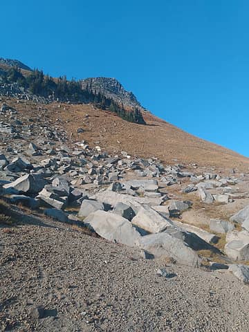 Mountain goats at Panhandle Gap, 10/17/2022  Skyscraper Pass 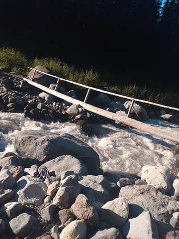 Crossing a creek in the evening 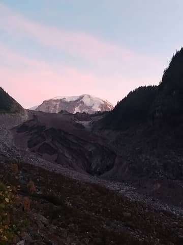 Carbon Glacier at dusk ![Superb details for the carbon crossing (from [url=https://www.williswall.com/wonderland-trail-in-3-days-2022-34]WillisWall[/url])](https://cloud.nwhikers.net/9my18_551x360.jpg) Superb details for the carbon crossing (from WillisWall) 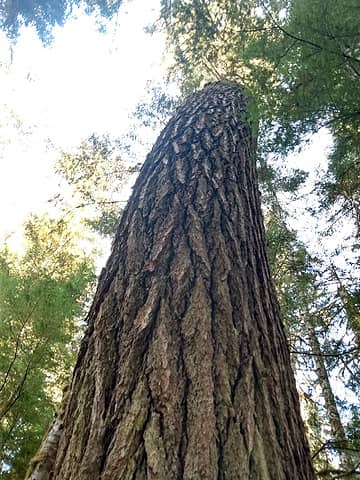 Giant Tree  Mowich Lake 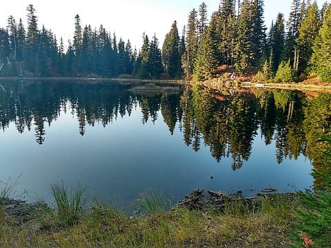 Golden Lakes 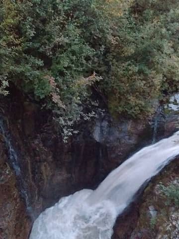 Waterfall at North Puyallup River 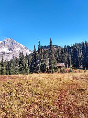 Indian Henrys Patrol Cabin 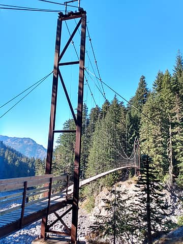 Tahoma Creek Suspension Bridge 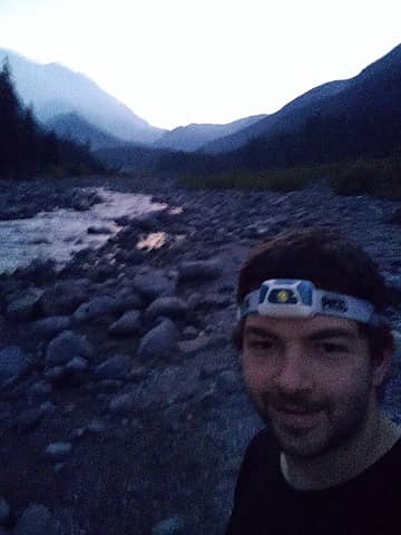 Crossing the White River the finish line is 300 meters away.
 Cam, kiliki, seawallrunner, jaysway, SpookyKite89, Slim, rubywrangler, awilsondc, Brushbuffalo, mosey, reststep, zimmertr, Tom Cam, kiliki, seawallrunner, jaysway, SpookyKite89, Slim, rubywrangler, awilsondc, Brushbuffalo, mosey, reststep, zimmertr, Tom
Cam, kiliki, seawallrunner, jaysway, SpookyKite89, Slim, rubywrangler, awilsondc, Brushbuffalo, mosey, reststep, zimmertr, Tom |
| Back to top |
  
|
|
williswall
poser

Joined: 30 Sep 2007
Posts: 1966 | TRs | Pics
Location: Redmond |
Congrats and nice write up! We were in the process of moving so I was unable to get out much during the weather window we had; it was fortunate for you to take advantage. Glad I was of some help, that Carbon crossing was a mess.
|
| Back to top |
|
|
peter707
Member
Joined: 16 Jun 2022
Posts: 136 | TRs | Pics
Location: Seattle, WA |
|
peter707
Member
|
Sun Oct 30, 2022 11:54 pm |
|
|
Thanks, hope the move went smoothly. As for the weather, it was better than I comprehended at the time. looked at the SNOTEL data - temperatures are now about 20-30F colder than during the trip and 10+ inches snowier at Paradise (although I'm not sure where on the trail would get the most / least snow). I am quite happy not exploring the temperature limits of the 30F quilt or the waterproofing limits of the bivy just yet.
https://wcc.sc.egov.usda.gov/nwcc/view
Site Id Date Time AVG.D-1 (degF) SNWD.I-1 (in)
679 2022-10-14 60 0 Day 1
679 2022-10-15 59 0 Day 2
679 2022-10-16 59 0 Day 3
679 2022-10-17 59 0 Day 4
679 2022-10-18 58 0
679 2022-10-19 59 0
679 2022-10-20 60 0
679 2022-10-21 49 0
679 2022-10-22 35 4
679 2022-10-23 32 5
679 2022-10-24 31 4
679 2022-10-25 33 8
679 2022-10-26 33 -99.9
679 2022-10-27 31 18
679 2022-10-28 35 15
679 2022-10-29 38 13
679 2022-10-30 38 13
Next time, I'll have to figure out how to modify the camera settings and take a photo of the stars! Couldn't get the stars to appear on the camera at all.
Bramble_Scramble
Bramble_Scramble |
| Back to top |
|
|
Navy salad
Member

Joined: 09 Sep 2008
Posts: 1865 | TRs | Pics
Location: Woodinville |
Awesome, highly detailed post! Thanks!!
RichardJ
RichardJ |
| Back to top |
|
|
|
|
You cannot post new topics in this forum
You cannot reply to topics in this forum
You cannot edit your posts in this forum
You cannot delete your posts in this forum
You cannot vote in polls in this forum
|
Disclosure: As an Amazon Associate NWHikers.net earns from qualifying purchases when you use our link(s). |


![Superb details for the carbon crossing (from [url=https://www.williswall.com/wonderland-trail-in-3-days-2022-34]WillisWall[/url])](https://cloud.nwhikers.net/9my18.jpg#2048x1338)


