Forum Index > Trip Reports > Loomis Mountain (Whatcom) 2022/11/13
 Reply to topic
Previous :: Next Topic
Author Message
wyattmullen
Wyatt


Joined: 22 Oct 2021
Posts: 41 | TRs | Pics
Location: Skagit County
wyattmullen
Wyatt
PostMon Nov 14, 2022 2:06 pm 
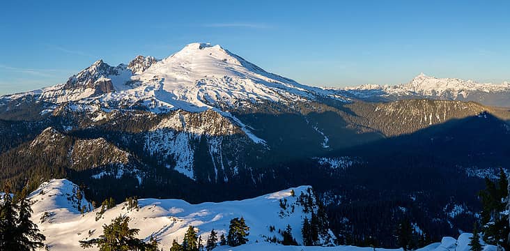
Summit pano towards the east
There haven’t been many reports on Loomis in the last decade so I thought I would provide some updates on this seldom summited peak near Mount Baker (2016 summer, 2012 Centennial Summer, 2010 winter). Loomis Mountain has been on my radar for a number of years, partly due to its prominence when viewed from the ever popular Park Butte Lookout. Most reports whether winter or summer had remarked on the thick brush on the approach which had kept me away, but with beautiful November weather after the first snow of the season I thought I would give it a shot. The quick summary is the brush is not nearly as bad as I was expecting, but the views in my opinion were comparable to Park Butte so if you want to work harder for similar views, but not encounter a soul, then this peak may be for you. There are two common routes to the summit: the east ridge and the south face. The east ridge supposedly has a class 3 narrow rock crux which I thought might be less than ideal with minimal snow cover so I decided on the south face. The snow level is remarkably low for this time of year. On the drive up there was snow at Lake Tyee which is under a thousand feet. When I turned off Baker Lake Road onto FS 12 towards Park Butte there was snow on the road almost immediately. As I headed up the road the snow deepened especially after I passed the Park Butte turnoff. FS 12 is still closed about a mile past that turnoff due to Rocky Creek undermining a bridge there, but I didn’t even make it to the bridge. Once my CR-V started scraping its bottom on the snow I was worried about finding a spot to turn around so I ended up parking shortly after where the road departs from Sulphur Creek in a turnout where I knew I wouldn’t get stuck. About a quarter mile after that there was a large tree blocking the road with deep snow (~6-8") and limited turnaround space so I was happy with my call.
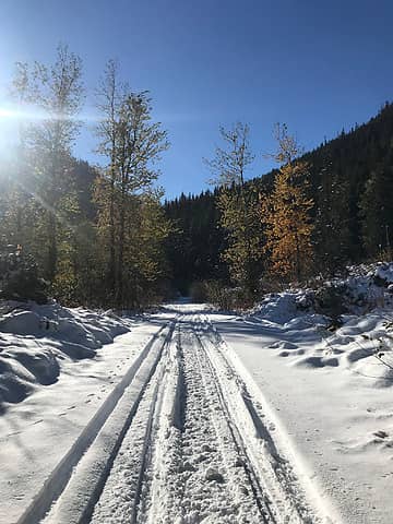
Following snowmobile tracks through a mix of fall and winter
I left from my car just before noon. I knew I probably wouldn’t be getting back before dark, but I wasn’t too worried about that and thought the lighting at the summit might be a bit better. I made my way up the closed road following some fresh snowmobile tracks (probably from the day before). Travel was easy on the partially packed snow and I made 2-3 mph. I also decided to cut off one of the road switchbacks because the forest looked relatively open. About a mile after the intersection with FS 1230 (leading up to Dock Butte and Blue Lake) and 3.5 miles after leaving my car, I encountered another washout. This was where the snowmobile had turned around, but was trivial to cross on foot and could probably even be crossed with a snowmobile with a couple feet of snow. Then after Loomis Creek I once again cut up into the forest to avoid an extra mile of road walking. While steep and a bit brushy at first the forest opened up quickly and I made it up to the old decommissioned Loomis Creek Road with little struggle. I would highly recommend this short cut if approaching from the south. I don’t know if this old road is easier to attempt in summer or winter or this time of year, but the slide alder bushwhack wasn’t nearly as bad as it could have been. It halved my pace so I was more like 45 min/mi instead of 25, but generally I was able to move branches out of my way or step around alder without too much gymnastics. The snow was just over a foot deep at this point and maybe that made it slightly easier? Hard to say, but after a mile I made it to the head of the valley where the road crosses Loomis Creek. From there I put on snowshoes and set off cross country. This travel was remarkably easy. I stayed on the north side of the creek and even found extensive flagging for the first quarter mile or so. I don’t know where it went after that and it definitely wasn’t necessary, but it showed that people make it up here every once in a while. Coming out of the forest into the avalanche meadows was also easy travel. Loomis looms above with its U-shaped notch and is actually quite a pretty mountain.
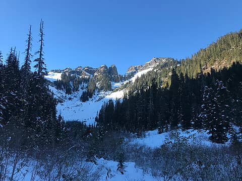
Loomis from end of old road (sorry no bushwhacking pics)
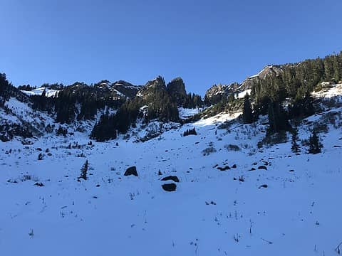
Easy travel up the snow covered meadows
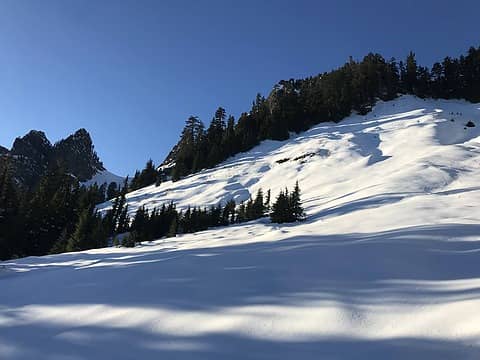
The upper meadow before gaining eastern ridge
Once you get really to the head of the valley (about 3,500’) there’s a nice "s-shaped" ledge system that leads up to the eastern ridge. The route almost never goes above 30º and is almost completely open as you transition from one meadow to the next through a small band of trees. There’s definitely some avy risk here though, so with more snow you’d want to go on a stable day. At 5,000’ you have to pass through one last small band of forest (and the steepest terrain of the day (about 35º) to make it to the ridge. I took the western notch although you may be able to take the eastern, lower notch even though it looks like the ridge narrows at that point. On the ridge was also the first time I saw Baker all day so definitely don’t climb Loomis from the south if you’re hoping for constant views.
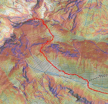
"S-shaped" ledge that takes you up the south face to the summit.
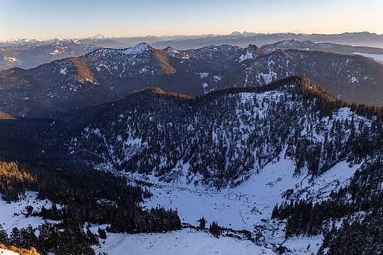
Looking down the Loomis Creek Valley I came up. You can see the brush road to the lower left.
The last 400’ to the summit had quite light, powdery snow that hadn’t seen much sun yet. The snow was a couple feet deep, although at times the powdery dust lay on top of a sheet of ice making climbing, even with snowshoes somewhat challenging. The terrain in this section is open and moderately steep and could also have a slight risk of sliding so just be aware. I reached the summit just before 4 p.m. so the ascend took a little over 4 hours at a moderately fast pace. The late afternoon light lit up the western face of Baker and there was a nice view of the rest of the North Cascades. As I mentioned earlier, while objectively the view of Baker may be slightly better than Park Butte, it felt pretty similar to me even if you’re slightly higher and get both Baker and Shuksan. Baker Lake was mostly in shadow, but you also have that to the east before Bacon and Blum and that section of the park rises. I was most disappointed with the view the Twin Sisters Range. I think it was partly because the whole range was in shadow, but also there are a couple trees on the summit that block an unobstructed view in that direction. You can maneuver around them, but with the snow and ice it was a bit sketchy.
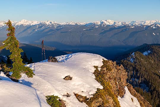
The summit is long and narrow, but has plenty of space
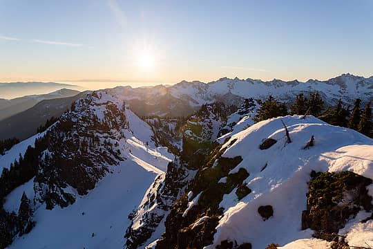
Looking towards the south end of the Twin Sisters Range and the other sub summits of Loomis
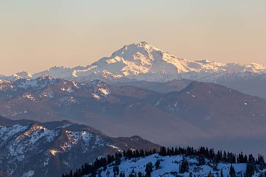
Glacier Peak to the south
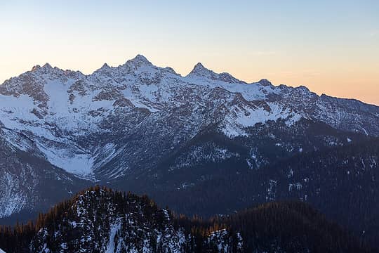
A little work to get unobstructed of the Twin Sisters Range
I was on the summit for a bit over 20 minutes before heading down. Perhaps I would have stayed longer if the sunset looked spectacular, but it was severe clear and I kind of wanted to get back to the road before darkness and the snow refroze. The descent was much quicker than the ascent and even though I was bushwhacking by headlamp, I ended up returning to my car in about 2:40, just before 7 p.m. Overall, a nice early season objective. Depending on how much time you want to spend in the dark, I would not suggest starting at noon this time of year.

Gimpilator, geyer, Now I Fly, fourteen410, JimK, ozzy, jaysway, RichP, awilsondc, Tom  KascadeFlat
Back to top Reply to topic Reply with quote Send private message
RichP
Member
Member


Joined: 13 Jul 2006
Posts: 5633 | TRs | Pics
Location: here
RichP
Member
PostWed Nov 16, 2022 12:30 pm 
Loomis is a great looking peak. Hoping to get there myself some day. Pretty sure this is it from the road on the way to Dock Butte TH.

Back to top Reply to topic Reply with quote Send private message
wyattmullen
Wyatt


Joined: 22 Oct 2021
Posts: 41 | TRs | Pics
Location: Skagit County
wyattmullen
Wyatt
PostThu Nov 17, 2022 11:36 am 
RichP wrote:
Loomis is a great looking peak. Hoping to get there myself some day. Pretty sure this is it from the road on the way to Dock Butte TH.
Yep! That's it with its characteristic u-shaped notch!

RichP
Back to top Reply to topic Reply with quote Send private message
   All times are GMT - 8 Hours
 Reply to topic
Forum Index > Trip Reports > Loomis Mountain (Whatcom) 2022/11/13
  Happy Birthday Crazyforthetrail, Exposed!
Jump to:   
Search this topic:

You cannot post new topics in this forum
You cannot reply to topics in this forum
You cannot edit your posts in this forum
You cannot delete your posts in this forum
You cannot vote in polls in this forum