| Previous :: Next Topic |
| Author |
Message |
rubywrangler
Member


Joined: 04 Aug 2015
Posts: 511 | TRs | Pics
|
Continuing the trend of out of state trips...
Julia and I met up on the north rim on the day before Thanksgiving for our second annual turkey day in the canyon. I had saved a bunch of info and TRs from this area on my phone but hadn't really read them yet, so we didn't have much of a (any) plan. We loaded up with water and set out from the saddle mountain trailhead (the lower elevation option off of buffalo ranch road/fr 8910) around 11am, hiked through a 2016 burn scar, and climbed 1500' to the park boundary/rim. Then we descended on the very meandering nankoweap trail to tilted mesa, where we dry camped in very windy conditions. Luckily there was a wind bunker waiting for us there. The park service description describes this as "MOST difficult of the named trails in Grand Canyon" but its really not that different from other non-corridor trails. Our camp spot was very scenic with views to nanko creek, mesa and butte as well as little nanko creek and lots of other stuff.
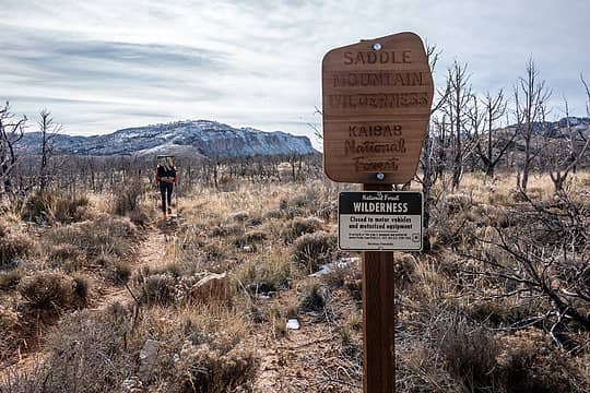 a new wilderness 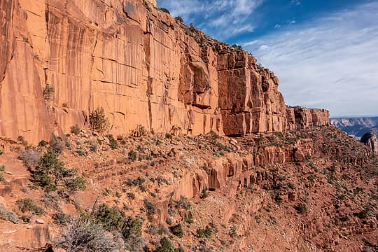 on the nankoweap trail 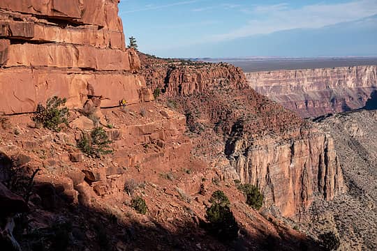 on the nankoweap trail 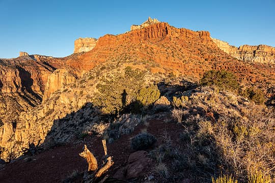 sunrise self portrait 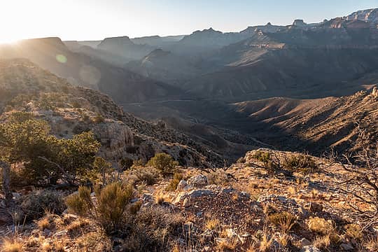 tilted mesa view toward nanko creek 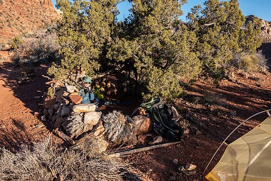 julia in the wind fortress 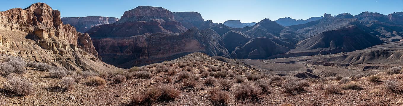 nanko creek - mesa - butte 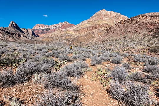 looking back to tilted mesa 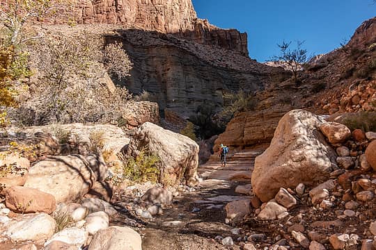 nanko creek 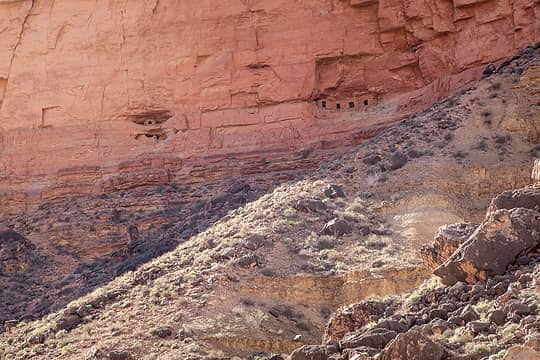 granaries 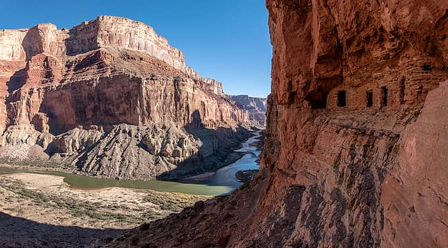 nanko granaries 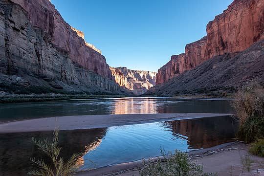 view from camp 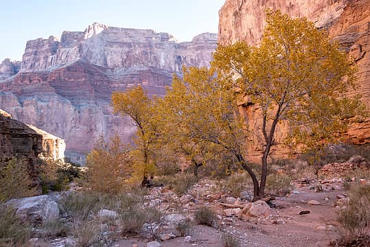 fall color 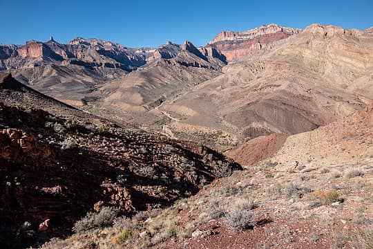 en route to nanko mesa, above the first gully 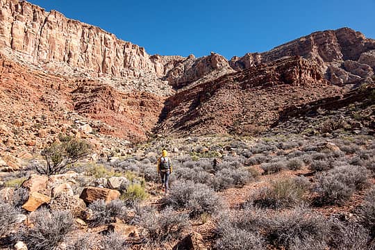 en route to nanko mesa 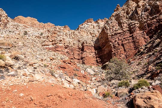 only 1000' feet to go 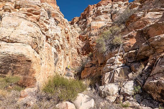 route climbs up to the right here 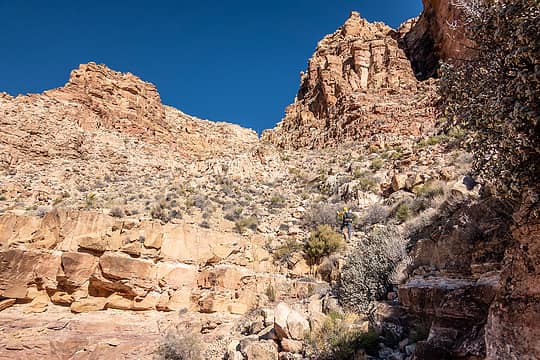 climbing talus to the final saddle 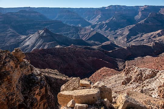 nanko mesa view 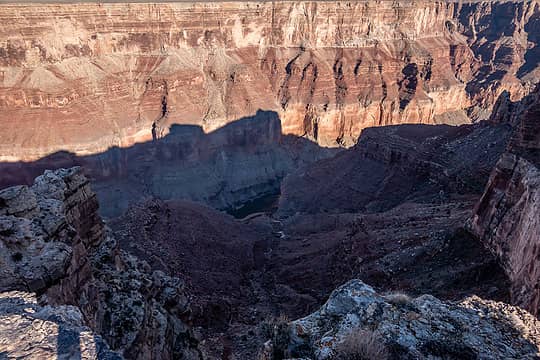 tiny glimpse of river 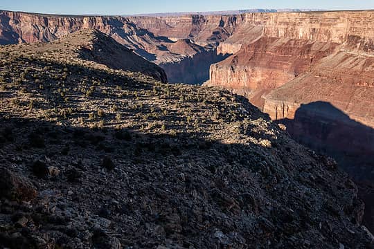 nanko mesa 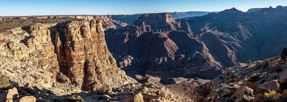 nanko mesa looking south(ish) 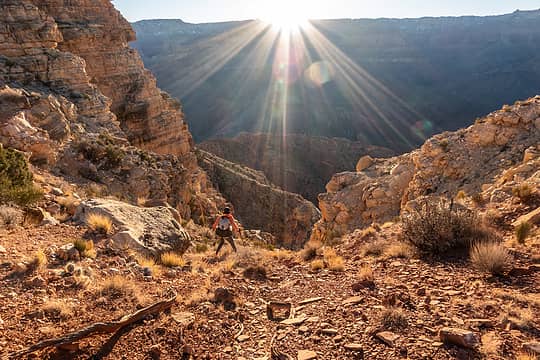 descending 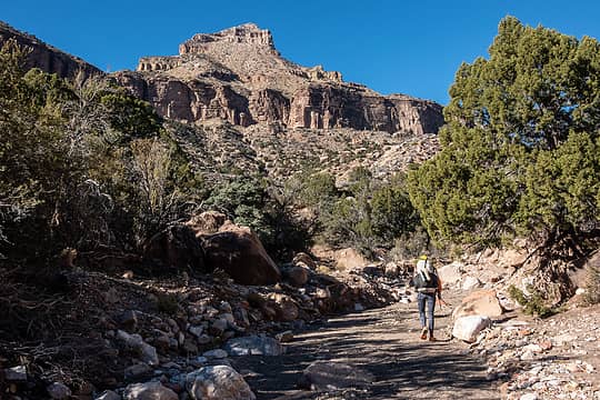 heading upstream 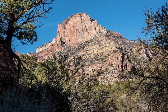 sieber pt 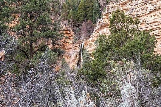 mystic falls 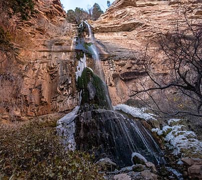 mystic falls 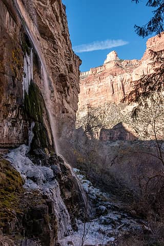 mystic falls 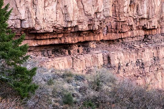 granaries 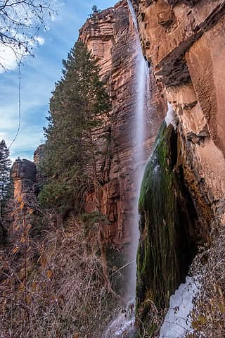 mystic falls 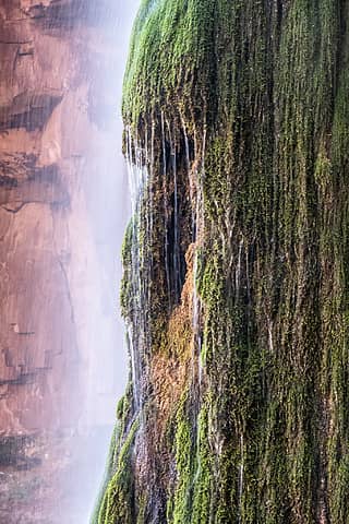 mystic falls 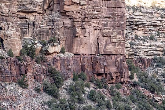 spotted another building in the wall across the canyon 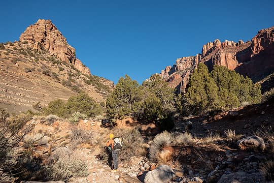 starting out on marion-sieber 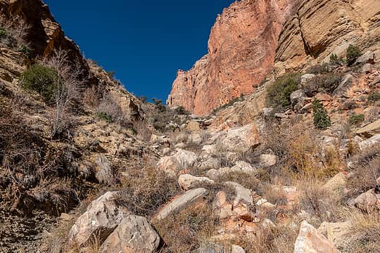 climbing above the 5600' spring 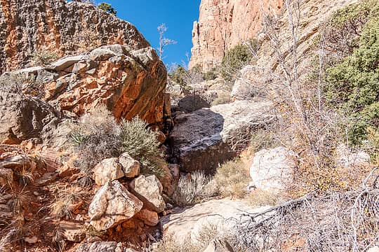 typical scrambling up the canyon 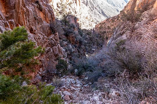 looking back down the steep scree slope, almost out of the gully 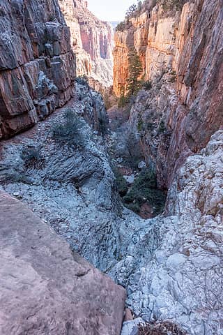 looking back down the final scrambly bit 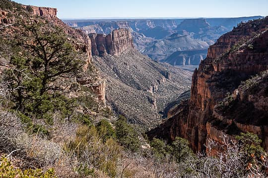 in the supai! 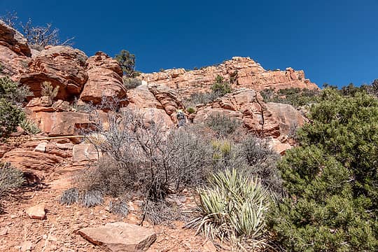 climbing through the supai 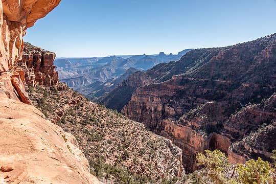 back on the trail
 drewcoll, Brushbuffalo, djt63, Gimpilator, Cam, fffej50, jaysway, Eric Hansen, Prosit, Slim, JonnyQuest, silence, John Mac, HitTheTrail, Nancyann, Tom, raising3hikers, zimmertr, graywolf, vogtski, jstern, neek, Kascadia drewcoll, Brushbuffalo, djt63, Gimpilator, Cam, fffej50, jaysway, Eric Hansen, Prosit, Slim, JonnyQuest, silence, John Mac, HitTheTrail, Nancyann, Tom, raising3hikers, zimmertr, graywolf, vogtski, jstern, neek, Kascadia  Lindsay, awilsondc Lindsay, awilsondc  fourteen410 fourteen410  geyer, kite geyer, kite
drewcoll, Brushbuffalo, djt63, Gimpilator, Cam, fffej50, jaysway, Eric Hansen, Prosit, Slim, JonnyQuest, silence, John Mac, HitTheTrail, Nancyann, Tom, raising3hikers, zimmertr, graywolf, vogtski, jstern, neek, Kascadia Lindsay, awilsondc fourteen410 geyer, kite |
| Back to top |
  
|
|
zephyr
aka friendly hiker

Joined: 21 Jun 2009
Posts: 3370 | TRs | Pics
Location: West Seattle |
|
zephyr
aka friendly hiker
|
 Sun Dec 11, 2022 6:37 pm |
|
|
So many beautiful images. Great report. It was fun to hear about your making friends with fellow adventurers along the way. Those homes in the great wall/crack raise a lot of questions. ~z
rubywrangler
rubywrangler |
| Back to top |
|
|
Eric Hansen
Member

Joined: 23 Mar 2015
Posts: 866 | TRs | Pics
Location: Wisconsin |
Great pictures and report Megan. You are styling, doing some great routes there.
Off trail rambler
rubywrangler, silence
Off trail rambler
rubywrangler, silence
|
| Back to top |
|
|
silence
Member

Joined: 25 Apr 2005
Posts: 4420 | TRs | Pics
|
|
silence
Member
|
Thu Dec 29, 2022 3:14 pm |
|
|
Again, just went back and read your detailed and insightful report for a 2nd time. First off, great photos as always! They help so much to support your awesome and challenging trip. I love imagining how life was in the past, for both for the Navajos and the whites. Thanks so much for sharing your boots on the ground experience. I wish we could do this some day from the rim, but think the only way now for our old legs would be from the river. Please just keep on truckin'
PHOTOS
FILMS
Keep a good head and always carry a light bulb. Bob Dylan
rubywrangler
PHOTOS
FILMS
Keep a good head and always carry a light bulb. Bob Dylan
rubywrangler
|
| Back to top |
|
|
drewcoll
Member
Joined: 19 Sep 2007
Posts: 288 | TRs | Pics
Location: Seattle |
|
drewcoll
Member
|
Thu Dec 29, 2022 4:11 pm |
|
|
This looks awesome. Did you need National Park permits for camping, or were you only camping in the national forest? Were they easy to get?
rubywrangler
rubywrangler |
| Back to top |
|
|
rubywrangler
Member
Joined: 04 Aug 2015
Posts: 511 | TRs | Pics
|
We camped in the park and needed permits - the rim is the boundary. In my experience, permits are not that difficult to get for non-corridor sites in November. We got ours about 2 weeks in advance. But this was our second choice so there is still some competition.
drewcoll
drewcoll |
| Back to top |
|
|
|
|
You cannot post new topics in this forum
You cannot reply to topics in this forum
You cannot edit your posts in this forum
You cannot delete your posts in this forum
You cannot vote in polls in this forum
|
Disclosure: As an Amazon Associate NWHikers.net earns from qualifying purchases when you use our link(s). |


