| Previous :: Next Topic |
| Author |
Message |
puzzlr
Mid Fork Rocks


Joined: 13 Feb 2007
Posts: 7220 | TRs | Pics
Location: Stuck in the middle |
|
puzzlr
Mid Fork Rocks
|
 Sat Jan 14, 2023 11:27 am |
|
|
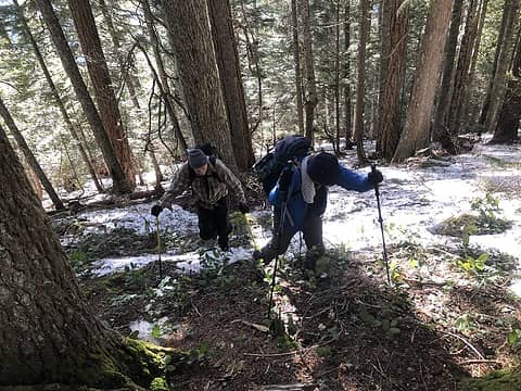
Taking advantage of a break in the string of rainy days, we decided to repeat Now I Fly's Bandera direct route but turn it into a loop. It was an absolutely beautiful day to be out and the snow conditions (or lack of it) made it easier and safe. The lower section that gets more sun exposure was mostly melted out and the upper part had firm snow that was great for booting up. We used snow shoes for the last 1000' up and almost all the way down.
I was surprised when I first read Brian's report about the lack of brush in the understory, either in the second growth or the old growth higher up, but that's absolutely true. Maybe higher up where there was more snow the brush was covered, so I don't know about that. The other surprising thing is how evenly graded the route is -- pretty much a steady climb all the way up with no obstacles.
Stats: 6.8 miles, 3630' up, 3820' down
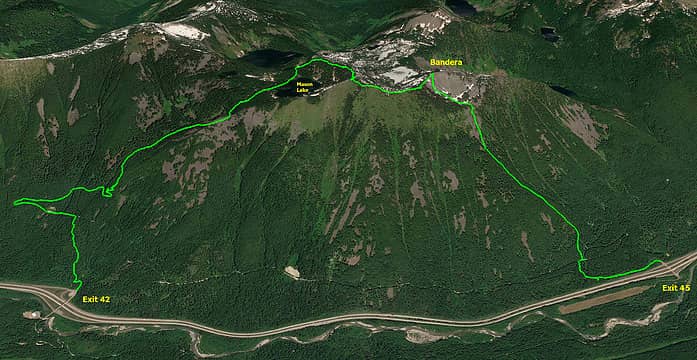 We used a car shuttle to start at Exit 45 and end at Exit 42. The road at Exit 45 was completely snowed in so we starting hiking from the exit. We cut a switchback up to the Talalpus trailhead road but then just kept going straight up. 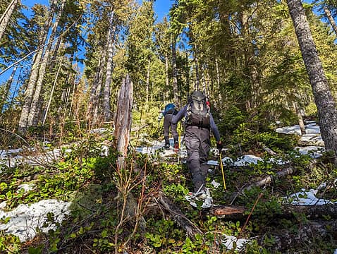 We started out on snowshoes at Exit 45 because the cold air at the valley bottom had kept snow around. As we climbed the snow thinned out and eventually we took off the snowshoes for a long time. 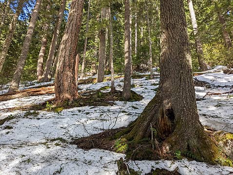 This crunchy snow cover under the canopy was excellent for booting up the slope 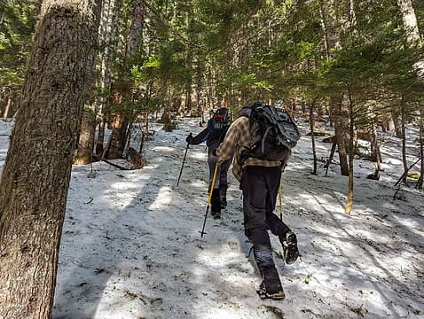 Continuing to boot up the excellent snow as we near the timberline 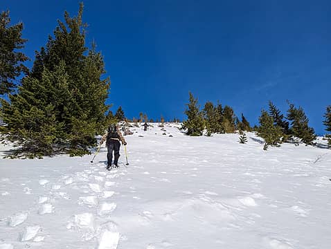 The skyline is the bottom of Hi Valley where the grade eases up a lot. This section was pretty steep but the snow was great for snowshoes. 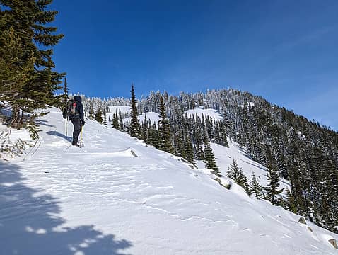 Entering Hi Valley. That name is on most maps for a wide high valley that is almost all talus rock, under the snow. We are at the bottom of it now and 600' from the true Bandera summit. 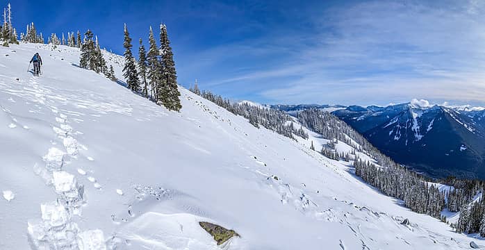 The final push to the summit at left 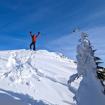 Brian on top 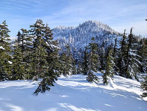 View back to the true Bandera summit where we just came from. It's the bump on the left, even though it looks lower than the right one. 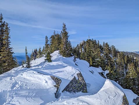 Running the ridge to the false Bandera summit 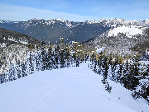 Descending the north ridge of (false) Bandera so we can return by going around Mason Lake 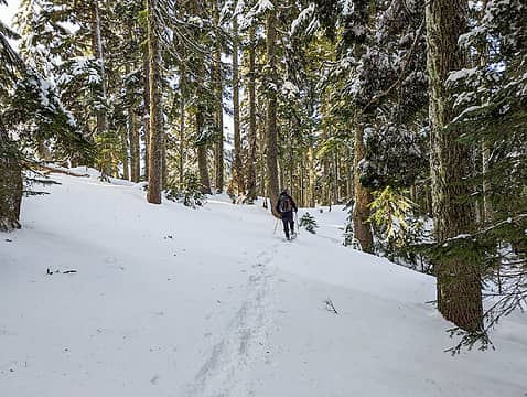 Beautiful forest near Mason Lake 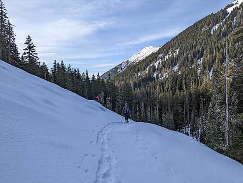 Crossing the boulder field below the headwall in Mason Creek vallley. Putrid Pete's Peak above.  Thinned forest below the Ira Spring trail near the first switchback. This area was logged in 2022 as part of the Hanson Creek Vegetation Project. 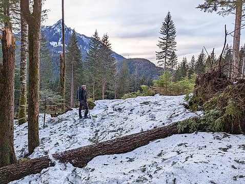 Forest opening logged in 2022 as part of the Hanson Creek Vegetation Project. 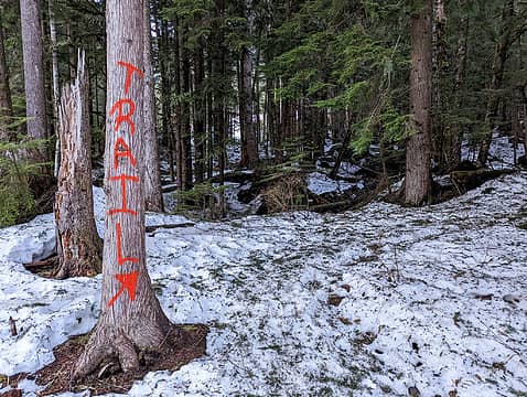 The group logging the forest just west of here marked the unofficial trail because people were wandering into the logging area on the temporary road put in to get the timber out. 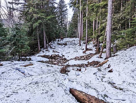 Temporary road put in to log this unit. Mason Creek is in the foreground. While it was being logged there was a bridge over the creek, but then it was pulled out. 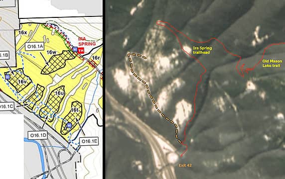 Hansen Creek Vegetation Project
Mid Fork Rocks flickr
 Fedor, Nancyann, The Ghost of Bear 380, RichP, JimK, Now I Fly, Bramble_Scramble Fedor, Nancyann, The Ghost of Bear 380, RichP, JimK, Now I Fly, Bramble_Scramble
Mid Fork Rocks flickr
Fedor, Nancyann, The Ghost of Bear 380, RichP, JimK, Now I Fly, Bramble_Scramble
|
| Back to top |
  
|
|
Now I Fly
Member
Joined: 07 Jun 2018
Posts: 467 | TRs | Pics
|
Nice report Monty!
Super fun day, and this route was definitely better with the lower boulders (and much of the brush) filled in! Also, doing a shuttle really did work well. :-)
 Men at Work! :-) 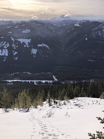 Bandera airstrip below. 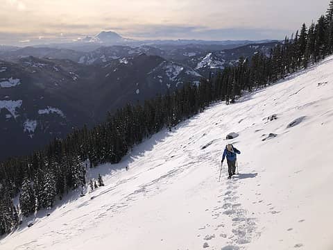 Puzzlr getting er done! Topping out of Hi Valley. 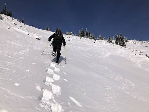 Bryan H. rocking the Snowshoes! 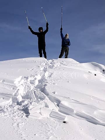 Penguino and the Puzzlr on top of Bandera 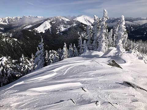 West Granite & Granite from Bandera. A big old easterly was a howling! 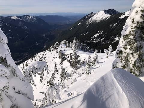 The untracked standard route up West Bandera
Fedor, RichP
Fedor, RichP |
| Back to top |
|
|
JimK
Member

Joined: 07 Feb 2002
Posts: 5606 | TRs | Pics
Location: Ballard |
|
JimK
Member
|
Sat Jan 14, 2023 4:35 pm |
|
|
Here is a similar view of the boulder field without the snow.
| puzzlr wrote: | The final push to the summit at left |
|
| Back to top |
|
|
Now I Fly
Member
Joined: 07 Jun 2018
Posts: 467 | TRs | Pics
|
| JimK wrote: | | Here is a similar view of the boulder field without the snow. |
Wow! That really is nasty!
|
| Back to top |
|
|
|
|
You cannot post new topics in this forum
You cannot reply to topics in this forum
You cannot edit your posts in this forum
You cannot delete your posts in this forum
You cannot vote in polls in this forum
|
Disclosure: As an Amazon Associate NWHikers.net earns from qualifying purchases when you use our link(s). |


