Matt Lemke
High on the Outdoors


Joined: 15 Jul 2010
Posts: 2052 | TRs | Pics
Location: Grand Junction |
|
Matt Lemke
High on the Outdoors
|
 Sun Feb 12, 2023 10:36 am |
|
|
Introduction
Cerro Barros Arana is a major peak rising right above the town of La Junta in the northern sector of Chilean Patagonia. The mountain is the highest peak among a linear group of towers on the north-south oriented crest which also includes the south towers, and a large massif guarding the northern end. A couple shorter towers are also present between the northern massif and the main peak of Cerro Barros Arana. The main peak, with elevation somewhere between 2165 and 2304 meters has seen to date three successful ascents. A GPS reading at the summit would be nice to have if anyone ventures here in the future.First ascent was by Douglas Tompkins and Galen Rowell in December 1990. Both the 2nd and 3rd ascents were made via the west ridge in April 2020 by two local La Junta climbers, and early February 2023 by Matt Lemke and Itai Cohen,
The northern massif remains unclimbed while the south towers, offering perhaps the best quality granite rock in the group have been climbed once by a team in late March 2015 consisting of Chilean climbers Juan Ruiz, Martin Hartmann, Cristóbal García and Hugo Castaneda approaching from the south.They followed the general approach path originally attempted in January 2012 by a team consisting of Armando Montero, Daniel Zapata and Darío Arancibia who approached via the Rio Quinto valley to the south of the crest (also referenced as Rio Cuarto) and ascending the first side drainage Northward towards the massif and around the 1900 meter knoll just southwest of the south towers. With the previous help of local gauchos, this southern approach was made possible for the 2015 party, however it is quite long if the main summit is the goal.
The direct west ridge of Cerro Barros Arana is the most feasible route to the summit, and offers the cleanest approach taking the author a total of 9 hours to break free of the jungle from the bridge over Estero Mirta.Timberline is reached at 1300 meters and a great camp is found at a flat knoll in the ridge at 1650 meters only a 5-10 minute walk away from twin alpine tarns that offer great water. Cliff bands in the lower part of the west ridge can be avoided by first hiking up valley near Estero Mirta on its south side for 1.5 kilometers before starting up the lenga slopes towards the large bench at 950 meters elevation. Expect thick, but manageable lenga. This approach also provides access to the northern massif, which is a complex peak with numerous small towers and an imposing south face that beckons you from camp on the ridge.
The climbing route to the summit via the west ridge includes two sections of 5th class climbing (one pitch each) up to 5.7 on decent rock, with extensive exposed 3rd and 4th class scrambling on loose rock everywhere else. From the summit of Cerro Barros Arana, dozens of unnamed towers that are not visible from roads present themselves, few of which have seen ascents. To the northwest, Cerro Barros Luco across Valle Mirta is particularly impressive, and has seen one ascent in November 2013. The towers directly east of Barros Arana have large walls but with questionable looking darker colored rock. Many other striking towers off to the south towards Tres Hermanos also flaunted this darker colored rock that would require extra care.
Trip Report
The above text is a contribution I made to the Andes Handbook website, the most difinitive source for beta for mountains in Chilean Patagonia. Barros Arana is a stunning peak that I am thrilled to have climbed, despite the horrid bushwhack to get up there. We made a couple reconissance drives along the Valle Mirta road that heads east from the Carraterra Austral right outside the town of La Junta, and decided the best line of approach was directly up the west ridge. From treeline, from what we could see at the valley floor way down at an elevation of only 300 feet we saw potential routes up the west ridge direct, or potentially up the north ridge. Since we were at the end of a short weather window, we would have to wait a full week before heading up, so we waited out a week of bad weather in El Bolson, Argentina. This total hippie and tourist town is chock full of incredible food, sweet treats and scenic hiking and scrambling options. Excellent place to wait out bad patagonia weather and since it's further east, we actually had some sunny days to relax. It's axin to the east side of the Cascades versus the west side.
After a quick two day ascent of Cerro Conico just south of Futaleufu (that is a story for a different trip report), Bri dropped Itai and myself off in Valle Mirta right where the road X-11 crosses the Estero Mirta where we began walking up along the south side of the river. Bless her soul as she would wait for us for 3 nights in Puyuhuapi. This starting point was only 200 meters in elevation. We decided to hike about a mile up the valley, which we had found a couple different gaucho trails that aided this part of the approach significantly. At an elevation of 330 meters, a sizable side stream coming from the east down the valley just north of the west ridge is seen. We began ascending the steep lenga and brush covered slopes just before reaching this stream. Overall, the bushwhacking was not too bad for Patagonia standards, as I have done worse in the Cascades. We were able to make a fairly direct ascent without weaving left or right too much. A few spots did have some very thick lenga and brush that slowed progress. Since we got a late start of 5pm that first day we were hoping to get up to the large flat bench at 950 meters elevation where we could make a camp. It took us about 2 hours to reach the point where we left the Mirta valley and begin ascending, and another 2.5 hours to ascend from 330 meters to 800 meters through the steepest of the bushwhacking. Right at the base of a 30 foot cliff band as it was getting dark, we excavated out some duff to make a large enough flat spot for the two of us to sleep. It was so calm and warm we didn't even bother using sleeping pads or a tent.
We were moving again by 7:30am the following morning, with the first obstacle requiring us to surmount this cliff band right above us. We found a spot we could climb bushes and trees to get up and after a few hundred more geet of steep ascending through thick brush, we could see the terrain levelling out considerably. The big flat bench ended up being relatively devoid of the worst brush, and as we continued up the much more gentle angled ridgecrest, the brush became thinner. Generally only knee height brush was encountered from 1000 to 1350 meters elevation, at which point we emerged out of the jungle right around noon. The biting flies were pretty bad above 1000 meters however and they ended up following us as we continued to ascend up to an elevation of 1650 meters where a beautiful flat spot made for a perfect camp for a couple nights. A small tarn was passed a short distance above treeline, but we wanted to camp higher. At 1650 meters, a good snowfield a few yards to the south offered afternoon drips for water, or a 5 minute walk to the north there were two beautiful blue-green alpine tarns for liquid water. The first image below shows a map of the route we took on this ascent.
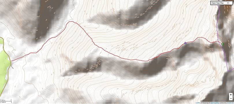 Map of our route 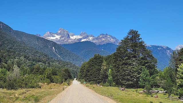 Cerro Barros Arana from Valle Mirta 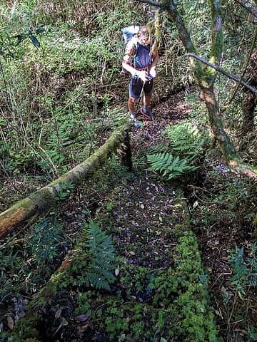 Navigating through thick brush 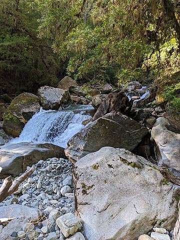 Estero Mirta 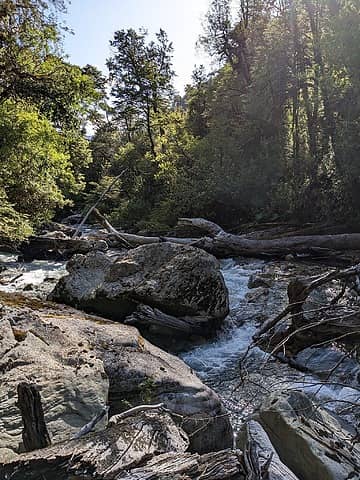 Estero Mirta 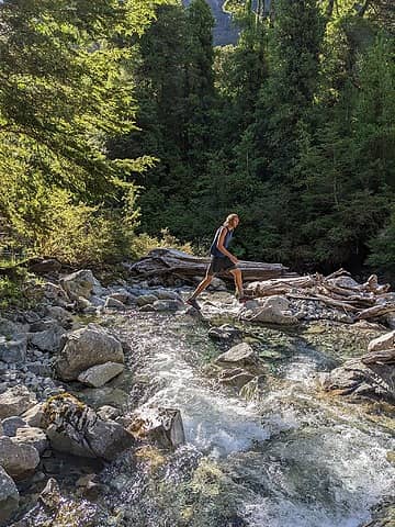 Getting water at the side stream 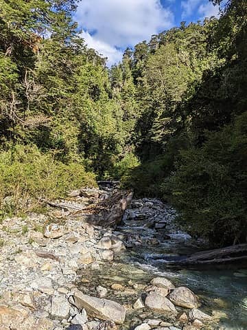 Looking up the side stream 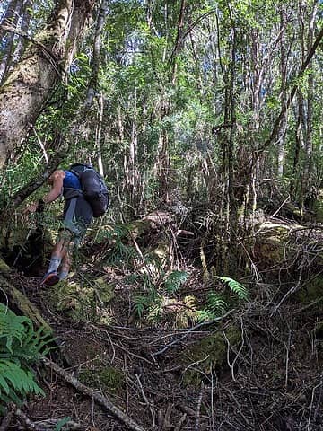 Typical brush 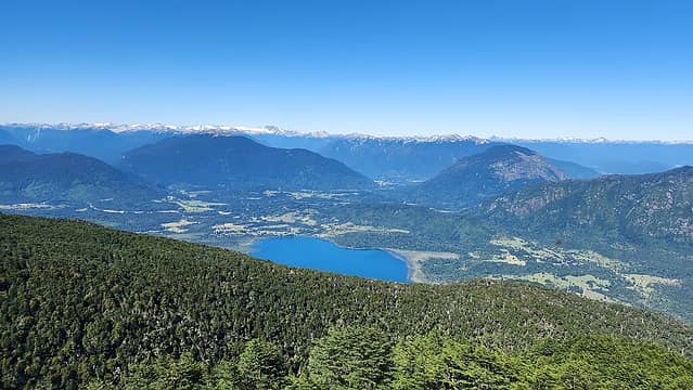 Lago Claro Solar 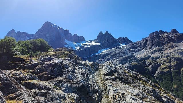 First views at treeline 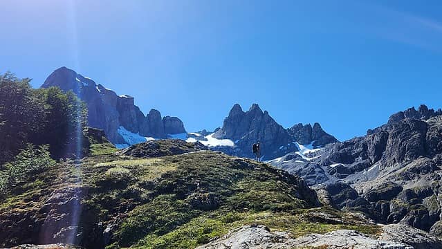 Barros Arana (left) and the south towers (right) 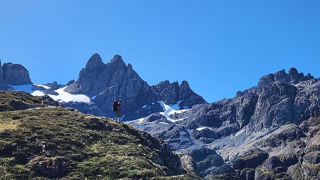 South towers 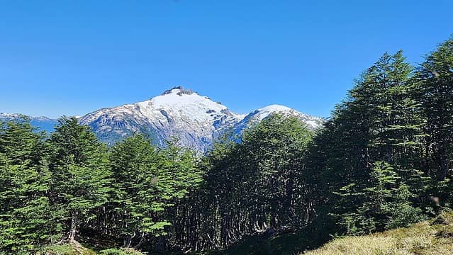 Barros Luco 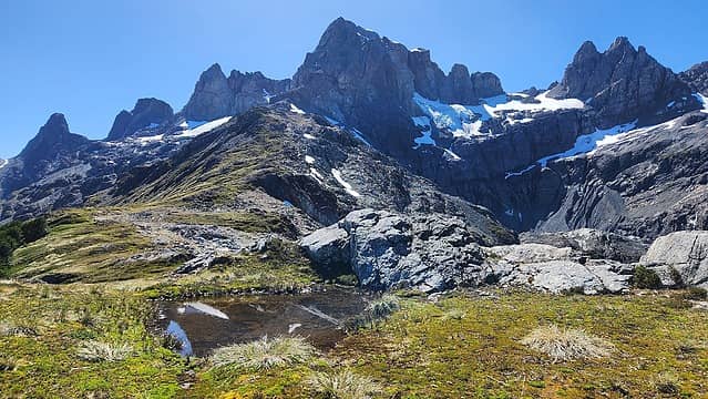 Small pond at about 1400 meters 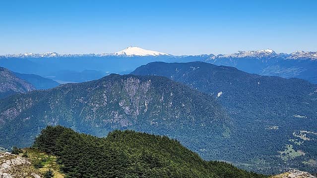 View west towards Monte Melimoy 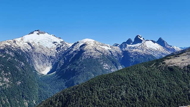 View northwest with Barros Luco on the left 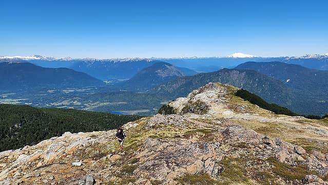 Gentle west ridge above the trees 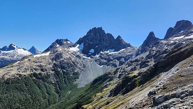 The northern massif of Barros Arana 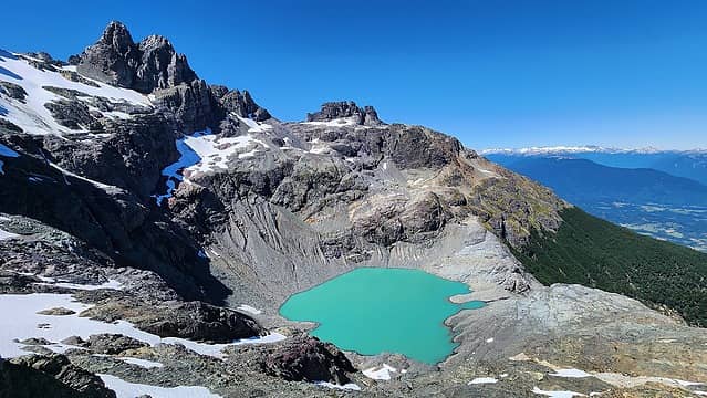 Alpine lake to the south of the west ridge 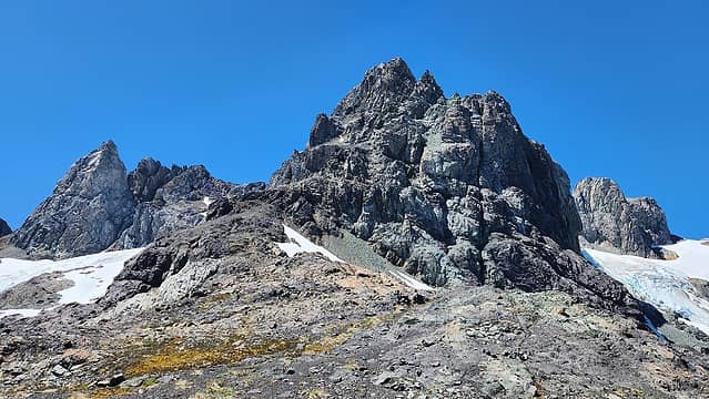 Barros Arana 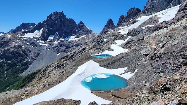 Twin alpine tarns 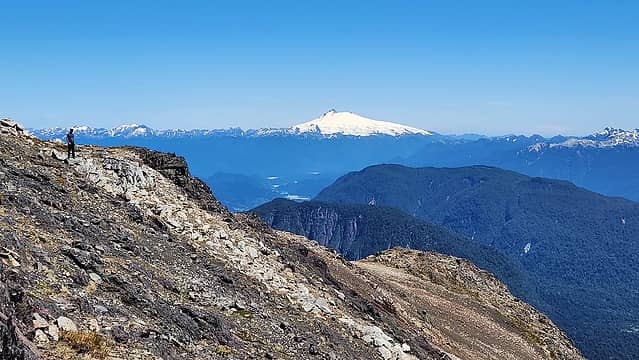 Melimoy volcano to the west 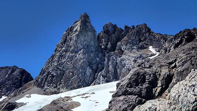 Smaller tower just north of the main peak 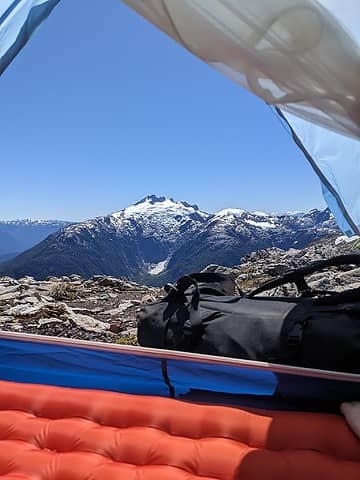 Barros Luco from the tent 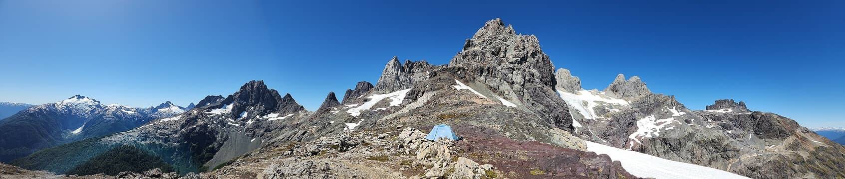 Panorama of Barros Arana from camp 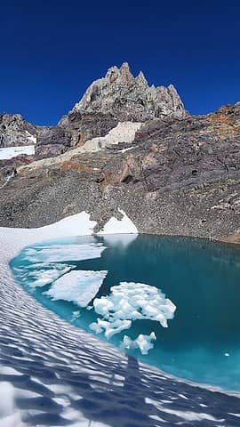 Icebergs 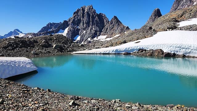 Northern massif 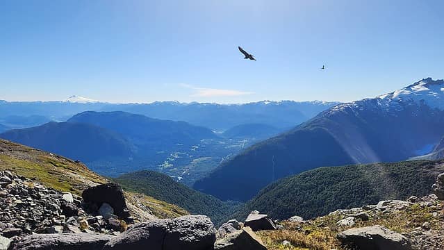 Condors 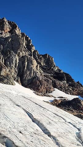 West Ridge profile 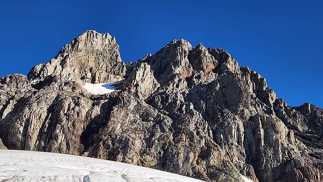 West ridge profile with summit on the left 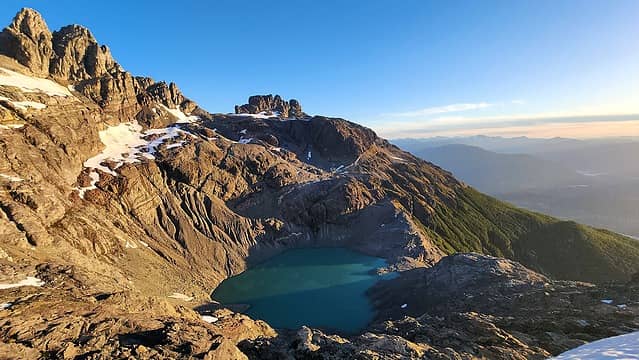 Sunset with the lake below 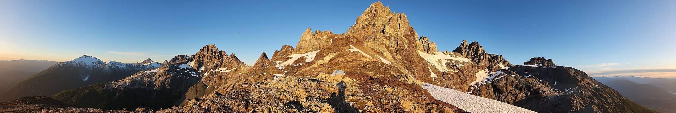 Sunset panorama 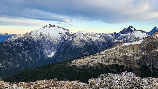 Early morning high clouds 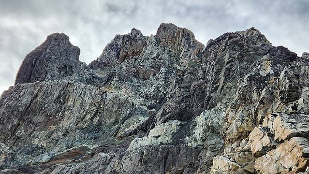 Scrambling up the initial ascent 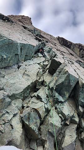 Climbing the smooth 55m pitch 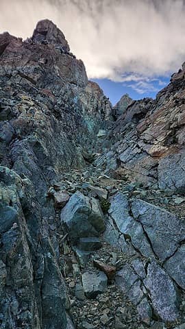 Scrambling this gully 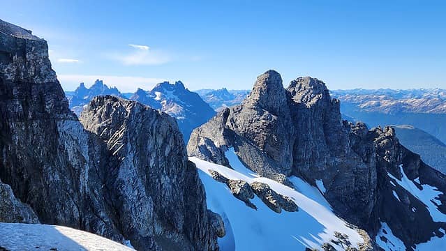 View south 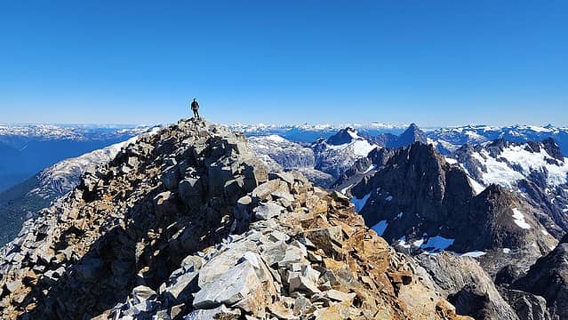 On the summit 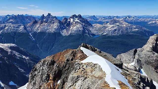 View south from summit 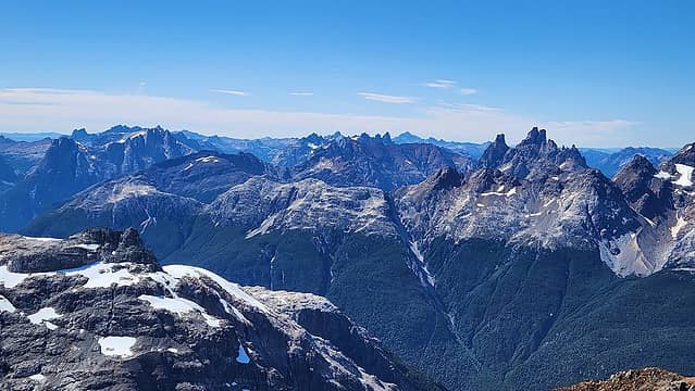 View southeast 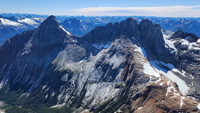 View east 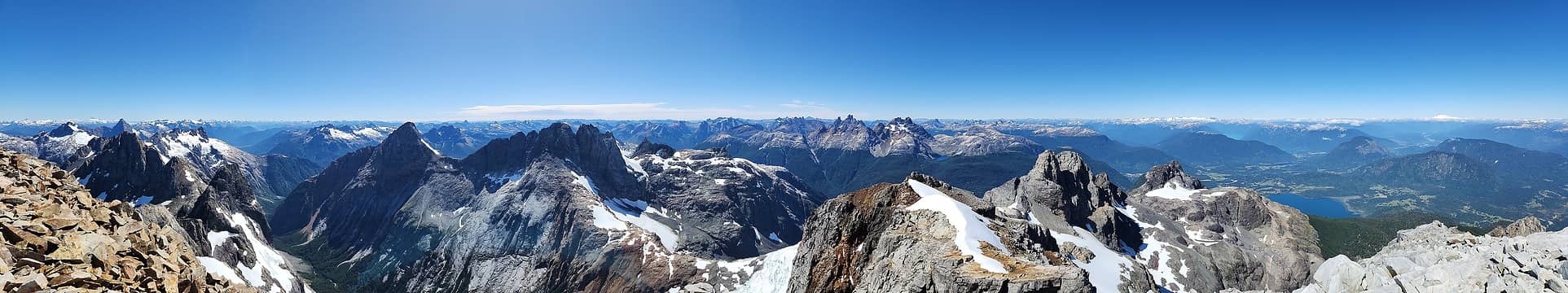 Summit pano east to southwest 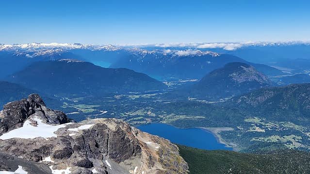 Lago Claro Solar and Rosselot 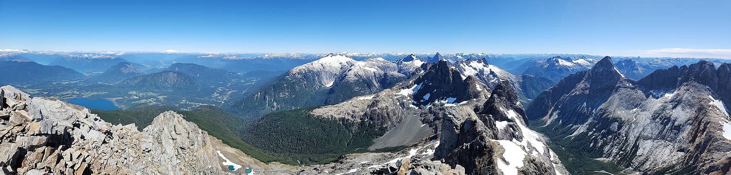 Summit pano west to northeast 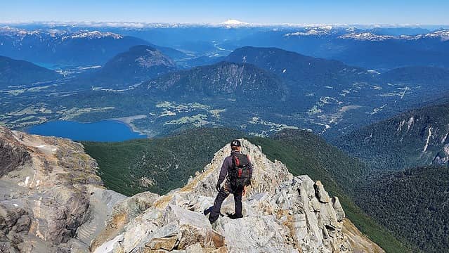 Starting down 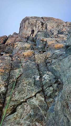 Making the first double rap 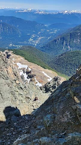 Descending the gully 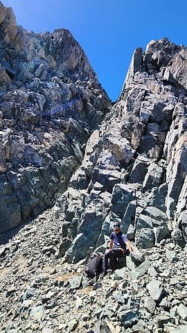 The gully 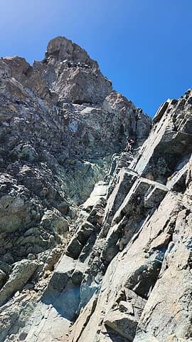 View up the gully 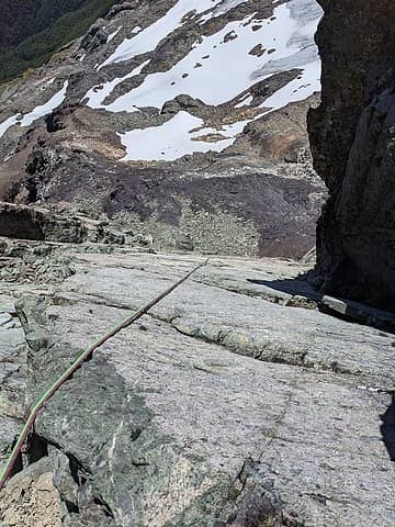 Looking down the second double rap 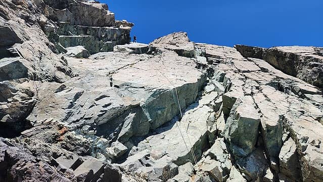 View of the first pitch 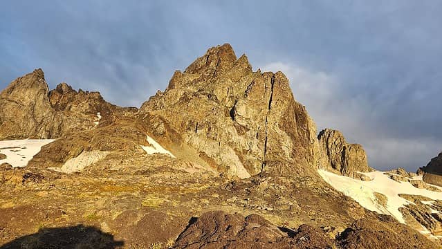 Sunset the second evening 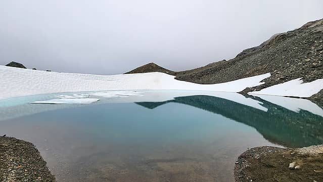 Grabbing water at the tarn before descending  View the full photo album here.
|


